Minneapolis Wells Fargo Bank Demolition After George Floyd Riots
March 2021 — Demoition of the one time Wells Fargo Bank on Nicollet in Minneapolis on March 3, 2021. The bank was destroyed in riots folowing the murder of George Floyd.
Explore photos tagged Minnesota.
March 2021 — Demoition of the one time Wells Fargo Bank on Nicollet in Minneapolis on March 3, 2021. The bank was destroyed in riots folowing the murder of George Floyd.
March 2021 — Razor wire around the temporary Minneapolis Police third precinct on March 3, 2021.
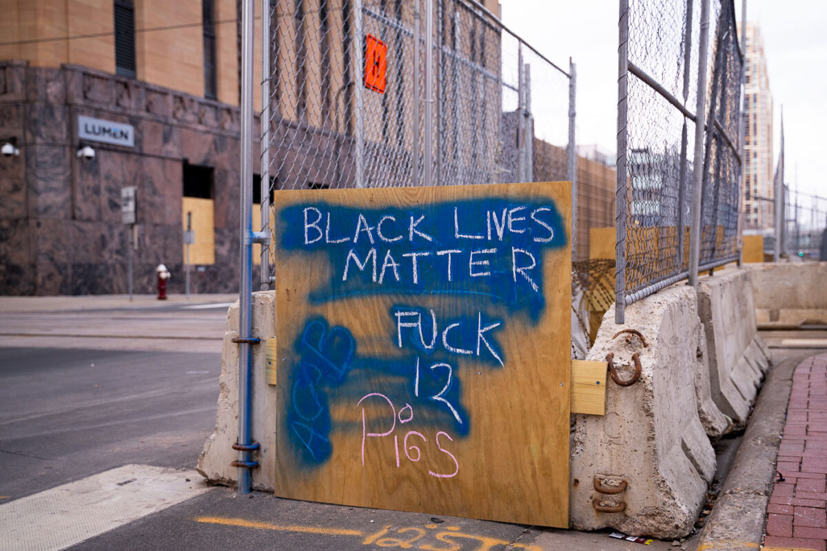
March 2021 — Chalk laying outside a building across the street from the Hennepin County Government Center where the trial of Derek Chauvin has begun. Chauvin is charged in the May 25th, 2020 murder of George Floyd.
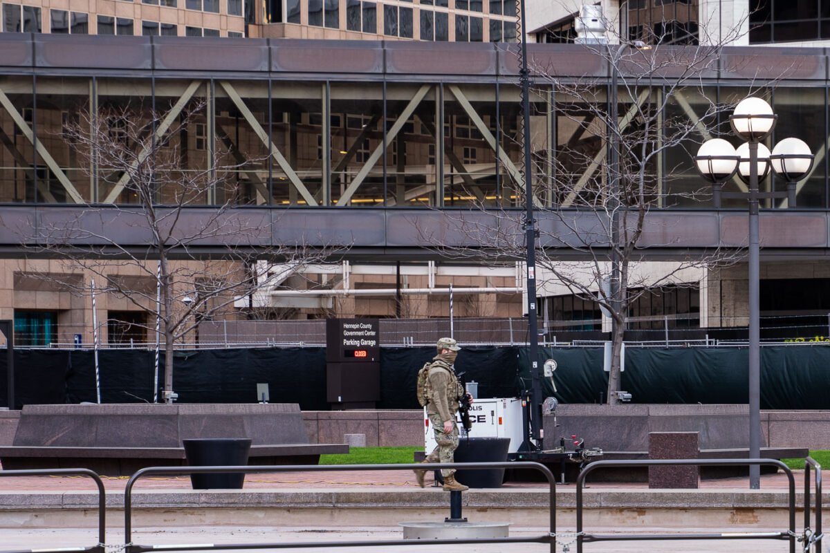
March 2021 — The Hennepin County Government Center. The courthouse is currently holding the Derek Chauvin murder trial. Chauvin is charged in the May 25th murder of George Floyd in South Minneapolis.
March 2021 — A military vehicle drives around the Hennepin County Government Center. The courthouse is currently holding the Derek Chauvin murder trial. Chauvin is charged in the May 25th murder of George Floyd in South Minneapolis.
March 2021 — Protest signs in the form of mirrors outside the Hennepin County Government Center. The courthouse is currently holding the Derek Chauvin murder trial. Chauvin is charged in the May 25th murder of George Floyd in South Minneapolis.
March 2021 — A lock hanging on fencing around the Hennepin County Government Center. The courthouse is currently holding the Derek Chauvin murder trial. Chauvin is charged in the May 25th murder of George Floyd in South Minneapolis.
March 2021 — A Minneapolis Police squad drives down 3rd Ave in Downtown Minneapolis.
March 2021 — Toussaint Morrison speaking during a march during the Derek Chauvin murder trial in Minneapolis on March 15, 2021.
March 2021 — Protesters march around the Hennepin County Government Center. The courthouse is currently holding the Derek Chauvin murder trial. Chauvin is charged in the May 25th murder of George Floyd in South Minneapolis.
March 2021 — Protesters march around the Hennepin County Government Center demanding a fair jury selection process in the Derek Chauvin trial. Former Minneapolis Police Officer Derek Chauvin is accused of murdering George Floyd on May 25th, 2020.
March 2021 — Protesters march around the Hennepin County Government Center demanding a fair jury selection process in the Derek Chauvin trial. Former Minneapolis Police Officer Derek Chauvin is accused of murdering George Floyd on May 25th, 2020.
March 2021 — Protesters march around the Hennepin County Government Center demanding a fair jury selection process in the Derek Chauvin trial.
March 2021 — A mobile surveillance camera at a Target parking lot in Minneapolis on March 16th, 2021.
March 2021 — Mobile security cameras located near the intersection of the Third Precinct.
March 2021 — Locks with the names of police violence victims were placed on fencing around the Government Center where Derek Chauvin is on trial for the murder of George Floyd. A day later they were cut off.
March 2021 — A National Guard vehicle with a optical CROWS system attached sits under the courthouse where Derek Chauvin is standing trial for the death of George Floyd.
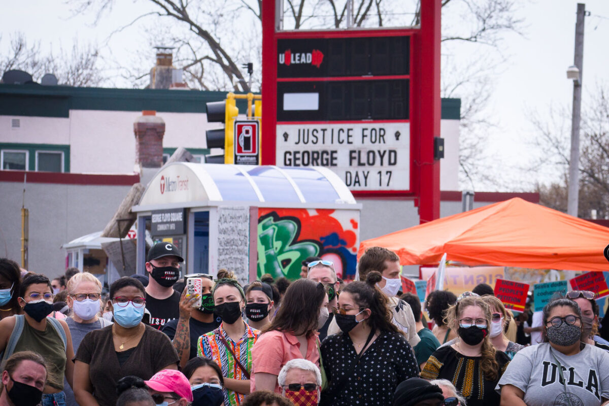
March 2021 — The "Community Info" board at George Floyd Square on March 16, 2021.
March 2021 — A warming shelter at George Floyd Square in Minneapolis on March 16, 2021. The shelters were built near the street barricades.
March 2021 — A sign reading "Justice 4 George" on a home in South Minneapolis.
March 2021 — Say Their Names Cemetery in South Minneapolis near George Floyd Square.
March 2021 — Minneapolis Police arrive to a crowd of camp protectors who were waiting after the City of Minneapolis had said they would clear the homeless encampment.
March 2021 — Locks of police violence victims hang on the security fencing around the Hennepin County Government Center.
March 2021 — "No Justice, No Strteet!" written on the side of building in Uptown Minneapolis. It refers to George Floyd Square where the city has had press conferences the last 2 days about opening the intersection back up to vehicular traffic. The intersection has been closed since George Floyd's May 25th death and been held by the community as a place of protest and sacred ground.
March 2021 — Protesters march near the Minnesota State Capitol demanding justice for George Floyd as well as all lives impacted by police brutality.
March 2021 — Protesters march demanding justice for George Floyd and all those who are victims of police violence.
March 2021 — Security fencing around US Bank Stadium in downtown Minneapolis during the Derek Chauvin murder trial.
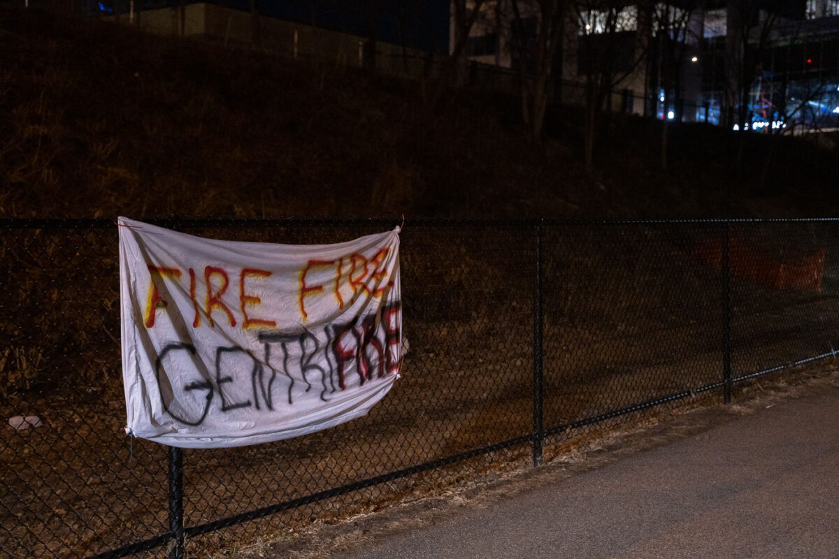
March 2021 — A protest sign seen on the Midtown Greenway that reads "Fire Fire Gentrifire"
March 2021 — The Minneapolis Police 2nd precinct secured with razorwire during the Derek Chauvin murder trial.
March 2021 — The Minneapolis Police 2nd precinct secured with razorwire during the Derek Chauvin murder trial.
March 2021 — The 24 demands of George Floyd Square written on street barricades in March 2021.
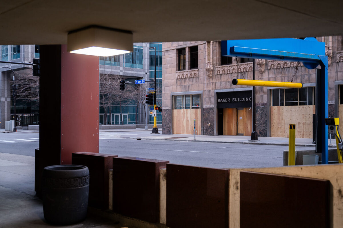
March 2021 — Centre Village a Hyatt Place hotel in downtown Minneapolis.

March 2021 — Concrete barricades in front of doors at The Amory concert venue in downtown Minneapolis.
March 2021 — The Hennepin County Health Services Building in downtown Minneapolis.
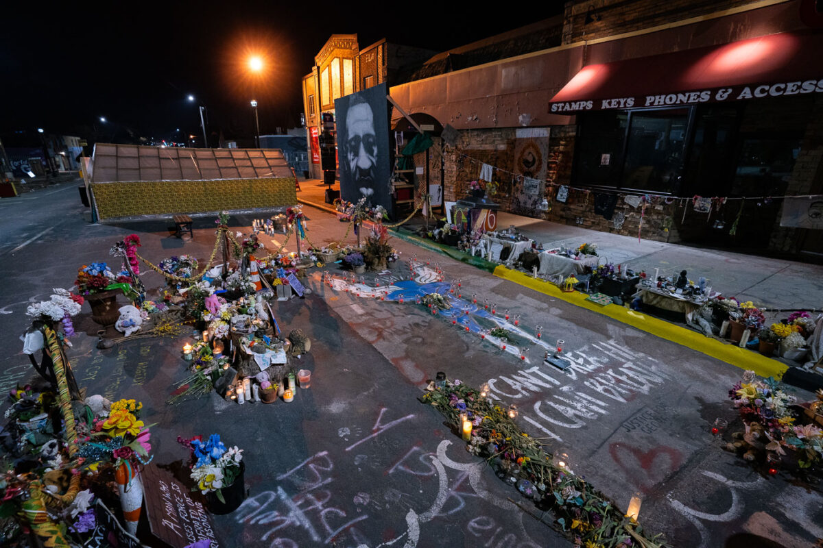
March 2021 — The George Floyd memorial outside of Cup Foods in South Minneapolis.
March 2021 — The former Speedway Gas sign reads "Welcome to George Floyd Square".
March 2021 — Minneapolis -- Cup Foods in South Minneapolis, the store that George Floyd was killed in front of. A George Floyd mural painted on the 38th Street side.
March 2021 — Protest signs leaning against Cup Foods in George Floyd Square.
March 2021 — George Floyd memorial at George Floyd Square in South Minneapolis.
March 2021 — A letter to George hanging at the George Floyd Memorial.
March 2021 — Toussaint Morrison speaks at a press conference asking for the firing of a Minneapolis Police Officer who was shown on bystander video punching a teenager the night before. The teen was said to be protesting the arrest of who the Minneapolis Police said was a carjacking suspect. The Minneapolis Police have said an internal affairs investigation was opened.
March 2021 — Mel Reeves talks to the media after video emerged of a Minneapolis Police Officer punching a teenager who was protesting the arrest of a carjacking suspect. The Minneapolis Police have said an internal affairs investigation was opened.
March 2021 — Radisson RED hotel in downtown Minneapolis.
March 2021 — The Speedway gas station preparing to re-open after being rebuilt. The gas station burned during unrest over the May 2020 death of George Floyd.
March 2021 — The Minneapolis police third precinct, Autozone, and Target on East Lake St on March 27, 2021.
March 2021 — Autozone, Wendy's and Ever Lake apartments on March 27, 2021 being rebuilt after being destroyed in riots over the murder of George Floyd.
March 2021 — "RIP George" "Can you hear us now!" written on a rooftop of a building across from the Minneapolis Police Third Precinct. The Third Precinct was burned during unrest over the May 25th murder of George Floyd.
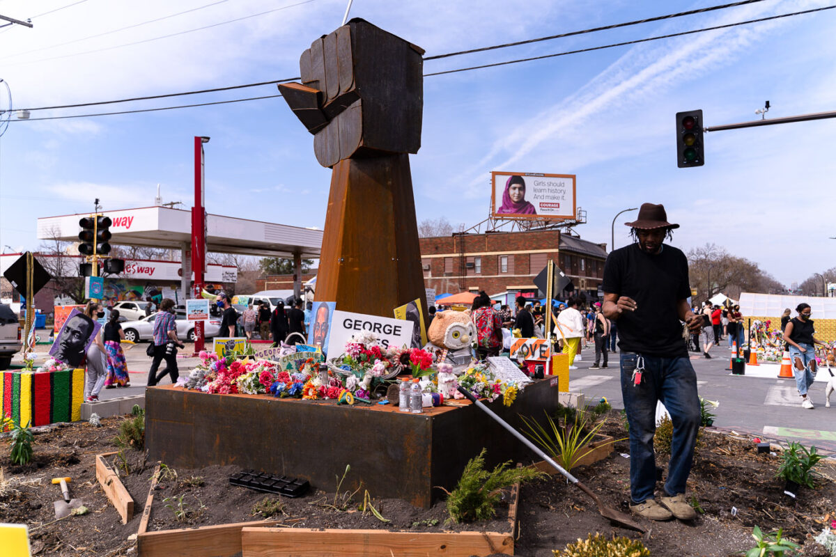
March 2021 — The fist at George Floyd Square.
March 2021 — March 27, 2021 - Minneapolis -- The George Floyd Memorial. Located at the intersection of 38th and Chicago Ave in South Minneapolis.
March 2021 — The greenhouse at George Floyd Square where flowers and plants were kept through the winter.
March 2021 — Protesters march through downtown Minneapolis the day before the Derek Chauvin murder trial opening statements.
March 2021 — A prayer vigil and rally atended by Al Sharpton and the family of George Floyd held at the Greater Friendship Missionary in South Minneapolis.
March 2021 — Terrence and Philonise Floyd arrive to a press conference outside the Hennepin County Government Center where opening statements in the Derek Chauvin murder trial are set to begin.
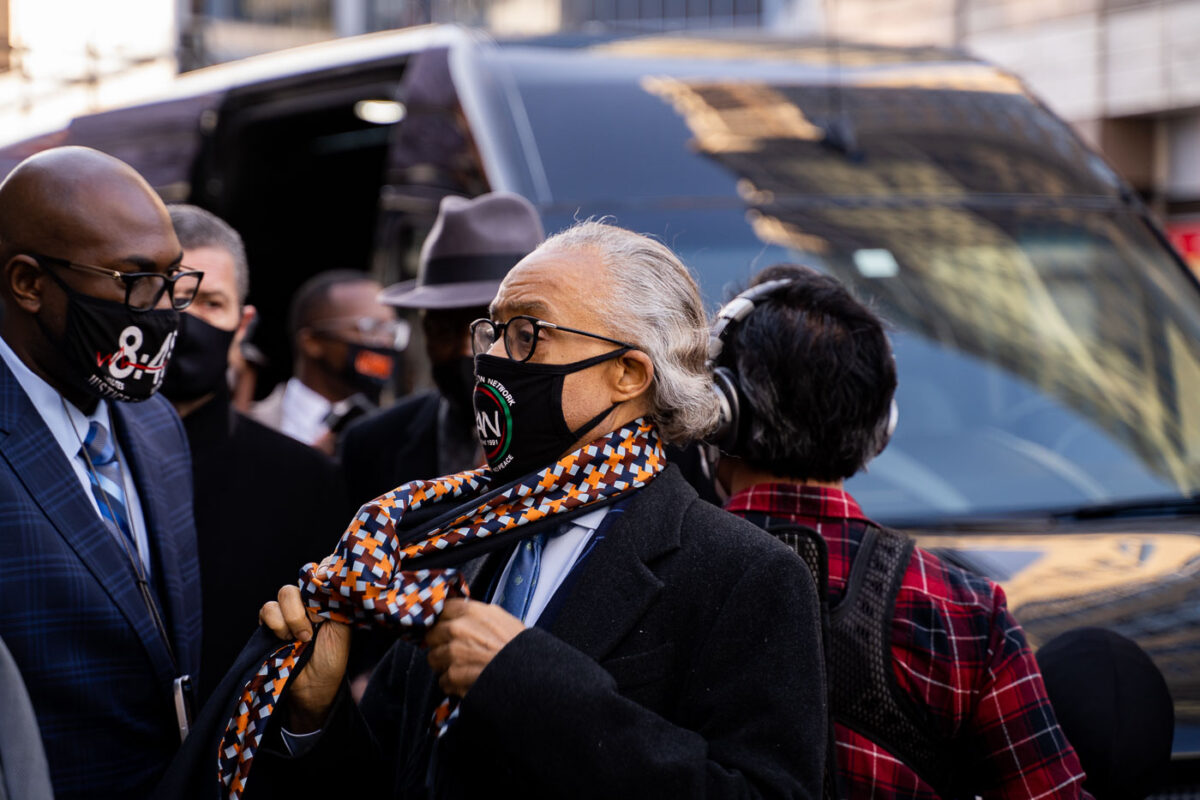
March 2021 — Rev Al Sharpton arrives with the George Floyd family for a press conference outside the Hennepin County Government Center where opening statements in the Derek Chauvin were set to begin an hour later.
March 2021 — Ben Crump, the attorney for the George Floyd family speaks outside the Hennepin County Government Center prior to opening statements began in the Derek Chauvin murder trial. Chauvin is accused of murdering George Floyd on May 25th, 2020.
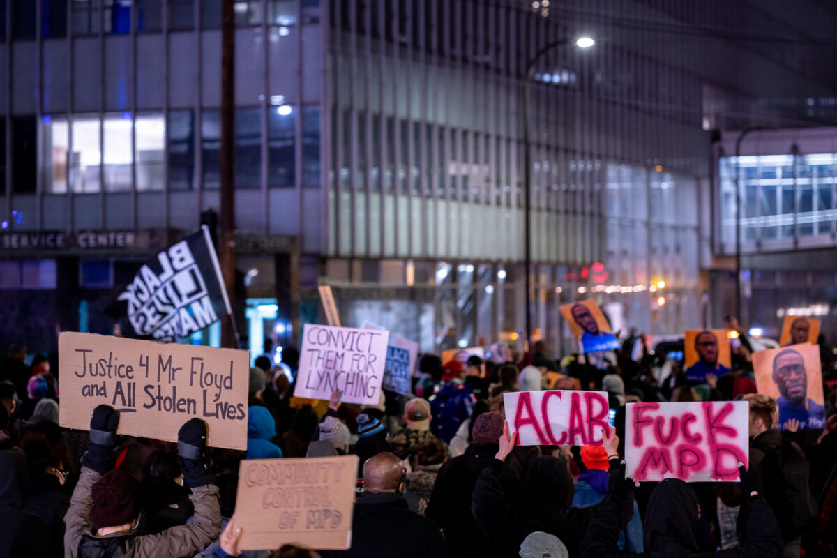
March 2021 — Protesters hold up signs outside the Hennepin County Government Center as opening statements in the Derek Chauvin murder trial begin.
March 2021 — Rev Al Sharpton speaks outside the Hennepin County Government Center where opening statements of the Derek Chauvin trial were set to begin. He's joined by George Floyd's brothers Philonise and Terrence Floyd.
March 2021 — March 29, 2021 - Minneapolis -- Ben Crump, the attorney for the George Floyd, Rev. Al Sharpton, and George Floyd Family take a kneel for 8:46 outside the Hennepin County Government Center prior to opening statements began in the Derek Chauvin murder trial. Chauvin is accused of murdering George Floyd on May 25th, 2020.
March 2021 — National Guard guarding the Government Center.
March 2021 — George Floyd family, their attorney Ben Crump and Rev. Al Sharpton arrive to a heavily fortified Hennepin County Government center on the day of opening statements in the murder trial of Derek Chauvin. Chauvin is charged in the May 25th murder of George Floyd.
March 2021 — All Eyez On Justice, Justice for George Floyd flyer seen outside the courthouse where Derek Chauvin is being tried for murder on March 29, 2021.
March 2021 — Protesters rally and march through Downtown Minneapolis on the day opening statements began in the Derek Chauvin murder trial. Chauvin is accused of murdering George Floyd on May 25th, 2020.
March 2021 — Protesters rally and march through Downtown Minneapolis on the day opening statements began in the Derek Chauvin murder trial. Chauvin is accused of murdering George Floyd on May 25th, 2020.
March 2021 — Protesters rally and march through Downtown Minneapolis on the day opening statements began in the Derek Chauvin murder trial. Chauvin is accused of murdering George Floyd on May 25th, 2020.
March 2021 — Protesters rally and march through Downtown Minneapolis on the day opening statements began in the Derek Chauvin murder trial. Chauvin is accused of murdering George Floyd on May 25th, 2020.
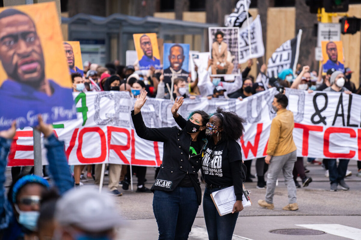
March 2021 — Protesters rally and march through Downtown Minneapolis on the day opening statements began in the Derek Chauvin murder trial. Chauvin is accused of murdering George Floyd on May 25th, 2020.
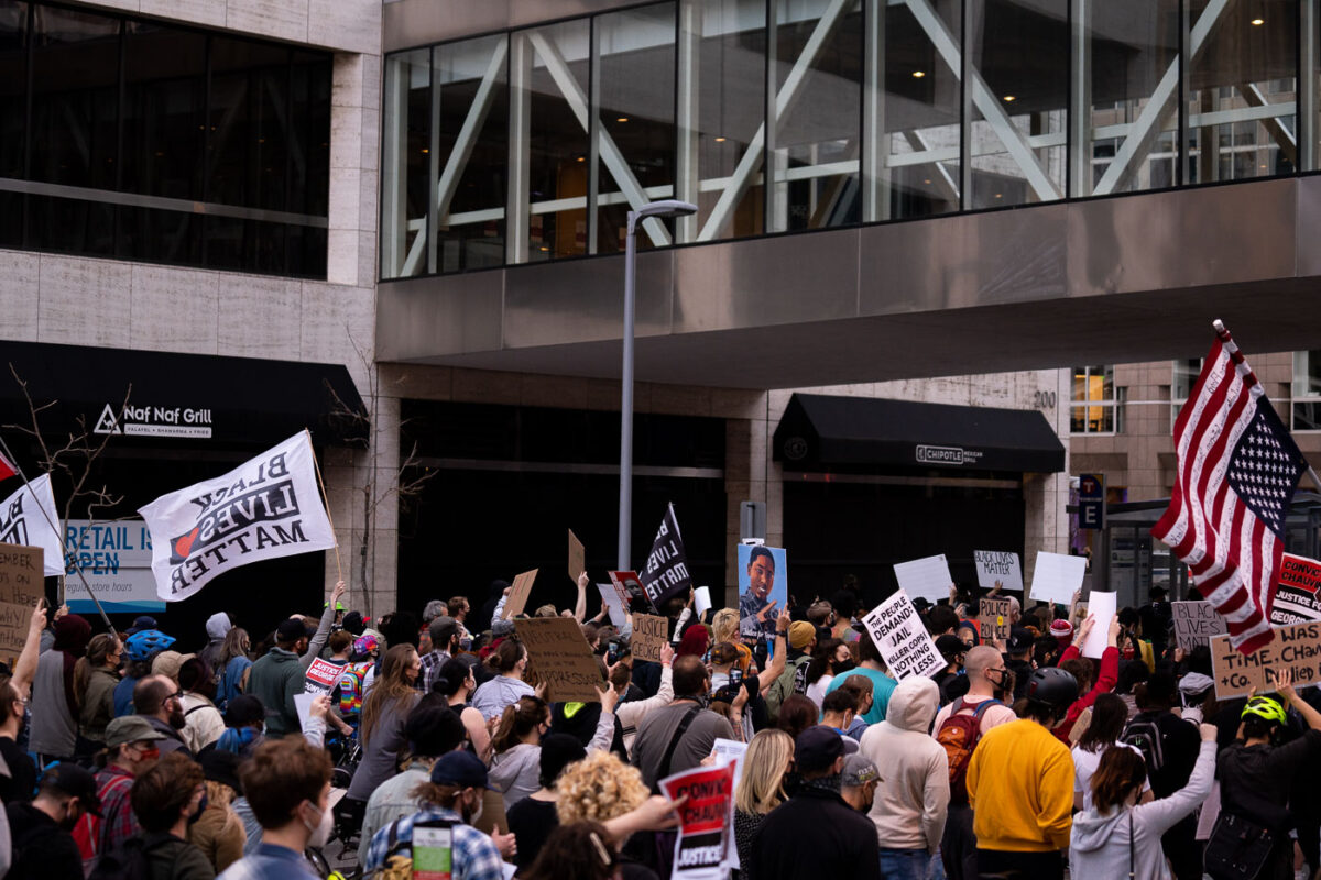
March 2021 — Protesters rally and march through Downtown Minneapolis on the day opening statements began in the Derek Chauvin murder trial. Chauvin is accused of murdering George Floyd on May 25th, 2020.
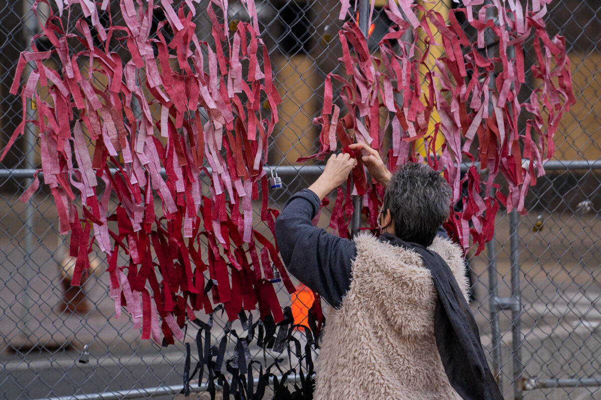
March 2021 — A woman ties ribbons in the shape of a heart to security fencing around the Hennepin County Government Center on the day opening statements began in the Derek Chauvin murder trial. Chauvin is accused of murdering George Floyd on May 25th, 2020.
March 2021 — Protesters tie ribbons with stories of police brutality to the security fencing around the Hennepin County Government Center on the day opening statements began in the Derek Chauvin murder trial. Chauvin is accused of murdering George Floyd on May 25th, 2020.
March 2021 — Security fencing around the Hennepin County Governmeent Center in Downtown Minneapolis where Derek Chauvin is standing trial for the murder of George Floyd.

March 2021 — An Abolish The Police protest sign on the security fencing around the Hennepin County Government Center where Derek Chauvin is on trial for the May 25, 2020 murder of George Floyd in South Minneapolis.
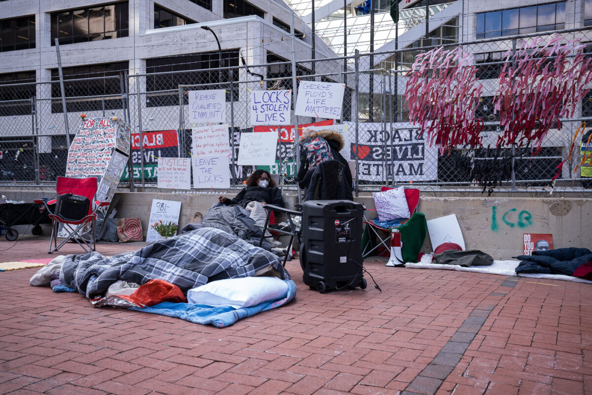
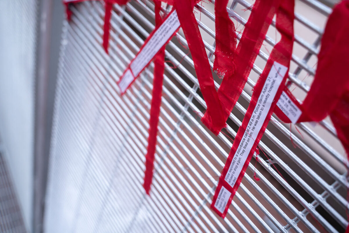
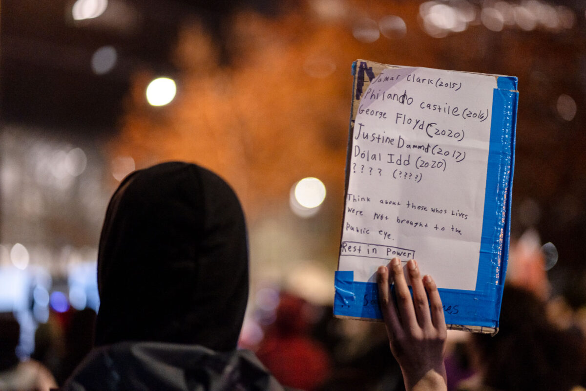
March 2021 — Since March 15th families and those supporting the families of the victims of police brutality have been placing locks on fencing around the Hennepin County Government Center. The locks, which have the names of victims of police violence written on them, have been continuously cut off by police. Theres now a couple hundred locks along with protesters who've locked themselves to the fence 24/7 one at a time. Among their demands are for the Minneapolis and St. Paul mayors & the Governor to meet with families of those killed by police, ending qualified immunity for police and for voting on police accountability bills to occur. .
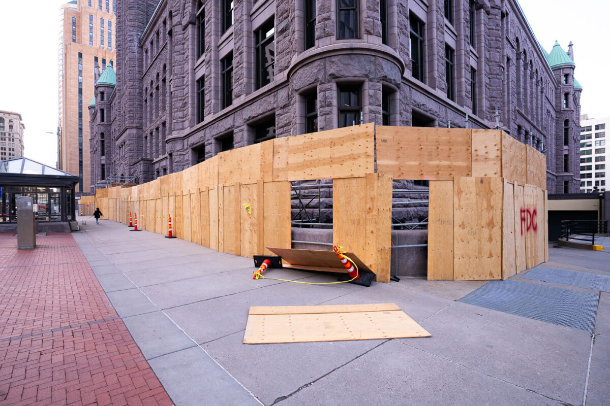
April 2021 — Boards on US Bank Plaza during the Derek Chauvin murder trial in 2021.
April 2021 — Security around the Hennepin County Government Center in downtown Minneapolis during the Derek Chauvin murder trial.
April 2021 — Chalk graffiti on a Hennepin County Government Center building. Derek Chauvin is currently on trial for the May 25, 2020 murder of George Floyd.
April 2021 — Security fencing around the Hennepin County Government Center.
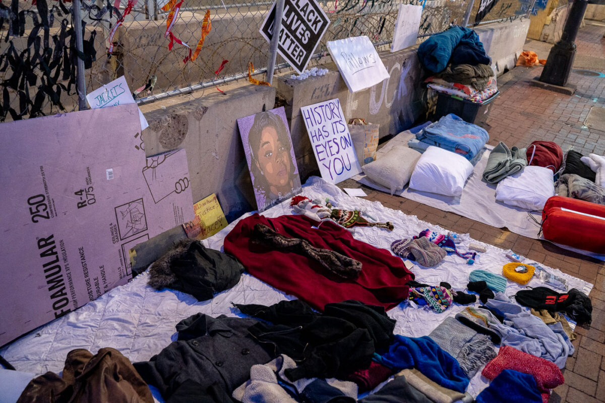
April 2021 — Supplies made available as temperatures drop inside the Government Center fencing where protesters have been occupying the space 24/7.
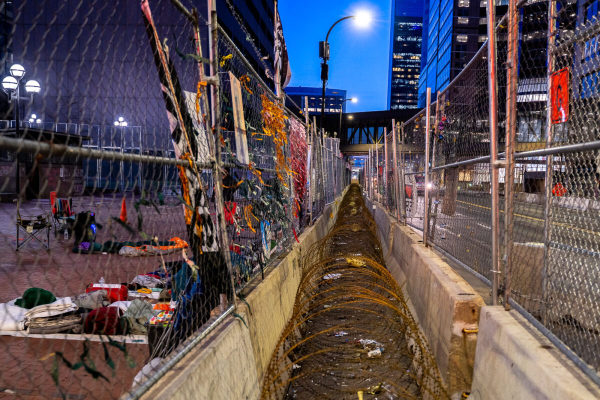
April 2021 — The security "cage" around the Hennepin County Government Center has begun to be decorated by ribbons and signs as protesters occupy the space 24/7. Derek Chauvin is currently on trial for the May 25th death of George Floyd.
April 2021 —
April 2021 —
April 2021 — Heavy winds knock off boarding around the Minneapolis City Hall building in downtown Minneapolis.
April 2021 — Minnesota National Guard patrolling inside the security cage around the Hennepin County Government Center where Derek Chauvin is being tried for the murder of George Floyd.
April 2021 — Minneapolis City Hall during the Derek Chauvin muerder trial.
April 2021 — A member of the Minnesota National Guard walks the fencing around the Hennepin County Government Center during the Derek Chauvin murder trial in 2021.
April 2021 — A couple walked by and picked up chalk to help finish a Black Lives Matter mural during the Derek Chauvin murder trial.
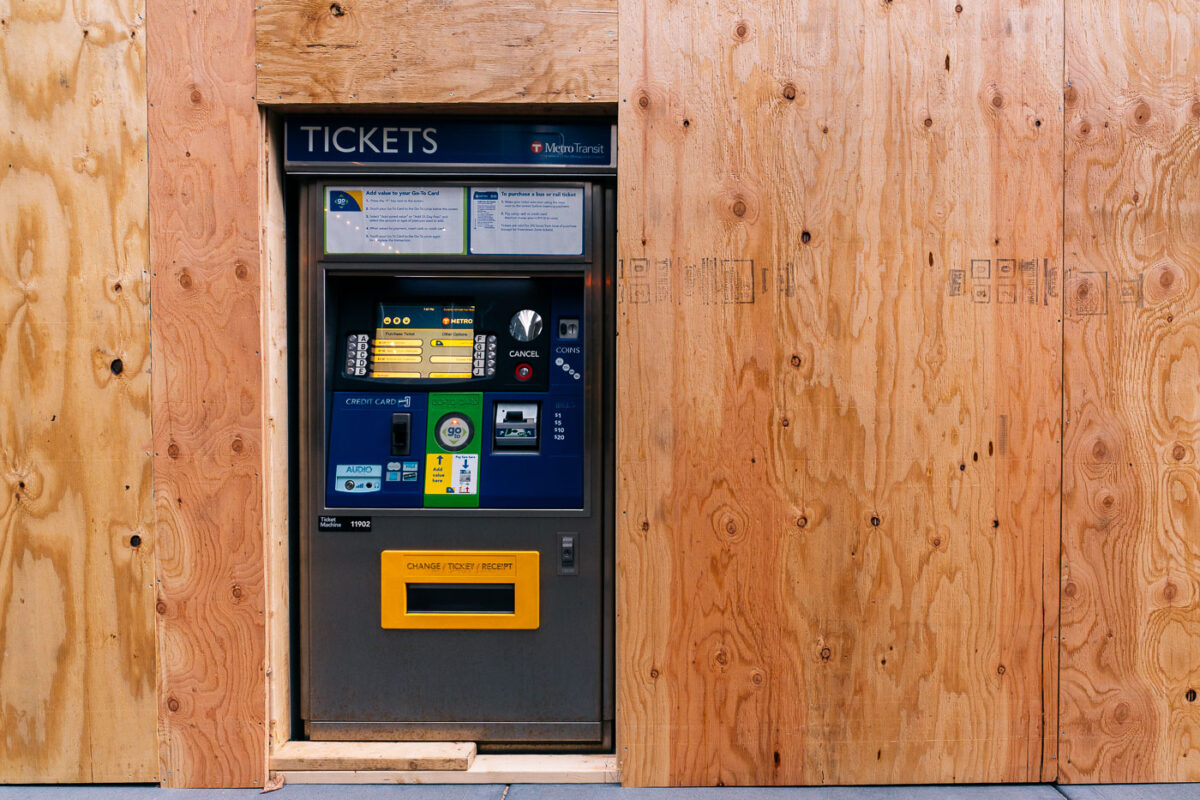
April 2021 — A Metro Transit ticket machine on Marquette Ave during the Derek Chauvin murder trial.
April 2021 — Signs in the windows of Catholic Charities.
April 2021 — George Floyd Square, April 2021
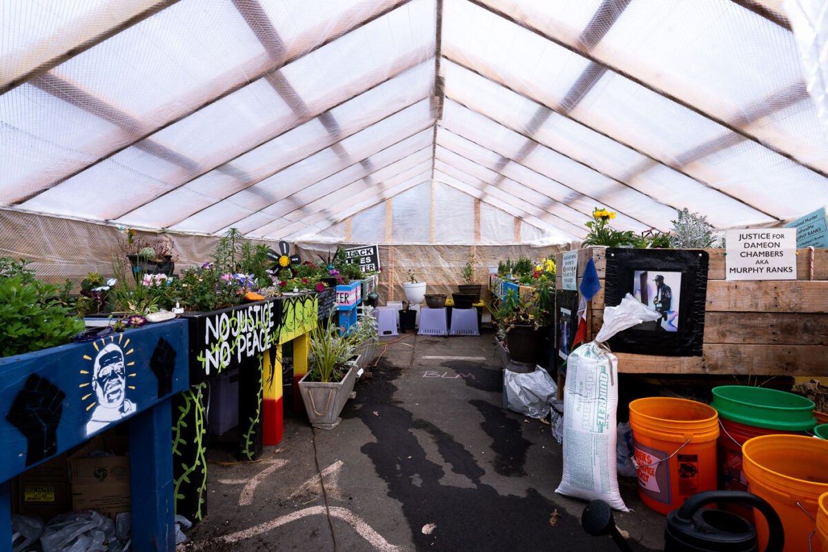
April 2021 — The greenhouse at George Floyd Square where plants were kept from the memorial through the winter. They've since been brought back out into the square.
April 2021 — The gardener at George Floyd Square plants flowers and plants around the memorial.
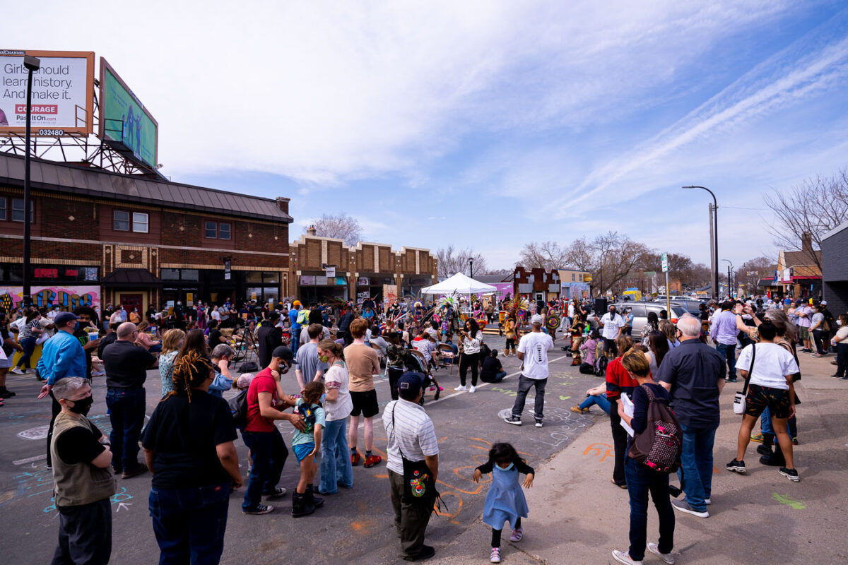
April 2021 — “The Peoples Power Love Fest” at George Floyd Square.
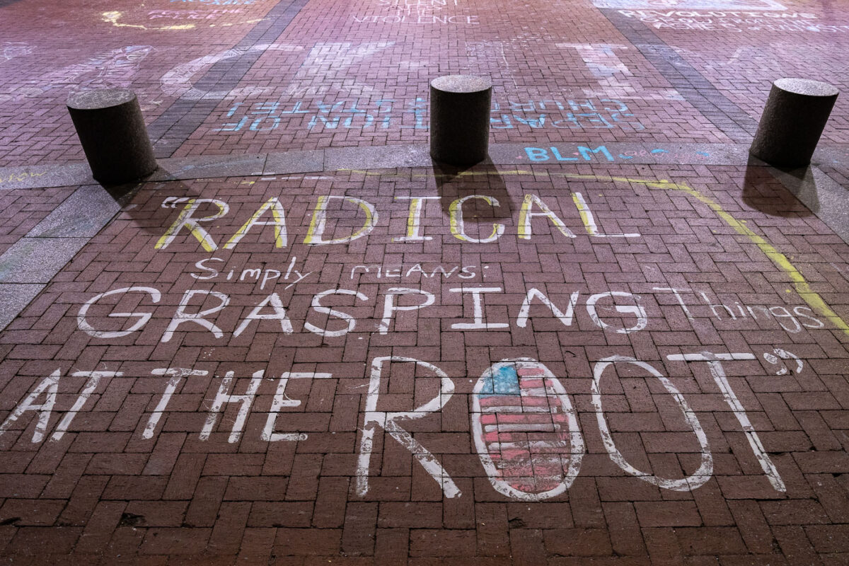
April 2021 — Chalk writing on the plaza outside the Hennepin County Government Center. The courthouse is currently holdin the Derek Chauvin murder trial. Chauvin is charged in the May 25th murder of George Floyd in South Minneapolis.
April 2021 — Rick's Cabaret with security boarding during the Derek Chauvin murder trial.
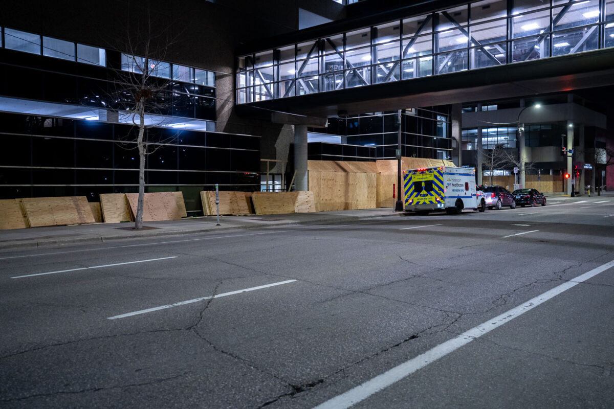
April 2021 — Boards going up at the Hennepin County Medical Center.
April 2021 — George Floyd Square, April 2021.
April 2021 —
April 2021 — Locks with the names of police brutality victims placed on the fencing around the Hennepin County Government Center during the Derek Chauvin murder trial.
April 2021 — Boards at the Star Tribune across from the courthouse.
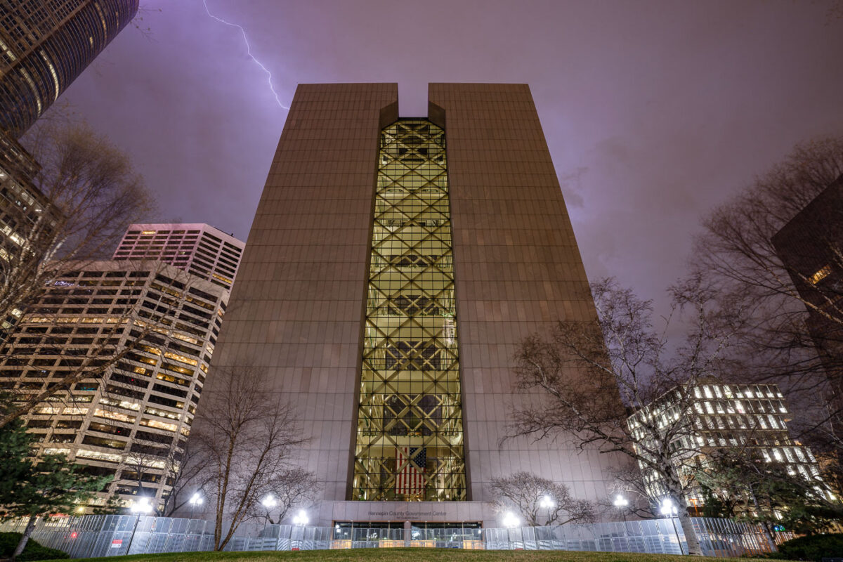
April 2021 — The skies over Hennepin County Government Center lit up by lightning. The heavily guarded and fortified courthouse in Downtown Minneapolis is where the Derek Chauvin murder trial is taking place. Chauvin is charged in the May 25th, 2020 murder of George Floyd.
April 2021 — A sign reading "Spruce Up Your City" next to a surveillance camera behind barbed wire in downtown Minneapolis.
April 2021 — George Floyd's family leaves the Hennepin County Government Center in downtown Minneapolis.
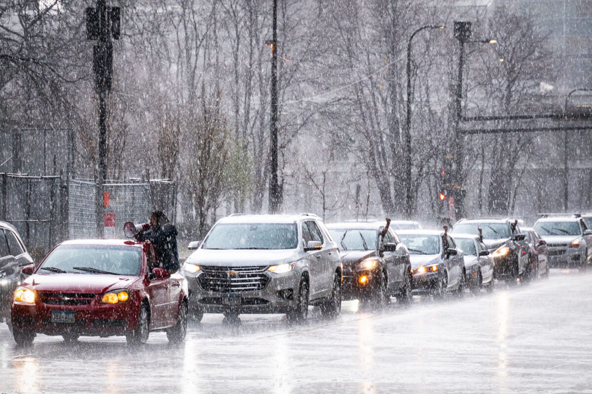
April 2021 — Protesters arrive in a car caravan around the Hennepin County Government Center in the pouring rain. The courthouse is currently holding the Derek Chauvin murder trial. Chauvin is charged in the May 25th murder of George Floyd in South Minneapolis.
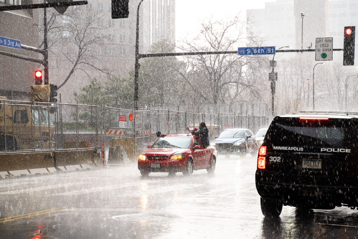
April 2021 — Protesters arrive in a car caravan around the Hennepin County Government Center in the pouring rain. The courthouse is currently holding the Derek Chauvin murder trial. Chauvin is charged in the May 25th murder of George Floyd in South Minneapolis.
April 2021 — United States Federal courthouse behind barricades and fencing during the Derek Chauvin murder trial.
April 2021 — Powderhorn Park in South Minneapolis
April 2021 — More Value Food & Deli at East 28th and Bloomington in Minneapolis.
April 2021 — George Floyd Square as seen from Chicago Ave.
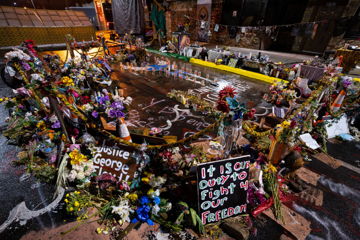
April 2021 — The George Floyd Memorial at George Floyd Square.
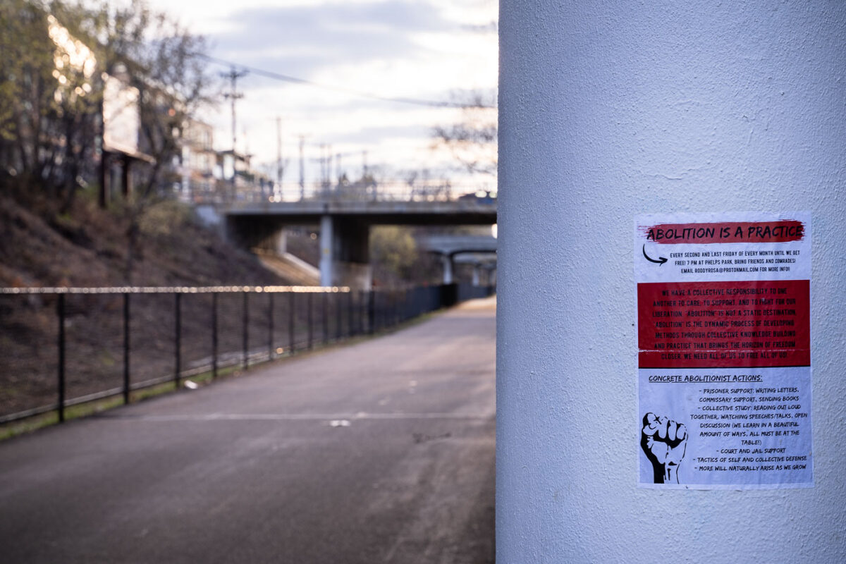
April 2021 — A police abolition sign pasted under a bridge on the Minneapolis Midtown Greenway.
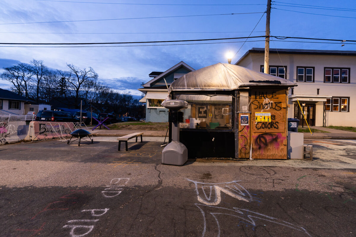
April 2021 — The warming station and street barricade at George Floyd Square in April 2021.
April 2021 — Boarded up and broken windows at the USPS Loop Station in downtown Minneapolis.
April 2021 — RIP Floyd written inside a popular abandoned building in Minneapolis.
April 2021 — Security fencing around the Hennepin County Medical Examiner's office as the Chauvin trial begins.
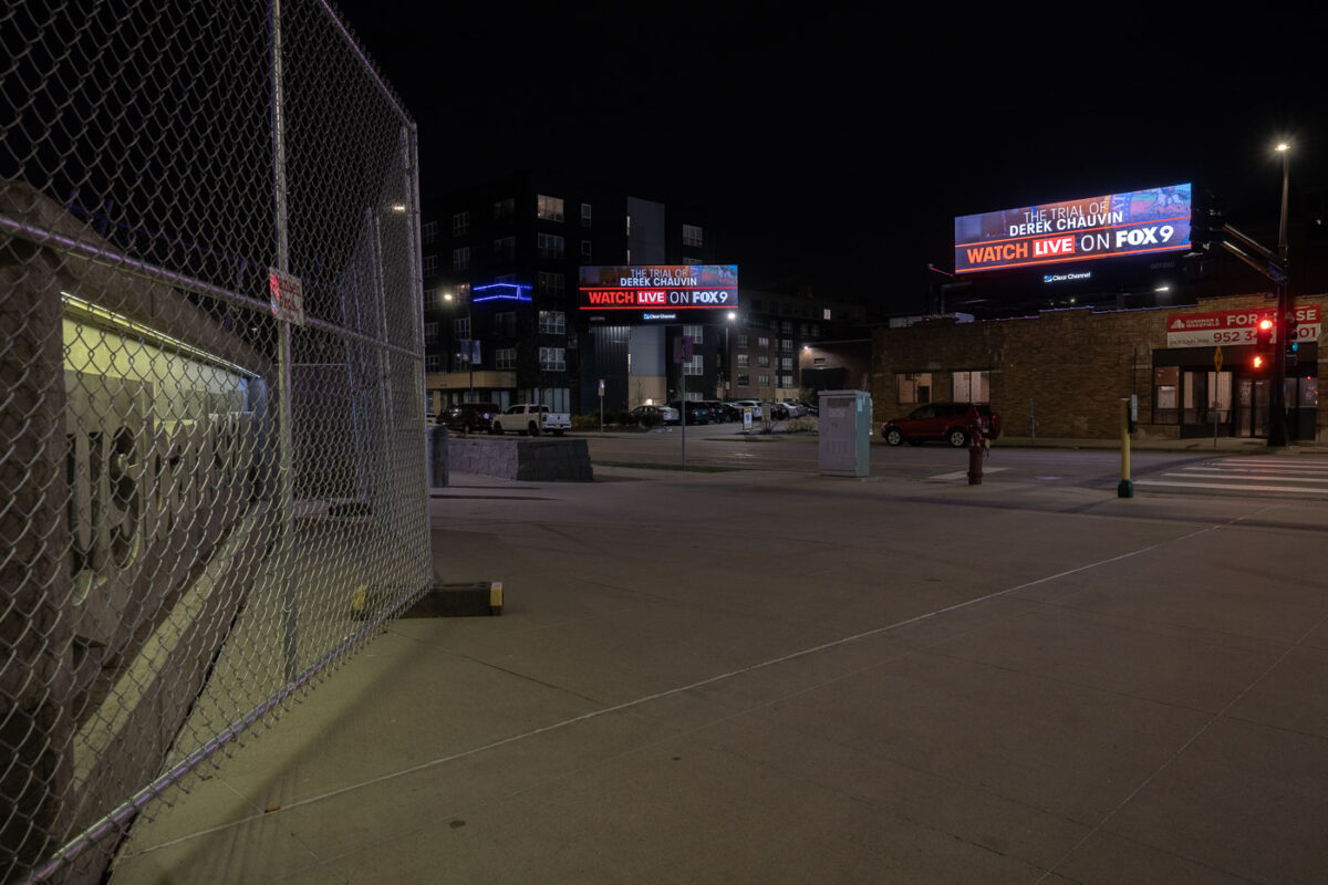
April 2021 — FOX9 billboards in downtown Minneapolis. US Bank Stadium to the left behind security fencing.
April 2021 — Boarded up windows at Hennepin County Medical Center during the Derek Chauvin murder trial.
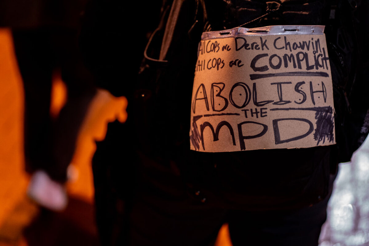
April 2021 — Abolish the MPD protest sign on someones back during a march through downtown Minneapolis.
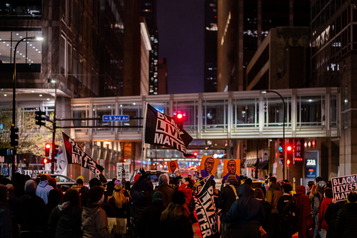
April 2021 — Protesters march through downtown Minneapolis starting at ending at the courthouse that's holding the Derek Chauvin murder trial.
April 2021 — Protesters march through downtown Minneapolis during the Derek Chauvin murder trial.
April 2021 — Protesters march through downtown Minneapolis during the Derek Chauvin murder trial.
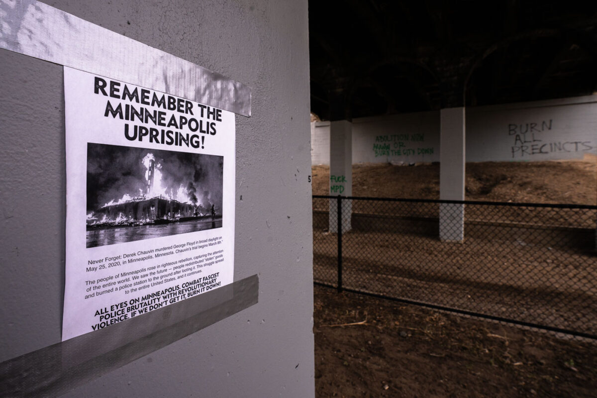
April 2021 — A posting on the Minneapolis Midtown Greenway.