Abandoned

345 photos · 2008–2026

345 photographs tagged Abandoned, 2008–2026.

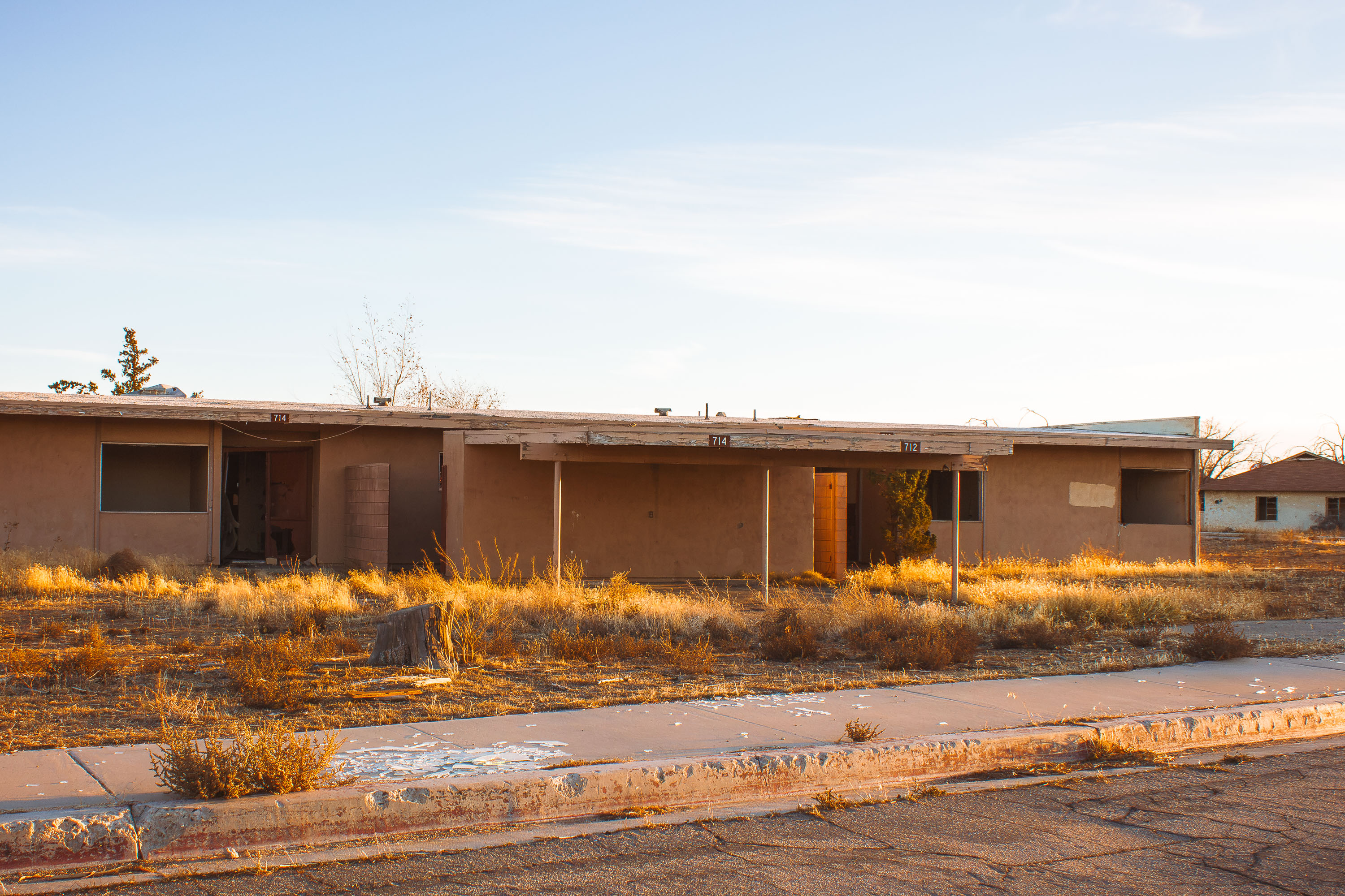
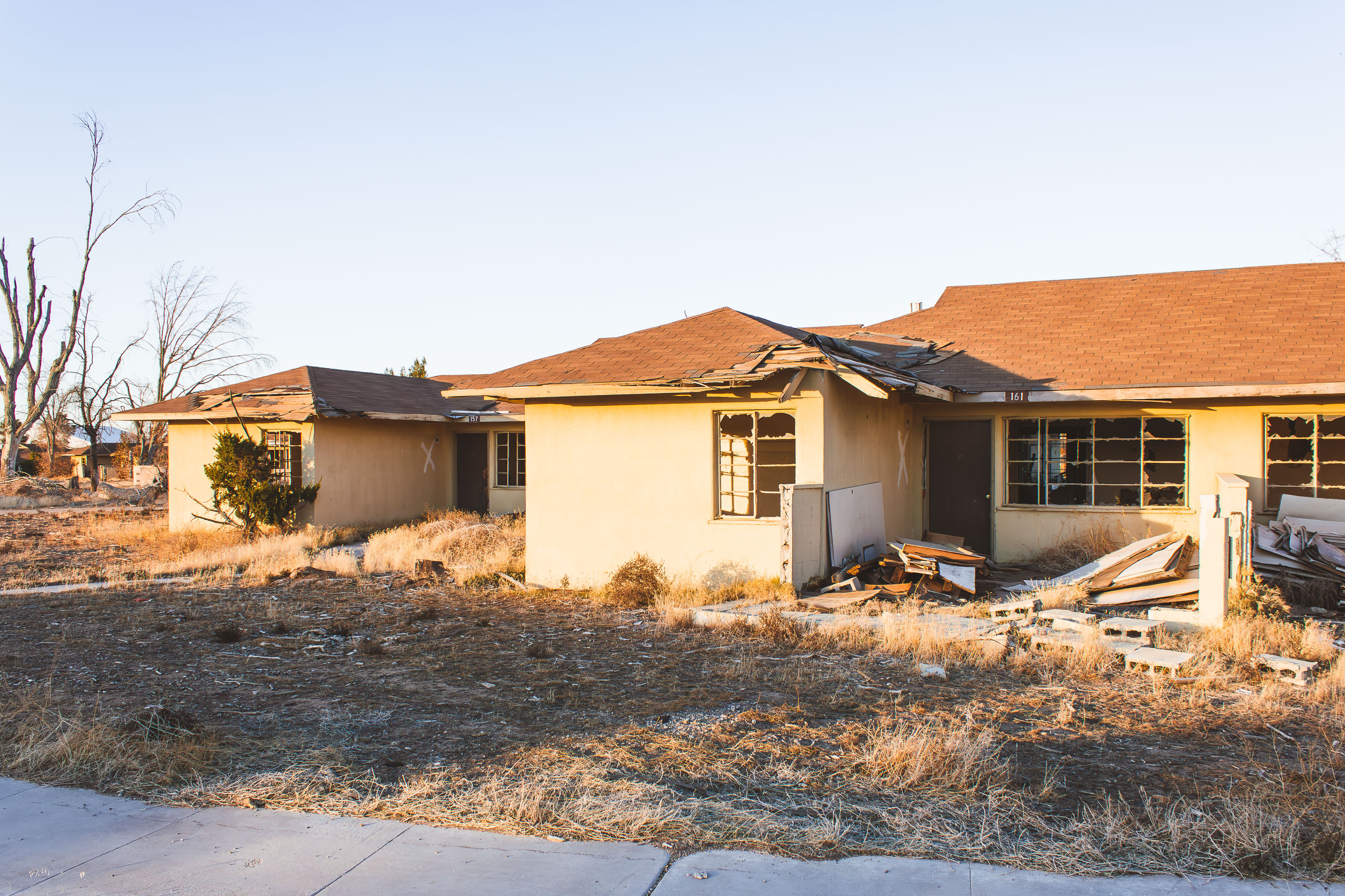
Abandoned stucco duplex at George Air Force Base in Victorville, California.
George Air Force Base operated near Victorville, California, from 1941 until it closed under the Base Realignment and Closure program in 1992. Family housing on the base supported thousands of assigned personnel, including those attached to fighter and training squadrons stationed there during the Cold War. After closure, much of the residential stock was left standing rather than demolished, and stucco homes like this one went unoccupied and unmaintained. The surrounding land was later redeveloped as Southern California Logistics Airport, though pockets of the old housing tracts remain, overtaken by desert grasses and brush.

Overgrown Yard at Abandoned Housing, George Air Force Base

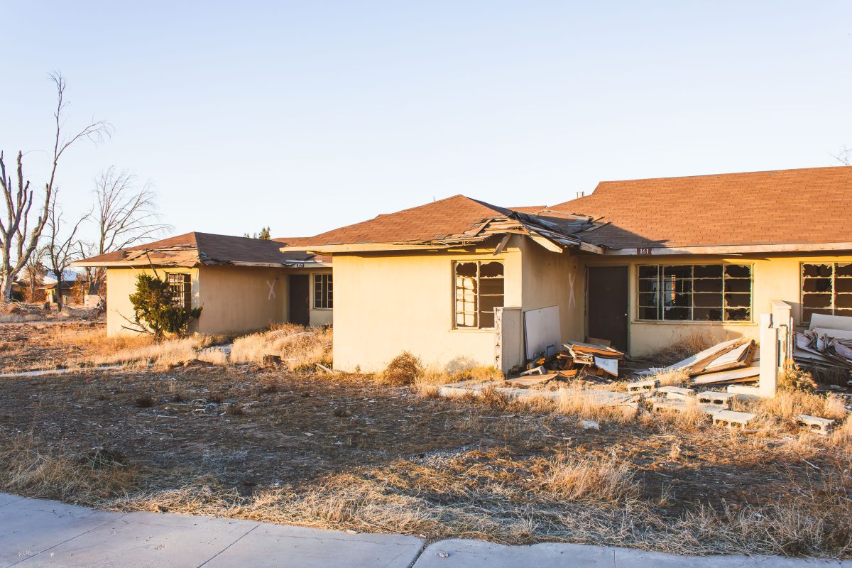
Abandoned residential building at George Air Force Base in Victorville, California, with deteriorated concrete foundation and
George Air Force Base operated near Victorville, California, from 1941 to 1992, training fighter pilots for World War II, Korea, and Vietnam before closing under a round of federal base realignment. Homes like this one housed airmen and their families during the base's decades of active service. After the Air Force transferred the property to local authorities, much of the residential stock was left standing rather than demolished, and decades of exposure have since collapsed roofs, walls, and cinderblock partitions throughout the neighborhood. Southern California Logistics Airport now operates on part of the former base, using its runways for aircraft storage and testing, while the old residential blocks remain largely untouched.

Crumbling Cinderblock Wall at Abandoned Housing, George Air Force Base

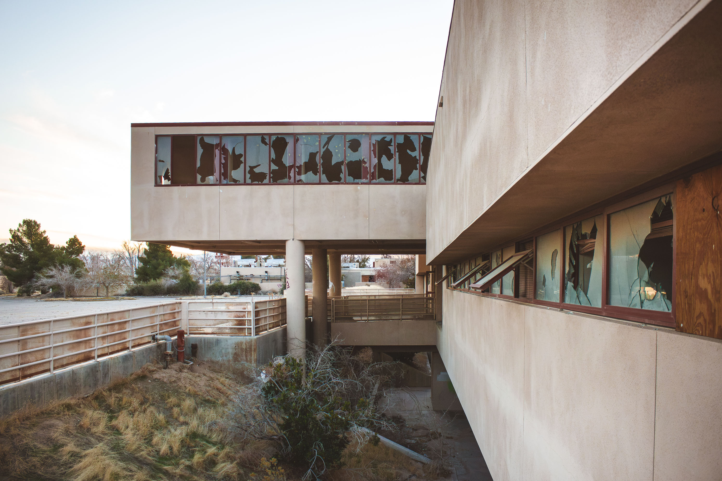
Elevated walkway with shattered windows at abandoned George Air Force Base in Victorville, California.
George Air Force Base operated near Victorville, California, from 1941 until its closure in 1992 during a round of nationwide base realignment. The elevated concrete walkway connected separate wings of the facility, letting personnel move between buildings without crossing the grounds below. After the closure, much of the property was redeveloped into the Southern California Logistics Airport, an aviation and industrial complex that reuses portions of the former runways and support buildings. Sections of the original base, including this passage, were left vacant, and decades without maintenance have left the windows broken out and the framing exposed.

Broken-Glass Skybridge at George Air Force Base

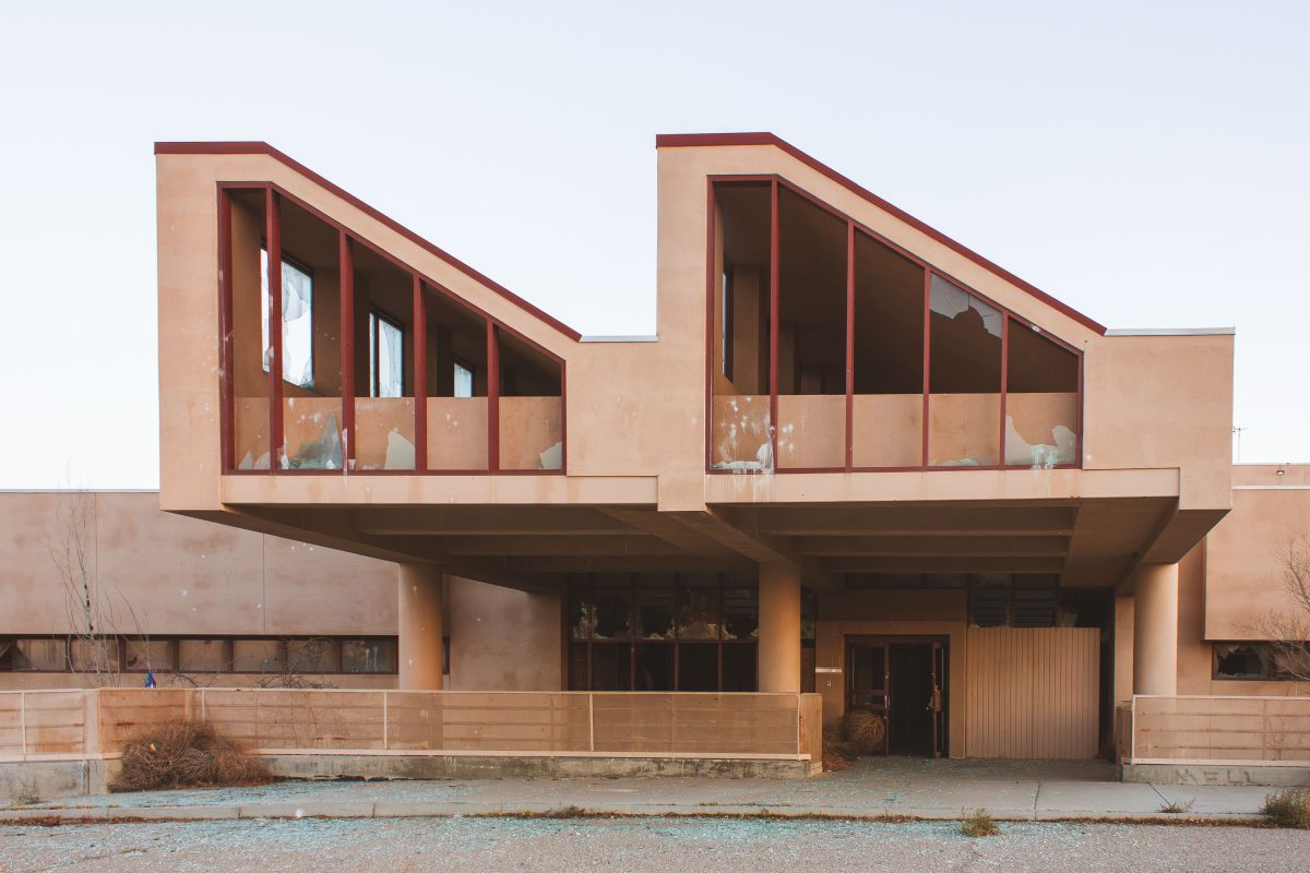
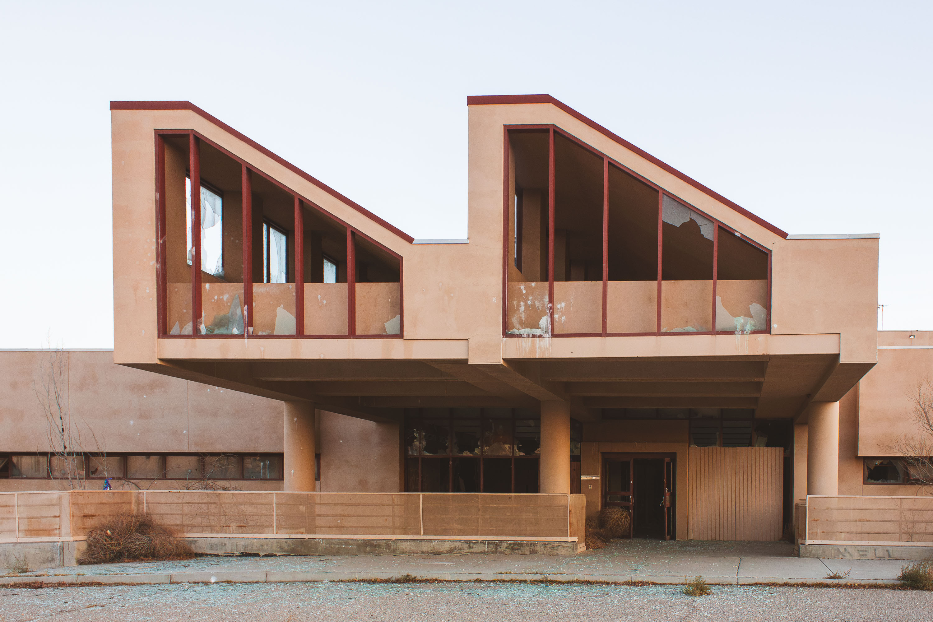
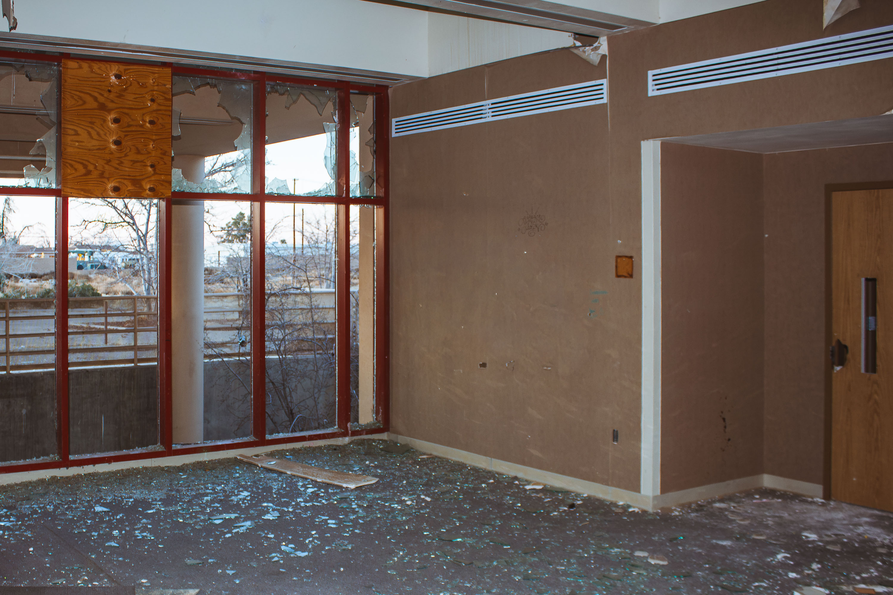
Abandoned community center at closed George Air Force Base in Victorville, California, with deteriorating stucco and broken
George Air Force Base trained fighter and bomber crews from 1941 until Congress ordered its closure under the 1988 Base Realignment and Closure Act, with final withdrawal in 1992. During the Cold War, the base hosted Tactical Air Command units alongside its training mission. Structures like this one served the base's recreational and community functions, built to support thousands of stationed personnel and their families. Much of the property now falls within the Southern California Logistics Airport, a joint civilian-military reuse of the former base, while other sections remain undeveloped and abandoned.

Angled Rooflines of the Community Center at George Air Force Base

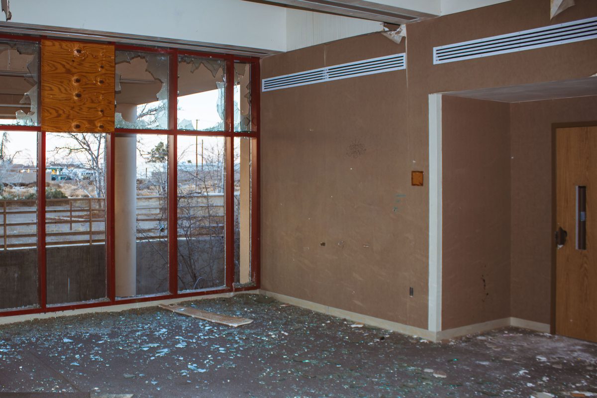
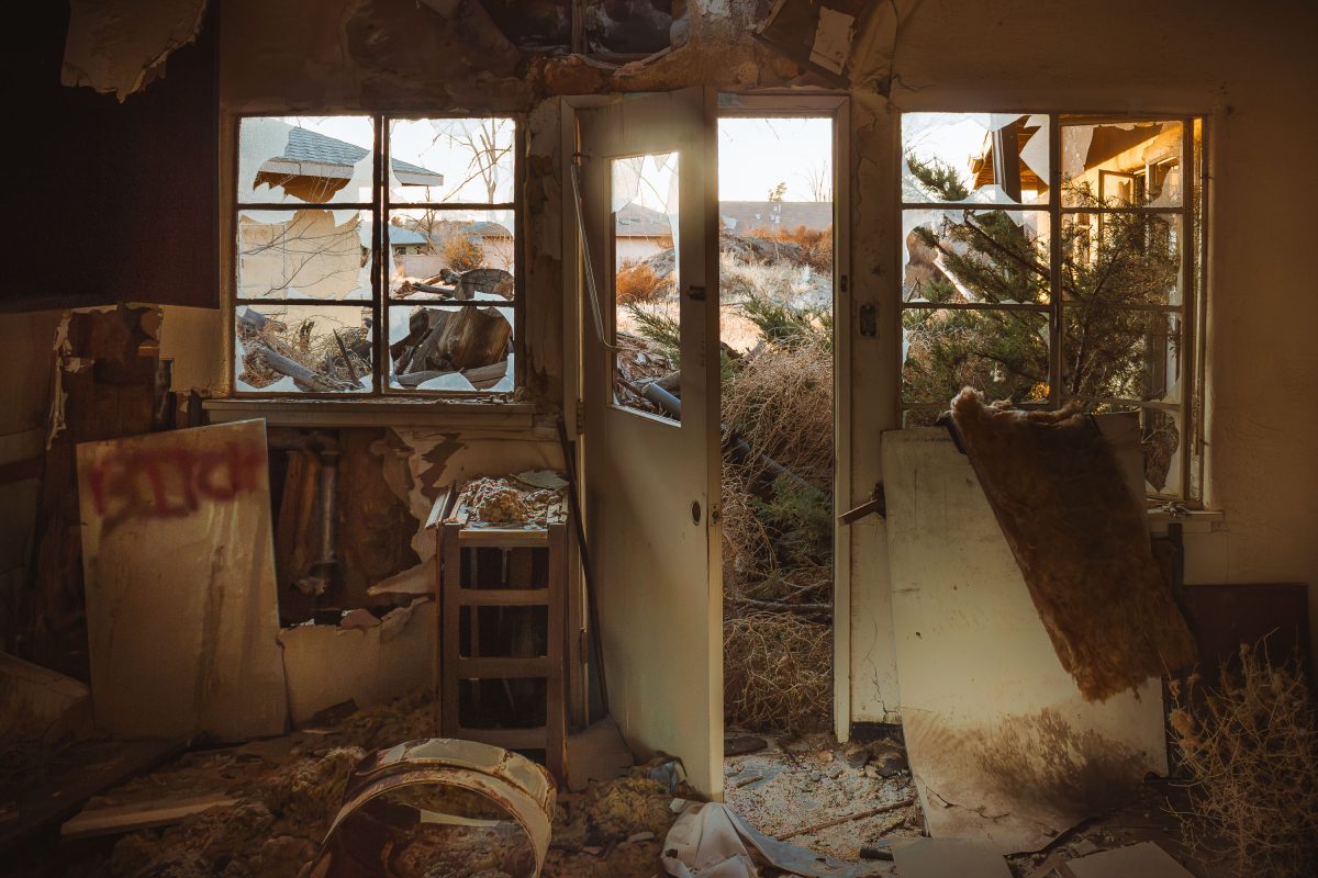
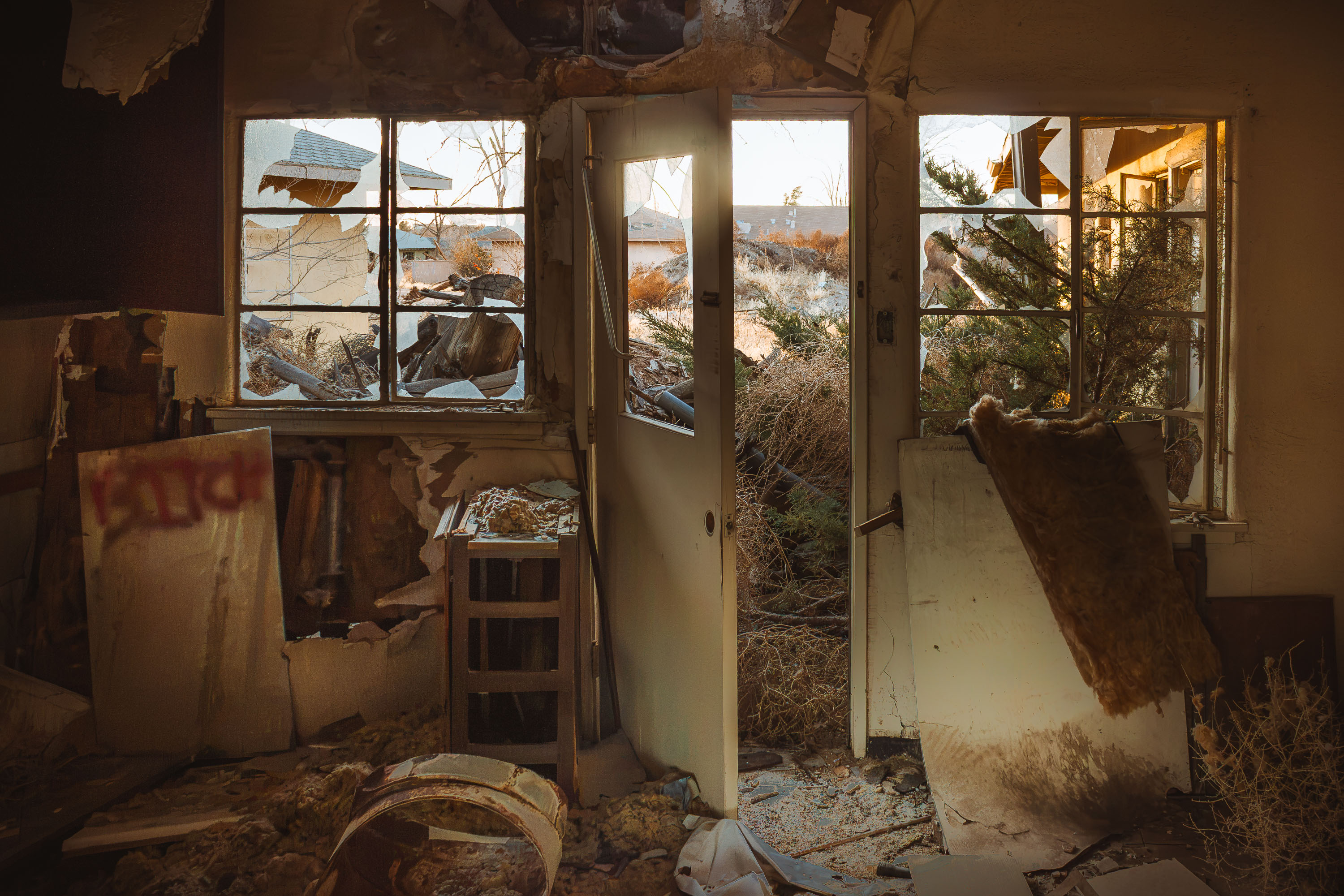
Abandoned officer housing interior with shattered glass doors at closed George Air Force Base, Victorville.
George Air Force Base opened in 1941 as Victorville Army Airfield and was renamed in 1950 to honor Brigadier General Harold H. George. It operated for decades as a fighter training installation, hosting squadrons that flew the F-4 Phantom and later the F-4G Wild Weasel. The Base Realignment and Closure Commission ordered the facility shut down in 1988, and the Air Force transferred the property in 1992. Part of the former base became Southern California Logistics Airport, while many administrative and support buildings from its operational years were left vacant and have since deteriorated.

Broken Glass Wall in an Administrative Building at George Air Force Base

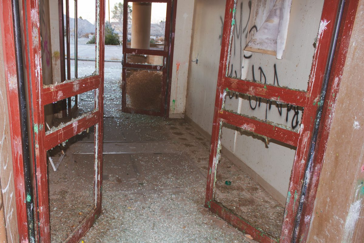
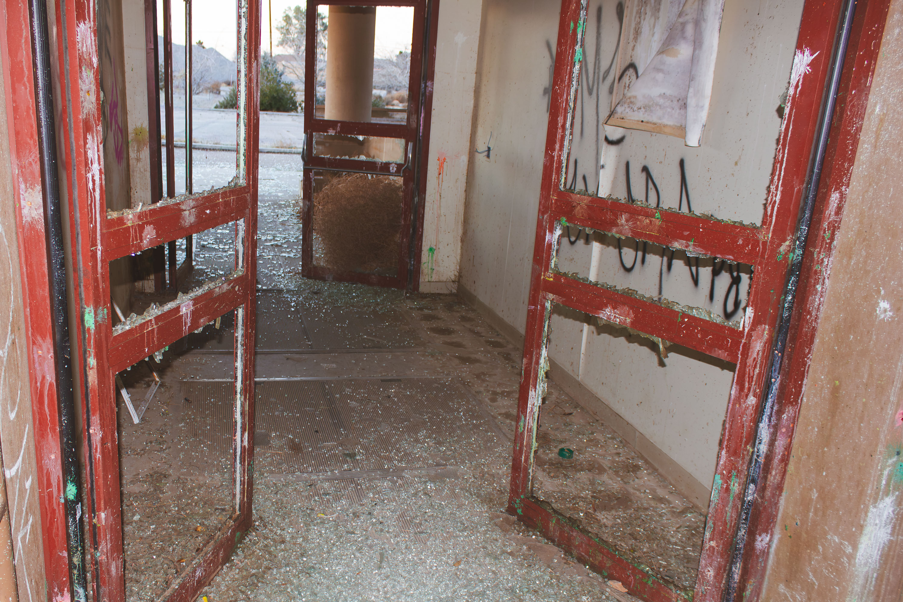
Deteriorated red doors with broken glass open onto an abandoned barracks interior at closed George Air Force Base in Victorville
George Air Force Base operated near Victorville, California, from 1941 until it closed in 1992 as part of a nationwide round of military base realignments. It served as a training installation for Tactical Air Command fighter pilots through much of the Cold War. Since closure, many of its former buildings have sat empty, with door frames, glass, and interior fixtures stripped or destroyed over decades of exposure and vandalism. Part of the base's runways and support facilities were later absorbed into Southern California Logistics Airport, though a large share of the original structures remain vacant.

Broken Doorframes and Glass Debris at George Air Force Base

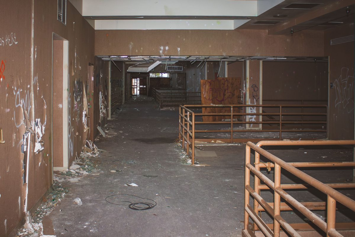
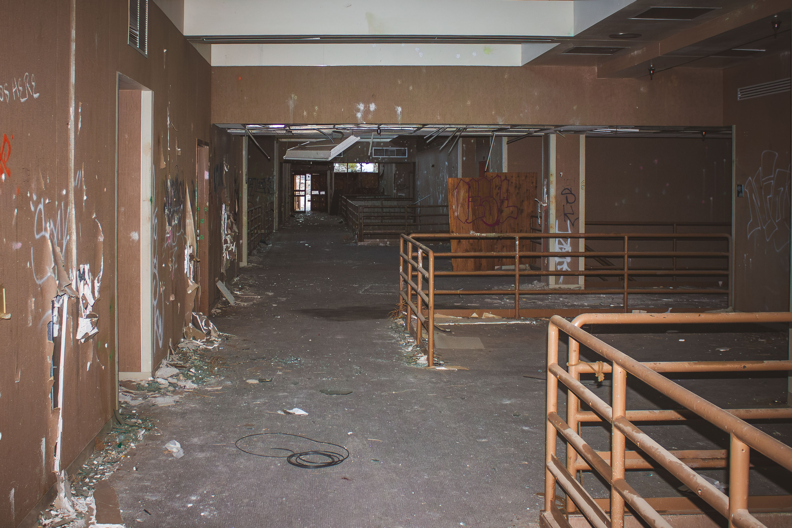
Gutted concourse of a base exchange at closed George Air Force Base in Victorville, California, with rusted railings and
George Air Force Base operated near Victorville, California, from 1941 until it closed under the 1991 Base Realignment and Closure process, with final shutdown in 1992. It served as a Tactical Air Command and later Air Combat Command installation, and its on-base community included a base exchange and commissary complex that functioned as the primary shopping center for resident personnel and their families. Since closure, portions of the former base have been redeveloped as Southern California Logistics Airport, while other structures, including former retail buildings, have been left vacant and stripped of fixtures.

Abandoned Base Exchange Concourse at George Air Force Base

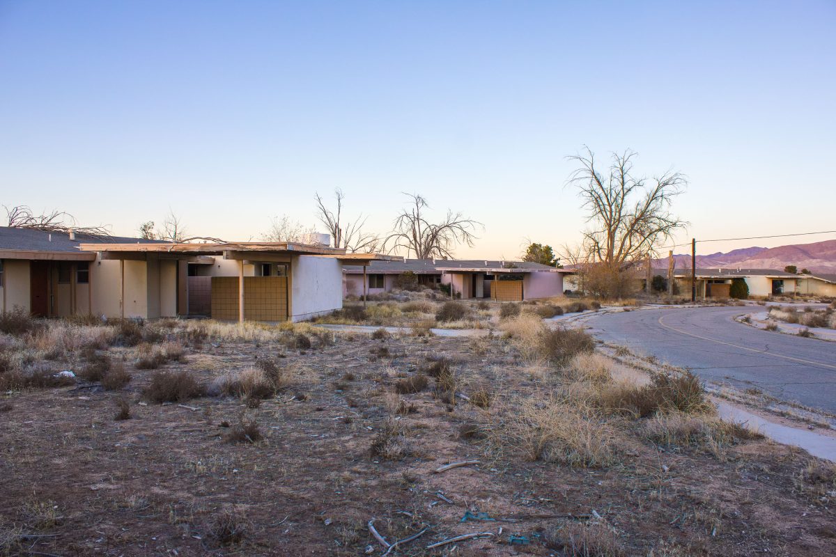
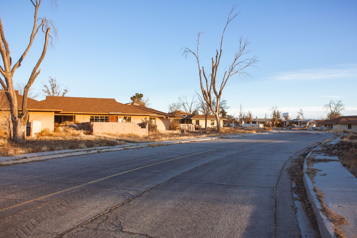
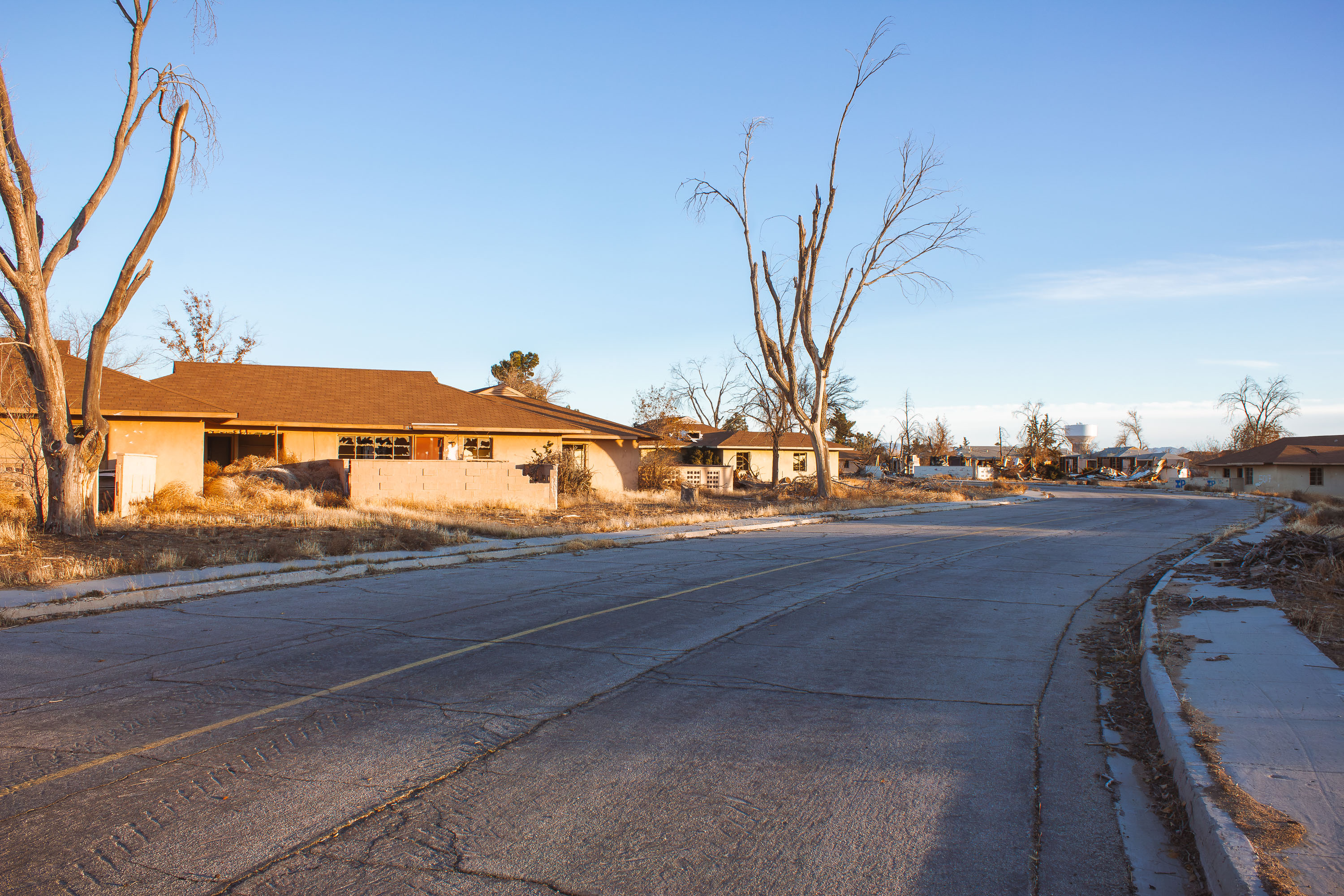
Abandoned ranch-style housing units along a curved road at George Air Force Base in Victorville, California.
George Air Force Base operated in Victorville, California, from 1941 until it closed in December 1992 under the 1991 Base Realignment and Closure process. Originally established as Victorville Army Air Field, it later served as a Strategic Air Command and Tactical Air Command installation, home to bomber and fighter squadrons for five decades. Its family housing tracts, built in the ranch-style common to Cold War-era military construction, once housed hundreds of families stationed at the base. After closure, the property was redeveloped as Southern California Logistics Airport, but many of the old residential streets and housing rows sat empty for years afterward.

Bare Trees and Empty Streets at George Air Force Base Housing

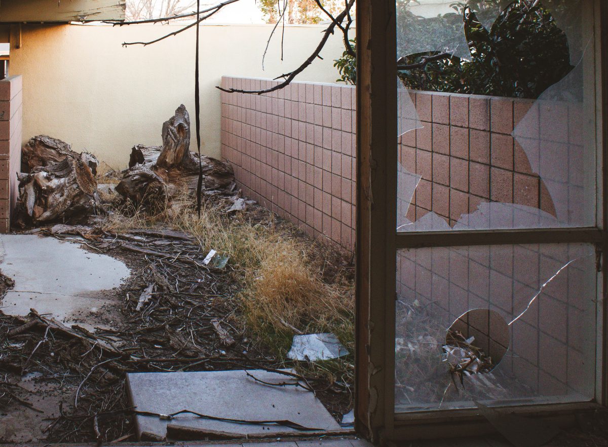
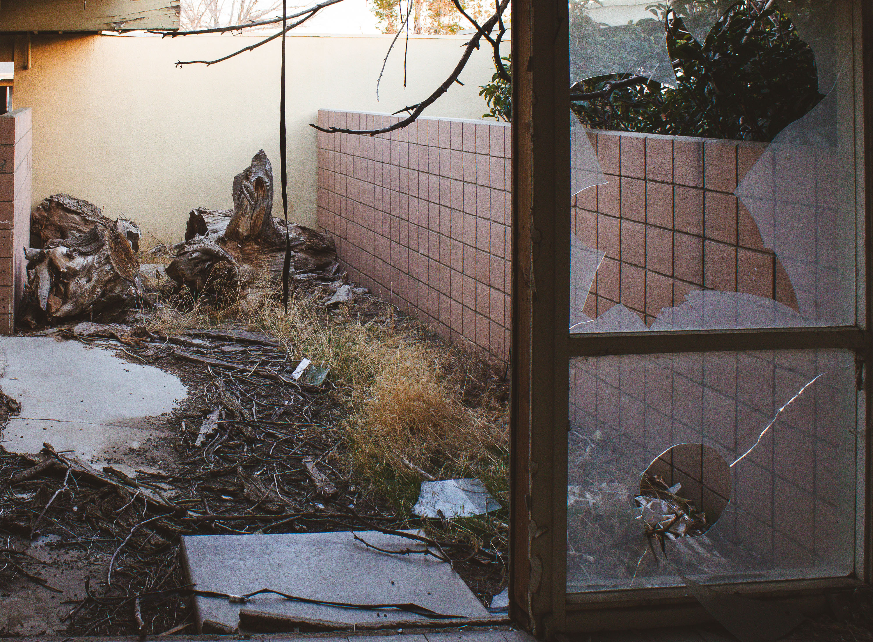
Shattered patio door and overgrown courtyard at abandoned officer housing, George Air Force Base, Victorville, California.
George Air Force Base closed in 1992 under the federal Base Realignment and Closure Act, ending more than five decades of Air Force operations near Victorville, California. Housing built for officers and enlisted families was left standing afterward, and much of it has never been reoccupied. Redevelopment agencies took control of the residential blocks in the years following closure, but reuse plans repeatedly stalled. Yards and patios in these former quarters have gone untended for decades, with broken glass and dead vegetation now common throughout the old housing tracts.

Broken Patio Glass and Debris at George Air Force Base Housing

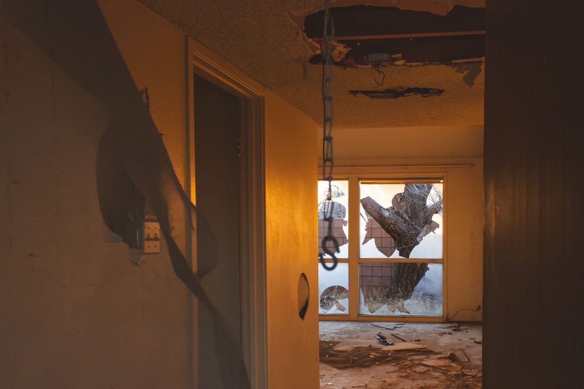
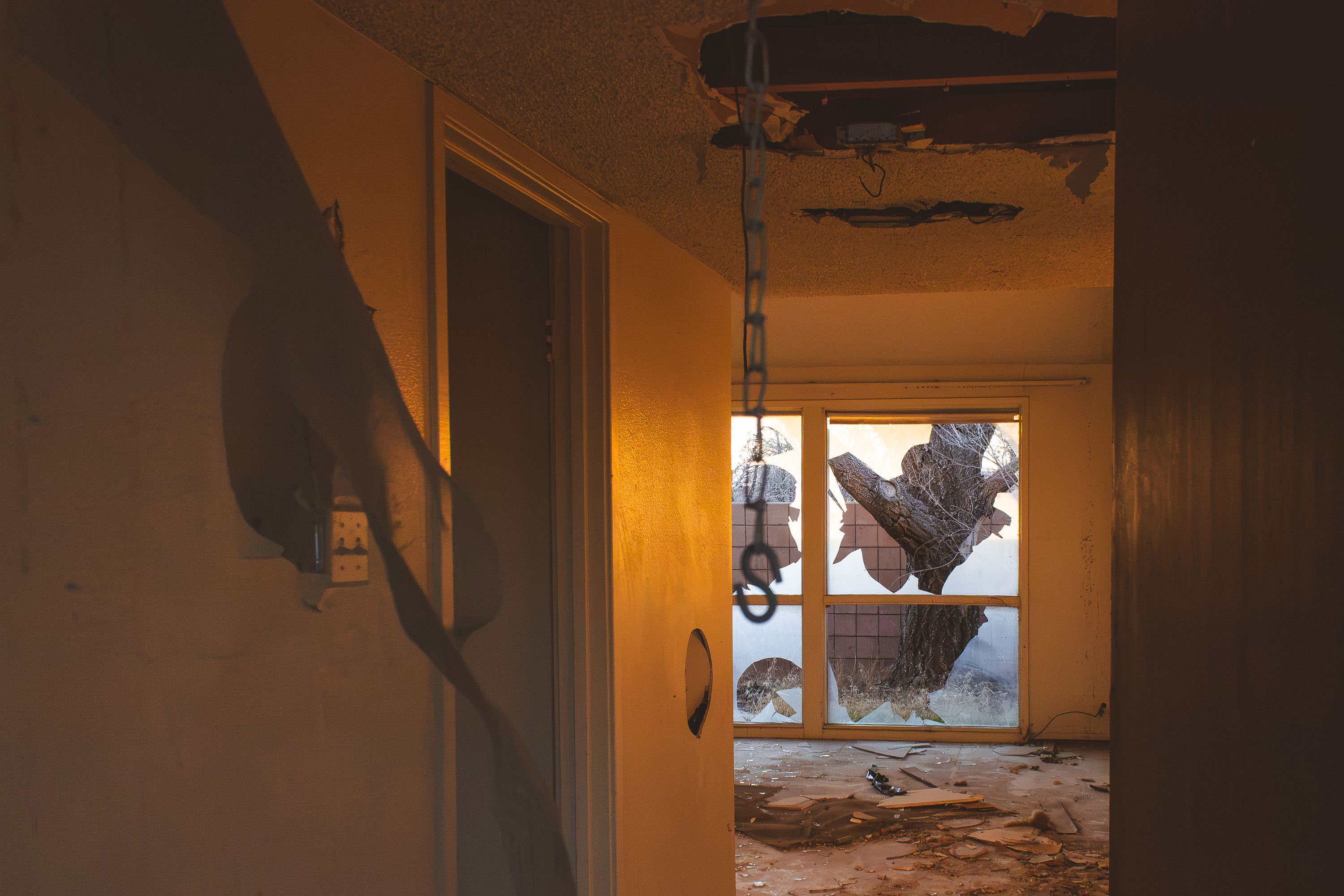
Interior of abandoned officer housing at George Air Force Base showing collapsed ceiling and broken windows.
George Air Force Base closed in 1992 following the 1988 Base Realignment and Closure Commission decision, ending more than five decades of Air Force operations near Victorville, California. Its family housing units were left standing afterward, unmonitored for years as redevelopment plans for the site repeatedly stalled. Copper theft, vandalism, and weather exposure gradually gutted many of the structures, collapsing ceilings and shattering windows throughout. Some portions of the former base later became Southern California Logistics Airport, but the residential blocks were largely left to deteriorate on their own.

Hallway View Through a Gutted Unit at George Air Force Base

Abandoned residential street at closed George Air Force Base in Victorville, California with deteriorating buildings and cracked
George Air Force Base operated in Victorville, California, from 1941 until it closed under the 1991 Base Realignment and Closure round, with the last personnel departing in 1992. For much of the Cold War it trained fighter and attack pilots, hosting squadrons that flew the F-4 Phantom and later the F-16. Its family housing areas held rows of duplex and fourplex units arranged along interior streets, laid out like a small residential town rather than a typical military compound. When the base closed, the surrounding land became Southern California Logistics Airport, but large sections of the old housing were left standing rather than demolished. Decades later, the pavement markings and concrete curbs remain the clearest trace of streets that once ran through a neighborhood of thousands of military families.

Deserted Street Curving Past Family Housing at George Air Force Base

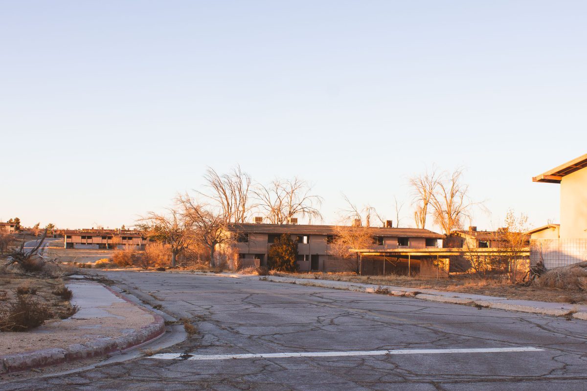
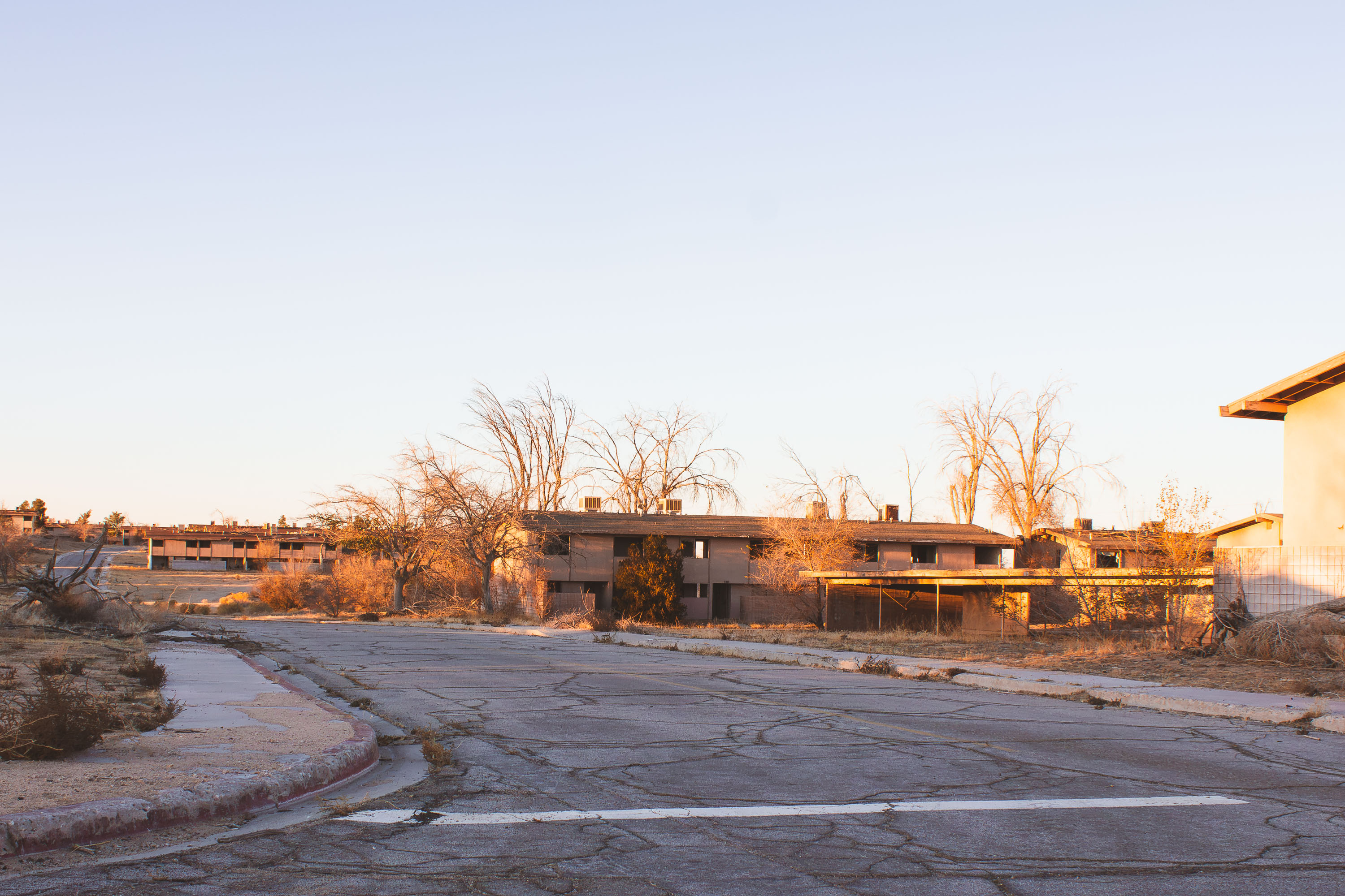
Cracked asphalt street lined with deteriorating stucco buildings at abandoned George Air Force Base in Victorville, California.
George Air Force Base operated from 1941 until it closed in 1992 under the federal Base Realignment and Closure program, one of many installations cut as Cold War-era defense spending declined. At its peak the base supported thousands of Air Force personnel and their families, with on-base housing built for airmen assigned to tactical fighter training squadrons. Streets, curbs, and driveways from the old neighborhood remain in place today, even as the houses that once lined them have been gutted and left to decay. A portion of the former base was redeveloped as Southern California Logistics Airport, while other sections, including much of the old housing area, were simply left standing empty.

Sunset Light on an Empty Road at George Air Force Base

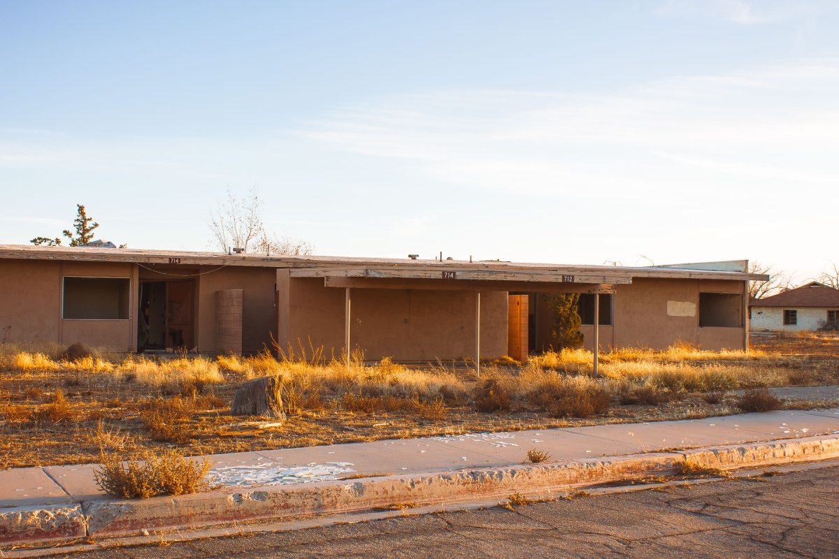
Abandoned duplex units 712 and 714 at closed George Air Force Base near Victorville, California.
George Air Force Base near Victorville, California operated as an Army Air Forces training installation starting in 1941 and later served as a Tactical Air Command fighter base before closing in 1992 under a federal realignment program. Its family housing included single-story duplexes built for enlisted personnel and their families. When the base closed, the land was repurposed as the Southern California Logistics Airport, but many residential streets, including this one, were left standing rather than redeveloped. Units 712 and 714 remain among the unaddressed duplexes still standing decades after the base's closure.

Duplex Units 712 and 714 at George Air Force Base

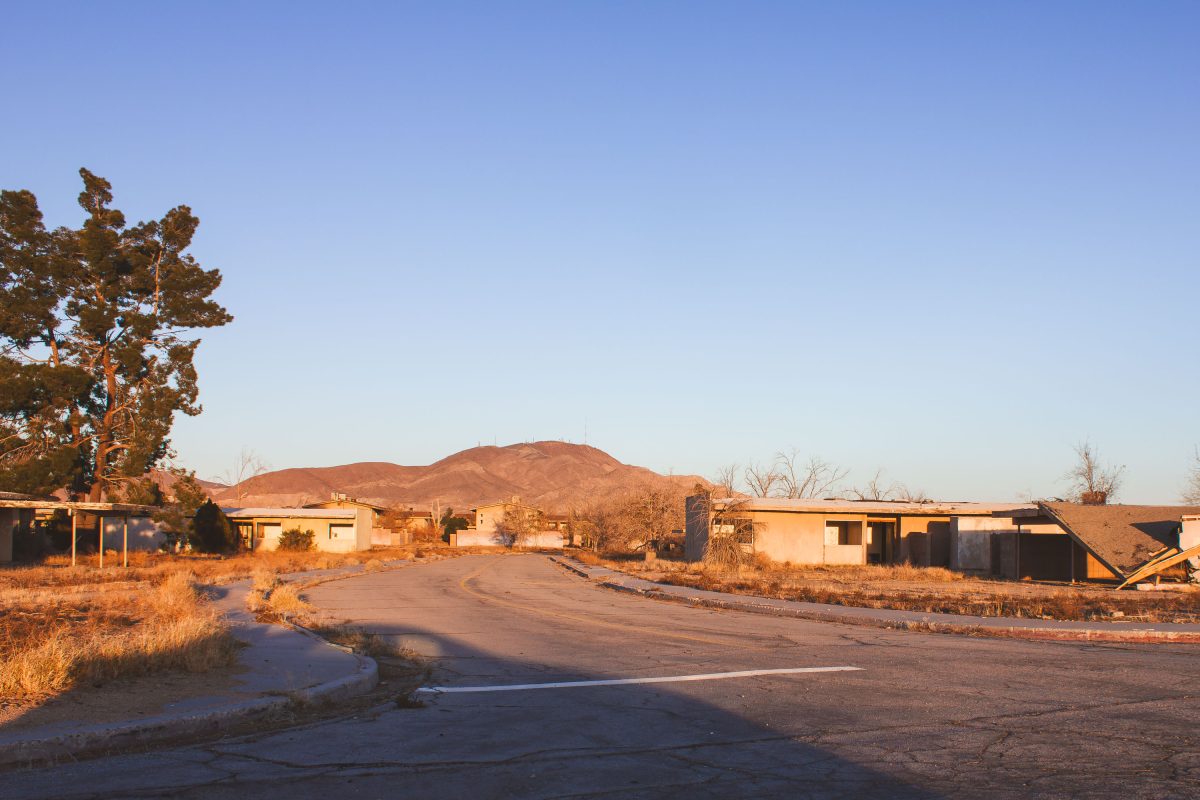
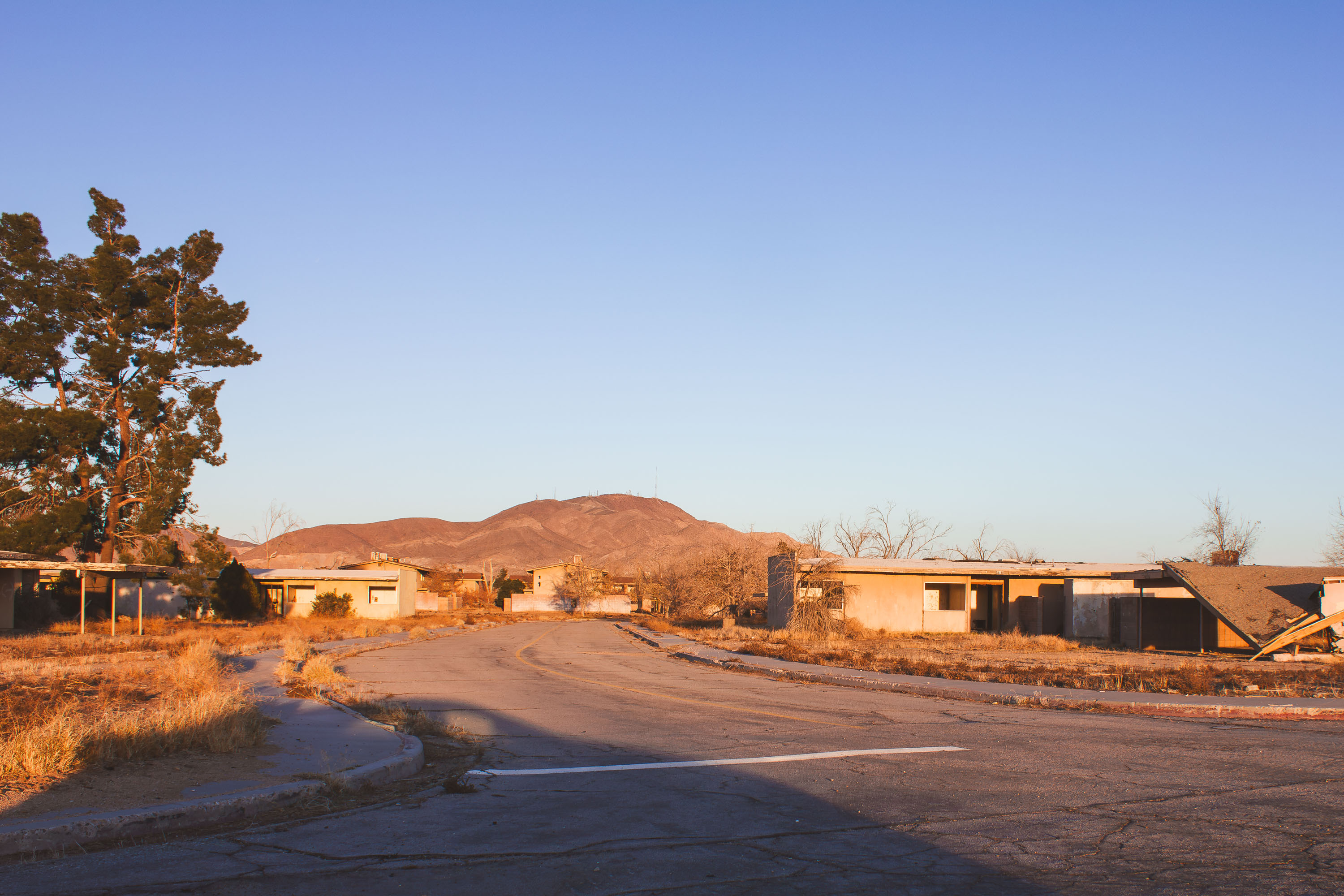
Abandoned residential street at closed George Air Force Base in Victorville, California with deteriorating buildings and bare
George Air Force Base closed in 1992 under the federal Base Realignment and Closure program after more than five decades of service, having opened in 1941 near Victorville, California. It hosted fighter and bomber squadrons through its history, including F-4 Phantom and F-111 units during the Cold War. The neighborhoods built for service members and their families were never demolished after decommissioning, leaving rows of vacant homes along the base's old residential streets. Part of the former base site is now Southern California Logistics Airport, but the housing areas remain largely untouched.

Winding Street Through Abandoned Housing at George Air Force Base

Abandoned residential unit at George Air Force Base in Victorville, California with marked windows and deteriorating roof.
George Air Force Base began in 1941 as Victorville Army Air Field, an Army Air Corps site for bombardier and gunnery training. It was renamed in 1950 for Brig. Gen. Harold Lee George, an early advocate of American strategic bombing doctrine, and spent its later decades as a Strategic Air Command installation during the Cold War. A 1992 Base Realignment and Closure order shut the base down, leaving its family housing units vacant. Portions of the former base now fall within the Southern California Logistics Airport, but rows of stucco duplexes remain standing, their doors and windows still marked with the spray-painted X's left by post-closure inspectors.

Spray-Painted X’s Mark Abandoned Duplexes at George Air Force Base

Gutted kitchen interior of abandoned officer housing at George Air Force Base, Victorville, California.
George Air Force Base operated northeast of Victorville from 1941 until it was shuttered under the 1992 Base Realignment and Closure Act. The residential blocks that once housed Air Force families were left standing after closure, and the Southern California desert has spent three decades working through the drywall, glass, and wood framing left behind. Broken window glass and stripped door hardware are typical of the housing stock here, most of which was never demolished or repurposed. A portion of the former base was redeveloped into Southern California Logistics Airport, but the family housing sections were largely bypassed and left to decay in place.

Broken Doorway and Windows in Abandoned Housing at George Air Force Base

Abandoned ranch-style home at George Air Force Base in Victorville, California, with deteriorating stucco and desert vegetation.
George Air Force Base operated in Victorville, California, from 1941 until its 1992 closure under the federal Base Realignment and Closure program. Ranch-style homes like this one housed Air Force families assigned to the base's fighter and tactical training squadrons, with much of the housing stock dating to the 1950s Cold War-era expansion. After decommissioning, ownership of the residential area passed to the Southern California Logistics Airport authority, which left many structures standing rather than demolishing them. Decades of vacancy have made the former housing area a frequent destination for explorers of abandoned Mojave Desert sites.

Evening Light on an Abandoned Ranch Home at George Air Force Base

Abandoned stucco duplexes at closed George Air Force Base in Victorville, California, with a dead tree and desert scrub.
George Air Force Base operated near Victorville, California, from 1941 until it was shuttered under the 1991 Base Realignment and Closure round, with the last personnel departing in 1992. The base supported fighter and bomber squadrons through World War II, Korea, and the Cold War, and its residential blocks once housed thousands of Air Force families. After closure, much of the property was redeveloped as the Southern California Logistics Airport, but many of the original housing units were left standing rather than demolished. Decades on, the stucco duplexes sit stripped of doors and fixtures, with dead trees and wild grasses reclaiming the yards where military families once lived.

A Snapped Tree in the Yard of George Air Force Base Housing

Abandoned two-story barracks at George Air Force Base in Victorville, California, deteriorating in the desert.
George Air Force Base operated near Victorville, California, from 1941 until it closed under the 1991 Base Realignment and Closure Act, with the last personnel leaving in 1992. It served fighter and bomber squadrons for five decades, including F-4 Phantom and F-111 units during the Cold War. After decommissioning, two-story barracks and housing blocks like this one were left standing, stripped of utilities and exposed to the Mojave Desert climate. Part of the former base site was later redeveloped into Southern California Logistics Airport, but much of the residential and support housing was simply abandoned in place.

Two-Story Housing Block at George Air Force Base, Victorville

Abandoned residential buildings at George Air Force Base in Victorville, California, with bare desert landscape.
George Air Force Base operated near Victorville, California, from 1941 until it closed under the 1991 Base Realignment and Closure Act, with the last personnel leaving in 1992. During its active decades the base trained fighter pilots, including F-4 Phantom and F-111 crews during the Vietnam War era. The housing blocks built for enlisted families and officers have sat vacant since closure, stripped of fixtures and left exposed to the Mojave Desert climate. Part of the former base was redeveloped into Southern California Logistics Airport, while sections of family housing were left standing and fenced off from public access.

Abandoned Housing Row at George Air Force Base

Abandoned residential unit 129 at closed George Air Force Base in Victorville, California, with broken windows and deteriorated
George Air Force Base operated near Victorville, California, from 1941 until it closed under the 1991 Base Realignment and Closure round, with final shutdown in 1992. Unit 129 was part of a residential section built for Air Force personnel and their families during the base's decades as a fighter training installation. The Southern California Logistics Airport and Victor Valley College now occupy portions of the former base, but much of the old family housing was left standing and unmaintained after closure. Decades of exposure to the Mojave Desert climate have left the vacant units with broken windows and stripped interiors.

Boarded-Up Unit 129 at George Air Force Base Housing, Victorville

Broken double-pane glass doors at vacant officer housing at closed George Air Force Base in Victorville, California.
George Air Force Base operated near Victorville, California, from 1941 until it closed under the 1991 Base Realignment and Closure round, with the Air Force ceasing operations there in 1992. Housing units like this one sheltered military families during the base's decades as a fighter training installation. After closure, ownership of the residential sections passed to local redevelopment authorities, and many structures were stripped of fixtures and left to deteriorate. Portions of the former base now form the Southern California Logistics Airport, while the old housing rows remain vacant.

Shattered Window Frame at Abandoned Housing, George Air Force Base
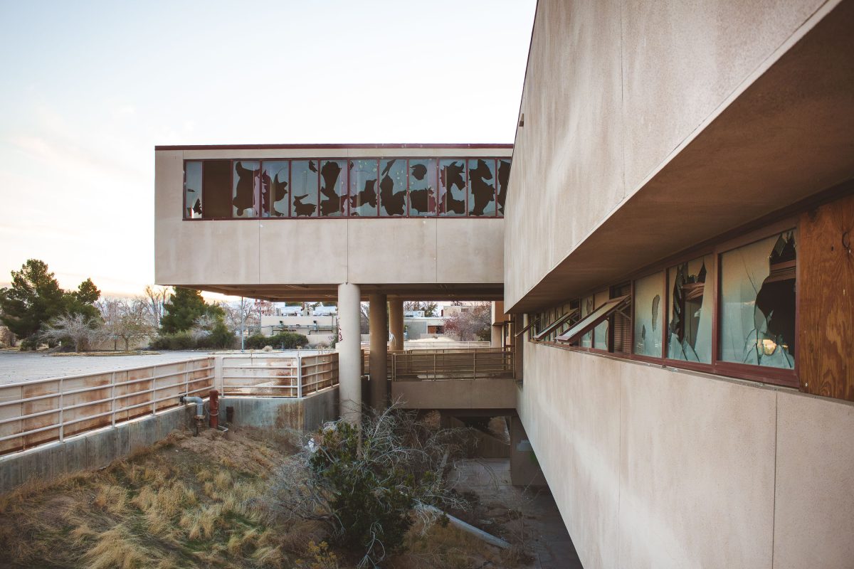
Vacant residential buildings on abandoned George Air Force Base in Victorville, California.
George Air Force Base sits just north of Victorville, California, on land the Army first used as a training field in the 1920s before the Air Force took it over in 1941 and named it for Brigadier General Harold H. George. At its Cold War peak, the base trained fighter pilots and hosted squadrons flying the F-4 Phantom and later the F-4G Wild Weasel. The 1991 Base Realignment and Closure Commission ordered its shutdown, and the Air Force officially closed George in 1992, transferring roughly 5,300 acres to civilian control. Much of the former base, including its residential housing tracts, has sat empty for decades, while other sections were redeveloped into the Southern California Logistics Airport and an adjoining business park.

Overgrown Lots Along Base Housing Row at George Air Force Base

Abandoned officer housing at George Air Force Base in Victorville, California, with cracked pavement and desert vegetation.
George Air Force Base operated in Victorville, California, from 1941 until it closed in 1992 under a federal base realignment order. During the Cold War it served as home to fighter squadrons flying F-4 Phantoms and later F-4G Wild Weasels, training crews for electronic warfare and air combat missions. Officer housing on base sheltered military families for decades before the closure left the neighborhood empty. Part of the former base has since been redeveloped as Southern California Logistics Airport, but sections of the old residential streets remain abandoned.

Cracked Roadway Through Officer Housing at George Air Force Base

The Lowertown Depot building in St. Paul, Minnesota, formerly the Standard Oil Branch Warehouse, a key industrial structure.
The "Lowertown Depot" building in St. Paul, Minnesota, once served as the Standard Oil Branch Warehouse. This structure was a key component of the city's industrial and commercial infrastructure, facilitating the distribution of petroleum products. Its demolition marked the end of an era for this historic industrial site in the Lowertown district.

Standard Oil Branch Warehouse, St. Paul

Storm-damaged service building at abandoned Six Flags New Orleans with Mega Zeph roller coaster structure behind.
Six Flags New Orleans opened in 2000 as Jazzland before Six Flags took over operations in 2002. Hurricane Katrina's storm surge flooded the eastern New Orleans park with several feet of saltwater in August 2005, damaging structures like this one beyond repair. The park never reopened, and ownership reverted to the city of New Orleans, which has weighed demolition and redevelopment proposals for the 227-acre site for years. The Mega Zeph, the wooden coaster visible behind the building, operated at the park from 2000 until the storm.

Broken Windows at a Service Building Beneath the Mega Zeph

Abandoned Six Flags New Orleans midway with mermaid-themed facade and Mega Zeph roller coaster structure.
Six Flags New Orleans opened in 2000 as Jazzland before Six Flags took over operations in 2003, adding coasters and reworking the park's themed sections. The Mega Zeph, a wooden roller coaster visible looping through this plaza, was named for the Zephyr, a wood-framed coaster that ran at the city's old Pontchartrain Beach amusement park from 1939 until that park's closure in 1983. Hurricane Katrina's storm surge submerged the park under several feet of saltwater in August 2005, destroying rides and structures beyond repair. The park never reopened, and ownership disputes between Six Flags and the city of New Orleans over the leased land kept the site in legal limbo for years afterward.

Mermaid Facade and Midway Path at Six Flags New Orleans

The Jester roller coaster entrance sign at the abandoned Six Flags New Orleans amusement park.
The Jester was a steel roller coaster manufactured by Vekoma, featuring a signature "cobra roll" inversion element. It operated at the park—then known as Jazzland—starting in 2000, before the property was acquired by Six Flags the following year. Hurricane Katrina's floodwaters submerged the site in 2005, and the park never reopened. Its coasters and structures were left standing in the abandoned grounds for years afterward, corroding in the salt air and humidity of eastern New Orleans.

“The Jester” Coaster Entrance at Six Flags New Orleans

Skycoaster Gifts storefront at abandoned Six Flags New Orleans amusement park, with neon sign and green doors.
Skycoaster Gifts sold souvenirs near the park's Skycoaster swing ride, one of the attractions along the abandoned midway at Six Flags New Orleans. The park opened in 2003 on the site of the former Jazzland and closed permanently after Hurricane Katrina flooded the grounds in 2005. Ownership of the property later passed to the City of New Orleans, and the rides and buildings were left standing for years afterward.

Skycoaster Gifts Storefront Beneath Its Neon Sign

Abandoned Cool Zone plaza at Six Flags New Orleans with Mega Zeph roller coaster structure visible beyond wooden buildings.
Six Flags New Orleans opened in 2000 as Jazzland before Six Flags took over operations in 2002. Hurricane Katrina's floodwaters submerged the park in up to seven feet of saltwater in August 2005, corroding rides and structures beyond repair. The park never reopened to the public, and the Mega Zeph wooden coaster, visible looping through the site, remained standing for years as a landmark of the abandonment. The state of Louisiana and the city of New Orleans have held ownership disputes over the land, with demolition plans surfacing periodically since the storm.

Deserted Midway Near the Mega Zeph at Six Flags New Orleans

Abandoned amusement park midway with red wooden structures and green roller coaster framework at shuttered Six Flags New Orleans.
Six Flags New Orleans opened in 2000 as Jazzland before Six Flags took over operations in 2002. Hurricane Katrina flooded the 227-acre site in 2005 with several feet of saltwater, corroding rides and structures beyond repair. The park never reopened and Six Flags let its lease lapse in 2009, leaving ownership with the city of New Orleans. Rides including the Mega Zeph wooden coaster and Batman: The Ride remained standing on the grounds for years after the storm, slowly dismantled by decay, scrapping, and later demolition efforts.

Rain Puddles in the Midway at Six Flags New Orleans

Abandoned P. Joe's Pretzels and Churros concession stand at Six Flags New Orleans amusement park.
P. Joe's Pretzels and Churros operated as a concession stand at Six Flags New Orleans, a 140-acre amusement park in the Eastern New Orleans neighborhood of New Orleans East. The park opened in 2000 as Jazzland before Six Flags took over operations in 2002 and rebranded it the following year. Six Flags New Orleans closed permanently after Hurricane Katrina flooded the site with several feet of saltwater in August 2005, and ownership disputes with the City of New Orleans have kept it shuttered ever since. Several ride structures from the park's operating years remain standing nearby.

P. Joe’s Pretzels and Churros Stand Near the Mega Zeph Midway

Wooden storefront building with "Rita's Creole Kitchen" sign at abandoned Six Flags New Orleans amusement park.
Rita's Creole Kitchen was one of the food concessions built along the Jazzland-era midway that became Six Flags New Orleans in 2003. The park sits on former wetlands in eastern New Orleans, near Interstate 10 and the Industrial Canal. Hurricane Katrina's storm surge flooded the property with several feet of saltwater in August 2005, and the site never reopened. Six Flags terminated its lease with the land's owner in 2009, leaving the wooden storefronts and painted signage to weather in place for years afterward.

Rita’s Creole Kitchen Storefront at Abandoned Six Flags New Orleans

Abandoned "It's Playtime!" promotional cutout at Six Flags New Orleans amusement park with roller coaster in background.
Six Flags New Orleans opened in 2000 as Jazzland before Six Flags acquired it in 2002. Hurricane Katrina flooded the park under several feet of brackish water in August 2005, and it never reopened. The property, owned by the City of New Orleans and leased to Six Flags, sat abandoned for years afterward, with rides, signage, and promotional displays left standing amid the wreckage. Six Flags and the city eventually ended their lease agreement, and the site remained vacant while various redevelopment plans stalled.

Barker Cutout and “Playtime!” Sign at Six Flags New Orleans

Abandoned Cosmopolitan Hotel facade and French Quarter-themed streetscape at shuttered Six Flags New Orleans amusement park.
The Cosmopolitan Hotel facade fronts a stretch of Jazzland's old French Quarter-themed streetscape at Six Flags New Orleans. The park opened as Jazzland in 2000 and was rebranded under the Six Flags name in 2003, with sections designed to evoke New Orleans architecture. Hurricane Katrina's storm surge in 2005 flooded the site under several feet of saltwater, corroding structures and ending operations for good. The property has sat undisturbed in eastern New Orleans in the years since, with ownership disputes between the city and Six Flags stalling redevelopment plans.

French Quarter Streetscape at Six Flags New Orleans

Jackson Square Confectionary building at abandoned Six Flags New Orleans with colorful French Quarter-style facades.
Jackson Square Confectionary anchored the park's Mardi Gras-themed section, designed to evoke the French Quarter facades that inspired its name. The building's cast-iron balconies and pastel paint scheme mimicked the architecture found around the real Jackson Square in downtown New Orleans. Six Flags New Orleans closed permanently after Hurricane Katrina flooded the park in August 2005, and the confectionary has stood empty since, part of a site that has never reopened to the public.

French Quarter-Style Facades on the Abandoned Six Flags Midway

Theatre building with New Orleans-style architecture at the abandoned Six Flags New Orleans amusement park.
Six Flags New Orleans occupied a 227-acre site in New Orleans East, built around a Jazzland-themed streetscape meant to evoke old New Orleans architecture, complete with wrought-iron balconies and shuttered facades like those on this building's theatre storefront. The park opened as Jazzland in 2000 and was purchased by Six Flags in 2002. Hurricane Katrina flooded the property with several feet of saltwater in August 2005, and the park never reopened. Ownership passed to the city of New Orleans, and the site has sat vacant for years amid repeated redevelopment proposals.

Faded Theatre Storefront at Six Flags New Orleans

Basin Street Bakery storefront at abandoned Six Flags New Orleans with Mega Zeph roller coaster visible beyond.
Basin Street Bakery once sold snacks to visitors at Six Flags New Orleans, a theme park in the city's Eastern New Orleans neighborhood built on the site of the former Jazzland park. Six Flags took over operations in 2003, two years before Hurricane Katrina's floodwaters inundated the site in 2005. The park never reopened, and its rides and buildings were left to decay for years afterward. The Mega Zeph wooden roller coaster, visible beyond the bakery, was one of the park's signature attractions before the storm.

Graffiti-Tagged Basin Street Bakery Near the Mega Zeph

Ornate swing ride at abandoned Six Flags New Orleans amusement park, untouched since Hurricane Katrina in 2005.
The swing ride at Six Flags New Orleans has stood untouched since Hurricane Katrina flooded the park with several feet of saltwater in August 2005. The park, then known as Jazzland before Six Flags acquired it in 2002, never reopened; ownership reverted to the city of New Orleans, which has left the grounds largely intact for two decades. A Ferris wheel and a wooden roller coaster remain visible nearby, part of the same abandoned midway.

Abandoned Swing Ride and Ferris Wheel at Six Flags New Orleans

The SkyCoaster gift shop building at the abandoned Six Flags New Orleans amusement park.
Skycoaster Gifts sold souvenirs near the SkyCoaster attraction at the former Six Flags New Orleans, a 140-acre amusement park in the city's eastern section. The park, originally opened in 2000 as Jazzland before Six Flags took over operations in 2002, flooded under several feet of water when Hurricane Katrina breached nearby levees in August 2005. Six Flags never reopened the property, and its lease with the local development authority was later terminated amid disputes over storm damage and unpaid rent. The site has sat abandoned for years, with the New Orleans Redevelopment Authority fielding various redevelopment proposals that have yet to materialize.

Faded “Skycoaster” Sign at Six Flags New Orleans

Ferris wheel and colorful drop tower stand abandoned at the shuttered Six Flags New Orleans amusement park.
Six Flags New Orleans opened in 2000 as Jazzland before Six Flags acquired the park a year later. Built on low-lying land in eastern New Orleans near Lake Pontchartrain, the site sat under several feet of floodwater for weeks after Hurricane Katrina made landfall in August 2005. Six Flags terminated its lease with the city in the years that followed, and the property has remained closed ever since, with rides like its Ferris wheel and drop tower left standing in place. New Orleans officials have periodically floated redevelopment plans for the roughly 140-acre site, but as of this the park's structures were still intact and abandoned.

Pavilions and Ferris Wheel Along the Midway at Six Flags New Orleans

Abandoned Six Flags New Orleans amusement park midway with Mega Zeph roller coaster and colorful closed ride structures.
Six Flags New Orleans opened in 2000 as Jazzland before Six Flags took over operations in 2002. The park sits in eastern New Orleans, near Lake Pontchartrain, on land that flooded under several feet of water when Hurricane Katrina struck in August 2005. Mega Zeph, the wooden-steel hybrid coaster visible here, was one of the park's signature rides before the storm. Six Flags never reopened the property, and the company's lease with the city ended in 2009 amid disputes over demolition and redevelopment plans. The site has remained largely intact since the flooding, drawing ers and urban explorers to its rusting rides and empty walkways.

Pink Food Stand Beneath the Coasters at Six Flags New Orleans

Jococo's Gift Shop stands beneath the deteriorating Mega Zeph wooden coaster at abandoned Six Flags New Orleans.
Jococo's Gift Shop stood near the entrance of the Batman: Coming Soon area of Six Flags New Orleans, formerly Jazzland, on the eastern edge of the city. The park opened in 2000 and was sold to Six Flags in 2002. Hurricane Katrina's floodwaters submerged the grounds for weeks in 2005, and the park never reopened. The wooden coaster looming behind the shop, known as the Mega Zeph, was left standing but structurally compromised by saltwater corrosion. Six Flags let its lease lapse in 2009, and the site has remained in legal limbo between the company and the City of New Orleans ever since.

Jococo’s Gift Shop and the Mega Zeph at Six Flags New Orleans

Abandoned green and blue roller coaster structure at Six Flags New Orleans amusement park after Hurricane Katrina.
Six Flags New Orleans in eastern New Orleans features an abandoned green roller coaster with blue support beams. The park closed after Hurricane Katrina in 2005 and remained shut in 2009.

Mega Zeph’s Loops Rise Over Abandoned Six Flags New Orleans

Abandoned Mega Zeph wooden roller coaster structure at Six Flags New Orleans after Hurricane Katrina damage.
The Mega Zeph, a wooden roller coaster built in 2000, once anchored the amusement park at the eastern edge of New Orleans, then known as Jazzland before Six Flags took over operations in 2002. Floodwaters from Hurricane Katrina inundated the park in 2005, and the ride's structure was never repaired or reopened. Six Flags allowed its lease with the local levee district to lapse in 2009, leaving the coaster and the rest of the park to sit derelict for years afterward.

Mega Zeph’s Track Rising Above an Abandoned Walkway at Six Flags

Abandoned Mega Zeph roller coaster with green and blue track structure at shuttered Six Flags New Orleans amusement park.
Mega Zeph was a wooden-steel hybrid coaster at Six Flags New Orleans, built in 2000 and reaching roughly 100 feet at its tallest drop. The park, originally opened in 2000 as Jazzland before Six Flags took over operations in 2002, flooded under several feet of saltwater when Hurricane Katrina breached the levees in 2005. Six Flags never reopened the property, and ownership reverted to the City of New Orleans, which has struggled for years to find a developer for the site. Mega Zeph's rusting track remained standing long after the ride itself stopped operating, one of the few recognizable structures left among the wreckage of the shuttered park.

Green and Blue Steel Coaster Loops at Six Flags New Orleans

Abandoned fermentation tanks in the yard of the closed Dixie Brewery on Tulane Avenue in New Orleans.
Dixie Brewery operated at this site on Tulane Avenue from 1907 until Hurricane Katrina forced its closure in 2005. Founded by Valentine Merz, the brewery was once one of the largest beer producers in the South, known for its Dixie Beer and Blackened Voodoo Lager brands. The circular concrete structures in the yard held the fermenting and lagering tanks used in the brewing process. Production never resumed at the original plant after the storm, and Dixie Beer is now contract-brewed elsewhere, leaving the historic complex vacant.

Overgrown Tank Yard at the Former Dixie Brewery

Deteriorating courtyard behind the abandoned Dixie Brewery on Tulane Avenue in New Orleans, with rusted metal stairway and
Dixie Brewery operated on Tulane Avenue in New Orleans from 1907 until Hurricane Katrina forced its closure in 2005. Founded by Valentine Merz, it was for decades the city's most recognized locally brewed beer, distributed throughout Louisiana and the Gulf South. The complex grew in stages over the twentieth century, combining brick production buildings with wood-frame additions used for storage and processing. After the storm, ownership disputes and unresolved insurance claims kept the site vacant for years, and the brand was eventually licensed out for brewing elsewhere while the original buildings sat empty.

Courtyard Tanks and Catwalk Behind the Dixie Brewery

Abandoned Dixie Brewery courtyard in New Orleans with concrete tank foundations and overgrown vegetation.
Dixie Brewing Company operated at this Tulane Avenue site from 1907 until Hurricane Katrina forced its closure in 2005. The circular concrete pads scattered across the courtyard once anchored large storage tanks used in the brewing process. Founded by Valentine Merz, Dixie was for decades the dominant local beer in New Orleans, sold under the "the beer you love, in the city you love." After the flood damaged the plant beyond repair, production moved elsewhere while the original buildings sat vacant. Wooden siding, exterior stairways, and open bays from the old production building still frame the overgrown yard.

Overgrown Tank Pads Behind the Dixie Brewery’s Production Building

Red steel door inside the abandoned Dixie Brewery building in New Orleans.
Dixie Brewery operated on Tulane Avenue in New Orleans from 1907 until Hurricane Katrina forced its closure in 2005. Founded by Valentine Merz, it was one of the last independent breweries in the South, known for Dixie Beer, a regional staple for much of the 20th century. Floodwaters and looting damaged the plant badly enough that production never resumed on site, though the Dixie Beer brand was later revived and brewed elsewhere. The building has sat empty since the storm, part of a stretch of Mid-City New Orleans slow to recover from the 2005 flooding.

Green-Walled Brewhouse Bay at the Former Dixie Brewery

Weathered industrial pendant lamp hangs inside the abandoned Dixie Brewery in New Orleans.
Dixie Brewery opened on Tulane Avenue in 1907 and brewed Dixie Beer for nearly a century, becoming one of New Orleans' best-known regional labels. Flooding and wind damage from Hurricane Katrina in 2005 forced the plant to shut down, and brewing operations never resumed at the site. The Dixie Beer brand was later revived and is now brewed elsewhere, while the original building has sat empty for close to two decades. Fixtures like this pendant lamp remain from the plant's working days, left in place as the structure awaits redevelopment.

Industrial Pendant Lamp and Exhaust Fan at Dixie Brewery

Second-floor gallery interior of the abandoned Dixie Brewery on Tulane Avenue in New Orleans.
Dixie Brewery operated on Tulane Avenue from 1907 until Hurricane Katrina forced its closure in 2005. Founded by Valentine Merz, it was Louisiana's oldest brewery and once produced Dixie Beer, a regional staple sold throughout the South. The main production hall shows the timber framing and raised gallery level typical of early 20th-century brewhouse construction, built to accommodate brewing equipment and grain storage above the working floor. The site has stood vacant since the storm, with redevelopment plans debated for years amid its listing on preservation watch lists for historic industrial buildings in New Orleans.

Open Timber-Framed Production Hall at Dixie Brewery

Raised wooden platform and support columns inside the abandoned Dixie Brewery production floor in New Orleans.
Dixie Brewery opened in 1907 on Tulane Avenue and brewed Dixie Beer, once one of the best-known labels in New Orleans. Flooding from Hurricane Katrina in 2005 knocked out the brewery's equipment and forced production to move elsewhere under contract brewing arrangements. The Tulane Avenue building was never reopened for brewing and sat vacant for years afterward. Wooden support posts and a raised loading platform remain from the plant's original production floor.

Loading Dock and Wooden Posts Inside the Dixie Brewery

Wooden support columns and plank flooring inside the abandoned Dixie Brewery in New Orleans.
Dixie Brewery operated on Tulane Avenue in New Orleans from 1907 until Hurricane Katrina forced its closure in 2005. The brand was founded by Valentine Merz and became one of the city's best-known regional beers before production shifted elsewhere and the original complex was abandoned. Wooden support columns and plank flooring throughout the building reflect its early-20th-century industrial construction. The site has remained vacant for years, subject to redevelopment proposals that stalled amid disputes over its historic status.

Open Timber Framing on the Upper Floor of Dixie Brewery

Ornate wrought-iron gates at the entrance to the former Dixie Brewery on Tulane Avenue in New Orleans.
Dixie Brewery operated on Tulane Avenue from 1907 until Hurricane Katrina forced its closure in 2005, making it one of New Orleans' longest-running regional beer producers. The wrought-iron gates seen here mark one of the site's entrances, decorative ironwork typical of the era's industrial architecture. The brewery building was later added to the National Register of Historic Places, though redevelopment plans for the property have stalled for years amid disputes over its future.

Wrought-Iron Gate Shadows Inside the Former Dixie Brewery

Abandoned machine room at Dixie Brewery in New Orleans with industrial equipment bases and overhead piping.
Dixie Brewery operated on Tulane Avenue from 1907 until Hurricane Katrina forced its closure in 2005, making it one of the longest-running breweries in New Orleans history. The complex fell into disrepair in the years after the storm, with equipment and fixtures left in place as the buildings deteriorated. Floor-mounted machine bases and overhead piping remain from the brewery's production era, remnants of the systems once used to process and package beer. The property has been the subject of redevelopment proposals for years, though much of the original structure has continued to sit vacant.

Equipment Bases and Overhead Piping Inside Dixie Brewery

Abandoned interior of Dixie Brewery in New Orleans filled with bagged debris and discarded furniture.
Dixie Brewery operated at 2401 Tulane Avenue in New Orleans from 1907 until Hurricane Katrina forced its closure in 2005. Founded by Valentine Merz, it was one of the city's last local breweries before shutting down, and its beer had been a regional staple for much of the 20th century. By the time this photo was taken in 2009, the plant had sat vacant for years, filled with abandoned furniture, bagged debris, and leftover industrial equipment from its final days of production.

Trash Bags and Office Chairs in the Dixie Brewery Production Hall

Wire-mesh partitions divide the abandoned production floor of the Dixie Brewery in New Orleans.
The Dixie Brewery operated at 2401 Tchoupitoulas Street from 1907 until Hurricane Katrina forced its closure in 2005. Founded by Valentine Merz, it was for decades the only brewery still operating in New Orleans, producing Dixie beer for regional distribution. Flooding and storm damage ended production at the site, and ownership later shifted brewing operations elsewhere while the original building sat vacant. The wood-frame floors and caged partitions inside date to the plant's early twentieth-century construction, built to separate work areas within the production floor.

Caged Partitions on the Production Floor at Dixie Brewery

Abandoned Market Street Power Plant with brick masonry walls and arched windows on Tchoupitoulas Street, New Orleans.
Market Street Power Plant on Tchoupitoulas Street in New Orleans is a former electric generating station built in the early 20th century. The facility supplied power to the city before closing and later becoming an abandoned industrial property. Its large masonry walls and arched windows are characteristic of the plant’s original industrial architecture.

Smokestacks and Arched Windows of the Market Street Power Plant

Abandoned Exxon gas station in Alabama, damaged by hurricane, stands as a relic of roadside commerce.
This abandoned Exxon gas station in Alabama stands as a relic of a bygone era of roadside commerce. Its prominent red and white branding, once a beacon for travelers, now signifies neglect and disuse. The structure's open-air design, typical of mid-to-late 20th-century service stations, allowed for easy access to fuel pumps. The presence of hurricane damage, as indicated by the keywords, likely contributed to its closure and subsequent abandonment, leaving it a silent testament to the region's vulnerability to natural disasters.

Abandoned Exxon Gas Station, Alabama

The weathered sign for the 45 Outdoor Theater in New London, Wisconsin, a remnant of mid-20th century roadside entertainment, stands as a visual marker of a past era.
The weathered sign for the 45 Outdoor Theater in New London, Wisconsin, is a remnant of mid-20th century roadside entertainment. The "45" likely referred to its location along U.S. Highway 45, a common practice for drive-in theaters that sought to attract travelers. Originally a popular community gathering spot, the theater has long since ceased operations, leaving its prominent, rusting signage as a visual marker of a past era. The sign's current state of decay speaks to the decline of drive-in theaters and the changing landscape of entertainment.

45 Outdoor Theater Sign, New London, Wisconsin

Abandoned barracks at Fort Snelling, Minneapolis, Minnesota, a historic military installation constructed in the early 20th century.
These abandoned barracks at Fort Snelling, Minnesota, represent a portion of the historic military installation. Constructed in the early 20th century, these buildings served as housing for soldiers. Fort Snelling has a long history dating back to 1819, playing a significant role in the region's military and economic development. The barracks, like much of the fort's infrastructure, have fallen into disuse and disrepair, standing as silent reminders of past military presence.

Abandoned Barracks at Fort Snelling, Minneapolis

Abandoned brick building at Fort Snelling, Minnesota, showing signs of disrepair and neglect.
This brick building, located at Fort Snelling near Minneapolis, Minnesota, is in a state of disrepair. The structure appears to be a former residential or administrative building, likely part of the historic military post. Its crumbling facade and damaged roof indicate significant abandonment and neglect. Fort Snelling has a long history, established in the 1820s, and has served various military functions throughout different eras of American history.

Fort Snelling Abandoned Building, Minneapolis

Boarded-up brick building at Fort Snelling, Minnesota, a historic military installation near Minneapolis.
This brick building, located at Fort Snelling near Minneapolis, Minnesota, has boarded-up windows and doors, indicating disuse. Fort Snelling is a historic military installation that served as a key strategic post for the U.S. Army in the Upper Midwest. The fort's history dates back to its establishment in 1819, and it played a significant role in westward expansion and military operations throughout the 19th and 20th centuries. The architectural style of the building suggests it may have been constructed during the fort's active military period, likely serving administrative or residential purposes for personnel.

Fort Snelling Building with Boarded Windows

The United States Department of the Interior, Bureau of Mines building in Minneapolis
The United States Department of the Interior, Bureau of Mines building in Minneapolis/ Established in 1910, the Bureau of Mines was tasked with promoting the conservation and efficient utilization of the nation's mineral and fuel resources. It has since been demolished.

US Department of the Interior, Bureau of Mines – Minneapolis

The Minneapolis Bureau of Mines building, part of the Department of the Interior, was a federal facility for mining research. Located in Minneapolis, Minnesota, it was closed in 1996.
The Minneapolis Bureau of Mines building, part of the Department of the Interior, was a federal facility dedicated to research and development in mining and mineral resources. Established to advance the understanding and utilization of the nation's mineral wealth, the Bureau played a significant role in geological surveys, safety research, and resource management. This building, located in Minneapolis, Minnesota, served as a hub for these critical scientific and governmental functions. Its demolition signifies the changing landscape of federal research facilities and the eventual closure of the Bureau of Mines itself in 1996.

Minneapolis Bureau of Mines Building, Department of the Interior

Abandoned Smart Start educational electronics device lying in debris on the ground.
VTech's Smart Start was a battery-powered learning toy marketed in the 1980s to teach preschool-age children colors, numbers, and basic letters through a simplified keyboard interface. The company, originally known as Video Technology and based in Hong Kong, built the line as part of its early expansion into educational electronics for children under six. Color-coded keys and a small LCD screen guided kids through matching games rather than true programming, positioning Smart Start below VTech's more advanced computer-style toys for older children. VTech later grew into one of the world's largest makers of electronic learning toys, though units like this one were commonly discarded once newer models took their place.

VTech Smart Start Learning Toy, Abandoned in Minnesota
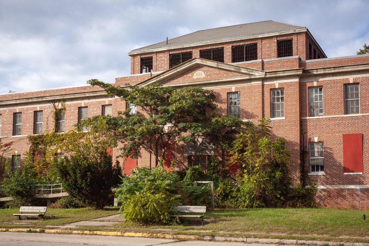
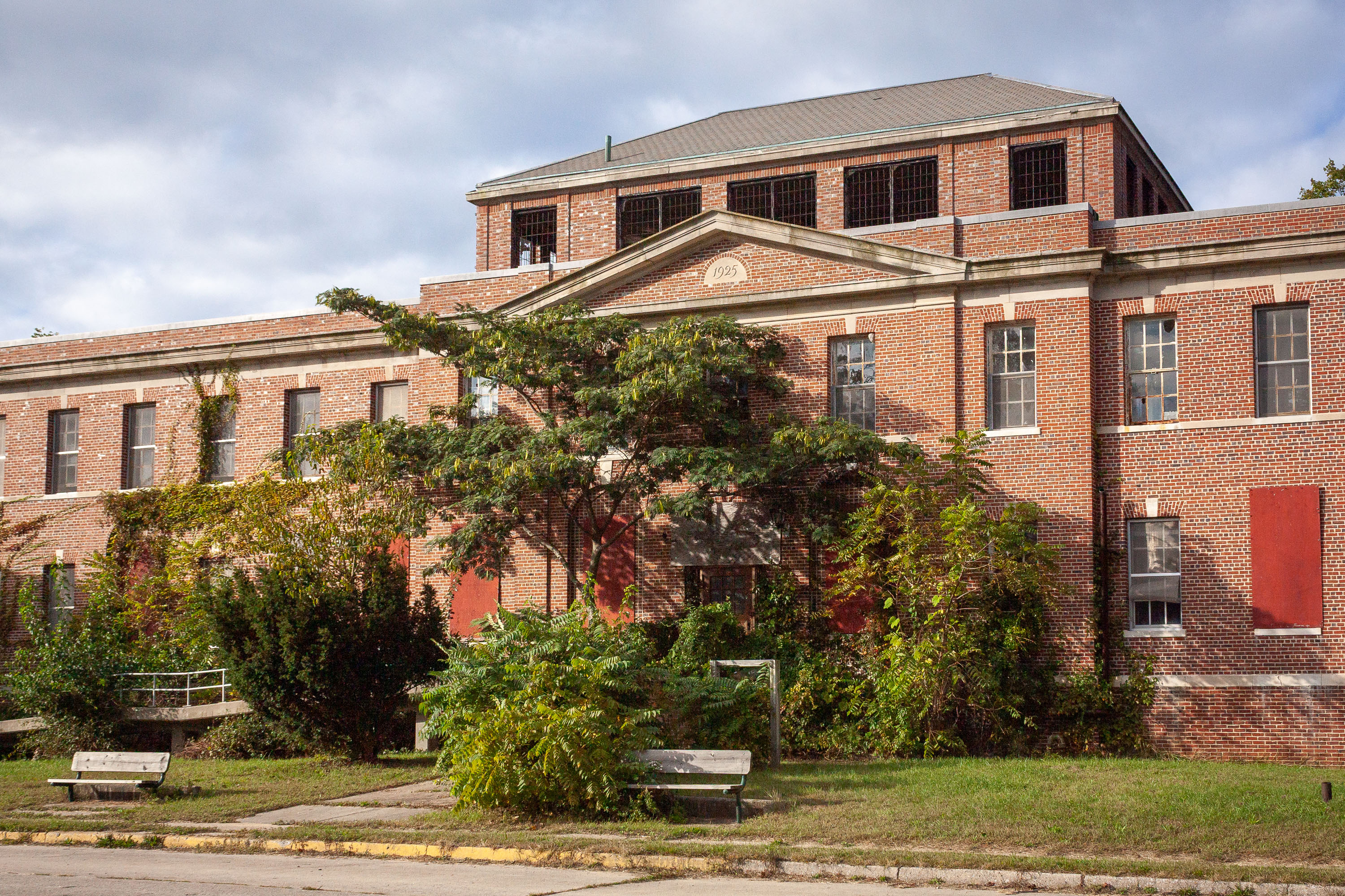
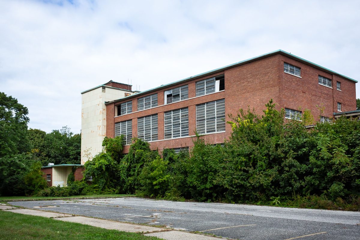
A brick ward building from 1929 at Kings Park Psychiatric Center on Long Island, New York, with overgrown vegetation in the foreground.
Kings Park Psychiatric Center operated in Kings Park, New York, from 1885 until its closure in 1996, at its peak housing more than 9,000 patients across dozens of brick ward buildings on a campus of over 800 acres. Many of the structures, including this one, date to the hospital's major expansion in the 1920s, when the state built additional wards to accommodate the growing patient population under New York's "Kirkbride"-influenced institutional model. The facility relied on a self-contained infrastructure, including its own power plant, farm, and rail spur, to support the thousands of patients and staff on site. Since the hospital's closure, most of the campus buildings have sat vacant, with New York State and Kings Park Heritage Museum overseeing limited preservation and redevelopment efforts on portions of the property.

1925 Ward Building Entrance at Kings Park Psychiatric Center
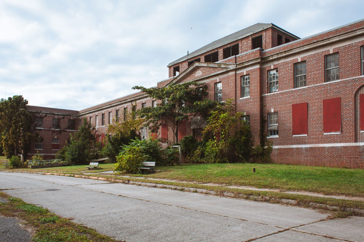
Boarded brick ward building at the abandoned Kings Park Psychiatric Center on Long Island, New York.
Kings Park Psychiatric Center opened in 1885 as the Kings Park State Hospital, part of New York's effort to move psychiatric care away from crowded urban institutions. At its peak in the 1950s, the campus held more than 9,000 patients across over 150 buildings on roughly 875 acres of Long Island farmland, much of it worked by patients as part of an early self-sustaining agricultural program. The hospital operated its own power plant, farm, and rail spur to move goods and coal across the grounds. Deinstitutionalization policies and the rise of outpatient psychiatric treatment led to a steady decline in population through the late 20th century, and the facility closed in 1996. Many of the brick ward buildings, including this one, have sat vacant for decades, their windows sealed with steel plates as the state weighs redevelopment and preservation of the site.

Overgrown Ward Wing at Kings Park Psychiatric Center
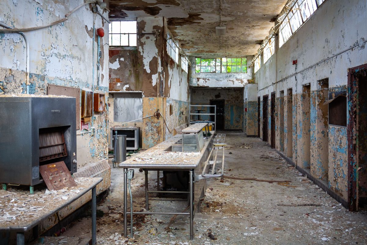
Abandoned ward corridor at Kings Park Psychiatric Center with deteriorated walls, cast iron sink, and open patient room doorways.
Kings Park Psychiatric Center opened in 1885 as the Kings County Farm for the Insane, later expanding under state control into dozens of buildings across its Long Island campus. At its peak in the 1950s, the facility housed more than 9,000 patients and operated largely as a self-sufficient community, with its own power plant, farm, and staff housing. Wards like this one were built with rows of small patient rooms off a central corridor, a layout common to state hospitals designed for custodial care rather than treatment. The state began closing buildings in the 1980s as psychiatric care shifted toward outpatient models, and the campus was fully decommissioned by 1996.

Washbasin Trough Along a Patient Ward at Kings Park Psychiatric Center
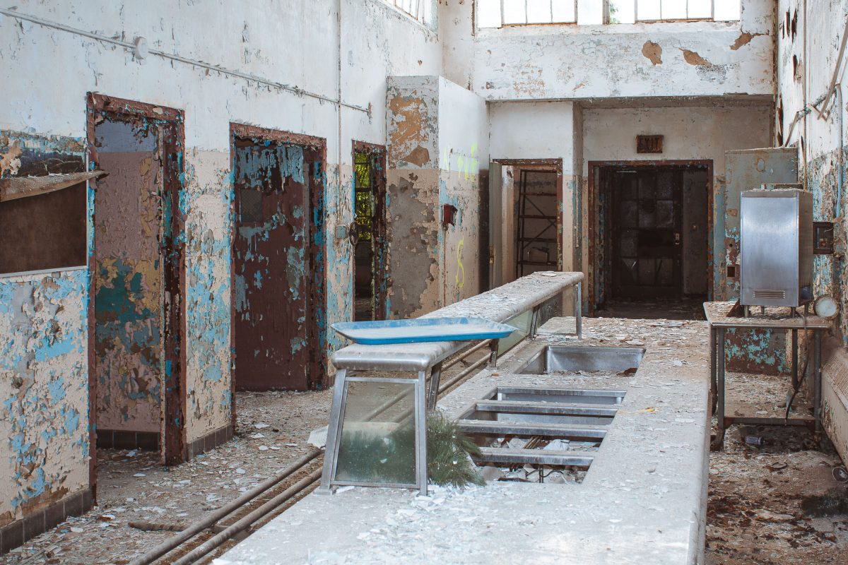
Abandoned ward corridor at Kings Park Psychiatric Center with deteriorated walls, rusted doorways, and communal sink trough.
Kings Park Psychiatric Center operated in Kings Park, New York, from 1885 until its closure in 1996, at its peak housing more than 9,000 patients across dozens of buildings on a sprawling campus overlooking Long Island Sound. Long communal sinks and troughs like this one were standard fixtures in ward washrooms, designed for group use rather than individual privacy, reflecting the institutional approach to daily care common in state psychiatric facilities of the era. New York State shifted toward outpatient and community-based mental health treatment in the latter half of the 20th century, a policy change that led directly to the hospital's decommissioning. Many of the campus's brick ward buildings, including this one, have sat vacant for decades, with ownership and redevelopment plans debated by local and state authorities ever since.

Shattered Wash Trough Along a Ward Hallway at Kings Park

Abandoned communal washroom at Kings Park Psychiatric Center with stainless-steel trough sinks and peeling paint walls.
Kings Park Psychiatric Center operated as a New York State mental hospital from 1885 until its closure in 1996. At its peak population in the 1950s, the campus housed more than 9,000 patients across dozens of buildings, making it one of the largest psychiatric facilities in the country. Communal washrooms like this one, fitted with long stainless-steel trough sinks, served entire wards rather than individual rooms, a design common to institutional dormitories built before private plumbing became standard. The state transferred much of the campus to Kings Park Bluff and surrounding parkland after decommissioning, leaving many of the original ward buildings unused and structurally unstable.

Stainless Steel Wash Trough Along a Ward Hallway at Kings Park

Abandoned bathroom inside a Kings Park Psychiatric Center ward building with deteriorated walls, cast-iron sink, toilet, and steam radiator.
Kings Park Psychiatric Center operated as a New York State institution from 1885 until its closure in 1996, at points housing more than 9,000 patients across dozens of buildings on its Long Island campus. Bathrooms like this one, tied to individual wards, were built with tiled walls and cast-iron fixtures standard to state institutional construction of the early 20th century. Steam radiators supplied heat throughout the ward buildings, fed by the campus's own power plant, which also generated electricity for the facility. Since the hospital's closure, many structures have sat unused, with New York State and Suffolk County managing portions of the property for parkland and preservation study.

Debris-Strewn Bathroom Through a Rusted Door at Kings Park

Deteriorated stairwell with debris-covered steps and rusted metal railings inside an abandoned ward building at Kings Park Psychiatric Center on Long Island.
Kings Park Psychiatric Center opened in 1885 as the Kings Park State Hospital, eventually growing to more than 150 buildings across 900 acres on Long Island's north shore. At its peak population in the 1950s, the facility housed close to 9,000 patients and operated its own power plant, farm, and rail spur for deliveries. New York State began downsizing the hospital after federal deinstitutionalization policies took hold in the 1960s and 70s, and the campus closed for good in 1996. Many of its ward buildings, connected by internal stairways and steam tunnels, have sat untouched since closure, leaving decades of plaster and paint to collect on the floors below.

Rubble-Strewn Staircase to Ward Doors at Kings Park

Abandoned ward interior at Kings Park Psychiatric Center showing deteriorated doorways with peeling blue and white paint and a freight elevator.
Kings Park Psychiatric Center opened in 1885 as the Kings Park State Hospital, built to relieve overcrowding at Brooklyn's asylums and to test a farm-colony model of care that put patients to work in agriculture and trades. The campus grew to more than 150 buildings across 900-plus acres on Long Island's north shore, with its own power plant, farms, and rail spur for deliveries and coal. Population peaked near 9,300 patients in the early 1950s, making it one of the largest psychiatric institutions in the country at the time. Deinstitutionalization policies and the shift toward outpatient care led to a steady decline in the following decades, and the facility closed in 1996. New York State has left most of the campus vacant since then, and many structures, including patient wards fitted with freight elevators for moving supplies between floors, have sat exposed to decades of water damage and decay.

Rusted Freight Elevator Flanked by Peeling Doors at Kings Park

Rotary telephone abandoned on the floor of a deteriorated ward building at Kings Park Psychiatric Center on Long Island, New York.
Kings Park Psychiatric Center opened in 1885 as the Kings County Farm for the Insane and grew into one of New York State's largest psychiatric institutions, housing more than 9,000 patients at its peak in the 1950s. The campus once operated its own power plant, farm, and rail spur to support dozens of wards spread across the grounds. State budget cuts and a shift toward outpatient care led to a gradual decline, and the facility closed in 1996. A rotary telephone, left behind on the floor of one of the ward buildings, is a remnant of the internal communication system that once connected staff across the sprawling campus.

Discarded Rotary Phone Near a Scorched Iron Gate at Kings Park

Deteriorated interior doorway with peeling pink and green paint at the abandoned Kings Park Psychiatric Center on Long Island.
Kings Park Psychiatric Center opened in 1885 as the Kings County Asylum, later becoming a New York State-run institution that at its peak housed more than 9,000 patients across dozens of buildings on the Long Island campus. Chronic overcrowding and shifting approaches to mental health care led to steady downsizing after the 1950s, and the facility closed for good in 1996. Many of its ward buildings, including this one, were left to decay, their lath-and-plaster walls stripped bare by decades of moisture and neglect. Portions of the campus were later transferred to New York State Parks, which now oversees the grounds as part of Nissequogue River State Park.

Open Door to a Brick Stairwell at Kings Park Psychiatric Center

Combination padlock secured on a peeling painted door at the abandoned Kings Park Psychiatric Center on Long Island, New York.
Kings Park Psychiatric Center operated in Suffolk County, New York, from 1885 until its closure in 1996, at its peak housing more than 9,000 patients across a sprawling campus of over 150 buildings. Many of the ward structures were secured with simple combination padlocks rather than standard keyed locks, a practical measure in a facility where staff needed quick, code-based access without carrying dozens of individual keys. The peeling paint and rusted hardware found throughout the campus today reflect decades of deferred maintenance after New York State began transferring patients to community-based care in the 1980s. Portions of the site were later incorporated into Nissequogue River State Park, though many original buildings remain sealed off and untouched.

Rusted Combination Lock on a Peeling Door at Kings Park

Deteriorated corridor with open doorways and peeling paint inside an abandoned ward at Kings Park Psychiatric Center on Long Island.
Kings Park Psychiatric Center opened in 1885 as the Kings County Farm for the Insane, later expanding under New York State control into dozens of interconnected ward buildings across its Long Island campus. At its peak population in the 1950s, the facility housed more than 9,000 patients, making it one of the largest psychiatric institutions in the country. Many of its structures relied on a centralized layout of long corridors connecting patient rooms, a design meant to ease staff supervision across crowded wards. The hospital closed in phases between the 1980s and 1996, following a statewide shift toward deinstitutionalization and outpatient mental health care. Several buildings remain standing on the property, which is now partly managed as Nissequogue River State Park.

Open Doorway Leading Into a Ward Hallway at Kings Park Psychiatric Center

Peeling paint and a rusted light switch on the doorframe of an abandoned ward corridor at Kings Park Psychiatric Center on Long Island, New York.
Kings Park Psychiatric Center operated in Kings Park, New York, from 1885 until its closure in 1996, at its peak housing more than 9,000 patients across dozens of ward buildings connected by tunnels and corridors. The state ran the facility as a self-contained community, with its own power plant, farm, and staff housing, before deinstitutionalization and funding cuts led to its gradual shutdown. Many of the ward buildings have sat empty for decades, and lead paint on the walls and door frames has cracked and lifted in long sheets as the structures went unheated and unmaintained. The New York Office of Parks, Recreation and Historic Preservation now controls most of the site, and several buildings, including Building 93, have been documented for their historical and architectural significance even as demolition has removed others.

Layered Doorways at Kings Park Psychiatric Center

Peeling walls and open doorways line a deteriorated corridor inside an abandoned ward building at Kings Park Psychiatric Center on Long Island.
Kings Park Psychiatric Center opened in 1885 as the Kings Park State Hospital, part of a wave of New York institutions built to treat the mentally ill under the era's "farm colony" model, where patients worked the grounds as part of their care. At its peak in the 1950s, the campus held more than 9,000 patients across dozens of buildings connected by tunnels and covered walkways. Deinstitutionalization policies and the rise of outpatient psychiatric care drained the population through the 1960s and '70s, and the state closed the hospital in 1996. Many of the original ward buildings, with their plaster walls and cast-iron radiators, have sat untouched since, left to the slow work of moisture and time.

Rusted Door Frames Along a Ward Hallway at Kings Park

Deteriorated green metal shelf bracket with peeling paint layers mounted on a cracked wall at the abandoned Kings Park Psychiatric Center.
Kings Park Psychiatric Center opened in 1885 as the Kings County Asylum for Insane and grew into a self-sufficient village of more than 150 buildings on the north shore of Long Island. At its peak in the 1950s the hospital housed close to 9,000 patients, treated largely in isolation from New York City. Deinstitutionalization policies and the shift toward outpatient care led to a steady decline in population, and the facility closed in 1996. Many of its structures, left unheated and unmaintained for decades, now show the effects of that neglect in cracked plaster and peeling layers of paint on walls, trim, and built-in fixtures.

Teal Wall Bracket Peeling at Kings Park Psychiatric Center

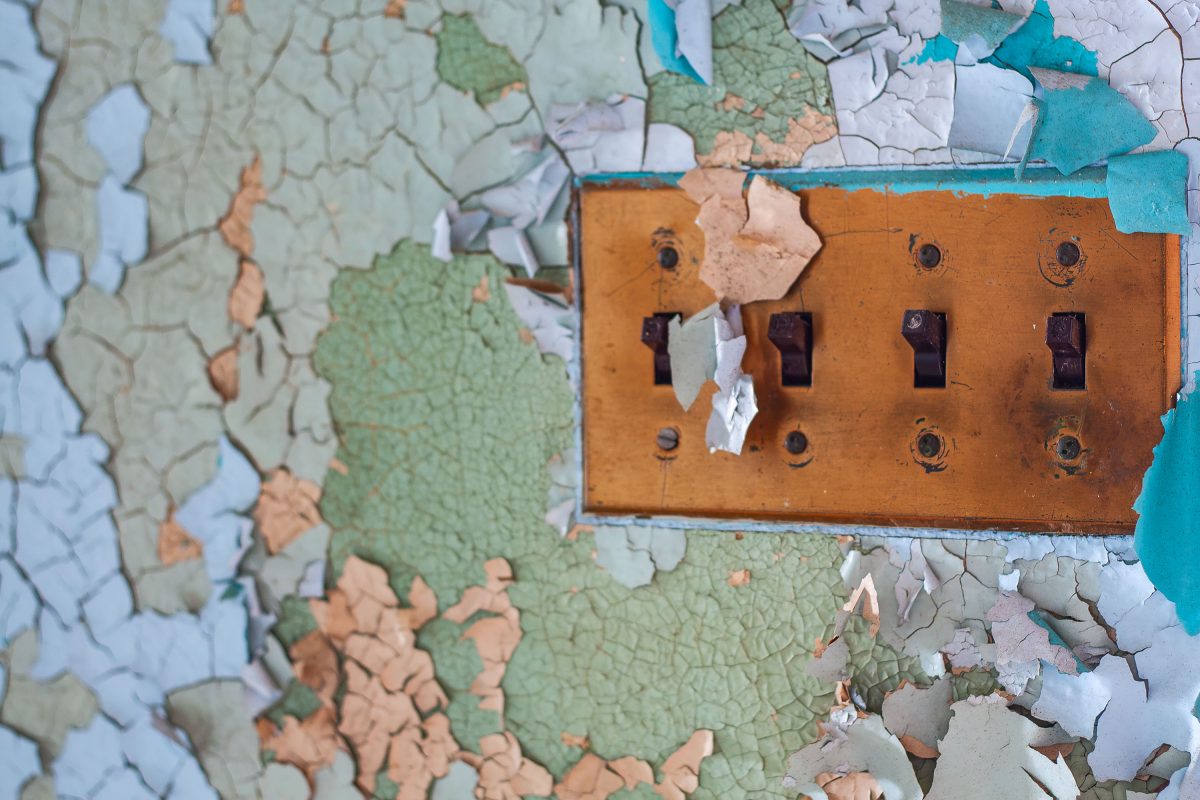
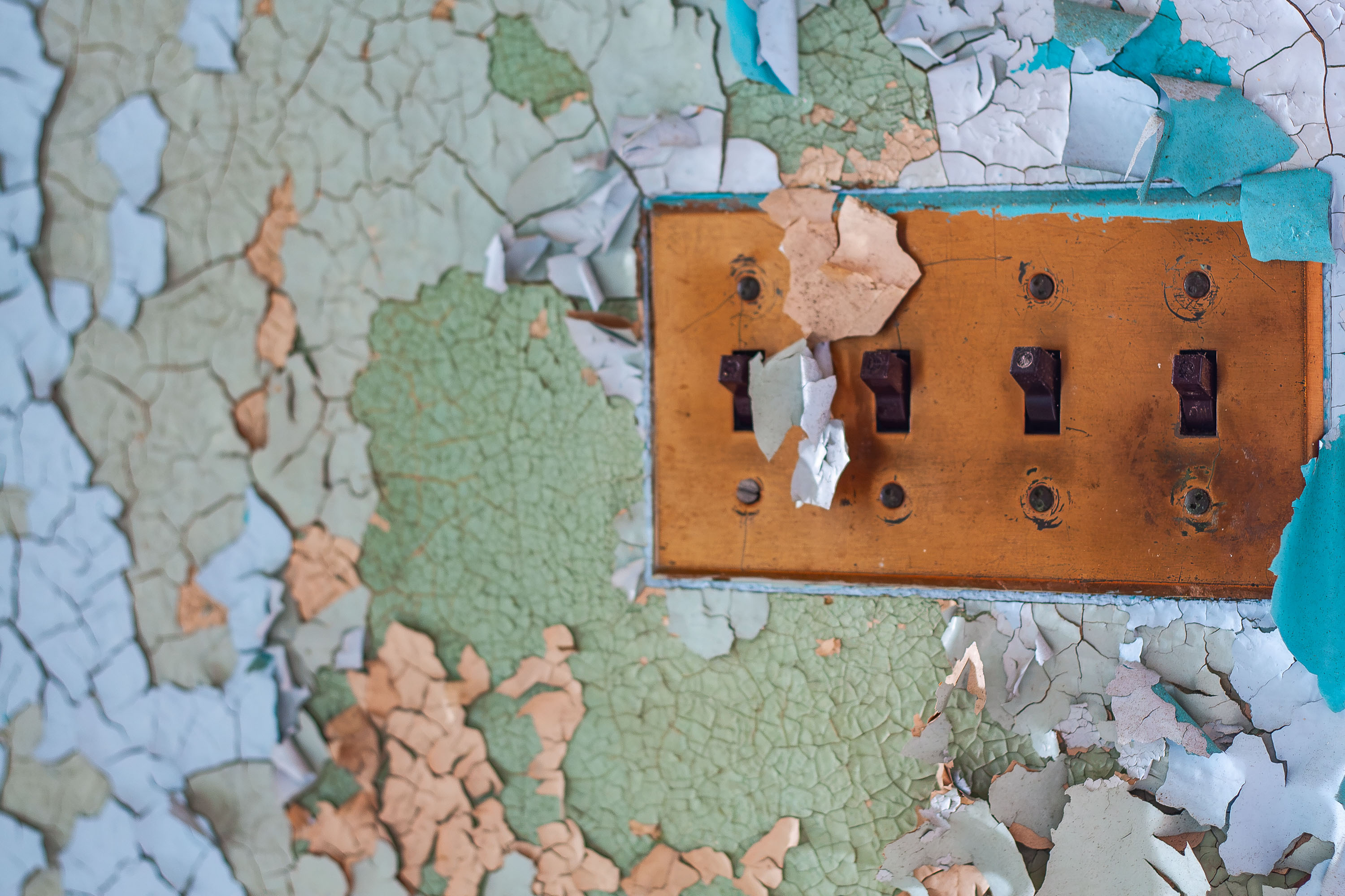
Copper light switch panel with four toggle switches mounted on cracked, peeling paint at the abandoned Kings Park Psychiatric Center on Long Island.
Kings Park Psychiatric Center operated in Suffolk County, New York, from 1885 until its closure in 1996, once housing more than 9,000 patients at its peak in the 1950s. The state-run facility grew to over 150 buildings across its campus, many of which have sat vacant for decades since the hospital's population declined and services were consolidated elsewhere. Toggle switch banks like this one controlled lighting and electrical circuits throughout the ward buildings, standard fixtures in institutional construction of the early to mid-20th century. Layers of paint on the surrounding walls, applied and reapplied over the facility's century of operation, have separated and cracked as the buildings have gone without climate control or maintenance.

Four-Gang Toggle Switch Amid Peeling Paint at Kings Park

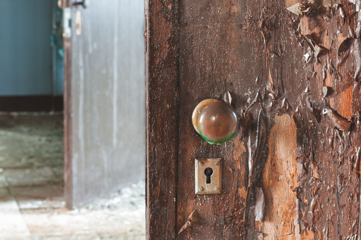
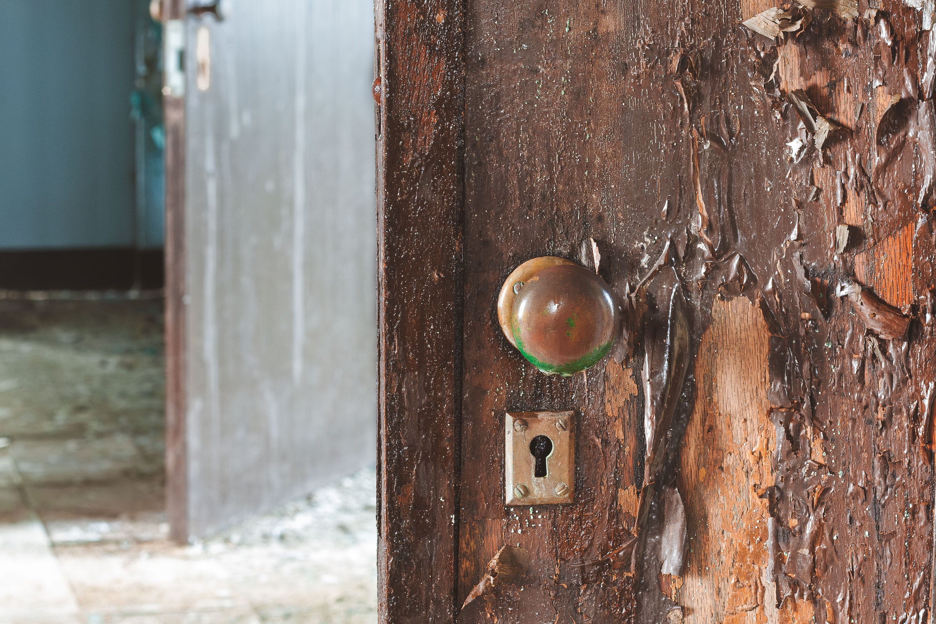
Weathered wooden door with brown glass doorknob and brass keyhole plate at the abandoned Kings Park Psychiatric Center on Long Island.
Kings Park Psychiatric Center opened in 1885 as the Kings County Farm for the Insane, eventually growing to more than 150 buildings across its Long Island campus. At its peak population in the 1950s, the state hospital housed over 9,000 patients, many treated in wards connected by tunnels and covered walkways. New York State began downsizing the facility in the 1980s as mental health care shifted toward outpatient treatment, and the hospital closed entirely in 1996. Many of its original doors, hardware, and fixtures remain untouched since the buildings were vacated, left to decay under decades of exposure.

Peeling Ward Door with Brass Knob at Kings Park Psychiatric Center

Deteriorated corridor with dark wooden doors and peeling walls inside an abandoned ward at Kings Park Psychiatric Center on Long Island.
Kings Park Psychiatric Center opened in 1885 as the Kings Park State Hospital, growing over the decades into a sprawling campus of more than 150 buildings on the north shore of Long Island. At its peak in the early 1950s, the facility housed over 9,000 patients, many held in dense wards connected by long corridors lined with individual doors like these. Changes in psychiatric care, including the introduction of new medications and a national push toward deinstitutionalization, drove steady population declines from the 1960s onward. The hospital closed for good in 1996, and its buildings have sat empty since, gradually giving way to peeling paint, collapsing ceilings, and decay.

Open Doors Along an Exit Corridor at Kings Park Psychiatric Center

Abandoned ward room at Kings Park Psychiatric Center with deteriorated walls, cast-iron radiator, and barred window overlooking overgrown grounds.
Kings Park Psychiatric Center operated in Suffolk County, New York, from 1885 until its closure in 1996. At its peak in the 1950s, the state-run facility housed more than 9,000 patients across dozens of buildings, making it one of the largest psychiatric institutions in the country. Steam heat piped from the campus's own power plant warmed patient wards through cast-iron radiators like the one still standing here. Many of the structures, built between the 1900s and 1930s, were abandoned in place after the hospital's downsizing and later closure, leaving fixtures, plaster, and paint to deteriorate for decades. New York State has since designated portions of the grounds as parkland while other buildings remain sealed and unused.

Caged Radiator Beneath a Barred Window at Kings Park Psychiatric Center

Deteriorated corridor with peeling paint and open doors inside an abandoned ward building at Kings Park Psychiatric Center on Long Island, New York.
Kings Park Psychiatric Center opened in 1885 as the Kings County Asylum for the Insane, later becoming a New York State institution that at its peak housed more than 9,000 patients across dozens of buildings on the Long Island campus. Many of the wards were built with private rooms and lockable doors rather than open dormitories, a design meant to reflect contemporary ideas about patient dignity. The hospital operated its own power plant, farm, and rail spur to sustain a population that functioned nearly as a self-contained town. State budget cuts and the shift toward outpatient psychiatric care led to a steady decline in the mid-20th century, and the facility closed in 1996. Its vacant buildings have sat untouched for decades, with lead paint and plaster falling from the walls in layers that record decades of use and neglect.

Layers of Peeling Paint Along a Ward Hallway at Kings Park

Abandoned patient room at Kings Park Psychiatric Center on Long Island with peeling white and turquoise paint, rusted radiator, and large window.
Kings Park Psychiatric Center opened in 1885 as the Kings County Farm for the Insane, built to relieve overcrowding at Brooklyn's asylums. The campus eventually grew to more than 150 buildings across 875 acres on Long Island's north shore, housing a peak population of roughly 9,300 patients by the early 1950s. New York State ran the facility as a largely self-sufficient complex, with its own power plant, farm, and rail spur for deliveries. Budget cuts and the shift toward outpatient care emptied most wards by the 1980s, and the state shut the hospital down entirely in 1996. Many of its buildings, including patient rooms like this one, have sat untouched since closure, left to lead paint, rust, and decades of exposure.

Moss-Covered Radiator Beneath a Window at Kings Park Psychiatric Center

Deteriorating interior doorways with peeling blue and red paint at the abandoned Kings Park Psychiatric Center on Long Island, New York.
Kings Park Psychiatric Center opened in 1885 as the Kings Park State Hospital, eventually growing to more than 150 buildings on over 800 acres in Suffolk County, New York. At its peak population in the 1950s, the facility housed close to 9,000 patients, making it one of the largest psychiatric institutions in the state system. Changes in mental health treatment and a shift toward outpatient care led to a steady decline in population through the following decades, and the hospital closed in 1996. Many of its buildings, including patient wards and administrative offices, have sat vacant since then, with lead paint and plaster deteriorating across interior walls and doorframes. The site is now part of Nissequogue River State Park, though numerous structures remain fenced off and closed to the public.

Nested Doorways Through a Ward at Kings Park Psychiatric Center
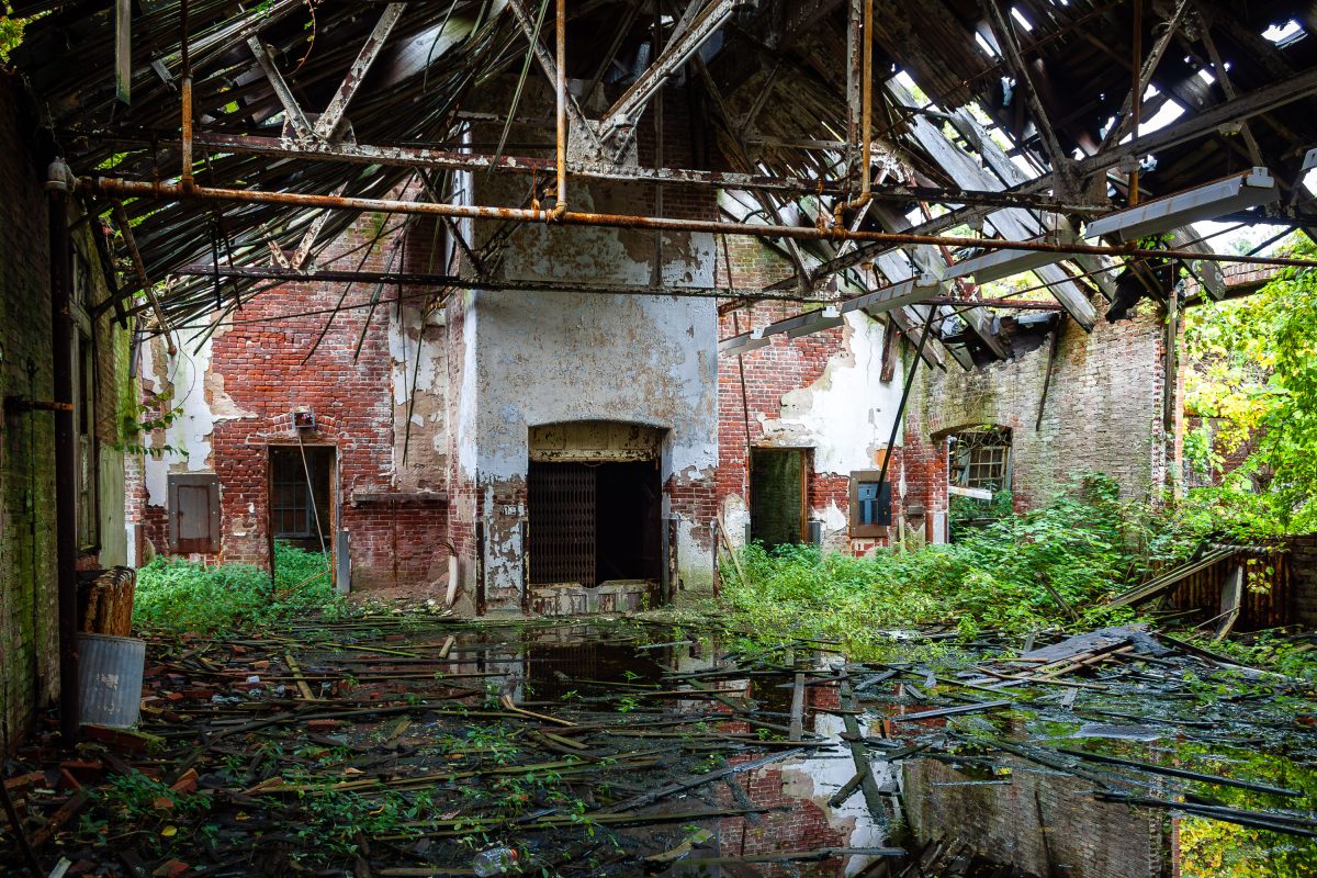
Long brick corridor with large windows and arched openings inside an abandoned building at Kings Park Psychiatric Center on Long Island, New York.
Kings Park Psychiatric Center opened in 1885 as the Kings County Farm for the Insane, growing over the following decades into a sprawling campus of more than 150 buildings on Long Island's north shore. Covered walkways like this one connected wards and service buildings, letting staff and patients move between them without going outside, a common design feature in early twentieth-century asylum planning. At its peak in the 1950s the institution housed close to 9,000 patients, making it one of the largest psychiatric facilities in the country. New York State began closing the hospital in stages after deinstitutionalization policies took hold, and it shut down entirely in 1996. Many of its buildings, including these interconnected passageways, have stood vacant since.

Arched-Window Walkway Between Wards at Kings Park Psychiatric Center

Boarded courtyard between brick ward buildings at the abandoned Kings Park Psychiatric Center on Long Island, New York.
Kings Park Psychiatric Center opened in 1885 as the Kings Park State Hospital, growing over the following decades into a sprawling campus of dozens of brick ward buildings connected by tunnels and courtyards on Long Island's north shore. At its peak in the 1950s the facility housed more than 9,000 patients and operated largely as a self-sufficient farm colony, with its own power plant, railroad spur, and agricultural fields. Deinstitutionalization and changing standards of psychiatric care led New York State to close the hospital in phases, with the last buildings vacated by 1996. Many of the remaining structures have sat sealed with plywood and steel since closure, awaiting redevelopment plans that have repeatedly stalled amid the site's asbestos and structural hazards.

Tree-Filled Courtyard at Kings Park Psychiatric Center

Ivy-covered courtyard between brick ward buildings at the abandoned Kings Park Psychiatric Center on Long Island, New York.
Kings Park Psychiatric Center opened in 1885 on Long Island's north shore, growing over the following decades into a self-contained village of more than 150 buildings designed to house and treat thousands of patients. Its multi-story brick wards, many built in the early 20th century, relied on rows of steel-sash windows for light and ventilation in an era before mechanical air conditioning. The facility operated at its peak with a population exceeding 9,000 patients before New York State began scaling back its use following changes in mental health policy. It closed permanently in 1996, and many of its buildings have sat vacant since, with trees and vines gradually reclaiming the courtyards between them.

Ivy Climbing a Ward Wall at Kings Park Psychiatric Center

Deteriorated bathroom with cast-iron sink and peeling paint inside an abandoned ward at Kings Park Psychiatric Center on Long Island.
Kings Park Psychiatric Center operated in Suffolk County, New York, from 1885 until its closure in 1996, at its peak housing more than 9,000 patients across dozens of buildings. Many of the wards included utilitarian fixtures like the cast-iron sink typical of the facility's early-to-mid-20th-century plumbing, installed to serve communal patient bathing and washing needs. The hospital's decline began in the 1950s and 1960s as new psychiatric medications and a statewide push toward deinstitutionalization reduced patient populations. Since its shutdown, the campus has been left largely to decay, with lead paint and asbestos contributing to the deterioration seen in structures like this one. Portions of the grounds are now managed by New York State Parks, though most of the original buildings remain unused and inaccessible to the public.

Corner Sink Beneath a Barred Window at Kings Park Psychiatric Center
Brick ward building at the abandoned Kings Park Psychiatric Center in Suffolk County, Long Island, New York.
Kings Park Psychiatric Center opened in 1885 as the Kings Park State Hospital, built to relieve overcrowding at other New York asylums. At its peak in the 1950s, the facility housed more than 9,000 patients across dozens of buildings on a sprawling campus in Suffolk County, Long Island. Many of its brick ward buildings were constructed in the early to mid-20th century to accommodate the growing patient population under the state's mental health policies. The hospital shifted toward deinstitutionalization in the 1970s and 1980s as treatment approaches changed and patient numbers declined sharply. It closed permanently in 1996, and much of the property was later transferred to New York State Parks, leaving many of the original structures vacant.

Overgrown Pathway Leading to a Ward Building at Kings Park
Flooded interior of an abandoned brick building at Kings Park Psychiatric Center on Long Island, New York, with collapsed roof and overgrown vegetation.
Kings Park Psychiatric Center opened in 1885 as the Kings County Farm for the Insane, later expanding under state control into one of New York's largest psychiatric institutions, with more than 150 buildings across its campus on Long Island's north shore. At its peak in the 1950s, the facility housed over 9,000 patients and operated its own power plant, farm, and rail spur for deliveries. Deinstitutionalization policies and funding cuts led to a steady decline through the latter half of the 20th century, and the hospital closed in 1996. Many of its brick structures, left to the elements for decades, have suffered collapsed roofs and interior flooring damage as groundwater and rain infiltrate the abandoned interiors. Portions of the site are now managed by the state as parkland, while the remaining derelict buildings await stabilization or demolition.

Collapsed Roof and Flooded Floor at Kings Park Psychiatric Center
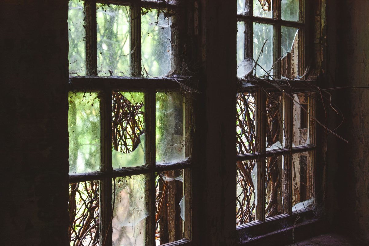
Broken windows with overgrown vines at the abandoned Kings Park Psychiatric Center in New York.
Kings Park Psychiatric Center opened in 1885 as the Kings Park State Hospital, established to relieve overcrowding at other New York asylums. At its peak in the mid-20th century, the campus held more than 9,000 patients across over 150 buildings on land along Long Island's Nissequogue River. The state began closing the facility in stages after the introduction of deinstitutionalization policies in the 1960s and 70s, and the hospital shut down completely in 1996. Many of its brick buildings have sat vacant since then, with vines and vegetation reclaiming window frames and interior spaces. Portions of the grounds are now part of Nissequogue River State Park.

Spiderwebs and Vines Fill Shattered Windows at Kings Park Psychiatric Center
Brick ward building at the abandoned Kings Park Psychiatric Center on Long Island, New York.
Kings Park Psychiatric Center opened in 1885 as the Kings Park State Hospital, established by Long Island municipalities to house patients transferred from overcrowded Brooklyn and Manhattan asylums. The state took over operation in 1895, and the campus eventually grew to more than 150 buildings spread across roughly 875 acres on Long Island's north shore. At its peak population in the 1950s, the hospital held more than 9,000 patients, making it one of the largest psychiatric institutions in the country. Changing treatment practices and the push toward deinstitutionalization led to a steady decline in the population, and the facility closed in 1996. Many of its brick ward buildings, including multi-story dormitory structures like this one, have stood vacant ever since, with the surrounding grounds now part of Nissequogue River State Park.

Overgrown Exterior of a Ward Building at Kings Park Psychiatric Center
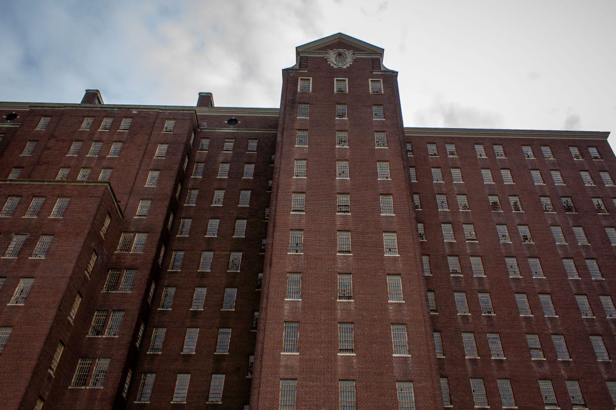
Building 93, a thirteen-story brick structure completed in 1939, stands at the former Kings Park Psychiatric Center on Long Island, New York.
Building 93 is the tallest structure at the former Kings Park Psychiatric Center on Long Island, rising thirteen stories above the surrounding campus. New York State opened the facility in 1885 as the Kings County Farm, later expanding it into one of the state's largest psychiatric hospitals, with a peak population of nearly 9,000 patients by the mid-20th century. Building 93 was completed in 1939 to house patients and support services as the hospital grew increasingly self-sufficient, operating its own power plant, farms, and rail spur. Deinstitutionalization and shifts in mental health policy led to the hospital's decline, and the state closed it in 1996. Much of the campus, including Building 93, has sat vacant since then, though a portion of the grounds was converted into Nissequogue River State Park in 2000.

Towering Façade of Building 93 at Kings Park Psychiatric Center
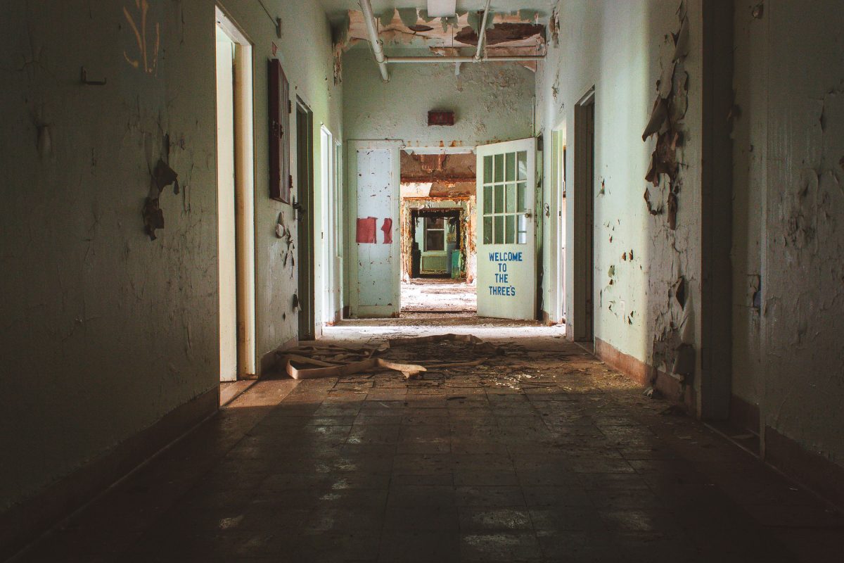
Abandoned corridor in Kings Park Psychiatric Center with peeling walls and a hand-painted "Welcome to the Three's" sign marking a former ward.
Kings Park Psychiatric Center operated in Kings Park, New York, from 1885 until its closure in 1996, at its peak housing more than 9,000 patients across dozens of buildings on the state hospital campus. Many structures were organized into numbered wards and cottages, a system meant to segregate patients by diagnosis and treatment stage as the institution expanded through the early twentieth century. The hand-painted sign reading "Welcome to the Three's" refers to one such ward designation, a naming convention once common across the sprawling grounds. New York State transferred much of the property to Kings Park Bluff and Nissequogue River State Park after decommissioning, leaving many of the original buildings standing but unused. Peeling paint, collapsed ceiling tiles, and deteriorating plaster throughout the corridors reflect decades of exposure following the facility's abandonment.

“Welcome to the Three’s” Sign Down a Ward Corridor at Kings Park

Abandoned Wisconsin farmhouse room with a rocking chair, vinyl records, and a leaning box spring.
An abandoned farmhouse room in Wisconsin contains a rocking chair, vinyl records, and a detached box spring leaning against wood-paneled walls. The scattered albums include Arthur Fiedler and the Boston Pops' World's Most Beautiful Waltzes. Green patterned carpet, yellow curtains, and a small stand remain in the room.

Abandoned Wisconsin Farmhouse Room with Vinyl Records

Spalling masonry exposes red brick on an abandoned church wall in Minnesota.
Spalling masonry on an abandoned church in Minnesota exposes red brick beneath a cracked concrete exterior. The wall section has failed mortar, broken concrete facing, and lichen growth near the damaged joint.

Spalling Masonry on Abandoned Minnesota Church

Weathered red wood with protruding nails is attached to a brick wall on an abandoned building.
A weathered wood board with exposed nails is attached to a brick wall on an abandoned building. Long screws and nails protrude from the board near the masonry, where cracked red paint, worn wood grain, and mortar joints show deterioration.

Exposed Nails in Weathered Wood on Brick Wall

An abandoned yellow brick farmhouse has a roof antenna in rural Wisconsin.
An abandoned yellow brick farmhouse stands in rural Wisconsin. The two-story house has broken and boarded windows, a front porch, and a roof-mounted television antenna. Tall grass and brush surround the property, with a small detached outbuilding nearby.

Abandoned Yellow Brick Farmhouse, Wisconsin
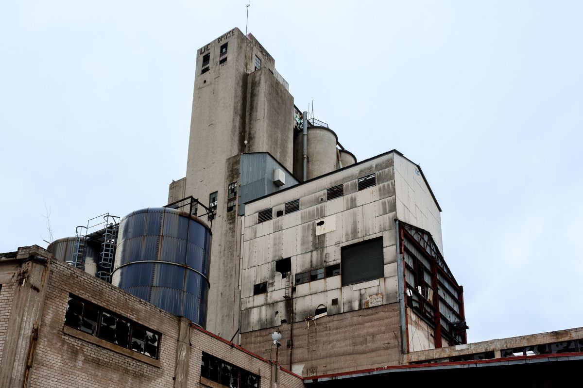
Fruen Mill, an abandoned grain processing facility in Minneapolis with deteriorating concrete silos and industrial structures.
Fruen Mill sits along the Bassett Creek corridor near the Bryn Mawr neighborhood of Minneapolis, where it once processed grain using water power drawn from the creek. The mill complex grew over decades into a cluster of concrete and steel structures, including a grain elevator tower and attached storage silos typical of early 20th-century milling operations. Milling in this stretch of the city dates back to the 1870s, tied to the industrial development that spread along Bassett Creek west of downtown. The property has stood vacant for years, its structures left to weather while the surrounding area redeveloped around it.

Grain Elevator Tower at Fruen Mill, Minneapolis

Abandoned Fruen Mill grain elevator complex with concrete towers and silos in Minneapolis.
Fruen Mill sits along Bassett Creek near Van White Memorial Boulevard in Minneapolis, on land tied to one of the city's earliest water-powered milling operations, dating back to the 1870s. The concrete grain elevator and adjoining steel-and-brick structures were built to store and process grain for regional distribution, part of the industrial corridor that once lined the creek west of downtown. The mill ceased operations decades ago, and the property has since sat vacant, drawing graffiti artists and urban explorers to its empty floors and silos. Bassett Creek itself was rerouted underground through much of Minneapolis in the 20th century as part of flood-control efforts, leaving this stretch as one of the few visible remnants of the waterway's industrial past.

Fruen Mill Grain Elevator, Minneapolis