Minnesota

5,852 photos · 2008–2026

5,852 photographs tagged Minnesota, 2008–2026.
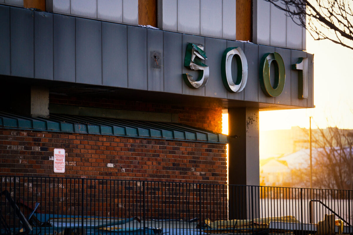
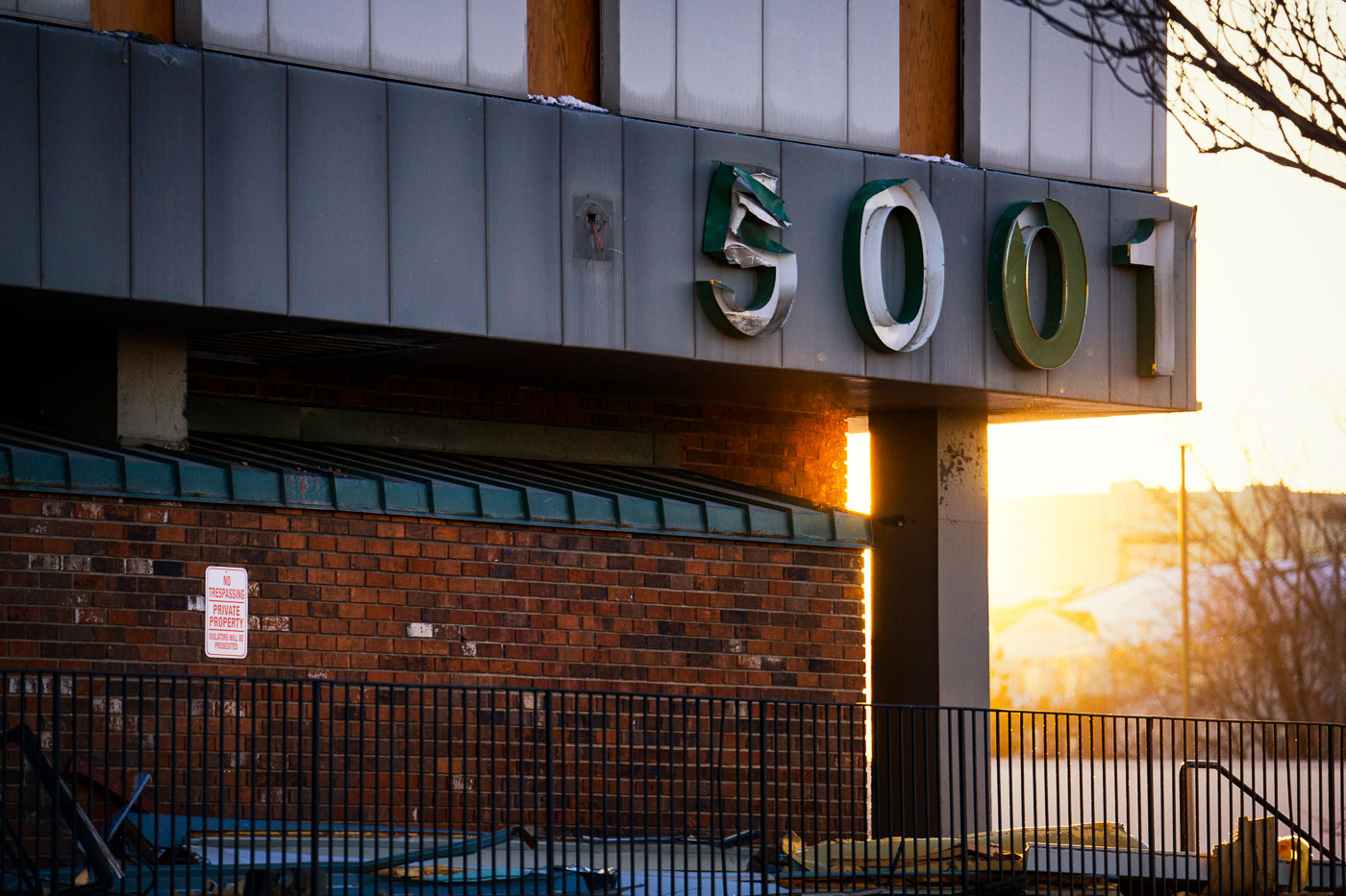
5001 Building During Southgate Demolition
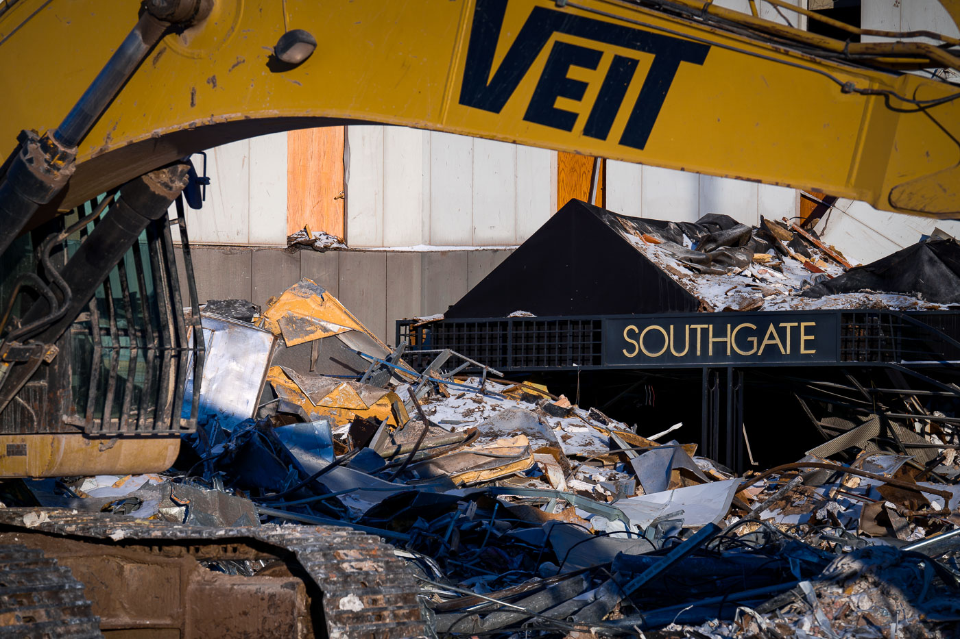
The address numbers 5001 hang damaged and partially peeled from the exterior of the former Southgate Office Tower in Bloomington, Minnesota. Shot during the late-afternoon winter light, the sign shows the wear of a building already deep into demolition. The brick façade, fencing, and scattered debris reflect the final stages of teardown at the long-vacant 1960s-era tower that once stood near I-494 and Portland Avenue.

5001 Building During Southgate Demolition

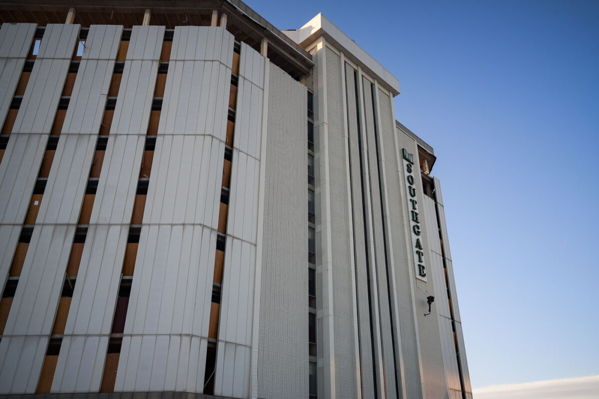
Southgate Office Tower Before Demolition
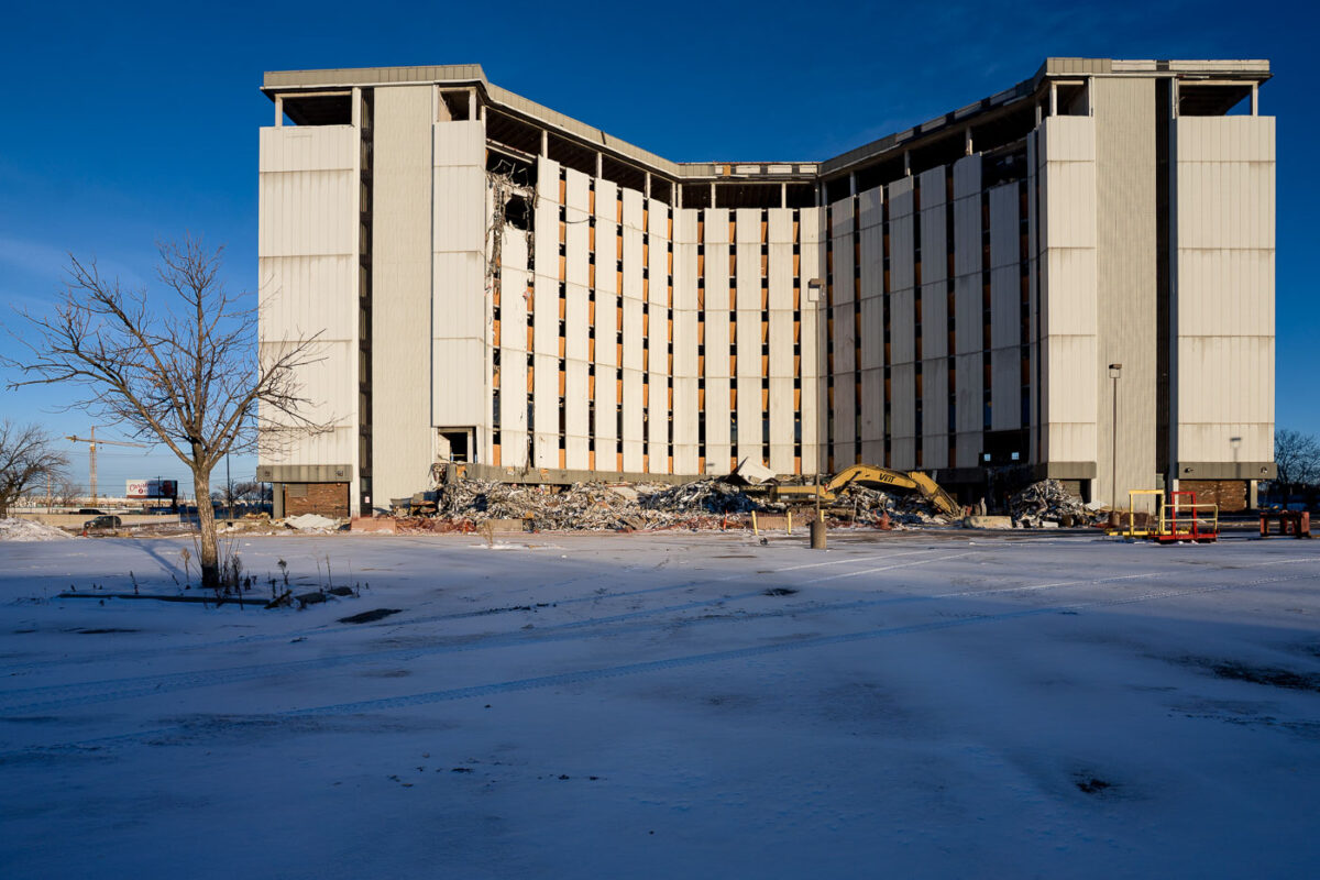
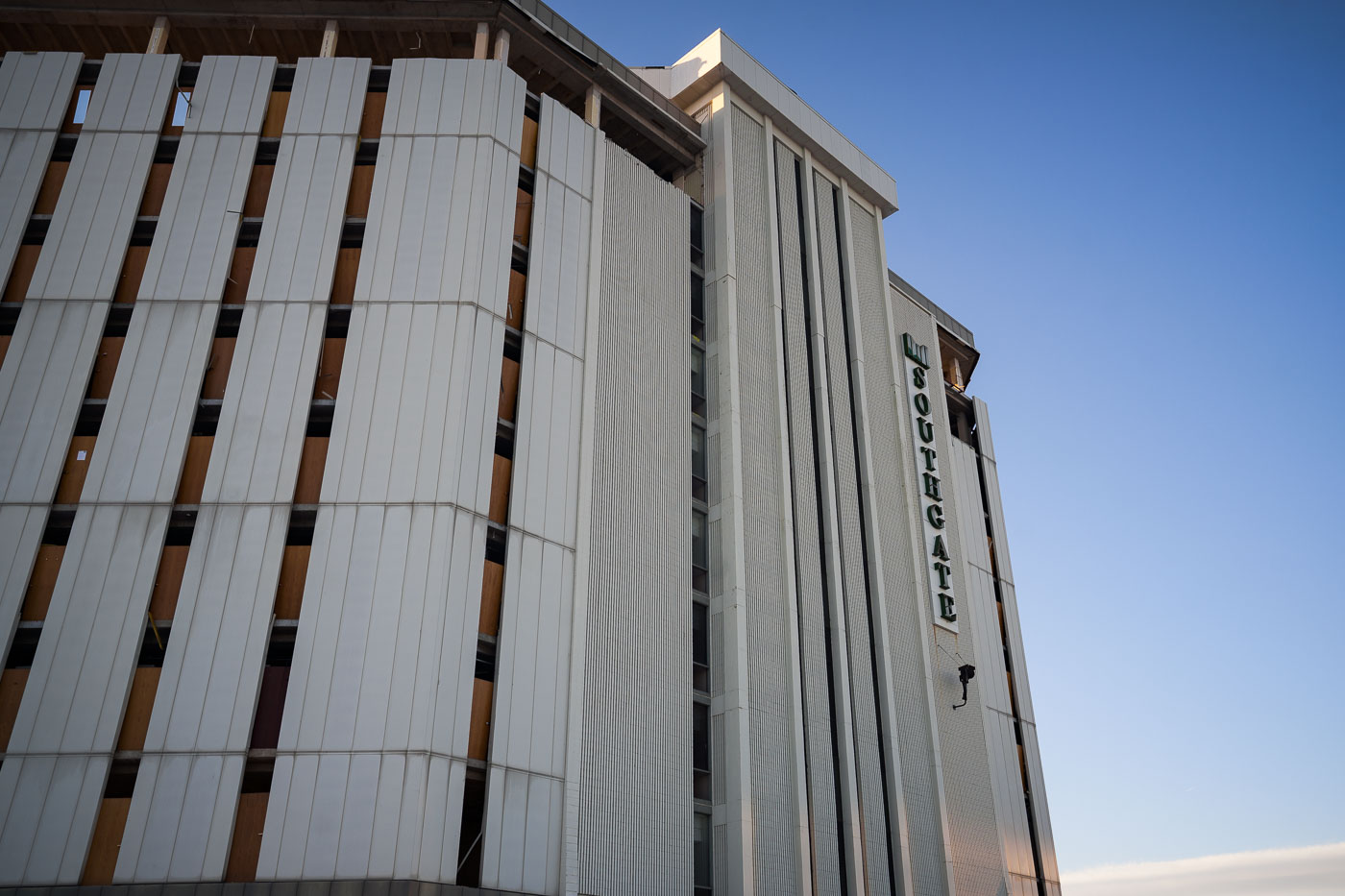
The Southgate Office Tower in Bloomington, Minnesota, stands with its vertical concrete panels and boarded-up windows in the final weeks before demolition. Built in the 1960s as part of a broader commercial corridor near I-494 and Portland Avenue, the building had become long vacant by the 2010s. Its distinctive mid-century façade—once a recognizable landmark for drivers on the interstate—shows stripped interiors and exposed structural elements as crews prepare the site for redevelopment.

Southgate Office Tower Before Demolition

Demolition of Vacant Office Tower in Bloomington
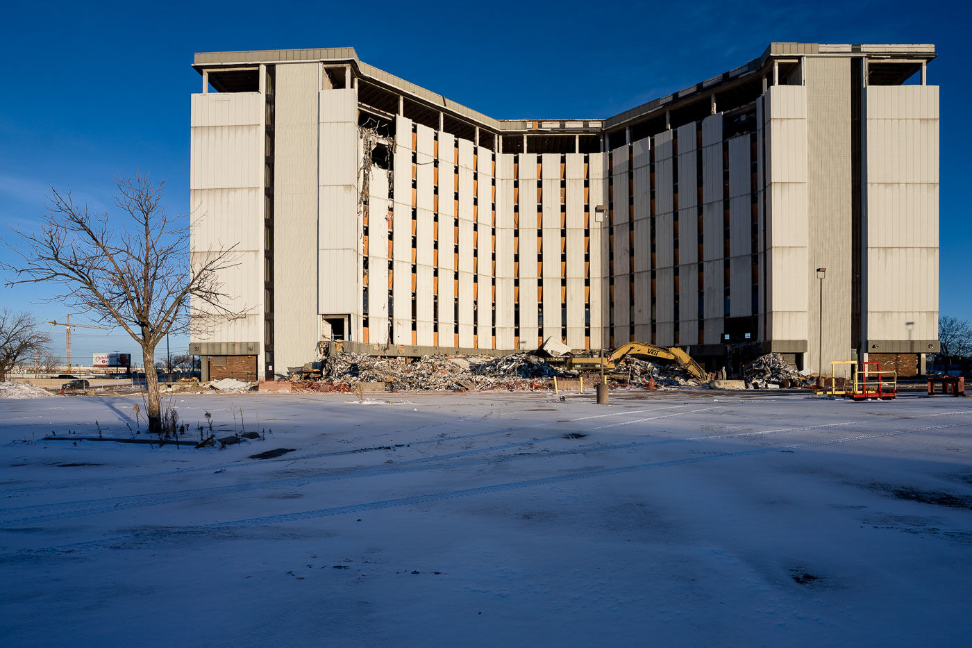
A partially dismantled mid-century office tower stands open to the winter light in Bloomington, Minnesota, as demolition crews continue taking down the long-vacant structure. The building’s exposed interior and collapsed debris field reflect the broader wave of suburban redevelopment that has reshaped commercial corridors near I-494 and the Minneapolis–St. Paul International Airport. Heavy equipment rests at the base of the tower, marking another step in clearing the site for future use amid changing regional land-use patterns.

Demolition of Vacant Office Tower in Bloomington

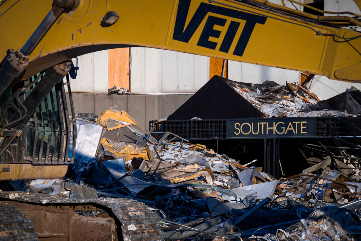
Demolition crews dismantle the Southgate Tower in Bloomington, MN, clearing the site for future redevelopment near I-494.
Demolition crews dismantle the Southgate Tower in Bloomington, Minnesota, near the I-494 commercial corridor. The structure, once a component of a mid-century office complex, is being cleared to make way for future redevelopment. Its removal signifies the end of an era for this part of Bloomington, which has long been a hub for business and commerce. The debris field, including twisted metal and structural remnants, illustrates the final stages of the building's deconstruction.

Southgate Tower Demolition in Bloomington, MN
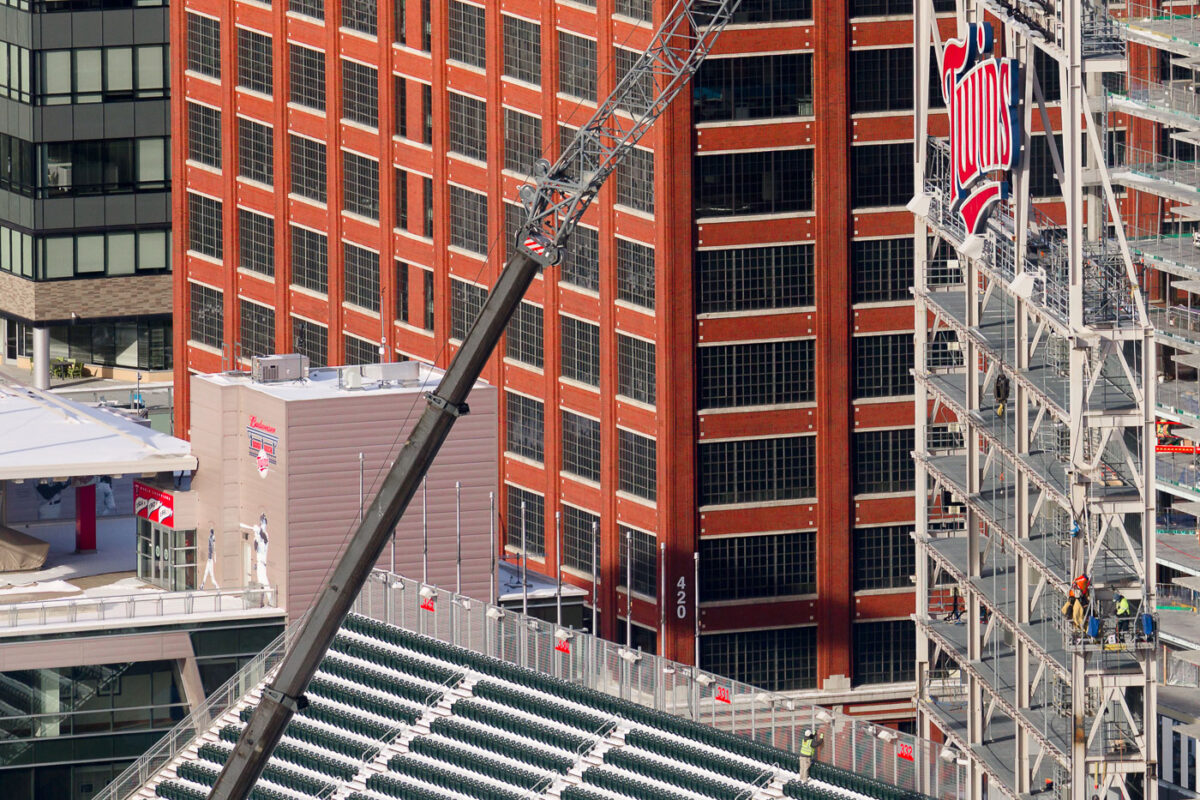
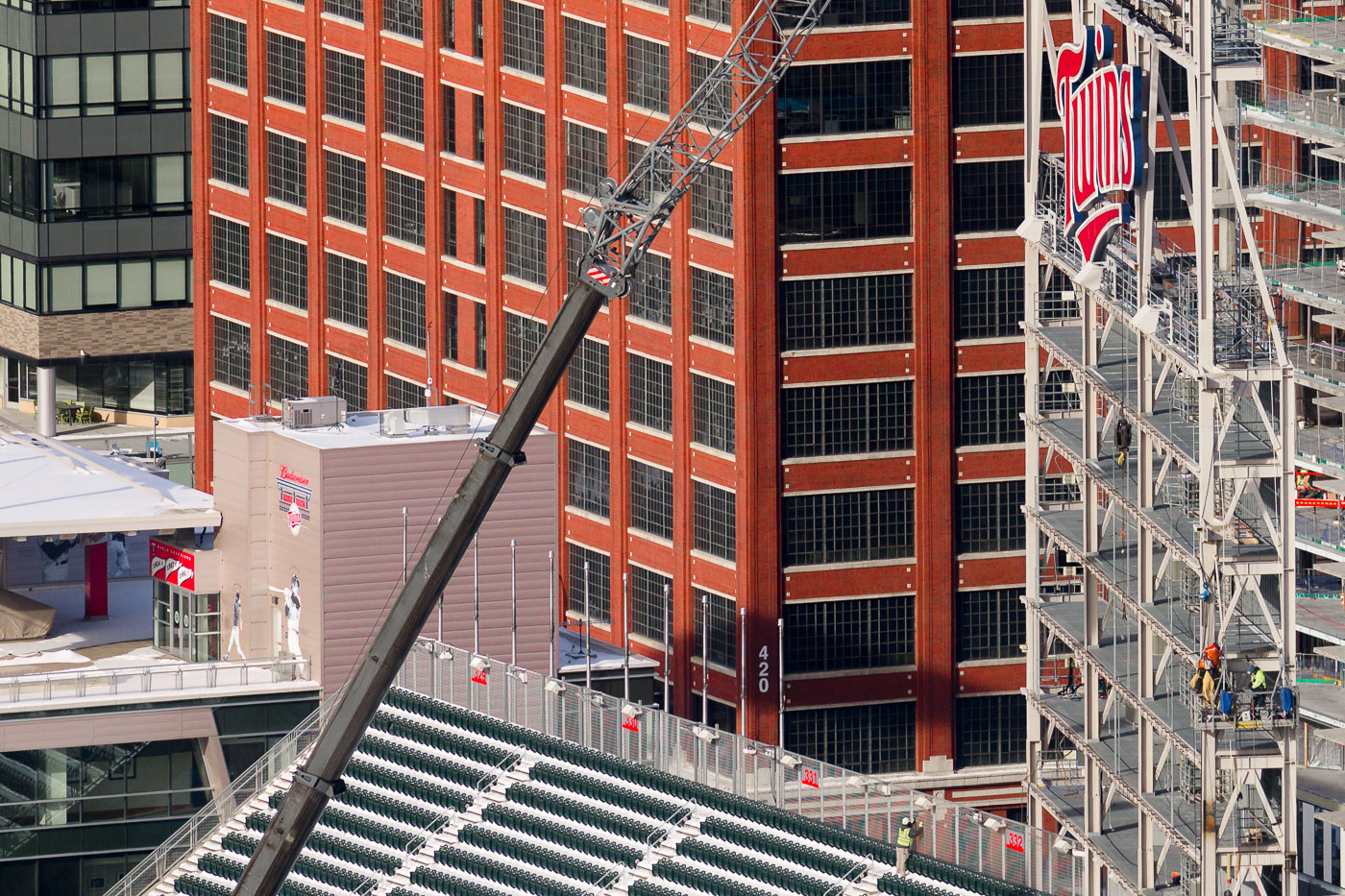
LED video board installation at Target Field
Construction workers install a new 10,000-square-foot LED videoboard at Target Field in Minneapolis in December 2022. The new display, which is 76% larger than its predecessor, was designed to be the fourth-largest video board in Major League Baseball and the fifth to offer HDR capability. This upgrade enhances the fan experience at the home ballpark of the Minnesota Twins, a venue that opened in 2010.

Target Field construction: New LED videoboard installation
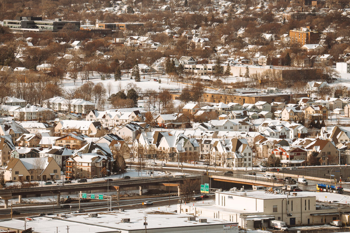
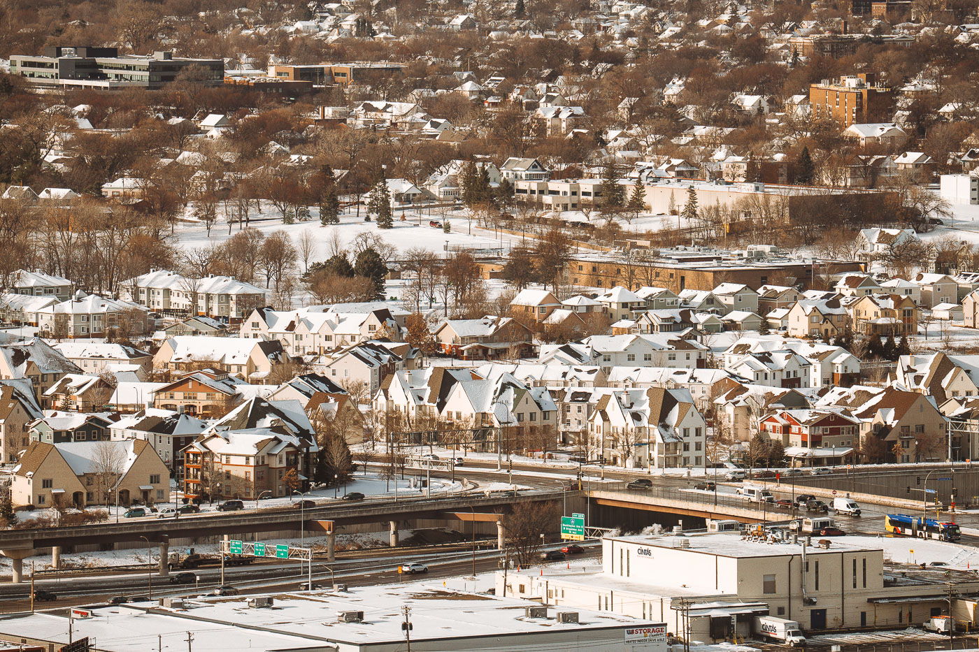
Winter Housing and Highway Corridor along I-94, Minneapolis
This view looks across the residential neighborhoods bordering Interstate 94 in Minneapolis, an area shaped heavily by mid-20th-century highway construction. When I-94 was built between the 1950s and early 1970s, it cut through several established communities—including parts of Cedar-Riverside, Seward, and Phillips—reshaping street grids, housing patterns, and long-standing cultural districts. The snow-covered homes clustered above the highway reflect a mix of older housing stock and later infill development that emerged after the corridor was completed. The elevated ramps and interchanges shown here connect local streets to one of the region’s primary east–west routes, linking downtown Minneapolis with St. Paul and the wider interstate system.

Winter Housing and Highway Corridor along I-94, Minneapolis

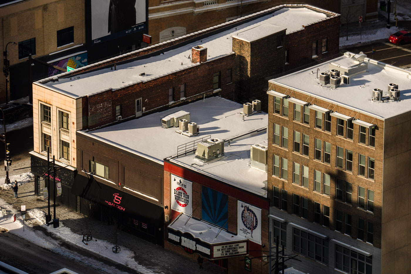
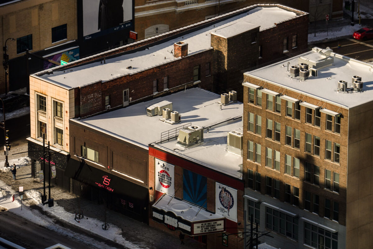
Saloon gay bar in Downtown Minneapolis
The Saloon and Brave New Workshop on Hennepin Avenue in downtown Minneapolis.

The Saloon, Minneapolis

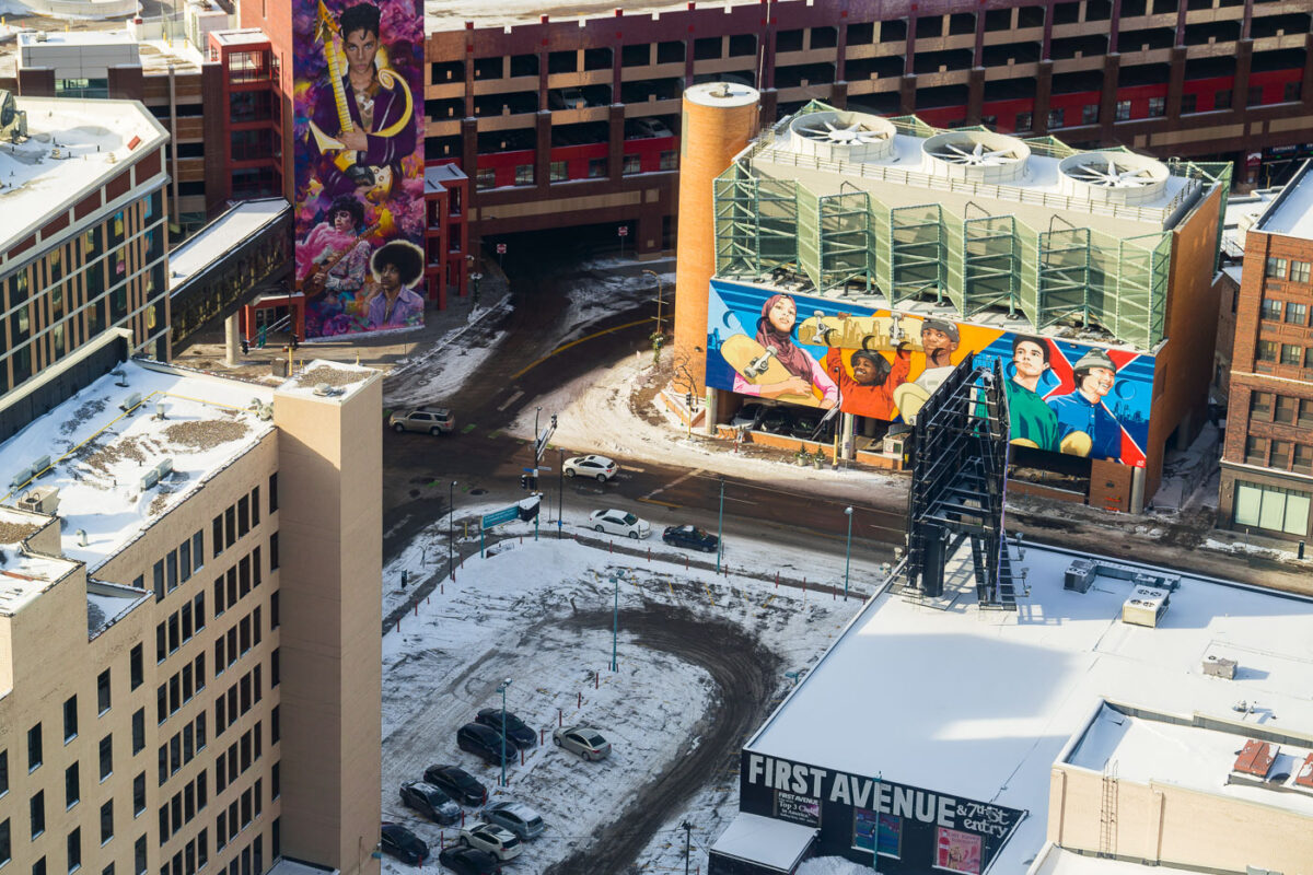
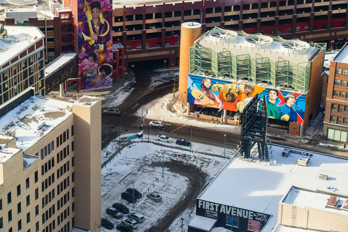
Colorful mural depicting Prince and figures in yellow clothing adorns a building adjacent to First Avenue music venue in downtown Minneapolis.
Prince mural at First Avenue in downtown Minneapolis. The mural is part of the First Avenue music venue complex, a landmark associated with Prince and Minneapolis music history.

Aerial View of Prince Mural Near First Avenue in Downtown Minneapolis

Holidazzle Yeti in Loring Park November 2022
A large, whimsical Yeti installation is displayed in Loring Park, Minneapolis, as part of the annual Holidazzle event. Holidazzle is a winter festival that typically features holiday-themed attractions, markets, and entertainment, drawing residents and visitors to the city's parks. The Yeti, a mythical creature from Himalayan folklore, is often associated with snow and winter, making it a fitting mascot for a seasonal celebration.

Holidazzle Yeti Installation in Loring Park, Minneapolis
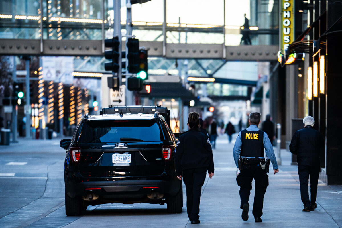
Minneapolis Police walk in Downtown Minneapolis part of Operation Endeavor
Minneapolis Police officers patrol downtown Minneapolis during "Operation Endeavor."

Minneapolis Police Patrol Downtown During Operation Endeavor
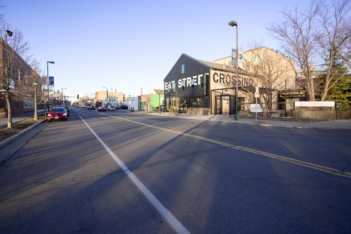
Eat Street Crossing on Nicollet Avenue in Minneapolis November 2022
Nicollet Avenue in South Minneapolis, a major thoroughfare known for its diverse businesses and cultural significance. Eat Street Crossing, a prominent building on the right, houses various establishments and serves as a hub for the surrounding community.

Eat Street Crossing, Nicollet Avenue, Minneapolis
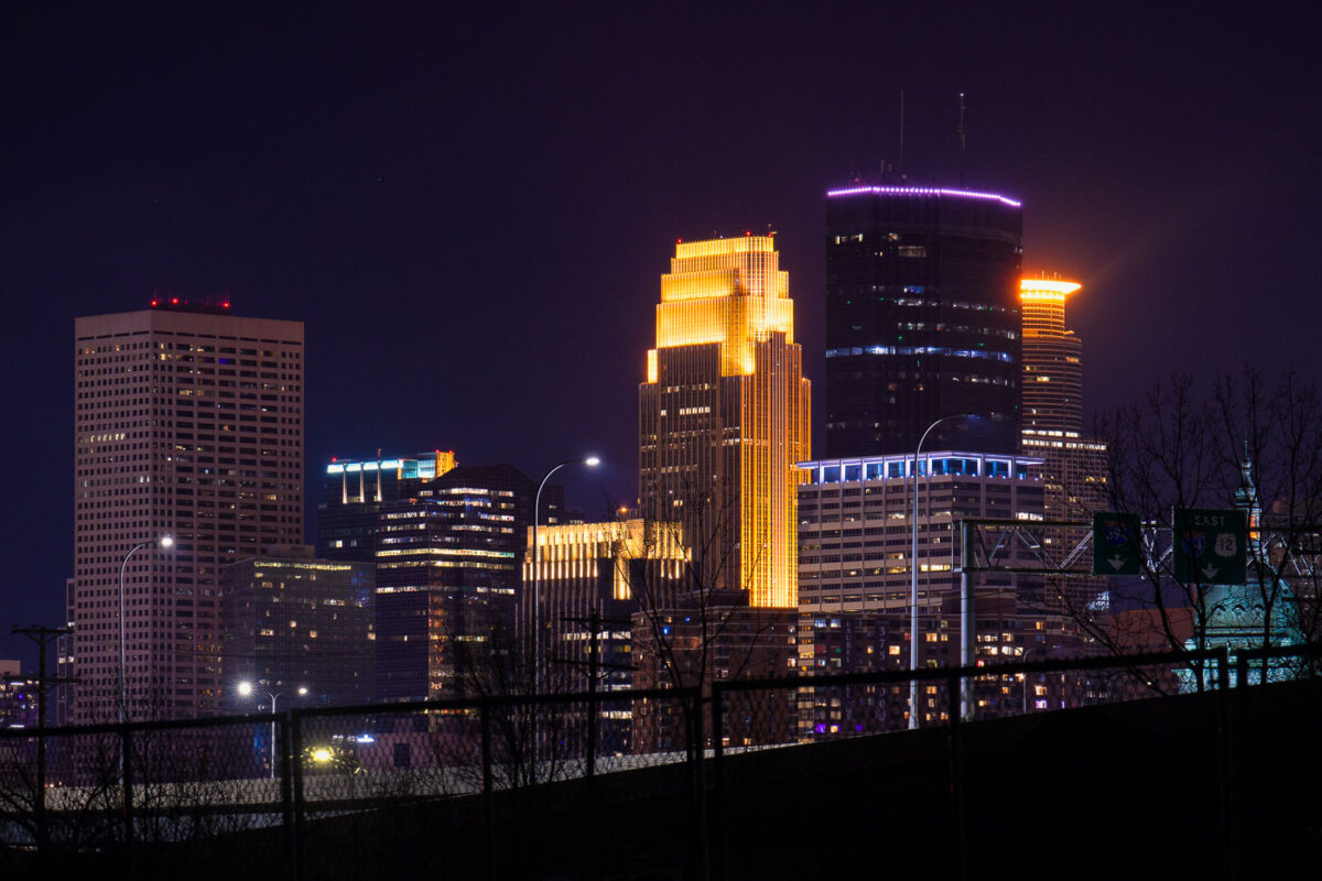
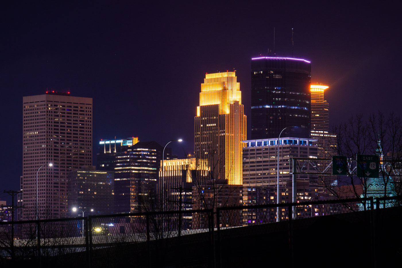
Capella Tower and Wells Fargo Center stand among illuminated skyscrapers in downtown Minneapolis at night.
Capella Tower rises 776 feet at 225 South Sixth Street, making it one of the tallest buildings in Minneapolis; designed by César Pelli and completed in 1992, it was originally known as Wells Fargo Center before taking its current name in 2010. Its crown, a ring of lights near the top, changes color for holidays and special occasions. Nearby, the Wells Fargo Center at 90 South Seventh Street — also designed by Pelli and completed in 1988 as Norwest Center — is nicknamed the "cash register building" for its tiered, stepped roofline. Both towers anchor the financial core of downtown Minneapolis, within blocks of the IDS Center and Nicollet Mall.

Capella Tower and Wells Fargo Center, Downtown Minneapolis
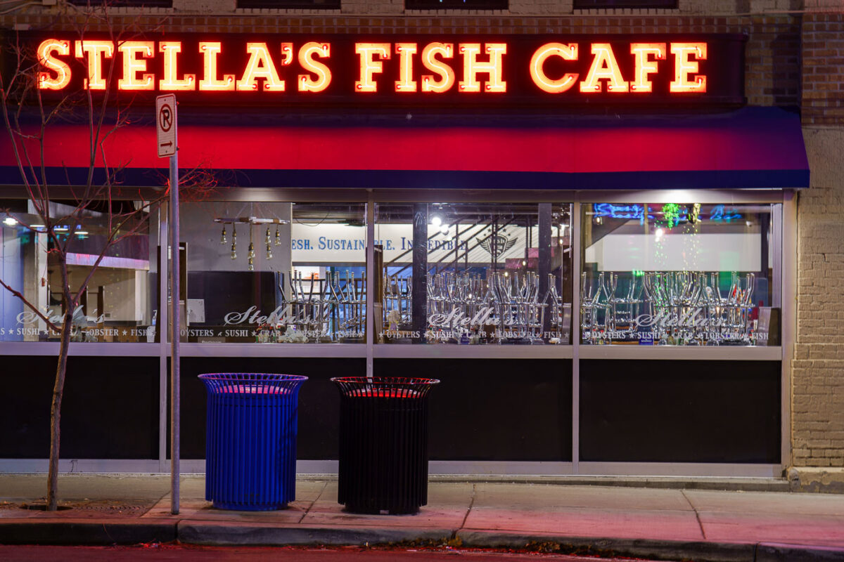
Stella's Fish Cafe storefront with illuminated neon sign on Lake Street in Uptown Minneapolis.
Stella's Fish Cafe is a seafood restaurant on Lake Street in Uptown Minneapolis.

Stella’s Fish Cafe Sign on Lake Street in Uptown Minneapolis
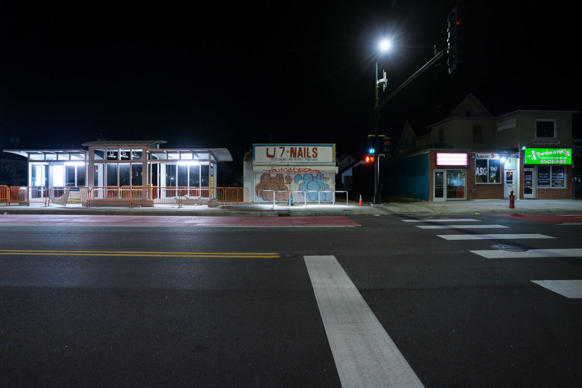
Metro Transit D Line Station on Chicago Ave in Minneapolis
The Metro Transit D-Line station is located at the Chicago-Lake Transit Center on Chicago Avenue in Minneapolis. This transit hub serves as a key point for bus routes, including the D-Line, connecting various parts of the city.

Metro Transit D-Line Station, Chicago Ave, Minneapolis

Jimmy Longoria mural on Chicago Lake Liquors in Minneapolis
A vibrant mural by artist Jimmy Longoria adorns the exterior of Chicago-Lake Liquors in Minneapolis. The artwork covers the building's front metal shutters, transforming the facade into a dynamic visual statement. This mural is part of a broader artistic response to the events of the Minneapolis Uprising.

Jimmy Longoria Mural on Chicago-Lake Liquors, Minneapolis
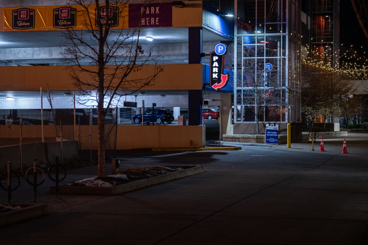
Seven Points parking ramp on Lake Street in Uptown Minneapolis November 2022
The Seven Points Parking Ramp, located on Lake Street in Minneapolis's Uptown neighborhood, serves as a primary parking facility for the area. In June 2021, this location became a site of national attention when Winston Smith was killed by law enforcement officers at the top of the ramp. The incident occurred during a period of heightened unrest following the murder of George Floyd.

Seven Points Parking Ramp, Lake Street, Minneapolis
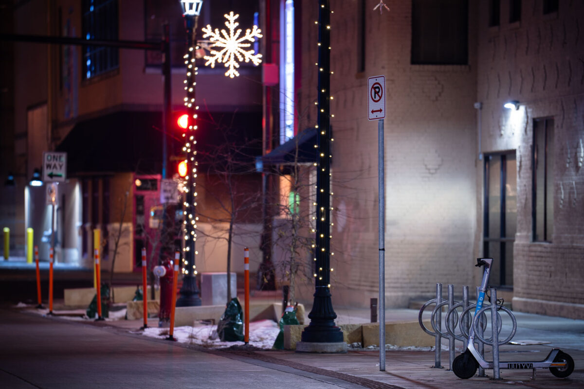
Bird Scooter on Girard in Uptown Minneapolis
A Bird scooter is parked at a bike rack on Girard Avenue in Uptown Minneapolis during the winter of 2022.

Bird Scooter on Girard Ave, Uptown Minneapolis at Night
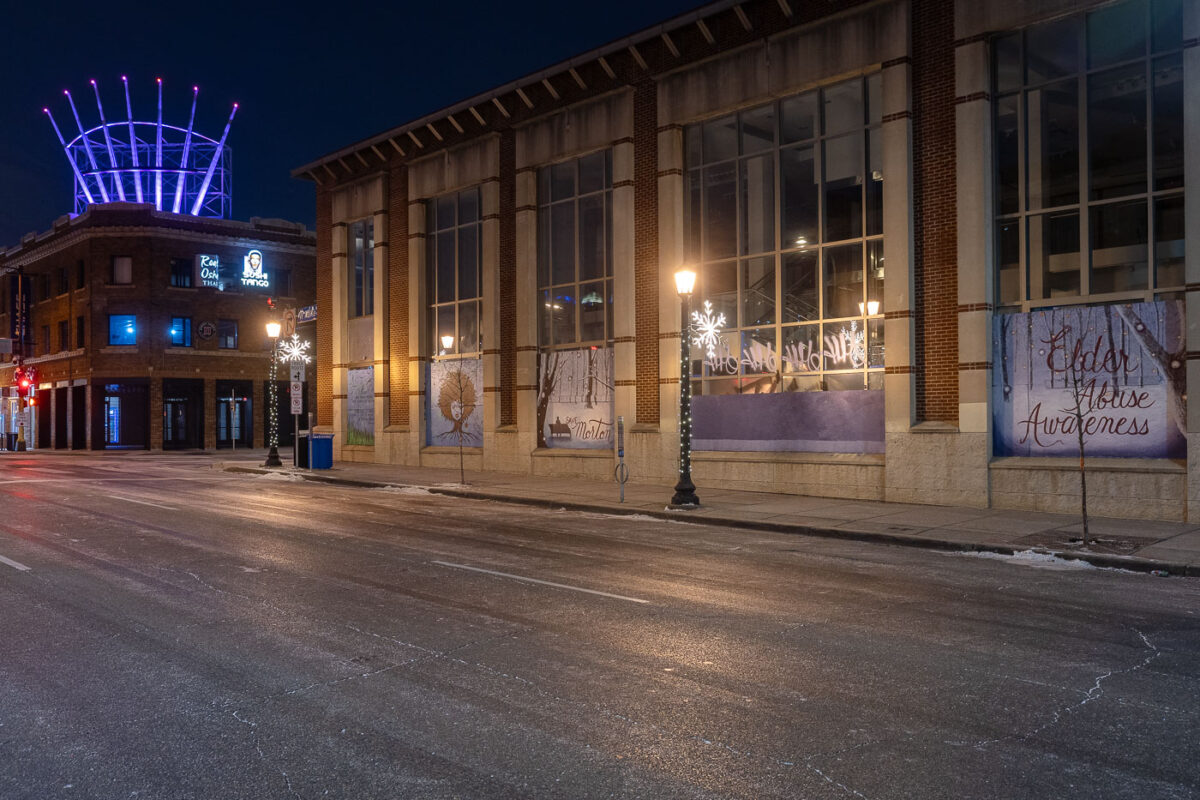
Boards on building in November 2022 Hennepin Ave Lake Street
Banners promoting Elder Abuse Awareness are displayed on the former Victoria's Secret and Gap building at the intersection of Lake Street and Hennepin Avenue in Minneapolis. The building's facade was previously covered with boards from the June 2020 protests following the murder of George Floyd.

Hennepin and Lake Street, Minneapolis: Elder Abuse Awareness Banner

Clearing snow on sidewalks in Downtown Minneapolis

A sidewalk snow polow on the first snowfall of the season in Minneapolis.

Clearing snow on sidewalks in Downtown Minneapolis

Giant Pencil Sculpture Near Lake of the Isles

A large pencil sculpture stands partly buried in fresh snow near Lake of the Isles in Minneapolis. The piece—well-known to neighborhood walkers and cyclists—sits on the lawn of a private residence and has become a quiet local landmark. Framed by stone steps, evergreens, and early-season snowfall, it reflects the eclectic public-facing art found throughout the surrounding residential areas of the Chain of Lakes.

Giant Pencil Sculpture Near Lake of the Isles

Biker in the snow biking around a lake in South Minneapolis
A cyclist navigates a snow-covered path on Lake of the Isles in Minneapolis during the season's first snowfall. The park, part of the Minneapolis Chain of Lakes, is a popular destination for recreation year-round, offering paved paths for walking, running, and cycling. Despite the winter weather, the park remains a vital part of the city's green infrastructure, providing residents with access to nature and opportunities for outdoor activity.

Biker on Lake of the Isles, Minneapolis, in first snowfall
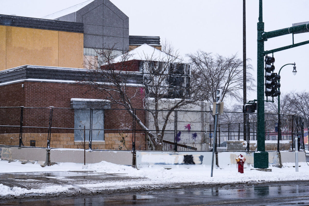
Snow around burned minneapolis police station
The former Minneapolis Police Third Precinct building in South Minneapolis is seen here during a snowfall. This precinct was a focal point of protests and unrest following the murder of George Floyd on May 25, 2020. The building was subsequently damaged by fire during demonstrations that occurred in the days following Floyd's death. The structure has remained vacant and secured since the incident.

Former Minneapolis Police 3rd Precinct in Snowfall
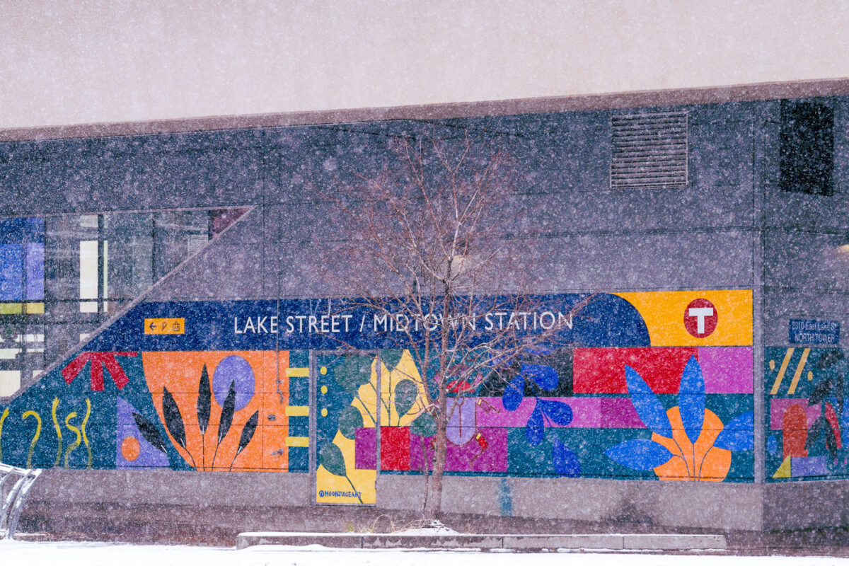
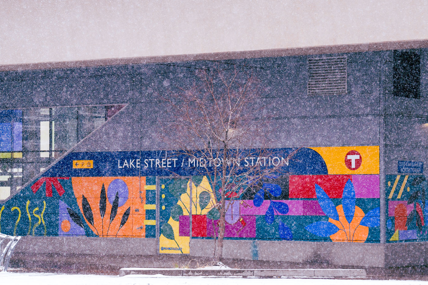
Snow falling with mural at Metro Transit train station
The Lake Street/Midtown Station in South Minneapolis is adorned with a vibrant mural, seen here during a November snowfall. This station serves as a key transit hub for the city, connecting multiple bus routes and the Blue Line light rail.

Lake Street/Midtown Station Mural in Minneapolis Snowfall
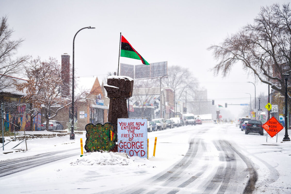
Snowfall and the fist at George Floyd Square Chicago Avenue
Snow falls on Chicago Avenue in Minneapolis, the site of George Floyd Square. This area became a focal point for protest and community organizing following the murder of George Floyd on May 25, 2020. The square, established by activists, represents a space dedicated to racial justice and remembrance. The "Free State of George Floyd" sign and the raised fist symbol are prominent markers of this significant public space.

George Floyd Square, Minneapolis, in November Snowfall
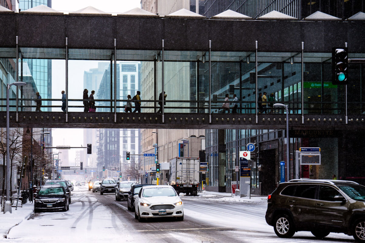
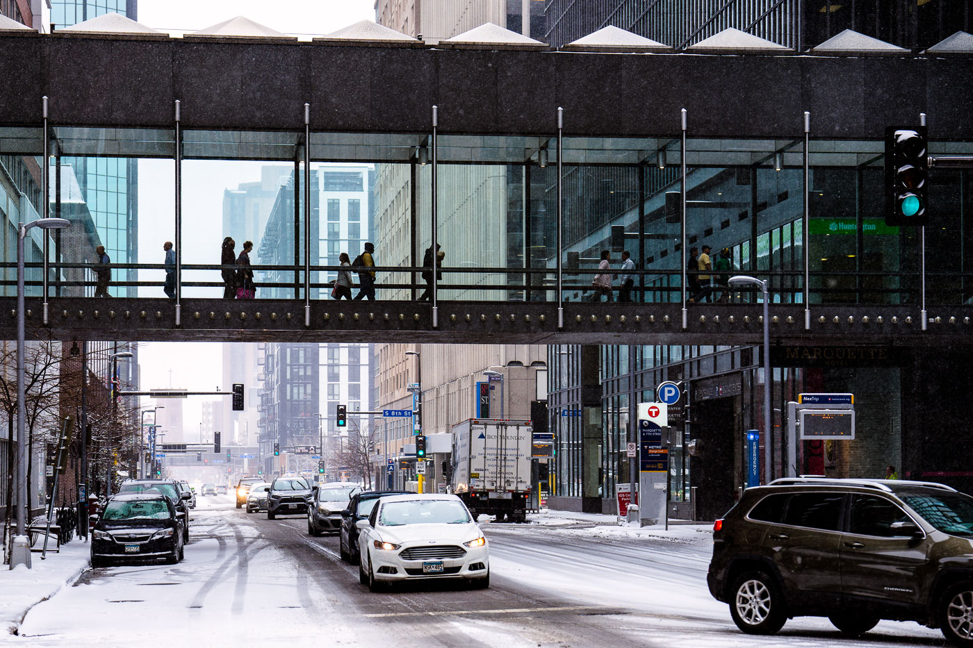
Snow falling with people in IDS Center skyway downtown Minneapolis
Pedestrians utilize the Minneapolis Skyway system, a network of enclosed pedestrian bridges connecting buildings in downtown Minneapolis, during the first snowfall of the season. The IDS Center, a prominent skyscraper completed in 1973, is visible in the background, with its skyway spanning Marquette Avenue. This elevated walkway system, initiated in 1962, allows people to navigate the city center year-round, shielded from weather conditions like the snow seen here.

IDS Center Skyway and Marquette Ave in Snow, Minneapolis
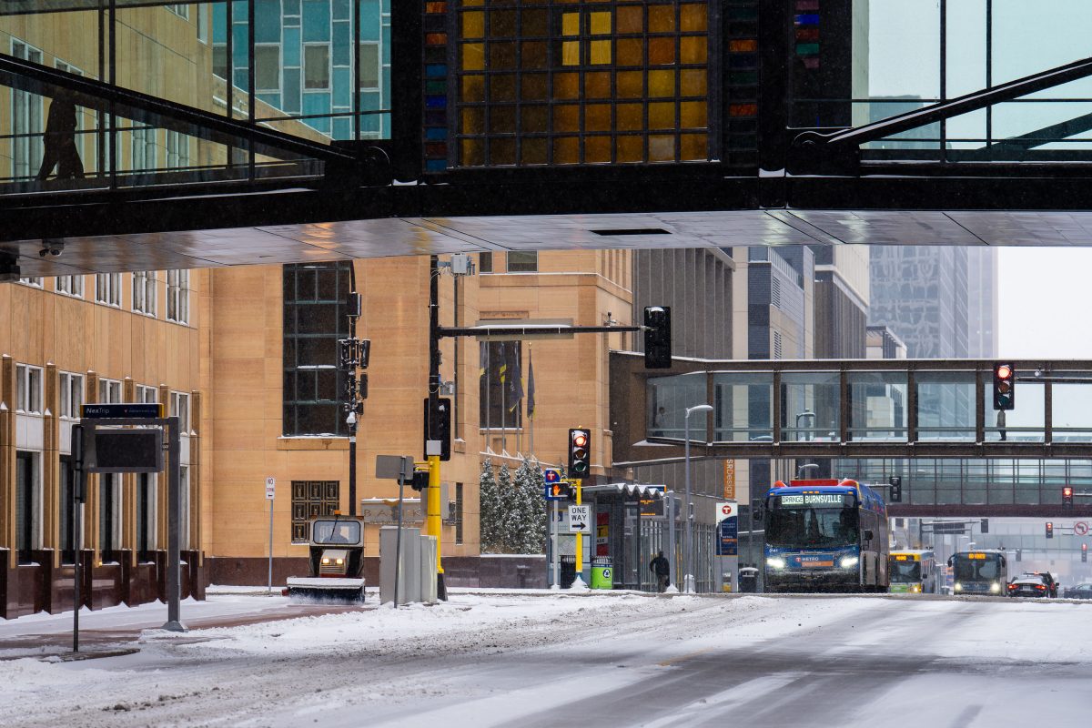
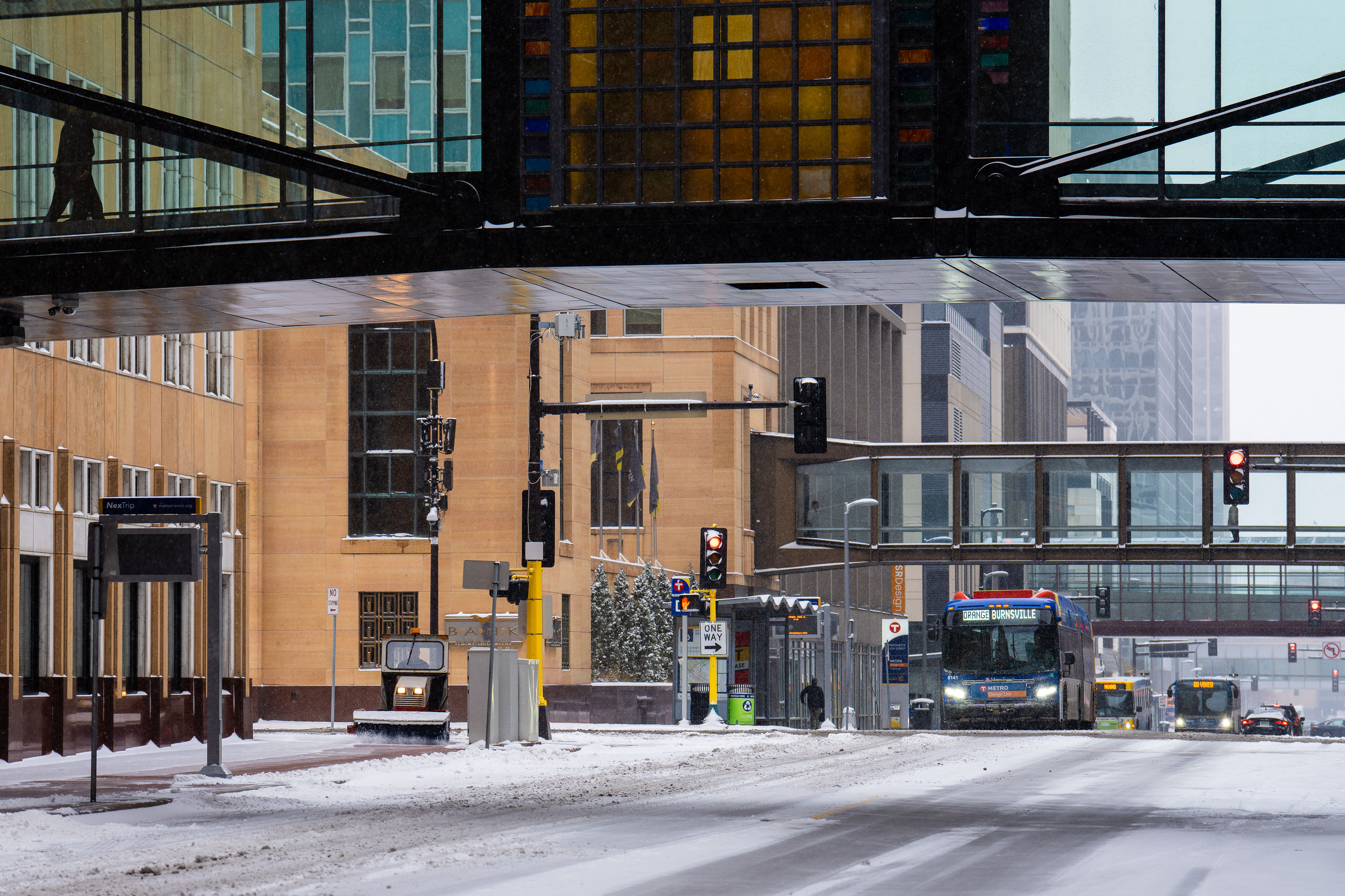
Metro Transit bus on snow-covered Marquette Avenue in downtown Minneapolis beneath an elevated skyway.
Marquette Avenue runs through the heart of downtown Minneapolis and serves as a primary corridor for Metro Transit's bus network. The METRO Orange Line, which opened in 2021, connects downtown to Burnsville along a dedicated bus rapid transit route running parallel to Interstate 35W. Marquette Avenue also sits beneath several segments of the Minneapolis Skyway System, an 8-mile network of enclosed pedestrian bridges connecting downtown buildings at the second-story level, first built in 1962 and now the largest continuous skyway system in the world.

Metro Transit Bus on Marquette Avenue, Minneapolis
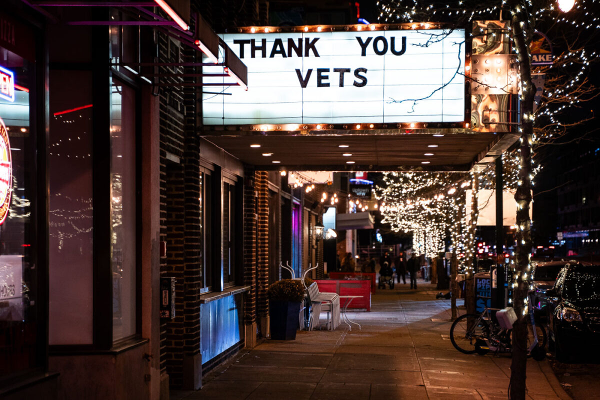
Thank You Vets on a Minneapolis theatre marquee
The marquee at a theatre on Lyndale Avenue in Minneapolis displaying "THANK YOU VETS.

Minneapolis Theatre Marquee: Thank You Vets
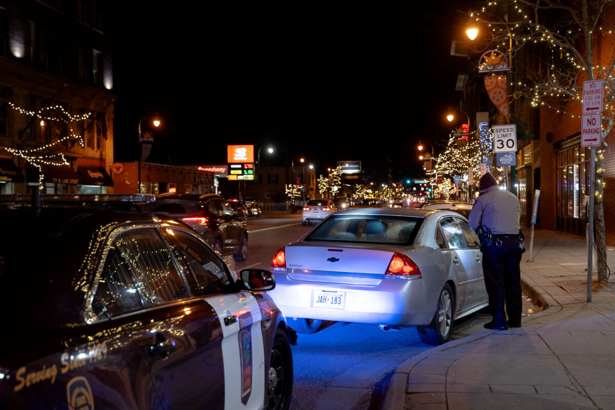
Minnesota State Patrol pulling over a vehicle on Hennepin Avenue
Minnesota State Patrol officers assisted Minneapolis Police on Lake Street doing traffic stops shown here on Lake Street and Lyndale.

Minnesota State Patrol assists Minneapolis Police on Lake Street
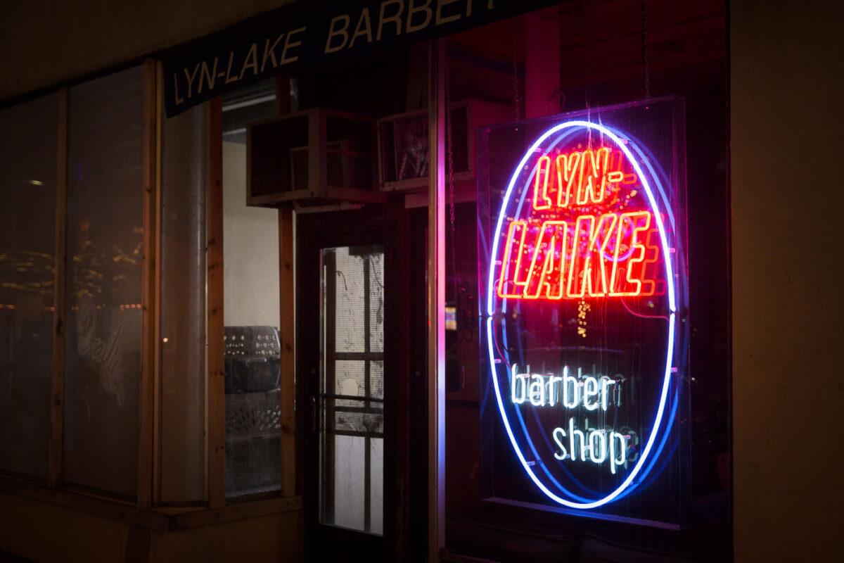
Lynlake Barber Shop neon sign on Lyndale in Minneapolis
The Lyn-Lake Barber Shop, located on Lyndale Avenue in Minneapolis, is illuminated by a vibrant neon sign.

Lyn-Lake Barber Shop Neon Sign, Minneapolis
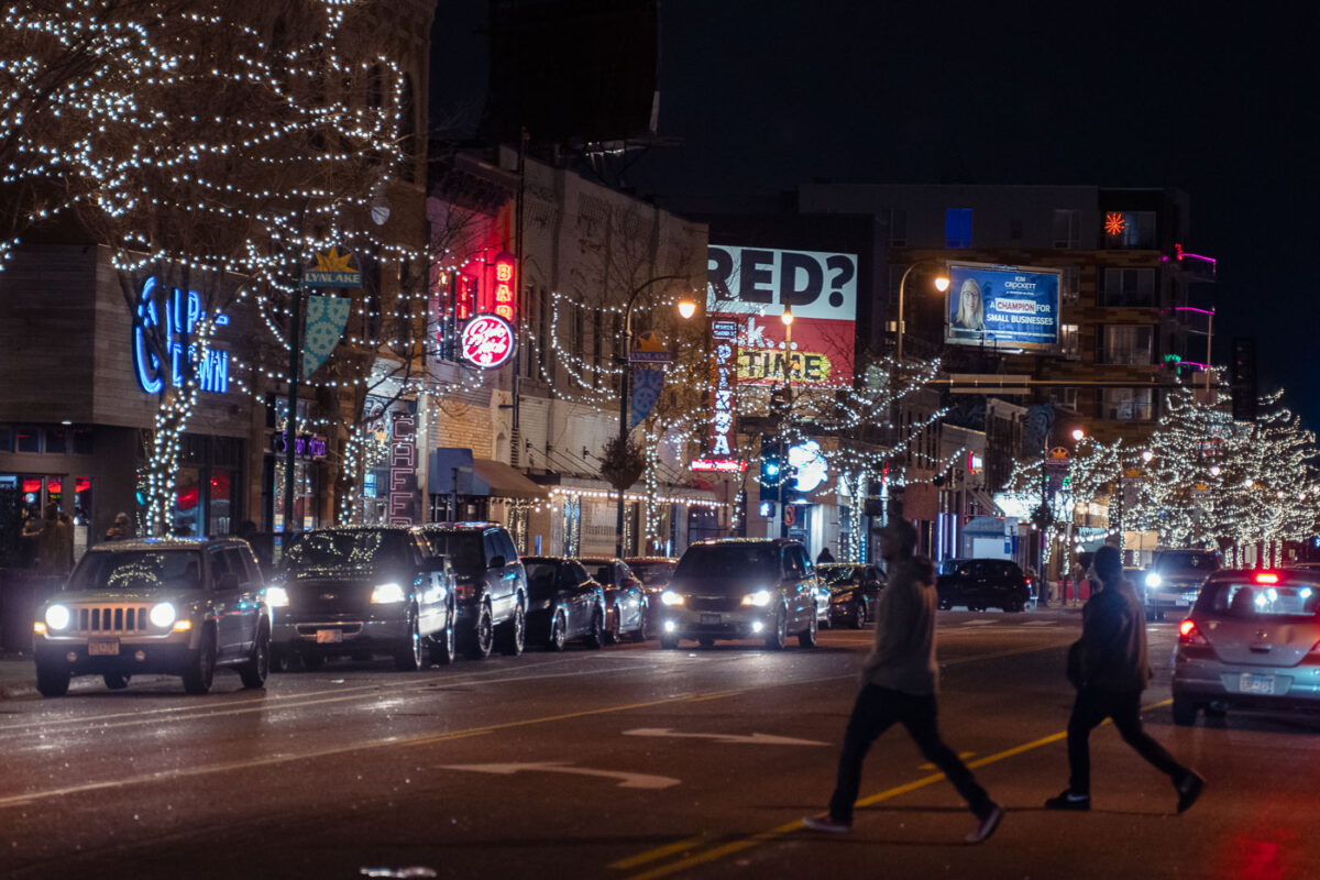
People walking across Lyndale Avenue in Minneapolis in 2022
Lyndale Avenue in Minneapolis is a vibrant commercial corridor, seen here at night in November 2022.

Lyndale Avenue, Minneapolis: Pedestrians Cross Street at Night
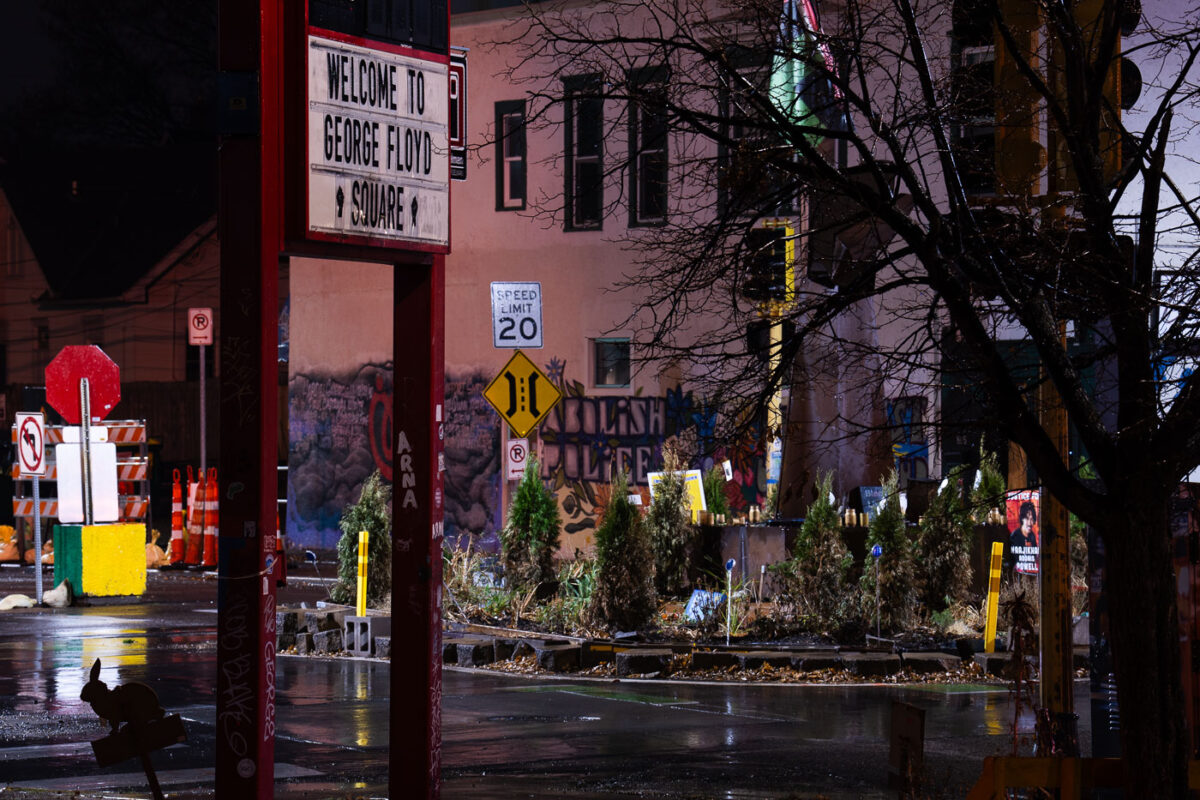
George Floyd Square in a late November 2022 rain
George Floyd Square, located at the intersection of Chicago Avenue and East 38th Street in Minneapolis, is seen here in November rain. This site became a focal point for protests and community organizing following the murder of George Floyd on May 25, 2020.

George Floyd Square, Minneapolis, in November Rain
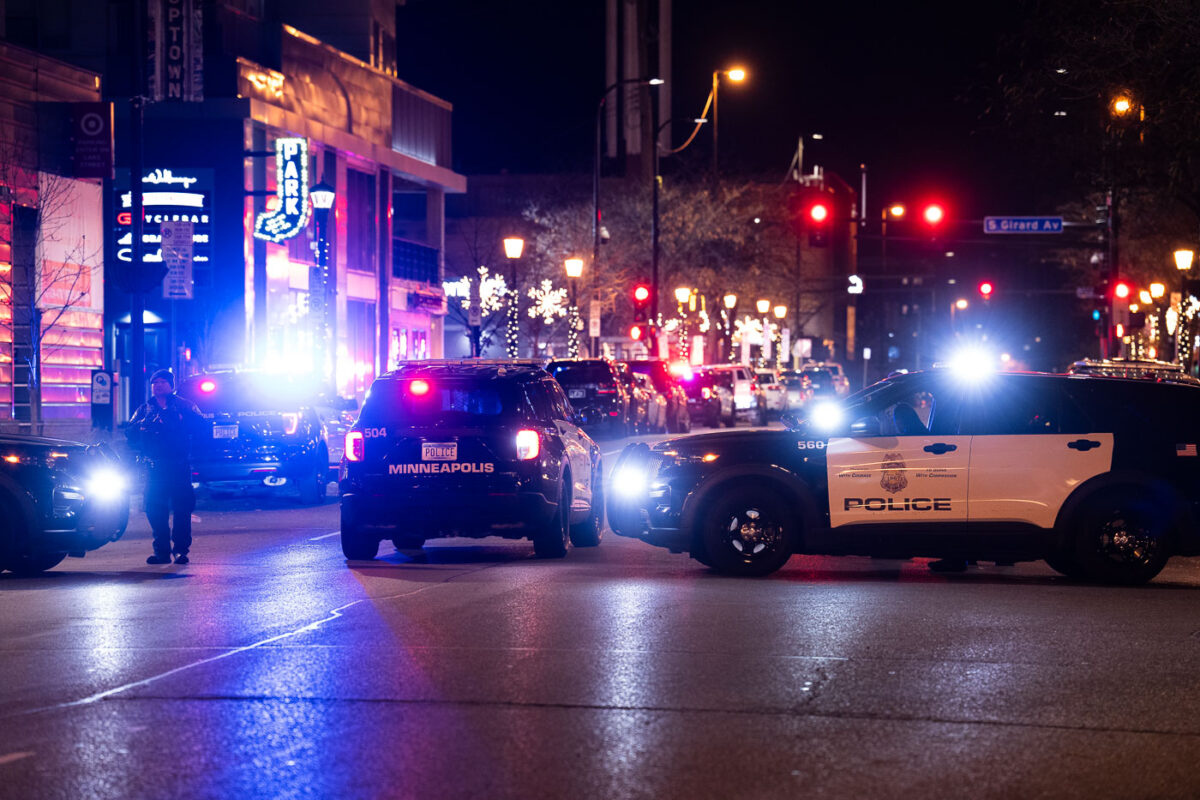
Minneapolis Police squad cars parked on Lagoon Ave November 2022
Minneapolis Police squad cars are visible on Lagoon Avenue in the Uptown neighborhood of Minneapolis.

Minneapolis Police Squad Cars on Lagoon Ave, Uptown

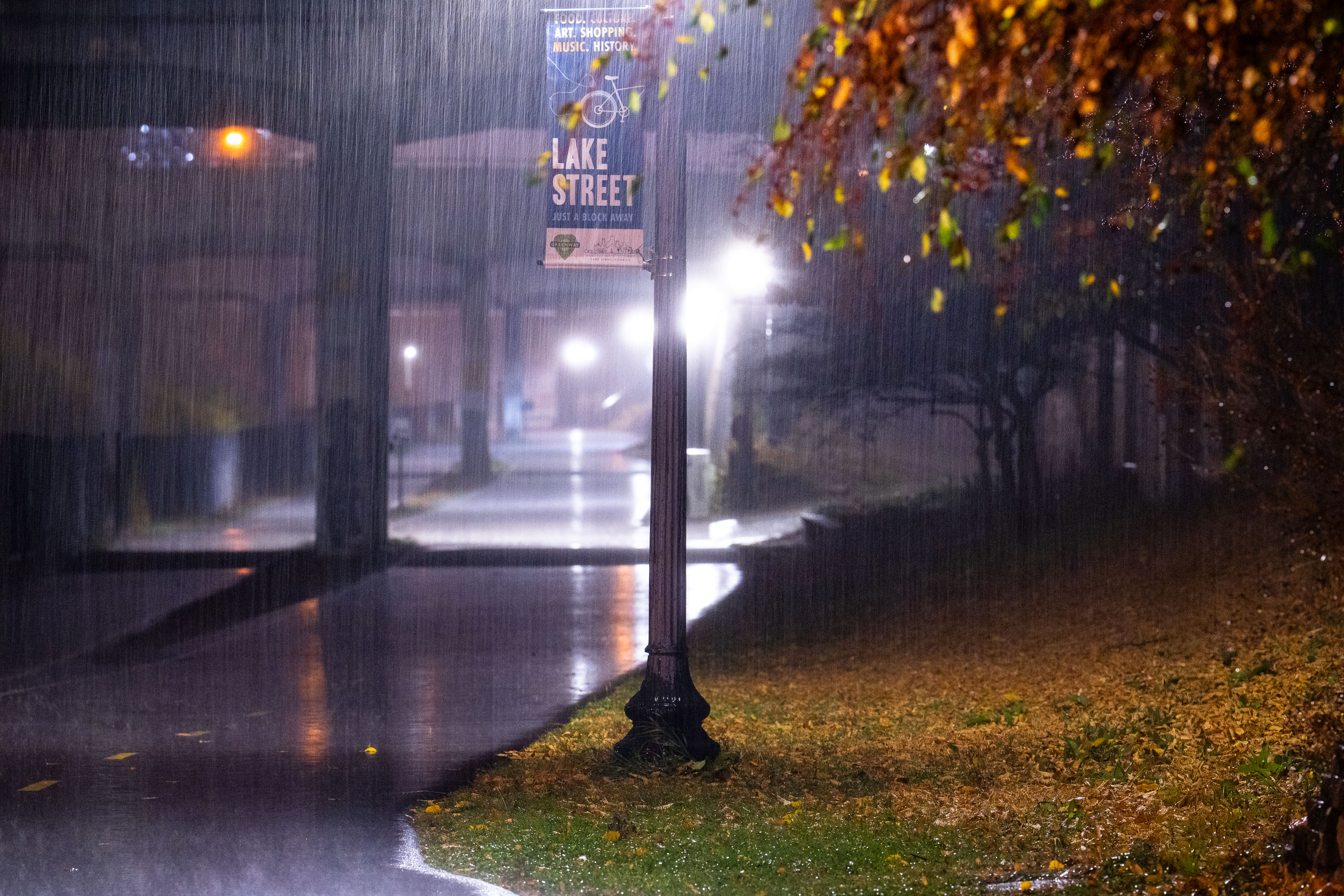
Lake Street sign illuminated at night during rainfall on the Midtown Greenway in Minneapolis.
The Midtown Greenway occupies a below-grade rail corridor once used by the Chicago, Milwaukee, St. Paul and Pacific Railroad, converted to a bicycle and pedestrian route beginning in the late 1990s. The trail runs roughly five and a half miles across south Minneapolis, linking the Chain of Lakes near Uptown to the Mississippi River at the West River Parkway. Lake Street, one of the city's principal commercial corridors, crosses the Greenway on a bridge above the trail. Signage along the route marks nearby cross streets and neighborhood landmarks for cyclists and pedestrians using the corridor.

Lake Street Sign at Midtown Greenway, South Minneapolis
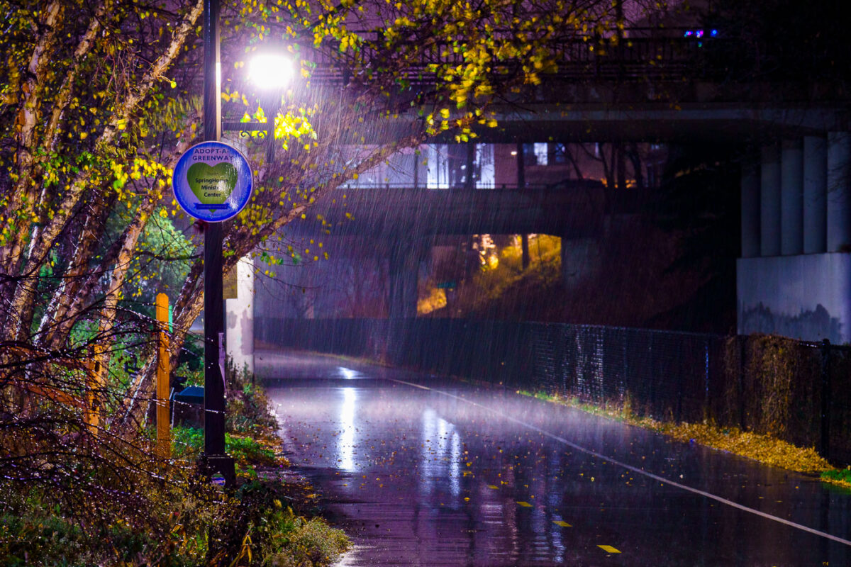
November rain on the midtown greenway bike trail in Minneapolis
The Midtown Greenway in South Minneapolis is a 5.5-mile paved trail for pedestrians and cyclists. Constructed on a former railroad corridor, it was developed in phases, with significant portions opening in the early 2000s. The trail provides a vital transportation and recreational link through the city.

Midtown Greenway, Minneapolis: November Rain on Bike Trail
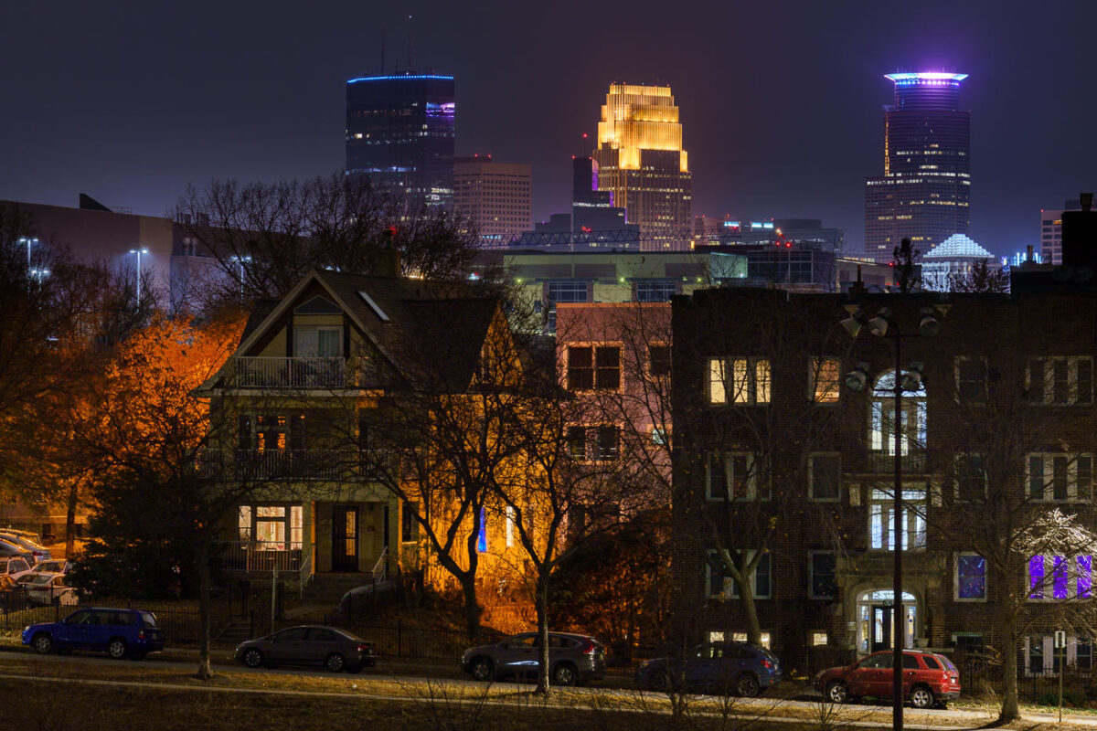
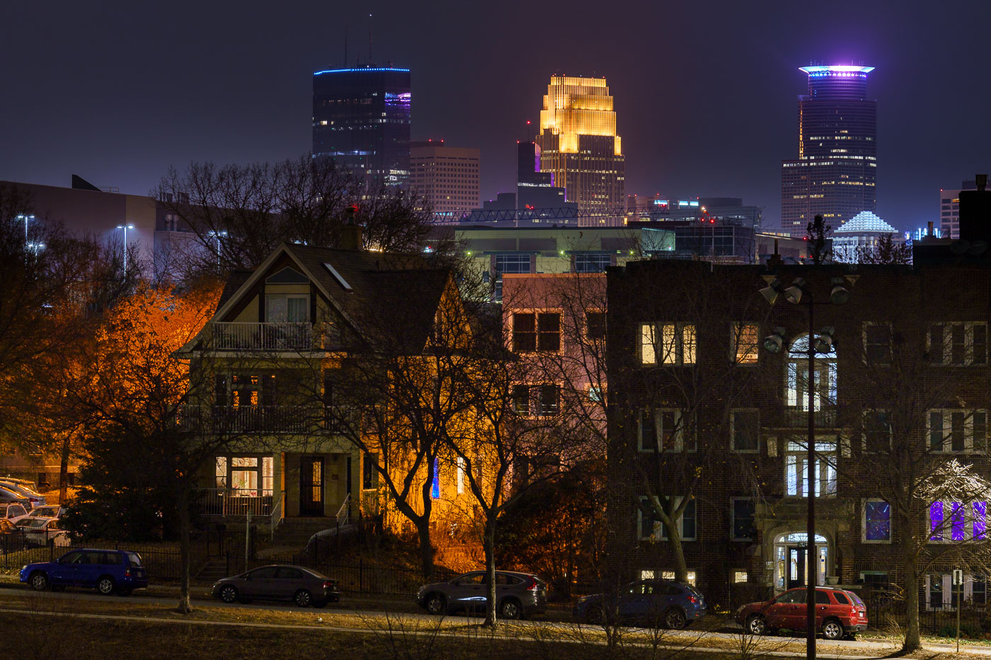
Minneapolis Skyline at night from Powderhorn Park 2022
The Minneapolis skyline is visible from Powderhorn Park, a public space in South Minneapolis. The park, established in 1889, is named for its central lake and has been a gathering place for the community for over a century.

Minneapolis Skyline from Powderhorn Park at Night 2022
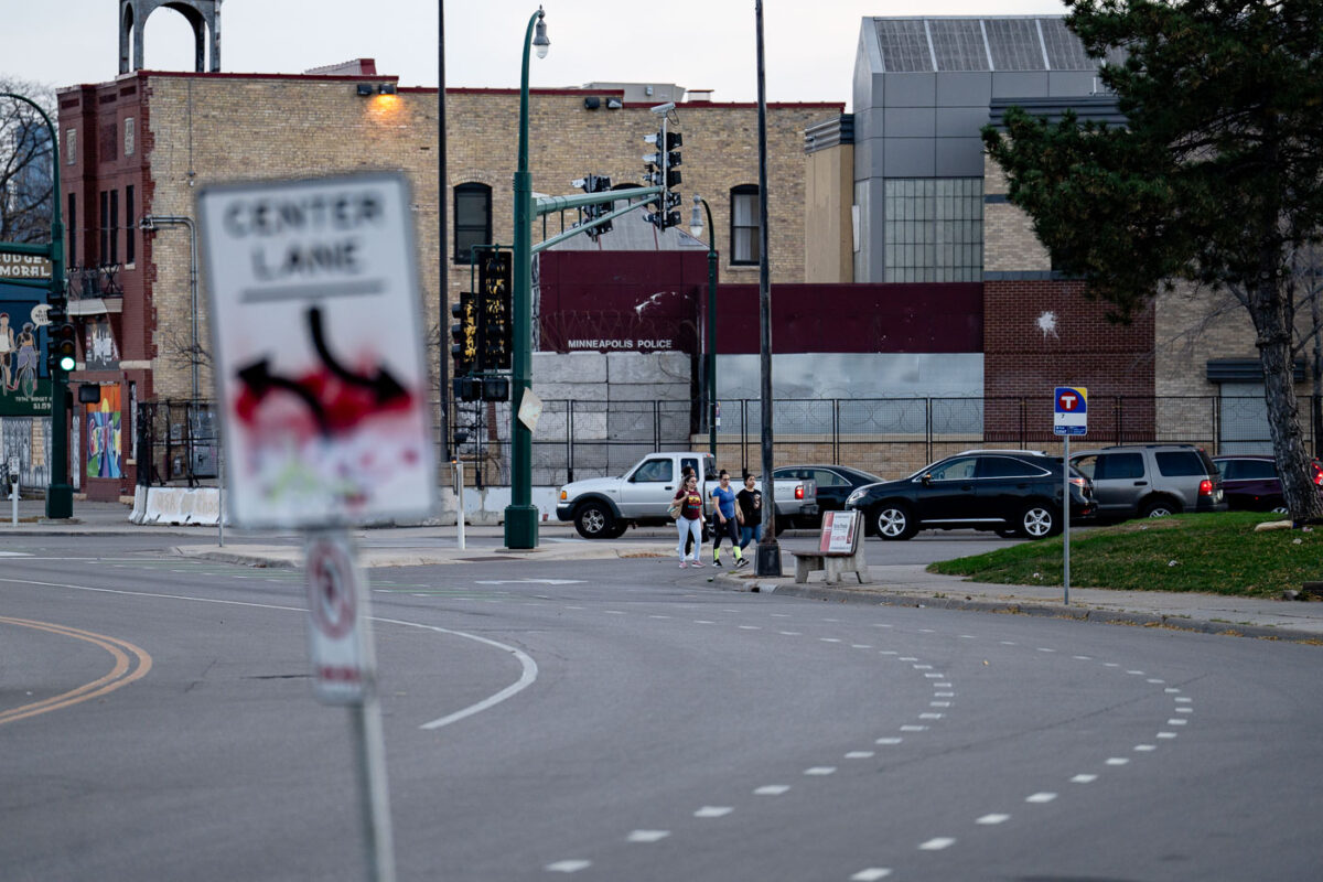
Minneapolis third precinct as seen on Minnehaha Ave
The former Minneapolis Police Third Precinct building, located on Minnehaha Avenue, stands after being significantly damaged by fire during protests in May 2020. The unrest followed the murder of George Floyd by a Minneapolis police officer.

Minneapolis Police 3rd Precinct, Minnehaha Ave, Post-Uprising
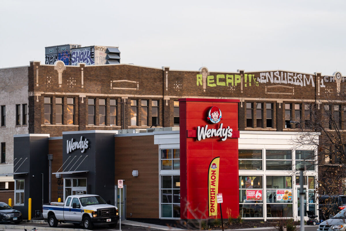
Now Hiring at newly built wendys with graffiti in background
This Wendy's restaurant in Minneapolis was rebuilt after being destroyed by fire during civil unrest in May 2020. The unrest followed the murder of George Floyd by Minneapolis police.

Minneapolis Wendy’s Rebuilt After 2020 Riots

Warehouse District Live Games on Halloween
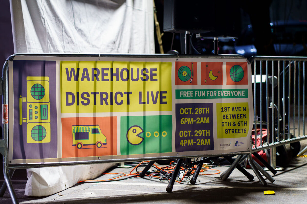
Thousands of costumed people downtown last night for various parties. Part of 1st Avenue was closed for Warehouse District Live with food trucks, arcades, and basketball hoops. Saw lots of bananas. (Minneapolis, October 2022)

Warehouse District Live Games on Halloween

Food trucks on Halloween in Downtown Minneapolis
Thousands of costumed people downtown last night for various parties. Part of 1st Avenue was closed for Warehouse District Live with food trucks, arcades, and basketball hoops. Saw lots of bananas. (Minneapolis, October 2022)

Food trucks on Halloween in Downtown Minneapolis

Warehouse District Live sign on Halloween
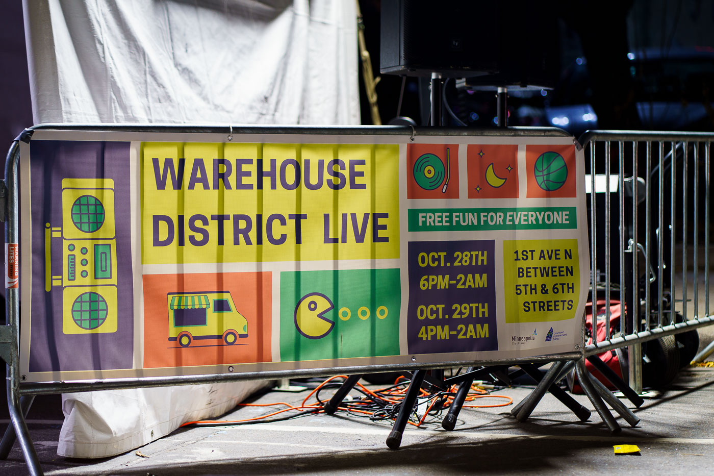
A banner advertises "Warehouse District Live," a free event held on October 28th and 29th, 2022, on 1st Avenue North between 5th and 6th Streets in Minneapolis. The event featured "free fun for everyone," with graphics suggesting music, food, and entertainment. The Warehouse District is a historic area of Minneapolis known for its late 19th and early 20th-century industrial architecture, which has since been redeveloped for residential, commercial, and entertainment purposes.

Warehouse District Live Event Sign, Minneapolis
Downtown Minneapolis crowds on Halloween
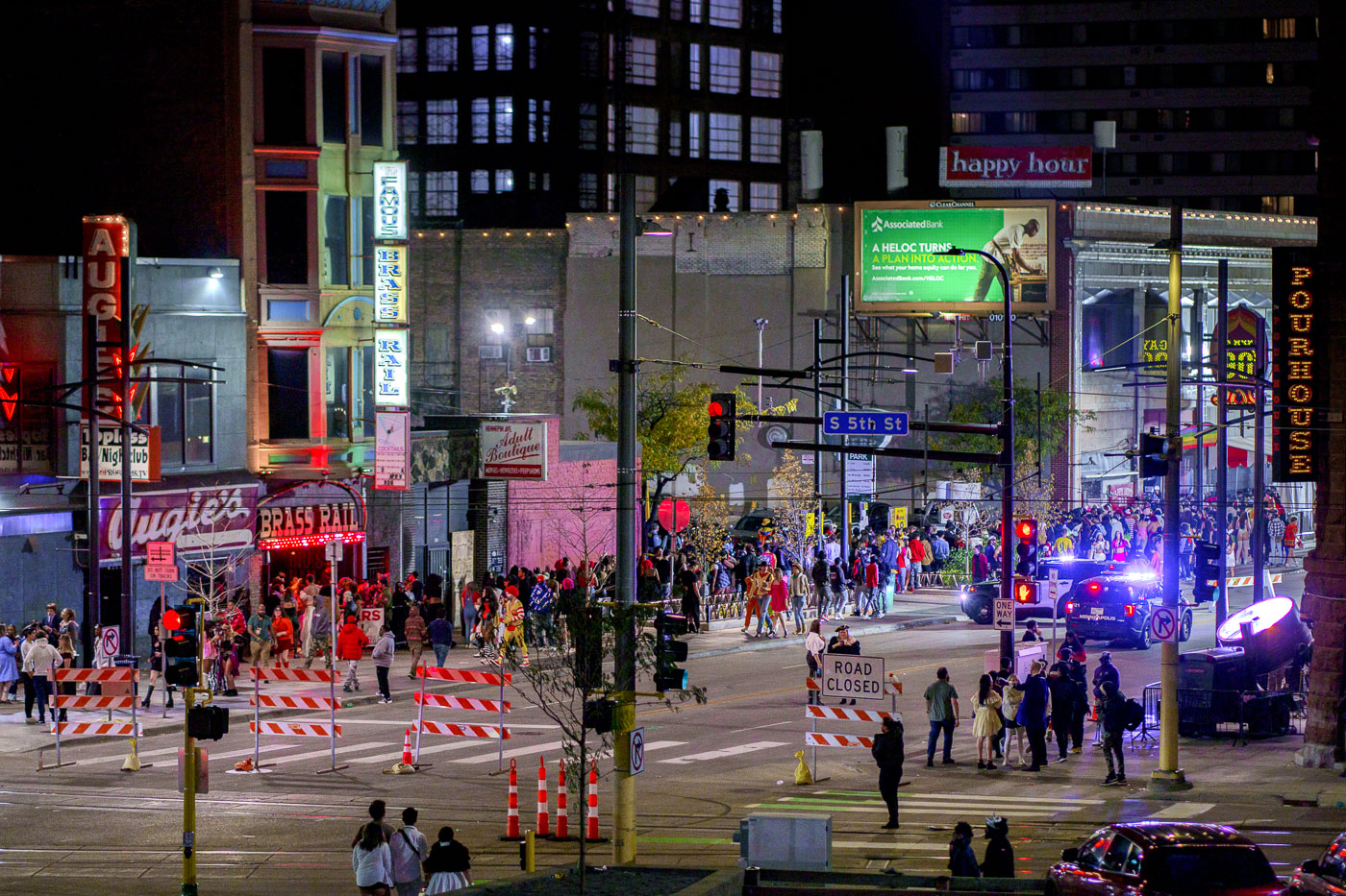
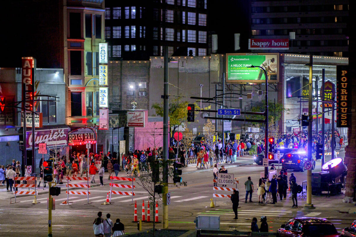
Thousands of costumed revelers filled downtown Minneapolis on Halloween night, congregating on 1st Avenue and South 5th Street.

Downtown Minneapolis Halloween crowds on 1st Ave and S 5th St
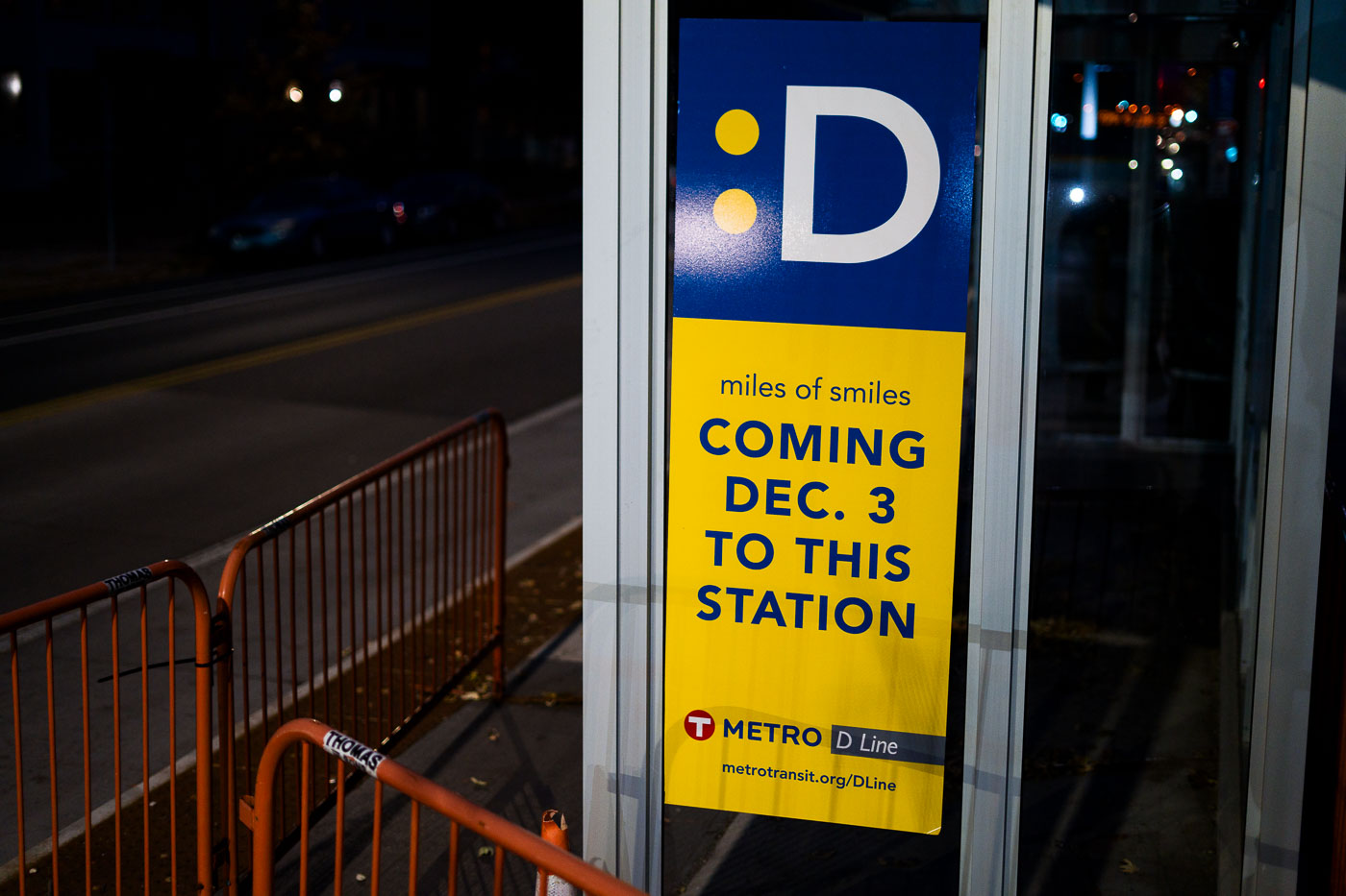
Metro Transit D Line Coming Soon
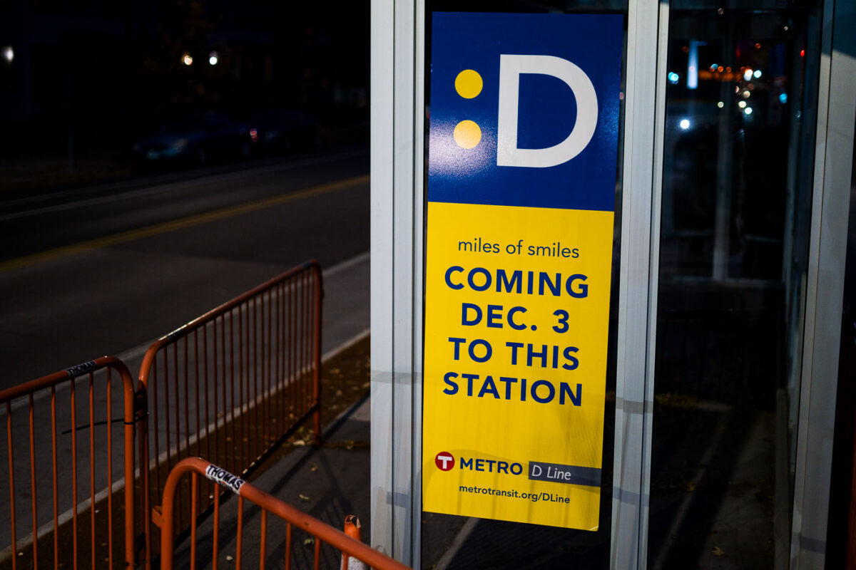
New signage announces the upcoming December 3 launch of the Metro Transit D Line rapid bus service on Chicago Avenue in Minneapolis. This new transit line aims to improve service frequency and reliability along one of the city's busiest corridors. The D Line is part of a larger initiative to enhance public transportation options within the Twin Cities metropolitan area. Its development reflects ongoing efforts to modernize and expand transit infrastructure to better serve residents and commuters.

Metro Transit D Line Signage on Chicago Ave, Minneapolis

Kindness is Free Box
A "Kindness is Free" box, a community initiative, is pictured in Minneapolis.

Kindness is Free Box, Minneapolis

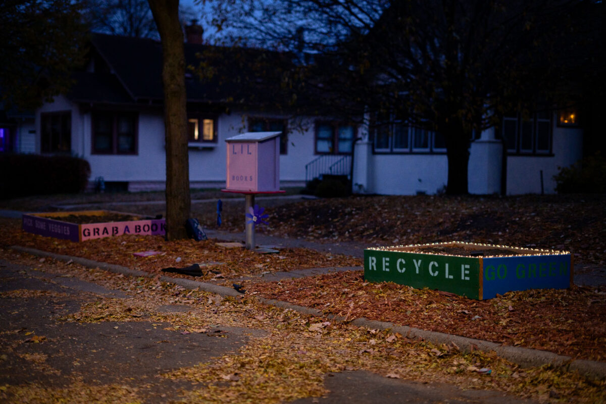
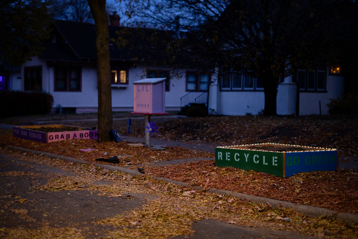
Recycle Go Green Flower Beds in Minneapolis
In a South Minneapolis neighborhood, a "Recycle Go Green" flower bed and a "Little Free Library" stand as community-driven initiatives. The "Recycle Go Green" planter, adorned with lights, promotes environmental consciousness, while the adjacent "Grab a Book, Pick Some Veggies" planter and the "Lil Books" library encourage resource sharing and community engagement.

Minneapolis “Recycle Go Green” Flower Bed and Little Free Library
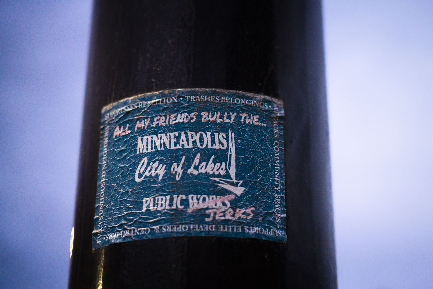
Radical Minneapolis Public Works sticker
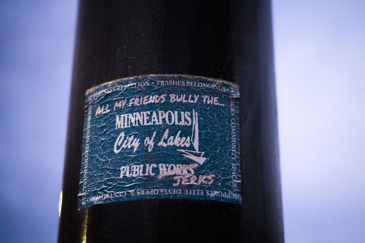
A sticker on a Minneapolis light pole reads "All My Friends Bully the... Minneapolis Public Works Jerks." The sticker also states "Suppresses Rebellion. Smashes Belongings. Evicts Unhoused Neighbors. Supports Elite Developers & Gentrifiers. Attacks Community Spaces." This message is a critique of the Minneapolis Public Works department's role in clearing encampments.

Minneapolis Public Works “Jerks” Sticker on Light Pole

Scott Jensen billboard at George Floyd Square
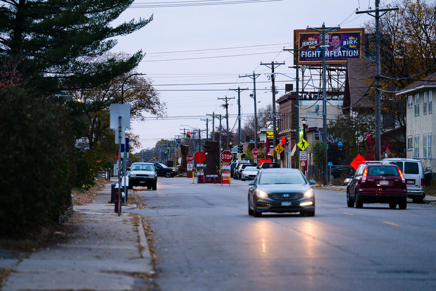
A billboard featuring Scott Jensen, a Republican candidate for Minnesota Governor, and Matt Birk, his running mate, is positioned directly above Cup Foods at George Floyd Square in Minneapolis. The location is significant as it is the site where George Floyd was murdered in May 2020, leading to widespread protests and the establishment of the "George Floyd Square" autonomous zone.

Scott Jensen Billboard Above George Floyd Square Mural, Minneapolis

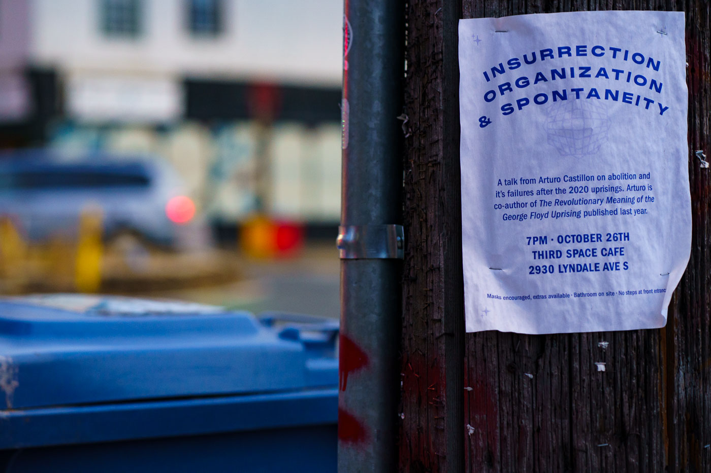
Flyer for Insurrection Organization Spontaneity
A flyer posted on a wooden surface advertises a talk by Arturo Castillon titled "Insurrection, Organization & Spontaneity." The event, held at Third Space Cafe at 2930 Lyndale Ave S in Minneapolis, focused on abolition and the perceived failures following the 2020 uprisings. Castillon is noted as the co-author of "The Revolutionary Meaning of the George Floyd Uprising," published the previous year.

Flyer for Arturo Castillon talk at Third Space Cafe, Minneapolis

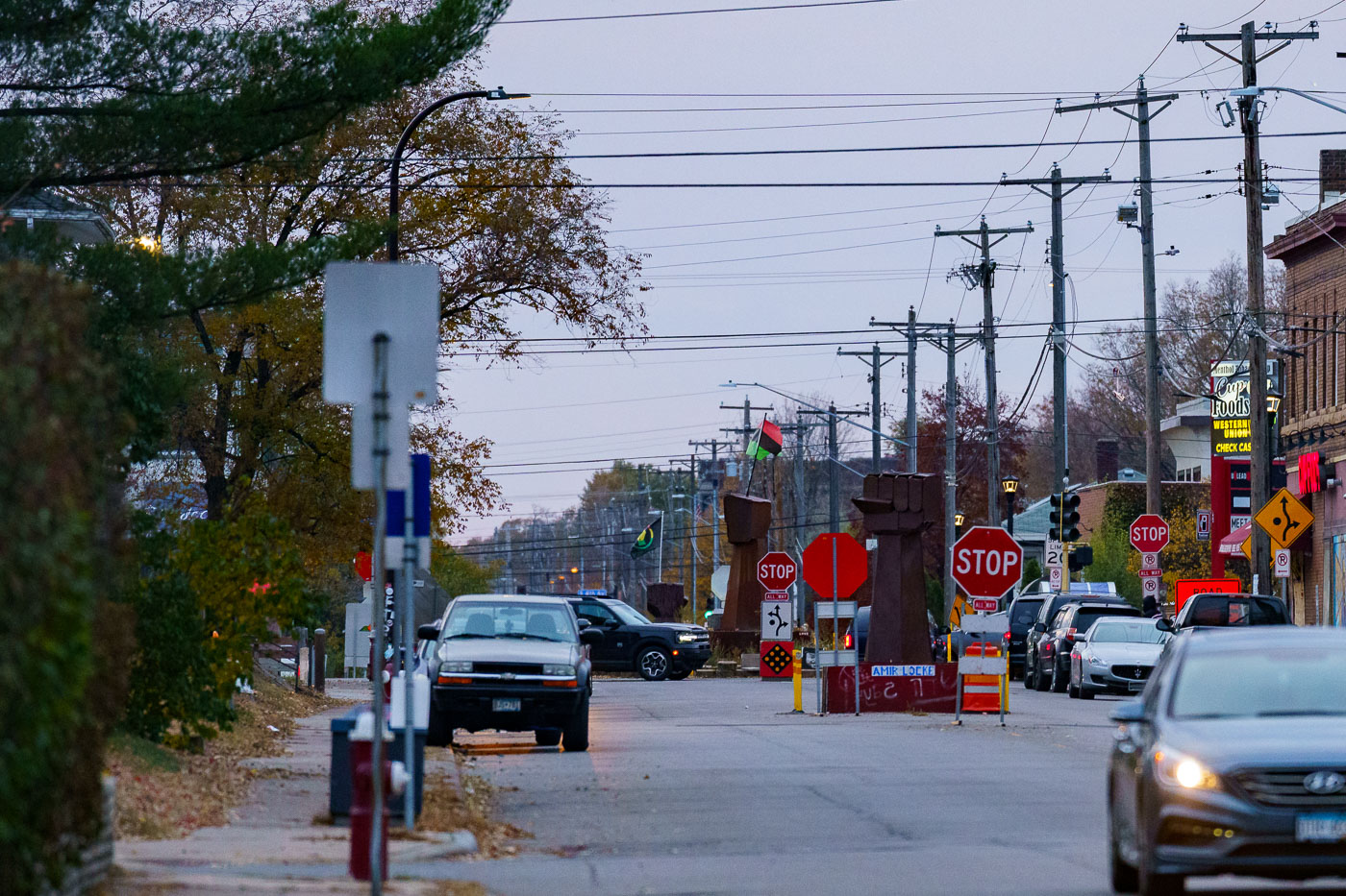
George Floyd Square fists October 2022
George Floyd Square, located at the intersection of East 38th Street and Chicago Avenue in Minneapolis, became a focal point of protests following the murder of George Floyd in May 2020. The area, often referred to as "The Autonomous Zone," was occupied by protesters for an extended period. In October 2022, political messaging, such as a billboard featuring gubernatorial candidate Scott Jensen, appeared above a mural dedicated to George Floyd, reflecting the ongoing political and social discourse surrounding the site.

George Floyd Square, Minneapolis: Fists and Stop Signs, October 2022

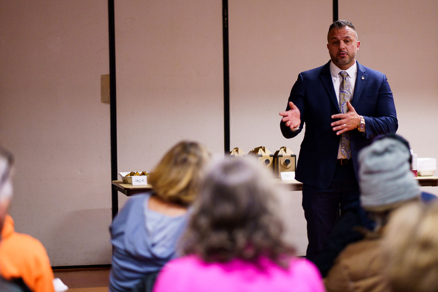
Brian Ohara speaks to the community
Minneapolis police chief nominee Brian O’Hara engaged with community members at Stewart Park. The meet and greet provided a forum for residents to discuss public safety concerns and the potential impact of a consent decree, a process O'Hara had experience with in Newark.

Brian O’Hara speaks to Minneapolis community at Stewart Park
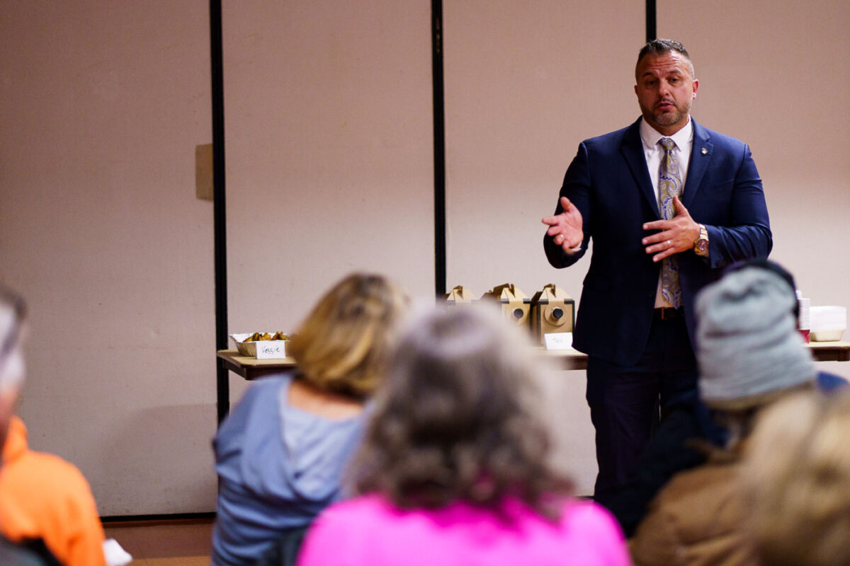
Minneapolis Police Chief Brian OHara at Community Meeting
Minneapolis Police Chief nominee Brian O’Hara addresses community members at Stewart Park in South Minneapolis. The meeting provided a forum for residents to discuss public safety and O'Hara's proposed leadership. During the gathering, O'Hara shared insights from his experience with a consent decree process in Newark, New Jersey, drawing comparisons to the unique challenges and context of Minneapolis.

Minneapolis Police Chief Brian O’Hara at Stewart Park Community Meeting

Brian OHara speaks in South Minneapolis
Minneapolis police chief nominee Brian O’Hara addresses community members at Stewart Park. O'Hara, who previously served in Newark, discussed the consent decree process that city underwent and drew comparisons to the situation in Minneapolis. This meet and greet provided residents an opportunity to engage with a candidate for a significant leadership position within the city's police department.

Brian O’Hara speaks to South Minneapolis community
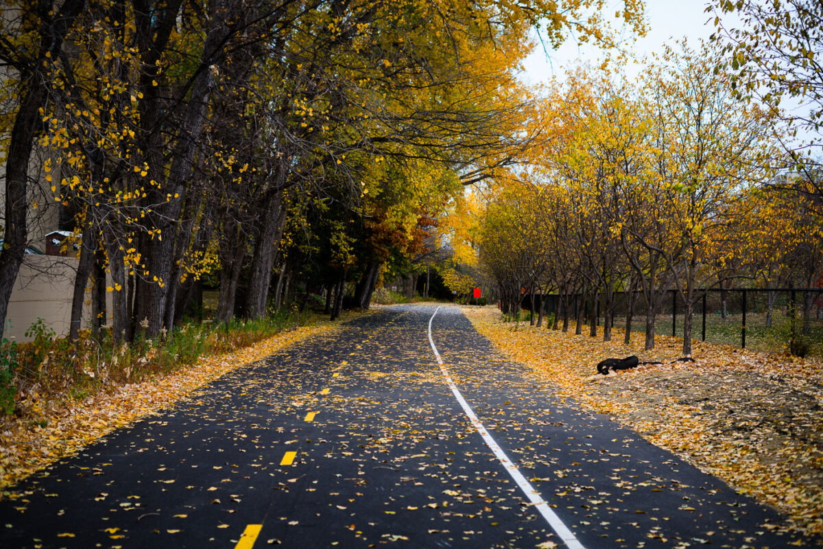
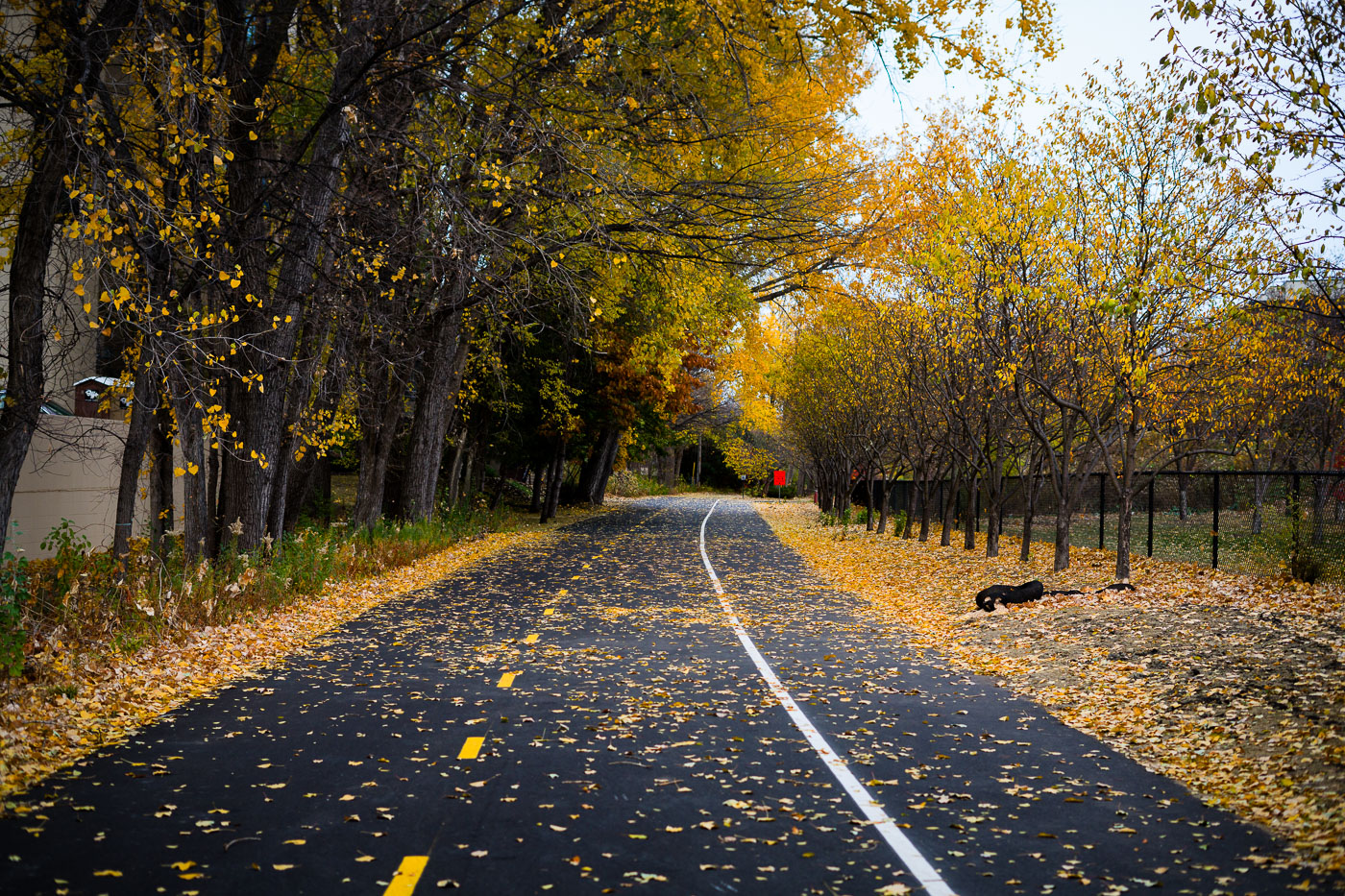
Yellow leaves on the Midtown Greenway
The Midtown Greenway in Minneapolis is a 5.5-mile paved multi-use trail that runs through the heart of the city. Originally a railroad corridor, it was converted into a public path in the early 2000s. The trail provides a vital connection for cyclists, walkers, and runners, offering a safe and scenic route away from vehicle traffic. This image captures the path during autumn, with fallen leaves blanketing the asphalt, highlighting the seasonal beauty of the urban landscape.

Midtown Greenway, Minneapolis: Fall leaves cover asphalt path

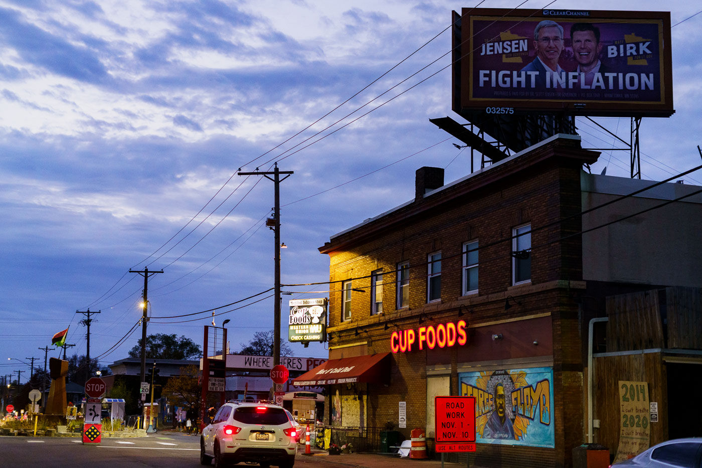
GOP candidate for Governor billboard at George Floyd Square
A billboard featuring Scott Jensen and Matt Birk, candidates for Minnesota Governor, is positioned directly above the George Floyd mural at George Floyd Square in Minneapolis. The billboard, which reads "FIGHT INFLATION," was erected during the 2022 election cycle. George Floyd Square, located at the intersection of 38th Street and Chicago Avenue, became a focal point of protests and activism following the murder of George Floyd in May 2020.

Scott Jensen Billboard Above George Floyd Square Mural
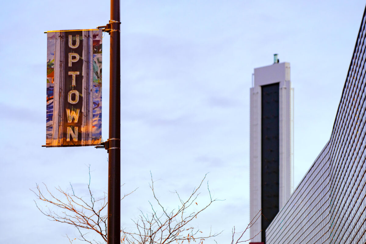
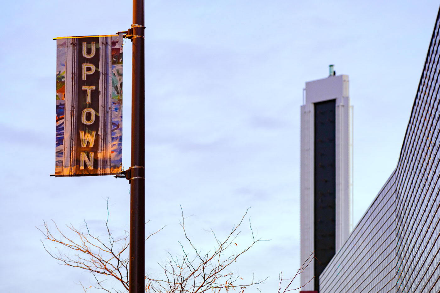
Uptown banner on Hennepin Avenue in Minneapolis beside the Uptown Theater sign.
The missing uptown theatre letters. The developer says they are rehabbing them.

Uptown Banner on Hennepin Avenue

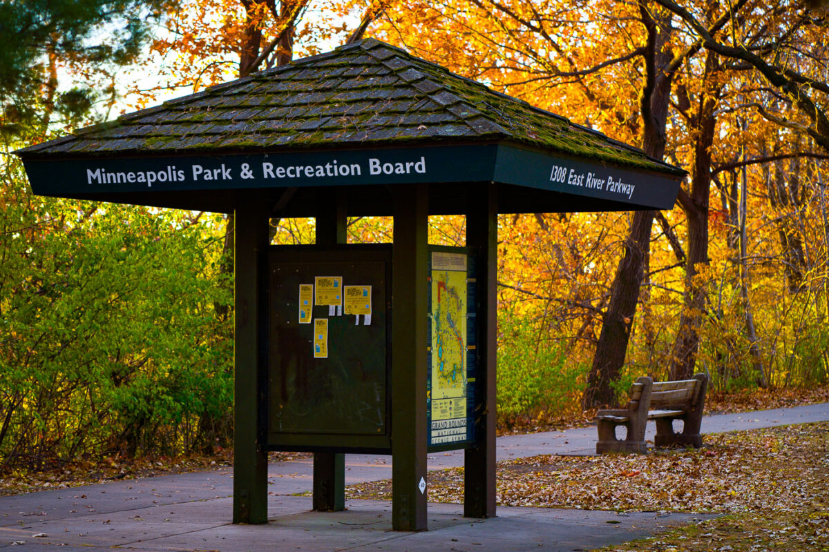
Minneapolis Park and Rec Board at East River Parkway
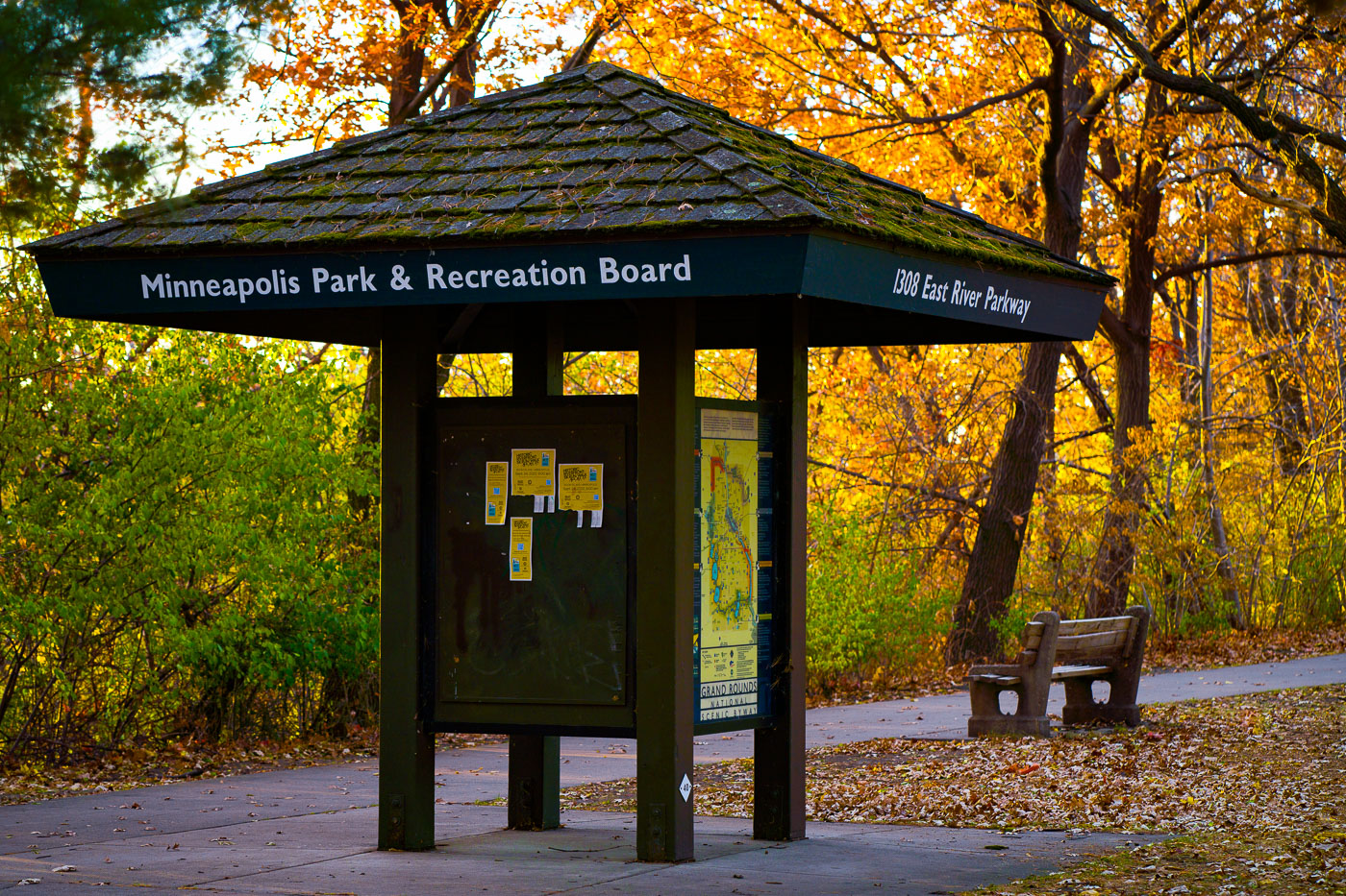
A Minneapolis Park & Recreation Board kiosk on East River Parkway in Minneapolis.

Minneapolis Park and Rec Board at East River Parkway

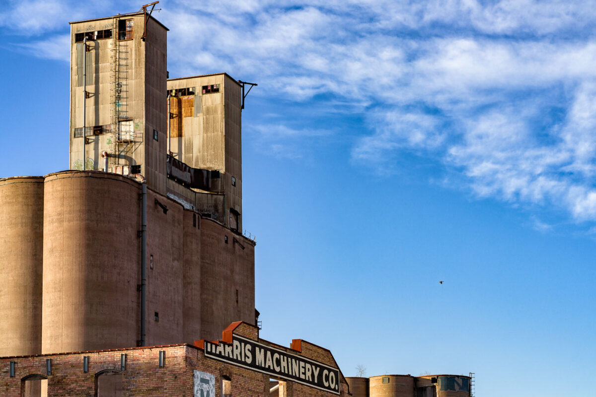
ADM Grain Elevator and Harris Machinery Co., Minneapolis
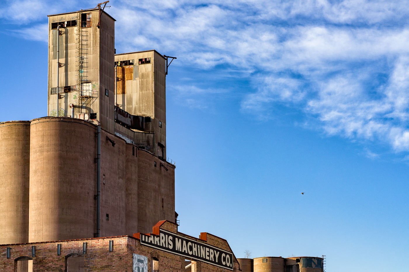
The aging ADM grain elevator rises over the Harris Machinery Co. building in Minneapolis, a reminder of the city’s long industrial relationship with grain milling and riverfront commerce. These concrete storage silos and metal-clad headhouses were once central to moving Midwestern grain through the milling district, part of an infrastructure network that fueled Minneapolis’s identity as the “Flour Milling Capital of the World.” Harris Machinery Co., a longtime supplier of industrial equipment, occupies the foreground, its brick façade contrasting with the weathered surfaces of the towering elevator. The structures together illustrate the layered industrial history of the city’s working riverfront.

ADM Grain Elevator and Harris Machinery Co., Minneapolis

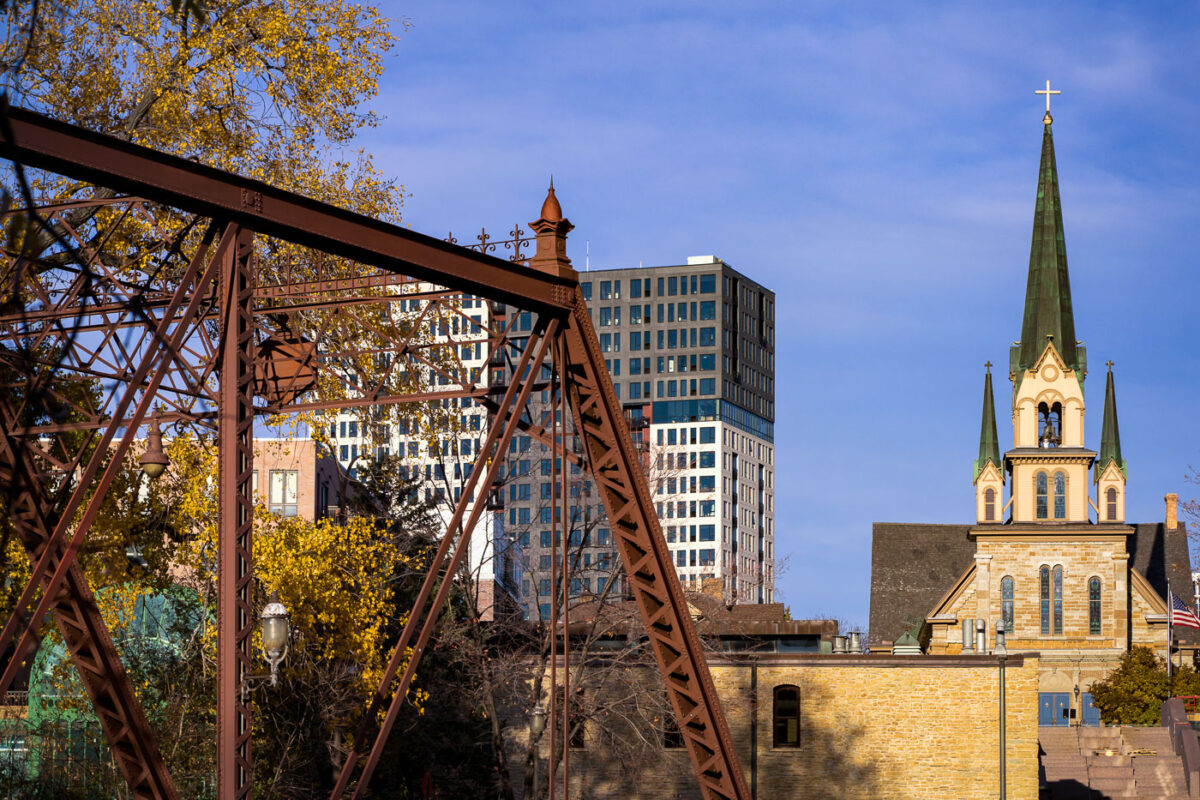
Nicollet Island East Bank in Minneapolis with a church steeple and modern buildings.
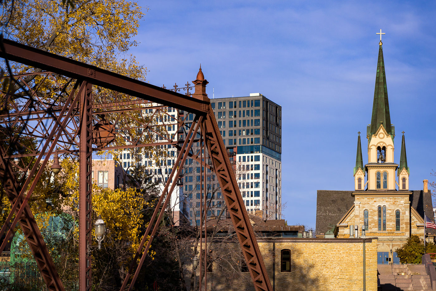
Nicollet Island East Bank in Minneapolis. The area lies along the Mississippi River near the historic St. Anthony Main district and includes restored industrial and residential buildings.

Nicollet Island East Bank, Minneapolis

Heavy-Metal Guitarist Wanted Flyer in Downtown Minneapolis
A flyer taped to a pole in downtown Minneapolis advertises a search for an “aggressive guitar player” and “people who give a damn,” echoing the recruitment style of 1980s metal bands. The poster lists influences ranging from Vixen and Madam X to Mötley Crüe, Poison, Ratt, and Judas Priest—names that shaped the Twin Cities’ hard-rock and glam-metal culture during the era of small clubs and independent bands. Its DIY design and bold typography reflect the ongoing tradition of grassroots music promotion that still surfaces in the city’s urban corridors.

Heavy-Metal Guitarist Wanted Flyer in Downtown Minneapolis

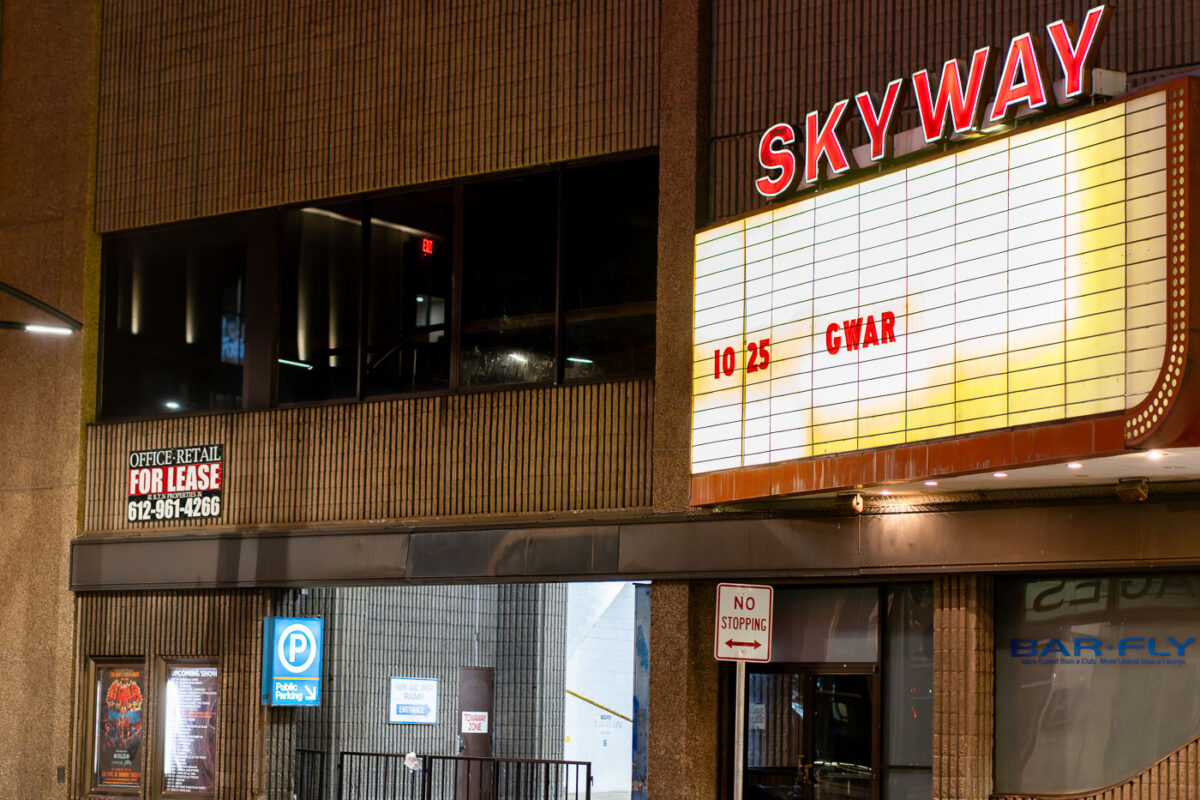
Gwar at the Skyway Theater
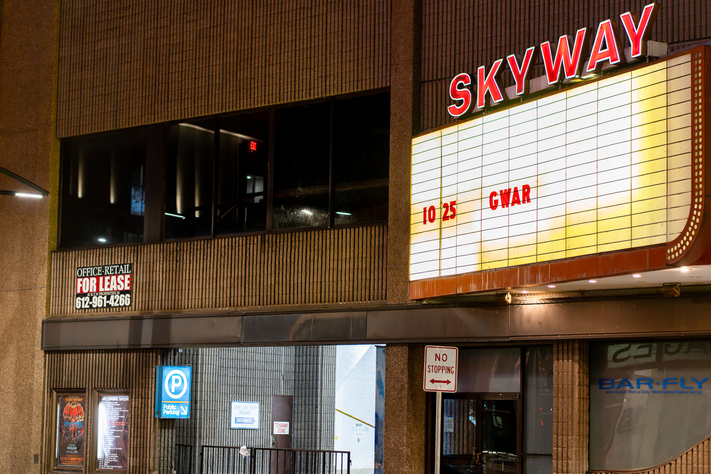
Gwar on the marquee of the Skyway Theatre in downtown Minneapolis.

Gwar at the Skyway Theater in Minneapolis
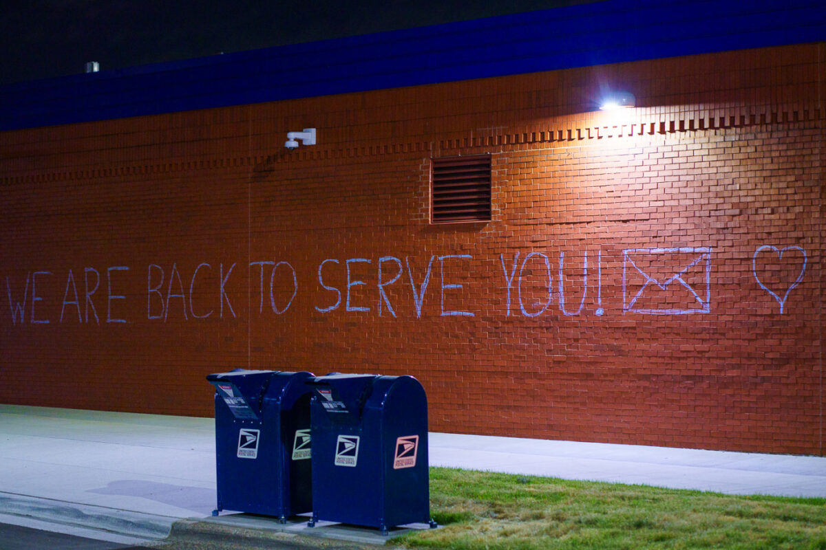
Graffiti on new post office in Minneapolis George Floyd
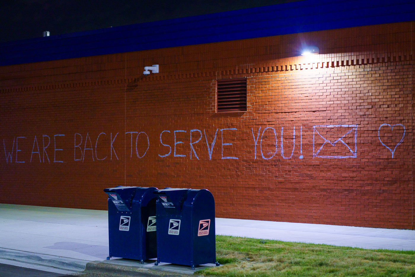
The Lake Street Post Office in Minneapolis, a vital community hub, reopened with a message of resilience painted on its exterior: "WE ARE BACK TO SERVE YOU!". The building had been damaged by fire during the protests that followed the murder of George Floyd on May 25, 2020. The graffiti, accompanied by symbols of a mail envelope and a heart, signifies the community's determination to rebuild and continue serving its residents.

Lake Street Post Office Reopens with Graffiti Message
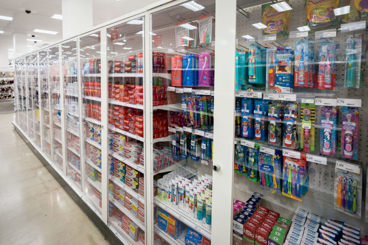
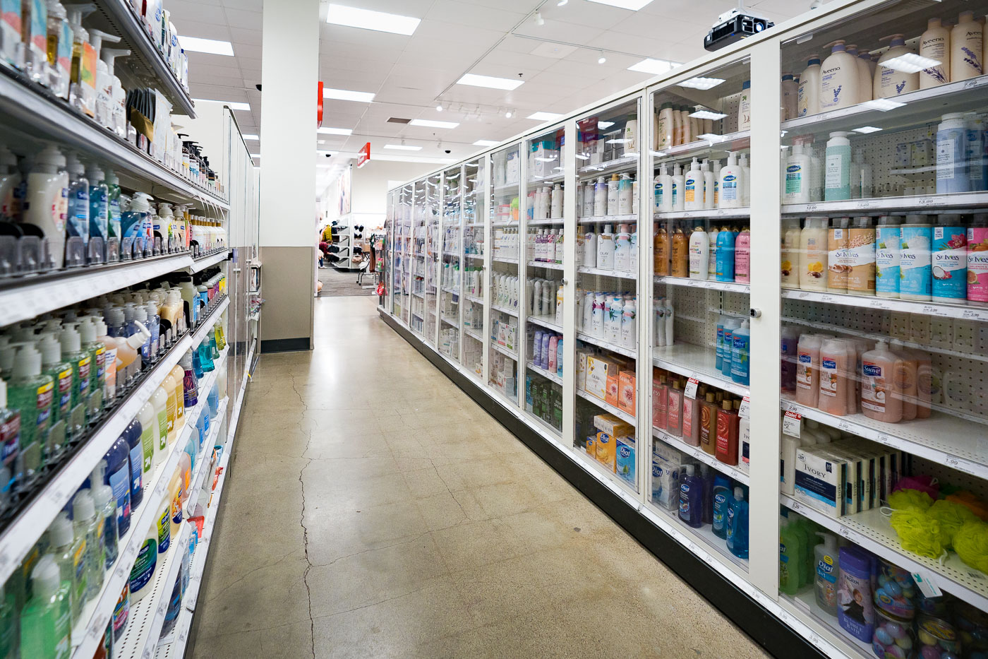
Locked Personal-Care Aisle at Target’s Downtown Minneapolis Store
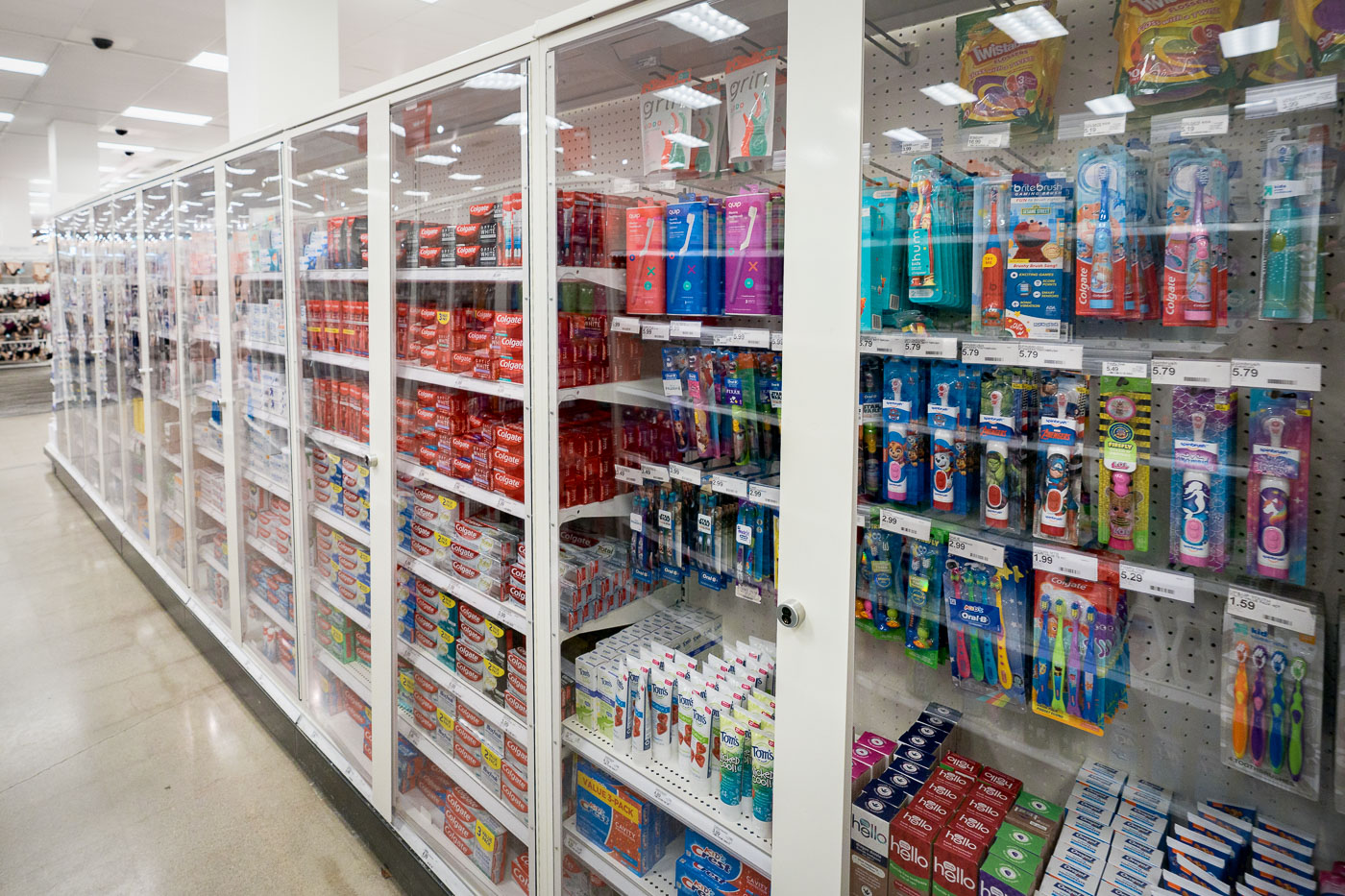
Personal-care items, including toothpaste and toothbrushes, are displayed behind locked glass cases at the Target store in downtown Minneapolis. This security measure, implemented in response to rising retail theft, now requires customer assistance for accessing many oral-care products. This practice reflects a broader trend among large retailers in urban centers to secure easily resold merchandise, altering the shopping experience and store operations in high-traffic areas.

Locked Toothpaste and Toothbrushes at Minneapolis Target

Target puts toothpaste behind glass
Personal care items are displayed behind locked glass cabinets in the flagship Target store located in downtown Minneapolis. This security measure, implemented to deter shoplifting and loss, is increasingly common for high-value or frequently stolen merchandise in retail environments. The store is situated within the Nicollet Mall, a prominent urban thoroughfare and shopping district that has undergone significant development and revitalization over the decades. The presence of such security reflects broader trends in retail loss prevention strategies.

Target Downtown Minneapolis: Locked Display of Personal Care Items

American Flag with a pot leaf on it in Downtown Minneapolis
An American flag modified with a marijuana leaf emblem flies in downtown Minneapolis.

American Flag with Pot Leaf in Downtown Minneapolis
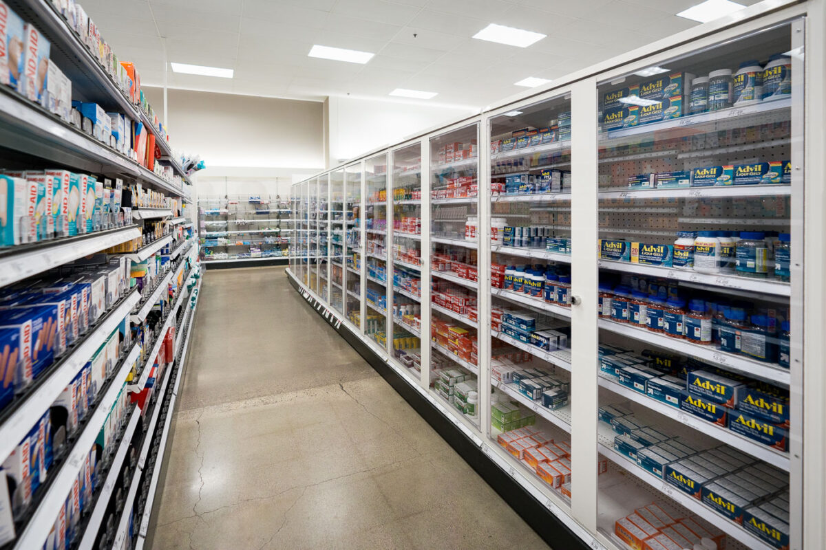
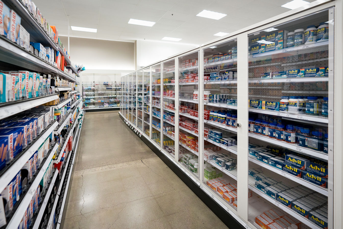
Locked up items at Target in Minneapolis
Medicine and health products are displayed behind locked glass doors in the flagship Target store located in downtown Minneapolis. This security measure is implemented to deter theft of high-value or frequently stolen items. The store is situated within the Nicollet Mall, a pedestrian zone that has been a central commercial and cultural hub in Minneapolis since its development in the 1960s.

Minneapolis Target: Locked Medicine and Health Aisles
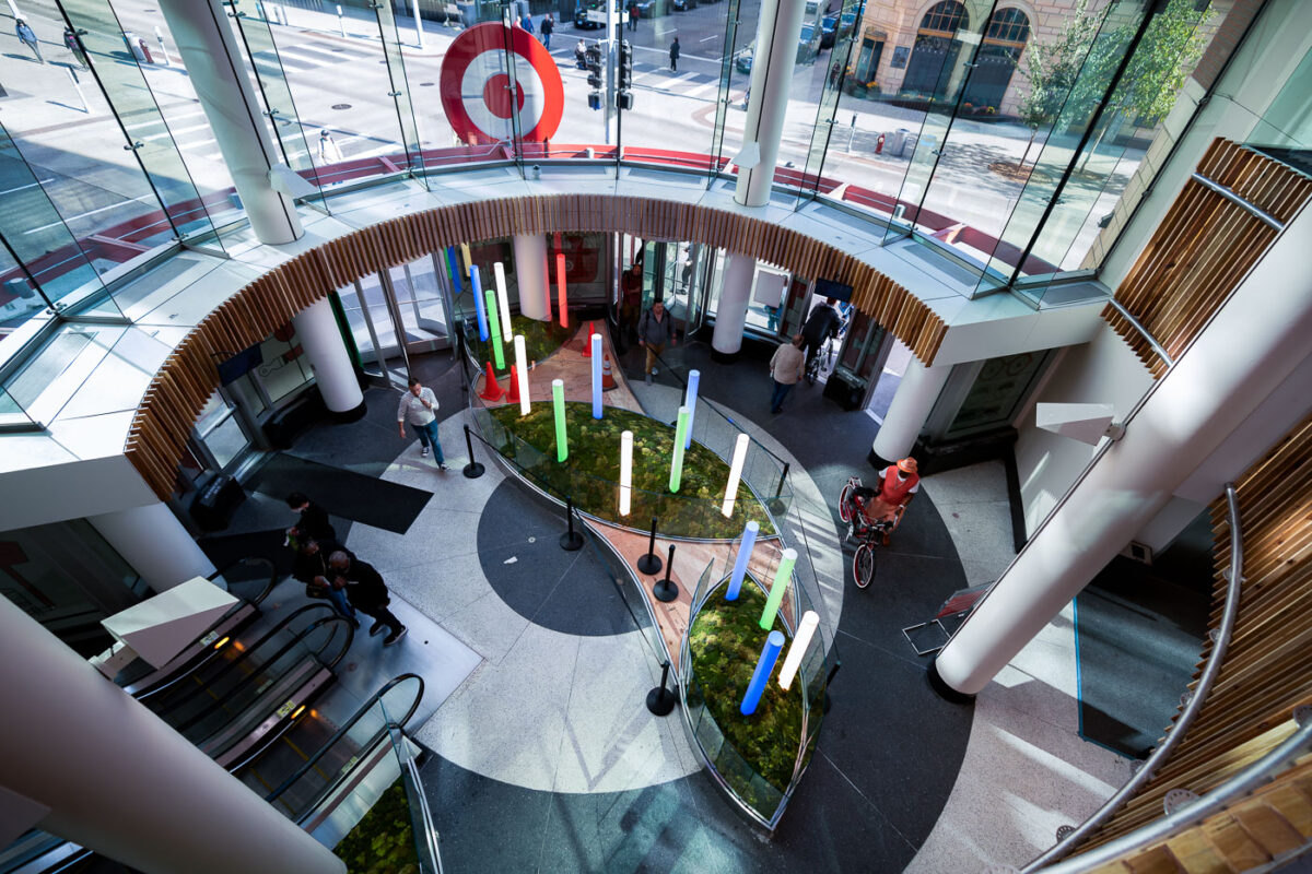
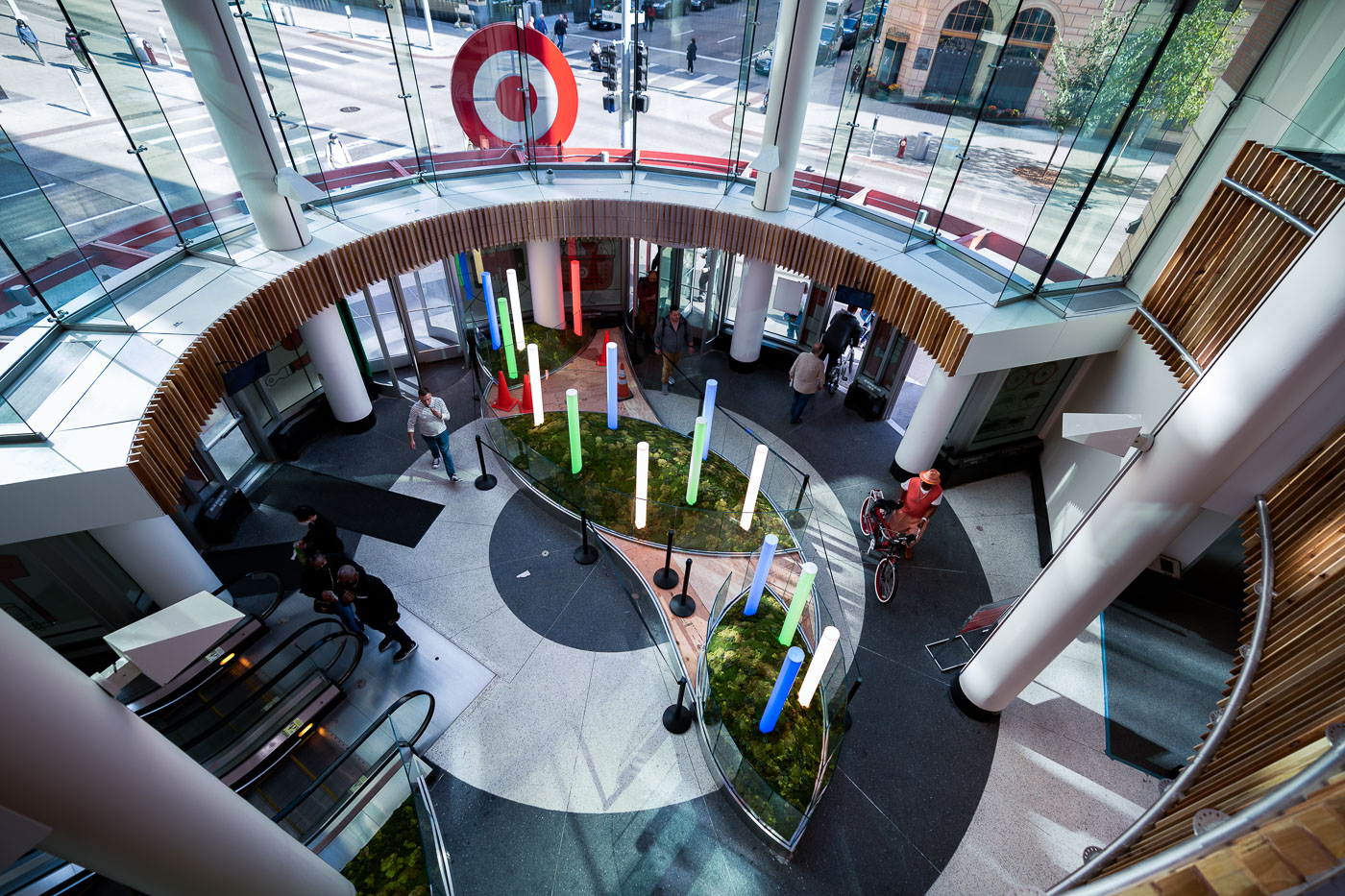
New entrance at Target store in Minneapolis
The entrance to the Target flagship store in downtown Minneapolis is a prominent feature of the city's retail landscape. Located within the Nicollet Mall area, this entrance serves as a gateway to the company's primary retail presence.

Target Flagship Store Entrance, Downtown Minneapolis
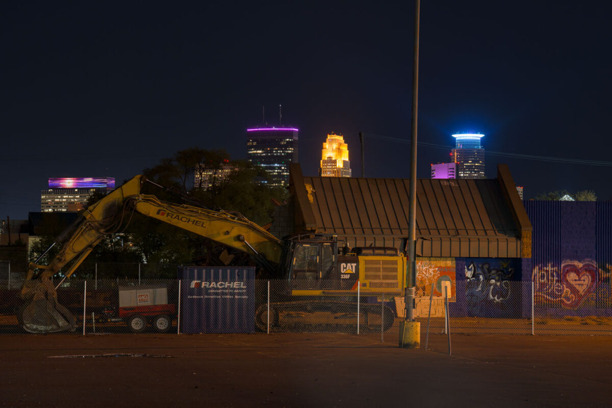
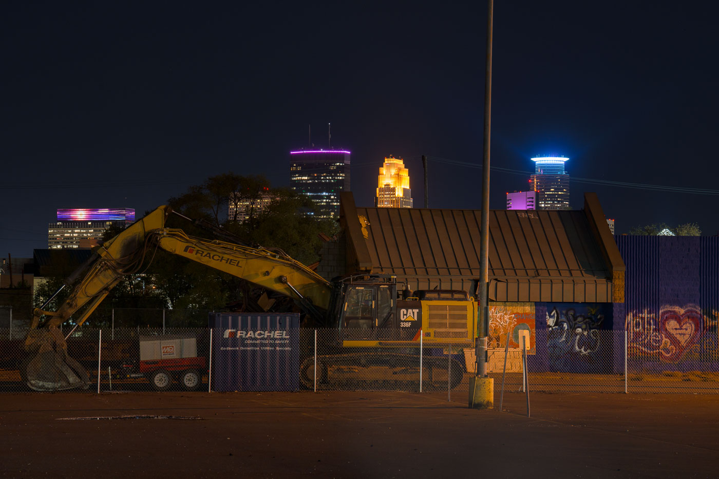
Supervalu Demolition on Lake Street
Demolition equipment is on-site at the former Supervalu store on Lake Street in South Minneapolis.

Minneapolis Supervalu Demolition at Night
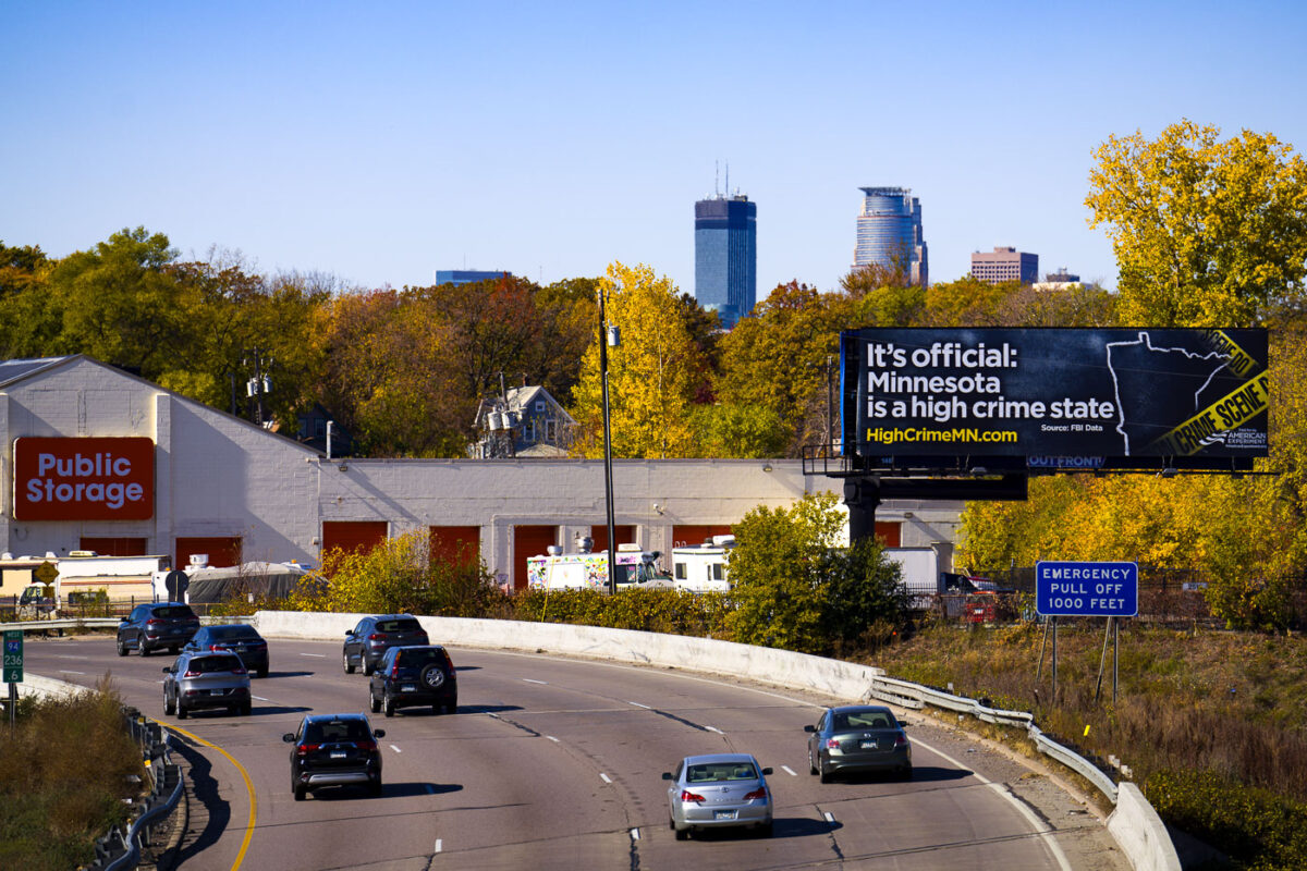
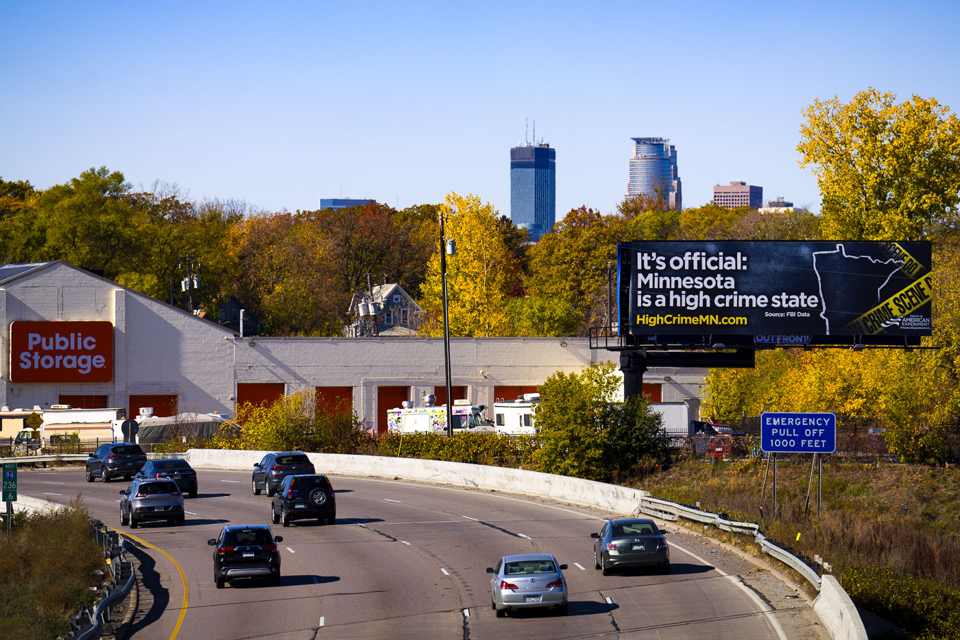
Center for American Experiment billboard in Minneapolis
A billboard along Interstate 94 in Minneapolis, sponsored by the Center for American Experiment, asserts that "Minnesota is a high crime state." The advertisement directs viewers to HighCrimeMN.com, a website that presents data interpreted by the organization to show an increase in crime.

Center for American Experiment Billboard on I-94 Minneapolis
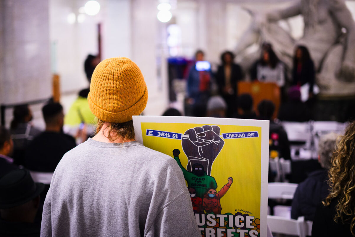
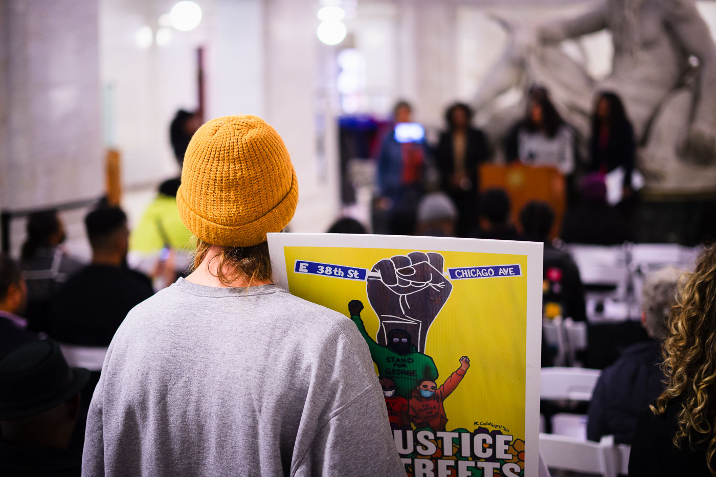
No Justice No Streets protest sign at City Hall
During a protest at Minneapolis City Hall, a demonstrator holds a sign reading “No Justice No Streets.” The sign also features street names, including E 38th St and Chicago Ave, referencing locations significant to the George Floyd movement. This event occurred as Mayor Jacob Frey proclaimed it George Floyd Day, marking what would have been Floyd's 49th birthday.

Minneapolis City Hall Protest: “No Justice No Streets” Sign
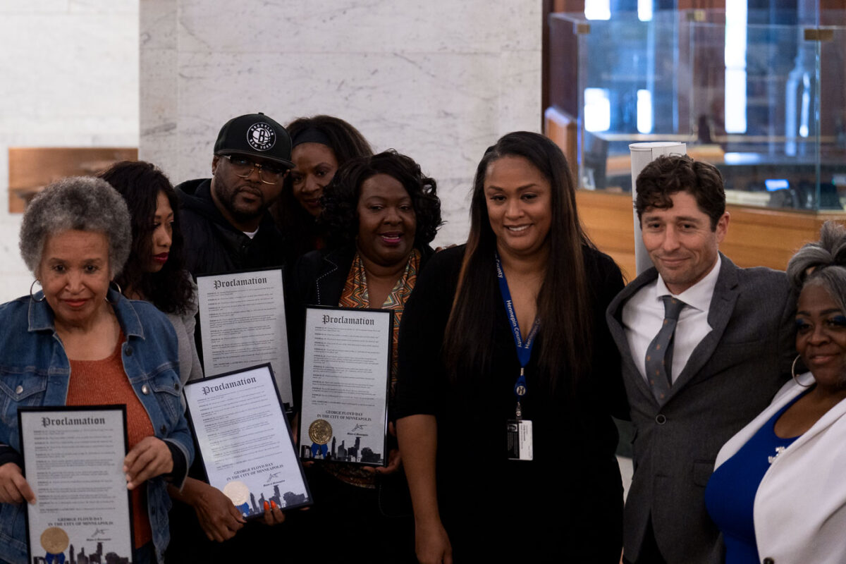
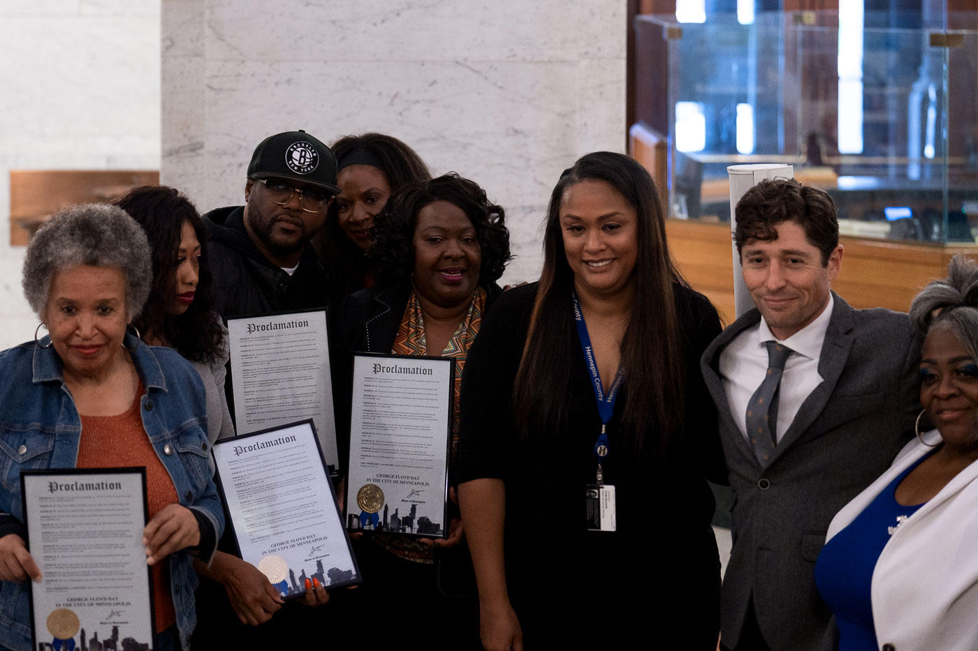
George Floyd's family and Minneapolis Mayor Jacob Frey
Minneapolis Mayor Jacob Frey stands with members of George Floyd's family, including Terrence Floyd, Paris Stevens, and Angela Harrelson, at Minneapolis City Hall. The group holds proclamations declaring "George Floyd Day" in the city, marking what would have been Floyd's 49th birthday. This event honors the memory of George Floyd, whose death in police custody in 2020 sparked widespread protests and a global reckoning on racial justice and police brutality.

Minneapolis Mayor Jacob Frey with George Floyd’s Family on George Floyd Day

Jacob Frey speaks on George Floyd Day at City Hall
Mayor Jacob Frey of Minneapolis stands at a podium in Minneapolis City Hall, proclaiming it George Floyd Day on what would have been Floyd’s 49th birthday. The proclamation occurred in the aftermath of the widespread protests and civil unrest that followed George Floyd's murder in May 2020.

Mayor Jacob Frey at Minneapolis City Hall for George Floyd Day
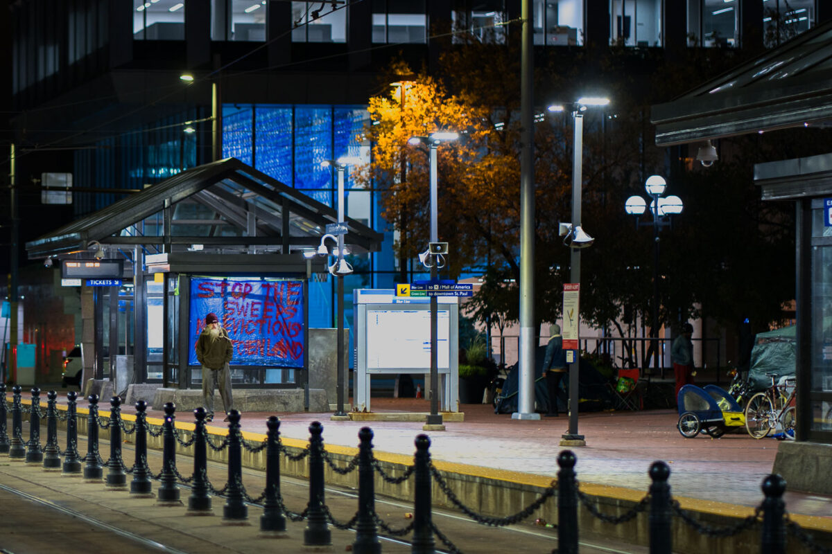
Homelessness protest at Minneapolis City Hall
A protestor stands before a banner at Minneapolis City Hall, demanding a moratorium on encampment clearings. The banner reads "STOP THE SWEEP" and lists demands for clear guidelines and proof of funding for housing solutions for unhoused residents. This protest highlights ongoing concerns about homelessness and housing security in Minneapolis, particularly in relation to public spaces and city governance.

Minneapolis City Hall Protest: Moratorium on Encampment Clearings
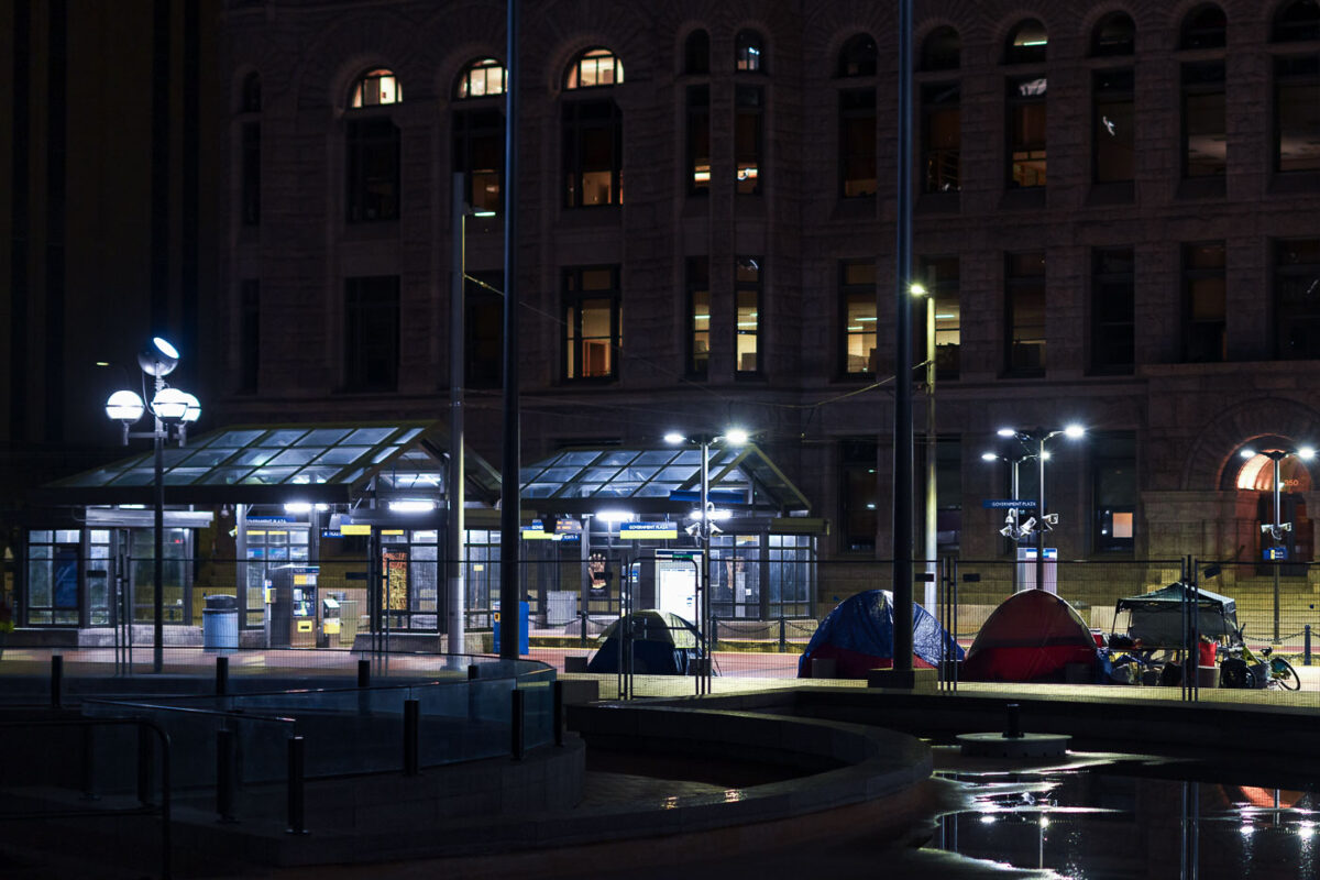
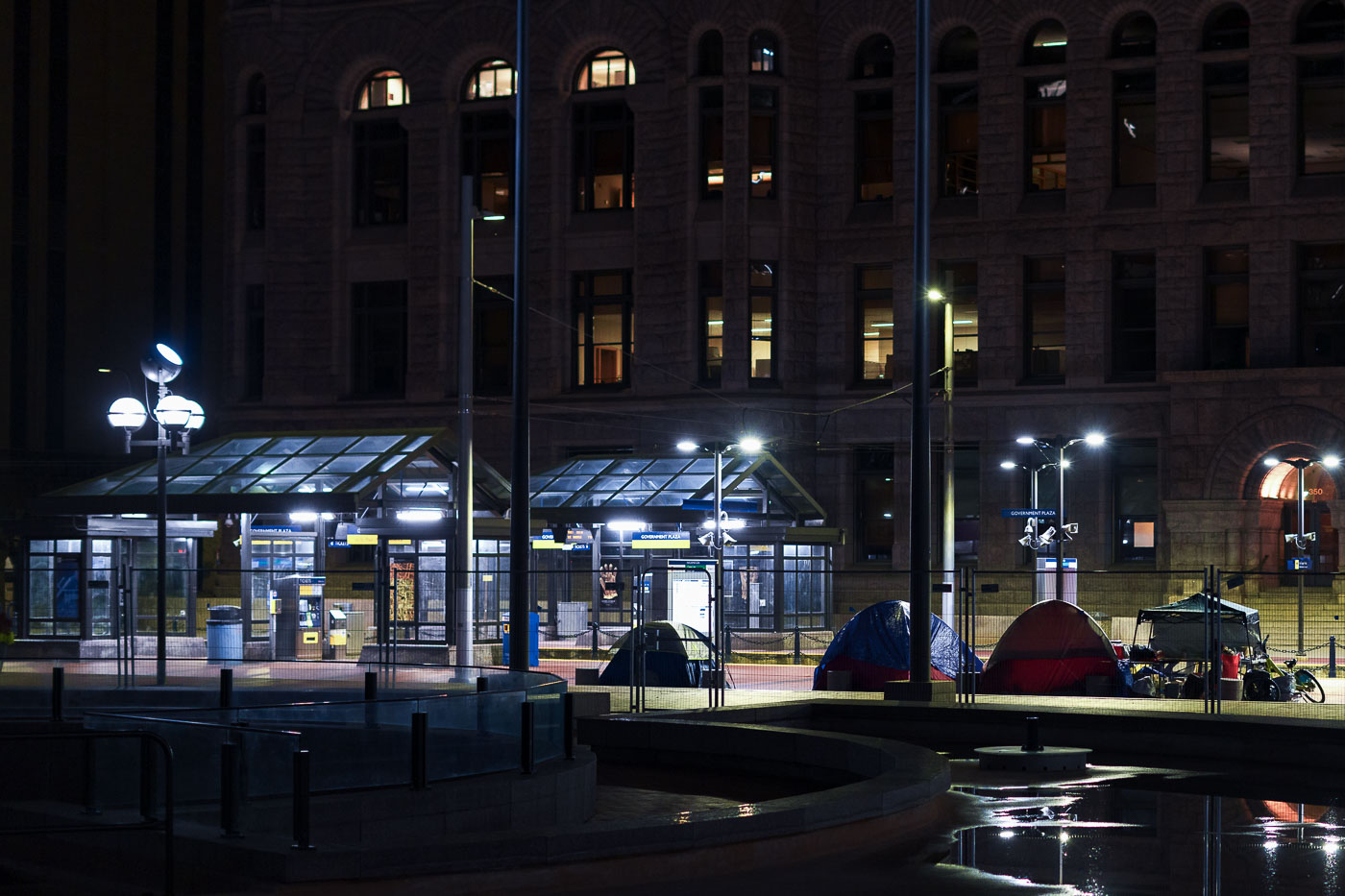
Protest Encampment at Minneapolis City Hall
Tents are set up outside Minneapolis City Hall at night, where protesters have been holding space. The protesters' demands include a moratorium on encampment clearings, clear guidelines for encampments, and proof of funding for permanent housing solutions for unhoused residents.

Minneapolis City Hall Protest Encampment at Night
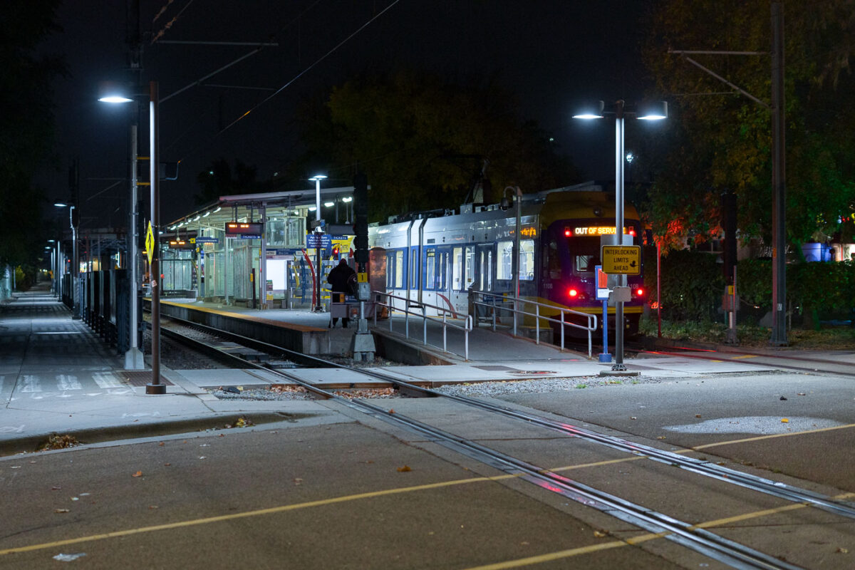
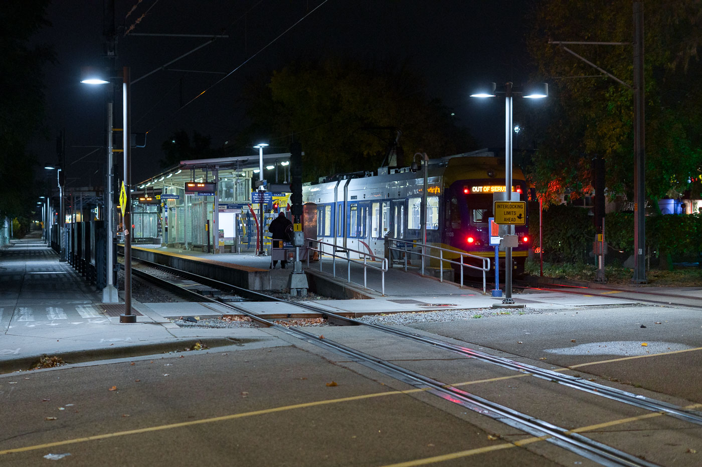
Cedar Riverside Train Station at night in Minneapolis
Cedar-Riverside Station, a key transit hub in South Minneapolis, serves as a stop on the Metro Transit Green Line. Opened in 2014 as part of the Central Corridor project, the station connects residents and visitors to downtown Minneapolis and St. Paul. The station's design incorporates modern elements while serving the daily needs of commuters and travelers.

Cedar Riverside Station, Minneapolis: Light Rail at Night
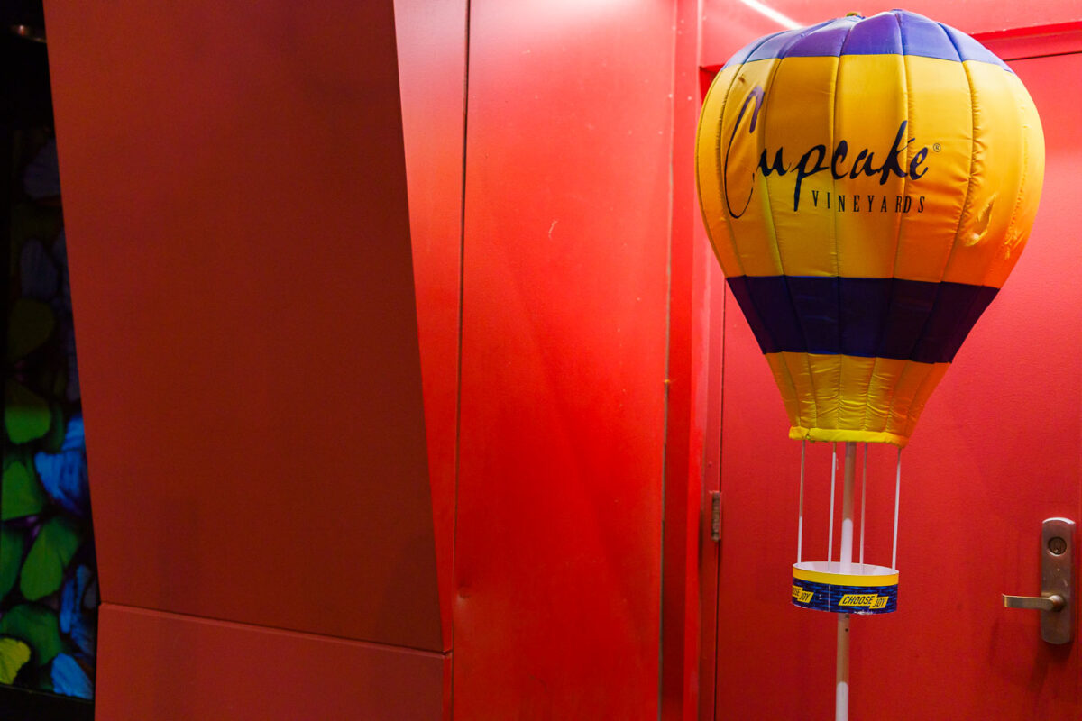
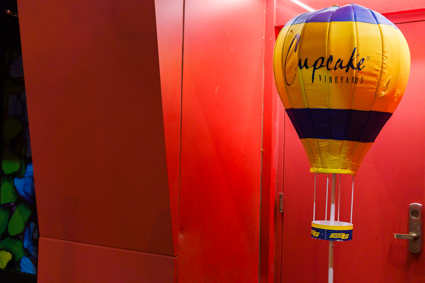
Cupcake Vineyards balloon display in a red-lit doorway in Minneapolis.
A Cupcake Vineyards promotional hot-air-balloon display stands at the edge of a red-lit entryway.

Cupcake Vineyards Display in a Red-Lit Entryway
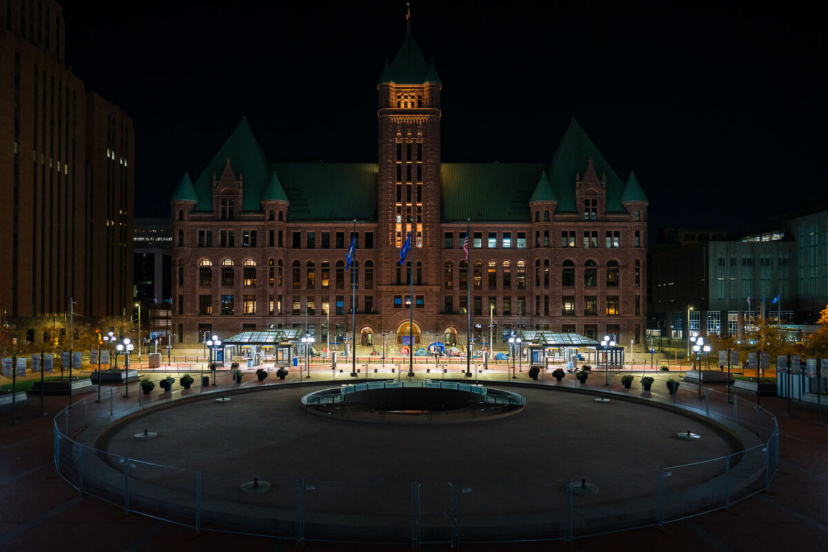
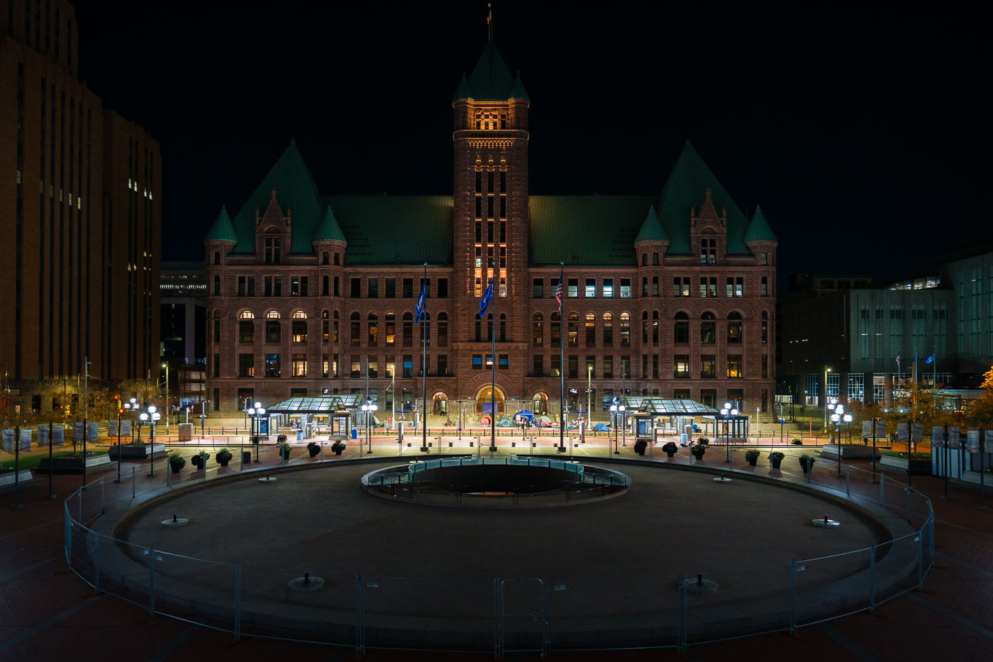
Encampment protest at Minneapolis CIty Hall
Minneapolis City Hall, a Beaux-Arts building completed in 1909, serves as the seat of government for the city. In this nighttime photograph, tents are visible on the plaza in front of the building, indicating an encampment. Protesters associated with this encampment have stated demands for a moratorium on encampment clearings, clear guidelines for encampments, and proof of funding for permanent housing solutions for unhoused individuals. The presence of the encampment highlights ongoing issues of homelessness in Minneapolis.

Minneapolis City Hall Encampment at Night
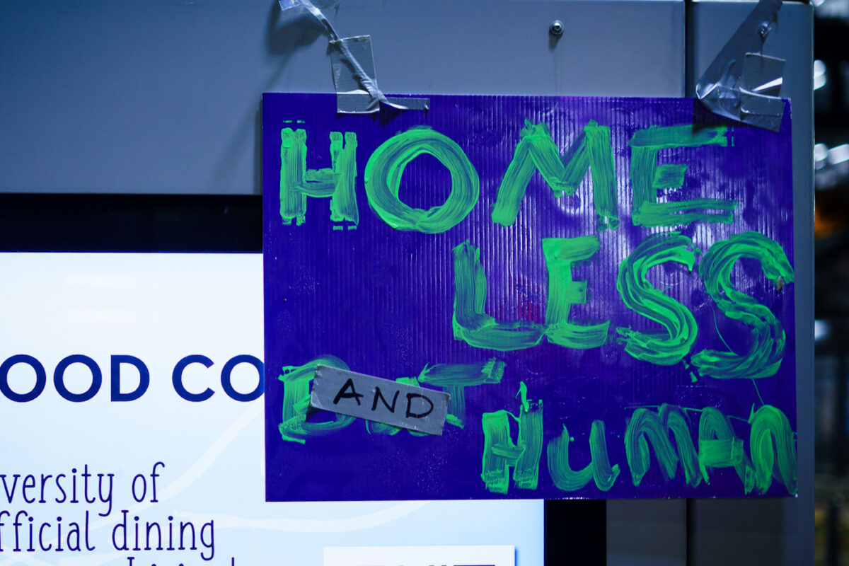
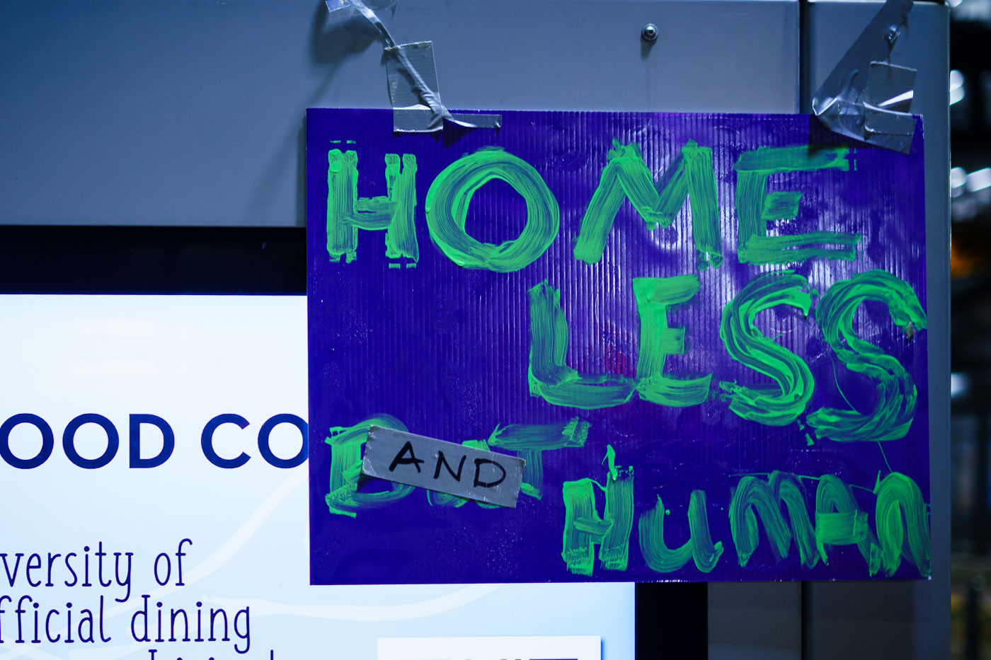
Homeless and Human protest sign at Minneapolis City Hall
Protesters gathered at Minneapolis City Hall to advocate for unhoused residents. The sign reads "HOMELESS AND HUMAN," emphasizing the humanity of those experiencing homelessness. The protest demanded a moratorium on encampment clearings, clear guidelines for encampments, and proof of funding for permanent housing solutions.

Minneapolis City Hall Protest: Homeless and Human Sign
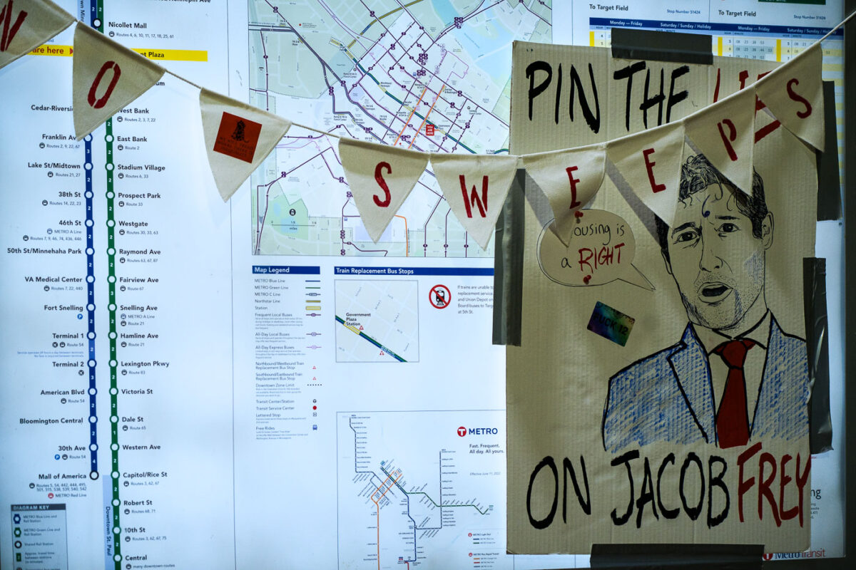
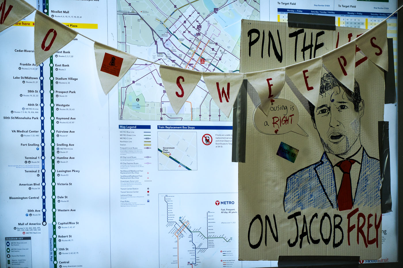
Pin the lies on Jacob Frey poster at city hall protest
Protesters gathered at Minneapolis City Hall to oppose the clearing of encampments. The "Pin the Sweeps on Jacob Frey" banner, featuring a caricature of the mayor, reflects the protesters' demands for a moratorium on encampment sweeps, clear guidelines, and proof of funding for permanent housing solutions.

Minneapolis City Hall Protest Against Sweeps of Encampments
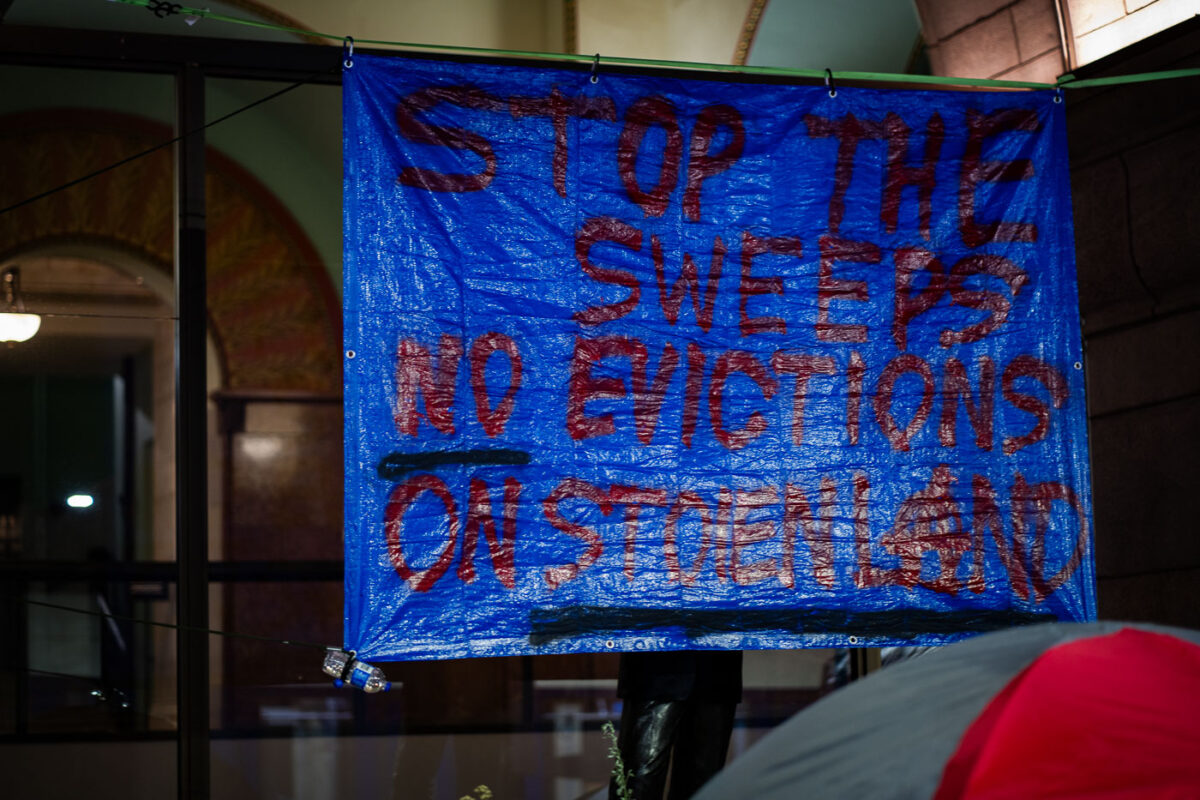
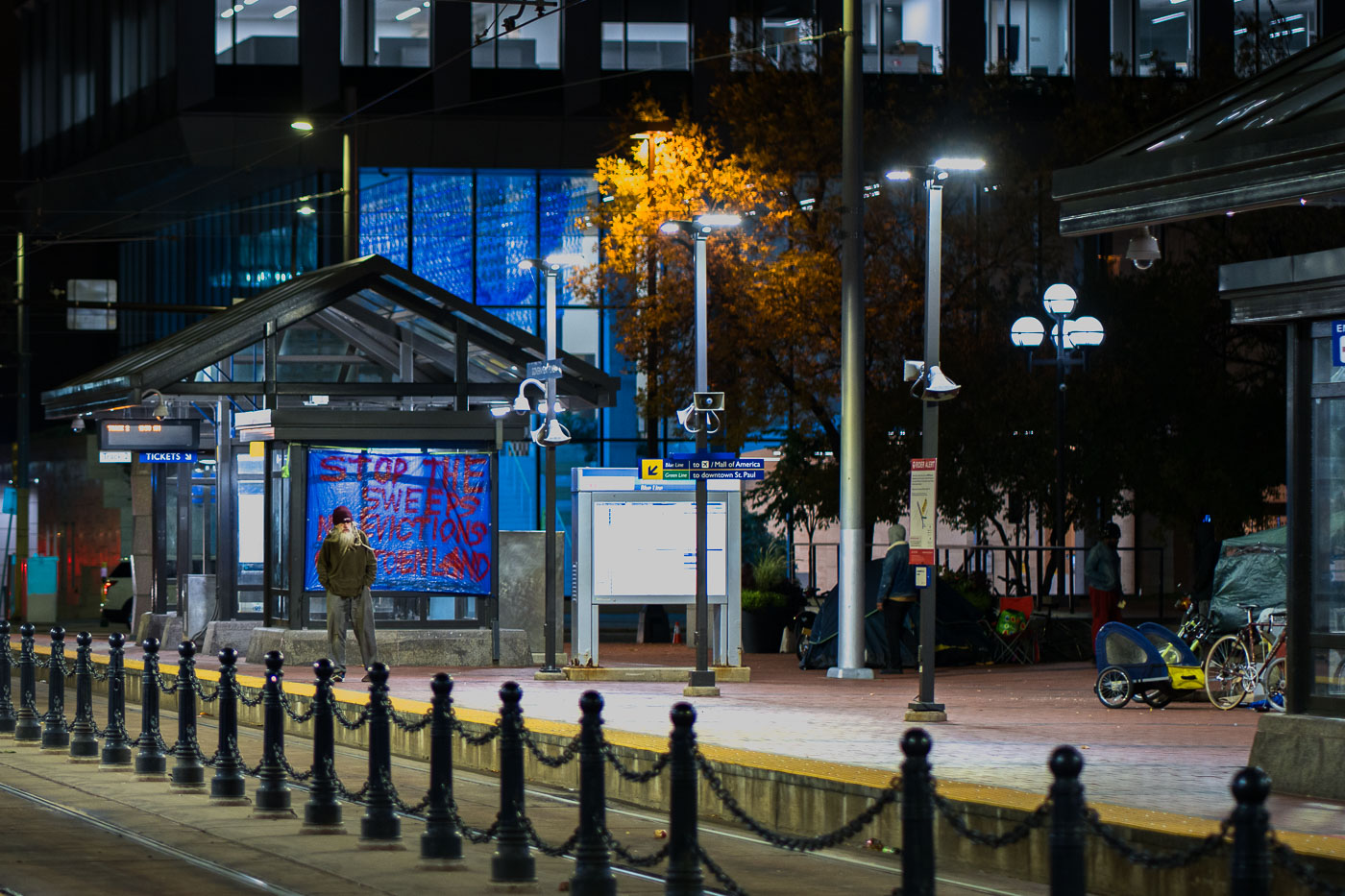
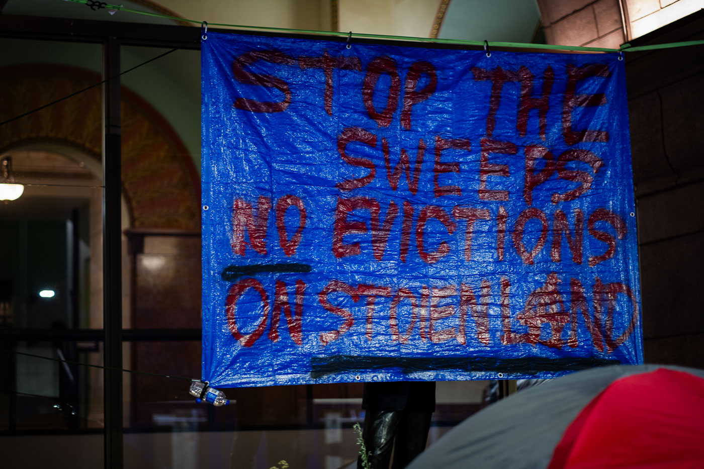
Stop The Sweeps No Evictions on Stolen Land
Protesters gathered at Minneapolis City Hall to advocate for unhoused residents. The banner reads "STOP THE SWEEPS, NO EVICTIONS ON STENCILAND," indicating a demand for a moratorium on encampment clearings and evictions. This protest highlights ongoing concerns about housing insecurity and the treatment of homeless populations in Minneapolis.

Minneapolis City Hall Protest: Stop Sweeps, No Evictions
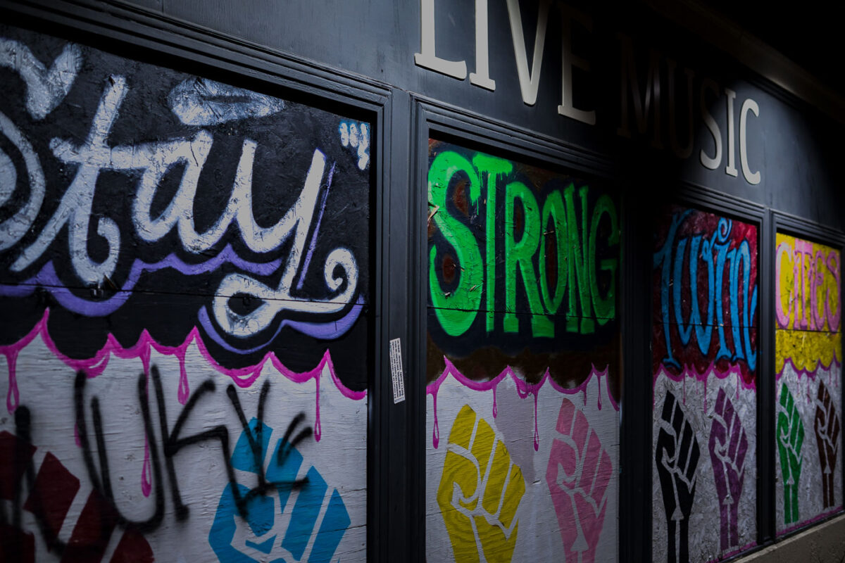
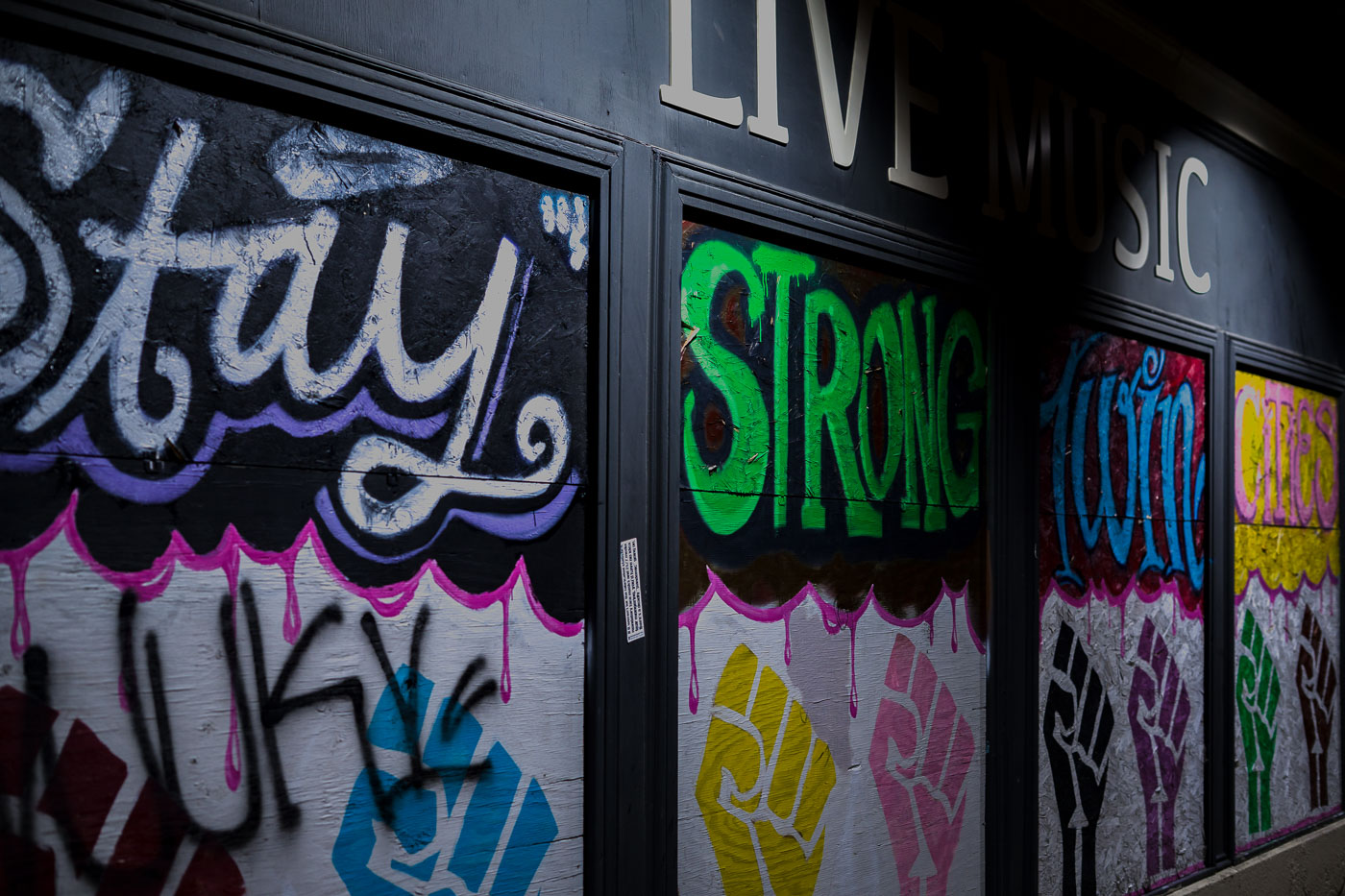
Mortimers Bar Painted Boards
Graffiti art adorns the boarded-up windows of Mortimer's Bar on Lyndale Avenue in Minneapolis. The messages "Stay Strong" and "Twin Cities" are visible, alongside painted fists symbolizing solidarity and resistance. These boards were installed during the civil unrest following the murder of George Floyd in 2020, a period of significant protest and activism in Minneapolis. Mortimer's, a long-standing establishment known for its live music, became a canvas for community expression during this time.

Mortimer’s Bar: “Stay Strong” Graffiti on Lyndale Ave, Minneapolis

Lake Minnetonka wetlands and boat slips near Deephaven, Minnesota.
Lake Minnetonka wetlands and boat slips near Deephaven, Minnesota. This shallow eastern bay includes marsh habitat along the shoreline and private docks extending from nearby homes. The area is part of the lake’s connected basin system and lies near the Deephaven and Greenwood shoreline communities.

Lake Minnetonka Wetlands and Boat Slips, Deephaven
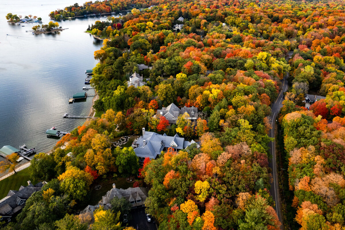
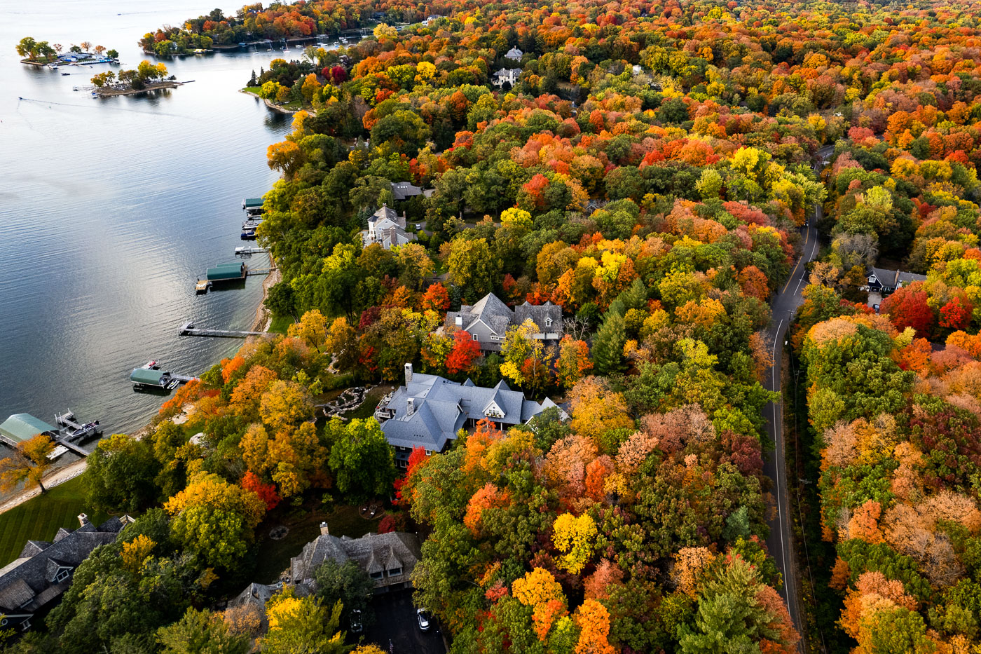
Deephaven, Minnesota shoreline homes on Lake Minnetonka surrounded by autumn trees.
Deephaven, Minnesota, lines the southeastern shore of Lake Minnetonka. The community is known for wooded residential lots, shoreline homes, and private docks along sheltered coves and peninsulas. In autumn, the dense tree cover surrounding the lakefront homes turns vivid shades of red, yellow, and orange.

Deephaven Shoreline Homes on Lake Minnetonka
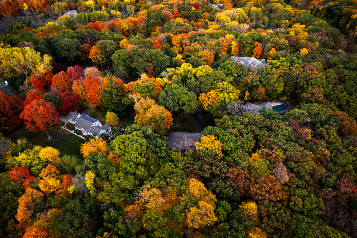
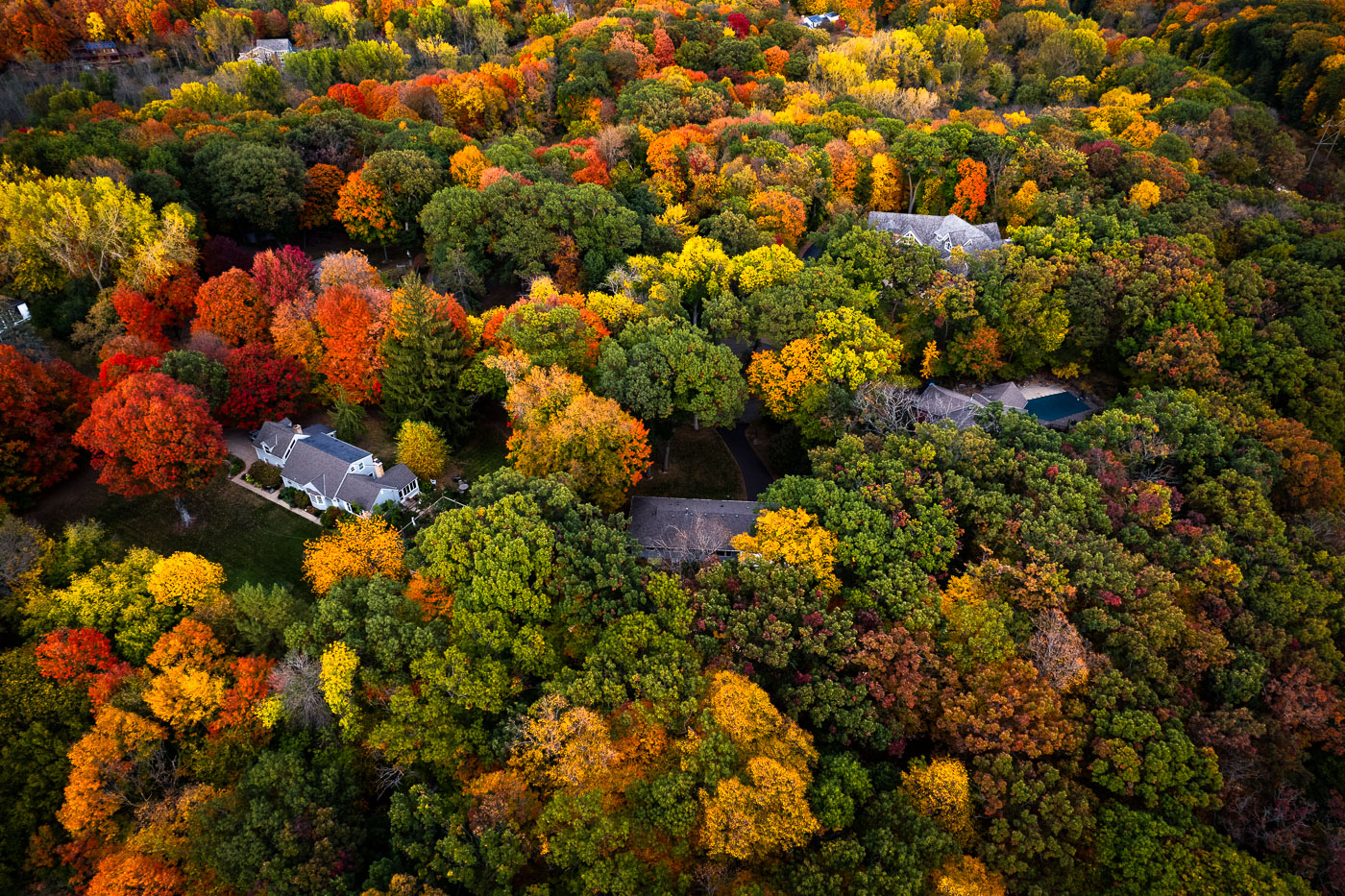
Deephaven, Minnesota residential canopy near Lake Minnetonka in autumn.
Deephaven, Minnesota, near Lake Minnetonka, is characterized by large wooded residential lots and mature hardwood trees. In autumn, the neighborhood’s canopy forms a dense mix of maple, oak, and basswood color across the shoreline community. The area developed with low-density housing and preserves extensive tree cover between homes and roads.

Deephaven Residential Canopy, Lake Minnetonka

Deephaven wetland basin near Lake Minnetonka surrounded by autumn woods.
Deephaven wetland basin near Lake Minnetonka, Minnesota. Seasonal low water has exposed mudflats around the basin, with surrounding hardwoods and pines in autumn color.

Deephaven Wetland Basin, Lake Minnetonka

Deephaven lakeside road near Lake Minnetonka bordered by dense autumn trees.
Deephaven, Minnesota, along a lakeside road near Lake Minnetonka. Mature hardwoods and pines form a dense residential canopy in autumn color along the shoreline.

Deephaven Lakeside Road in Autumn

Deephaven wetland basin near Lake Minnetonka surrounded by autumn trees.
A wetland basin in Deephaven, Minnesota, lies amid tree-lined residential streets near Lake Minnetonka. The surrounding canopy is in peak autumn color.

Deephaven Wetland in Fall Color

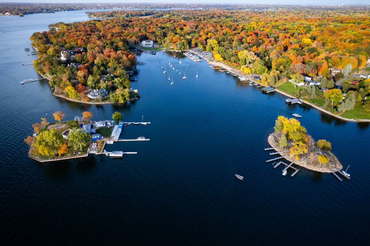
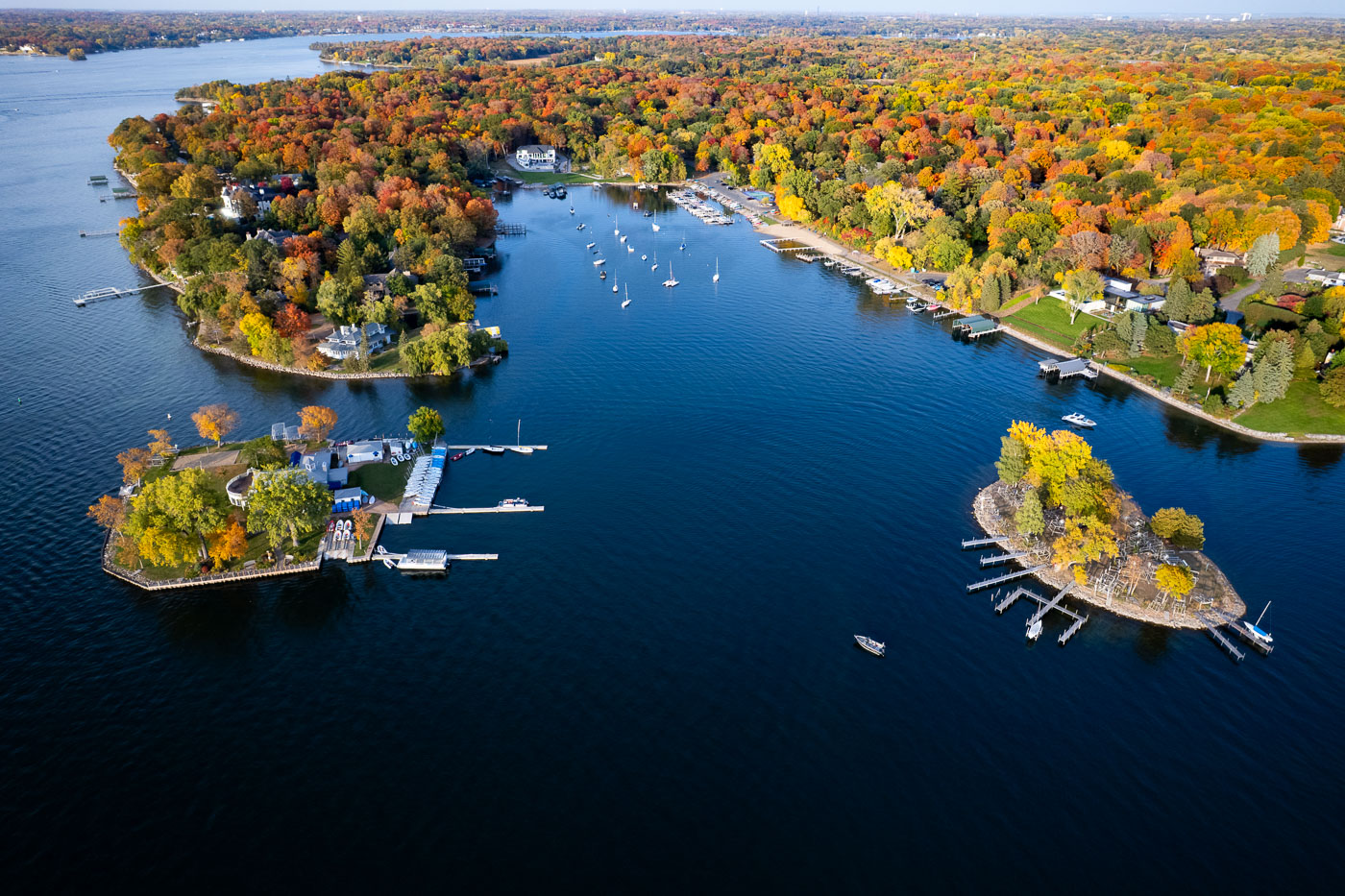
Lake Minnetonka near Deephaven, Minnesota, bordered by wooded coves, docks, and sailboats in autumn.
Lake Minnetonka near Deephaven, Minnesota, is bordered by wooded peninsulas, sheltered bays, and private docks. The lake’s irregular shoreline has long supported boating and lakeside residential development. Peak fall color covers the surrounding neighborhoods and wooded shoreline.

Lake Minnetonka shoreline coves in autumn

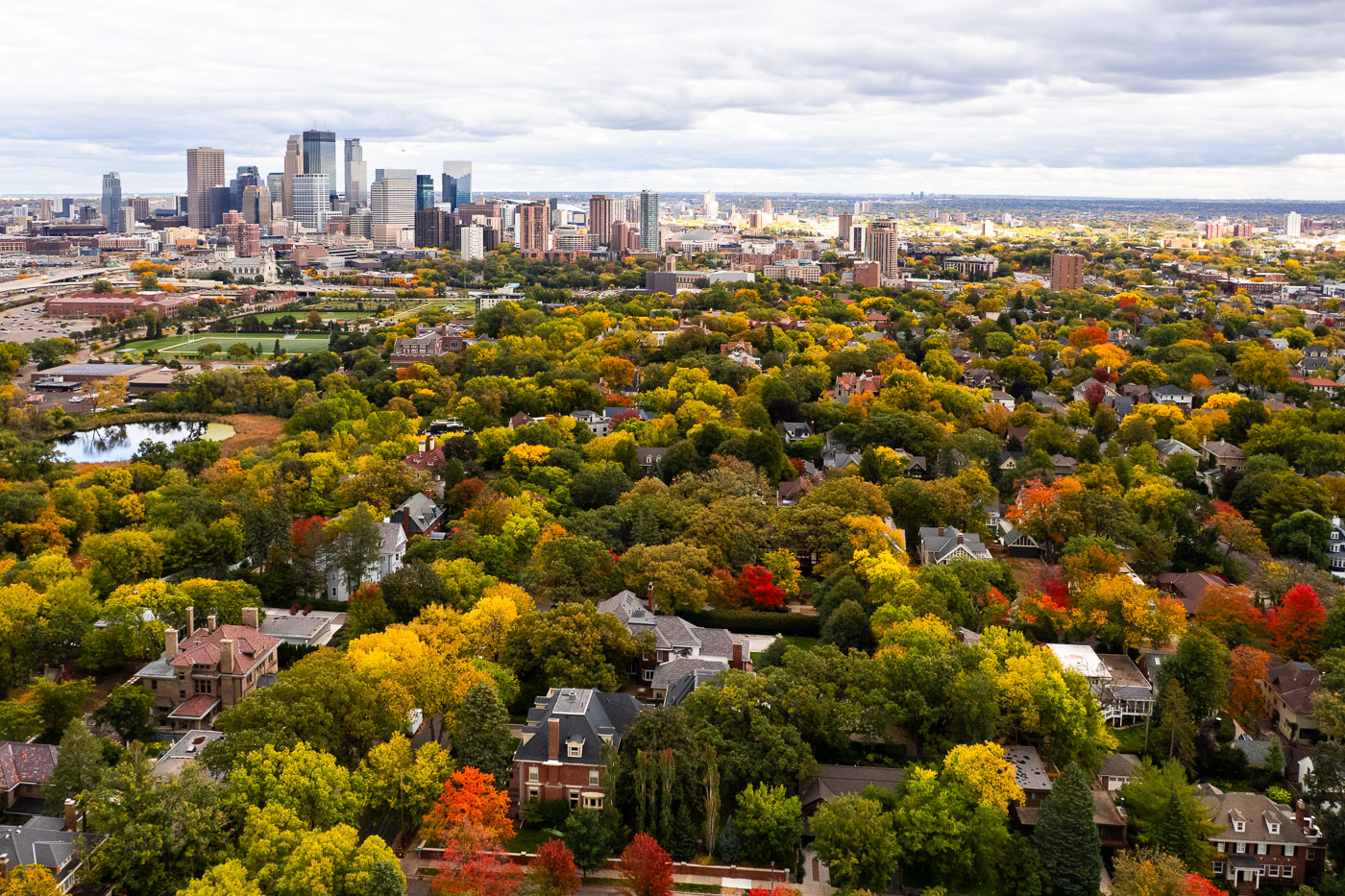
Minneapolis Skyline Over Kenwood in Peak Fall Color
A wide aerial view looks east toward the Minneapolis skyline, rising above the dense canopy of the Kenwood and Lowry Hill neighborhoods during peak autumn color. This part of the city was developed in the late 19th and early 20th centuries as a streetcar suburb, designed around curving streets, large residential lots, and proximity to the Chain of Lakes. Many of the homes below are early Minneapolis mansions built by lumber and milling-era industrialists, now tucked beneath mature trees that give the neighborhood one of the city’s most dramatic fall transitions. In the middle distance, the Basilica of Saint Mary, Loring Park, and the early downtown warehouse district reflect Minneapolis’s layered growth—from industrial rail corridors to modern glass towers. The contrast between the dense urban core and the tree-covered residential districts highlights how closely the city’s historic neighborhoods were shaped by parks, lakes, and the parkway system planned by Theodore Wirth in the early 1900s.

Minneapolis Skyline Over Kenwood in Peak Fall Color

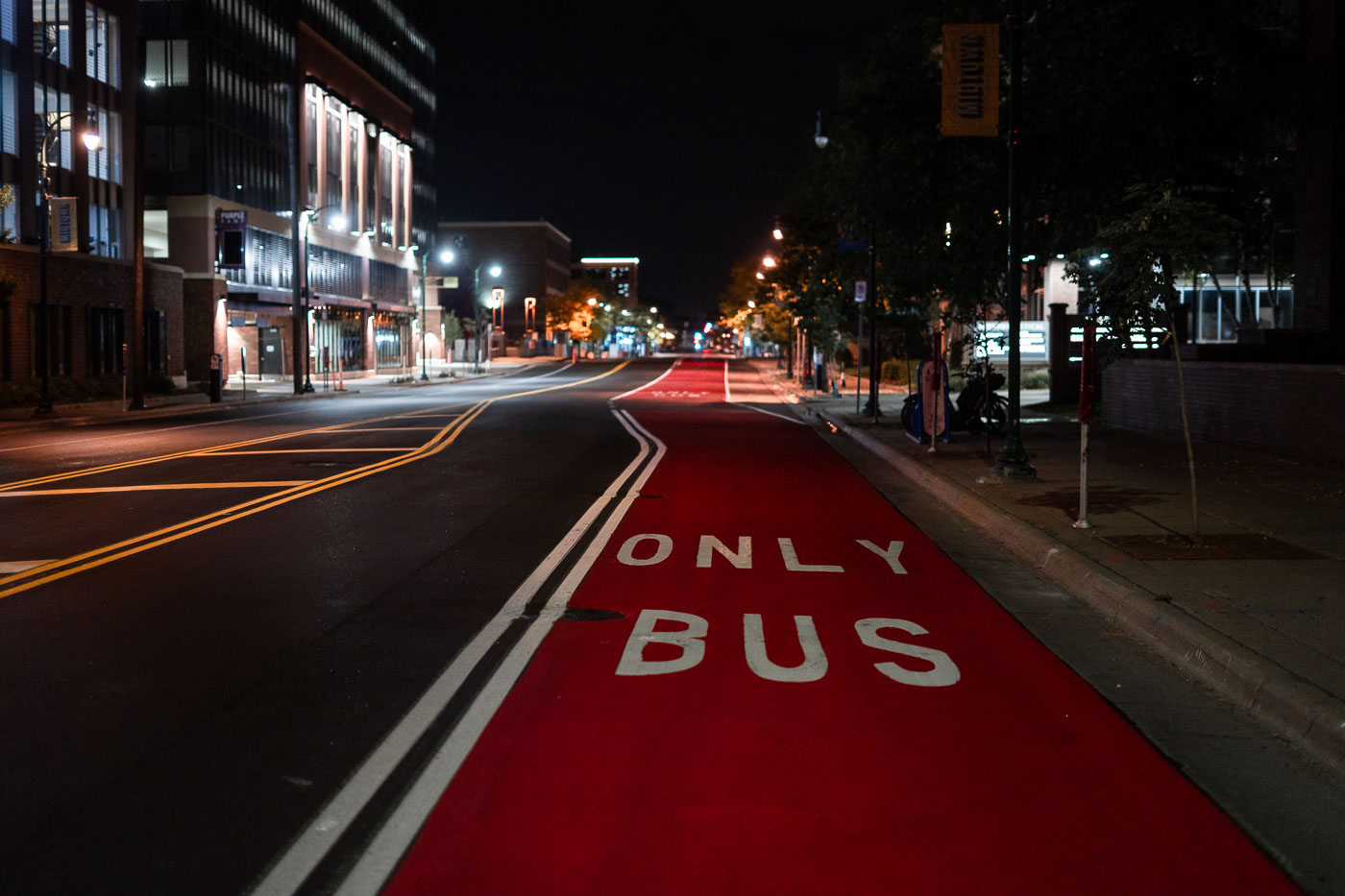
Red Bus Lane on Chicago Avenue at Night
A dedicated red bus-only lane runs along Chicago Avenue in Minneapolis, part of the city’s recent investments in transit priority corridors. These painted lanes are designed to give buses consistent travel times through dense urban segments, especially during peak hours, and they align with regional plans to improve service reliability on key north–south routes. Late at night the corridor is quiet, with the reflective pavement markings and overhead lighting emphasizing the straight line of the transit path through the Midtown area.

Red Bus Lane on Chicago Avenue at Nigh

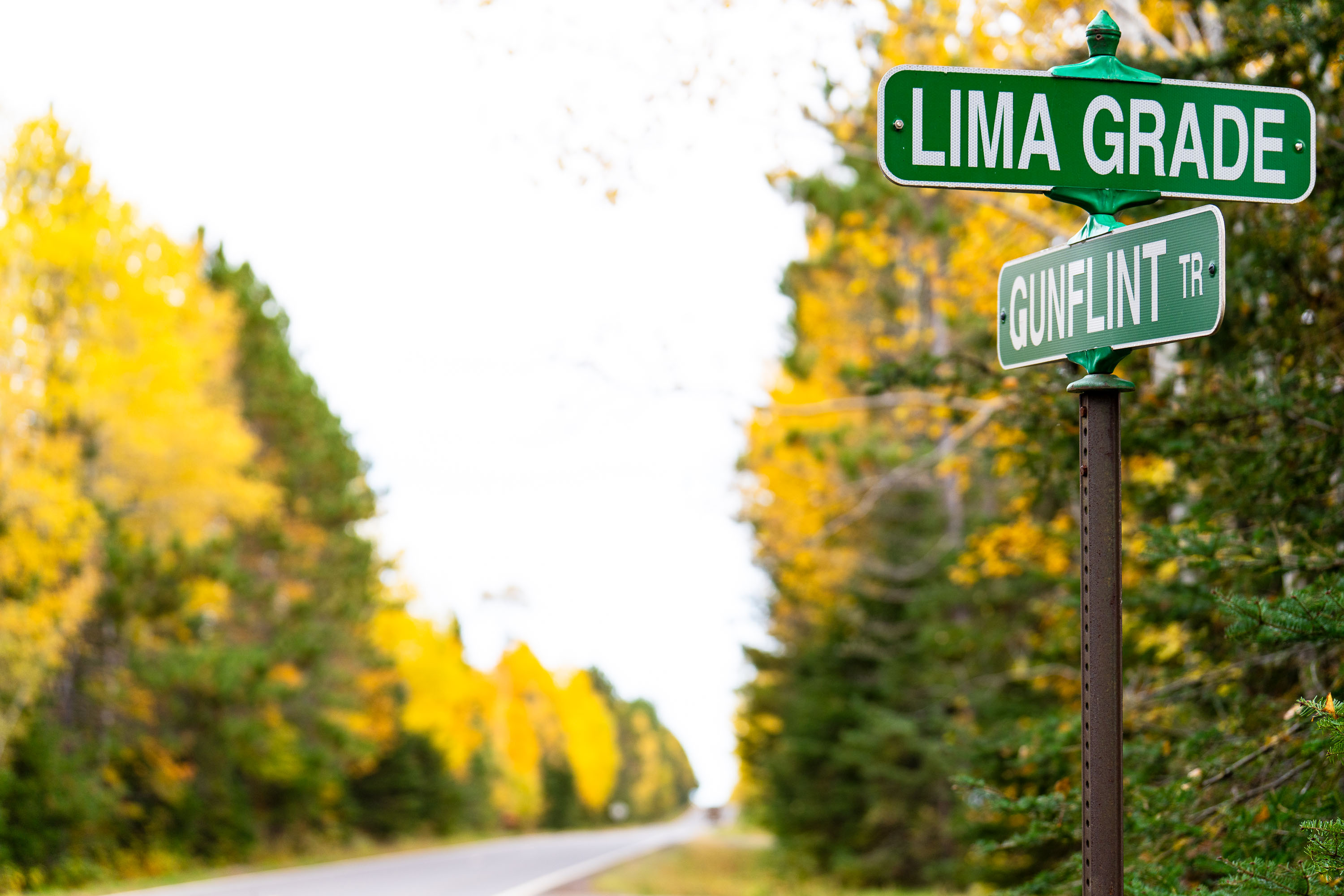
Lima Grade at Gunflint Trail, Grand Marais
Street signs at Lima Grade and Gunflint Trail in Grand Marais, Minnesota

Lima Grade at Gunflint Trail, Grand Marais

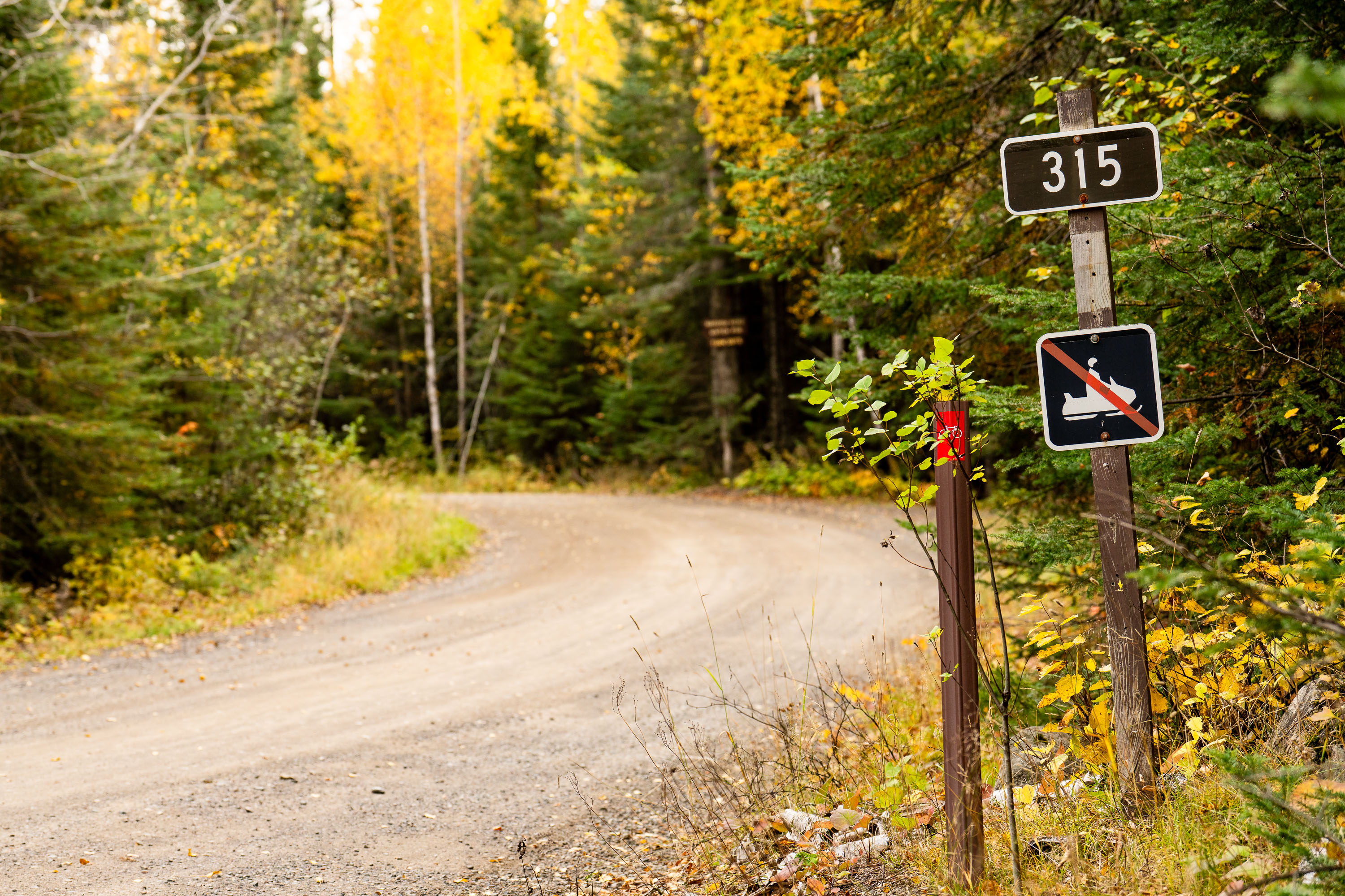
315 sign at Lima Grade at Gunflint Trail, Grand Marais

Lima Grade Road at the Gunflint Trail in Grand Marais, Minnesota.

315 sign at Lima Grade at Gunflint Trail, Grand Marais

US Forest Service grate
A firepit grate from the US Forest Service seen near the Gunflint Trail in Minnesota.

US Forest Service grate

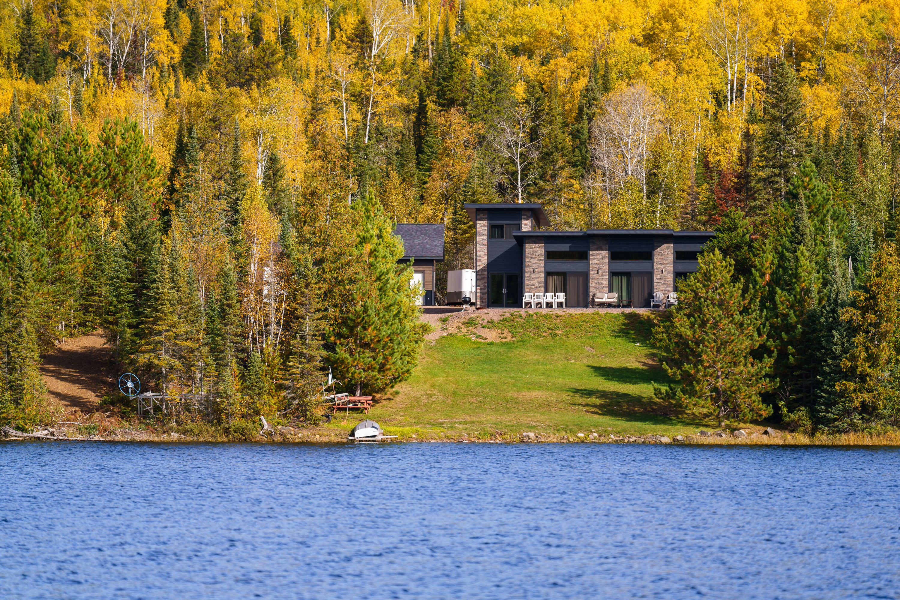
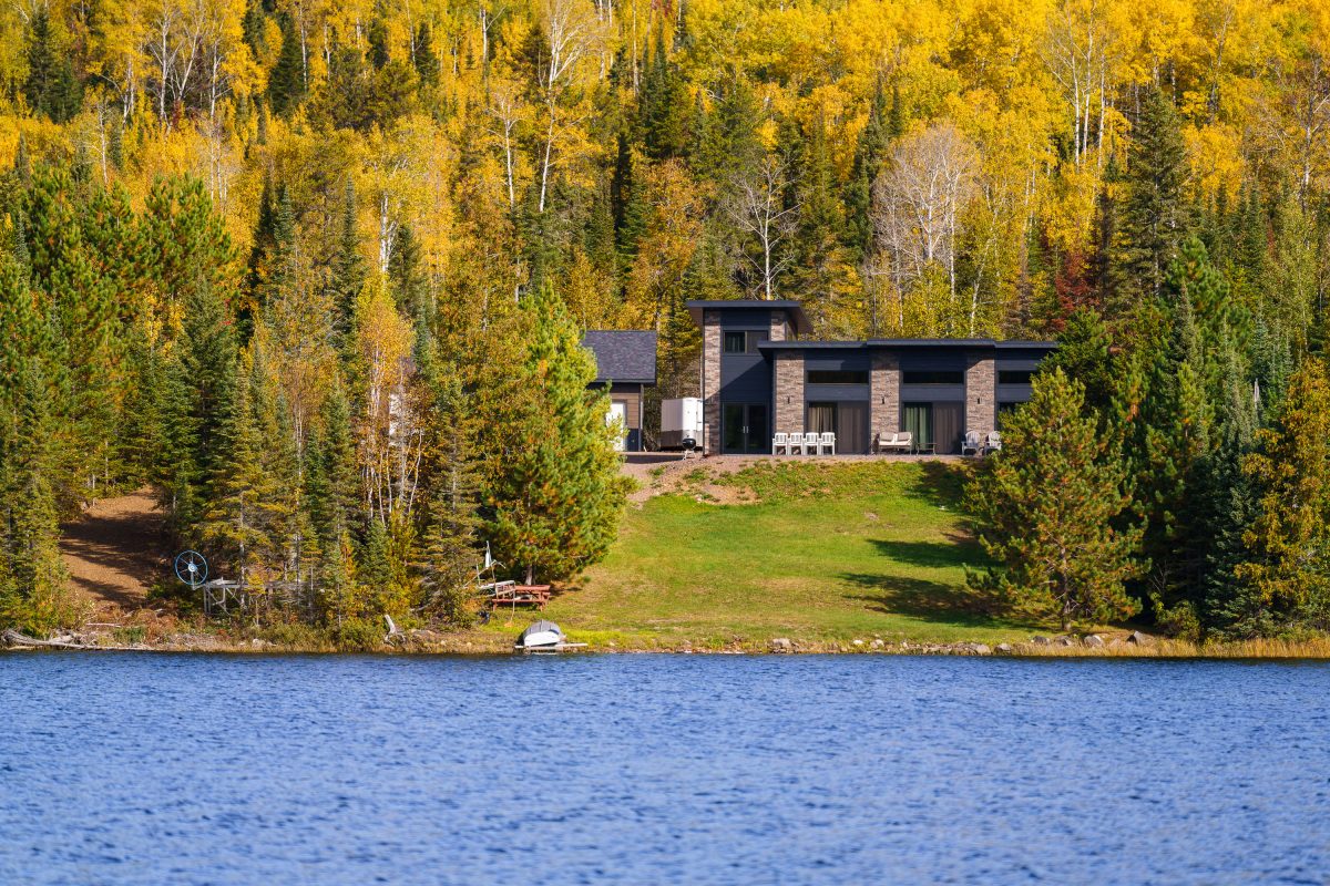
Modern home with stone facade on forested shoreline of Gunflint Lake, Minnesota, during autumn.
Gunflint Lake forms part of the international border between Minnesota and Ontario, Canada, within the Boundary Waters Canoe Area Wilderness and its Canadian counterpart, Quetico Provincial Park. The lake runs roughly six miles long and sits at the far end of the Gunflint Trail, about 45 miles northwest of Grand Marais. It's a popular put-in point for canoe and fishing trips into the connected chain of border lakes, and cabins along its shoreline are among the few private inholdings permitted within the wilderness boundary.

Lakeside Home Along the Gunflint Trail, Minnesota

Gunflint Trail picnic table on Birch Lake
A picnic table next to Birch Lake on the Gunflint Trail in Northern Minnesota.

Picnic Table, Birch Lake, Gunflint Trail

Autumn-colored water lily pads float on a still pond in Cook County, Minnesota.
Cook County sits at the northeastern tip of Minnesota along Lake Superior's North Shore, bordering Ontario and encompassing much of the Boundary Waters Canoe Area Wilderness. The county's terrain includes numerous bogs, beaver ponds, and small wetlands fed by the Sawtooth Mountains' runoff, where floating-leaved plants like water lilies and pond-lily species take hold in shallow, still water. By early October, water lily pads in the region typically turn shades of yellow, orange, and red as chlorophyll breaks down, a seasonal change tied to shortening daylight and dropping water temperatures. Much of the county's land is managed by the Superior National Forest, which oversees a large share of Minnesota's remaining undeveloped wetland habitat.

Water Lily Leaves in Autumn, Cook County, Minnesota

Cluster of gilled mushrooms growing on a moss-covered log in Superior National Forest, Minnesota.
Superior National Forest covers more than three million acres across northeastern Minnesota, bordering Canada along the Boundary Waters Canoe Area Wilderness. Fallen logs and decaying wood throughout the forest support clusters of gilled mushrooms, which break down cellulose and lignin as part of the forest's natural decomposition cycle. These fungi typically appear in fall, often growing in dense groups on moss-covered deadwood.

Wild Mushroom Cluster on Log, Superior National Forest

Dirt trail winds through dense underbrush and birch trees in Superior National Forest, Minnesota.
Superior National Forest covers roughly 3.9 million acres in northeastern Minnesota, managed by the U.S. Forest Service. It contains more than a million acres of lakes and streams, including the Boundary Waters Canoe Area Wilderness along its northern edge. The forest is dominated by boreal species such as birch, aspen, and various conifers, with understory plants like wood sorrel and ferns common along its trail systems. Established in 1909, it remains one of the most heavily visited wilderness areas in the country.

Forest Trail, Superior National Forest, Minnesota

Fallen logs and pine needles line a wooded trail in Superior National Forest, Minnesota.
Superior National Forest covers roughly 3 million acres in northeastern Minnesota, managed by the U.S. Forest Service. It contains more than 445,000 acres of the Boundary Waters Canoe Area Wilderness, the most-visited wilderness area in the country. The forest is dominated by boreal species like jack pine, spruce, and birch, with a mix of maple and aspen contributing to fall color displays. Fallen logs and pine needle litter along its trails are typical of the mixed conifer-hardwood stands found throughout the region.

Fallen Logs Along a Forest Trail, Superior National Forest

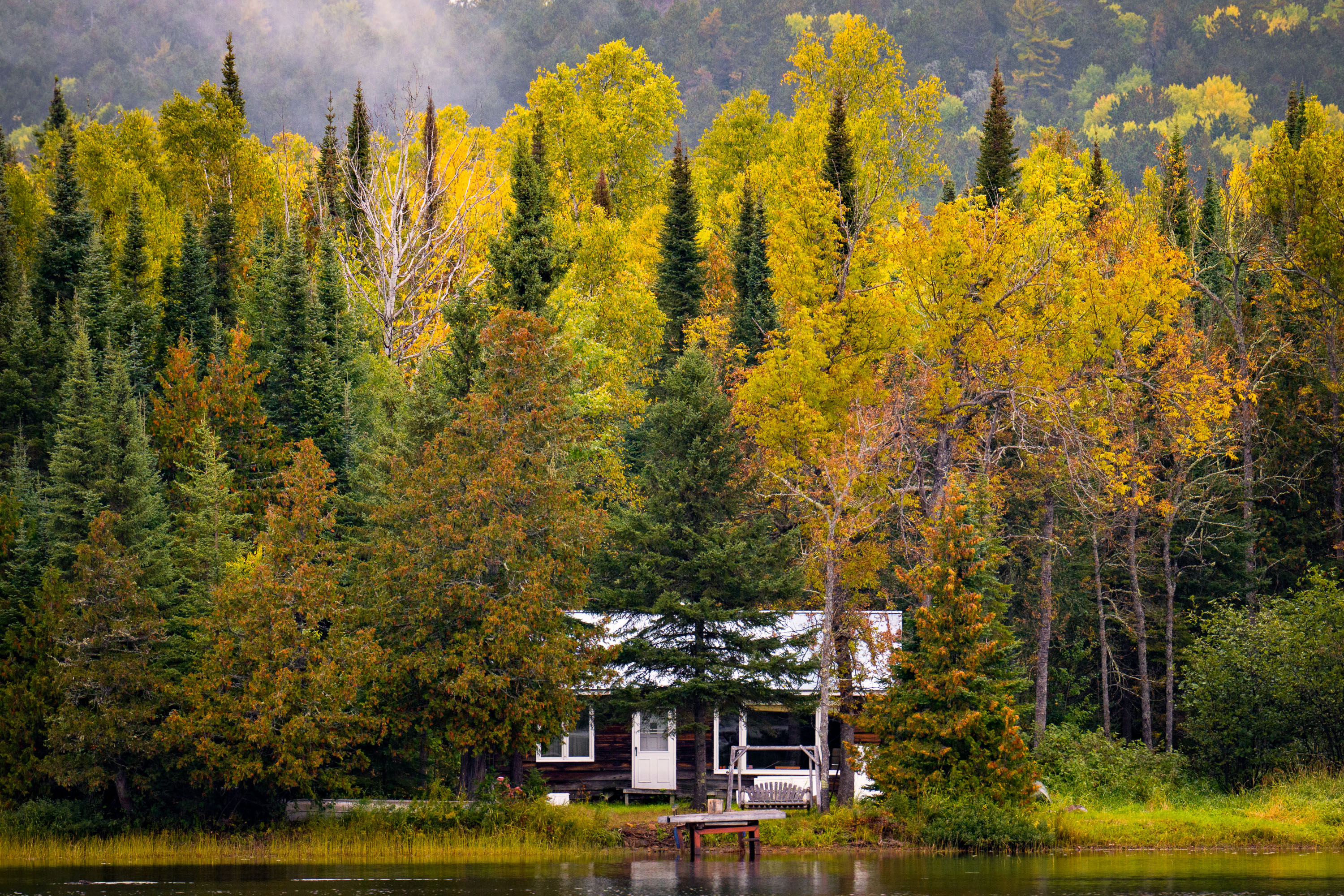
A cabin on McFarland Lake surrounded by birch and conifer trees in autumn foliage, northern Minnesota.
McFarland Lake sits along the Arrowhead Trail, a county road in Cook County near Grand Portage in far northeastern Minnesota. The lake lies close to the Canadian border and the eastern edge of the Boundary Waters Canoe Area Wilderness, an area popular for canoe access points and backcountry paddling routes. Cabins along this stretch of the Arrowhead Trail are mostly private, seasonal retreats built for fishing and access to the surrounding Superior National Forest.

Lakeside Cabin, McFarland Lake, Arrowhead Trail, Minnesota

Gravel road through northern Minnesota forest in autumn with yellow larch and evergreen trees.
The Arrowhead Trail runs roughly 27 miles north from Minnesota Highway 61 at Hovland to South Fowl Lake on the Canadian border. Most of the route is unpaved, passing through the Superior National Forest and skirting the eastern edge of the Boundary Waters Canoe Area Wilderness. Cook County maintains the gravel surface, which sees heavy use by hunters, anglers, and leaf-peepers each fall as sugar maples and aspen along the corridor turn color. The road ends at a boat landing on South Fowl Lake, one of the closest public access points to Canada in this part of the state.

Fall Colors Along the Arrowhead Trail, Cook County
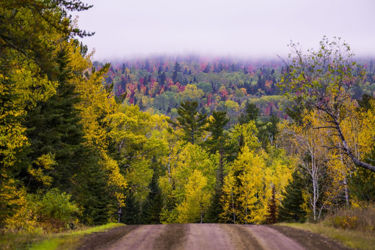
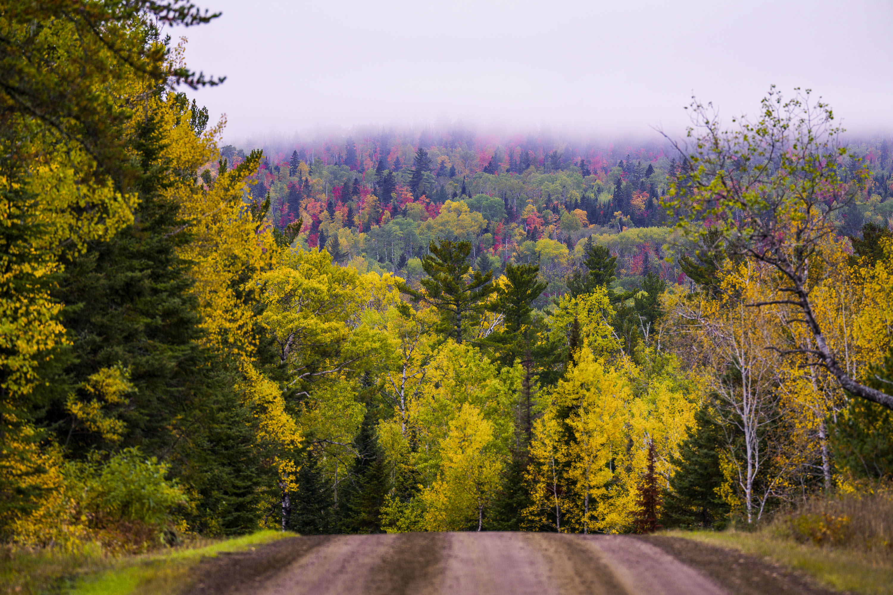
Dirt road through northern Minnesota forest displaying autumn foliage with yellow and red trees in distant fog.
The Arrowhead Trail is a roughly 20-mile gravel road, designated Cook County Road 16, running north from Hovland on Lake Superior's North Shore to the Ontario border at the Pigeon River. The route cuts through the Superior National Forest, passing stands of aspen, birch, and white and red pine mixed with maple that turn color each September and October. It's maintained as a low-traffic forest road rather than a state highway, popular with anglers heading to backcountry lakes and with fall-color drivers making the trip up from Highway 61.

Gravel Road Through Fall Foliage, Arrowhead Trail, Minnesota
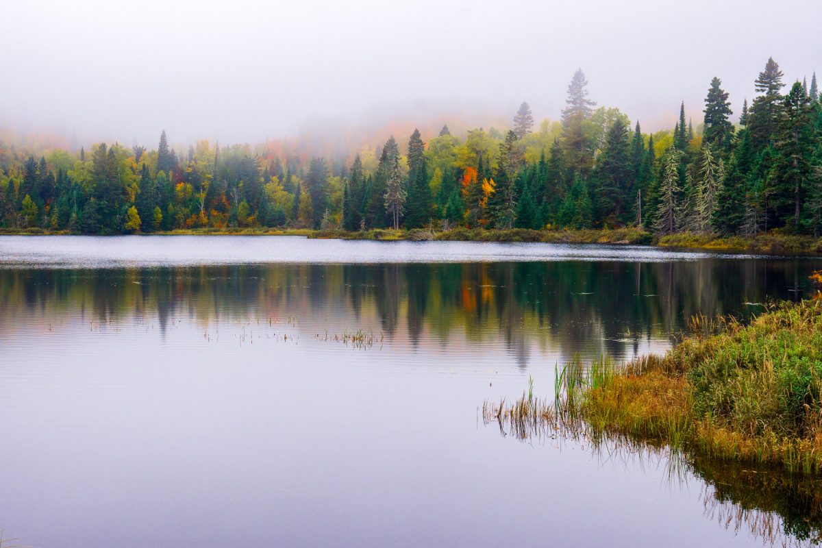
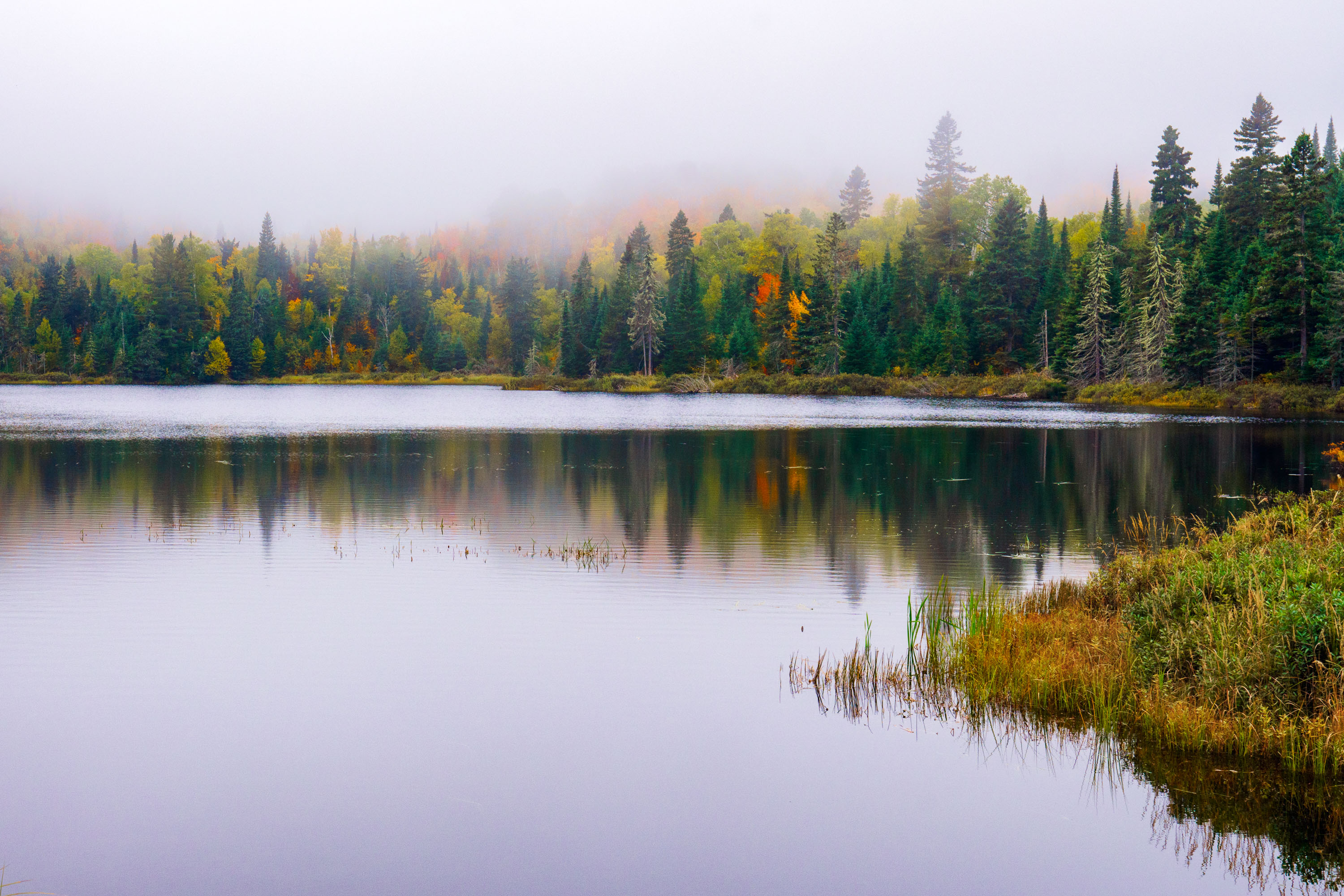
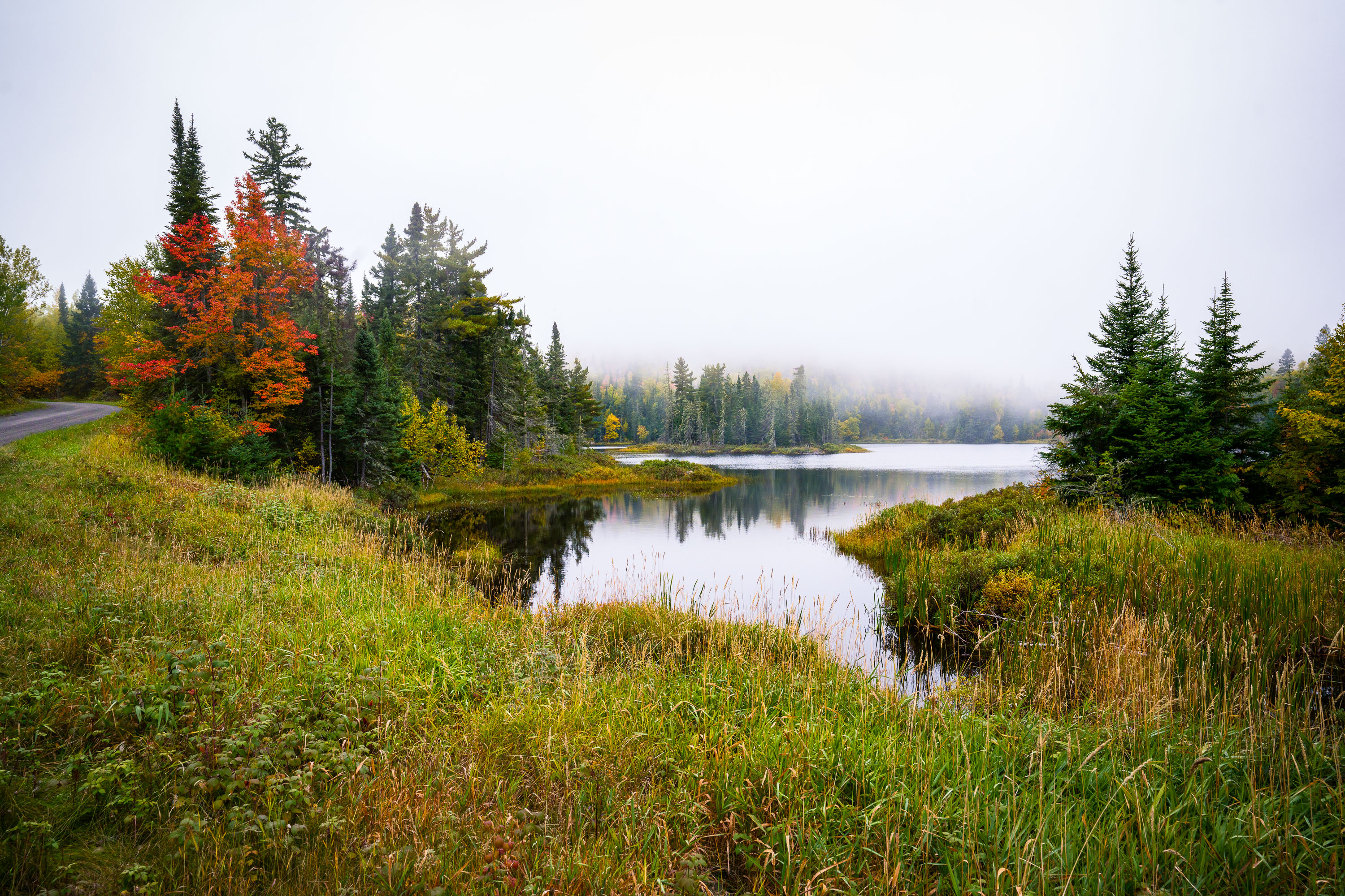
Fog over Loft Lake in Northern Minnesota
Foggy morning over Loft Lake as seen from Shoe Lake Road in Northern Minnesota.

Loft Lake from Shoe Lake Road in Minnesota
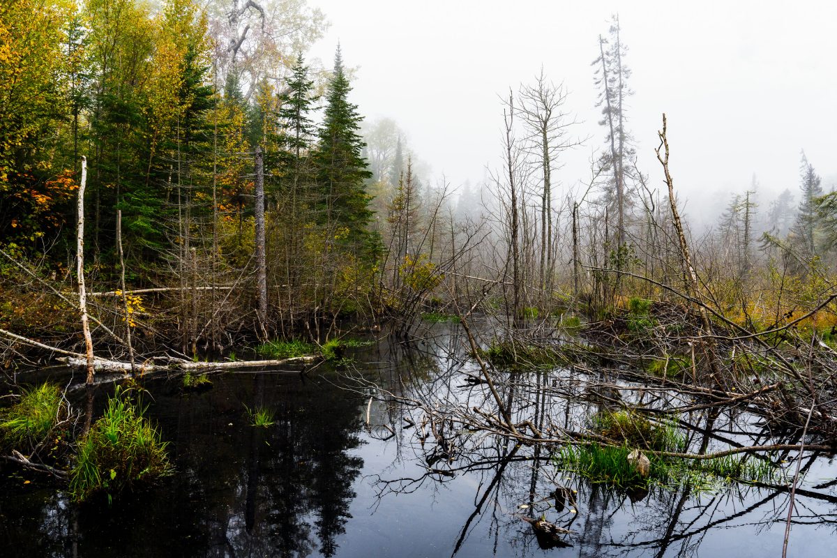
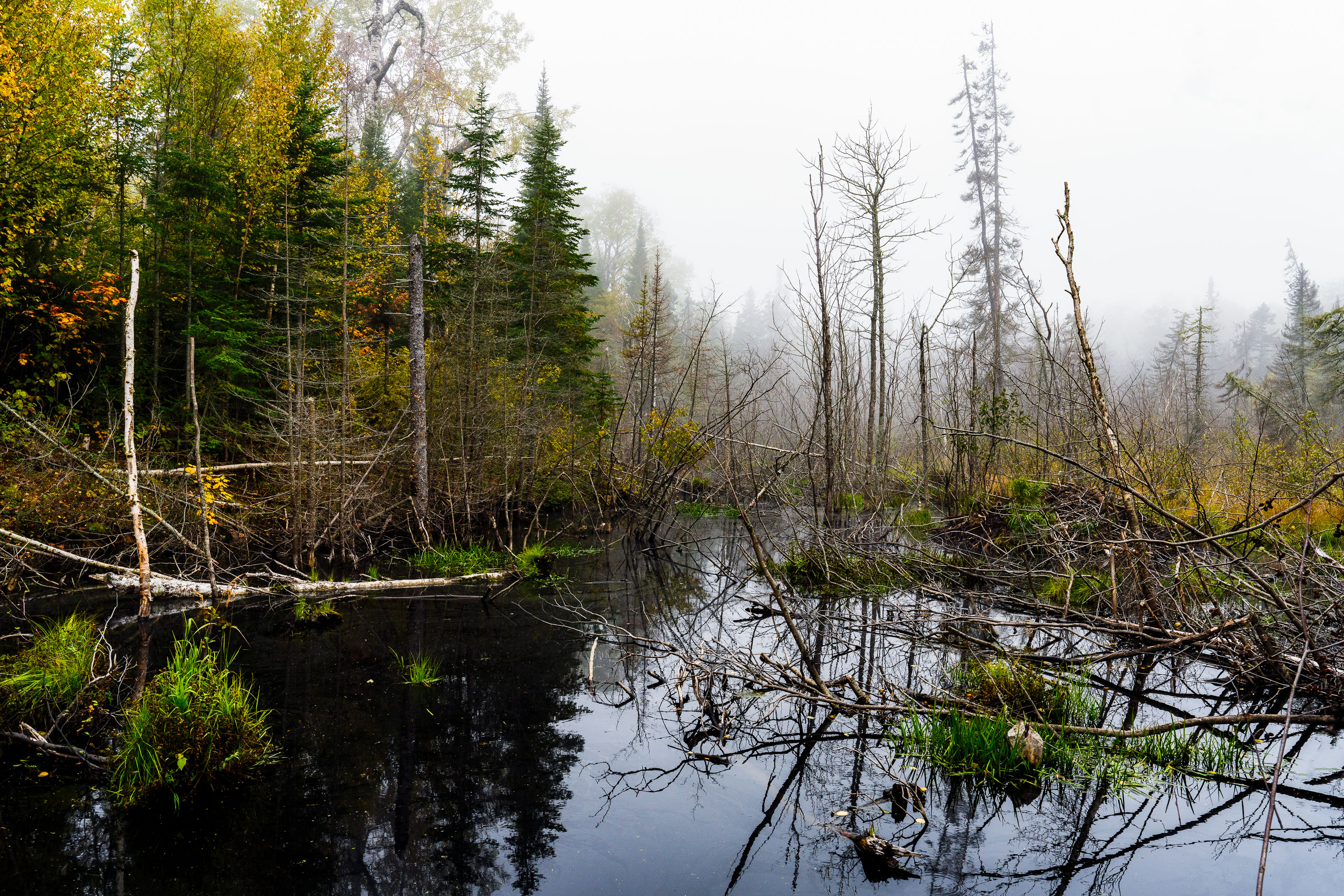
Flooded beaver wetland with standing dead trees near Shoe Lake Road in Superior National Forest, Minnesota.
Shoe Lake Road runs through the Superior National Forest in Cook County, Minnesota, near the edge of the Boundary Waters Canoe Area Wilderness. The surrounding forest is a mix of northern hardwoods and conifers, including birch, spruce, and balsam fir, typical of this part of the Superior National Forest. Beaver activity is common along the region's low-lying wetlands, where dammed water and downed trees create the shallow ponds and standing deadwood found throughout this stretch of forest. The area sits within the Laurentian Divide watershed, which separates drainage toward Lake Superior from waters flowing north toward Hudson Bay.

Beaver Pond Wetland Near Shoe Lake Road, Superior National Forest
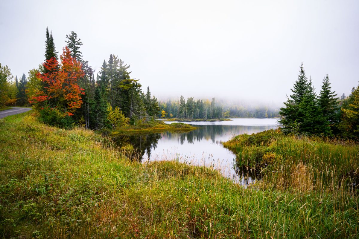
Shoe Lake surrounded by autumn forest and wetland grasses near Grand Marais, Minnesota.
Shoe Lake lies along Shoe Lake Road in Cook County, near Grand Marais, Minnesota, within the Superior National Forest region. The area is part of the North Shore's mixed boreal forest, where spruce, fir, and maple stands turn color each October.

Shoe Lake, Grand Marais, Minnesota

Mixed forest canopy in autumn with red, orange, and yellow deciduous trees among evergreens in Northern Minnesota.
Superior National Forest covers more than three million acres across northeastern Minnesota, including Cook County, and stands as Minnesota's largest national forest. The forest's canopy is a mix of birch, aspen, maple, and conifer species, a combination that produces a wide range of color change each autumn as hardwoods turn while pines and spruce stay green. Birch and aspen typically shift first, often in late September, while maples follow with reds and oranges. The forest is managed by the U.S. Forest Service and includes roughly 445,000 acres of the Boundary Waters Canoe Area Wilderness within its borders.

Mixed Hardwood Forest in Autumn, Superior National Forest
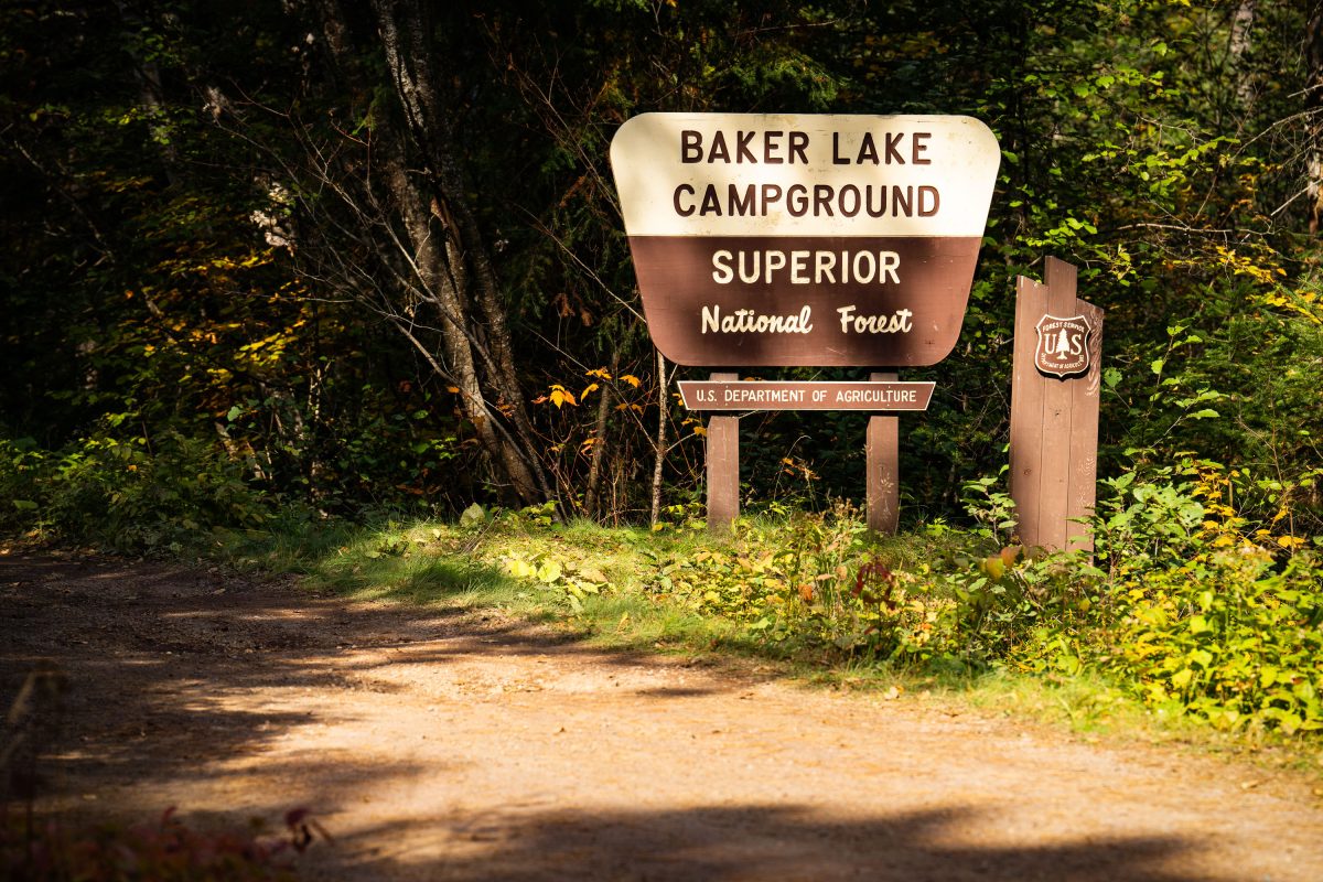
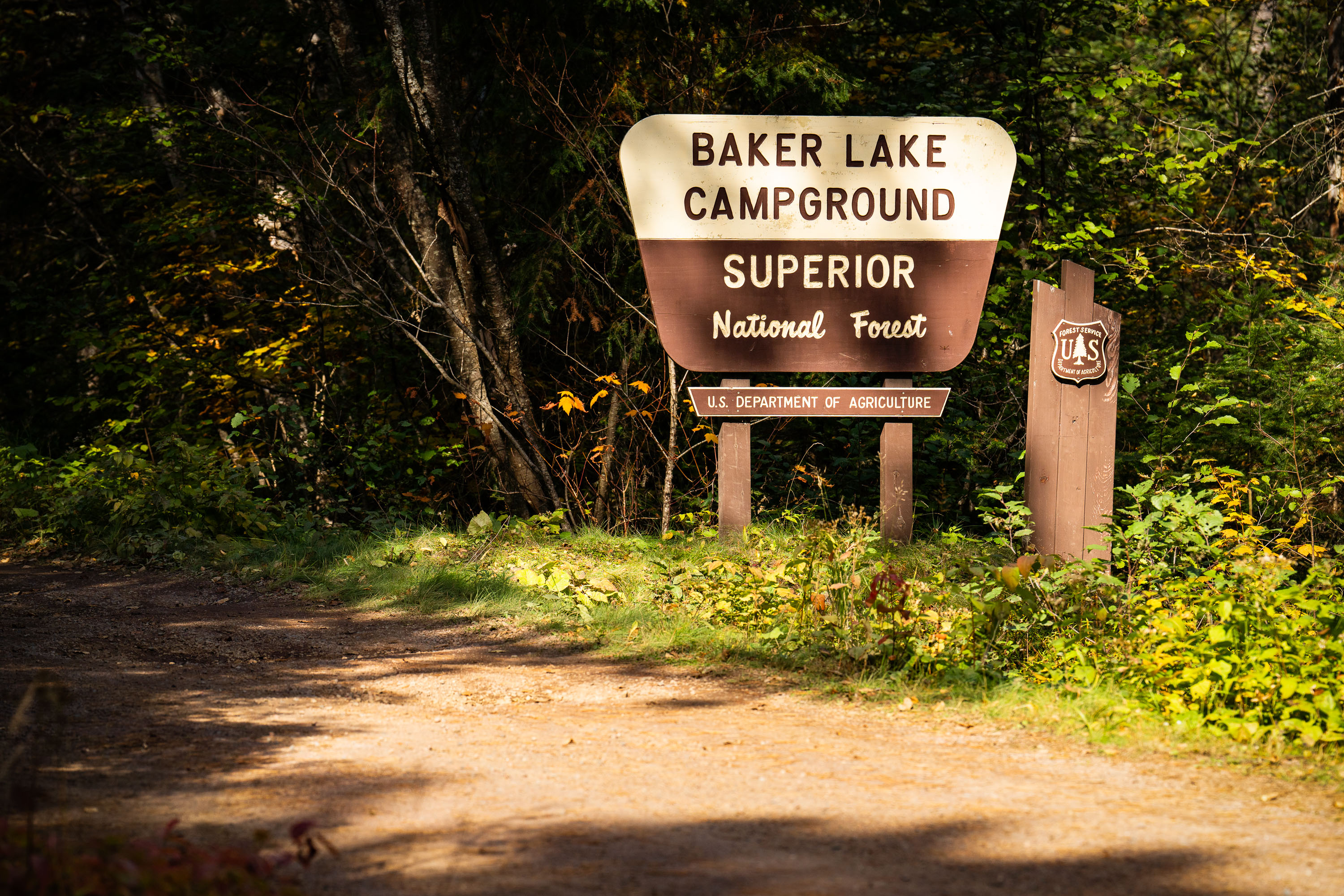
Baker Lake Campground sign in Superior National Forest, Minnesota, surrounded by forest.
Baker Lake Campground sits off the Sawbill Trail in Cook County, part of the Tofte Ranger District within the Superior National Forest. The U.S. Forest Service, an agency of the Department of Agriculture, maintains the site as a small, rustic campground with vault toilets and no electrical hookups. Its boat landing on Baker Lake serves as one of the entry points into the Boundary Waters Canoe Area Wilderness, giving paddlers direct access to the interior lake system. The surrounding forest is managed for multiple use, including timber, recreation, and wildlife habitat, under the Superior National Forest's broader stewardship of more than three million acres in northeastern Minnesota.

Baker Lake Campground Sign, Superior National Forest
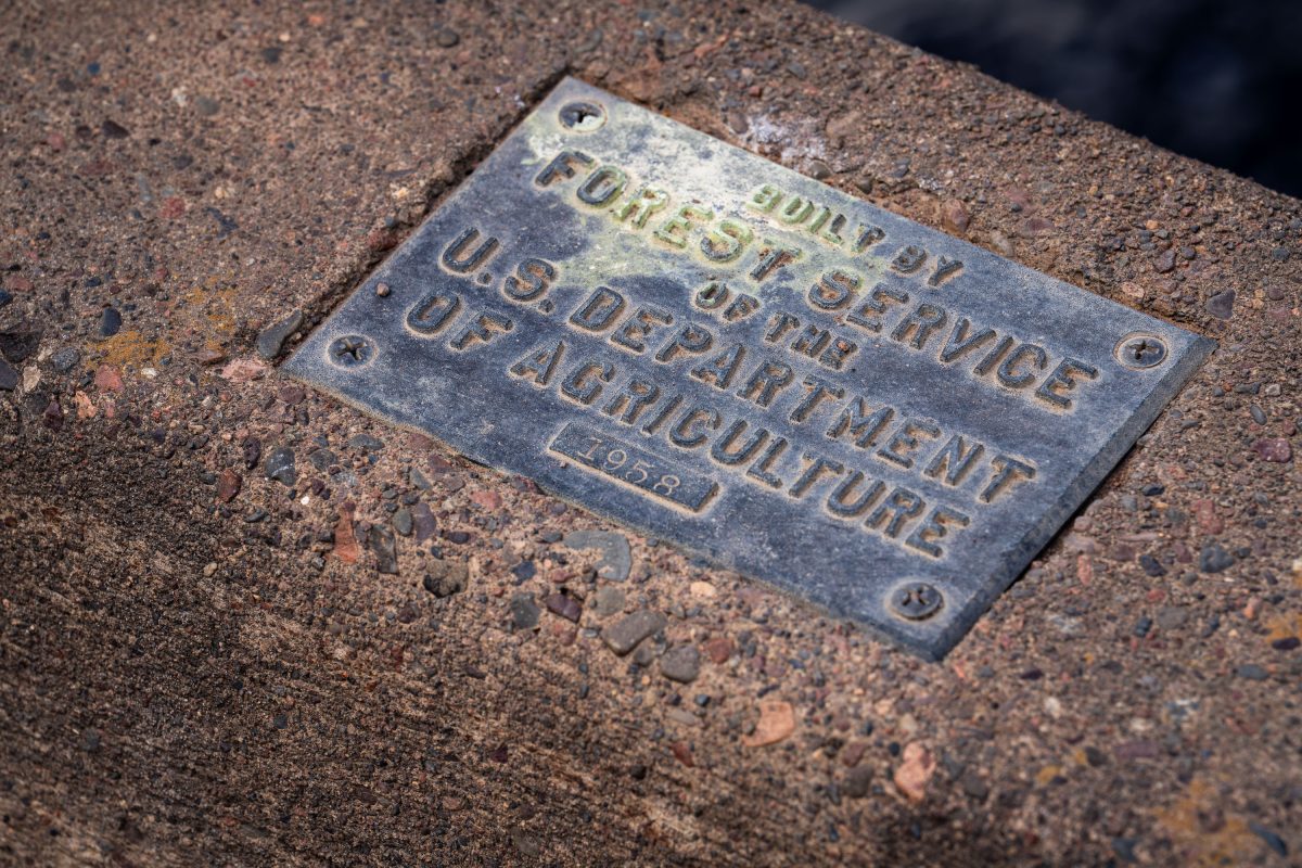
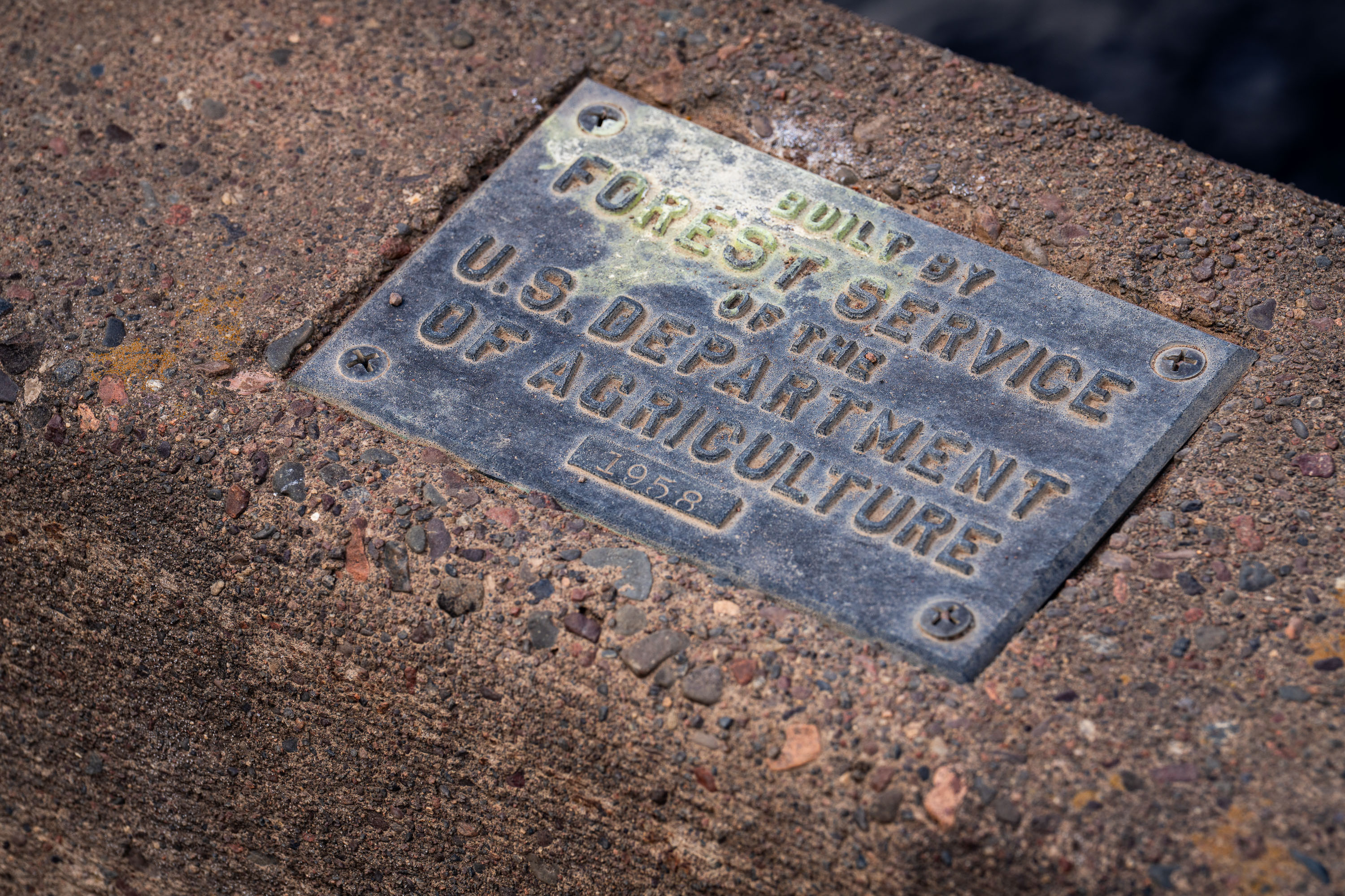
U.S. Forest Service plaque mounted on a bridge in Superior National Forest, Minnesota.
The U.S. Forest Service, part of the Department of Agriculture, builds and maintains bridges, culverts, and other infrastructure across the Superior National Forest in northeastern Minnesota. This plaque, dated 1958, marks one such structure from a decades-long program of forest road and bridge construction tied to logging access, fire management, and recreation. The Superior National Forest itself spans over three million acres and includes the Boundary Waters Canoe Area Wilderness. Forest Service builder's plaques like this one were standard practice for documenting agency construction projects, recording both the responsible agency and the year of completion.

1958 Forest Service Bridge Plaque, Superior National Forest

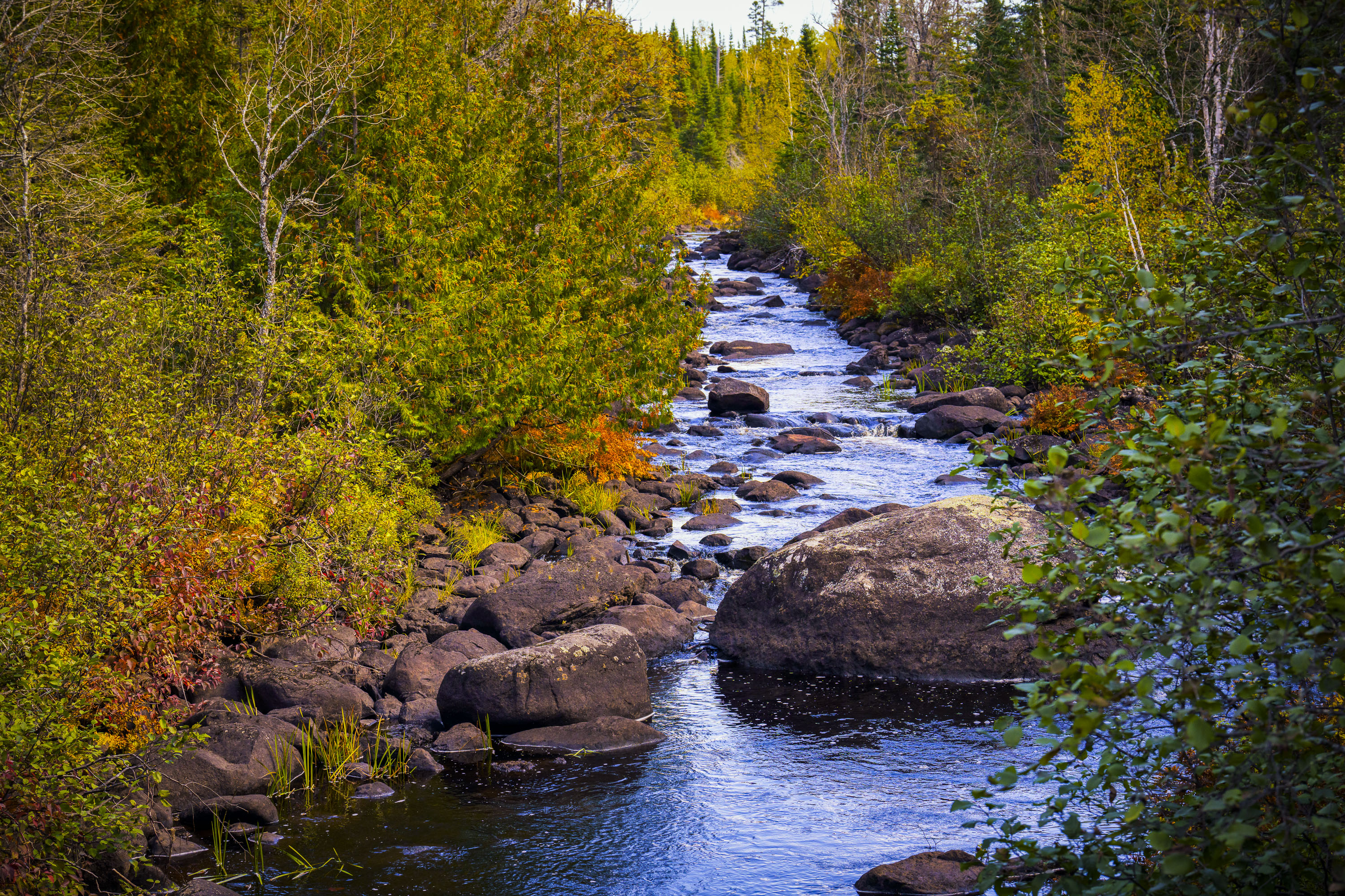
Temperance River flows through golden autumn foliage in Superior National Forest, Minnesota.
The Temperance River runs roughly 22 miles from its origin near the Laurentian Divide to Lake Superior, dropping through a series of potholes and gorges carved into volcanic rock along the way. It's one of the few rivers on Minnesota's North Shore with no sandbar at its mouth, which is how it got its name — early voyageurs who charted the region's rivers by their sandbars, or lack of a "bar," reportedly gave this one a teetotaling nickname. The river and its surrounding old-growth cedar and pine stands sit within the Superior National Forest, which spans nearly three million acres across northeastern Minnesota. Cook County's stretch of the river includes sections popular with anglers seeking steelhead and brook trout during their seasonal runs.

Rocky Stretch of the Temperance River, Superior National Forest
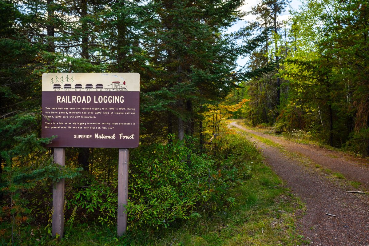
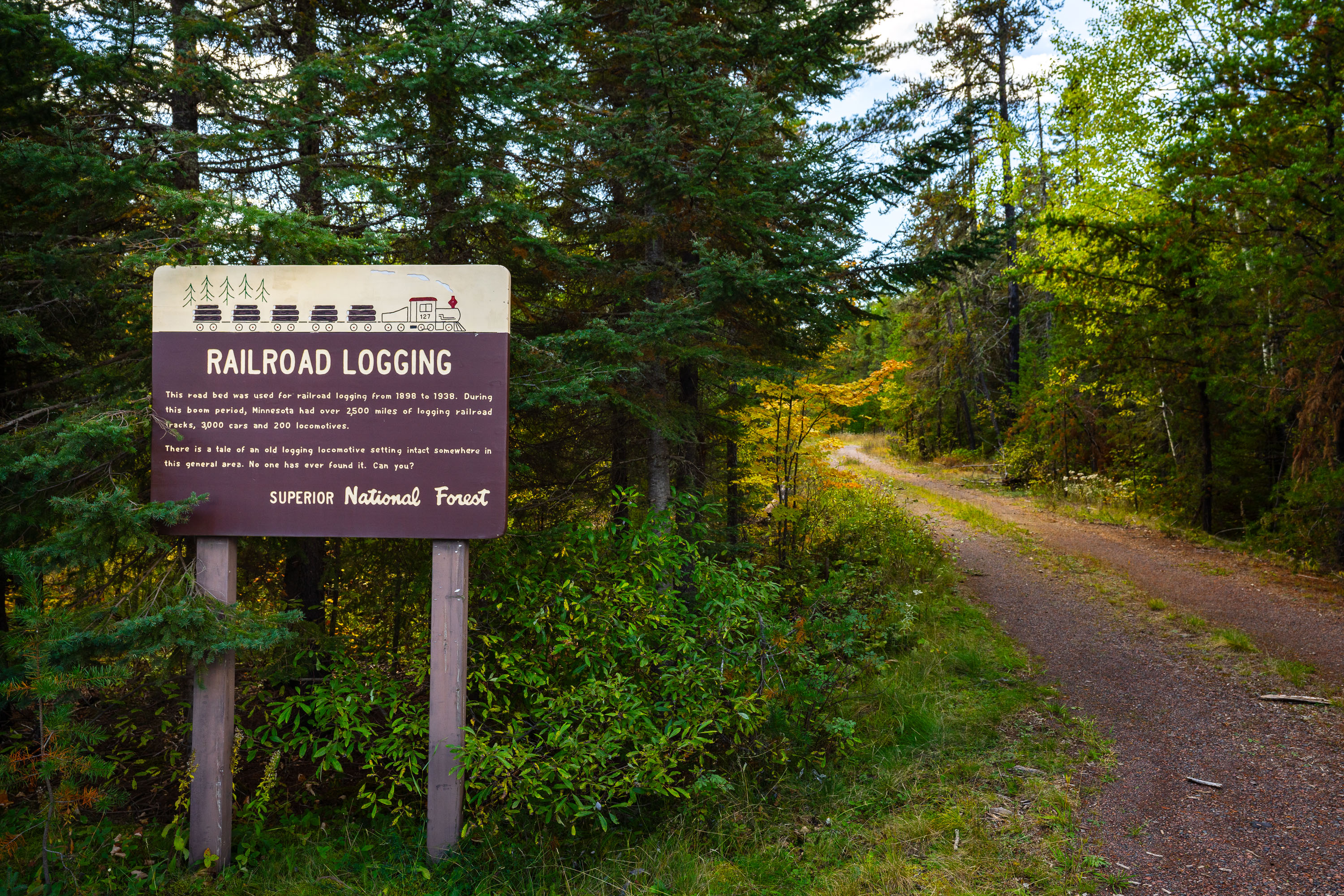
Railroad Logging sign in the Superior National Forest
RAILROAD LOGGING This road bed was used for railroad logging from 1898 to 1938. During this boom period, Minnesota had over 2,500 miles of logging railroad tracks, 3,000 cars and 200 locomotives. There is a tale of an old logging locomotive setting intact somewhere in this general area. No one has ever found it. Can you?

Railroad Logging sign in the Superior National Forest

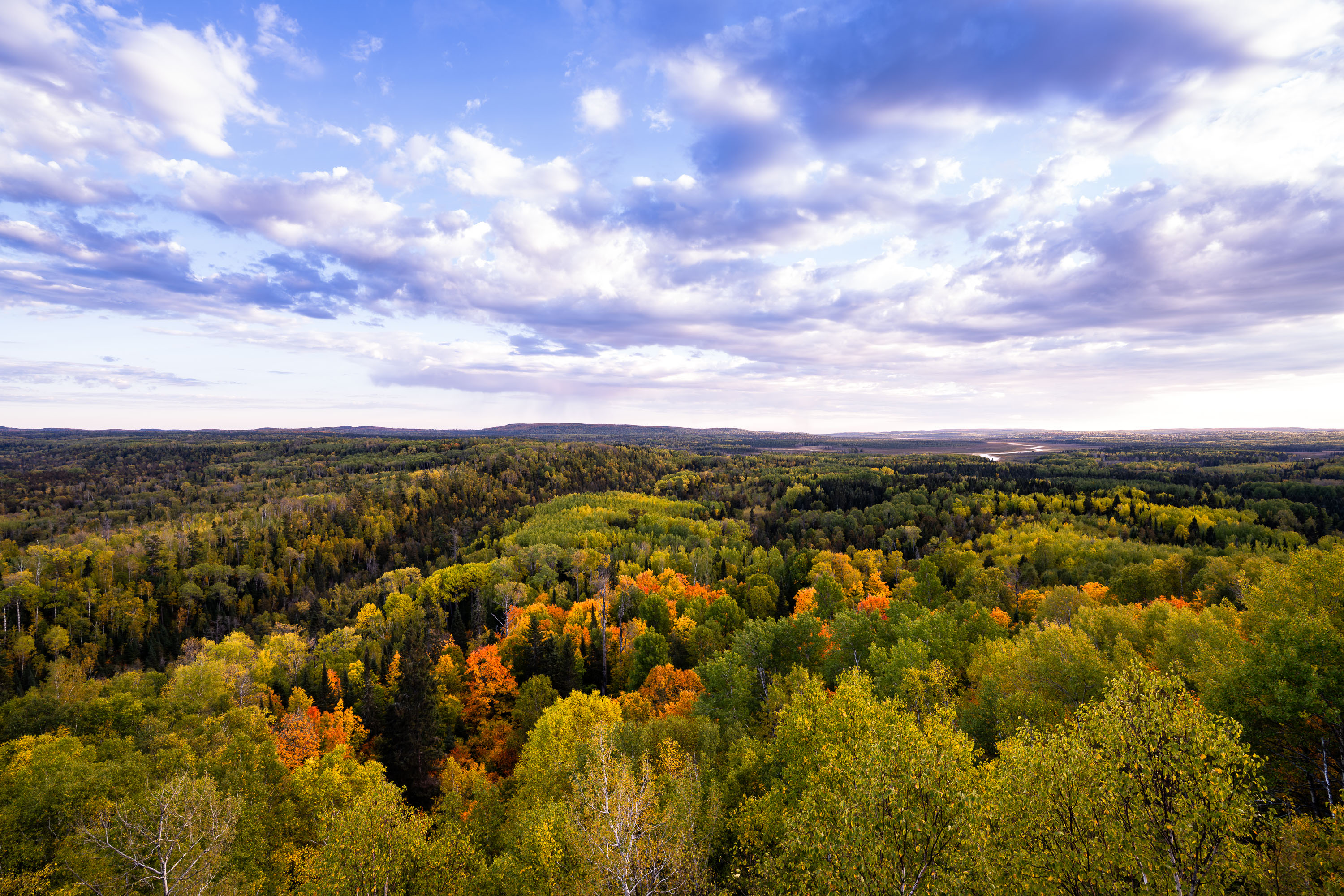
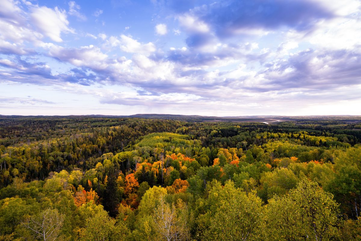
Autumn foliage colors the tree canopy of Superior National Forest in northeastern Minnesota.
Superior National Forest spans roughly 3 million acres across northeastern Minnesota, established in 1909 and managed by the U.S. Forest Service. It encloses the Boundary Waters Canoe Area Wilderness, more than a million acres of interconnected lakes and forest popular with canoeists. Aspen, birch, and pine make up much of its mixed hardwood-conifer cover, turning gold and orange each autumn. The forest holds over 2,000 miles of undeveloped shoreline, among the longest such stretches in the country.

Autumn Colors Over Superior National Forest, Minnesota
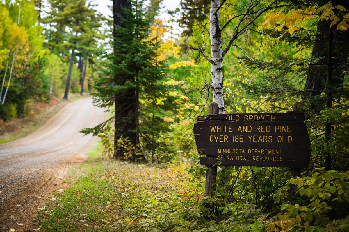
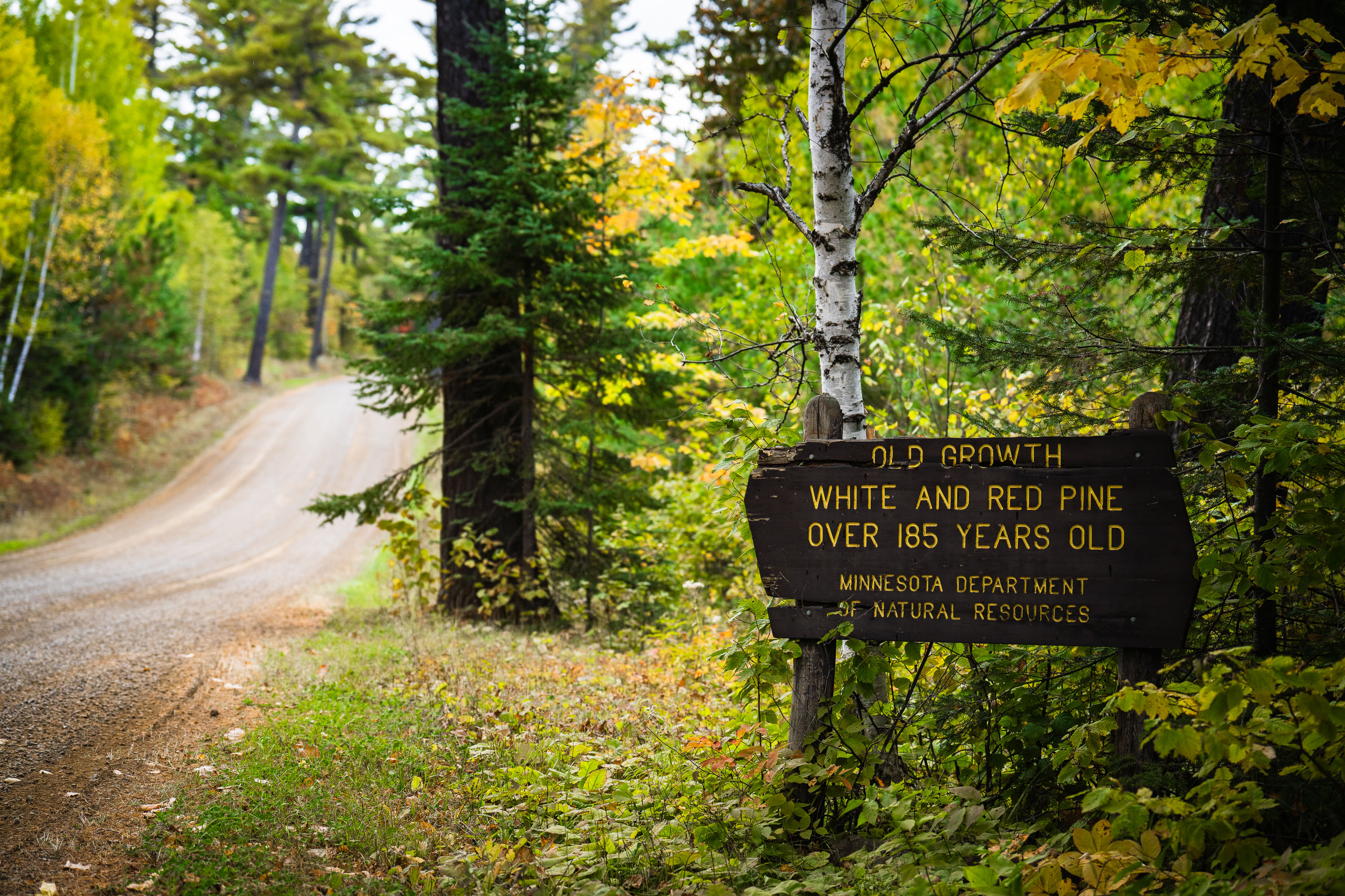
Old growth trees sign from the Minnesota Dept of Natural Resources
"Old growth white and red pine over 185 years old. Minnesota department of natural resources".

Old Growth Trees Sign in Minnesota

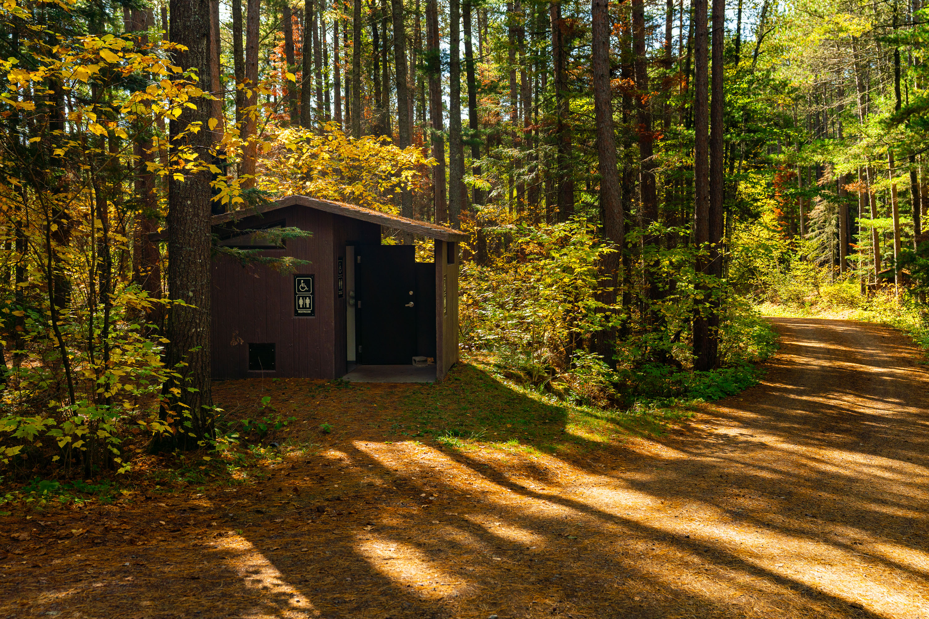
Baker Lake Campground Restrooms in Superior National Foresst
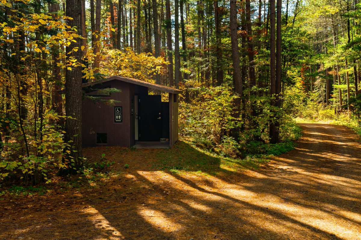
Outhouse at the Baker Lake Campground in the Superior National Forest.

Baker Lake Campground Restrooms in Superior National Foresst

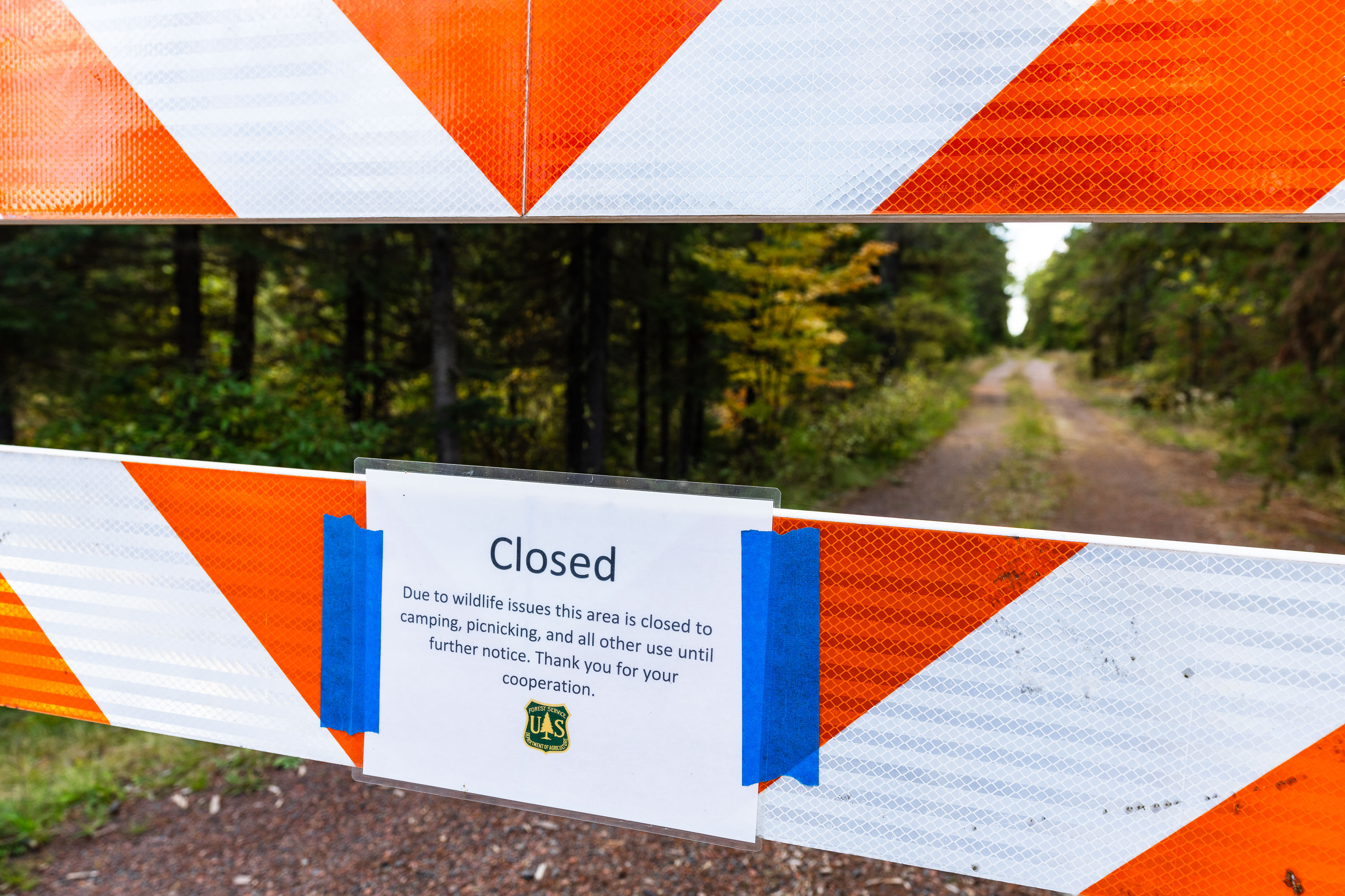
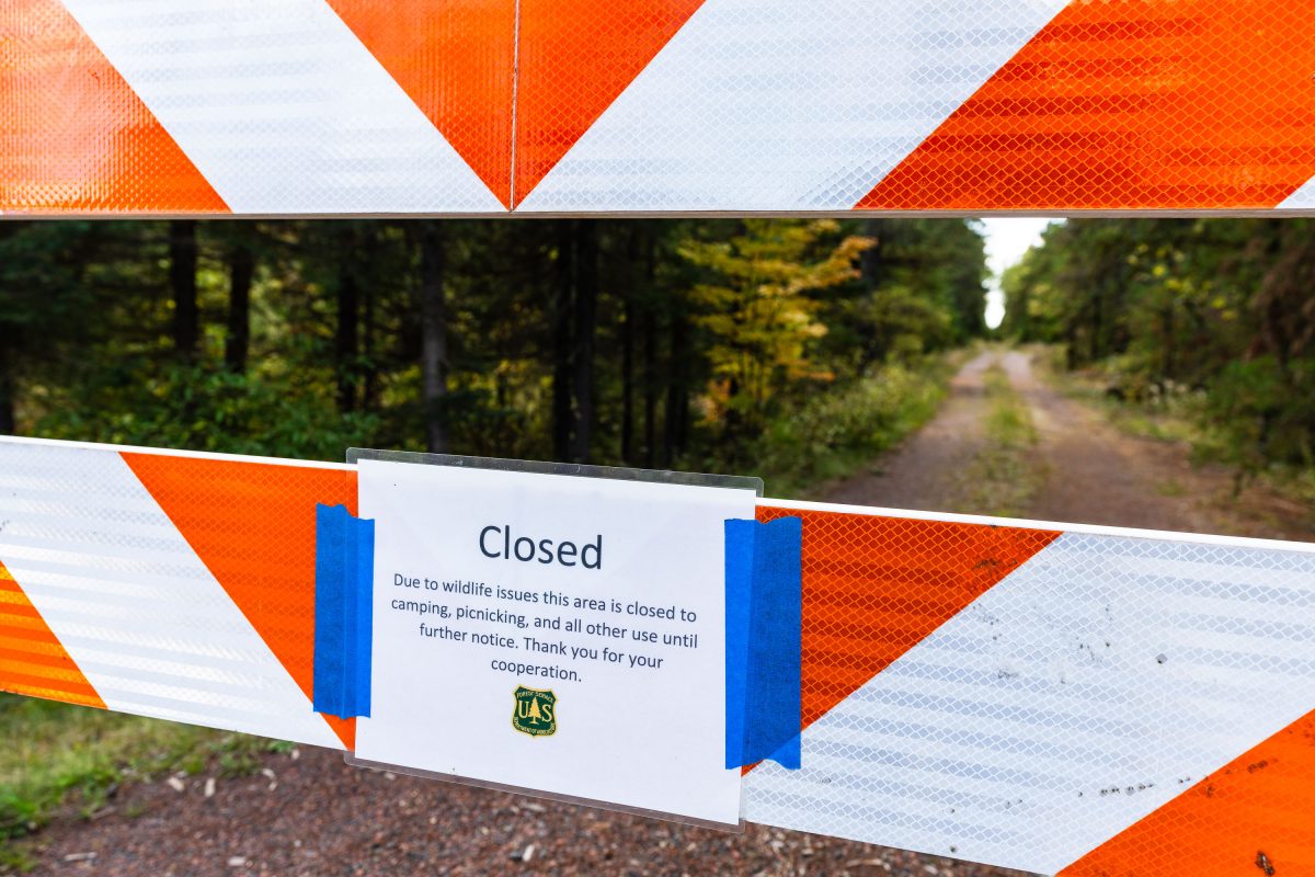
US Forest Service closure notice in Minnesota
"Due to wildlife issues this area is closed to camping, picnicking, and all other use until further notice. Thank you for your cooperation."

Road closure in Superior National Forest, September 2022
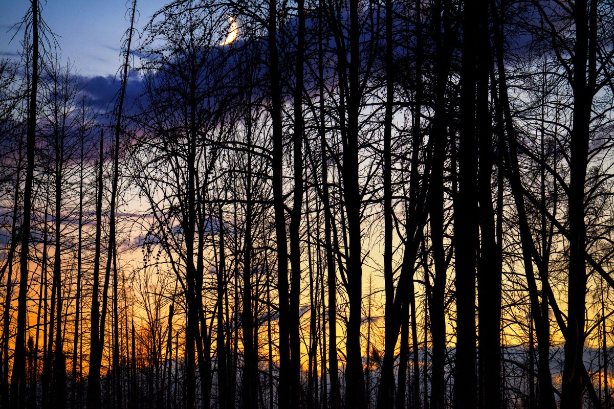
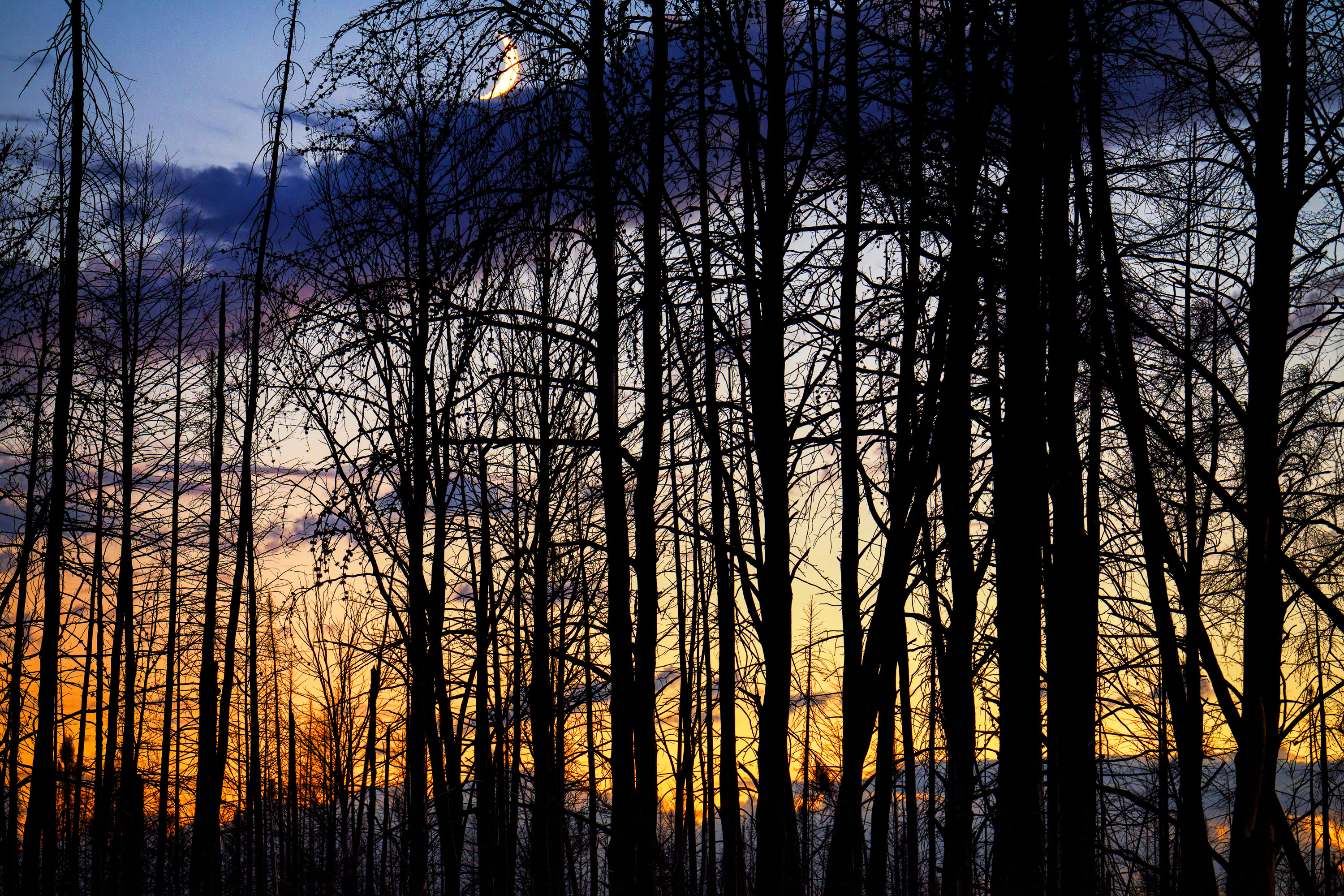
Moon rising over Superior National Forest
Burned trees inside the Greenwood fire zone a year after the wildfire.

Moon rising over Superior National Forest
Minneapolis Police Station on Nicollet Avenue at night
The Minneapolis Police 5th Precinct station is located on Nicollet Avenue.

Minneapolis Police 5th Precinct, Nicollet Ave at Night

2023 We Are Roosevelt Yard SIgn
A yard sign for Roosevelt High School's Class of 2023 is displayed in South Minneapolis. The sign, bearing the slogan "We are Roosevelt" and the school's mascot, is in a yard within George Floyd Square.

Roosevelt High School Class of 2023 Yard Sign, South Minneapolis

Portland Avenue in South Minneapolis at night
Portland Avenue in South Minneapolis is a major thoroughfare connecting residential neighborhoods to the downtown core. This view looks south down Portland Avenue, with the city's commercial center receding into the distance.

Portland Avenue, South Minneapolis at Night

Operation Endeavor Squad Cars Parked in Downtown Minneapolis
Minneapolis Police Department vehicles are visible downtown during "Operation Endeavor." The operation was spearheaded by Minneapolis Community Safety Commissioner Cedric Alexander.

Minneapolis Police Cars Downtown During Operation Endeavor

The THC Joint in Downtown Minneapolis
A mural of cannabis leaves adorns the exterior of a red brick building in downtown Minneapolis, adjacent to "The THC Joint" dispensary.

The THC Joint, Minneapolis: Cannabis Mural on Red Brick Building

We Remember signs at Minneapolis Police Station
The Minneapolis Police Third Precinct building, located on Lake Street, stands vacant and barricaded more than 2 years after it was taken over by protesters following the murder of George Floyd. Signs on the fencing read "The times are urgent, let us slow down". "We remember say their names" "cultivate care".

Minneapolis Police 3rd Precinct Barricade with Protest Signs

Demolition of US Bank Building After Fires
The US Bank building on East Lake Street in Minneapolis, shown here in a state of demolition, was destroyed during the protests that followed the murder of George Floyd in May 2020. The bank is one of many that were destroyed.

US Bank Building Demolition on East Lake Street, Minneapolis