September 2019
—
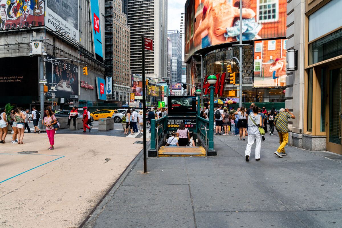
Pedestrians crowd the sidewalks around a subway entrance in Times Square, Manhattan. The 42nd Street–Times Square station, one of the busiest in New York City, connects multiple subway lines beneath the bright billboards, storefronts, and heavy traffic of the theater district.
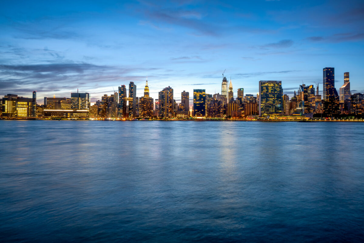
East River and Manhattan Blue Hour
August 2019
—
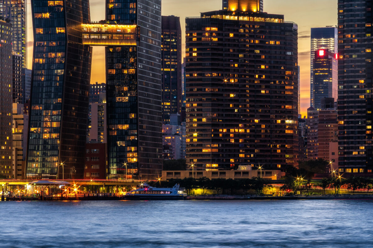
Manhattan as seen from across the East River.
Long Island City Architecture
August 2019
—
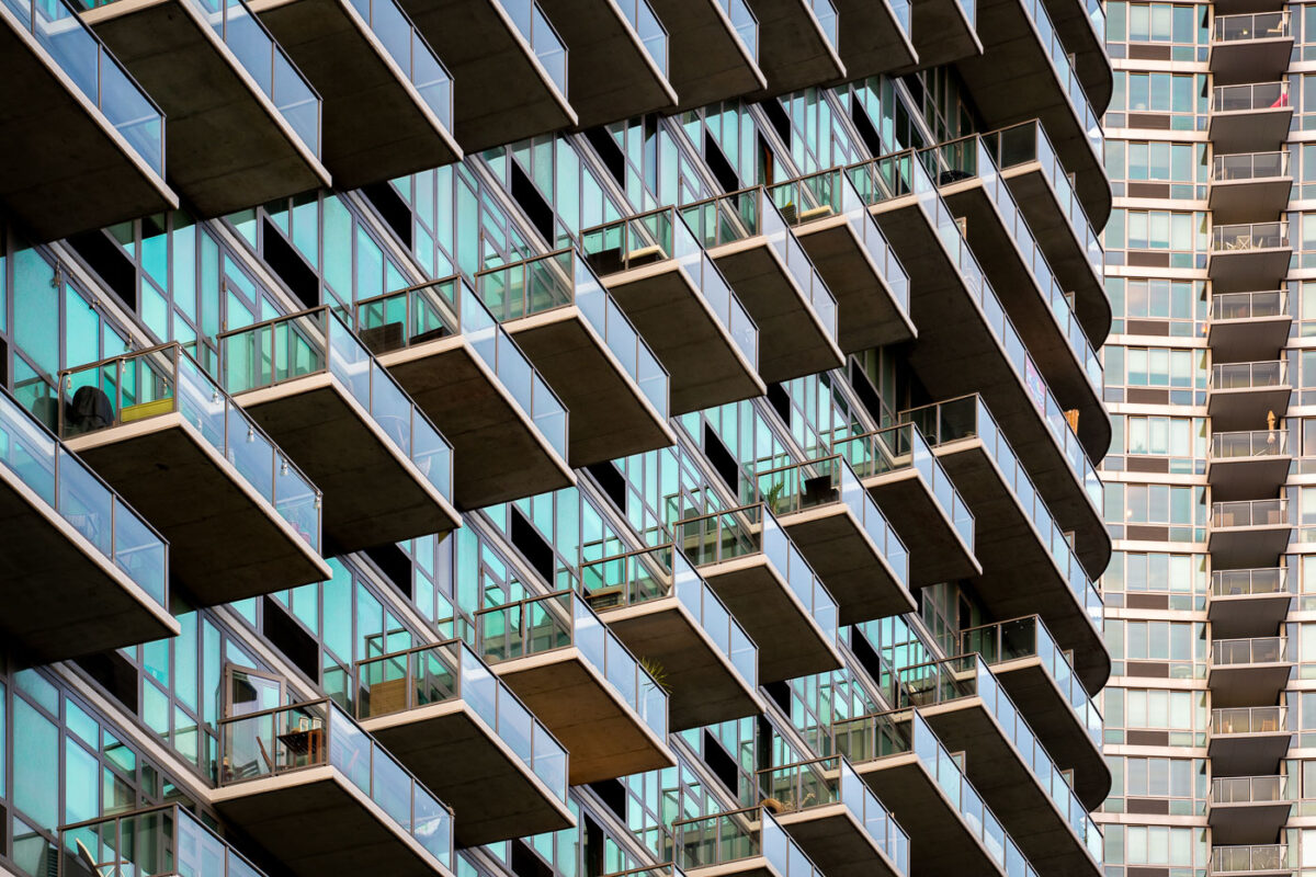
High rises in Long Island City, NY.
Manhattan Skyline from Long Island City
August 2019
—
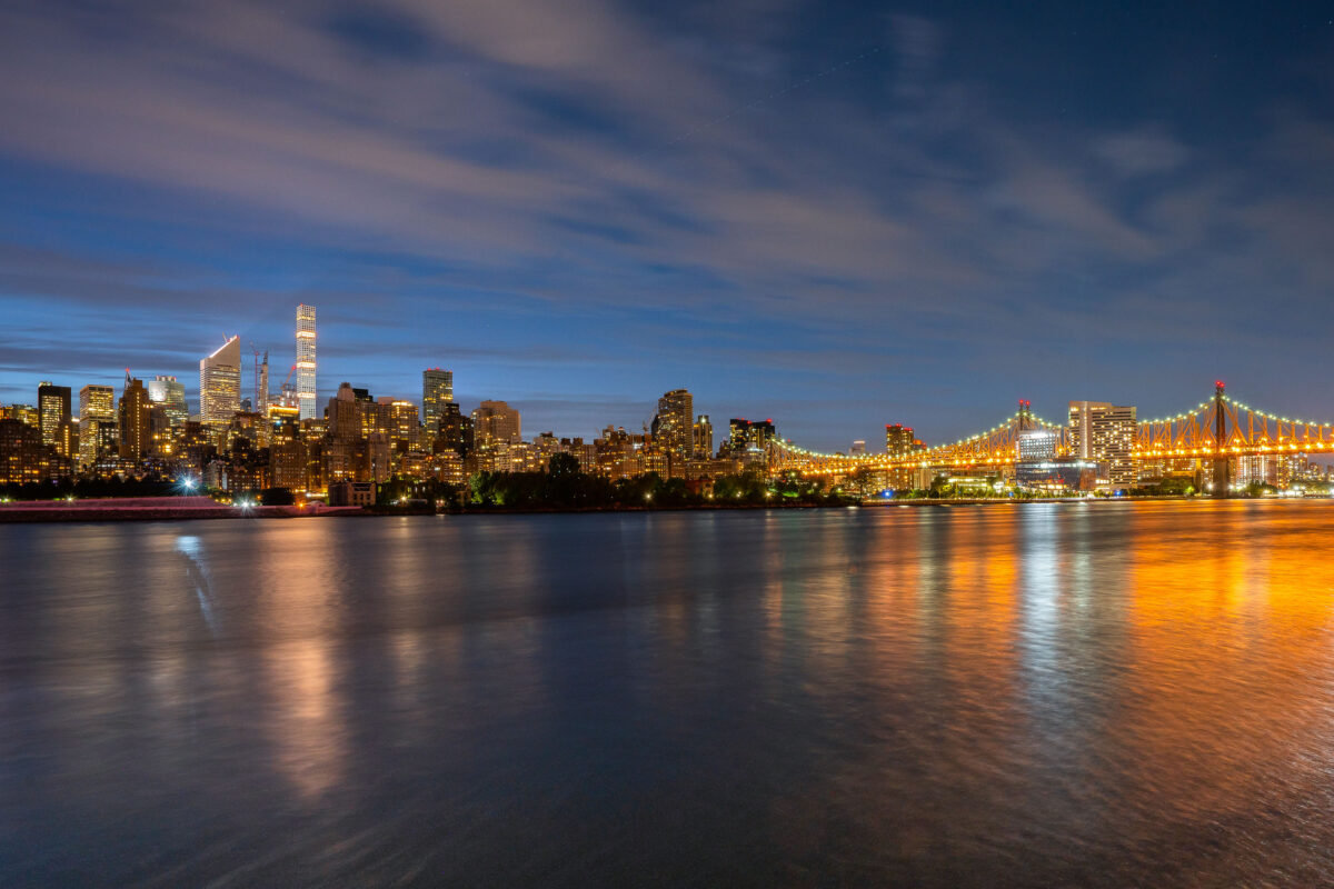
Manhattan as seen from Long Island City
Manhattan Skyline from Long Island City at Dusk
August 2019
—
Manhattan as seen from Long Island City
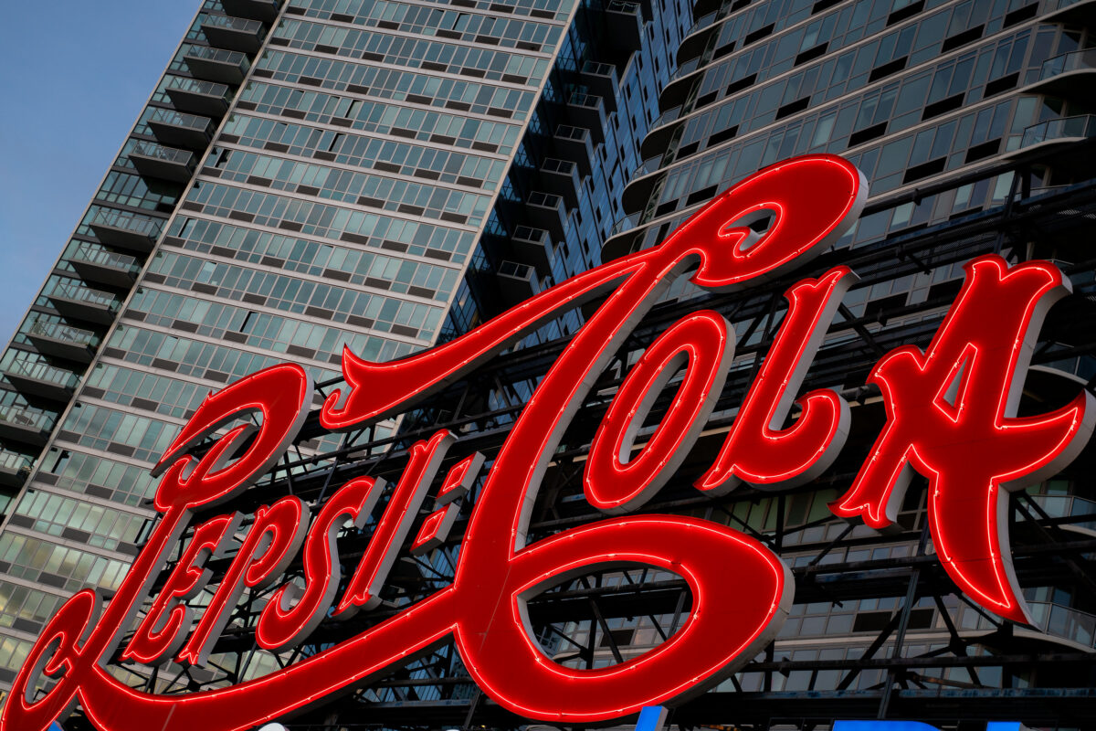
Pepsi-Cola Sign, Long Island City
August 2019
—
The iconic Pepsi-Cola sign glows in red neon along the East River waterfront in Long Island City, Queens. The landmark sign, originally installed in 1936, now stands in front of modern residential towers and remains a prominent feature of the New York City skyline.
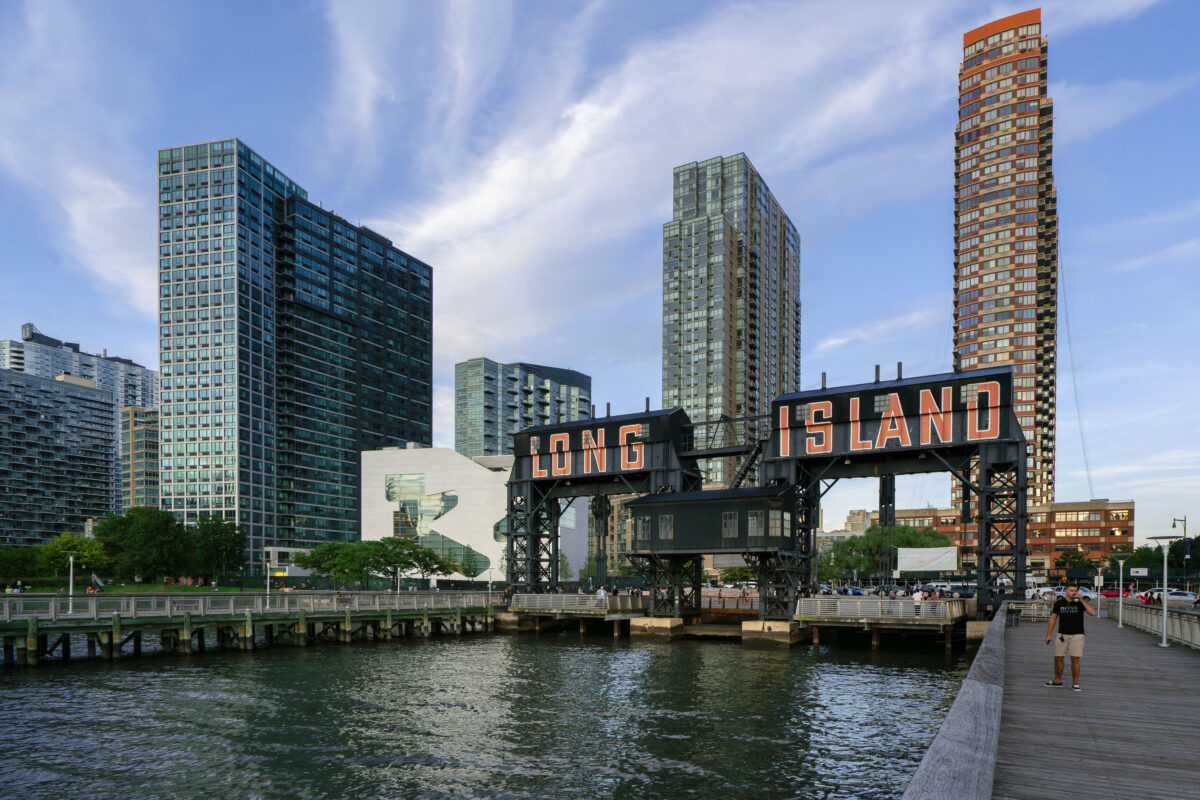
Long Island Sign, East River, Queens
August 2019
—
The iconic Long Island sign towers over the East River waterfront in Queens as evening light reflects off the glassy high-rises of Long Island City. Once a gritty industrial dock, the area has transformed into one of New York City’s fastest-growing neighborhoods.
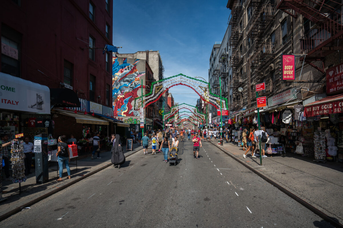
Mulberry Street Little Italy Manhattan
August 2019
—
People walk along Mulberry Street in Manhattan’s Little Italy under rows of simple festive arches. Shops and cafés line the street as vendors sell food and souvenirs to passersby. The scene reflects the neighborhood’s everyday rhythm and long-standing cultural roots.
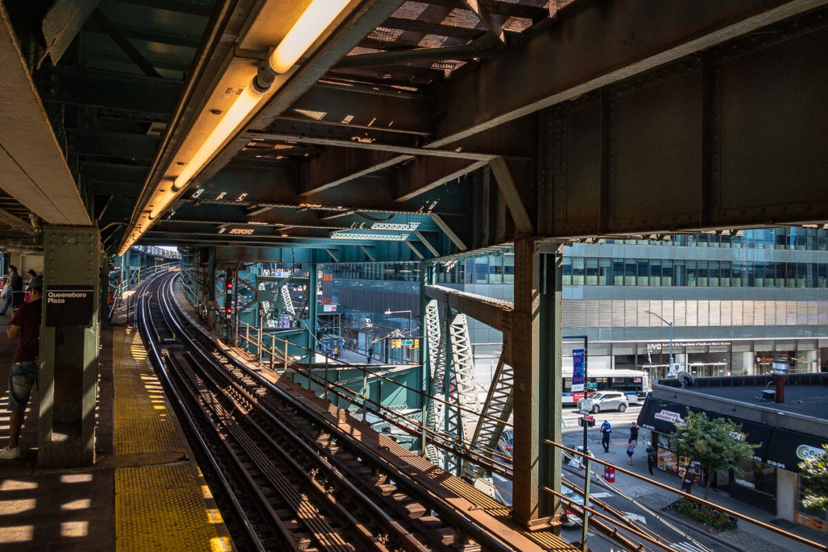
Queensboro Plaza Elevated Train Station, NYC
August 2019
—
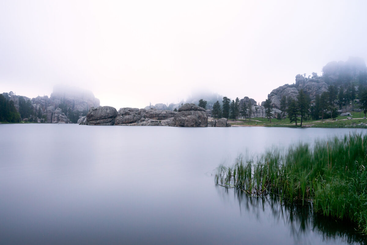
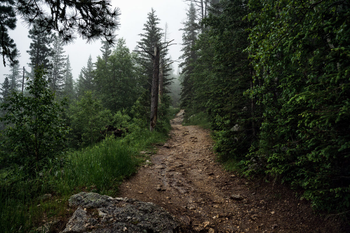
Sylvan Lake Fog, Black Hills, South Dakota
July 2019
—
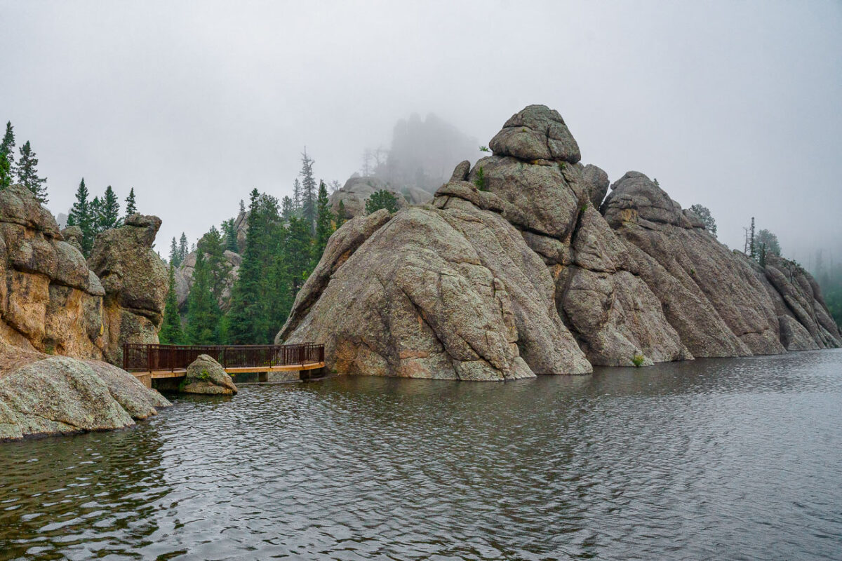
Early morning fog drifts across Sylvan Lake in the Black Hills of South Dakota, softening the granite spires and reflecting still light off the water’s surface. Created in 1891 by Theodore Reder’s dam, the lake sits at the head of the scenic Needles Highway and is surrounded by granite formations that attract climbers, photographers, and hikers. On this mist-covered morning, visibility narrows to the immediate shoreline, turning the familiar outcrops into shadowed silhouettes. The calm water and diffused light capture a rare quiet moment in one of Custer State Park’s most iconic and photographed landscapes.
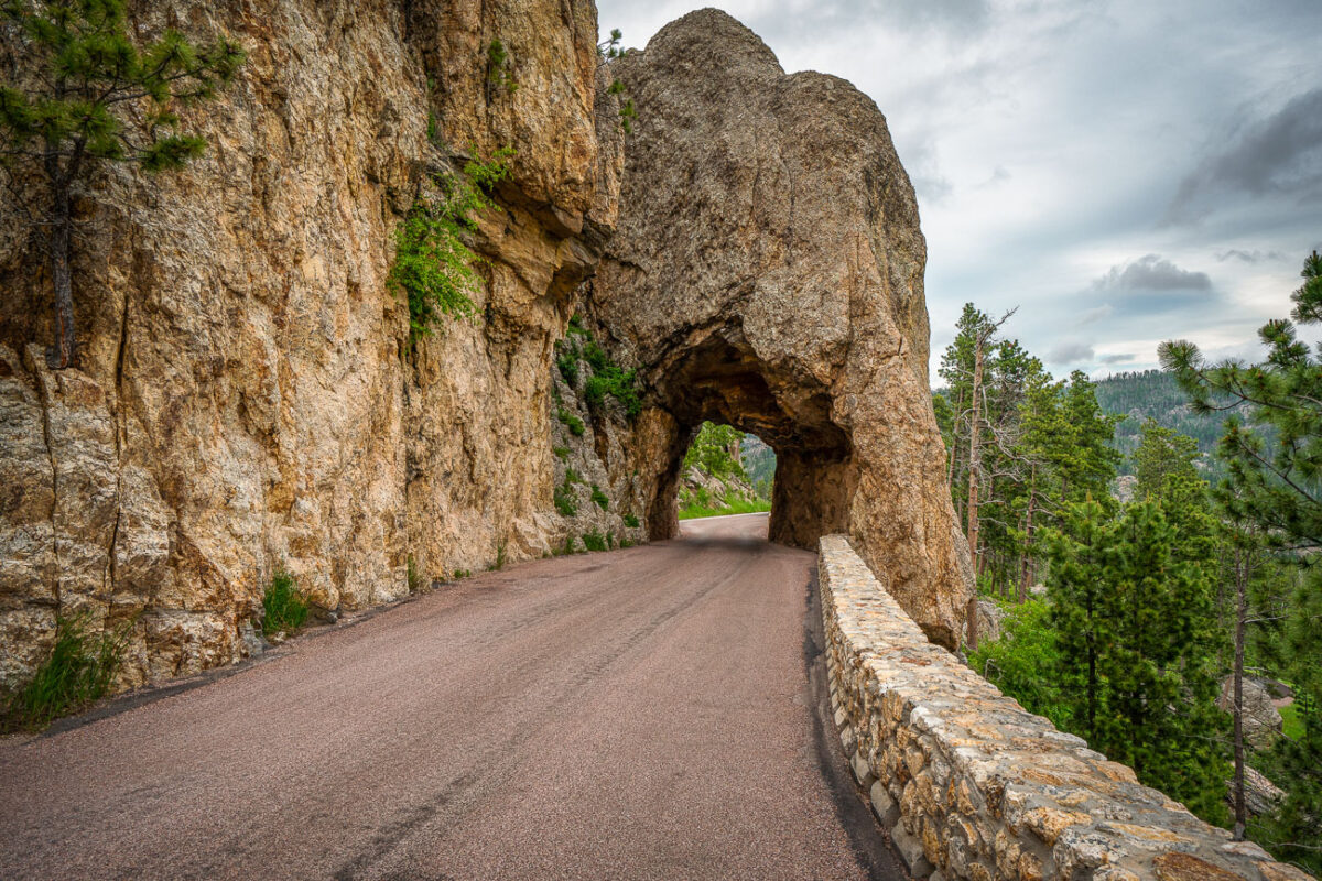
Needles Eye Tunnel, Custer State Park, South Dakota
July 2019
—
Carved directly through a narrow granite spire in the Black Hills, the Needles Eye Tunnel stands as one of South Dakota’s most distinctive engineering feats. Completed in 1922 as part of the Needles Highway (SD 87), the one-lane tunnel measures just 8 feet 4 inches wide and 11 feet 3 inches high, requiring careful navigation by passing vehicles. Its name comes from the adjacent rock formation, where centuries of wind and water erosion sculpted a sharp, needle-like opening. Surrounded by dense ponderosa pine forest and sheer stone walls, this section of the highway offers one of the most dramatic mountain drives in the American Midwest, linking the spire formations of Custer State Park with the scenic byways leading toward Sylvan Lake and Mount Rushmore.
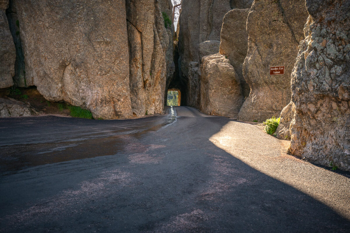
Needles Eye Tunnel, Needles Highway, Custer State Park, South Dakota
July 2019
—
The Needles of the Black Hills of South Dakota are a region of eroded granite pillars, towers, and spires within Custer State Park. Popular with rock climbers and tourists alike, the Needles are accessed from the Needles Highway, which is a part of Sylvan Lake Road (SD 87/89). The Cathedral Spires and Limber Pine Natural Area, a 637-acre portion of the Needles containing six ridges of pillars as well as a disjunct stand of limber pine, was designated a National Natural Landmark in 1976. -- Wikipedia
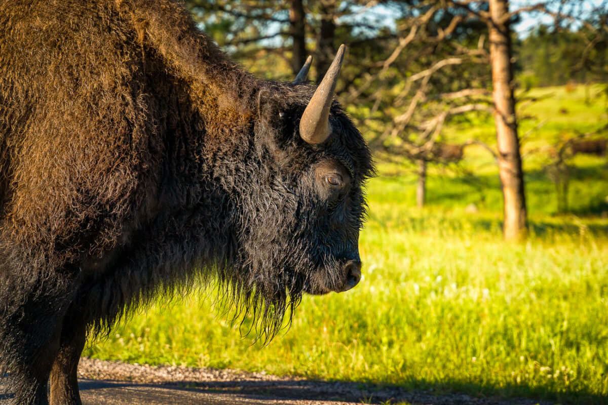
Bison on Wildlife Loop Road, Custer State Park
July 2019
—
An American bison stands along the Wildlife Loop Road in Custer State Park, South Dakota, illuminated by the first light of morning. The park’s herd, one of the largest managed populations in the country, roams freely across a landscape that mirrors the open grasslands once dominated by millions of these animals before the 19th-century decline. Bison are a keystone species of the Great Plains ecosystem, their grazing patterns shaping the prairie’s biodiversity. At Custer, annual roundups and controlled management preserve both the health of the land and the continuation of a lineage deeply tied to Native history and American conservation.
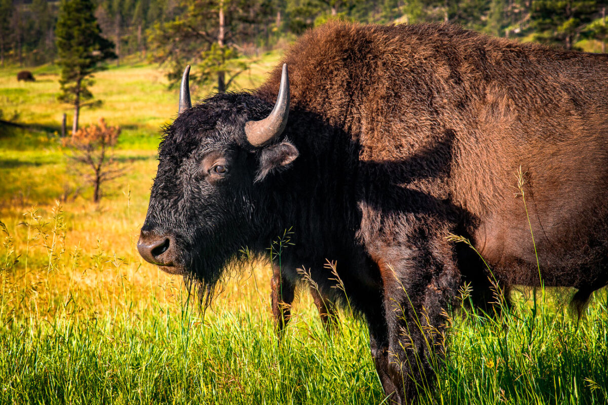
American Bison in Custer State Park, South Dakota
July 2019
—
A mature American bison grazes in the rolling prairie of Custer State Park in South Dakota, part of one of the largest publicly owned herds in the United States. Once on the brink of extinction, the park’s bison herd—established in 1914—now numbers more than a thousand animals, representing a critical effort in the preservation of the species. These massive mammals, capable of weighing over a ton, roam freely across the park’s 71,000 acres of mixed-grass prairie and ponderosa pine forest. The setting reflects both the ecological restoration of the Great Plains and the enduring legacy of America’s native megafauna, which has been tied to the land for millennia.
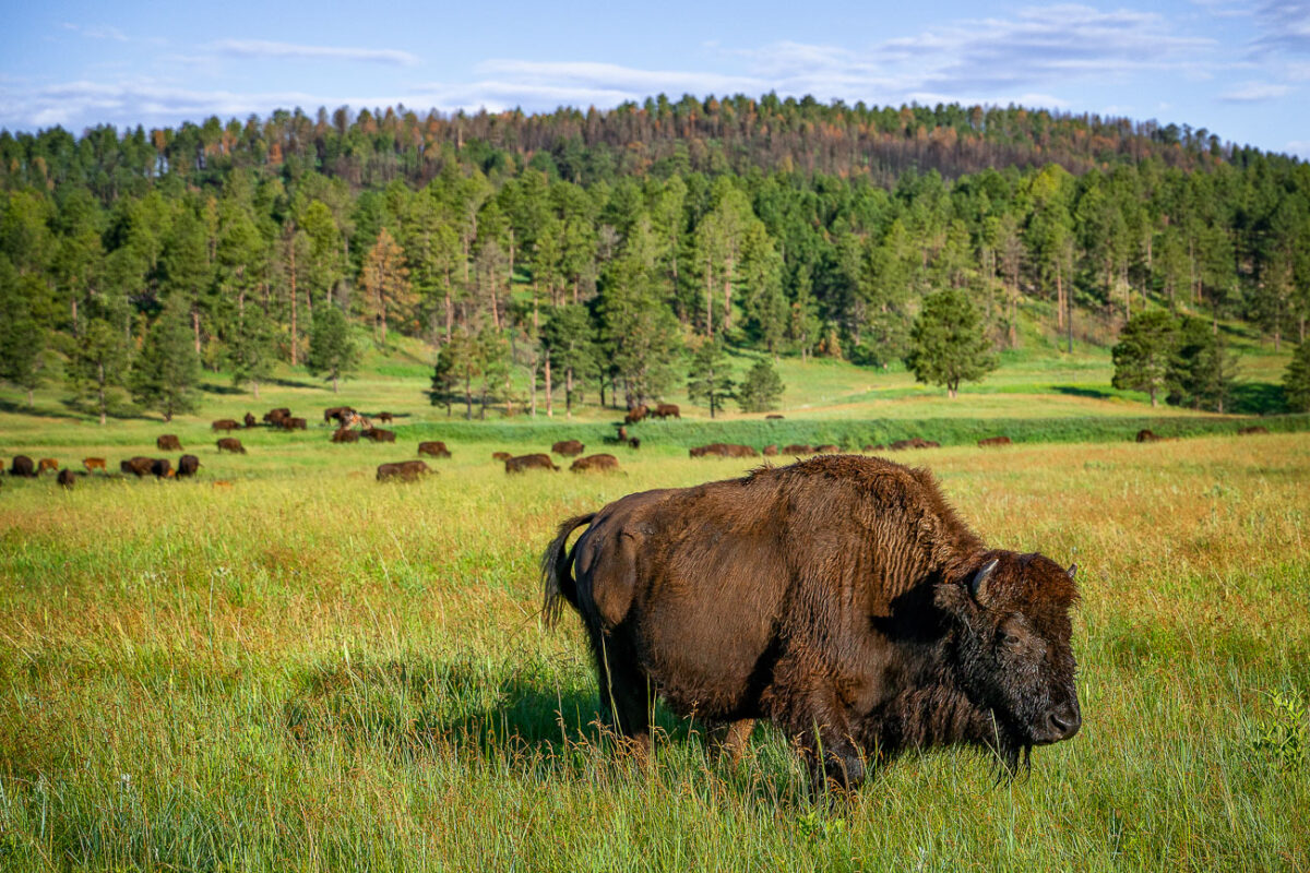
Bison Herd in Custer State Park, South Dakota
July 2019
—
Bison in Custer State Park in Custer, South Dakota.
Sylvan Lake, Custer State Park, South Dakota
July 2019
—
Sylvan Lake is a lake located in Custer State Park, in the Black Hills of South Dakota, United States. It was created in 1881 when Theodore Reder built a dam (the Sylvan Lake Water Dam) across Sunday Gulch Creek. The lake area offers picnic places, rock climbing, small rental boats, swimming, and hiking trails. It is also popular as a starting point for excursions to Black Elk Peak and The Needles. -- Wikipedia
Granite Outcrops Along Highway 87, Black Hills National Forest
July 2019
—
Along Highway 87 in the central Black Hills National Forest, this view captures the rugged landscape typical of the region’s granite highlands. Massive weathered outcrops rise sharply from the forest floor, remnants of the ancient Harney Peak granite formation that underlies much of this terrain. Scattered ponderosa pines cling to crevices in the rock, while fallen trunks and new saplings trace the slow recovery of the forest from past fires. The setting lies near the scenic Needles Highway corridor—an area known for its narrow tunnels, steep grades, and ever-changing mountain light that defines the wilderness character of western South Dakota.
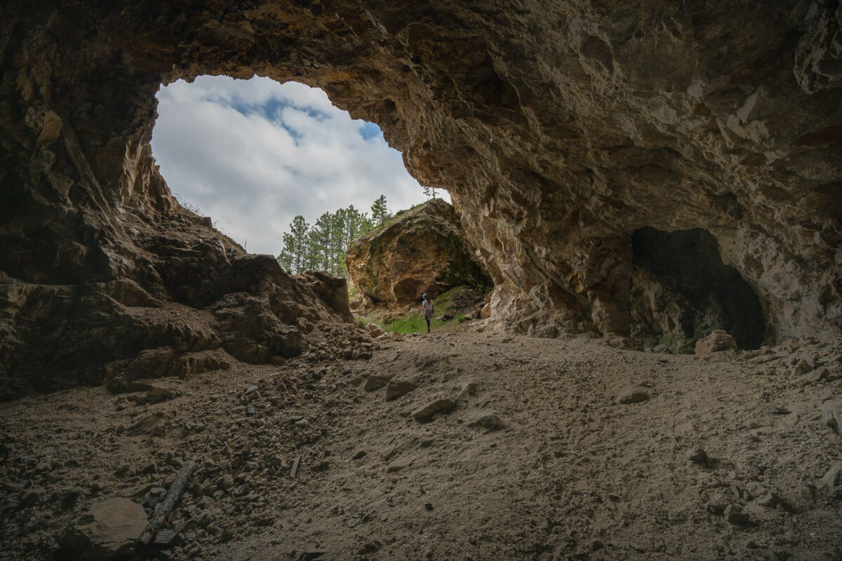
Abandoned Mine Entrance, Black Hills, South Dakota
July 2019
—
An abandoned mine in South Dakota near the Black Hills.
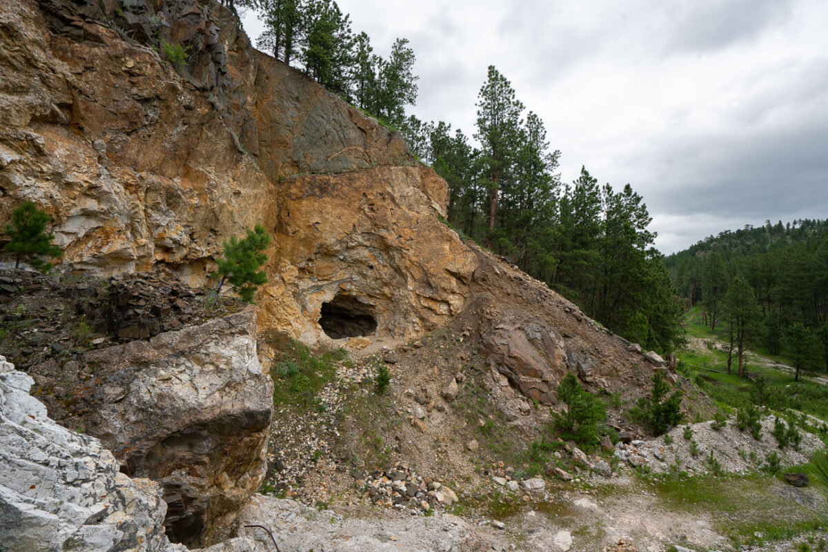
Abandoned Gold Rush Mine Entrance, Black Hills, SD
July 2019
—
Carved into a rugged slope of weathered schist and limestone, this small mine entrance sits near the historic mining corridors west of Custer, South Dakota — a remnant of the Black Hills’ 19th-century gold rush. The opening, likely hand-dug or expanded with early blasting techniques, leads into mineral-rich rock layers once prospected for gold, silver, and iron sulfides that fueled the regional boom of the 1870s. Surrounding the portal are piles of tailings and fractured quartz veins that reveal the area’s geologic complexity — part of an ancient mountain uplift more than 1.8 billion years old. Today, the forest has begun to reclaim the site, with pines and brush growing over the spoil heaps, blending traces of human industry back into the Black Hills landscape.
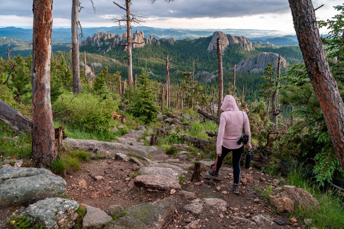
Black Elk Peak Trail Descent at Dusk, Black Hills, South Dakota
July 2019
—
A hiker descends the rugged granite path from Black Elk Peak, the highest summit in South Dakota, as the evening light softens over the Cathedral Spires. The trail—part of the Norbeck Wildlife Preserve within Custer State Park—winds through a landscape shaped by ancient uplift and erosion, where ponderosa pines cling to stone outcrops and fire-scarred trunks bear witness to the region’s cycles of renewal. From this vantage point, the Black Hills stretch endlessly toward the horizon, a place sacred to the Lakota people and enduringly wild in its beauty.
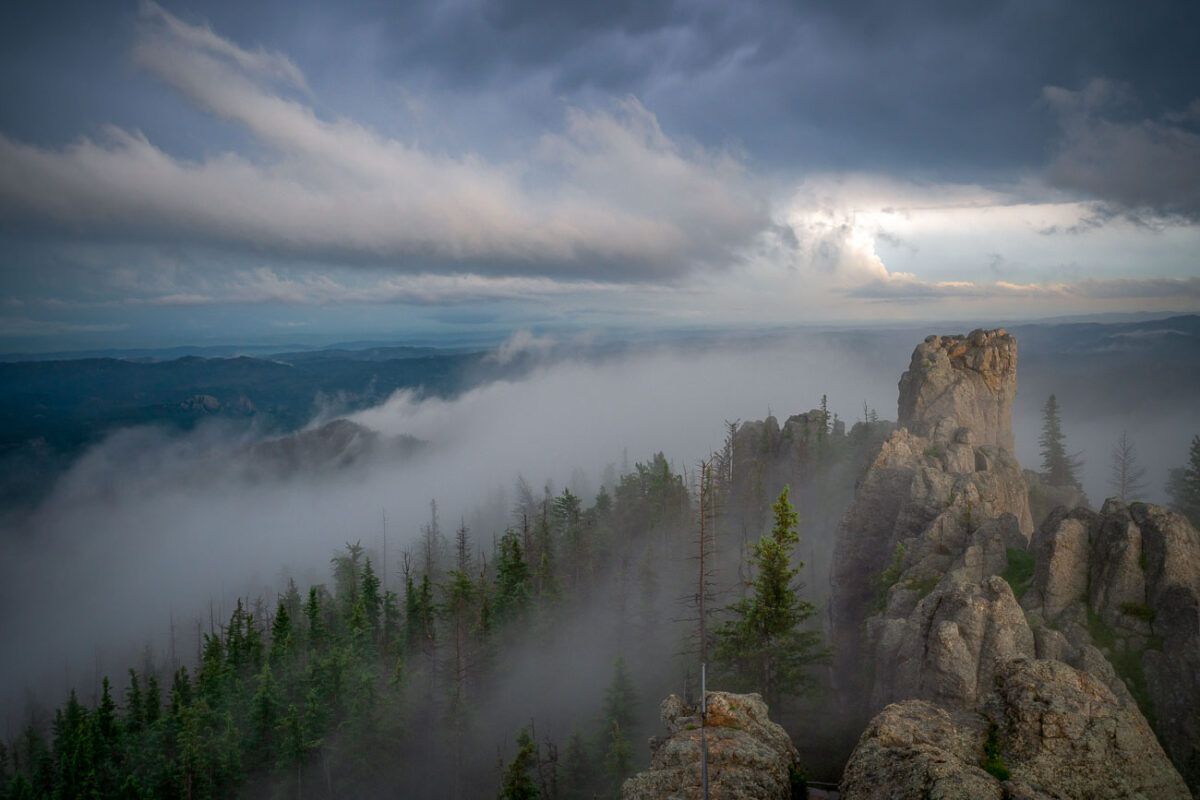
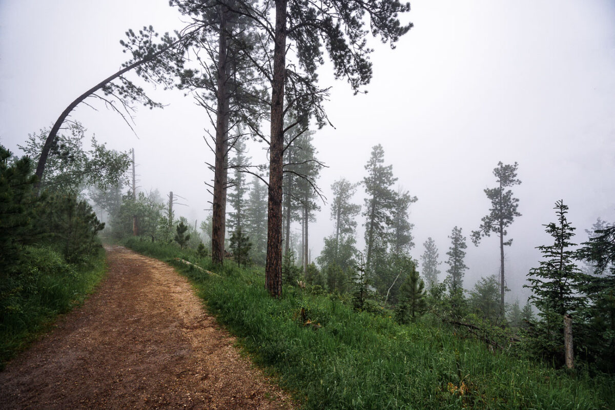
Cathedral Spires, Black Hills, South Dakota, Morning Fog
July 2019
—
Low clouds sweep across the granite pinnacles of the Cathedral Spires in the Black Hills of South Dakota, wrapping the rugged landscape in drifting fog just after dawn. These towering formations—some rising more than 5,000 feet above sea level—are part of the Needles range within Custer State Park, a region shaped by millions of years of erosion and uplift. The rock spires, composed primarily of Harney Peak granite, are a hallmark of the park’s dramatic geology and a favorite destination for climbers and photographers. On mornings like this, the fog often settles in the valleys below, creating a fleeting illusion of islands floating above the forest, while the peaks catch the first light breaking through the storm-heavy sky.
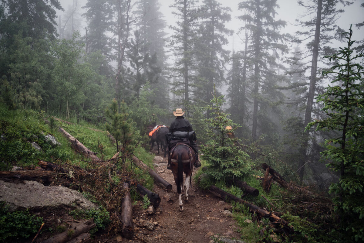
Horseback riders on Black Elk Peak trail, South Dakota
July 2019
—
Horseback riders navigate a mist-covered trail near the summit of Black Elk Peak in South Dakota’s Black Hills. The fog clings to the ponderosa pines, softening the rugged landscape that rises above Custer State Park. This peak—renamed in 2016 to honor Lakota spiritual leader Black Elk—has long served as both a place of pilgrimage and a vantage point over the vast granite formations and pine forests of the region.
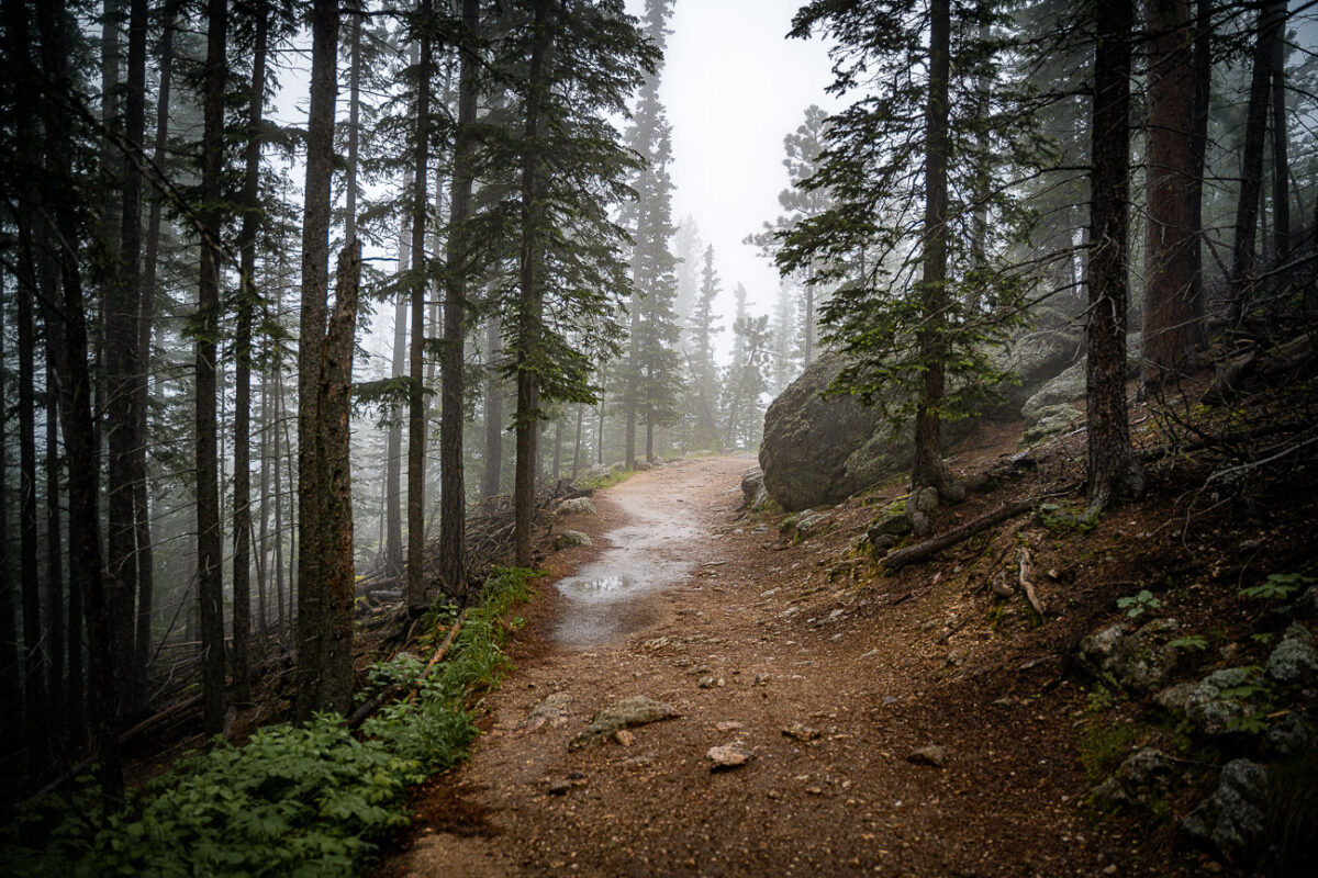
Black Elk Peak Trail in Fog, South Dakota
July 2019
—
A narrow trail winds through the fog-drenched forest of Black Elk Peak, South Dakota, as light rain dampens the granite path and pine needles. The area—part of the rugged Black Hills—sits at over 7,200 feet, the highest elevation east of the Rockies. The mist settles among ponderosa pines and spruce, creating a hushed, atmospheric climb through terrain sacred to the Lakota people and known for its sweeping, often cloud-hidden views.
Black Elk Peak Summit in Fog, Black Hills, South Dakota
July 2019
—
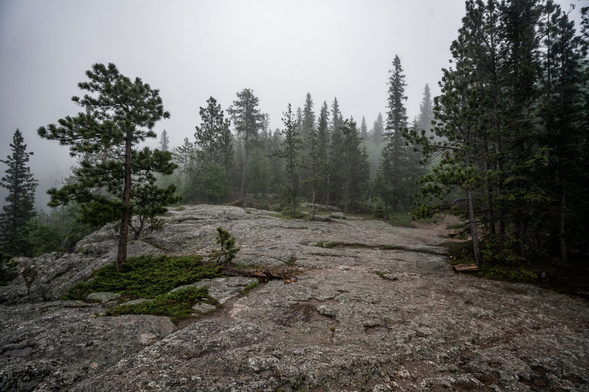
A dense fog envelops the granite summit area of Black Elk Peak, the highest natural point in South Dakota at 7,242 feet. The rocky terrain and scattered pines of the Black Hills fade into the mist, creating an ethereal atmosphere above Custer State Park. Once known as Harney Peak, the mountain holds deep spiritual significance for the Lakota Sioux and remains a striking natural landmark where weather and history intertwine in quiet solitude.
Black Elk Peak Trail in Fog, Black Hills, South Dakota
July 2019
—
A fog-covered hiking trail winds through the dense pines and granite slopes of Black Elk Peak in South Dakota’s Black Hills. The path, slick with rain and scattered with stones, climbs steadily toward the summit through ponderosa pine, birch, and spruce. This mountain—sacred to the Lakota and once called Harney Peak—rises to 7,244 feet, making it the highest natural point between the Rockies and the Pyrenees. In the early morning fog, the quiet forest and damp earth lend the trail a timeless stillness, recalling centuries of spiritual and geological history beneath the mist.
Black Elk Peak Trail in Fog, Black Hills, South Dakota
July 2019
—
A mist-laden trail winds through the ponderosa pine forest near the summit of Black Elk Peak in the Black Hills of South Dakota. The fog softens the rugged terrain, reducing the visibility of distant ridges and creating a quiet, atmospheric stillness in the morning air. This area, once known as Harney Peak, stands as the highest point east of the Rocky Mountains and is a sacred place to the Lakota Sioux, where natural beauty and cultural heritage converge in the clouds.
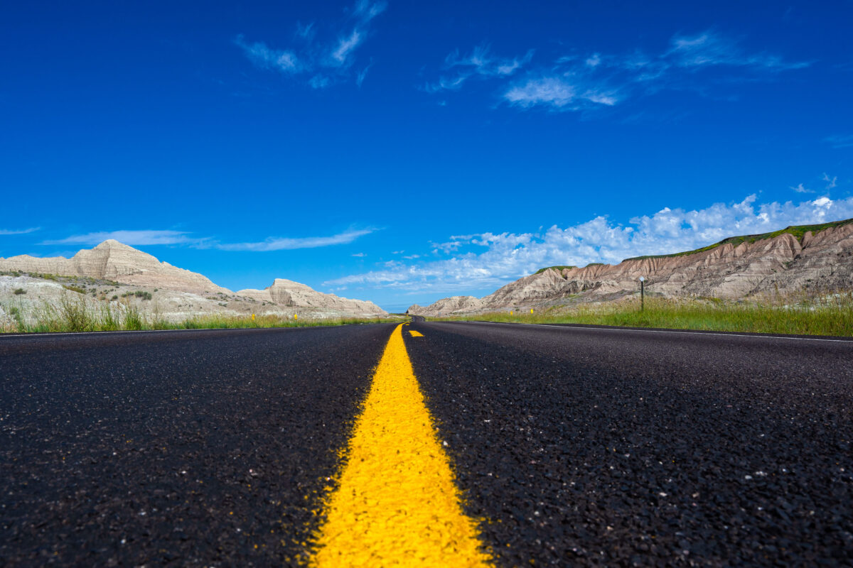
Highway 44 Through Badlands National Park, South Dakota
July 2019
—
A newly paved stretch of Highway 44 cuts through the rugged formations near Scenic, South Dakota, beneath a vivid summer sky. This east–west route skirts the southern boundary of Badlands National Park, where blacktop meets eroded buttes carved by millennia of wind and water. The low-angle view emphasizes the contrast between the engineered precision of the highway and the raw geologic textures of the surrounding landscape—an enduring symbol of travel through one of the Great Plains’ most striking natural corridors.
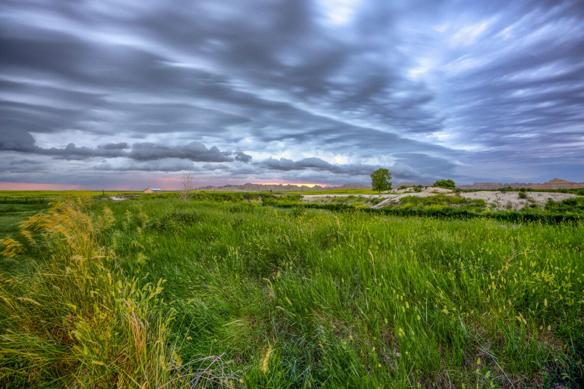
Badlands National Park, South Dakota: Storm Clouds Over Grasslands
July 2019
—
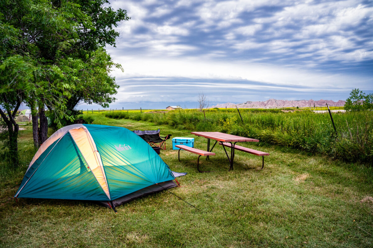
Amazing storm clouds rolling into Interior, South Dakota at our camp site near the Badlands National Park. It seems every year we get at least one really great thunderstorm when camping.
Tent camping at Badlands Hotel & Campground, Interior South Dakota
July 2019
—
Indian Creek Drive, Badlands National Park, South Dakota
July 2019
—
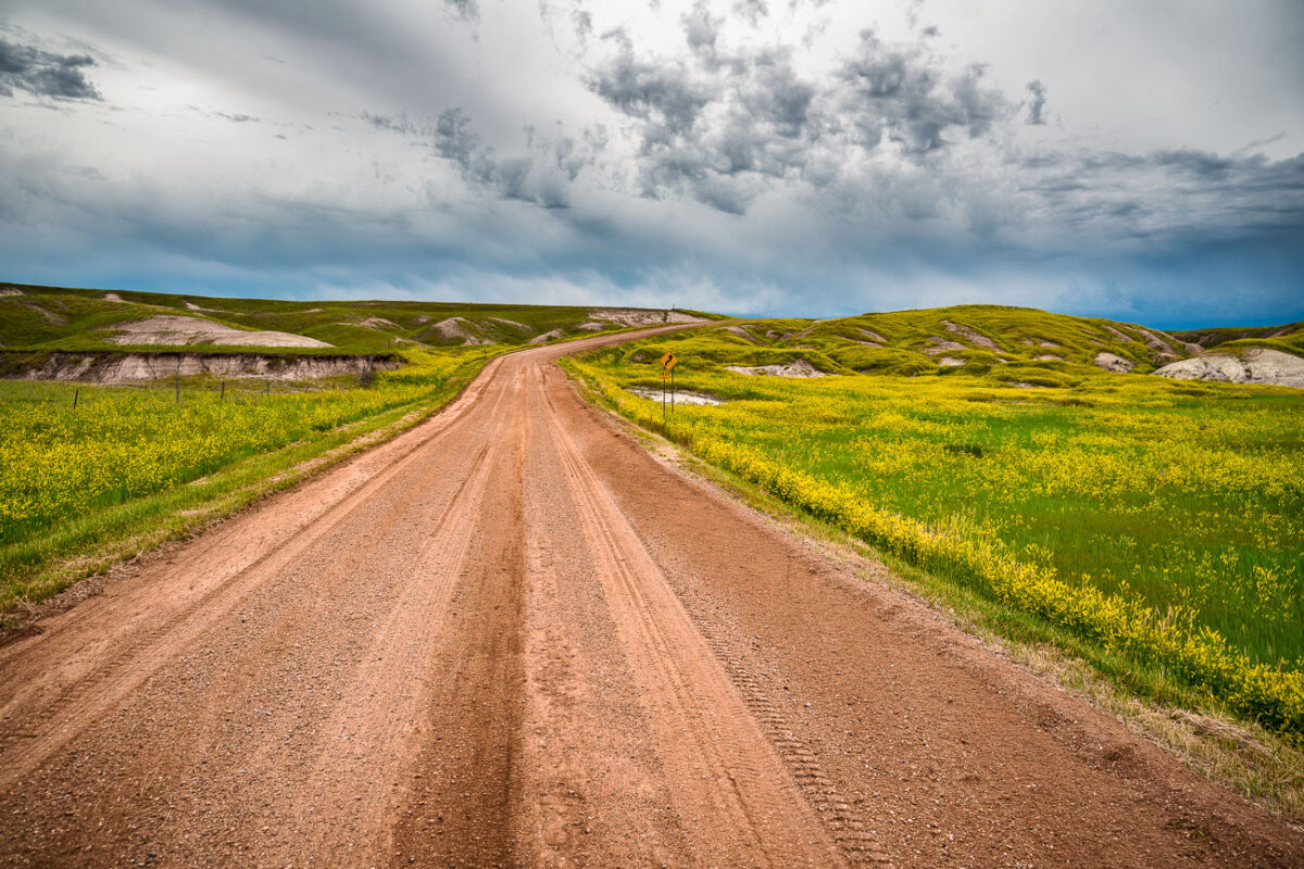
A dirt road cuts through the rolling prairie of Indian Creek Drive in the western reaches of Badlands National Park, near the small town of Scenic, South Dakota. Storm clouds build over the mixed-grass plains, casting dramatic light on the green hills and wildflower fields typical of the park’s early summer landscape. This remote section of the Badlands, less traveled than the main loop road, reveals the quieter beauty of the park—where erosion-carved ridges and open grasslands merge under a vast and changeable sky.
Badlands National Park: Storm Approaching Shed
July 2019
—
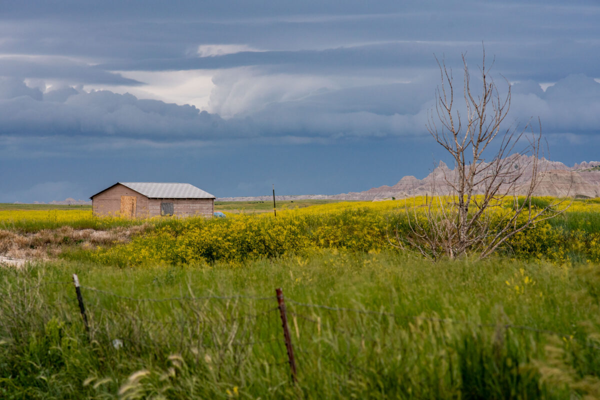
A lone wooden shed stands among fields of wild grasses and yellow blooms as storm clouds gather near Interior, South Dakota, on the outskirts of Badlands National Park. The layered sky hints at an incoming summer storm sweeping across the plains, with the rugged formations of the Badlands visible on the horizon. The muted colors and boarded windows evoke both isolation and endurance, capturing the tension between human settlement and the vast, unpredictable prairie environment.
Storm Clouds Over Badlands National Park, South Dakota
July 2019
—
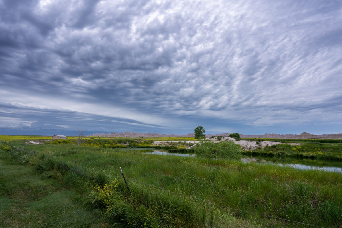
An approaching storm looms over the rolling grasslands near Interior, South Dakota, at the edge of Badlands National Park. The layered clouds form dramatic bands above the wetland and open prairie, where a small structure and fence line mark the human presence in this otherwise vast and untamed landscape. From this vantage point near the White River, the eroded formations of the Badlands rise faintly in the distance, emphasizing the contrast between the lush foreground and the arid, sculpted terrain beyond.
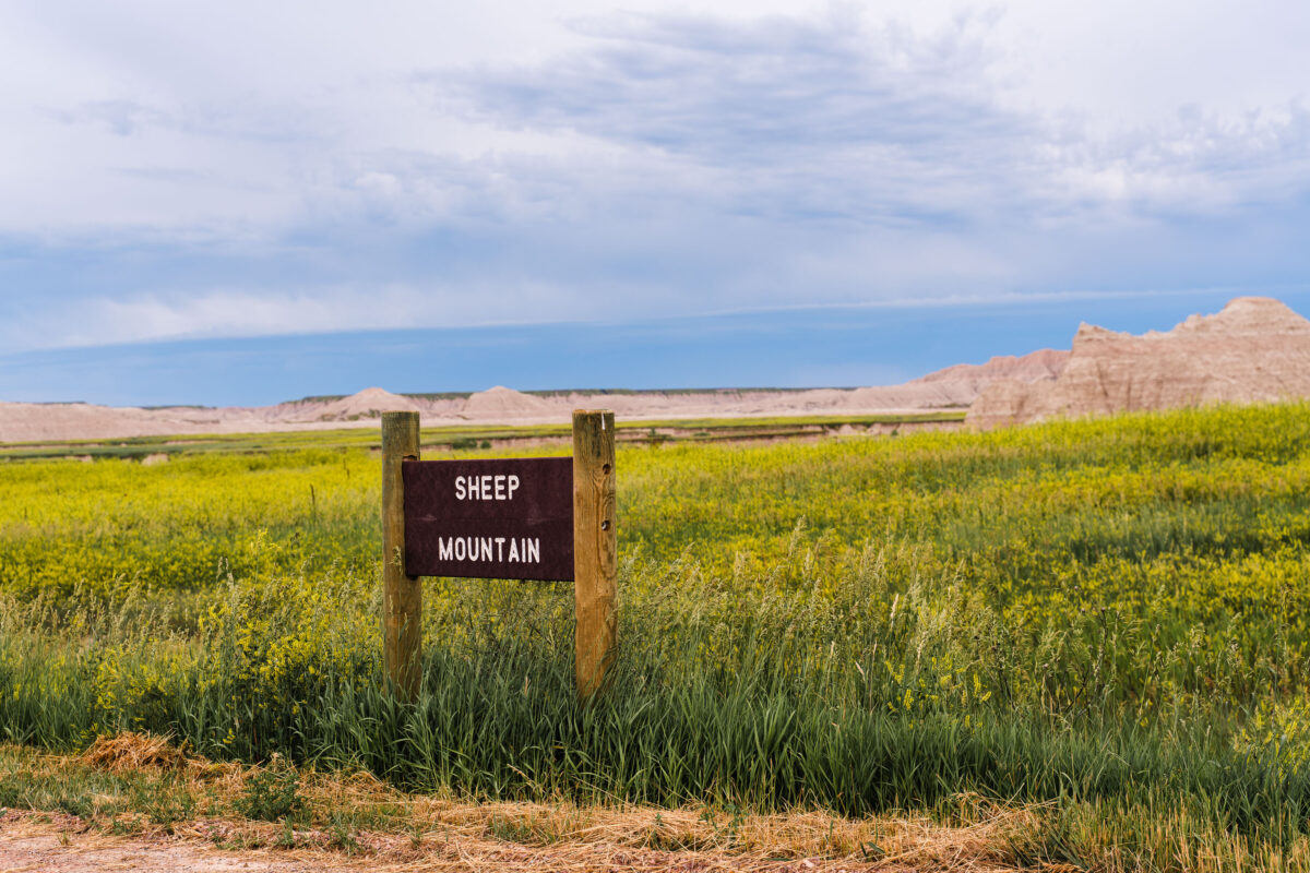
Sheep Mountain Sign, Badlands National Park, South Dakota
July 2019
—
Sheep Mountain in South Dakota near the Badlands National Park.
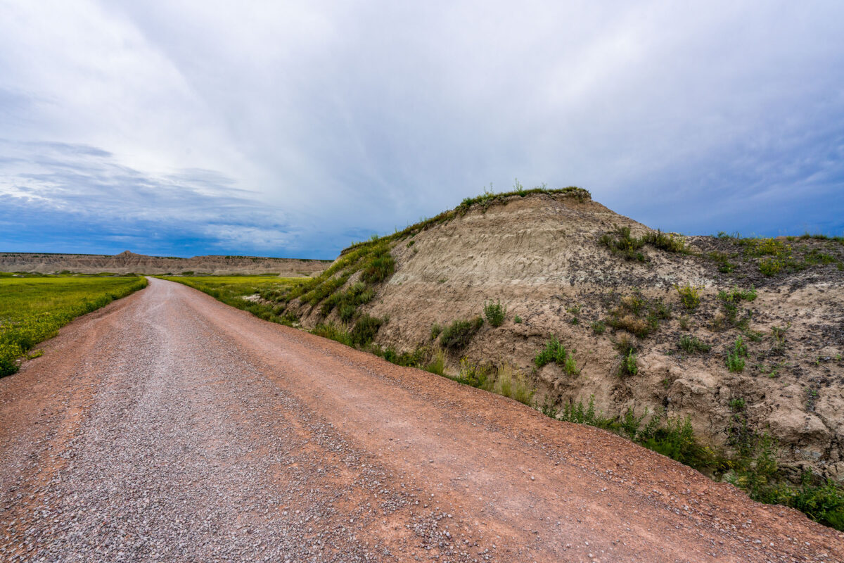
Sheep Mountain Road, Badlands National Park, South Dakota
July 2019
—
A weathered wooden sign marks the rugged entrance to Sheep Mountain in the southern reaches of Badlands National Park, South Dakota. This remote area, surrounded by the sweeping prairies of Buffalo Gap National Grassland, offers one of the park’s most dramatic and less-visited overlooks. The region sits within Oglala Lakota lands, where erosion has sculpted colorful buttes and steep ridges over millions of years. Accessible by an unpaved road, Sheep Mountain remains a quiet, untamed corner of the Badlands, revealing the deep geologic and cultural layers of the Northern Plains.
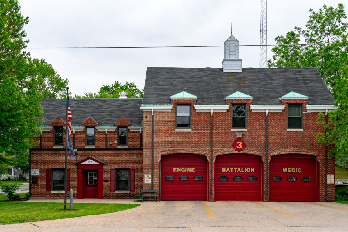
Green Bay Fire Station No. 3, Shawano Ave, Wisconsin
June 2019
—
Green Bay Fire Station No. 3, located in Green Bay, Wisconsin, represents a classic mid-20th-century firehouse design with its red brick façade, steep rooflines, and distinctive arched bay doors. Serving the west side of the city, this station houses an engine company, battalion chief, and medic unit, providing rapid response coverage to nearby residential and commercial areas. The building’s architecture reflects an era when civic structures balanced functionality with traditional craftsmanship, embodying a sense of permanence and community trust.
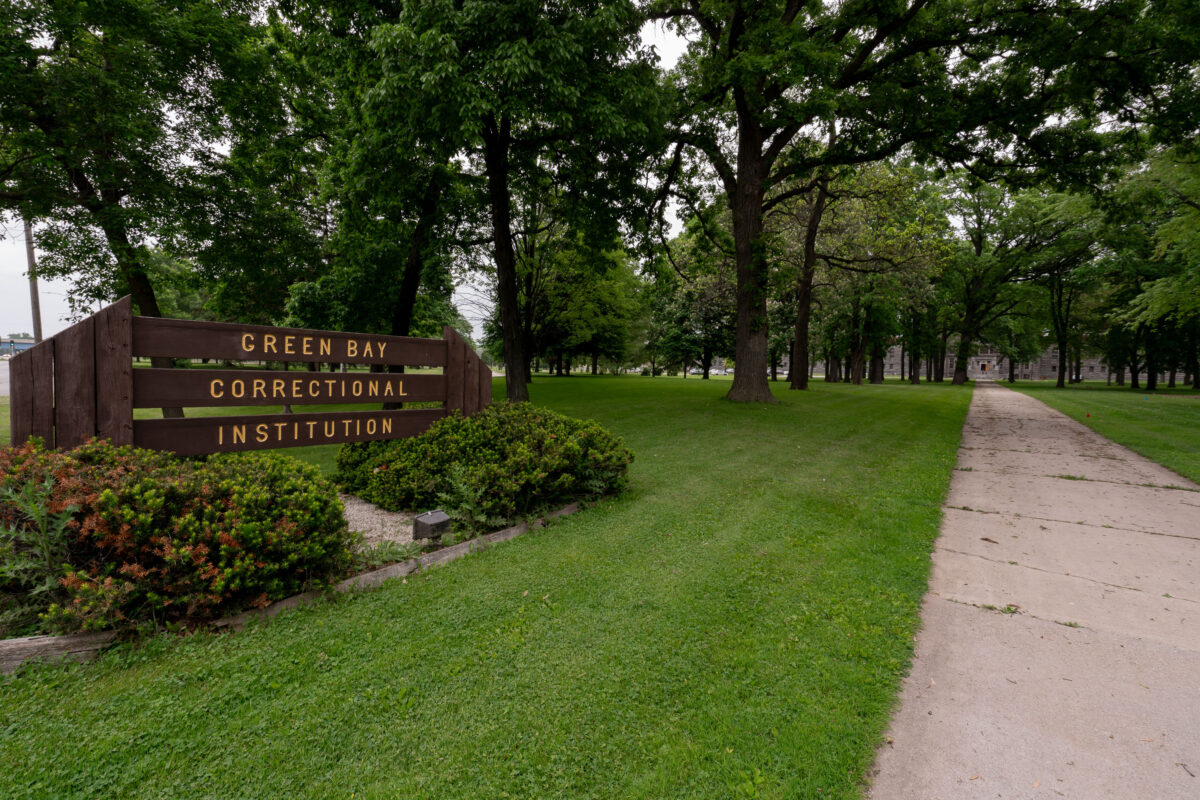
Green Bay Correctional Institution Entrance, Allouez, Wisconsin
June 2019
—
The entrance to Green Bay Correctional Institution in Allouez, Wisconsin, shows the tree-lined approach to one of the state’s oldest operating prisons. Opened in 1898 as the Wisconsin State Reformatory, the facility was designed during an era emphasizing reform and rehabilitation, reflected in its spacious campus and classical stone buildings visible in the distance. Today, the institution remains part of the Wisconsin Department of Corrections system, standing as a significant piece of the state’s correctional history and architectural heritage.
Wisconsin State Reformatory Main Entrance, Green Bay
June 2019
—
Built in 1898, the Wisconsin State Reformatory in Green Bay is a monumental example of early 20th-century correctional architecture, designed to project authority through its Romanesque Revival stonework and fortress-like symmetry. The façade, constructed from locally quarried gray limestone, features narrow arched windows, heavy masonry, and a commanding central pediment above the main entryway. Originally intended as a progressive institution focused on rehabilitation rather than punishment, the reformatory combined rigid design with reform-era ideals. The weathered sign above the entrance—still reading “Wisconsin State Reformatory”—marks one of the few remaining intact examples of this architectural period in the state’s penal history.
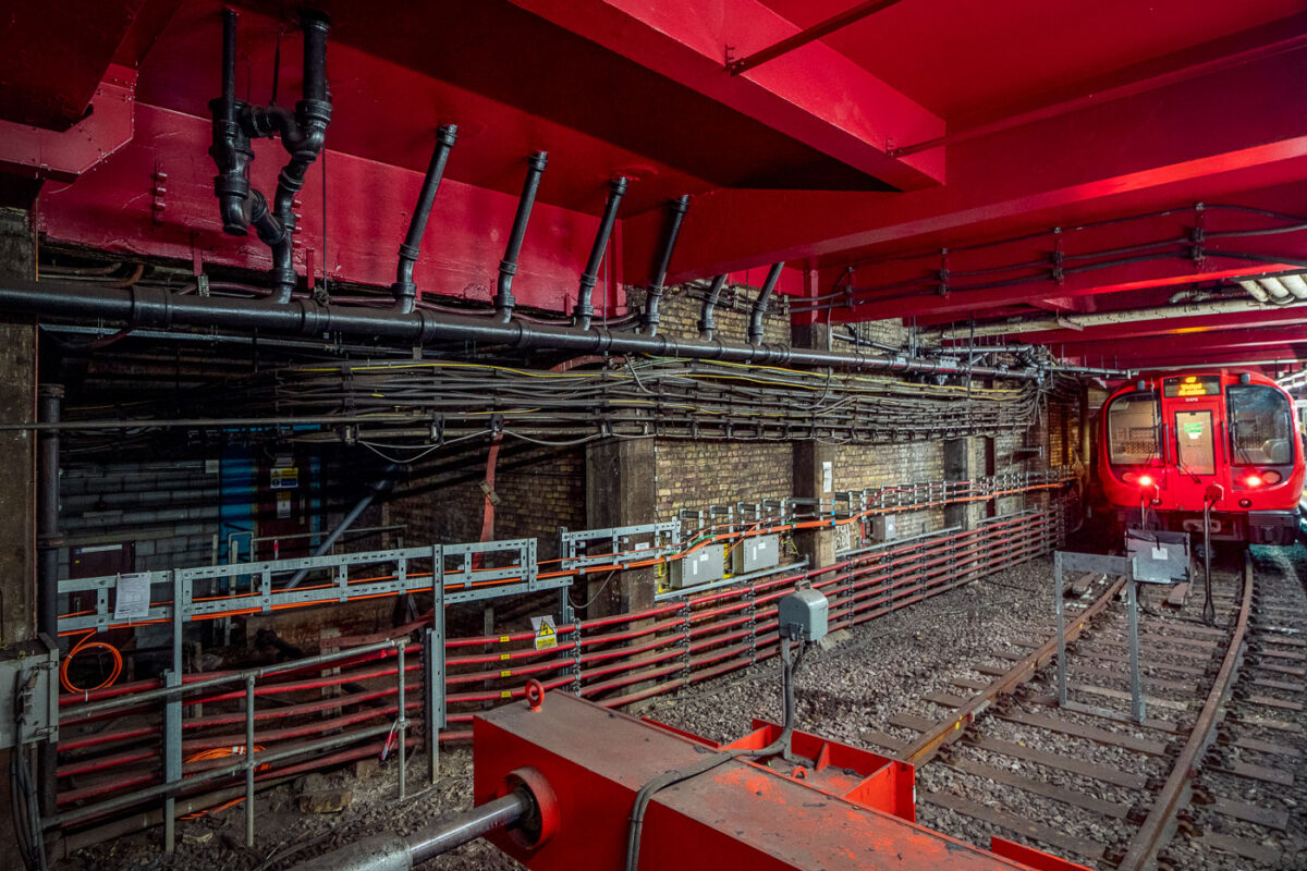
Baker Street Station: Victorian Tunnels and Modern Infrastructure
May 2019
—
Deep beneath central London, Baker Street’s Metropolitan Line platforms reveal the layered engineering of one of the oldest functioning railway systems in the world. The exposed brick tunnel and steel framing date back to the Victorian “cut-and-cover” era of the 1860s, when steam locomotives first ran through these very corridors. The heavy red girders seen above were reinforced during modern refurbishments, supporting the city streets above while housing utilities and cable conduits that power today’s Underground network.
The train at the far end belongs to the S8 Stock series, introduced in 2010 by Bombardier for the Metropolitan Line, equipped with air conditioning and regenerative braking. The dense web of cables and control boxes along the wall carries signal, communication, and traction power circuits, all vital to the line’s safe operation. Baker Street’s infrastructure embodies London Transport’s continual evolution—from soot-covered tunnels to precision-controlled, electrically powered systems still running along the same 19th-century alignments.
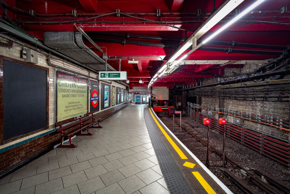
Baker Street Station: Metropolitan Line Victorian Platforms
May 2019
—
Baker Street Station’s Metropolitan Line platforms represent one of the oldest sections of the London Underground, opened in 1863 as part of the world’s first subterranean railway. The terminus platforms, seen here, retain their cut-and-cover Victorian brickwork paired with modern safety updates and striking red-painted steel reinforcements added during later refurbishments.
The station originally served the Metropolitan Railway’s steam-hauled trains running between Paddington and Farringdon before electrification in the early 20th century transformed the network. Period signage advertising “Chiltern Court” and the original Metropolitan Railway branding pay homage to its heritage, contrasting with the exposed wiring, signal lights, and tiling that reveal more than 160 years of evolving underground infrastructure. Today, Baker Street remains a key interchange, connecting five Underground lines while preserving much of the industrial atmosphere that defined London’s pioneering approach to mass transit.
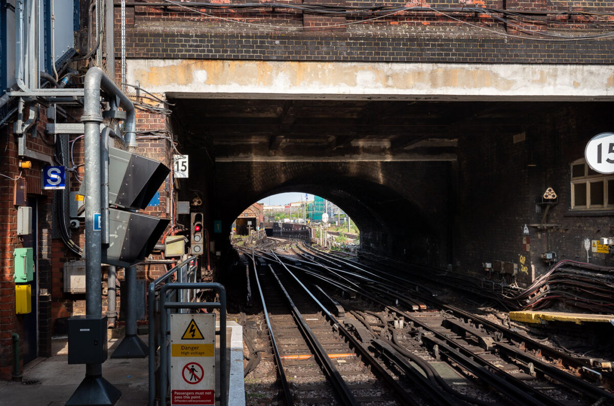
Queen’s Park Station: Bakerloo Line Junction and Network Rail Tracks
April 2019
—
The intricate trackwork and tunnel entrance at Queen’s Park Station in northwest London reveal the dual identity of this site as both a passenger stop and a key depot for the Bakerloo Line. Opened in 1915, Queen’s Park serves as the operational transition point where London Underground trains share Network Rail tracks toward Harrow & Wealdstone. The junction’s dense web of points, signals, and electrified rails embodies over a century of continuous modernization—bridging early 20th-century tube engineering with today’s integrated mainline-underground operations.
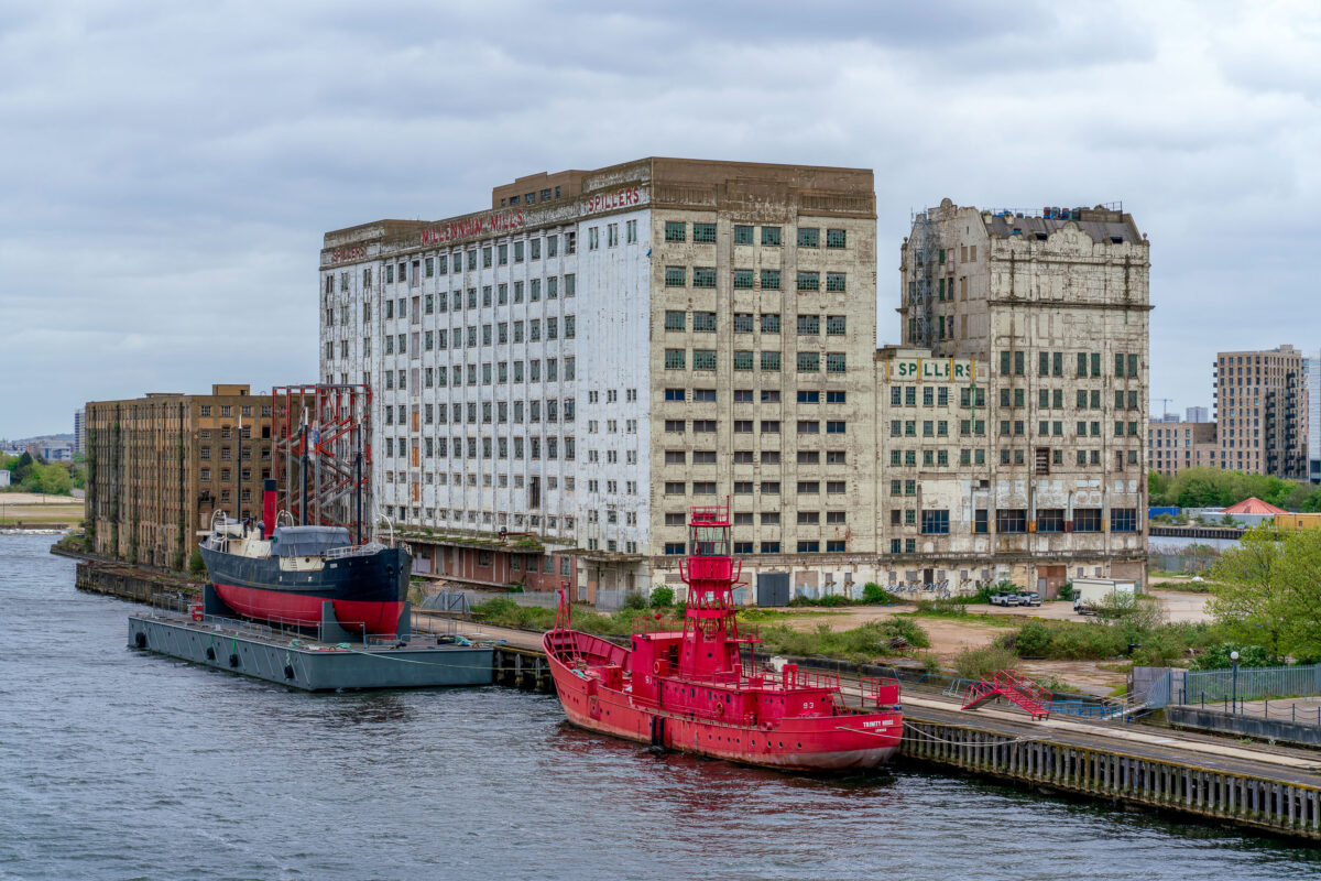
Millennium Mills and Trinity House Lightship 93, Royal Docks
April 2019
—
Once a centerpiece of London’s industrial age, Millennium Mills stands derelict on the south side of the Royal Victoria Dock in Silvertown. Built in 1905 for Spillers, the flour mill operated for decades before closing in the 1980s. The weathered façade and faded signage remain prominent features of the docklands skyline. Moored in front is the striking red Trinity House Lightship 93, formerly used as a floating lighthouse to warn ships at sea. Today, the area is part of the Royal Docks regeneration zone, blending remnants of Britain’s maritime and industrial heritage with modern redevelopment.
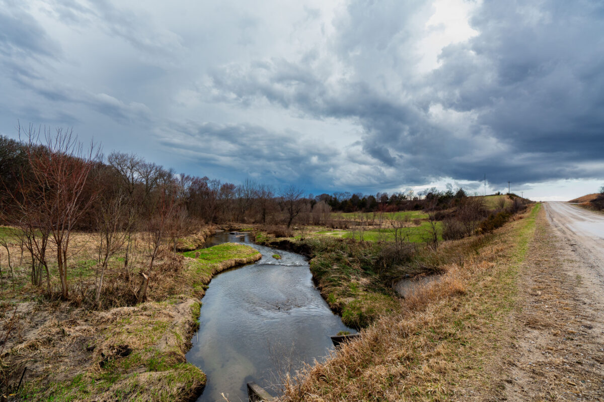
Bear Creek and Gravel Road Under Storm Clouds, Roland, Iowa
April 2019
—
A winding stretch of Bear Creek cuts through farmland near Roland, Iowa, beneath a brooding Midwestern sky. The narrow gravel road parallels the stream, leading the viewer’s eye toward the horizon where dark storm clouds gather. Early spring growth is visible along the banks, with fields just beginning to emerge from winter dormancy. This rural scene captures the quiet tension between stillness and the coming weather typical of Iowa’s open countryside.
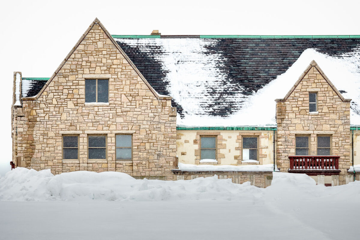
Downtown Green Bay YMCA in Winter Snow
March 2019
—
On the National Register of Historic Places, the downtown YMCA in Green Bay was built in 1924.
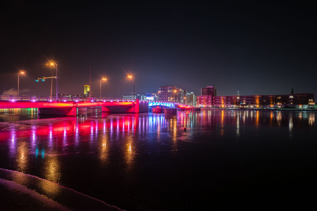
Walnut Street Bridge in Green Bay
December 2018
—
The Walnut Street bridge over the Fox River near Downtown Green Bay in Wisconsin,.
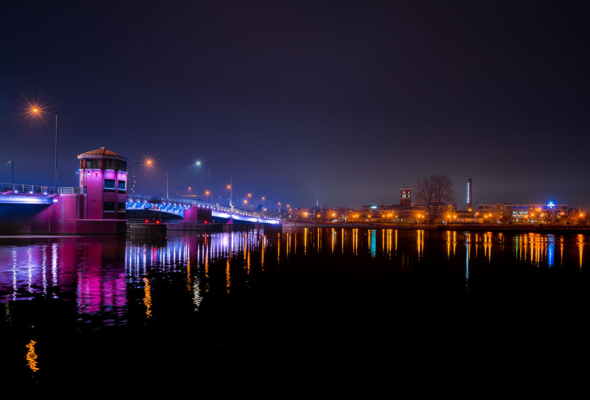
Mason Street Bridge in Downtown Green Bay
December 2018
—
The Mason Street bridge lit up red and blue in downtown Green Bay, Wisconsin. The bridge is over the Fox River.
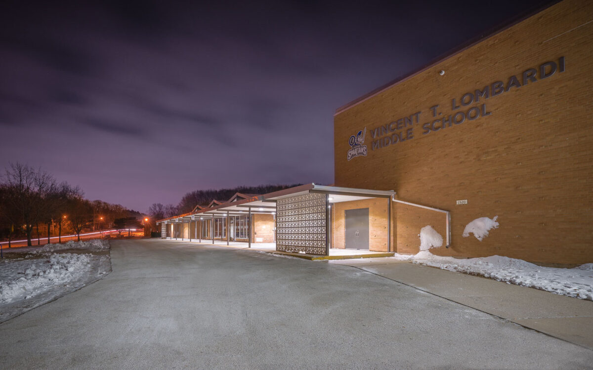
Vincent T. Lombardi Middle School, Green Bay, Wisconsin
December 2018
—
Lombardi Middle School in Green Bay, WI. The school on the city's far west side is named after legendary Green Bay Packers coach Vince Lombardi.
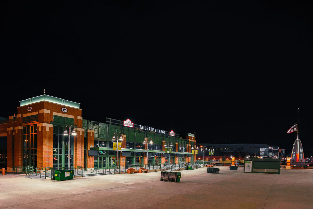
Tailgate Village at Lambeau Field
December 2018
—
Tailgate Village, outside of Lambeau Field in Green Bay, WI.
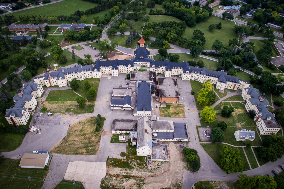
Fergus Falls Regional Treatment Center, Minnesota
July 2018
—
Fergus Falls Regional Treatment Center in Fergus Falls, Minnesota.
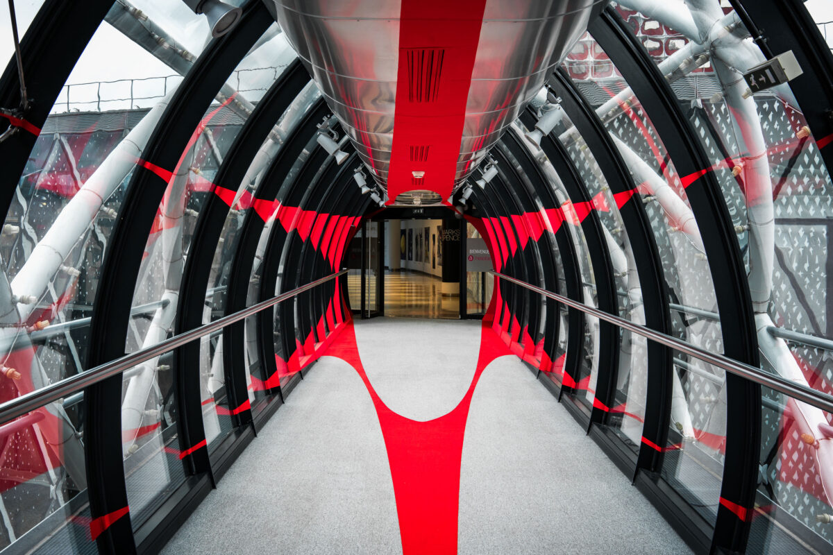
Paris Shopping Mall Skyway with Red Accents
October 2017
—
A skyway to a shopping mall in Paris. If you know what mall this is, i'd love to know!
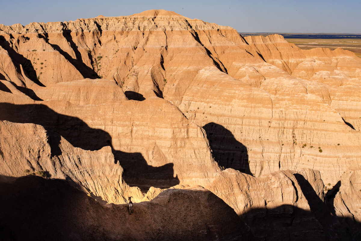
Badlands National Park: Saddle Pass Trailhead Area
July 2017
—
CS36B off of Highway 240 near the Saddle Pass Trailhead. The trail is a short hike up the Badlands Wall giving views of the White River Valley.
Sheep Mountain Road Sunflowers, Badlands National Park
July 2017
—
Rainbow Sunrise Over Buffalo Gap National Grasslands, South Dakota
July 2017
—
A beautiful rainbow at the Buffalo Gap National Grasslands. We camped here and woke up to this during the sunrise.
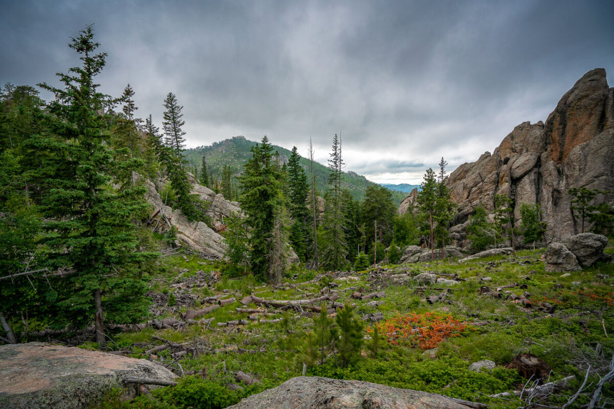
Granite Outcrops and Forest Near Needles Highway, Black Hills
July 2017
—
Sunrise over our tent at the Buffalo Gap National Grasslands. This Bureau of Land Management spot is one of our absolute favorite camping spots.
Sunrise Over Tent at Buffalo Gap National Grasslands, South Dakota
July 2017
—
Buffalo Gap National Grasslands: Sunset Over Badlands
July 2017
—
Sunset at the Buffalo Gap National Grasslands.
Bighorn Sheep at the Buffalo Gap National Grassland
July 2017
—
Bighorn Sheep at Buffalo Gap National Grassland in South Dakota.
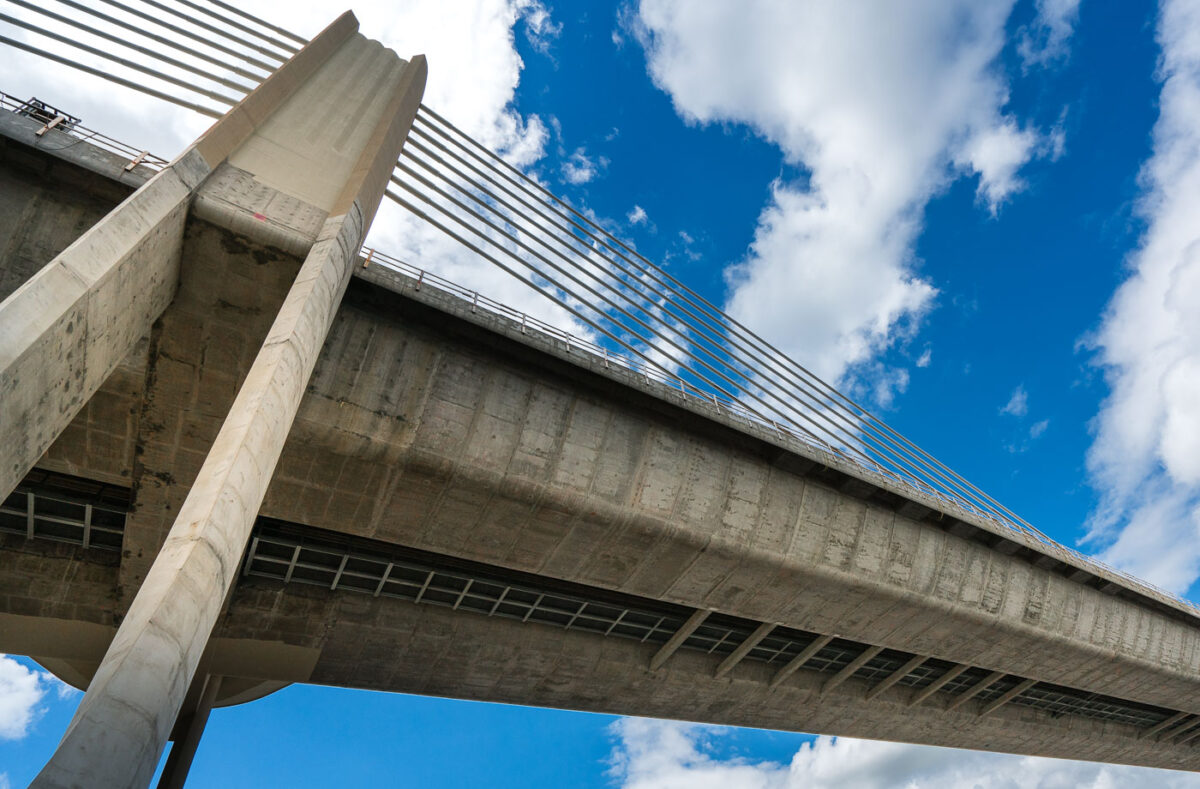
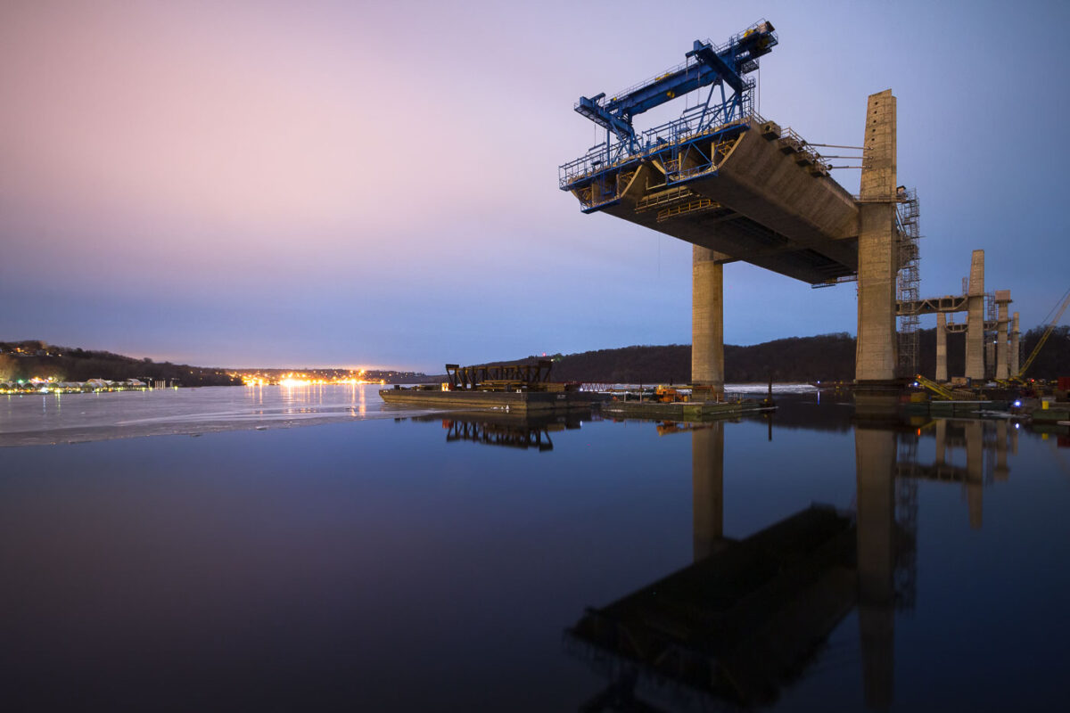
St. Croix Crossing Bridge: Minnesota-Wisconsin Connection
June 2017
—
From Wiki: The St. Croix Crossing is an extradosed bridge that spans the St. Croix River, between Oak Park Heights, Minnesota and St. Joseph, Wisconsin. Connecting Minnesota State Highway 36 and Wisconsin State Highway 64, the bridge carries four lanes of traffic (two lanes in each direction), and includes a bike/pedestrian path on the north side
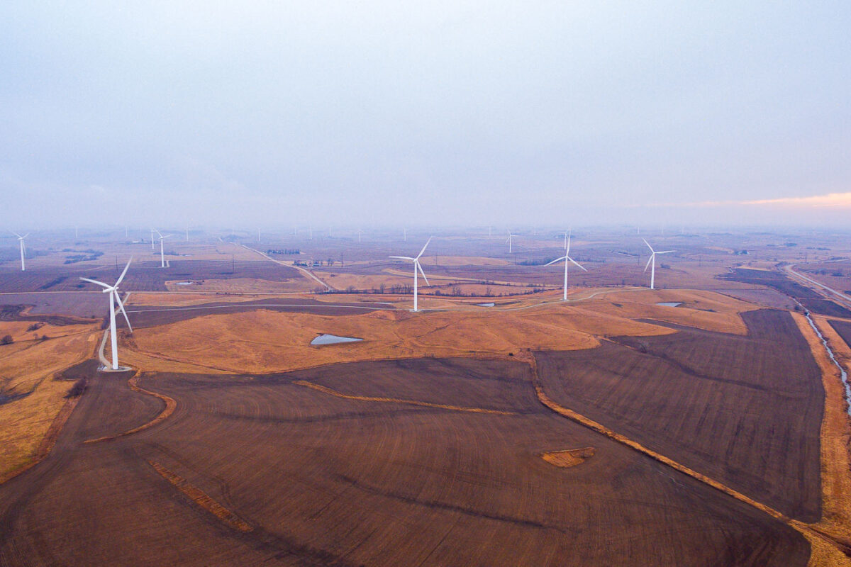
Wind Turbines in Adair, Iowa Farmland
February 2017
—
Windmills in Adair, Iowa.
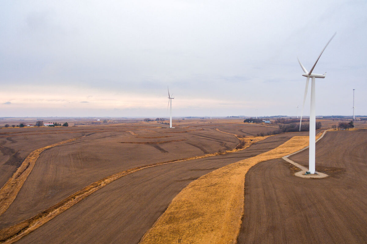
Wind Turbines in Adair, Iowa at Dusk
February 2017
—
Windmills in Adair, Iowa.
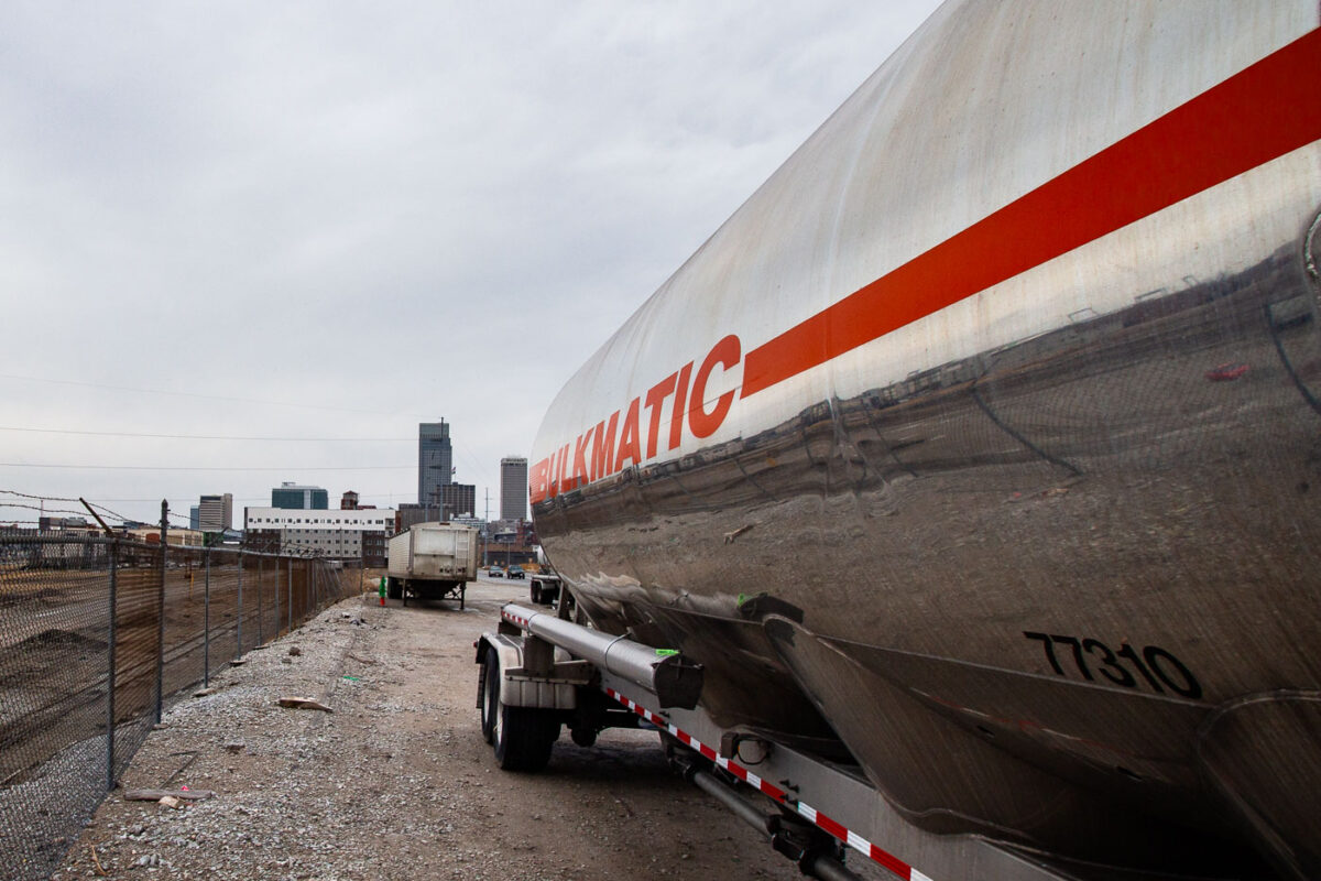
Bulkmatic Semi Truck 77310, Omaha, Nebraska
February 2017
—
A bulkmatic semi in Omaha, Nebraska.
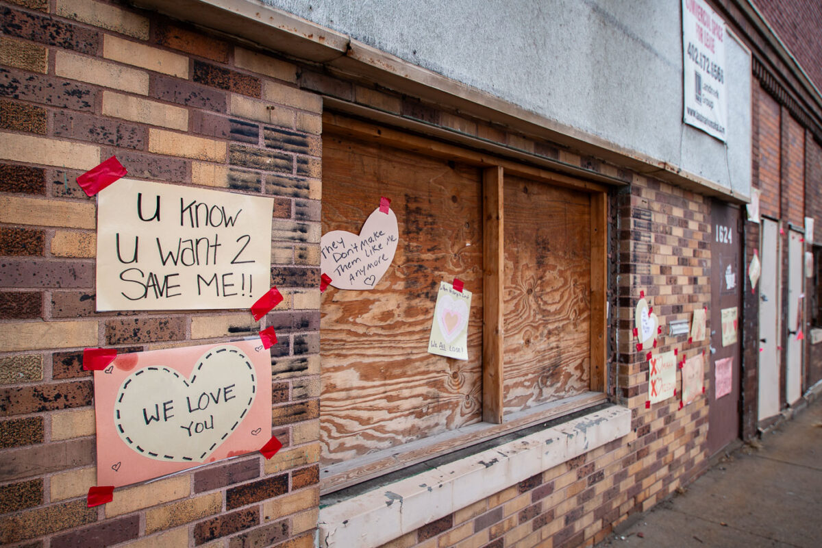
Fitzgerald Rooms Building Protest Signs, Omaha
February 2017
—
Signs hung on the historic building asking for it to be saved.
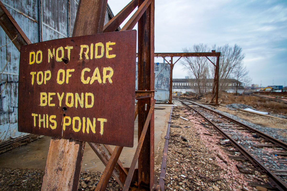
Omaha, NE: Do Not Ride Top of Car Beyond This Point Sign
February 2017
—
Sign that reads "Do not ride top of car beyond this point". Found in Omaha, NE.
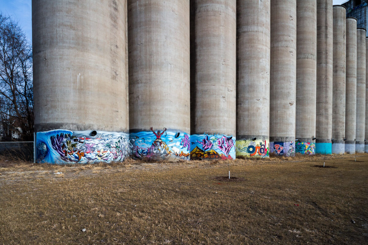
Omaha Grain Elevator Silos with Graffiti Art
February 2017
—
Mural on a concrete grain elevator in Omaha, Nebraska,
St. Croix Crossing Bridge Construction at Dusk
February 2016
—
St. Croix Crossing bridge under construction.
Fergus Falls Regional Treatment Center, Minnesota
July 2015
—
Fergus Falls Regional Treatment Center in Fergus Falls, Minnesota.
Fergus Falls Regional Treatment Center, Kirkbride Building
July 2015
—
The Fergus Falls Regional Treatment Center in Fergus Falls, Minnesota.
Fergus Falls Regional Treatment Center, Minnesota
July 2015
—
The Fergus Falls Regional Treatment Center in Fergus Falls, Minnesota.
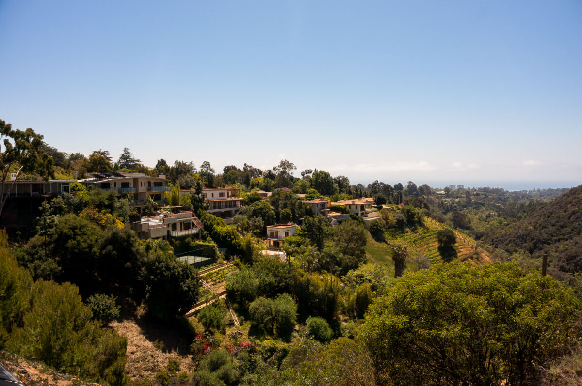
Pacific Palisades Homes and Landscape, April 2015
April 2015
—
View of Pacific Palisades from April 2015. The area has been ravaged by the January 2025 fires.
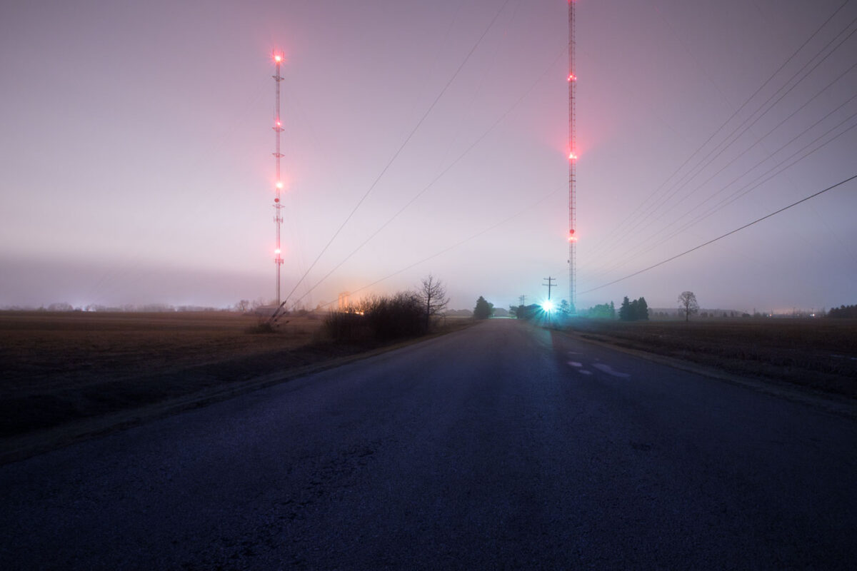
Radio and TV Towers on Video Lane, De Pere, Wisconsin at Night
December 2014
—
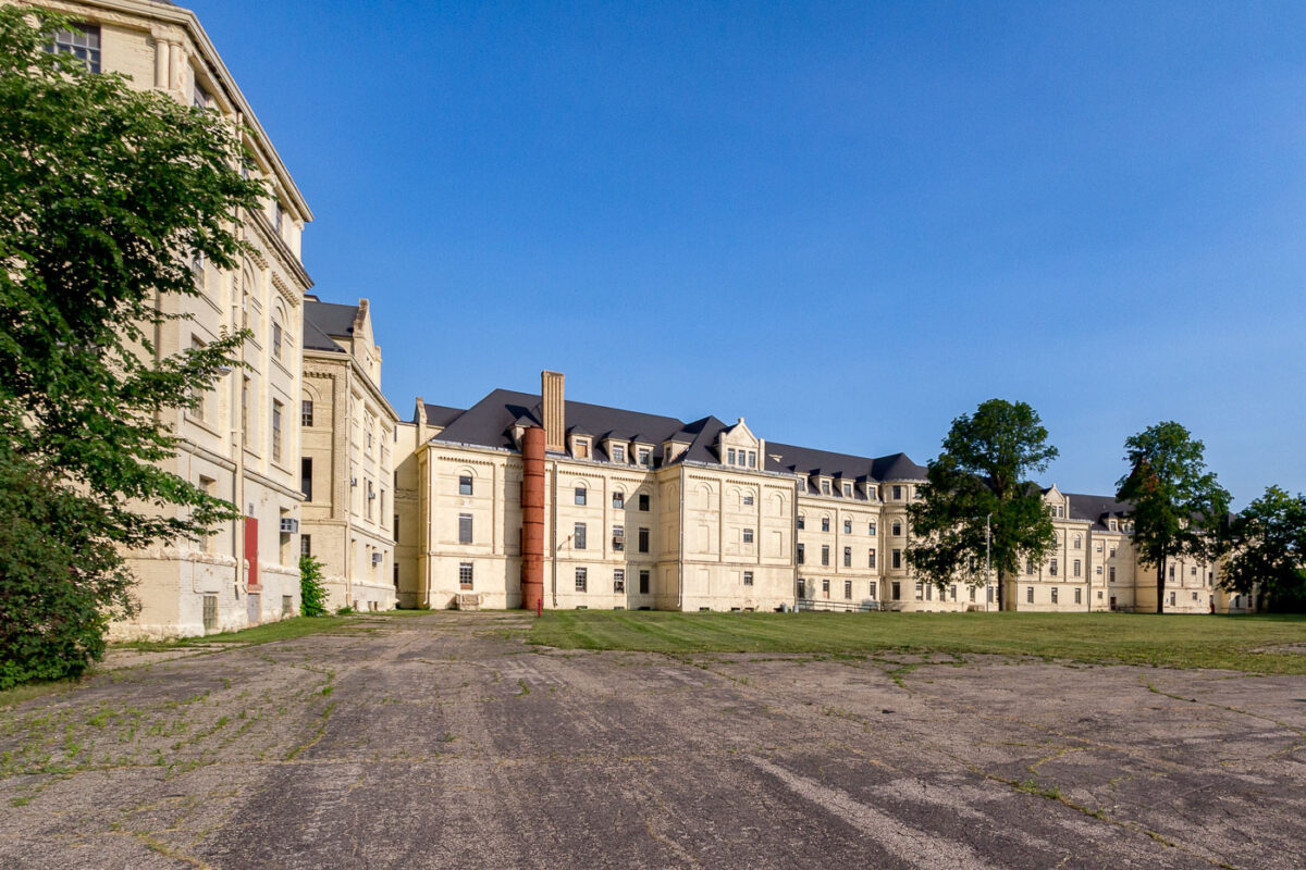
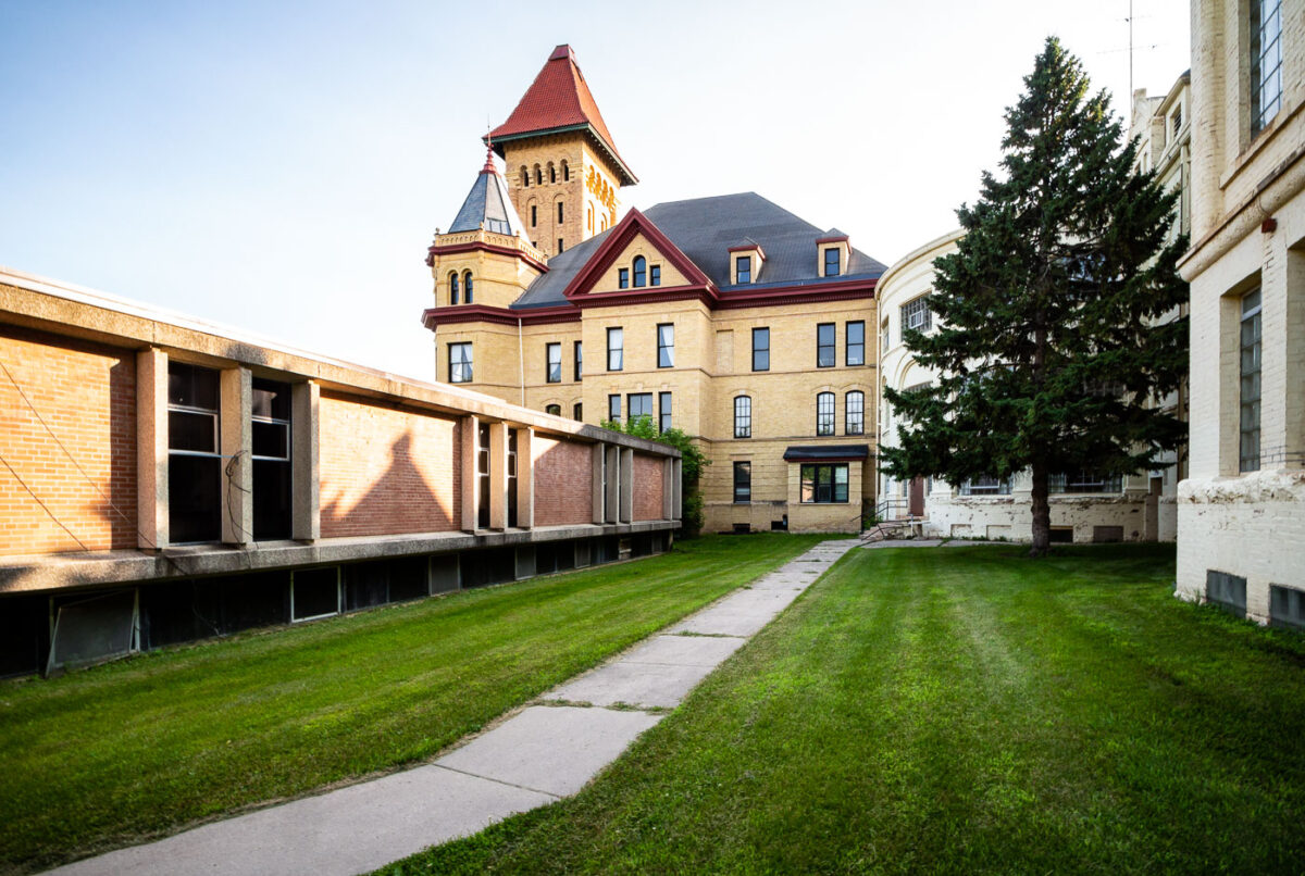
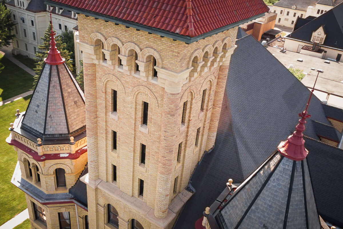
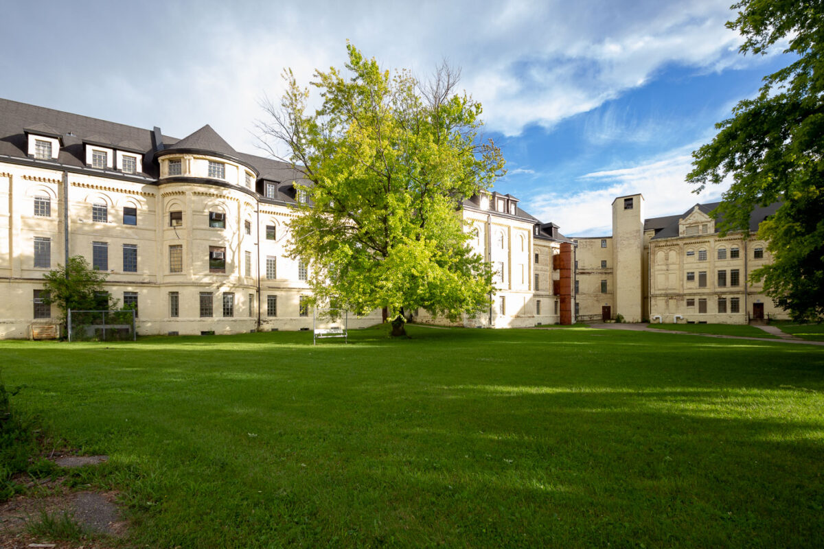
Fergus Falls Regional Treatment Center: Kirkbride Building
June 2014
—
The Fergus Falls Regional Treatment Center in Minnesota. The historic psychiatric hospital was built on the concepts of Dr. Thomas Kirkbride. The facility which was built in the 1800s has been closed since 2005.
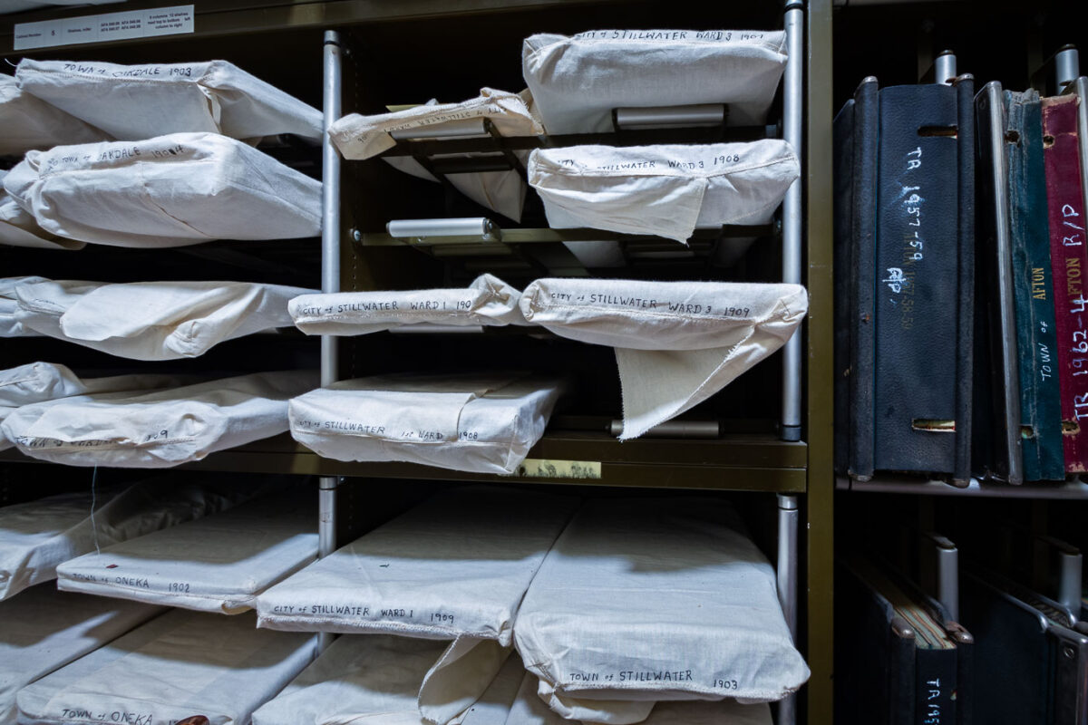
Stillwater Ward Records, 1903-1909
October 2013
—
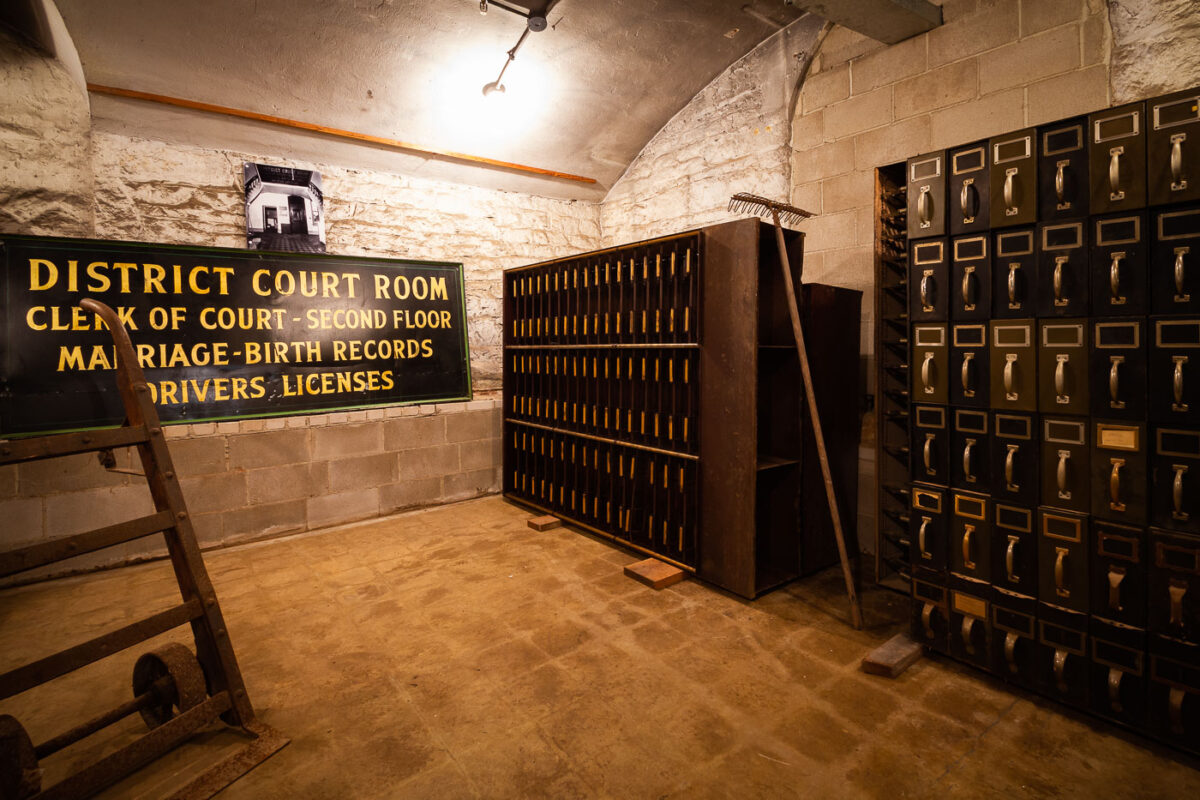
Historic Washington County Courthouse in Stillwater Minnesota.
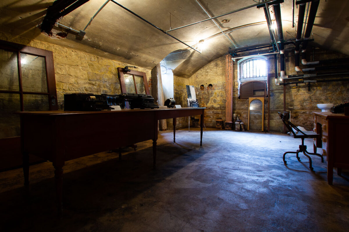
Washington County Courthouse Records Room, Stillwater, MN
October 2013
—
A tour inside the Historic Washington County Courthouse, Stillwater, Minnesota
Washington County Courthouse, Stillwater, MN: Office Interior
October 2013
—
Historic Washington County Courthouse, Stillwater, Minnesota
Centennial Olympics Atlanta 1996 Memorial Plaque
October 2012
—
Centennial Olympics, Atlanta
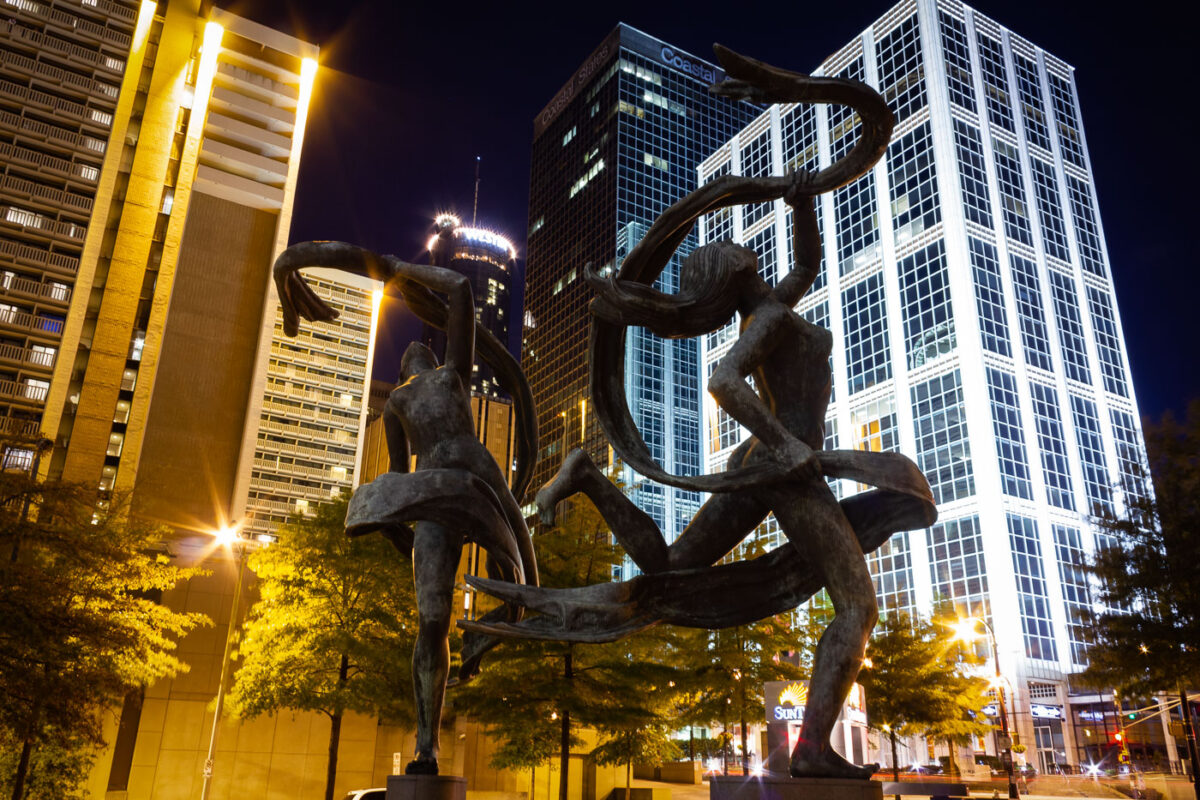
Atlanta Sculpture at Night
October 2012
—
A sculpture in Atlanta, Georgia.
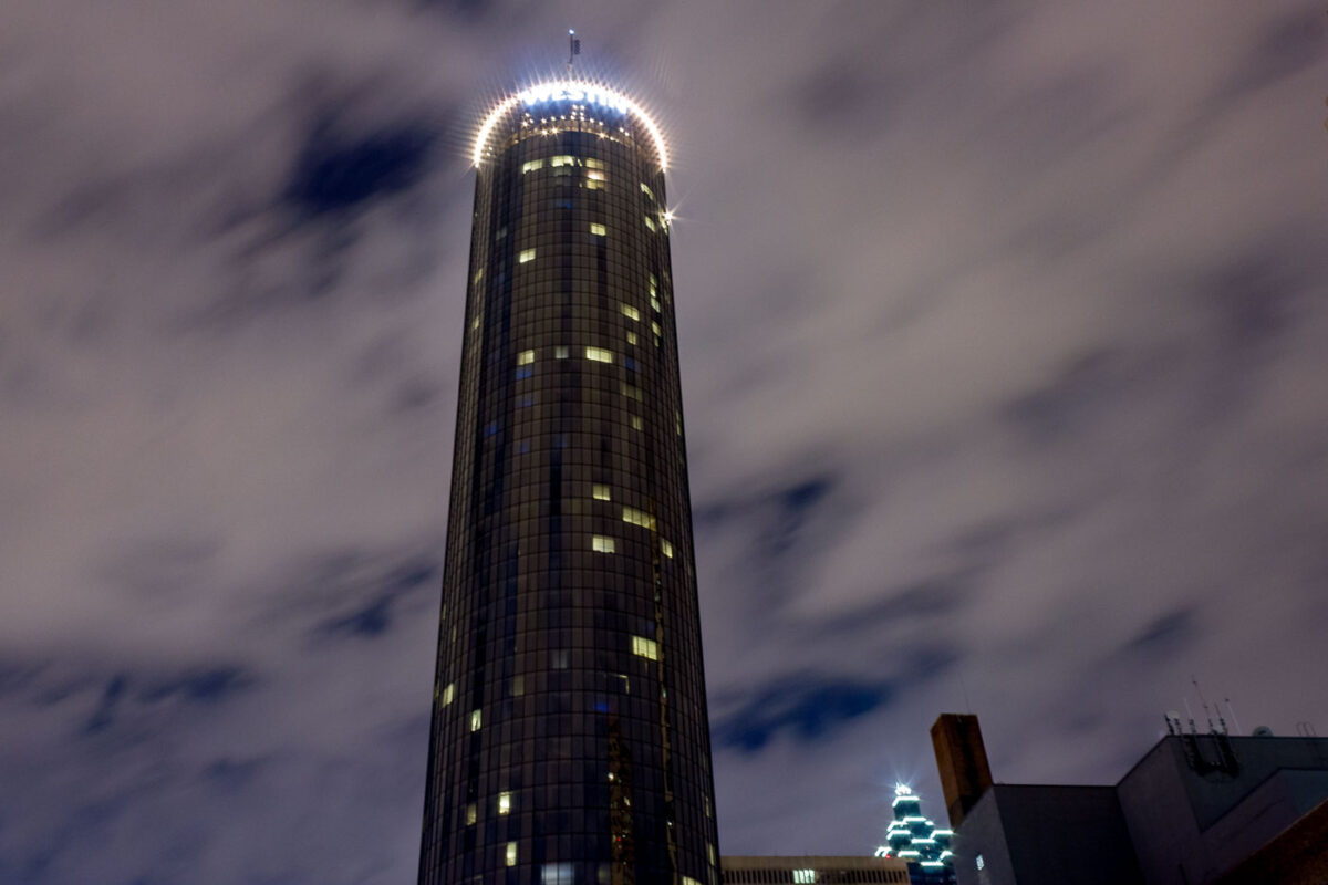
Westin Hotel, Downtown Atlanta at Night
October 2012
—
The Westin building Atlanta, Georgia.
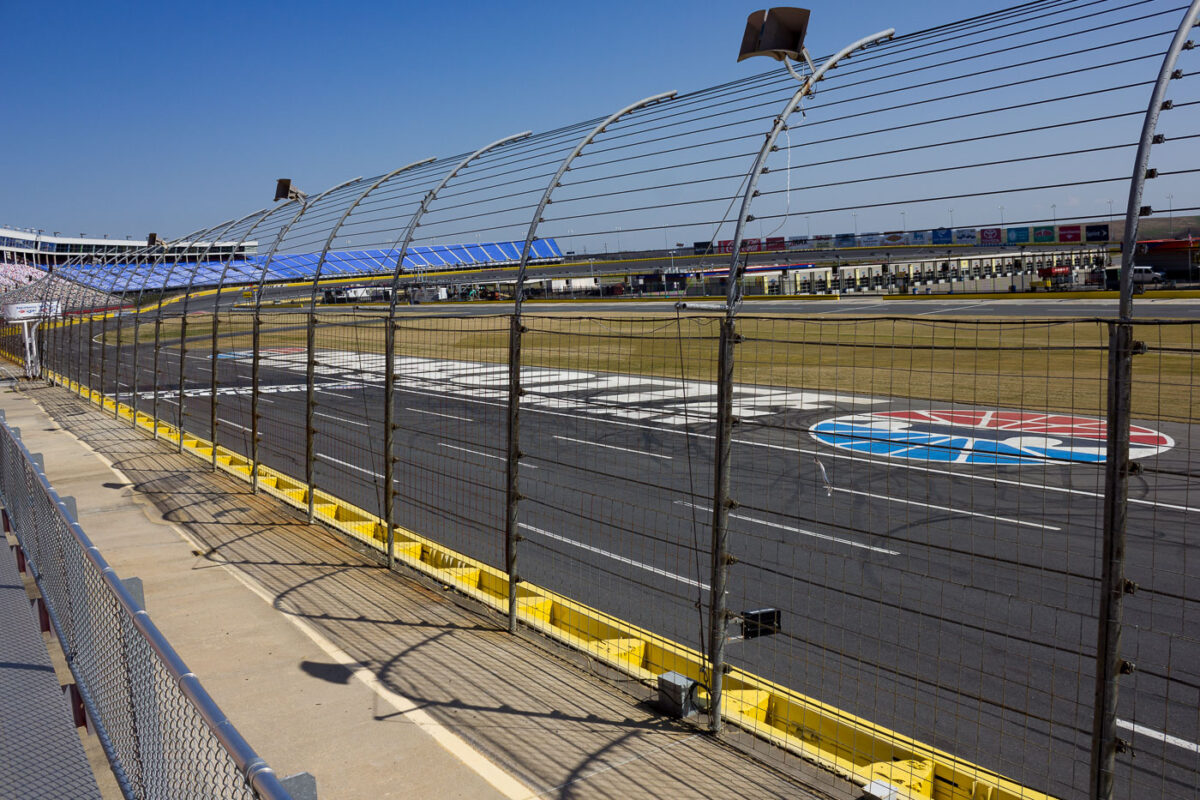
Charlotte Motor Speedway Seats, North Carolina
March 2012
—
Seats inside the Charlotte Motor Speedway in North Carolina.
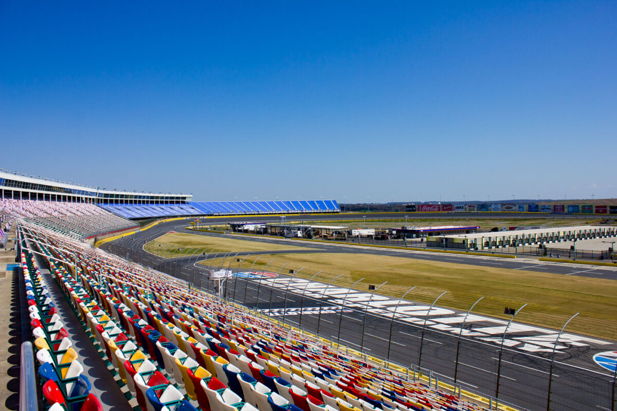
Charlotte Motor Speedway Track and the Grandstands
March 2012
—
Charlotte Motor Speedway in Concord North Carolina.
Charlotte Motor Speedway, Concord, North Carolina
March 2012
—
Charlotte Motor Speedway in Concord North Carolina.
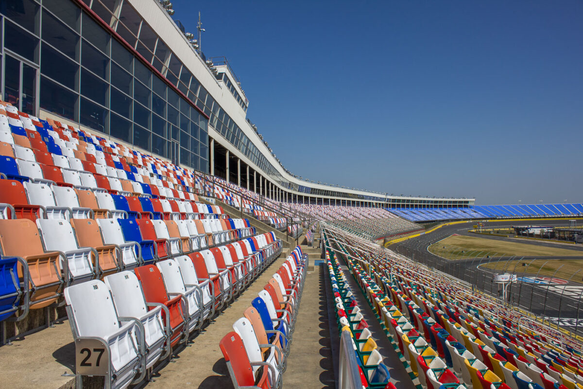
Charlotte Motor Speedway Seating, North Carolina
March 2012
—
Seating at Charlotte Motor Speedway.
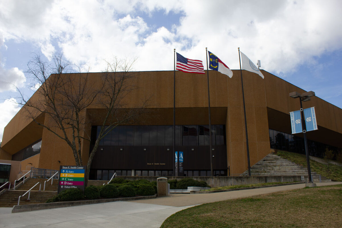
Dean E. Smith Center, University of North Carolina, Chapel Hill
March 2012
—
Dean Smith Center on the University of Carolina campus.
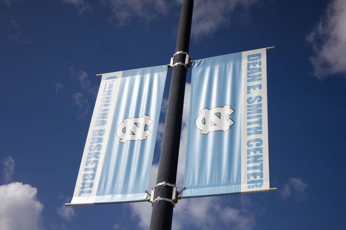
Dean E. Smith Center Carolina Basketball Banners, UNC
March 2012
—
Banners at the University of Carolina that read Dean E Smith Center Carolina Basketball.
San Pedro Coastal Rocks and Palm Trees
December 2011
—
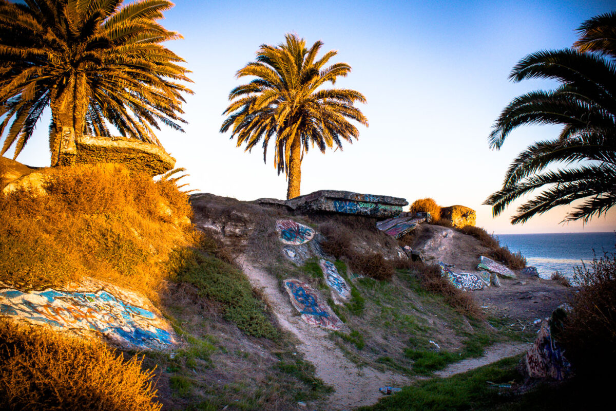
San Pedro Coastal Bluffs with Graffiti and Palm Trees
December 2011
—
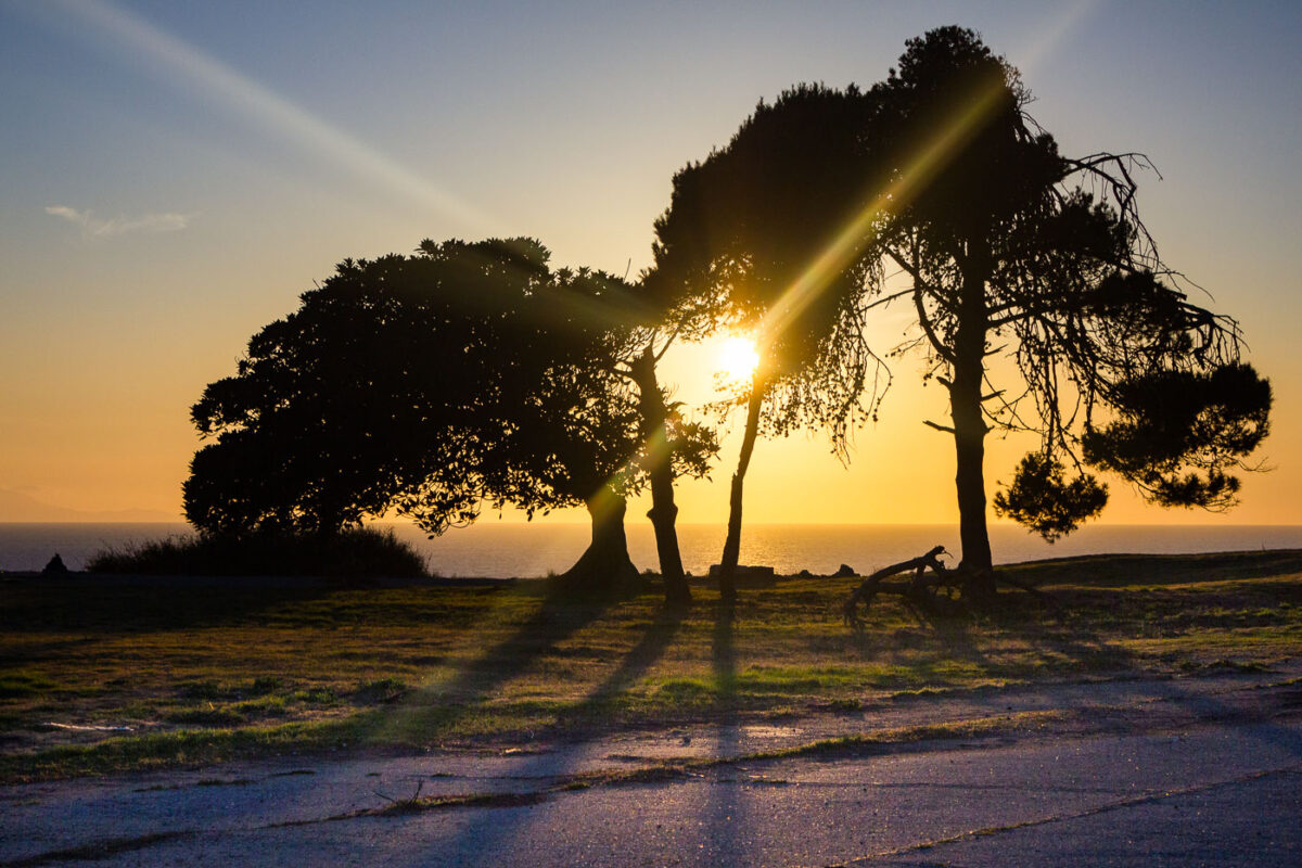
San Pedro, California: Sunset Over the Pacific Ocean
December 2011
—
Grafton on Sunset Hotel Room, Hollywood
December 2011
—
The Grafton on Sunset hotel in Hollywood California.
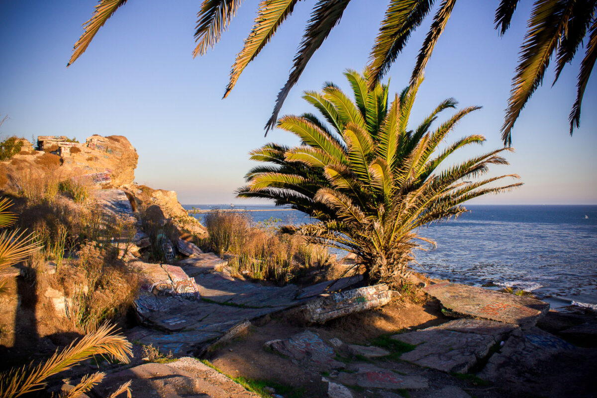
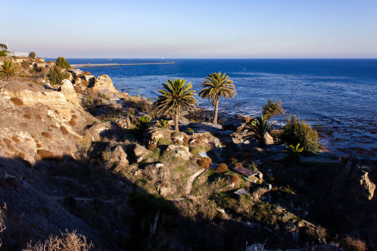
Sunken City, San Pedro, Los Angeles Coastline
December 2011
—
Coastal San Pedro Los Angeles California.
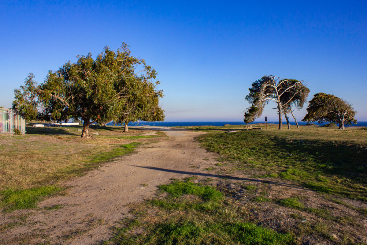
San Pedro Coastal Park, California
December 2011
—
Coastal San Pedro in California
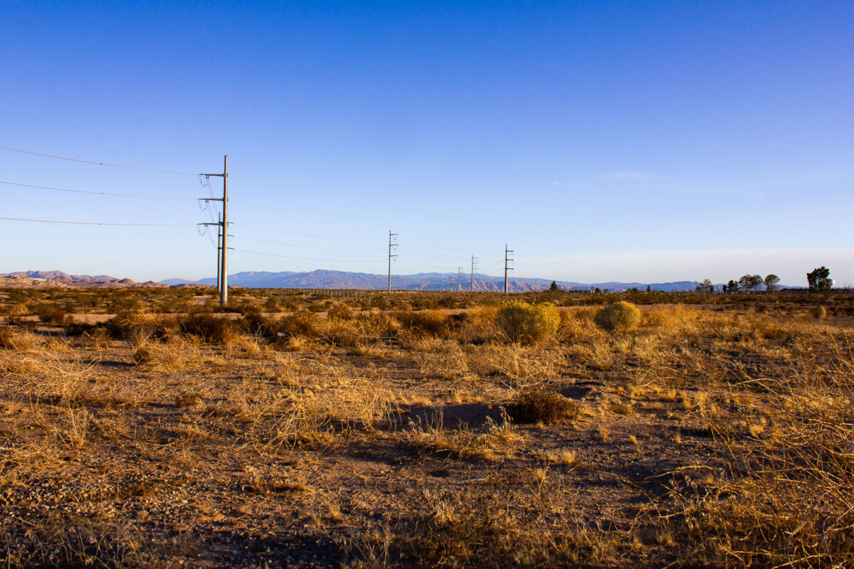
Victorville California Desert with Power Lines
December 2011
—
Victorville, California
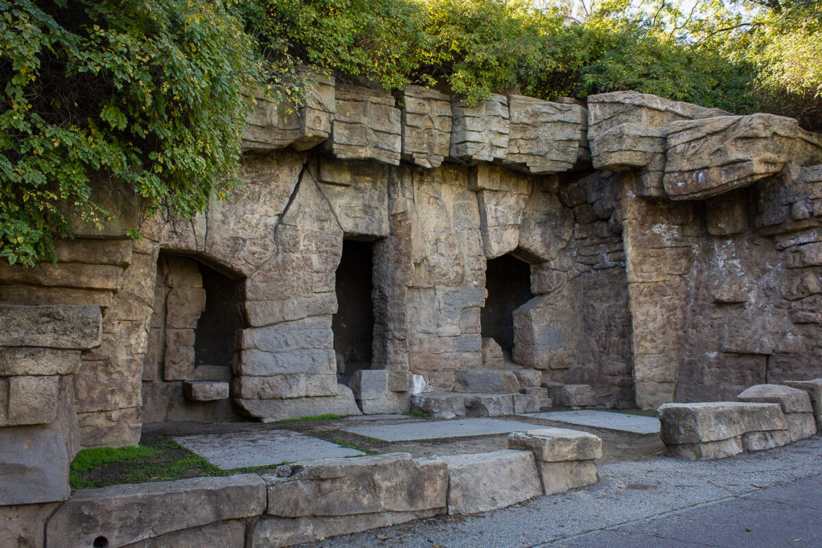
Griffith Park Zoo Abandoned Bear Enclosures
November 2011
—
Operating from 1912 to 1965, the Los Angeles Zoo once held bears, lions, monkeys, macaws, goats, elephants, reptiles and turtles. The animals were moved to a new zoo when this location was closed.
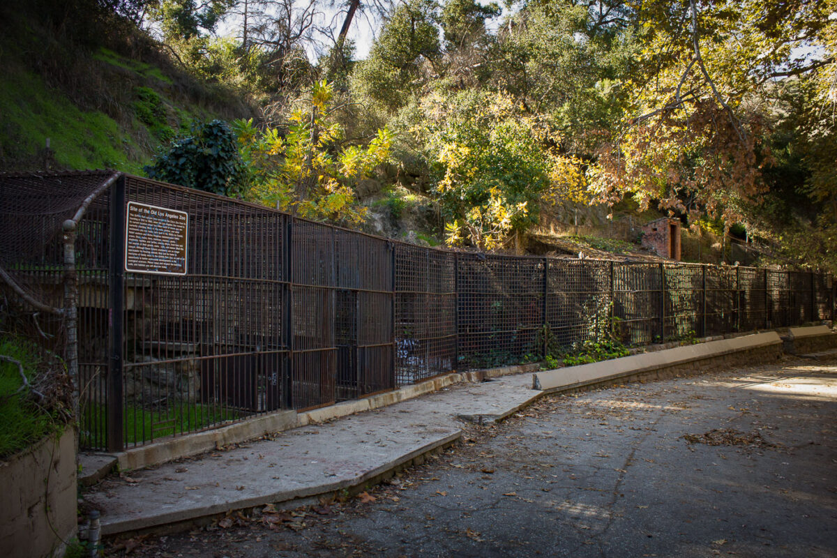
Griffith Park Zoo: Abandoned Enclosures, Los Angeles
November 2011
—
Operating from 1912 to 1965, the Los Angeles Zoo once held bears, lions, monkeys, macaws, goats, elephants, reptiles and turtles. The animals were moved to a new zoo when this location was closed.
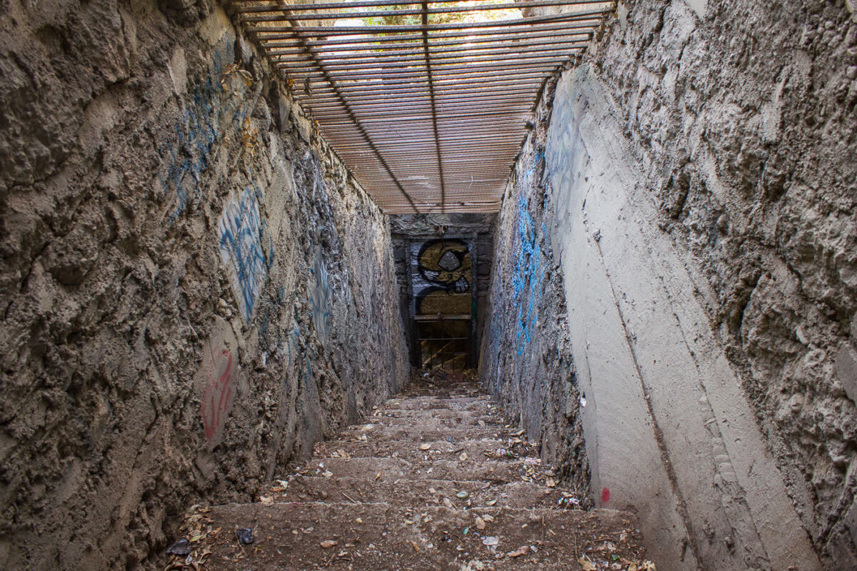
Griffith Park Zoo Inside Exhibit
November 2011
—
Operating from 1912 to 1965, the Los Angeles Zoo once held bears, lions, monkeys, macaws, goats, elephants, reptiles and turtles. The animals were moved to a new zoo when this location was closed.
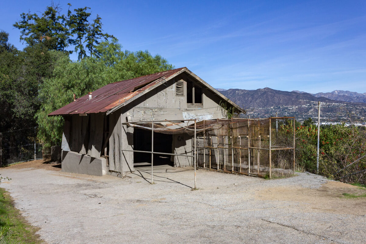
Griffith Park Zoo Overlook
November 2011
—
Operating from 1912 to 1965, the Los Angeles Zoo once held bears, lions, monkeys, macaws, goats, elephants, reptiles and turtles. The animals were moved to a new zoo when this location was closed.
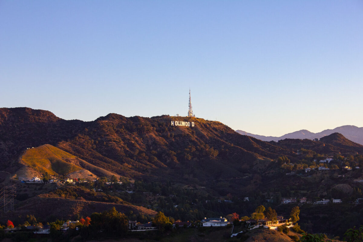
Hollywood Sign and Griffith Observatory, Los Angeles
November 2011
—
The Hollywood Sign in Los Angeles California.
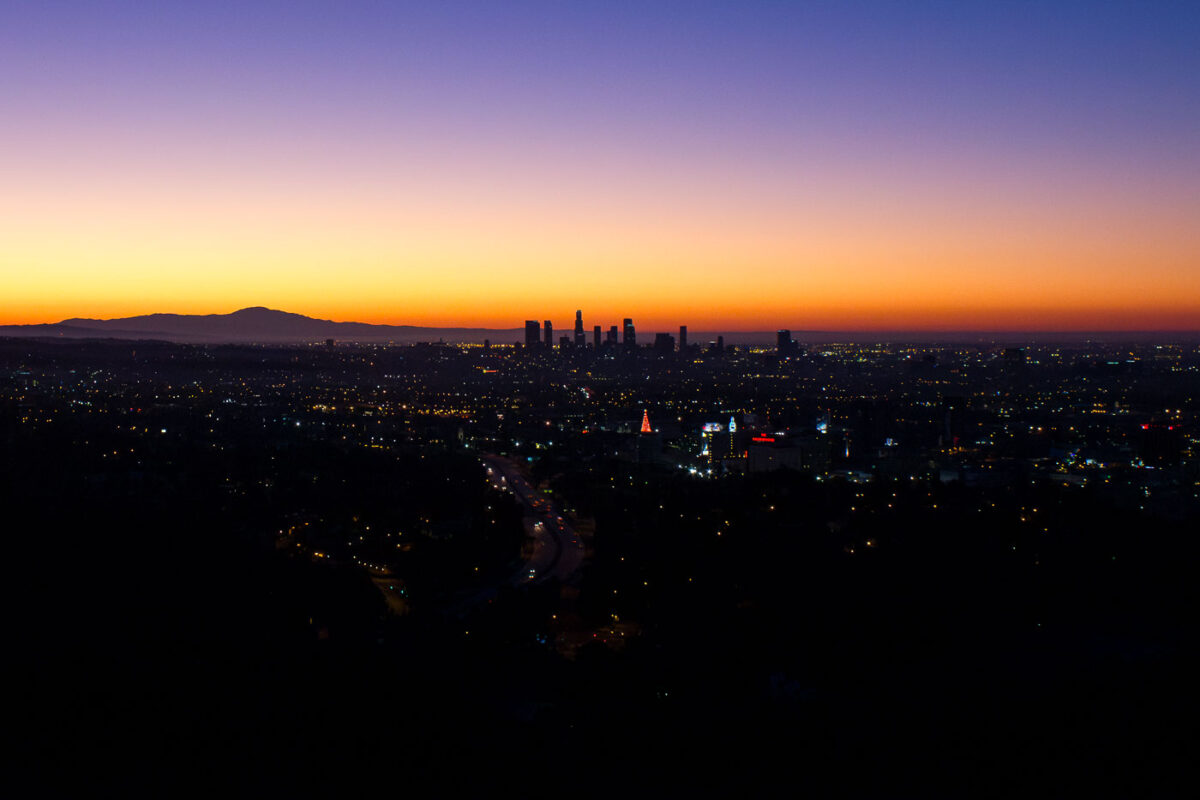
Downtown Los Angeles Sunrise, November 2011
November 2011
—
November 2011 Los Angeles California sunrise.
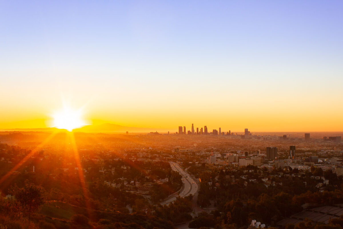
Los Angeles Sunrise from Mulholland Drive Overlook
November 2011
—
Sunrise behind Los Angeles as seen from Mulholland Drive.
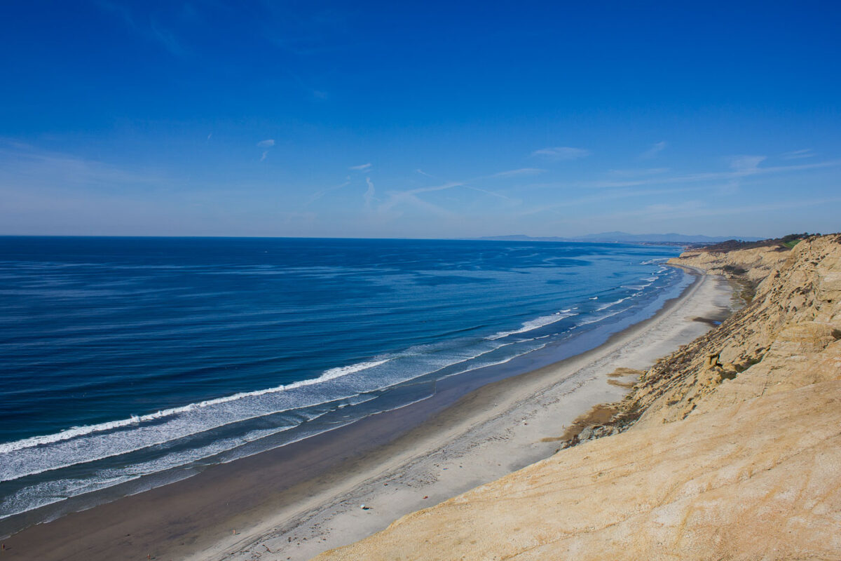
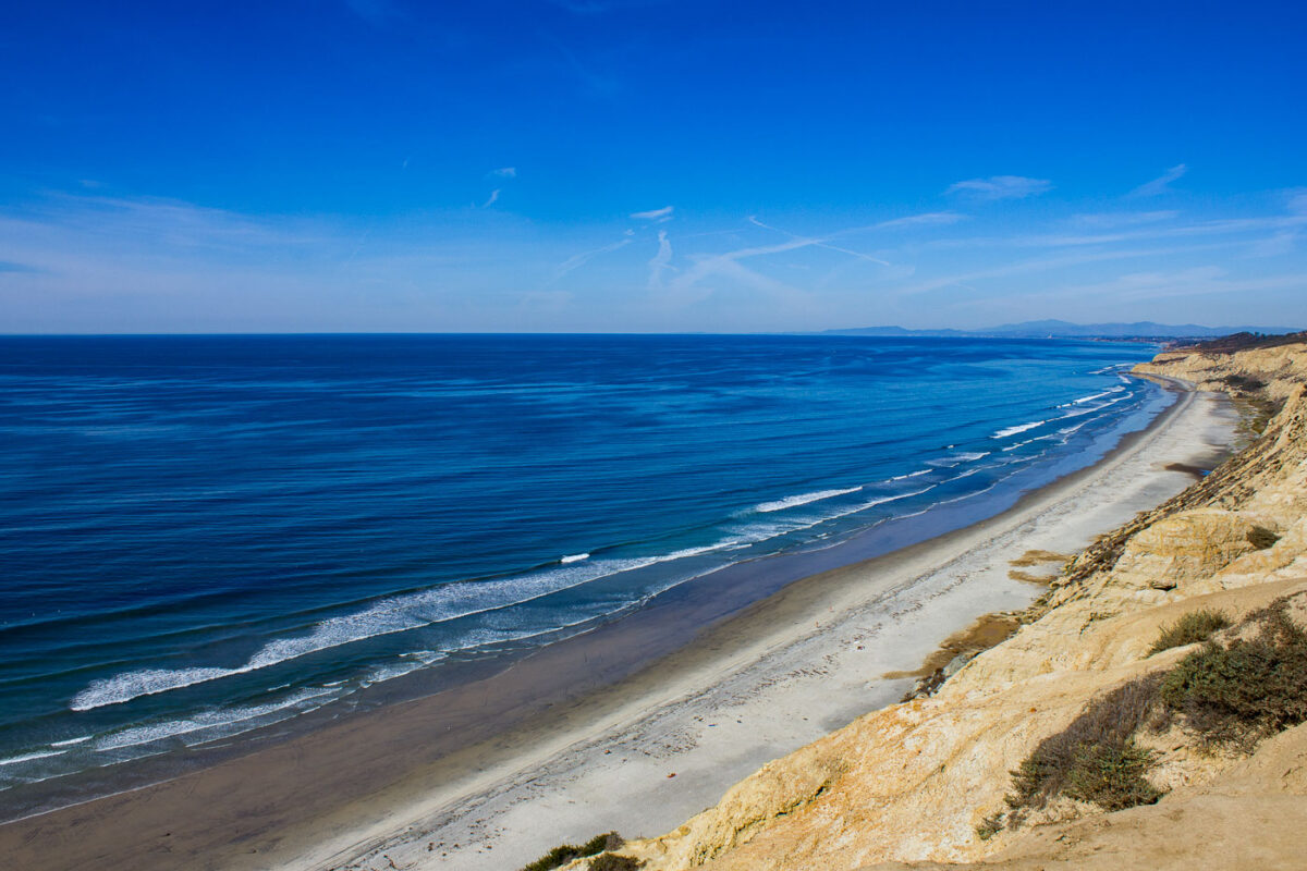
Torrey Pines Beach and Cliffs, San Diego
November 2011
—
The Pacific Ocean in San Diego, California as seen from Torrey Pines Gliderport
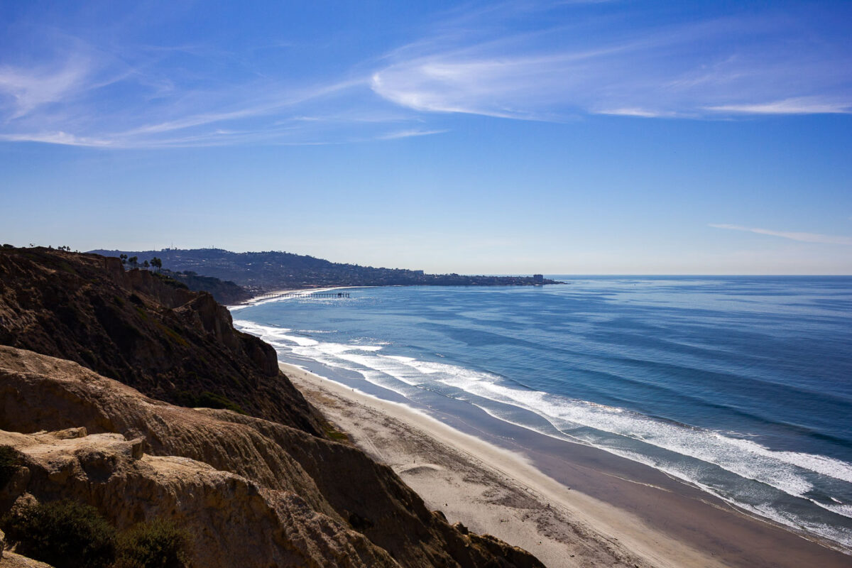
Black’s Beach Cliffs and Pacific Ocean, San Diego
November 2011
—
Black's Beach, San Diego, California
Black’s Beach in San Diego
November 2011
—
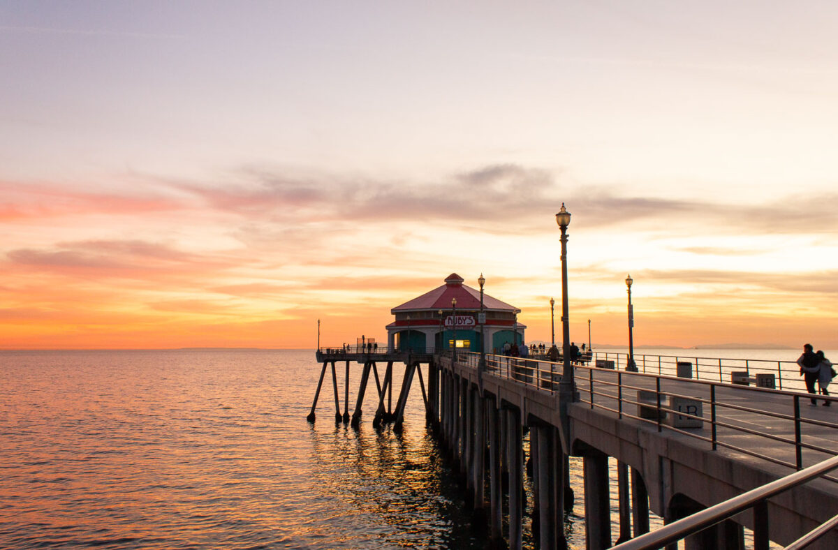
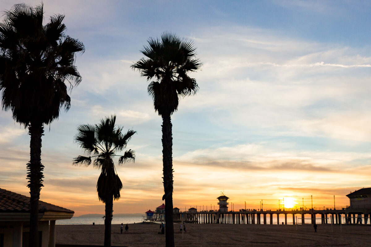
Ruby’s Diner on Huntington Beach Pier at Sunset
November 2011
—
The Ruby's on the pier in Huntington Beach.
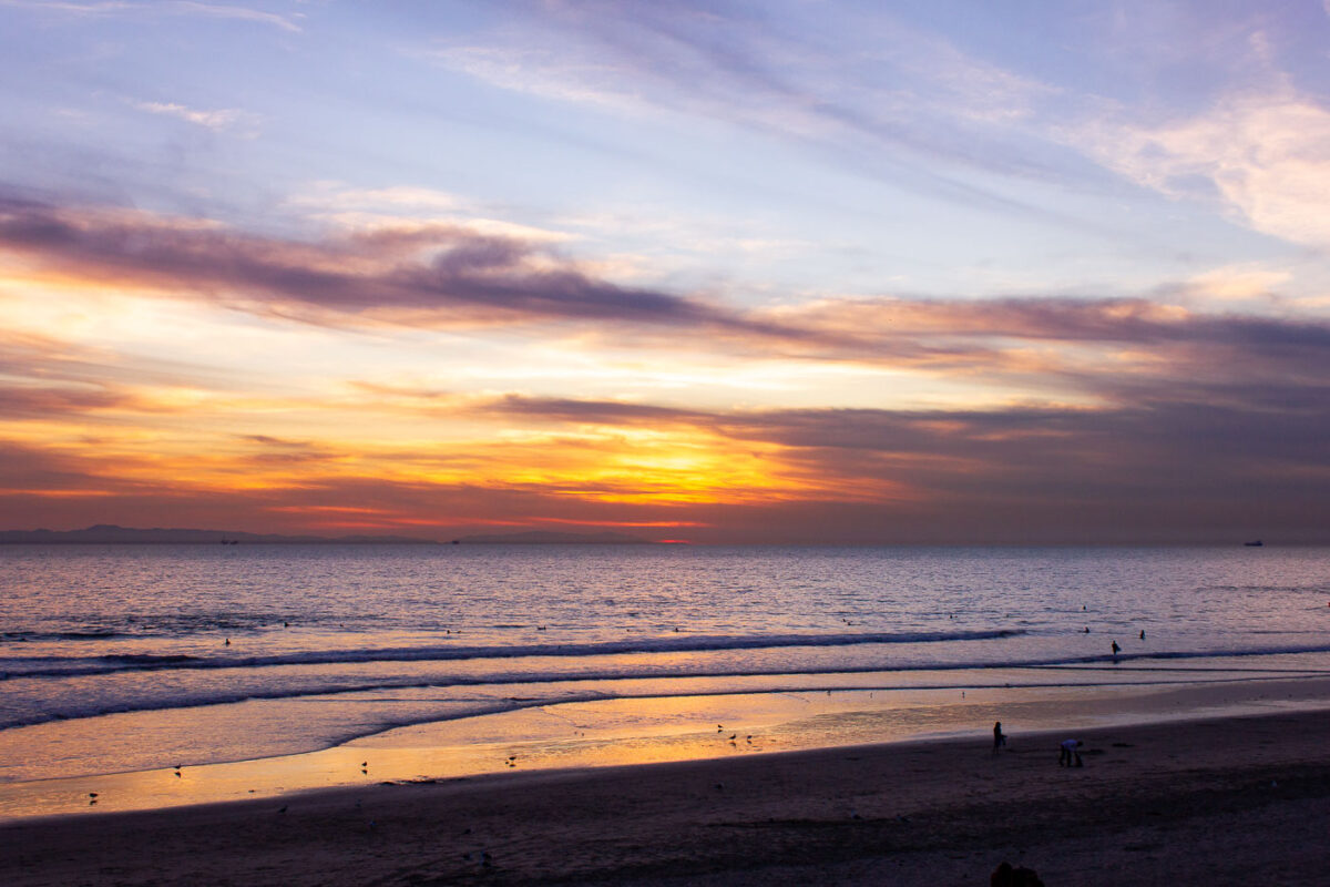
Huntington Beach Sunset with Surfers and Cargo Ships
November 2011
—
Sunset in Huntington Beach, California.
Huntington Beach Pier at Sunset, California
November 2011
—
Sunset in Huntington Beach, California
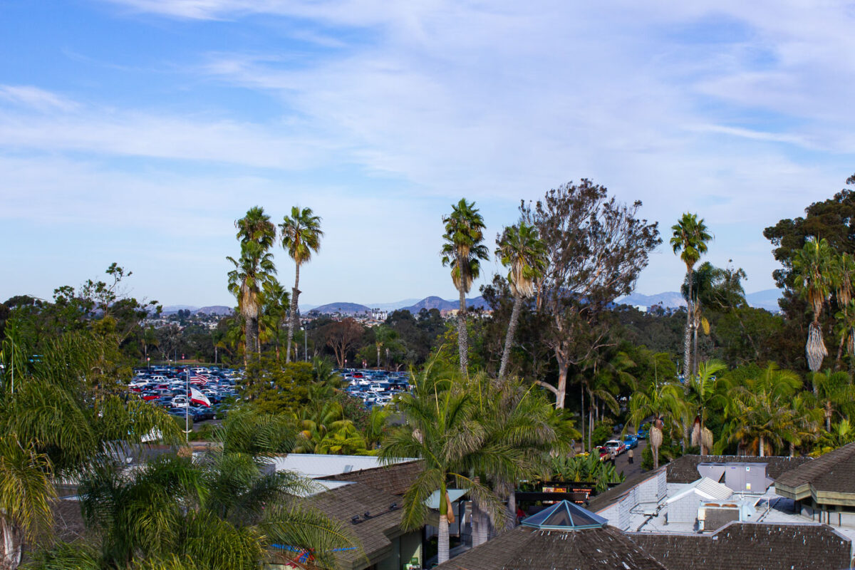
San Diego Zoo Parking Lot and Palm Trees
November 2011
—
The San Diego Zoo.
Giant Panda at San Diego Zoo Habitat
November 2011
—
A giant panda at the San Diego California Zoo.
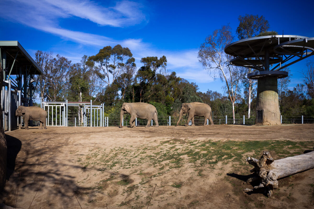
Elephants at San Diego Zoo, California
November 2011
—
Elephants at the San Diego Zoo.
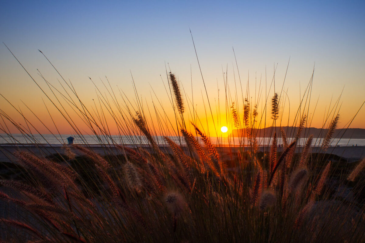
California Beach Sunset with Lifeguard Tower
November 2011
—
Pacific Ocean sunset in California.
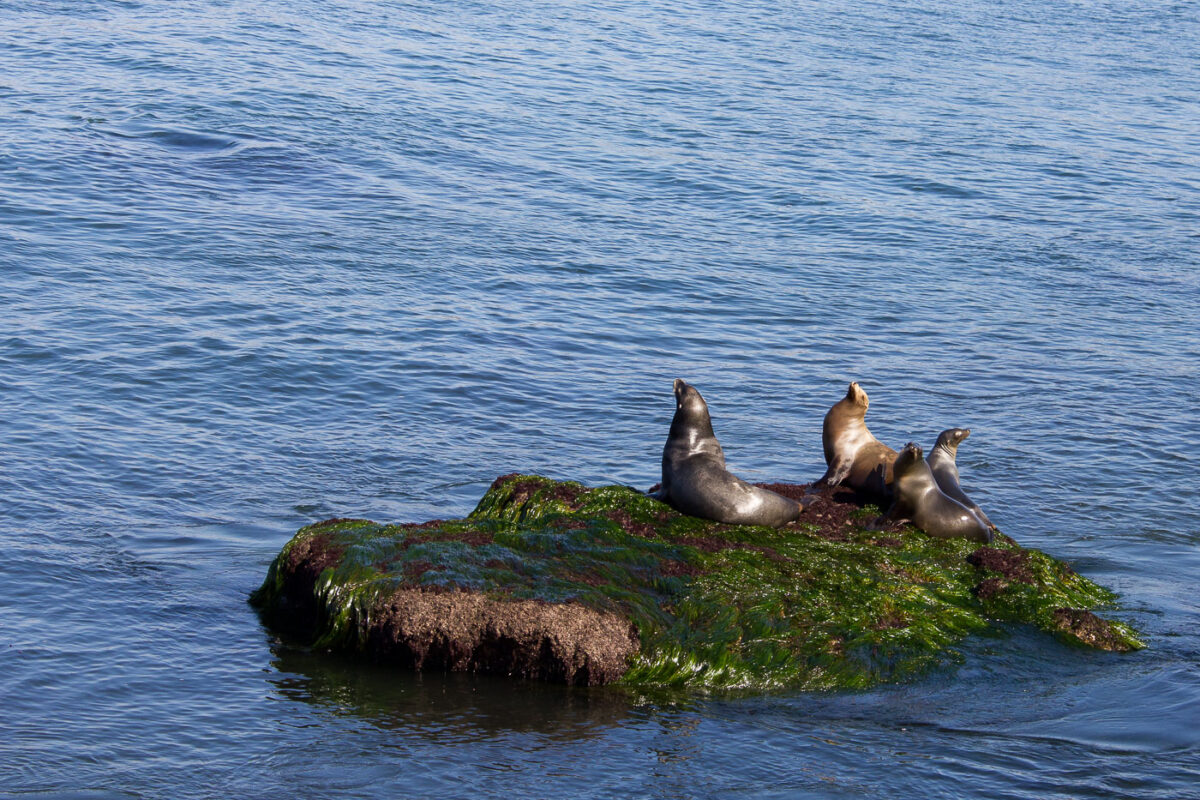
Sea Lions on Algae-Covered Rock, La Jolla, California
November 2011
—
Sea Lions in La Jolla, California.
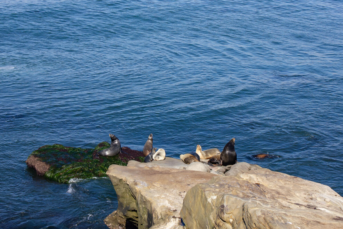
Sea Lions Resting on Rocks in La Jolla, California
November 2011
—
Seals in La Jolla, California.
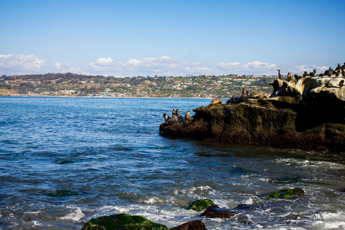
La Jolla Sea Lions and Cormorants on Rocks, California
November 2011
—
Seals and Sea Lions in La Jolla, California.
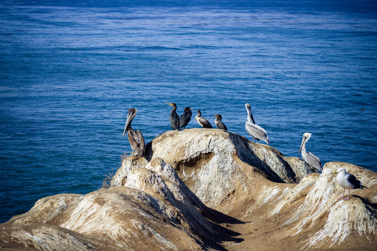
Brown Pelicans and Cormorants on La Jolla Rocks, California
November 2011
—
Pelicans in La Jolla, California.
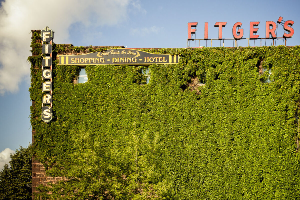
Fitger’s Hotel, Brewery, and Grille, Duluth, MN
August 2011
—
Fitger's Brewhouse Brewery & Grille in Duluth, Minnesota.
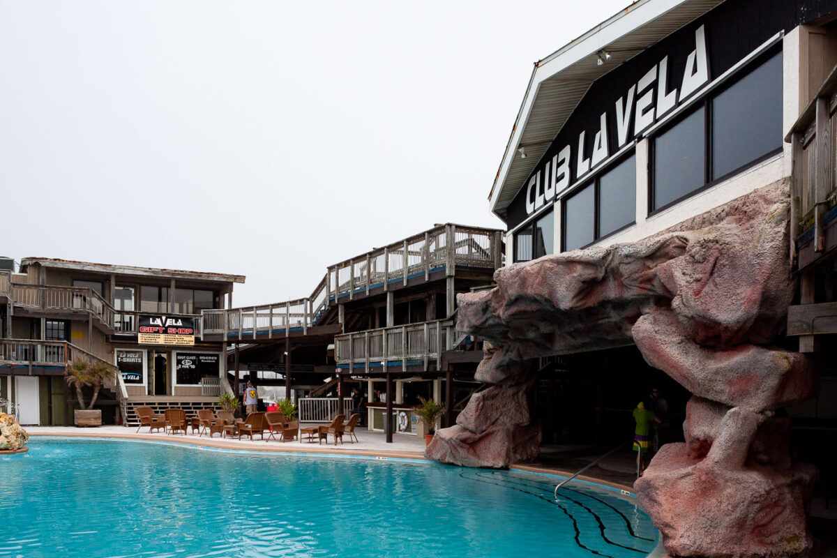
Club La Vela, Panama City Beach: Exterior and Pool
February 2011
—
Club La Vela in Panama City Beach. The nightclub which called itself the largest nightclub in the United States closed for good after damages from Hurricane Michael.
Panama City Beach, Florida: Beachgoers and Gulf of Mexico
February 2011
—
People lay and walk on the beach in Panama City Beach, Florida.
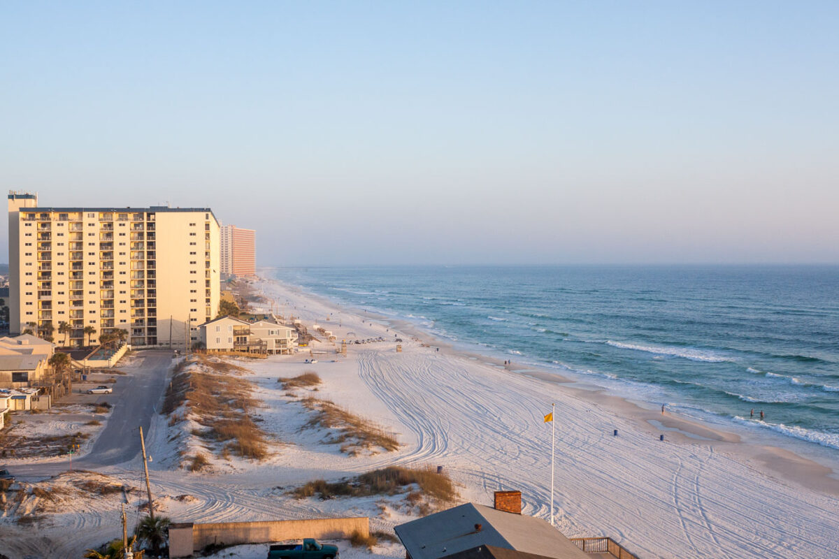
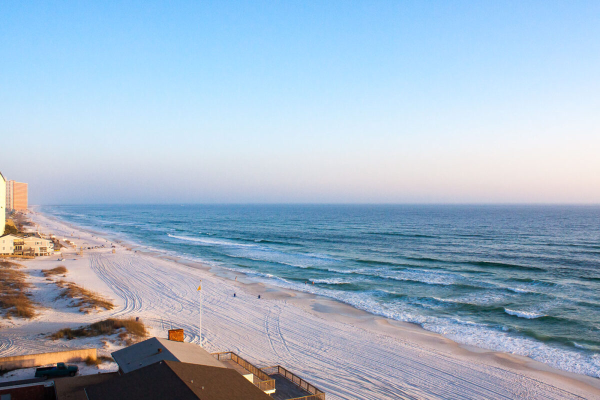
Panama City Beach, Florida: Gulf Coastline and High-Rise Condominiums
February 2011
—
Panama City Beach Florida
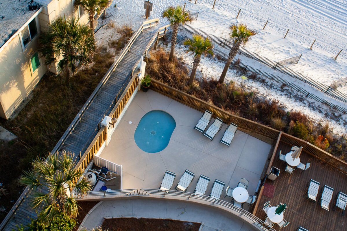
Panama City Beach Resort Pool and Boardwalk
February 2011
—
A hot tub in Panama City Beach, Florida
Gulf of Mexico Coastline, Panama City Beach, Florida
February 2011
—
The Gulf of Mexico in Panama City Beach, Florida.
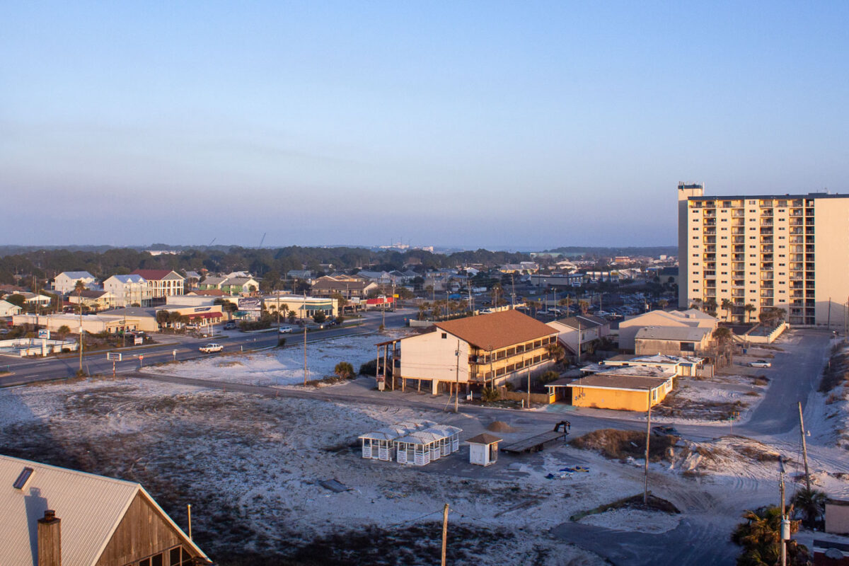
Panama City Beach, Florida: February 2011
February 2011
—
Panama City Beach, Florida.
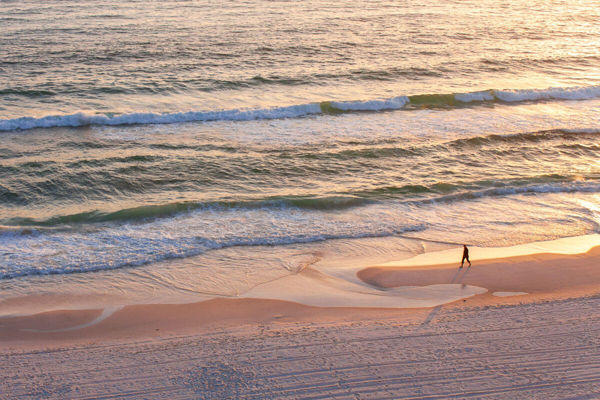
Person walks on Panama City Beach, Florida Gulf Coast
February 2011
—
Person walks on the beach of the Gulf of Mexico in Panama City Beach, Florida.
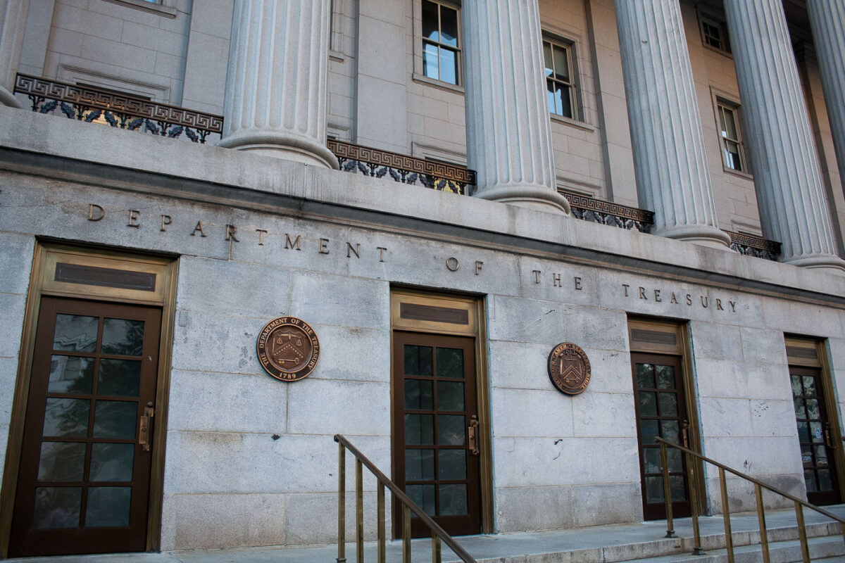
Department of the Treasury, Pennsylvania Ave, Washington D.C.
October 2010
—
Department Of the Treasury, Washington D.C.
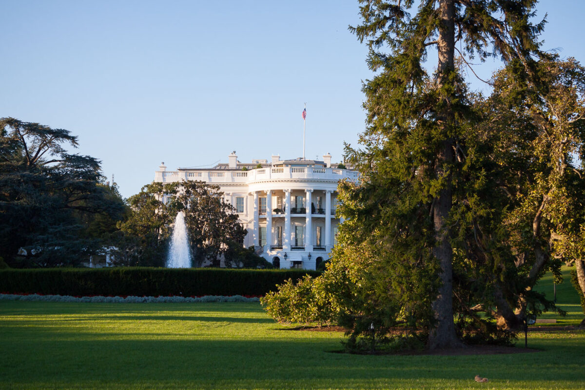
The White House, Washington D.C. – South Lawn
October 2010
—
The White House in Washington D.C.
Built in Minneapolis
Photographs showcasing change over time
Browse by location, move through long-running series, or start with recent work.