Map
More from South Dakota

Old Mine Tunnel Carved Into a Black Hills Hillside
This abandoned mine entrance in the Black Hills of South Dakota is a relic of the region's 19th-century gold rush.…

Ponderosa Pine Trail near Black Elk Peak, Black Hills, South Dakota
Black Elk Peak, once named Harney Peak, rises to 7,244 feet in South Dakota's Black Hills, making it the highest…

Eroded Spires of the Badlands Wall, South Dakota
The Badlands Wall formation stretches roughly 60 miles through Badlands National Park, separating the upper prairie from the lower prairie…
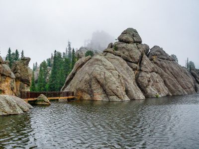
Sylvan Lake, Custer State Park, South Dakota
Sylvan Lake, located within Custer State Park in South Dakota's Black Hills, was formed in 1881 by Theodore Reder's construction…

Tent Camping Above the Badlands at Sunrise
A tent is pitched on a grassy overlook within the Buffalo Gap National Grasslands in South Dakota, as a dramatic…
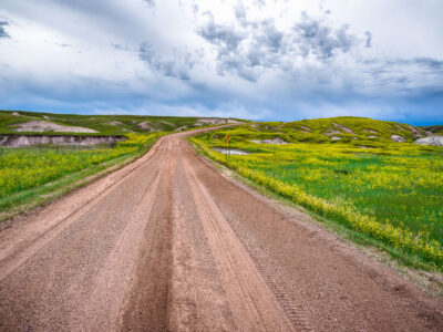
Dirt Road Through Grasslands Near Sheep Mountain, Badlands National Park
Badlands National Park's south unit is laced with unpaved roads like this one, which wind through mixed-grass prairie between the…
Nearby Photos
