July 2019
—
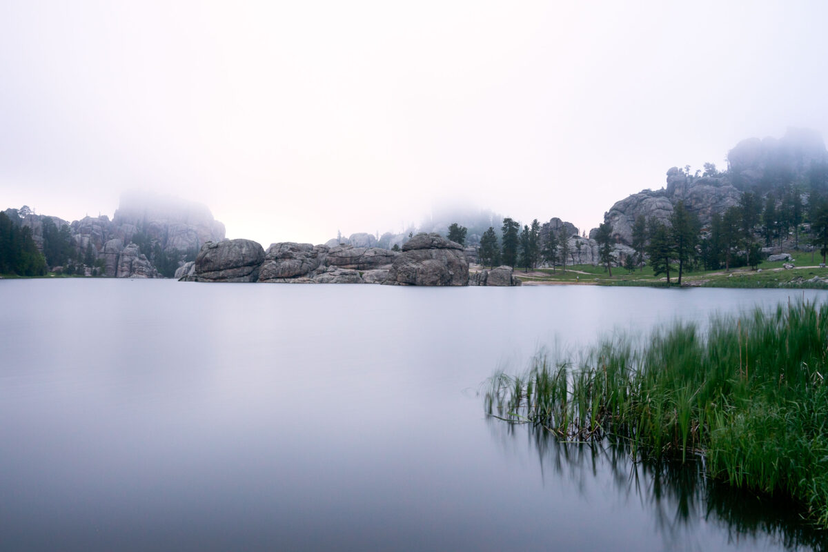
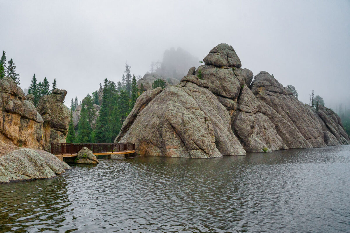
Early morning fog drifts across Sylvan Lake in the Black Hills of South Dakota, softening the granite spires and reflecting still light off the water’s surface. Created in 1891 by Theodore Reder’s dam, the lake sits at the head of the scenic Needles Highway and is surrounded by granite formations that attract climbers, photographers, and hikers. On this mist-covered morning, visibility narrows to the immediate shoreline, turning the familiar outcrops into shadowed silhouettes. The calm water and diffused light capture a rare quiet moment in one of Custer State Park’s most iconic and photographed landscapes.
Needles Eye Tunnel, Custer State Park, South Dakota
July 2019
—
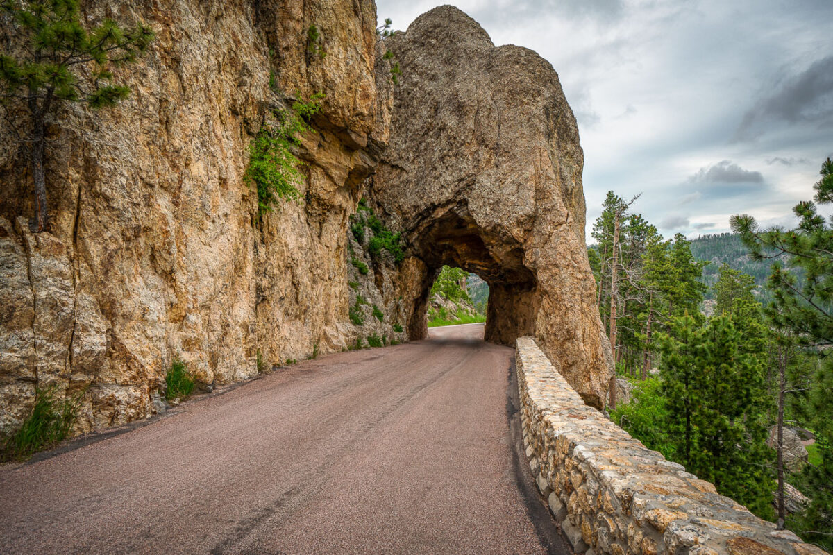
Carved directly through a narrow granite spire in the Black Hills, the Needles Eye Tunnel stands as one of South Dakota’s most distinctive engineering feats. Completed in 1922 as part of the Needles Highway (SD 87), the one-lane tunnel measures just 8 feet 4 inches wide and 11 feet 3 inches high, requiring careful navigation by passing vehicles. Its name comes from the adjacent rock formation, where centuries of wind and water erosion sculpted a sharp, needle-like opening. Surrounded by dense ponderosa pine forest and sheer stone walls, this section of the highway offers one of the most dramatic mountain drives in the American Midwest, linking the spire formations of Custer State Park with the scenic byways leading toward Sylvan Lake and Mount Rushmore.
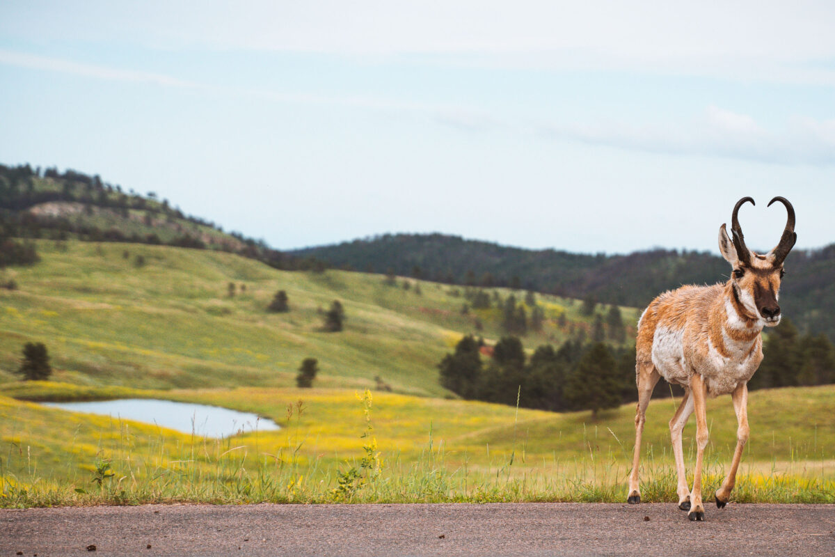
Pronghorn, Wildlife Loop Road, Custer State Park
July 2019
—
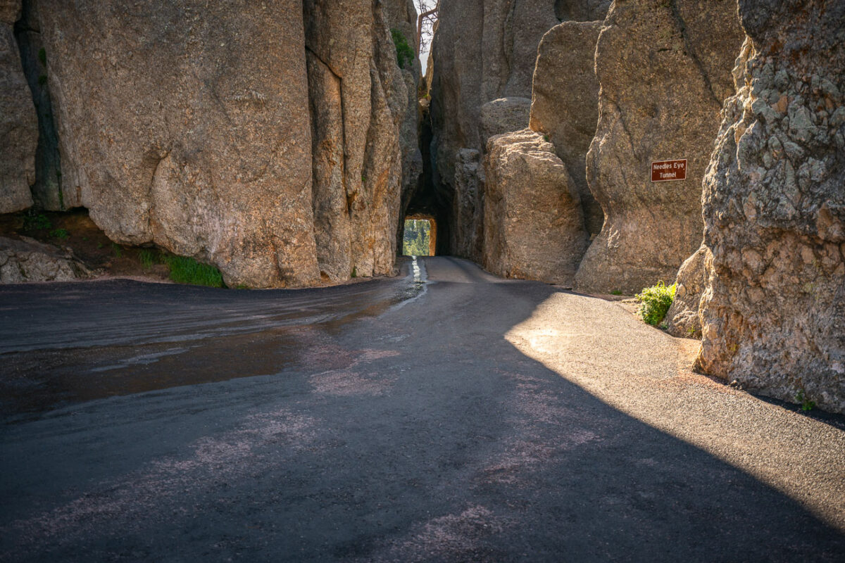
Needles Eye Tunnel, Needles Highway, Custer State Park, South Dakota
July 2019
—
The Needles of the Black Hills of South Dakota are a region of eroded granite pillars, towers, and spires within Custer State Park. Popular with rock climbers and tourists alike, the Needles are accessed from the Needles Highway, which is a part of Sylvan Lake Road (SD 87/89). The Cathedral Spires and Limber Pine Natural Area, a 637-acre portion of the Needles containing six ridges of pillars as well as a disjunct stand of limber pine, was designated a National Natural Landmark in 1976. -- Wikipedia
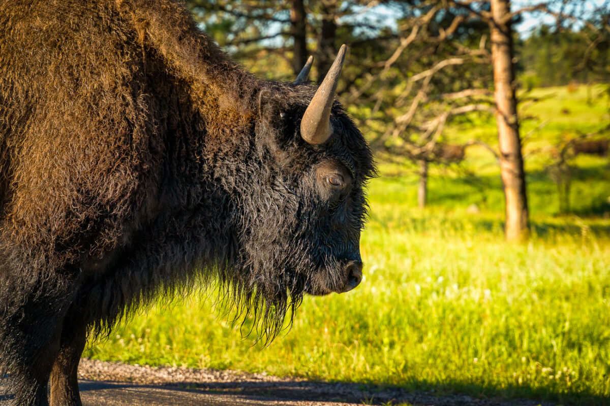
Bison on Wildlife Loop Road, Custer State Park
July 2019
—
An American bison stands along the Wildlife Loop Road in Custer State Park, South Dakota, illuminated by the first light of morning. The park’s herd, one of the largest managed populations in the country, roams freely across a landscape that mirrors the open grasslands once dominated by millions of these animals before the 19th-century decline. Bison are a keystone species of the Great Plains ecosystem, their grazing patterns shaping the prairie’s biodiversity. At Custer, annual roundups and controlled management preserve both the health of the land and the continuation of a lineage deeply tied to Native history and American conservation.
American Bison in Custer State Park, South Dakota
July 2019
—
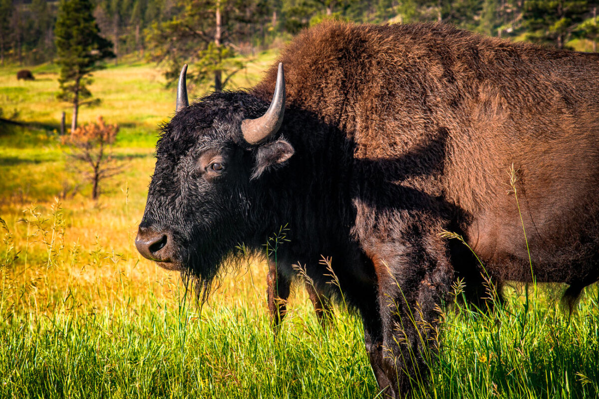
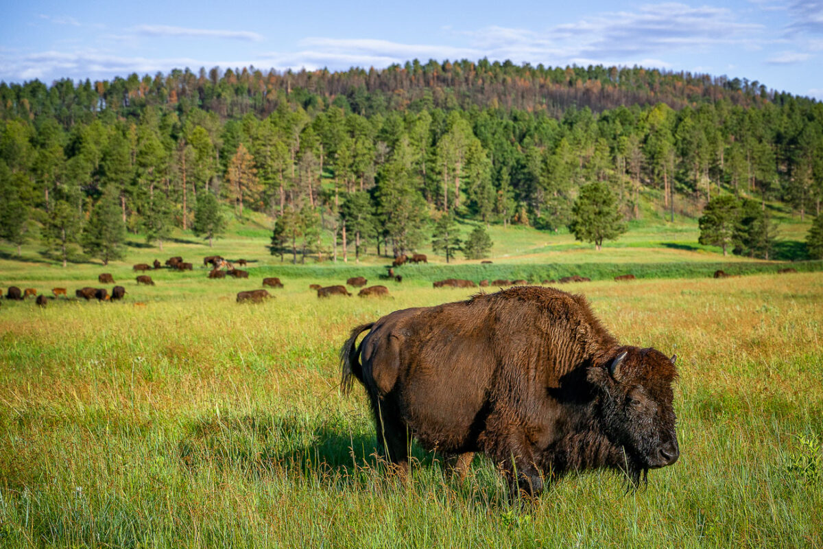
A mature American bison grazes in the rolling prairie of Custer State Park in South Dakota, part of one of the largest publicly owned herds in the United States. Once on the brink of extinction, the park’s bison herd—established in 1914—now numbers more than a thousand animals, representing a critical effort in the preservation of the species. These massive mammals, capable of weighing over a ton, roam freely across the park’s 71,000 acres of mixed-grass prairie and ponderosa pine forest. The setting reflects both the ecological restoration of the Great Plains and the enduring legacy of America’s native megafauna, which has been tied to the land for millennia.
Bison Herd in Custer State Park, South Dakota
July 2019
—
Bison in Custer State Park in Custer, South Dakota.
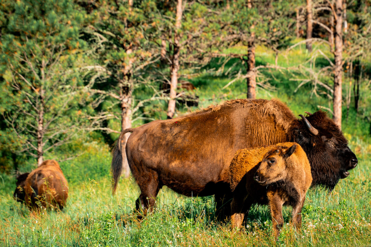
Bison Cow and Calf in Custer State Park, South Dakota
July 2019
—
A bison cow stands watch over her calf in the rolling meadows of Custer State Park, South Dakota. Each spring, the park’s herd welcomes hundreds of reddish-brown calves, often called “red dogs,” whose lighter coats gradually darken as they mature. The park maintains roughly 1,300 animals within its 71,000-acre reserve, a landscape of prairie and ponderosa pine forest that mirrors the natural habitat once spanning the Great Plains. This scene reflects both the resilience of the American bison and the conservation success that brought the species back from near extinction in the early 20th century.
Sylvan Lake, Custer State Park, South Dakota
July 2019
—
Sylvan Lake is a lake located in Custer State Park, in the Black Hills of South Dakota, United States. It was created in 1881 when Theodore Reder built a dam (the Sylvan Lake Water Dam) across Sunday Gulch Creek. The lake area offers picnic places, rock climbing, small rental boats, swimming, and hiking trails. It is also popular as a starting point for excursions to Black Elk Peak and The Needles. -- Wikipedia
Granite Outcrops Along Highway 87, Black Hills National Forest
July 2019
—
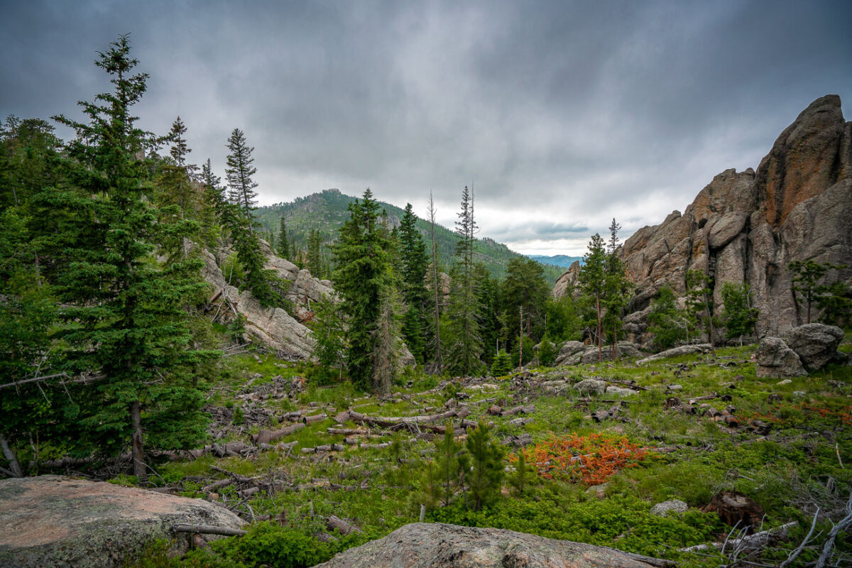
Along Highway 87 in the central Black Hills National Forest, this view captures the rugged landscape typical of the region’s granite highlands. Massive weathered outcrops rise sharply from the forest floor, remnants of the ancient Harney Peak granite formation that underlies much of this terrain. Scattered ponderosa pines cling to crevices in the rock, while fallen trunks and new saplings trace the slow recovery of the forest from past fires. The setting lies near the scenic Needles Highway corridor—an area known for its narrow tunnels, steep grades, and ever-changing mountain light that defines the wilderness character of western South Dakota.
Abandoned Mine Entrance, Black Hills, South Dakota
July 2019
—
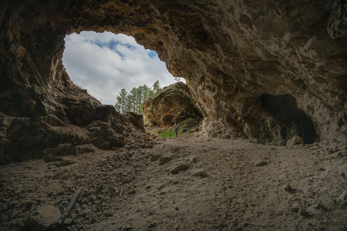
An abandoned mine in South Dakota near the Black Hills.
Abandoned Gold Rush Mine Entrance, Black Hills, SD
July 2019
—
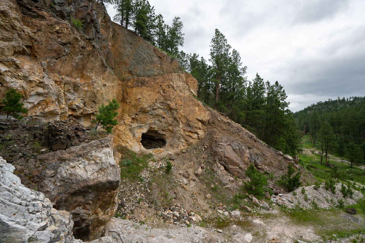
Carved into a rugged slope of weathered schist and limestone, this small mine entrance sits near the historic mining corridors west of Custer, South Dakota — a remnant of the Black Hills’ 19th-century gold rush. The opening, likely hand-dug or expanded with early blasting techniques, leads into mineral-rich rock layers once prospected for gold, silver, and iron sulfides that fueled the regional boom of the 1870s. Surrounding the portal are piles of tailings and fractured quartz veins that reveal the area’s geologic complexity — part of an ancient mountain uplift more than 1.8 billion years old. Today, the forest has begun to reclaim the site, with pines and brush growing over the spoil heaps, blending traces of human industry back into the Black Hills landscape.
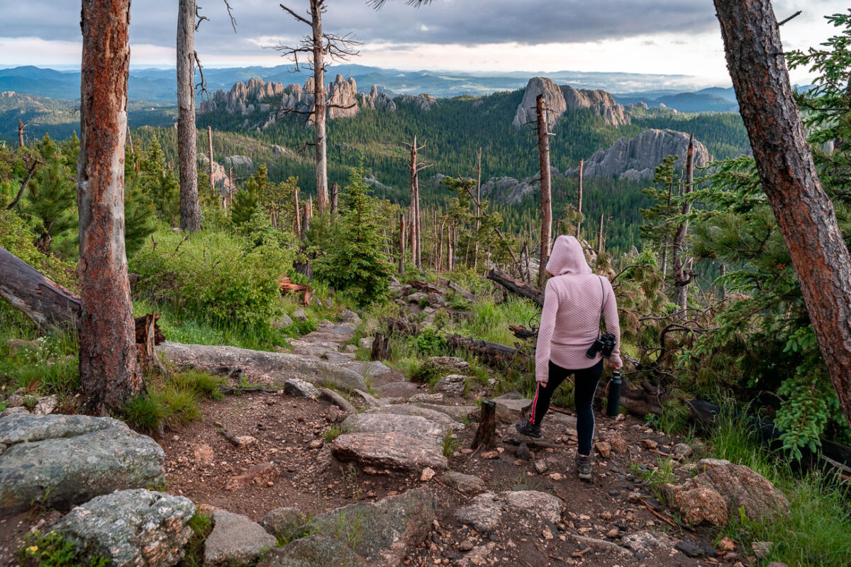
Black Elk Peak Trail Descent at Dusk, Black Hills, South Dakota
July 2019
—
A hiker descends the rugged granite path from Black Elk Peak, the highest summit in South Dakota, as the evening light softens over the Cathedral Spires. The trail—part of the Norbeck Wildlife Preserve within Custer State Park—winds through a landscape shaped by ancient uplift and erosion, where ponderosa pines cling to stone outcrops and fire-scarred trunks bear witness to the region’s cycles of renewal. From this vantage point, the Black Hills stretch endlessly toward the horizon, a place sacred to the Lakota people and enduringly wild in its beauty.
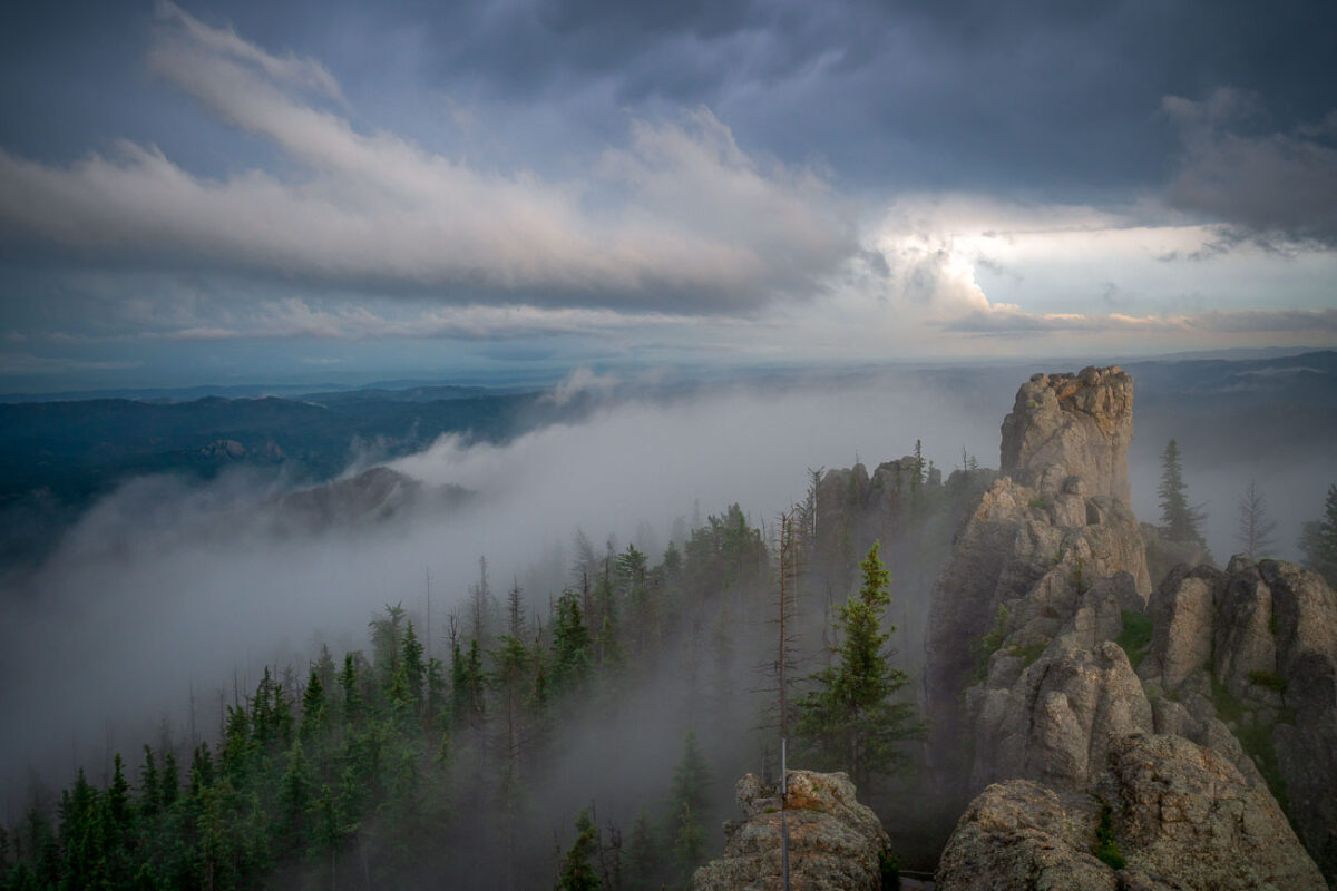
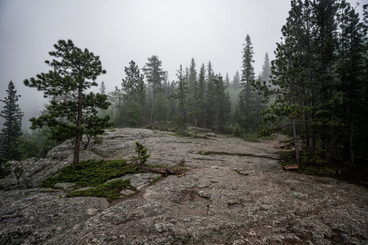
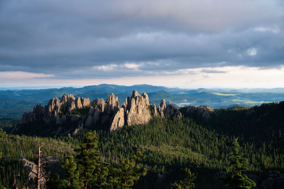
Cathedral Spires, Black Hills, South Dakota, Morning Fog
July 2019
—
Low clouds sweep across the granite pinnacles of the Cathedral Spires in the Black Hills of South Dakota, wrapping the rugged landscape in drifting fog just after dawn. These towering formations—some rising more than 5,000 feet above sea level—are part of the Needles range within Custer State Park, a region shaped by millions of years of erosion and uplift. The rock spires, composed primarily of Harney Peak granite, are a hallmark of the park’s dramatic geology and a favorite destination for climbers and photographers. On mornings like this, the fog often settles in the valleys below, creating a fleeting illusion of islands floating above the forest, while the peaks catch the first light breaking through the storm-heavy sky.
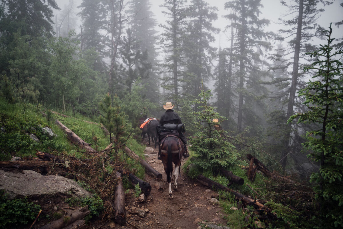
Horseback riders on Black Elk Peak trail, South Dakota
July 2019
—
Horseback riders navigate a mist-covered trail near the summit of Black Elk Peak in South Dakota’s Black Hills. The fog clings to the ponderosa pines, softening the rugged landscape that rises above Custer State Park. This peak—renamed in 2016 to honor Lakota spiritual leader Black Elk—has long served as both a place of pilgrimage and a vantage point over the vast granite formations and pine forests of the region.
Black Elk Peak Trail in Fog, South Dakota
July 2019
—
A narrow trail winds through the fog-drenched forest of Black Elk Peak, South Dakota, as light rain dampens the granite path and pine needles. The area—part of the rugged Black Hills—sits at over 7,200 feet, the highest elevation east of the Rockies. The mist settles among ponderosa pines and spruce, creating a hushed, atmospheric climb through terrain sacred to the Lakota people and known for its sweeping, often cloud-hidden views.
Black Elk Peak Summit in Fog, Black Hills, South Dakota
July 2019
—
A dense fog envelops the granite summit area of Black Elk Peak, the highest natural point in South Dakota at 7,242 feet. The rocky terrain and scattered pines of the Black Hills fade into the mist, creating an ethereal atmosphere above Custer State Park. Once known as Harney Peak, the mountain holds deep spiritual significance for the Lakota Sioux and remains a striking natural landmark where weather and history intertwine in quiet solitude.
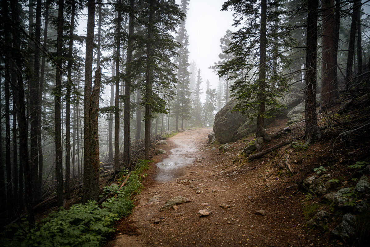
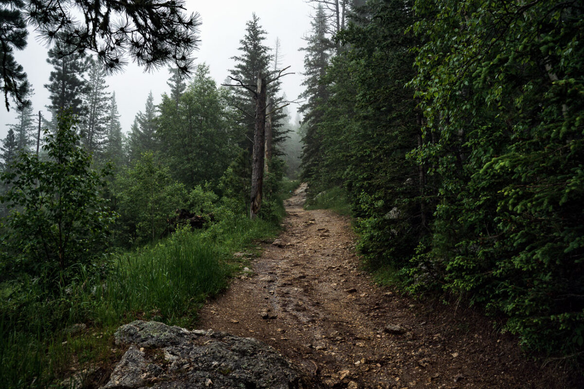
Black Elk Peak Trail in Fog, Black Hills, South Dakota
July 2019
—
A fog-covered hiking trail winds through the dense pines and granite slopes of Black Elk Peak in South Dakota’s Black Hills. The path, slick with rain and scattered with stones, climbs steadily toward the summit through ponderosa pine, birch, and spruce. This mountain—sacred to the Lakota and once called Harney Peak—rises to 7,244 feet, making it the highest natural point between the Rockies and the Pyrenees. In the early morning fog, the quiet forest and damp earth lend the trail a timeless stillness, recalling centuries of spiritual and geological history beneath the mist.
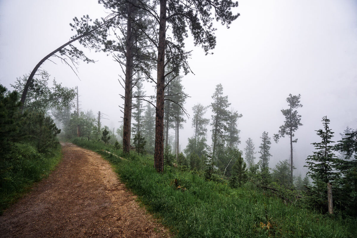
Black Elk Peak Trail in Fog, Black Hills, South Dakota
July 2019
—
A mist-laden trail winds through the ponderosa pine forest near the summit of Black Elk Peak in the Black Hills of South Dakota. The fog softens the rugged terrain, reducing the visibility of distant ridges and creating a quiet, atmospheric stillness in the morning air. This area, once known as Harney Peak, stands as the highest point east of the Rocky Mountains and is a sacred place to the Lakota Sioux, where natural beauty and cultural heritage converge in the clouds.
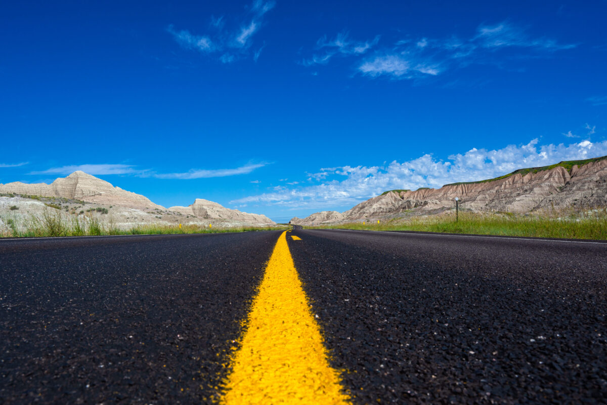
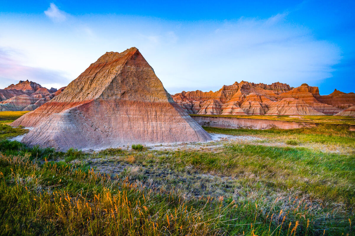
Highway 44 Through Badlands National Park, South Dakota
July 2019
—
A newly paved stretch of Highway 44 cuts through the rugged formations near Scenic, South Dakota, beneath a vivid summer sky. This east–west route skirts the southern boundary of Badlands National Park, where blacktop meets eroded buttes carved by millennia of wind and water. The low-angle view emphasizes the contrast between the engineered precision of the highway and the raw geologic textures of the surrounding landscape—an enduring symbol of travel through one of the Great Plains’ most striking natural corridors.
The Needles at Sunset, Custer State Park, South Dakota
July 2019
—
Evening light breaks through heavy clouds to illuminate the Needles, a cluster of towering granite spires rising above dense pine forest in the Black Hills of South Dakota. The sharp pinnacles, part of Custer State Park’s Cathedral Spires formation, are composed of eroded granite that dates back more than a billion years, sculpted by time and weather into their distinctive vertical forms. This region, accessible by the winding Needles Highway, is both a geological marvel and a spiritual landscape—its rugged skyline long revered by the Lakota Sioux and later celebrated by photographers, climbers, and travelers drawn to the surreal beauty of South Dakota’s mountain heartland.
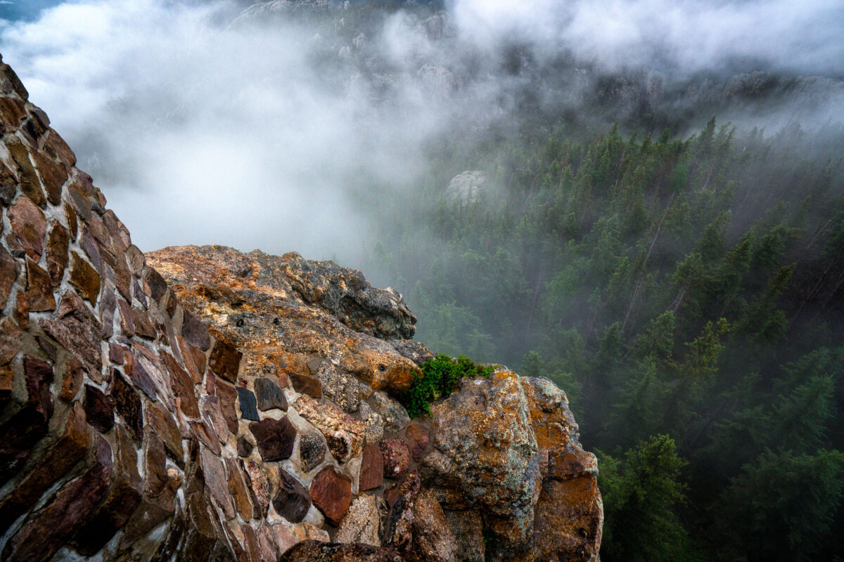
Black Elk Peak Summit Fog and Stone Tower
July 2019
—
At the summit of Black Elk Peak, low clouds roll through the granite spires and dense pine forest below, wrapping the mountain in a shifting veil of fog. The historic stone fire tower, built by the Civilian Conservation Corps in the 1930s, stands as a testament to early forest conservation in the Black Hills. From this vantage point—the highest in South Dakota—views often stretch into Wyoming and Nebraska, but on misty mornings like this one, the world feels confined to the mountaintop itself, suspended between rock and cloud.
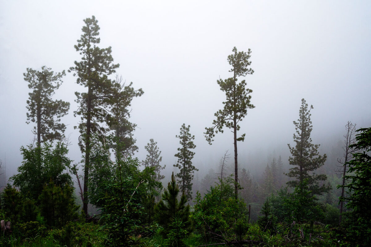
Black Elk Peak Fog, Black Hills, South Dakota
July 2019
—
A dense morning fog envelops the Ponderosa pines of the Black Hills in South Dakota, softening the outlines of the forest and muting the green tones of early summer. The moisture-laden air clings to the tall trunks, creating an atmosphere of quiet stillness and mystery. This type of fog commonly forms in the higher elevations near Custer State Park and the Needles Highway, where rapid temperature shifts cause mist to settle among the rugged hillsides and conifer stands, briefly transforming the landscape into an ethereal woodland veil.
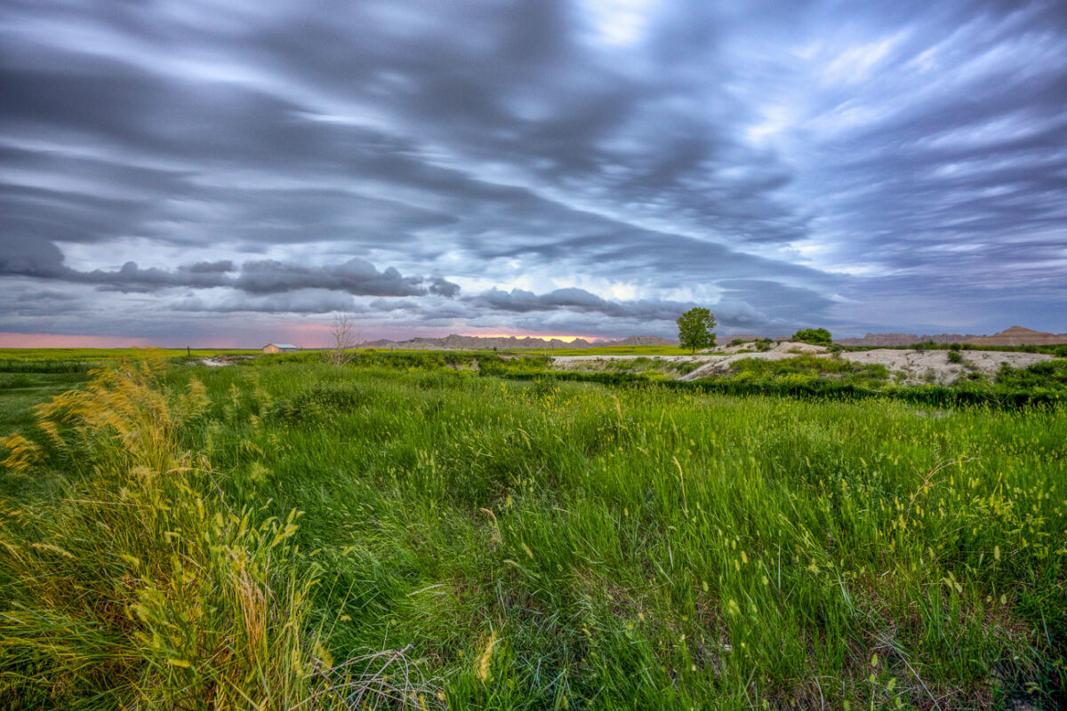
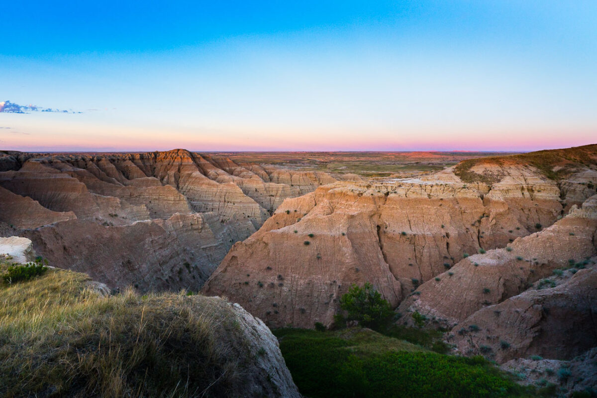
Badlands National Park, South Dakota: Storm Clouds Over Grasslands
July 2019
—
Amazing storm clouds rolling into Interior, South Dakota at our camp site near the Badlands National Park. It seems every year we get at least one really great thunderstorm when camping.
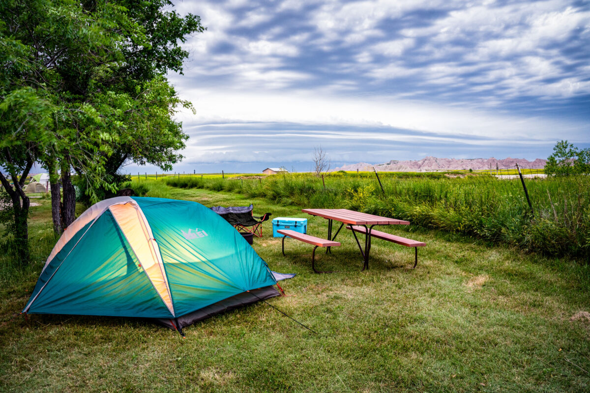
Tent camping at Badlands Hotel & Campground, Interior South Dakota
July 2019
—
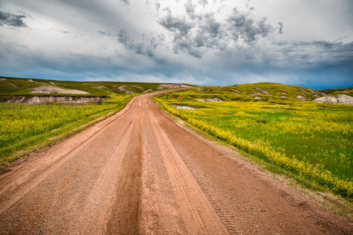
Indian Creek Drive, Badlands National Park, South Dakota
July 2019
—
A dirt road cuts through the rolling prairie of Indian Creek Drive in the western reaches of Badlands National Park, near the small town of Scenic, South Dakota. Storm clouds build over the mixed-grass plains, casting dramatic light on the green hills and wildflower fields typical of the park’s early summer landscape. This remote section of the Badlands, less traveled than the main loop road, reveals the quieter beauty of the park—where erosion-carved ridges and open grasslands merge under a vast and changeable sky.
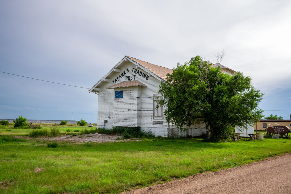
Tatanka Trading Post, Scenic, South Dakota
July 2019
—
The Tatanka Trading Post in Scenic, South Dakota, stands as a weathered relic of roadside commerce along the gateway to Badlands National Park. Once a small but lively hub for travelers and locals, the post’s peeling white paint and simple gabled design speak to decades of wind, sun, and changing times on the Great Plains. The name Tatanka—Lakota for “bison”—reflects the deep cultural ties of the region’s Indigenous heritage and the area’s rugged frontier identity. Today, the building endures as a quiet landmark of rural South Dakota’s layered history.
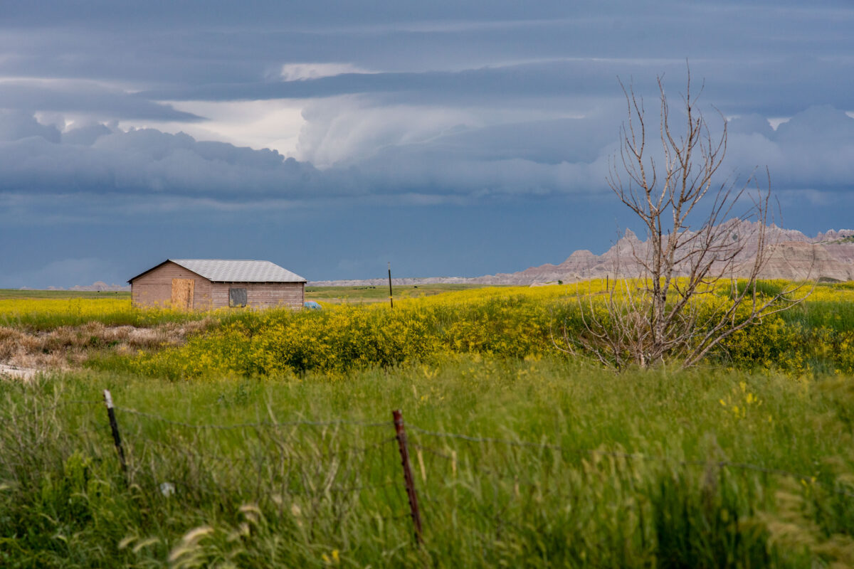
Badlands National Park: Storm Approaching Shed
July 2019
—
A lone wooden shed stands among fields of wild grasses and yellow blooms as storm clouds gather near Interior, South Dakota, on the outskirts of Badlands National Park. The layered sky hints at an incoming summer storm sweeping across the plains, with the rugged formations of the Badlands visible on the horizon. The muted colors and boarded windows evoke both isolation and endurance, capturing the tension between human settlement and the vast, unpredictable prairie environment.
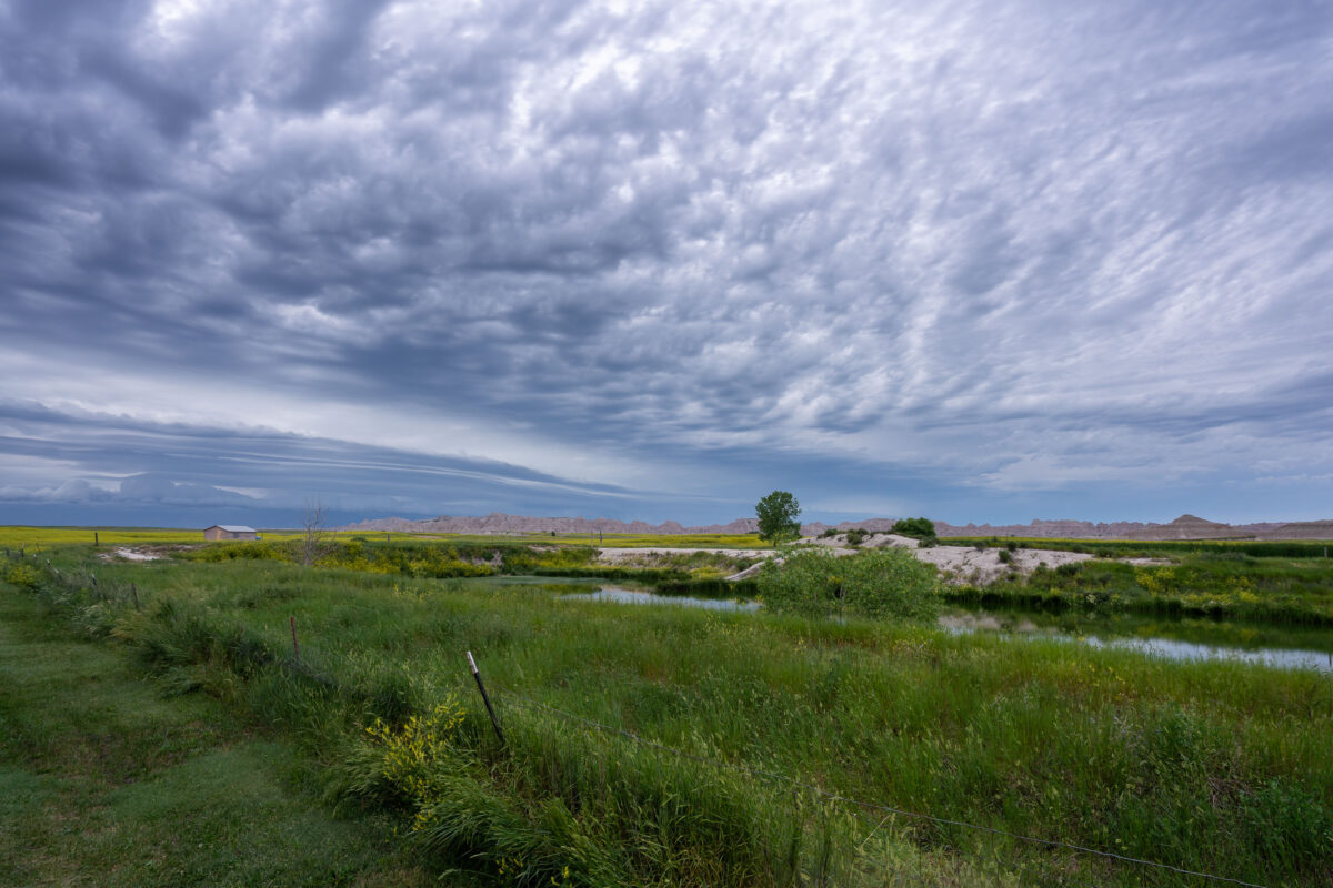
Storm Clouds Over Badlands National Park, South Dakota
July 2019
—
An approaching storm looms over the rolling grasslands near Interior, South Dakota, at the edge of Badlands National Park. The layered clouds form dramatic bands above the wetland and open prairie, where a small structure and fence line mark the human presence in this otherwise vast and untamed landscape. From this vantage point near the White River, the eroded formations of the Badlands rise faintly in the distance, emphasizing the contrast between the lush foreground and the arid, sculpted terrain beyond.
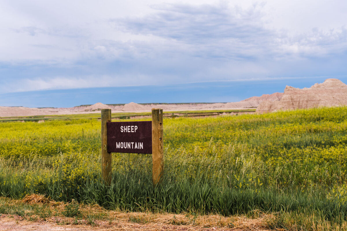
Sheep Mountain Sign, Badlands National Park, South Dakota
July 2019
—
Sheep Mountain in South Dakota near the Badlands National Park.
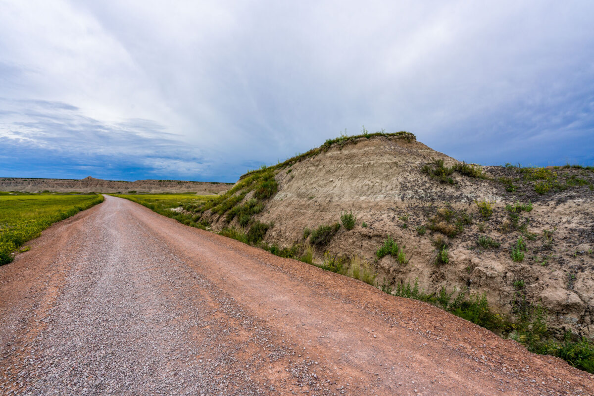
Sheep Mountain Road, Badlands National Park, South Dakota
July 2019
—
A weathered wooden sign marks the rugged entrance to Sheep Mountain in the southern reaches of Badlands National Park, South Dakota. This remote area, surrounded by the sweeping prairies of Buffalo Gap National Grassland, offers one of the park’s most dramatic and less-visited overlooks. The region sits within Oglala Lakota lands, where erosion has sculpted colorful buttes and steep ridges over millions of years. Accessible by an unpaved road, Sheep Mountain remains a quiet, untamed corner of the Badlands, revealing the deep geologic and cultural layers of the Northern Plains.
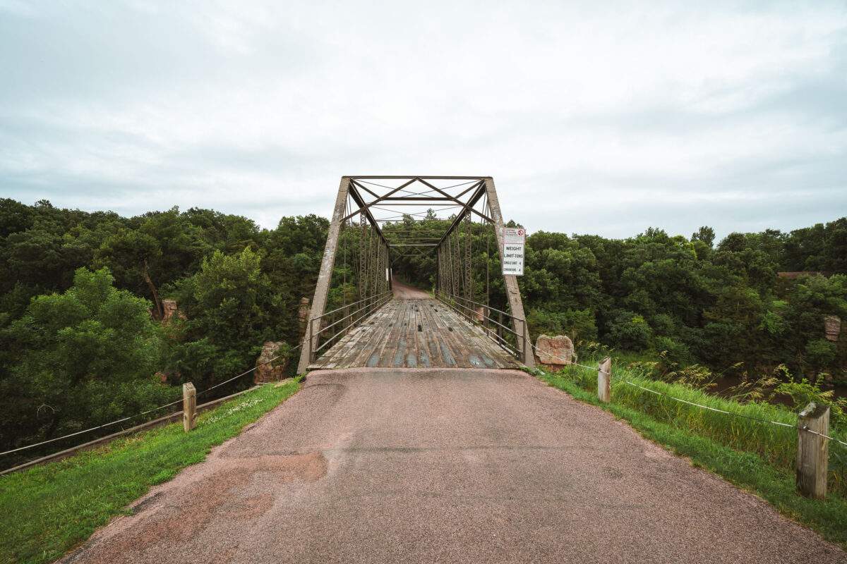
Garretson Truss Bridge over Split Rock Creek
July 2019
—
An old steel truss bridge spans Split Rock Creek near the town of Garretson, South Dakota, carrying a narrow, weathered wooden deck over the rocky gorge below. Built in the early 20th century, this Pratt through truss design reflects an era when such riveted steel frameworks connected small Midwestern towns before the advent of modern concrete spans. Its utilitarian geometry and riveted latticework remain intact, framed by the lush, tree-lined valley of Split Rock Creek—a setting that once hosted flour mills, quarries, and river crossings essential to the region’s early development. The bridge now stands as a quiet relic of rural American engineering, linking history and landscape on the edge of the prairie.
Badlands National Park: Saddle Pass Trailhead Area
July 2017
—
CS36B off of Highway 240 near the Saddle Pass Trailhead. The trail is a short hike up the Badlands Wall giving views of the White River Valley.
Sheep Mountain Road Sunflowers, Badlands National Park
July 2017
—
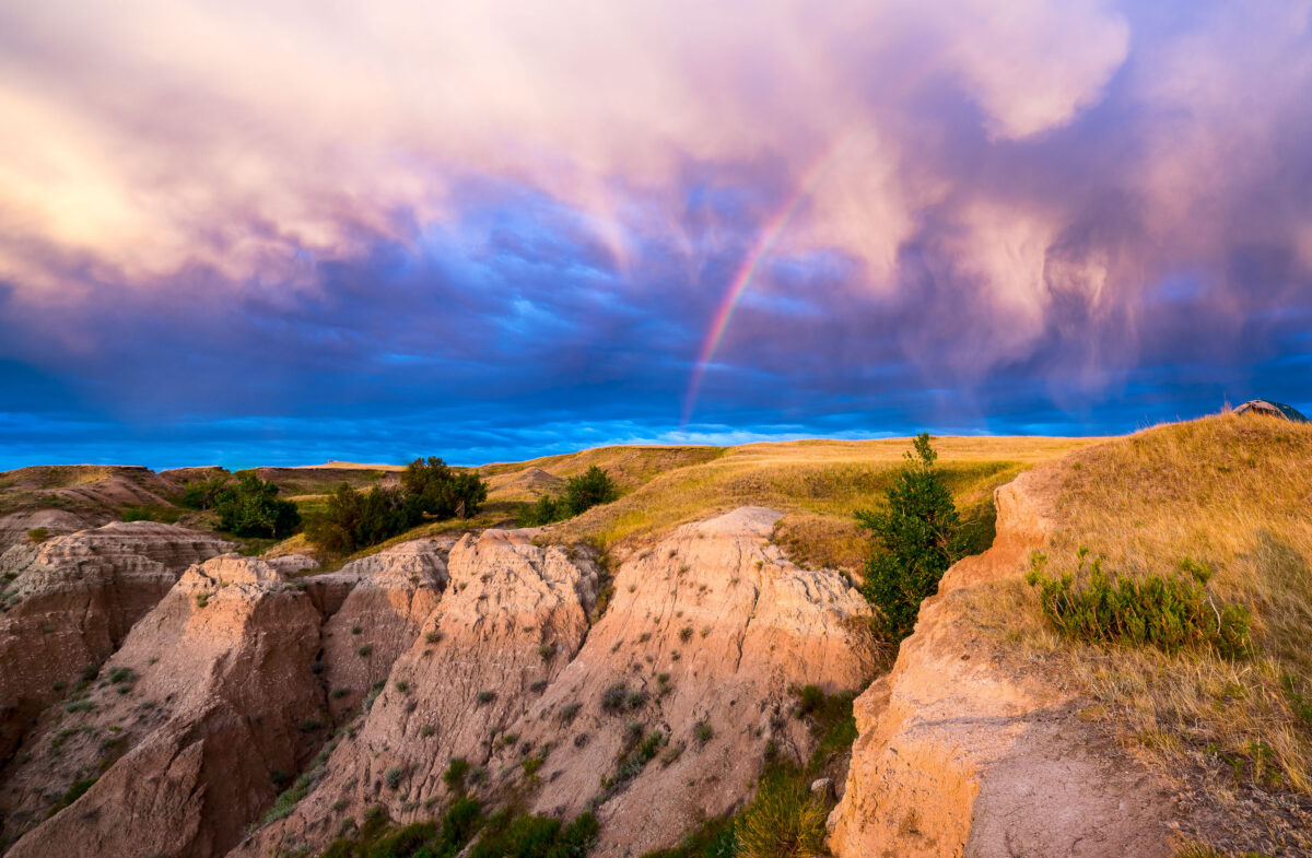
Rainbow Sunrise Over Buffalo Gap National Grasslands, South Dakota
July 2017
—
A beautiful rainbow at the Buffalo Gap National Grasslands. We camped here and woke up to this during the sunrise.
Granite Outcrops and Forest Near Needles Highway, Black Hills
July 2017
—
Sunrise over our tent at the Buffalo Gap National Grasslands. This Bureau of Land Management spot is one of our absolute favorite camping spots.
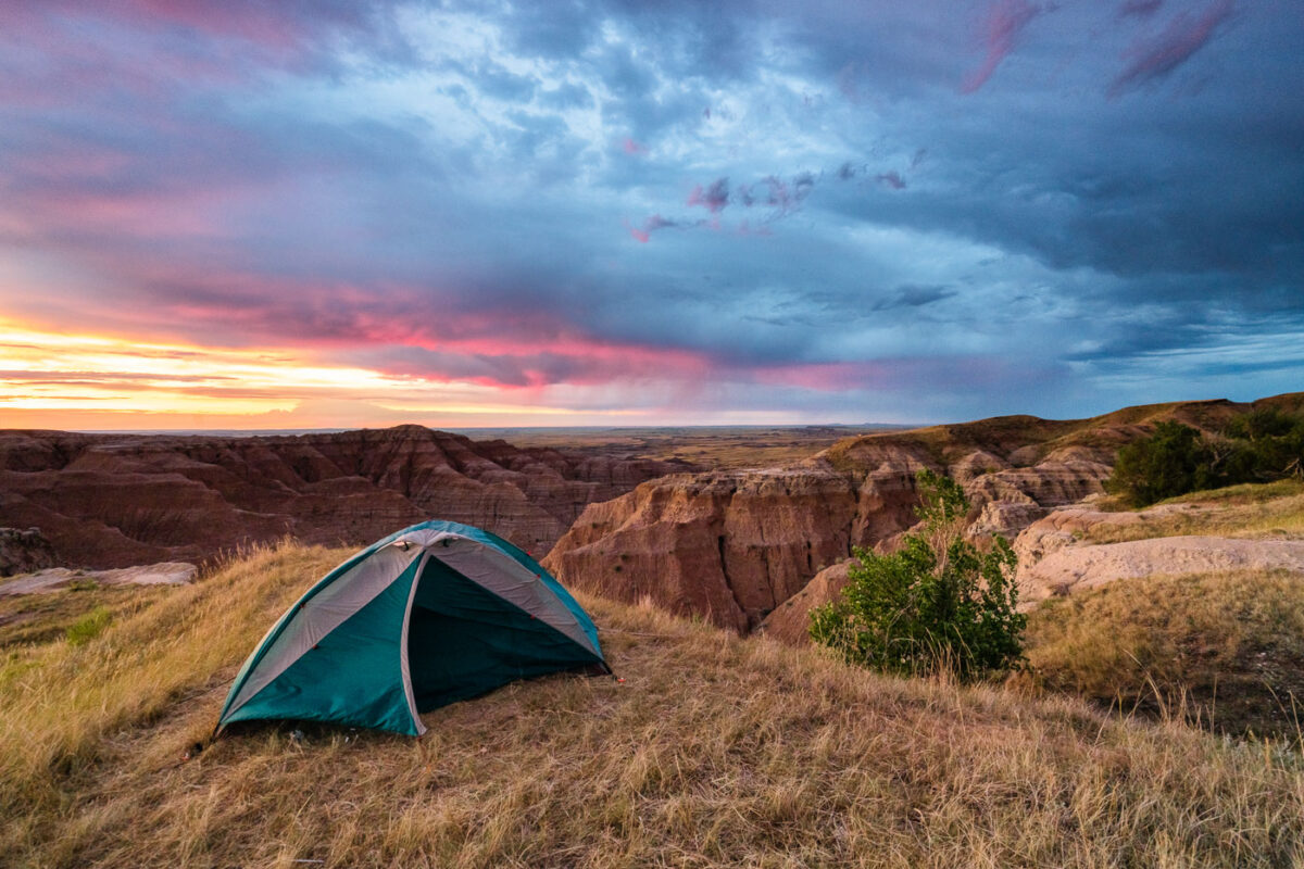
Sunrise Over Tent at Buffalo Gap National Grasslands, South Dakota
July 2017
—
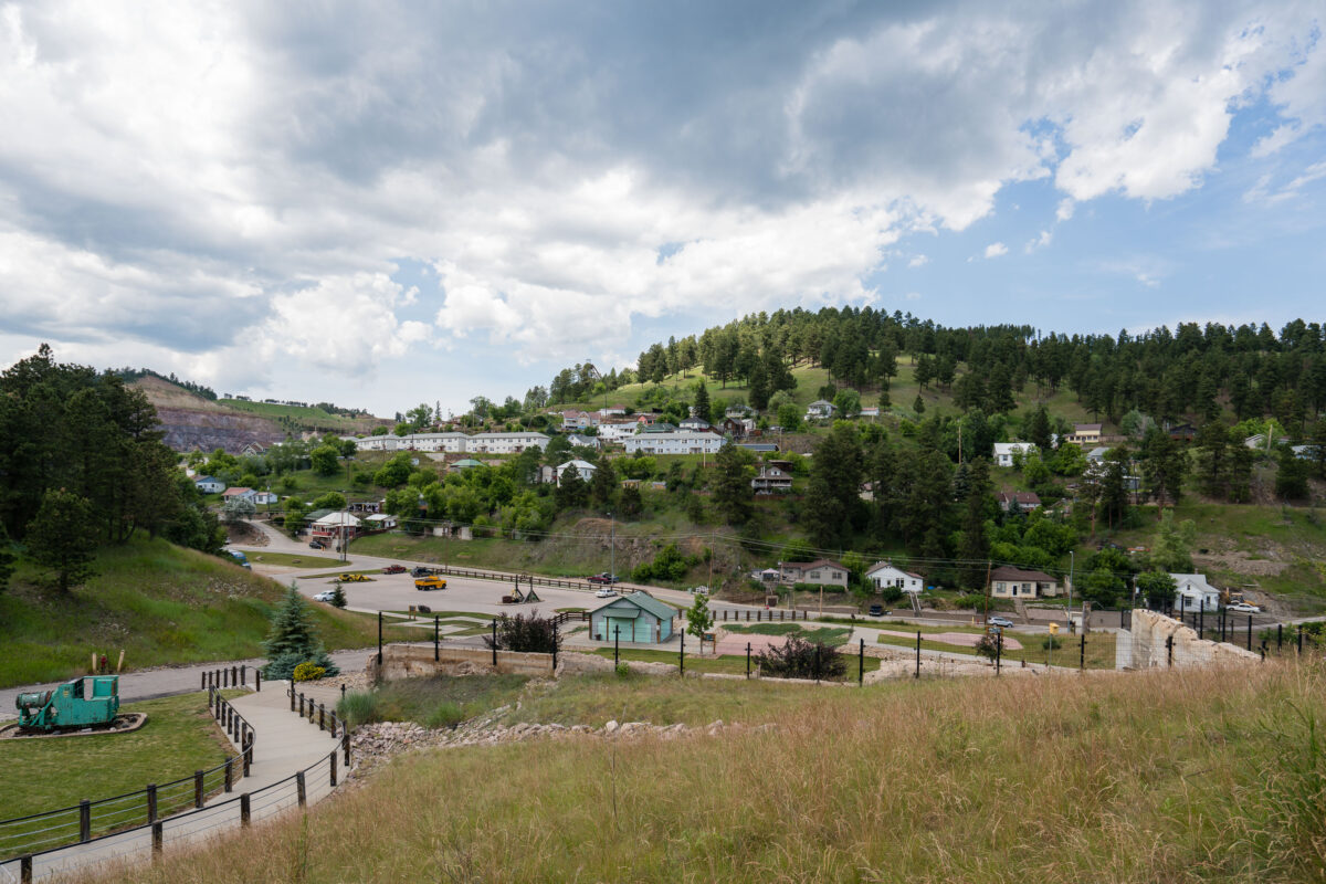
Gold Run Park Below Lead Hillside, South Dakota
July 2017
—
Gold Run Park in Lead, South Dakota.
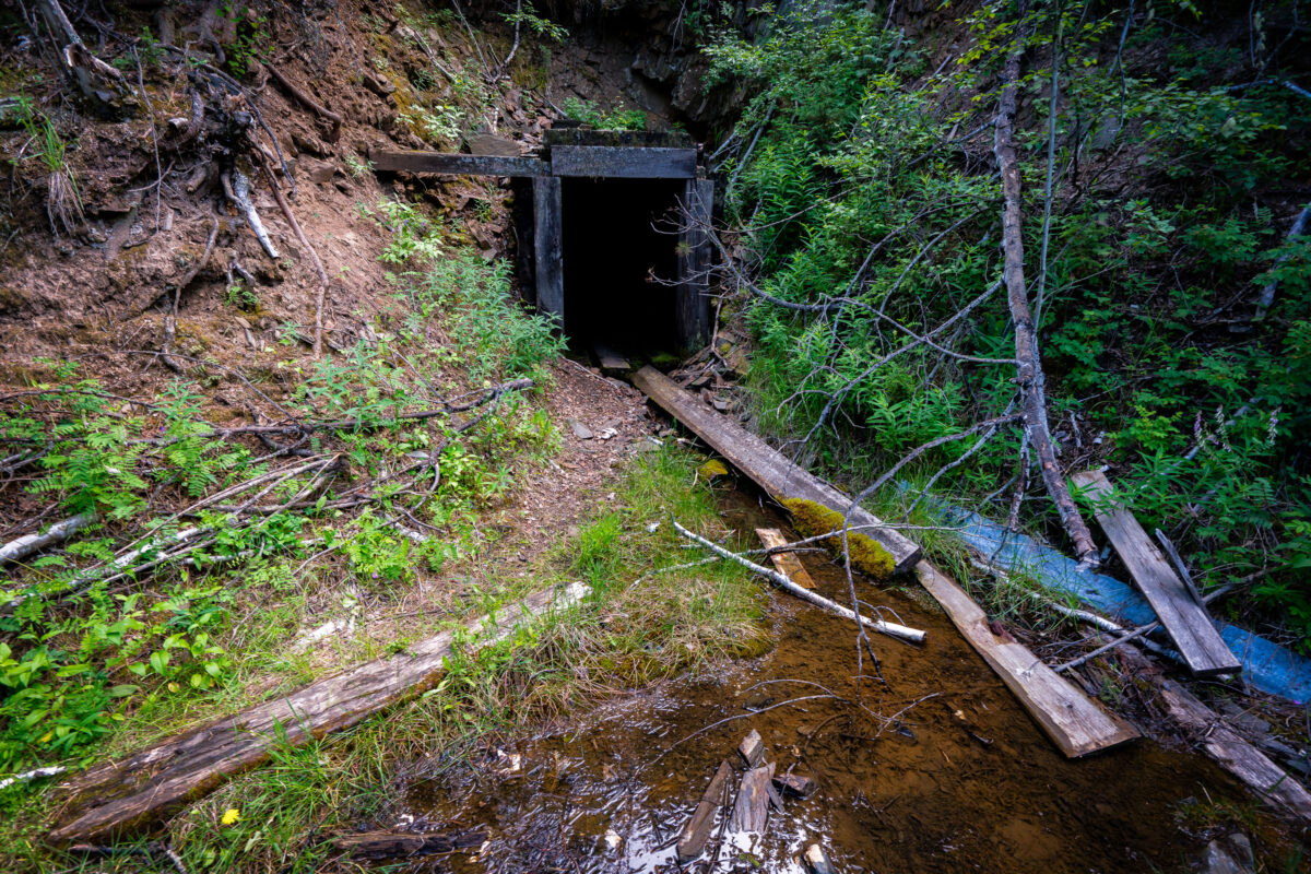
Abandoned Mine Adit, Black Hills near Lead, South Dakota
July 2017
—
A long-forgotten mine entrance lies hidden in the forested slopes near the old gold mining town of Lead, South Dakota. The timber-framed portal, now partially collapsed and overtaken by vegetation, dates back to the late 19th or early 20th century—part of the Black Hills’ extensive network of small exploratory mines that sprang up after the 1876 gold rush. Streams like this one often run through or near these adits, carrying trace minerals that once drew prospectors to the region. Though many of these shafts were short-lived, they remain scattered reminders of South Dakota’s mining heritage and the rugged ambition that once fueled settlement in the Black Hills.
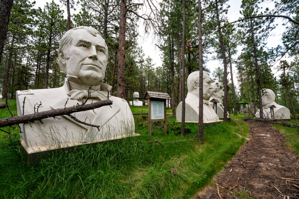
Abandoned Presidents Park Statues in Black Hills Forest, South Dakota
July 2017
—
These towering concrete presidential busts sit hidden in the woods near Lead, South Dakota—remnants of a once-ambitious roadside attraction called Presidents Park. Conceived by Texas artist David Adickes and opened in 2003, the park showcased forty-three sculptures, each roughly 20 feet tall, depicting every U.S. president from Washington through George W. Bush. The attraction struggled to draw visitors and closed by 2010, leaving the massive heads stranded in the forest. Over time, nature reclaimed the site, with fallen branches, moss, and pine needles collecting around the statues. Today, the figures stand as haunting relics of early-2000s Americana tourism and the impermanence of grand civic art in private hands.
Buffalo Gap National Grasslands Badlands, South Dakota
July 2017
—
Sunset at the Buffalo Gap National Grasslands.
Bighorn Sheep on the Badlands Cliffs, South Dakota
July 2017
—
Bighorn Sheep at Buffalo Gap National Grassland in South Dakota.
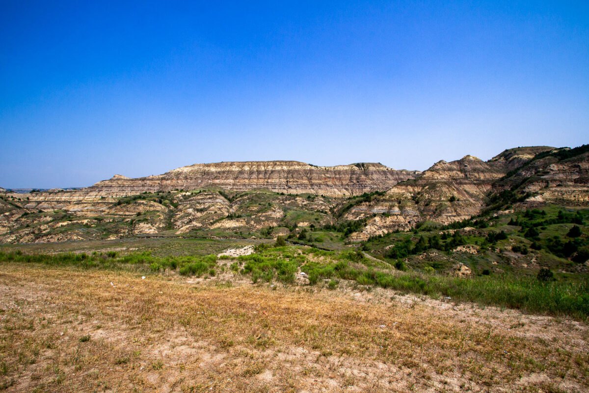
North Dakota Badlands from Theodore Roosevelt Expressway, July 2015
July 2015
—
The North Dakota badlands as seen from the Theodore Roosevelt Expressway.
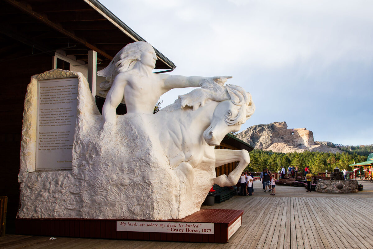
Crazy Horse Memorial, South Dakota
July 2014
—
Crazy Horse in South Dakota.
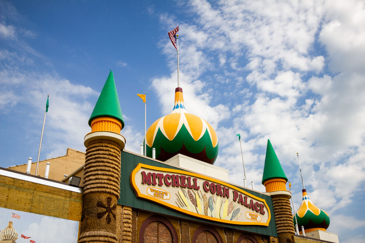
Mitchell Corn Palace, South Dakota: World’s Only Since 1892
July 2014
—
Mitchell Corn Palace in Mitchell, South Dakota.
Built in Minneapolis
Minneapolis Photographer
Browse by location, move through long-running series, or start with recent work.