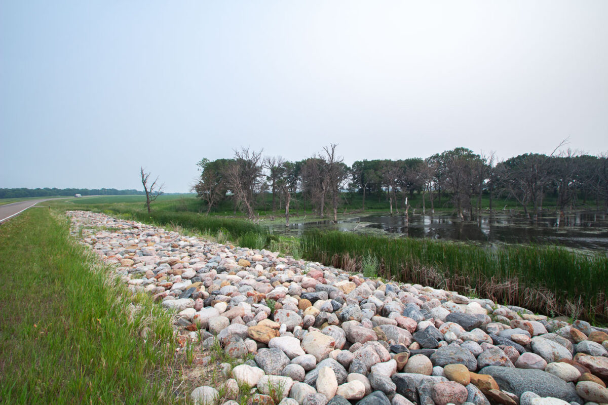
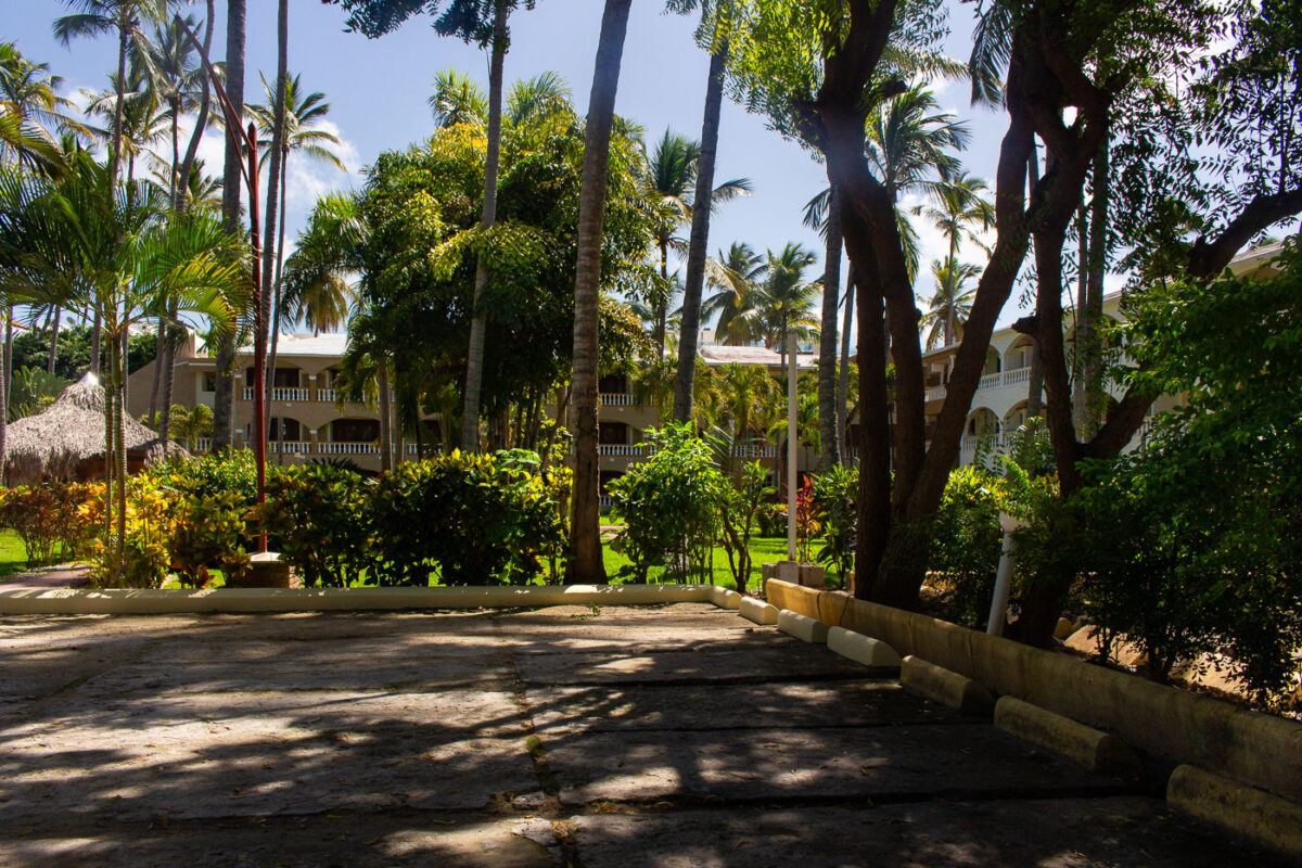
Devils Lake State Park, North Dakota: Shoreline Riprap and Wetland
July 2015 — Devils Lake State Park in North Dakota.
Explore photos in Uncategorized.
July 2015 — Devils Lake State Park in North Dakota.
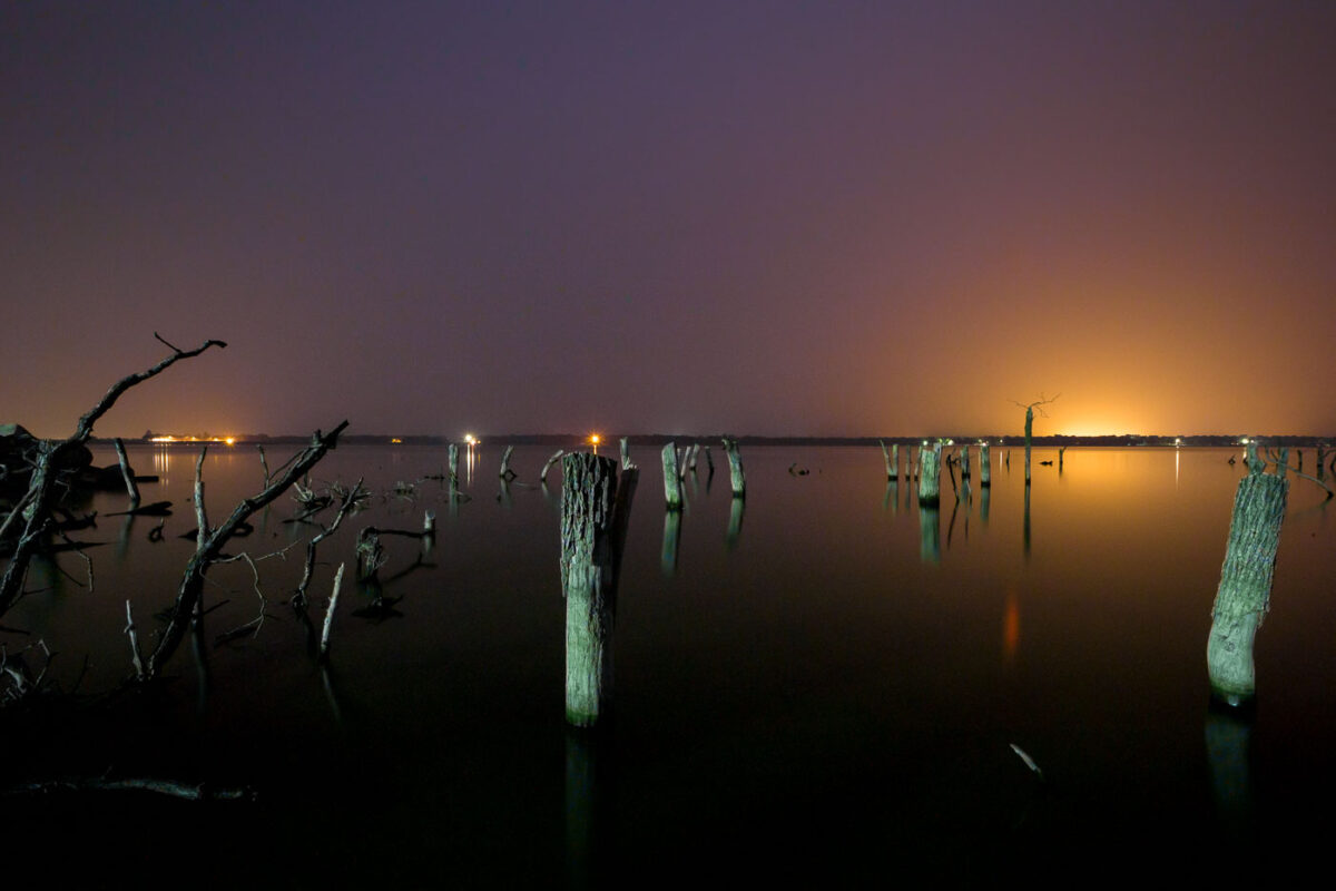
July 2015 — Sunset at Woodland Resort on Devil's Lake in North Dakota.
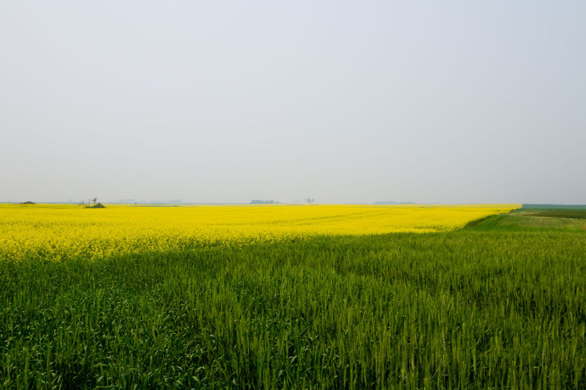
July 2015 — Grass near Starkweather North Dakota
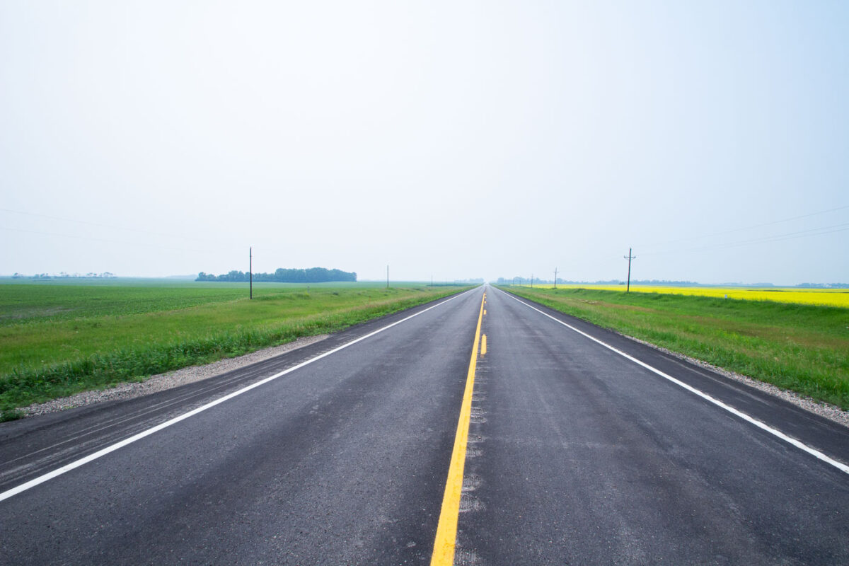
July 2015 — Highway 17 near Starkweather, North Dakota.

July 2015 — Highway near Wolford, North Dakota.
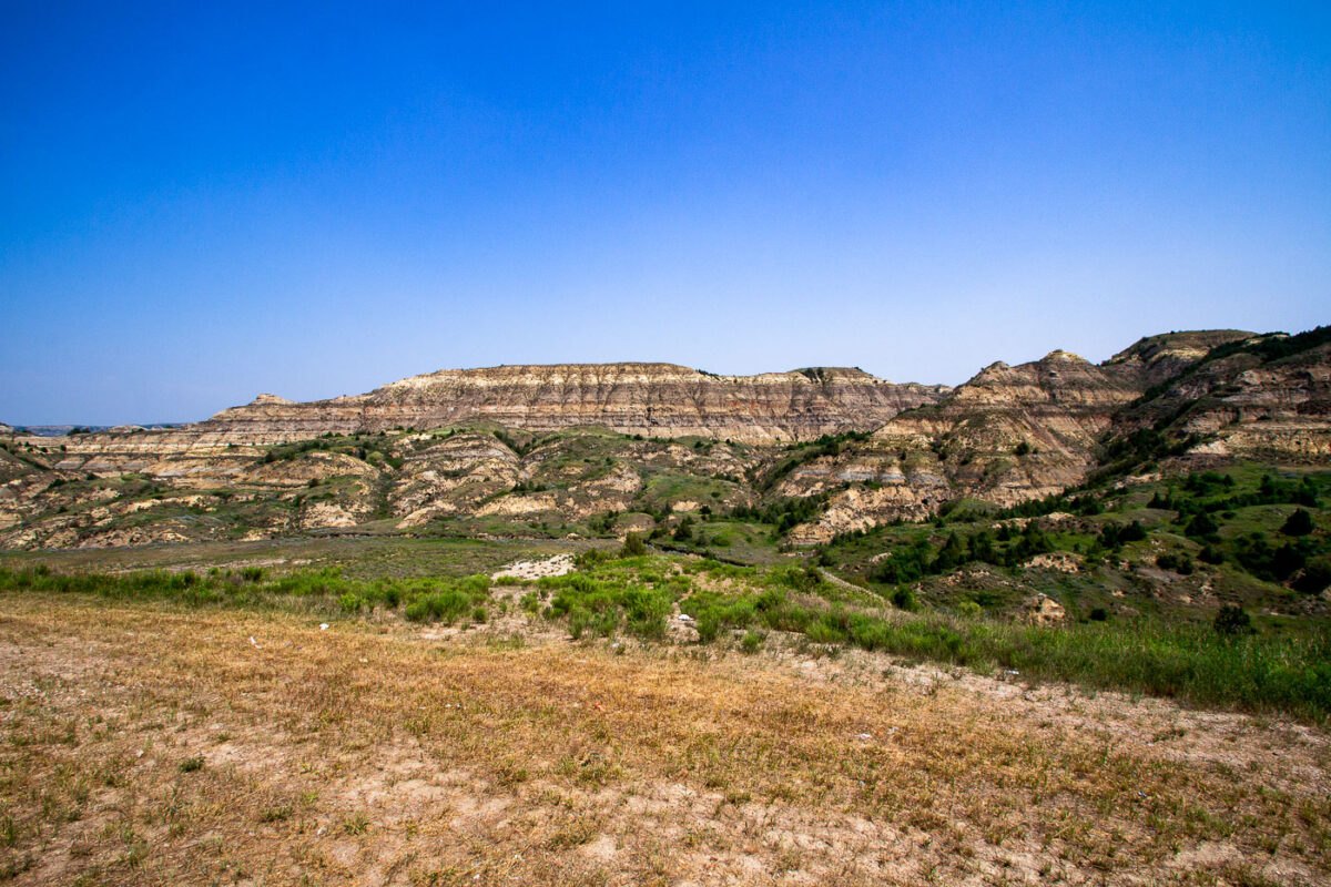
July 2015 — The North Dakota badlands as seen from the Theodore Roosevelt Expressway.
July 2015 — Charbonneau, North Dakota Ghost Town
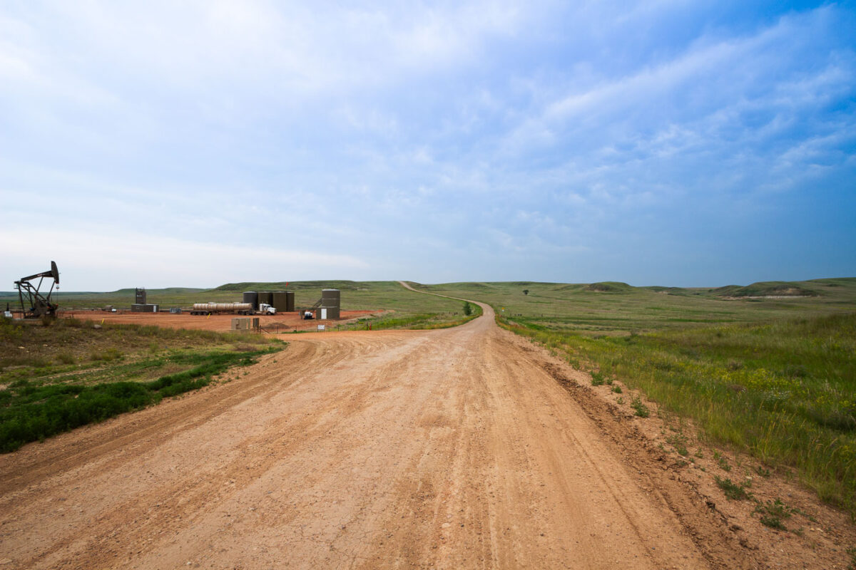
July 2015 — Oil rig in Charbonneau, North Dakota.
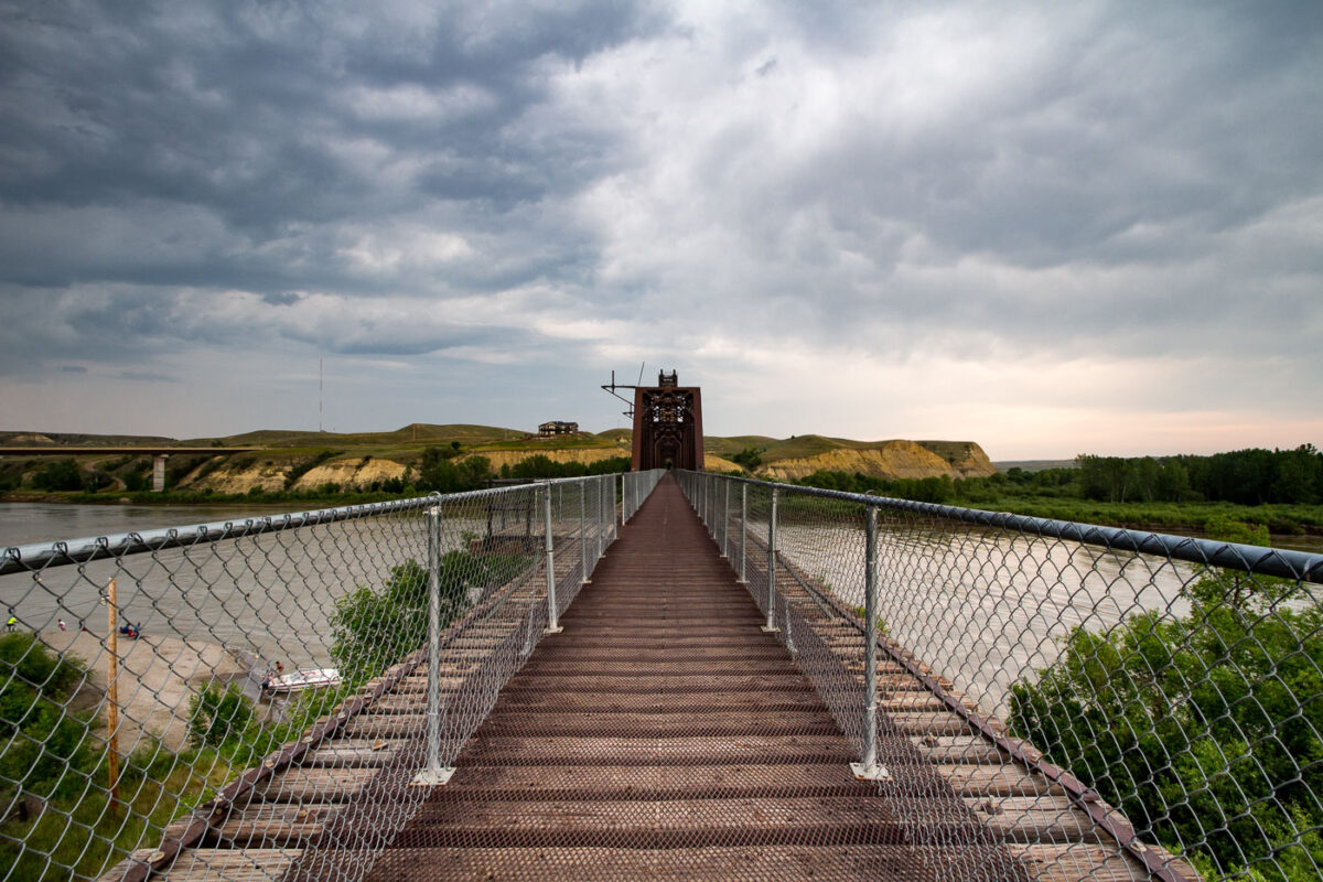
July 2015 — The Fairview Lift Bridge over the Yellowstone River in North Dakota. It was added to the National Register of Historic Places in 1997.
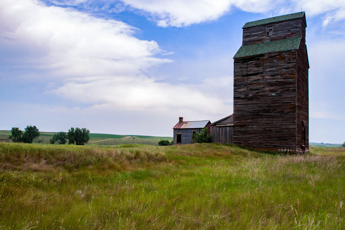
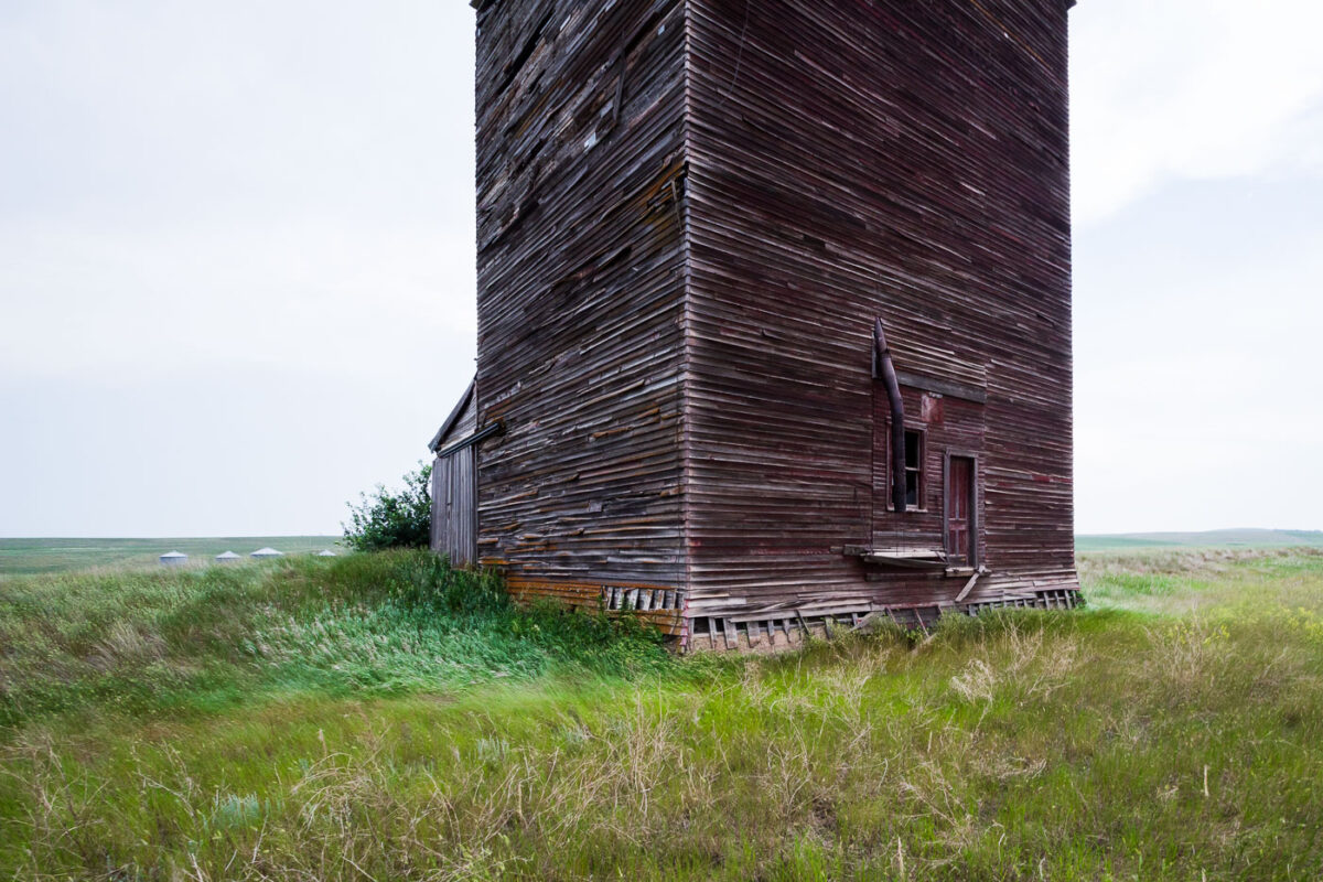
July 2015 — A elevator in Charbonneau, North Dakota.
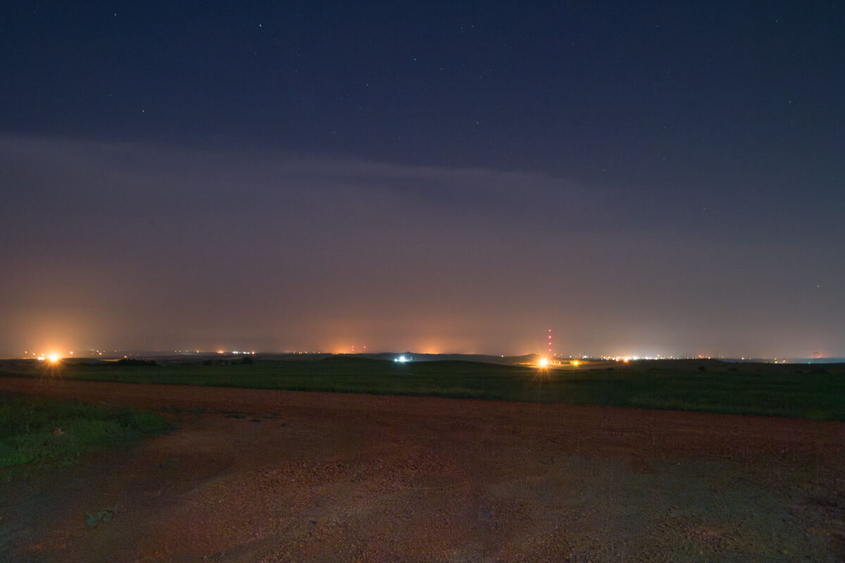
July 2015 — North Dakota oil fields in July 2015 in the middle of the night.

July 2015 — Juniper Campground at Theodore Roosevelt National Park in North Dakota.
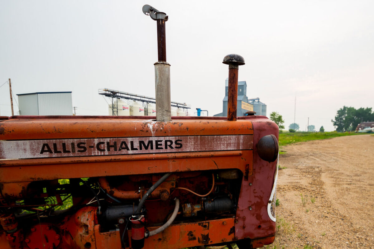
July 2015 — Allis-Chalmers tractor found in North Dakota.

July 2015 — Campsite at Sportsmen Centennial Park in Garrison, North Dakota.
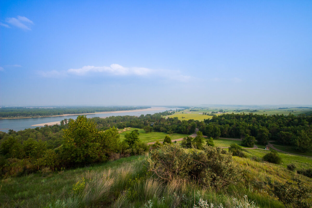
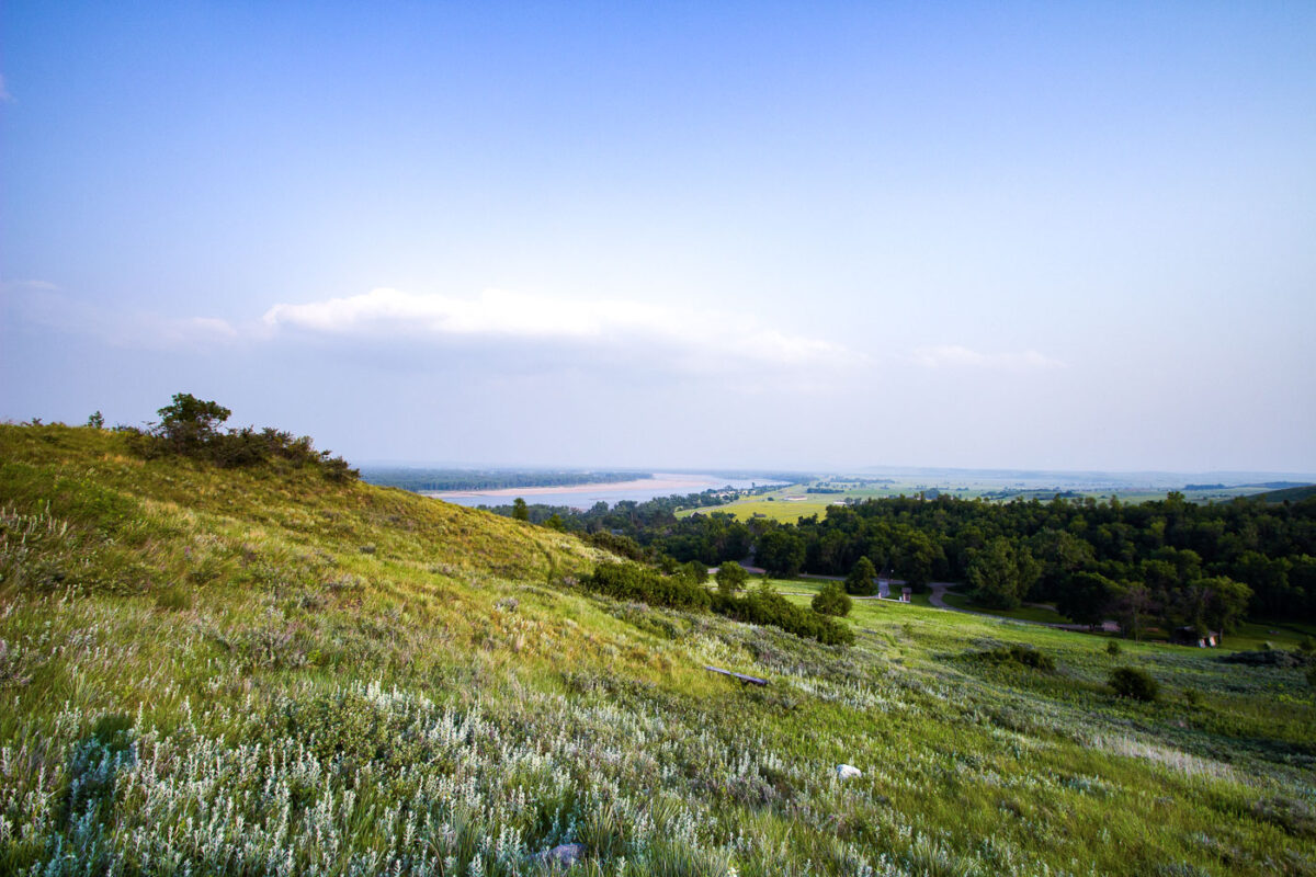
July 2015 — Fort Abraham Lincoln State Park overlook and the Missouri River in North Dakota.
July 2015 — Fort Abraham Lincoln State Park in Bismark, North Dakota
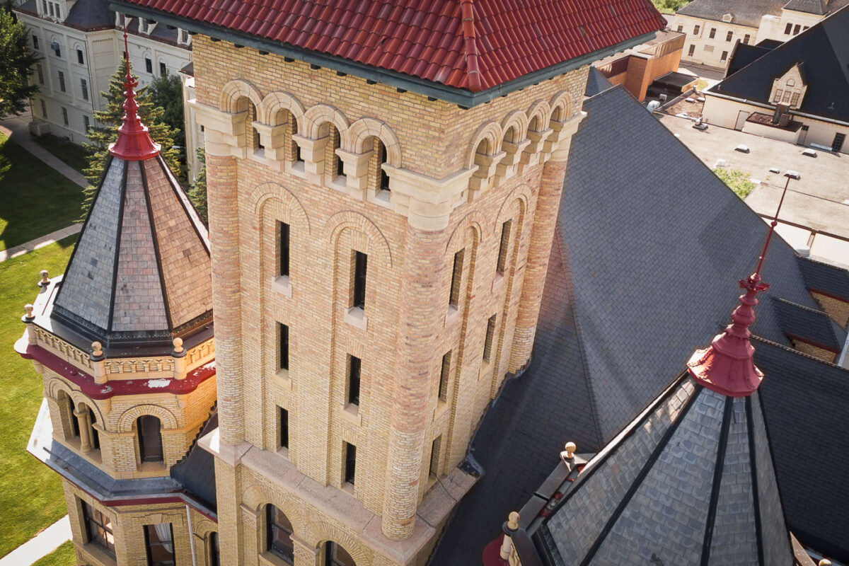
July 2015 — The Fergus Falls Regional Treatment Center in Fergus Falls, Minnesota.
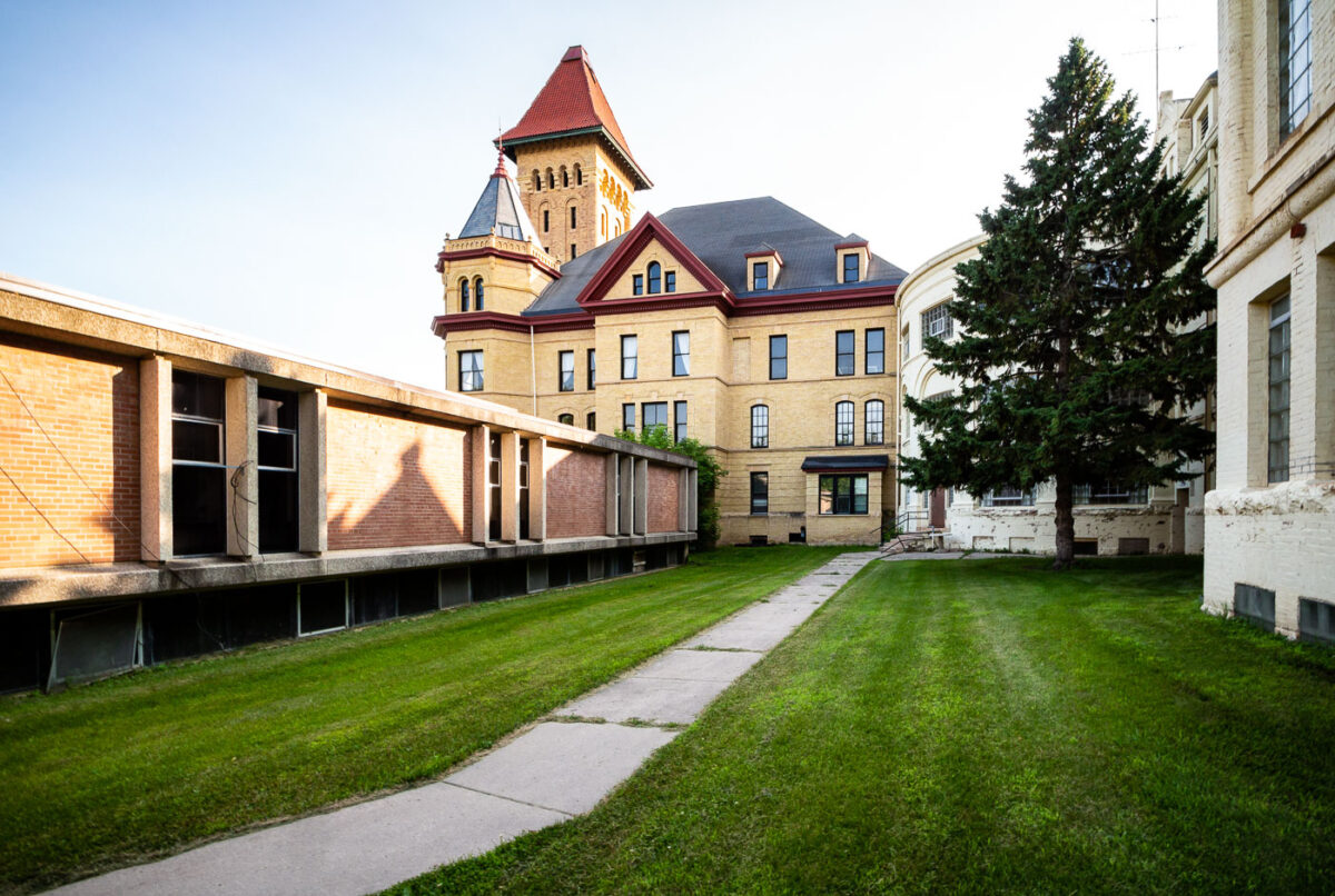
July 2015 — The Fergus Falls Regional Treatment Center in Fergus Falls, Minnesota.
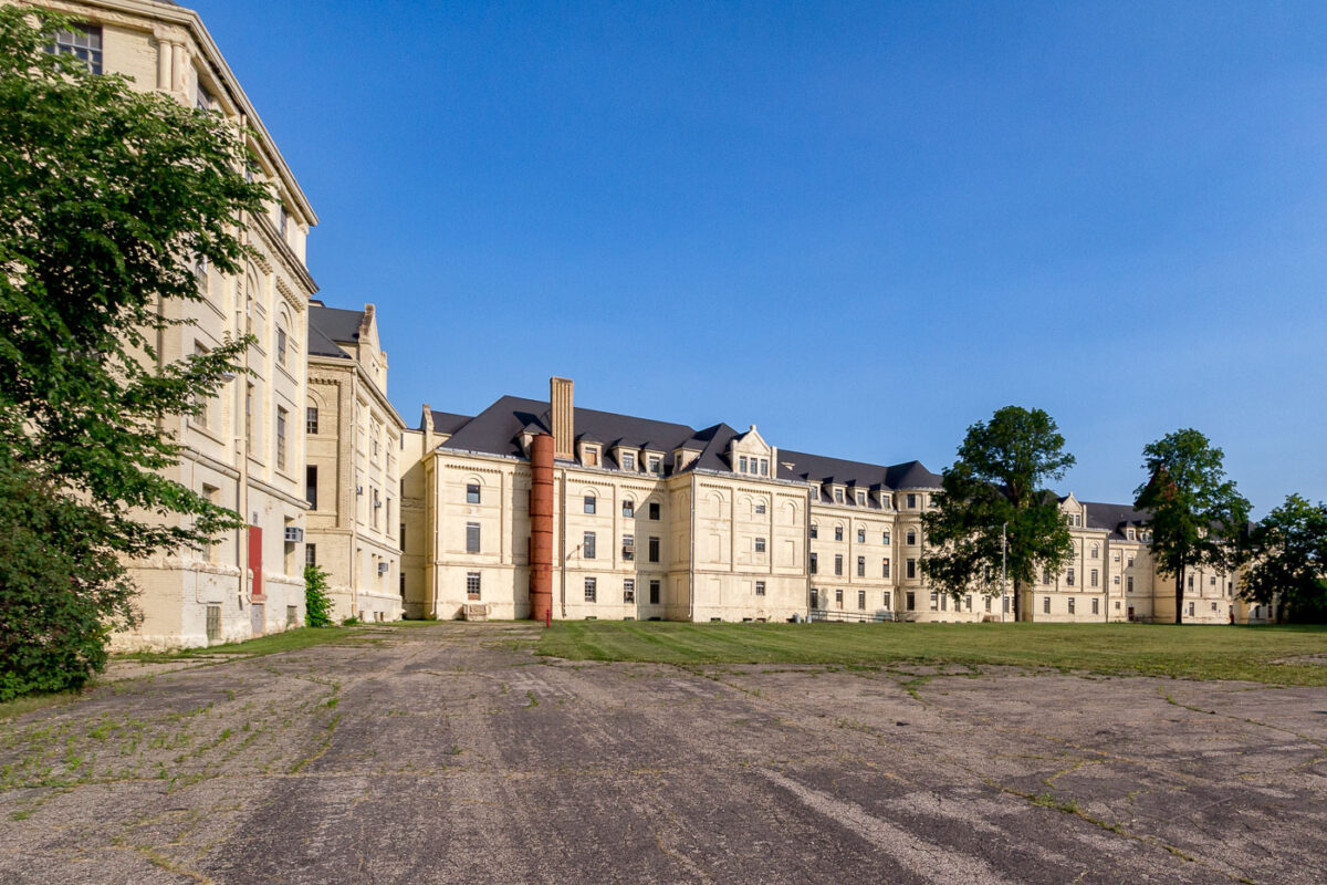
July 2015 — Fergus Falls Regional Treatment Center in Fergus Falls, Minnesota.
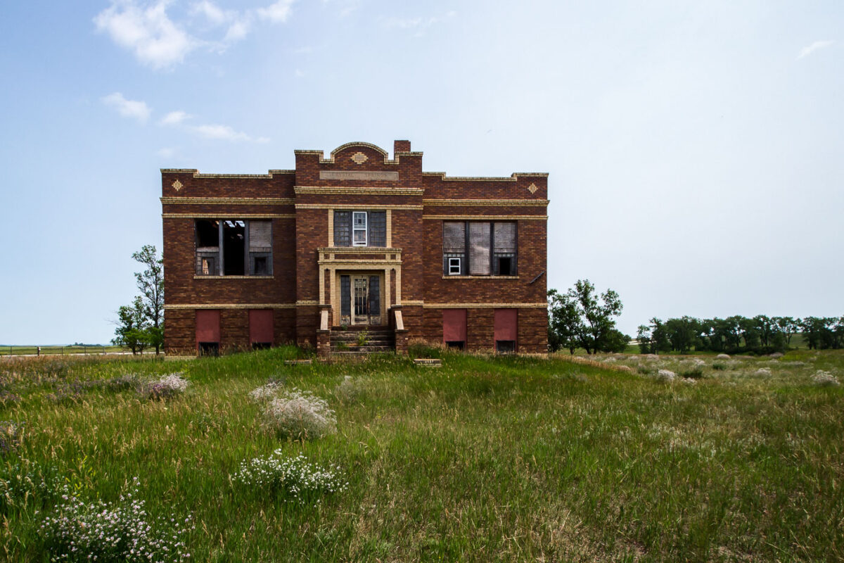
July 2015 — An abandoned schoolhouse in Crystal Springs, North Dakota.
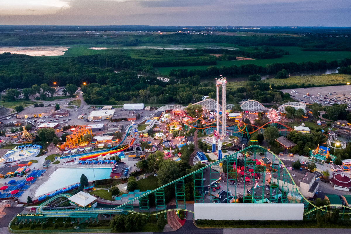
July 2015 — Valleyfair amusement park in Shakopee, Minnesota. The amusement park owned by Cedar Fair opened in 1976.
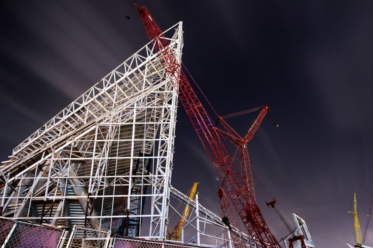
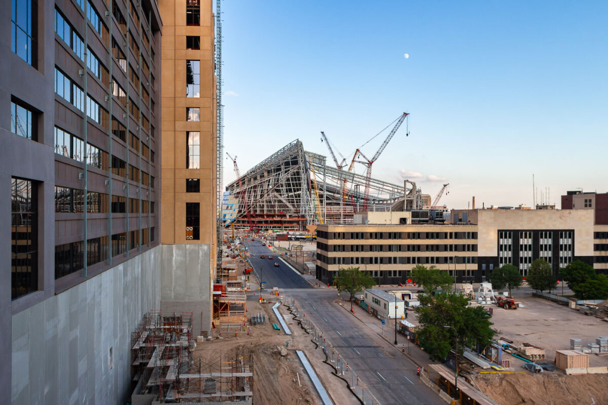
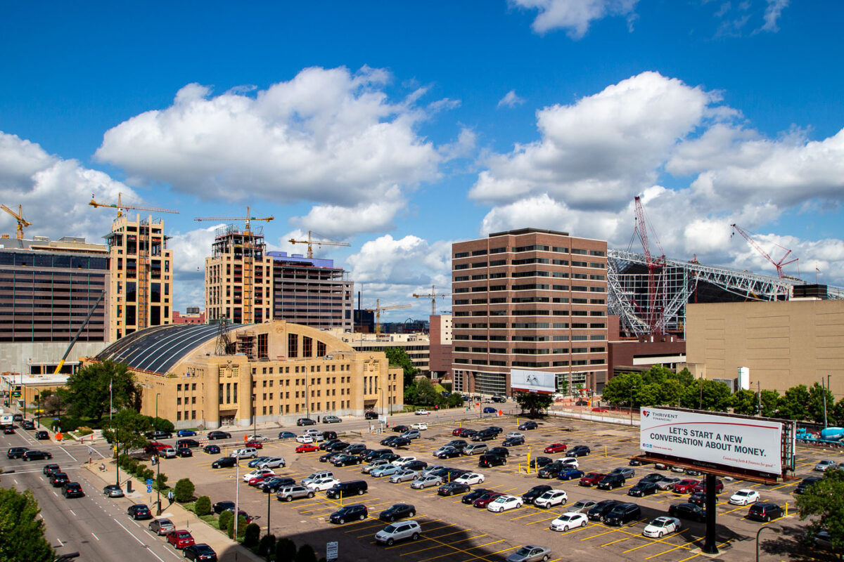
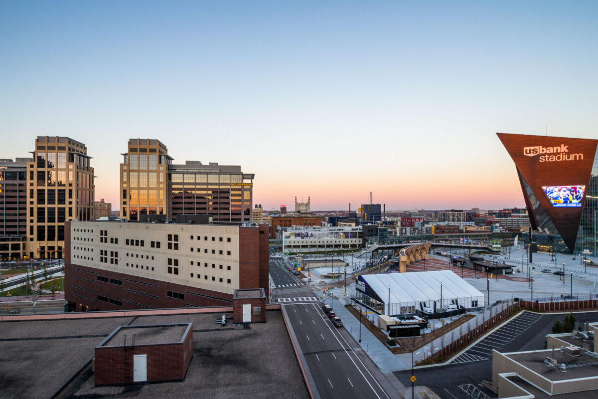
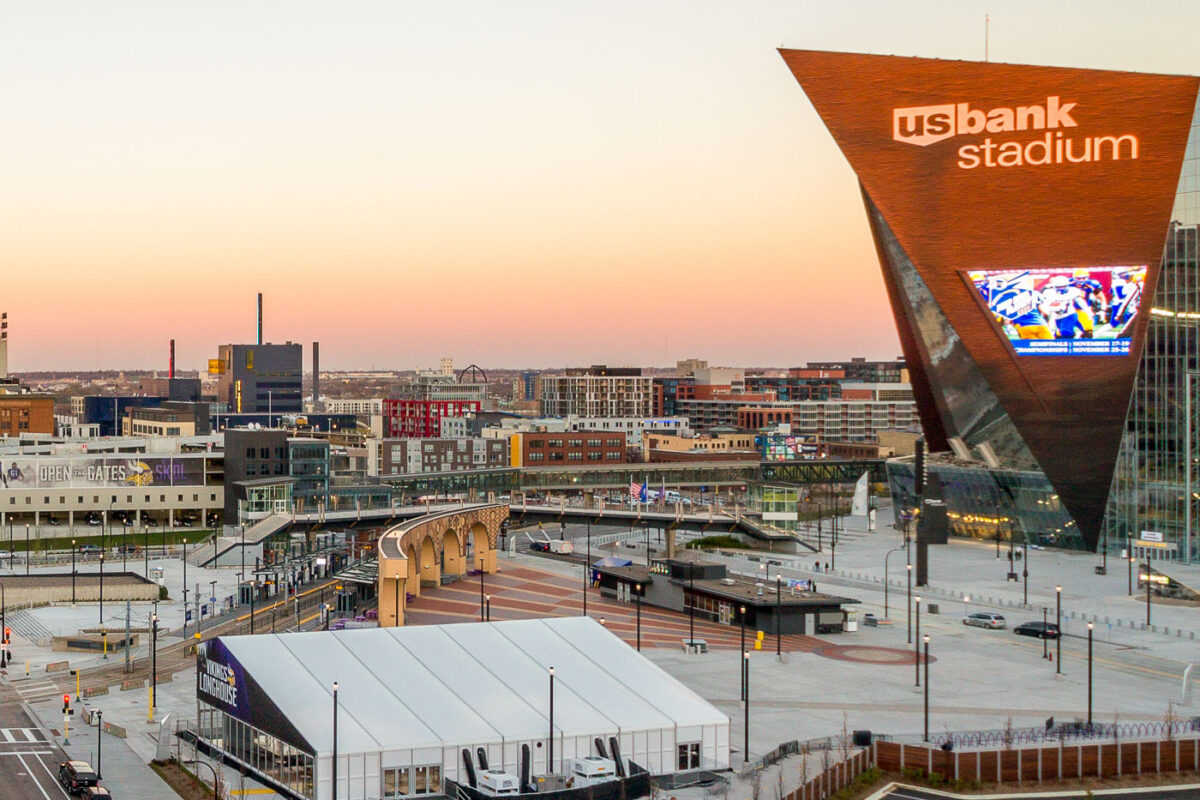
July 2015 — U.S. Bank Stadium, home of the Minnesota Vikings, began construction in December 2013 on the site of the former Hubert H. Humphrey Metrodome in downtown Minneapolis. The stadium’s steel skeleton, seen here during its mid-construction phase, showcases the dramatic angular geometry that defines its final form — a nod to both Nordic shipbuilding and Minnesota’s icy winter landscapes. The project, designed by HKS Architects and constructed by Mortenson, features over 19,000 tons of structural steel and spans 1.75 million square feet. Its transparent ETFE roof panels and vast steel trusses were among the most complex structural assemblies ever attempted in a U.S. stadium build. Completed in 2016, the $1.1 billion stadium remains one of the most technically ambitious indoor venues in North America, notable for its fixed-roof design, massive glass curtain walls, and precision-engineered support cranes like the red lattice boom seen here — used to hoist the roof trusses into place during overnight construction sessions.

July 2015 — Chicago Architecture and Lake Michigan
July 2015 —
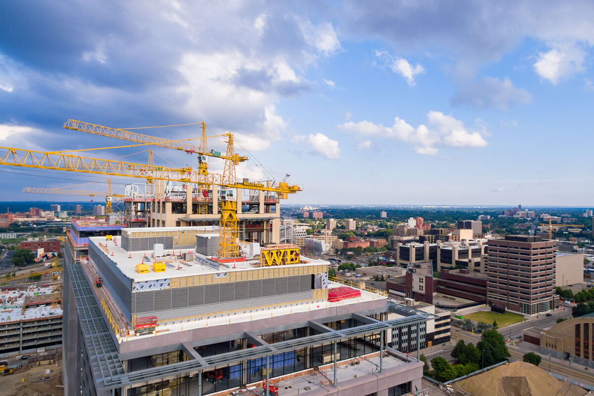
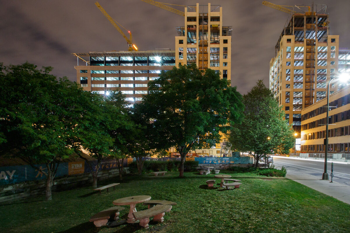
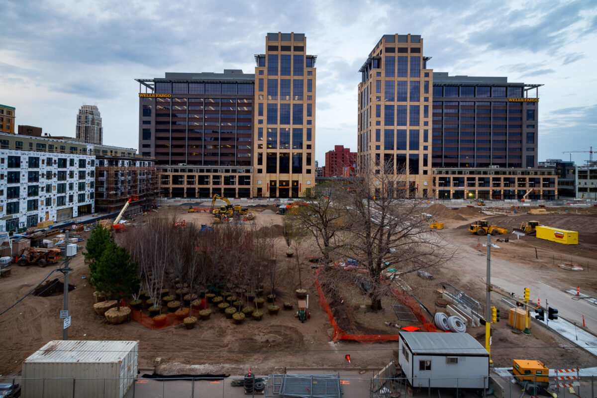
July 2015 — Construction of the Wells Fargo towers in Downtown East in Minneapolis, July 2015.
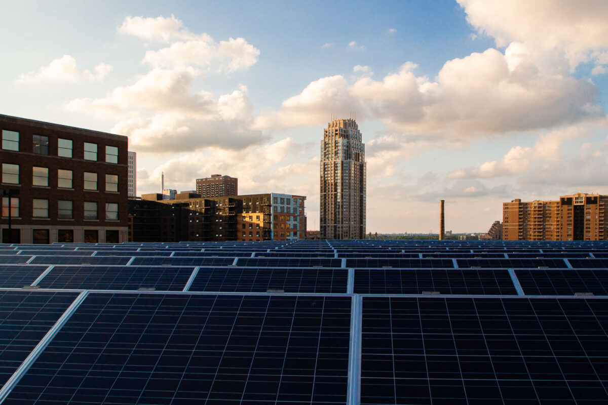
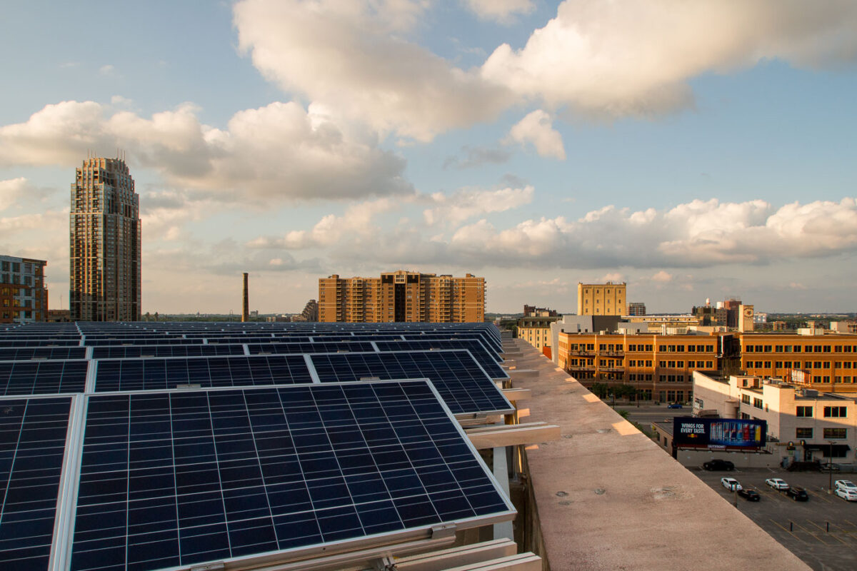
July 2015 — Solar panels on a rooftop in downtown Minneapolis.
July 2015 —
July 2015 —
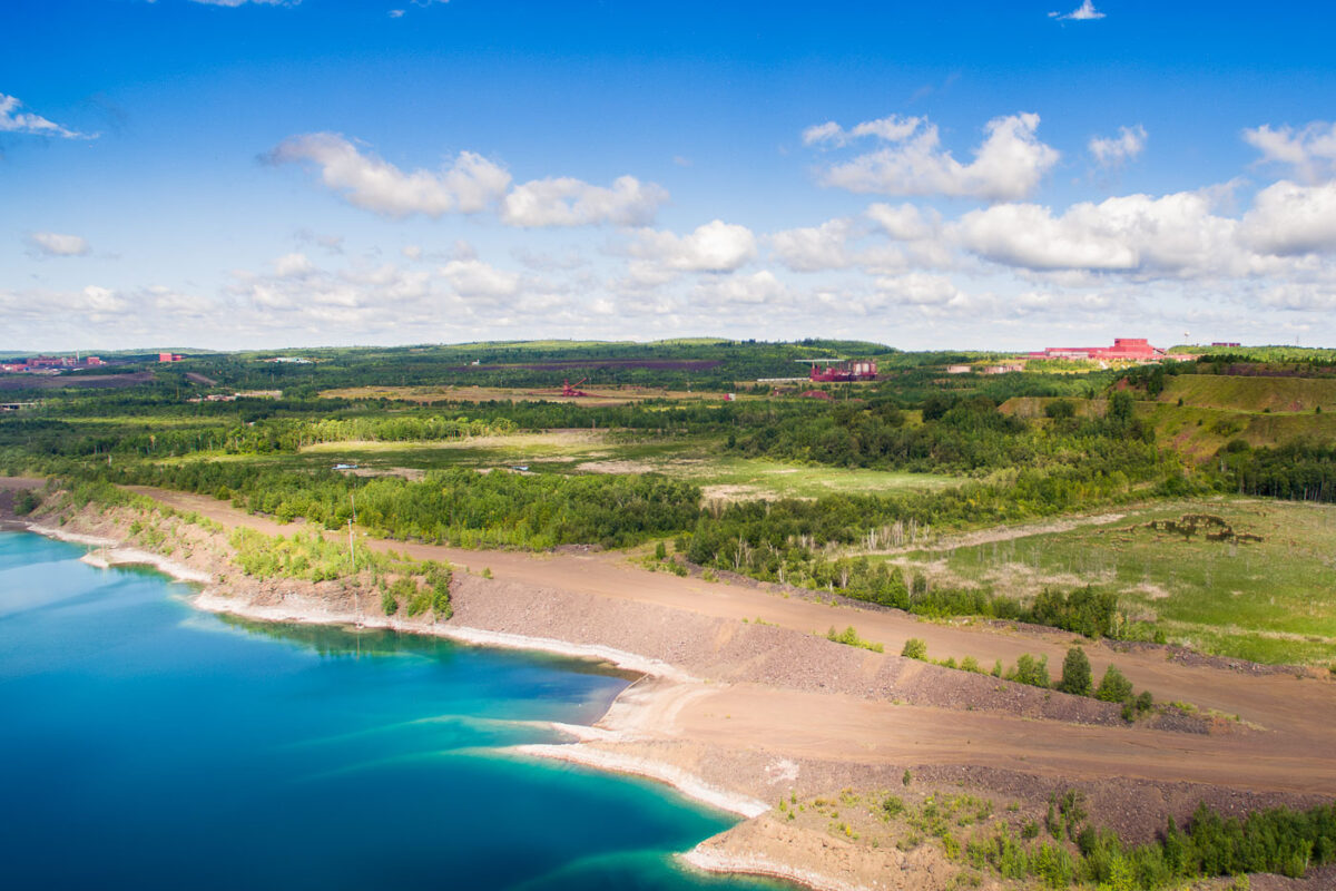
August 2015 — Polymet Mining/Glencore copper mine in Hoyt Lakes Minnesota.
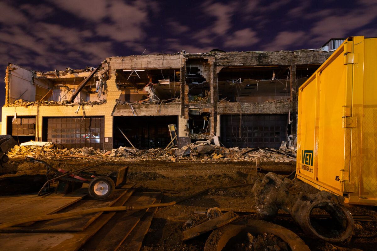
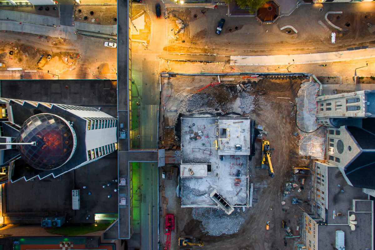
August 2015 — Demolition of the Star Tribune building in downtown Minneapolis. The building was razed to make room for construction of US Bank Stadium and the nearby area.
August 2015 —
August 2015 — The Capella Tower in Downtown Minneapolis. The Hennepin County Government Center on the right.
August 2015 —
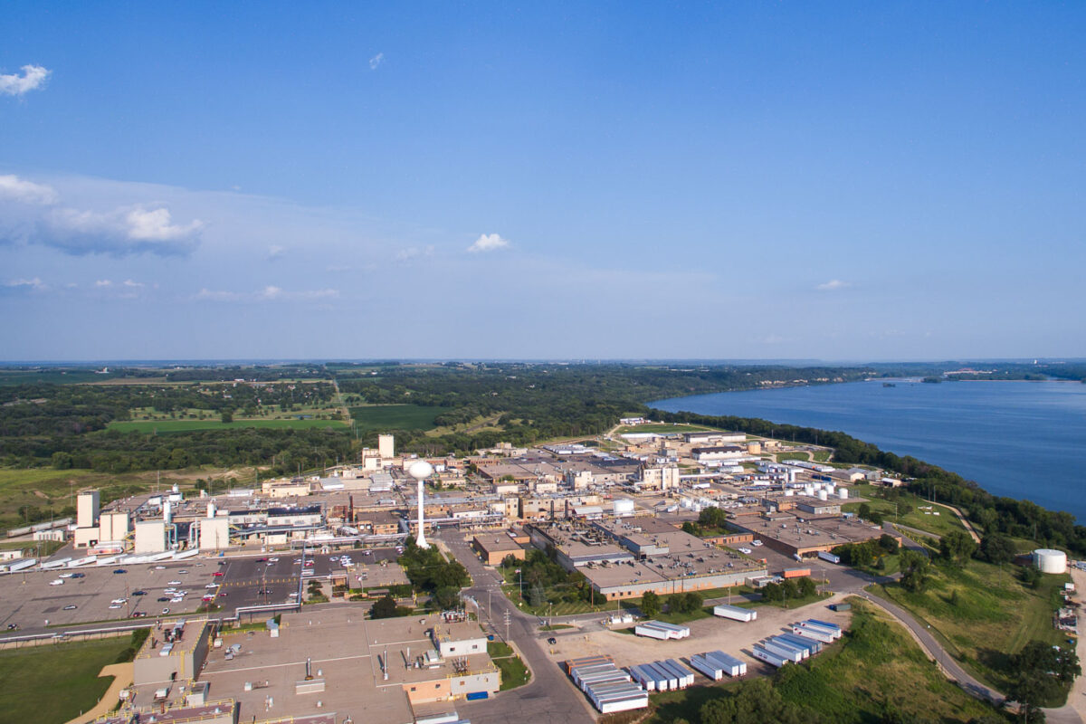
August 2015 — 3M plant in Cottage Grove, Minnesota.
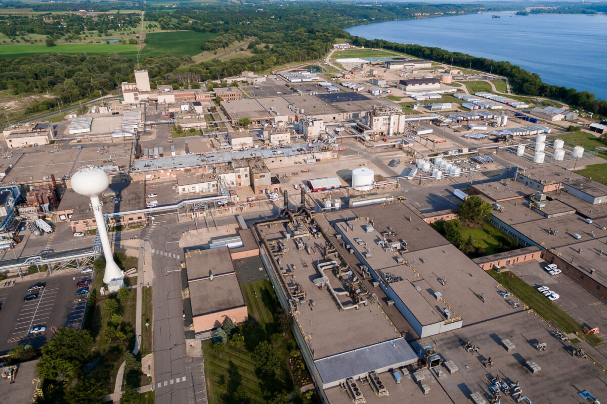
August 2015 — 3M manufacturing facility in Cottage Grove, Minnesota.
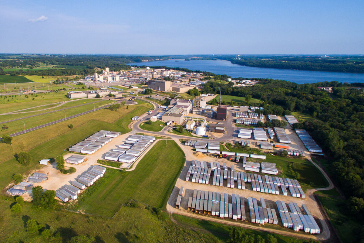
August 2015 — 3M plant in Cottage Grove, Minnesota.
August 2015 — Buildings in downtown Chicago.
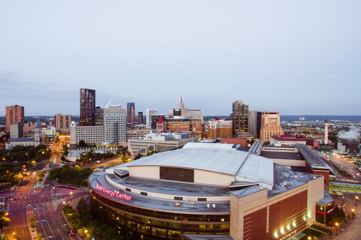
September 2015 — The Xcel Energy Center in Downtown St. Paul. In 2025, it was renamed Grand Casino Arena. It's the home of the Minnesota Wild.
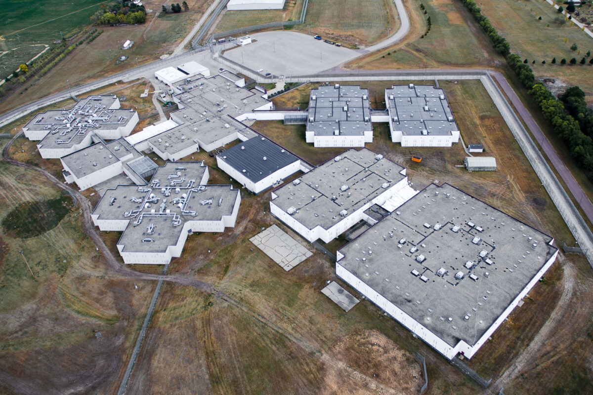
October 2015 — The Prairie Correctional Facility in Appleton, Minnesota. The 1,600 bed prison has been closed since 2010.
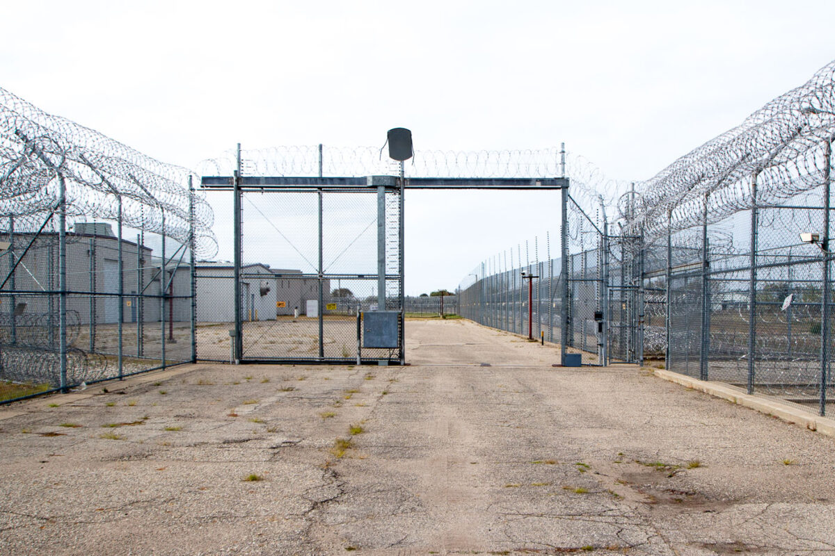
October 2015 — Security fencing around the Prairie Correctional Facility in Appleton, Minnesota. The 1,600 bed facility that's been closed since 2010 has been mentioned in plans by the federal government to be used as a ICE detention facility.
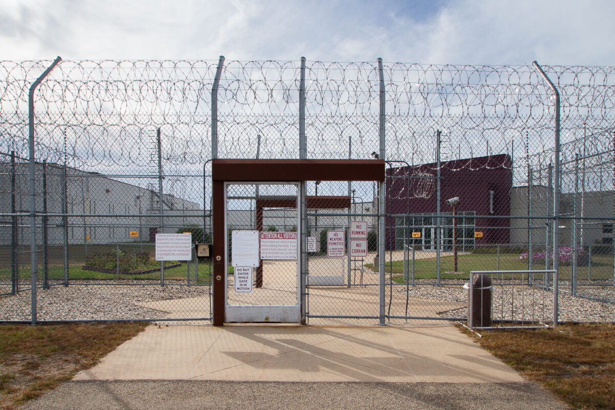
October 2015 — Entrance to the Prairie Correctional Facility in Appleton, Minnesota. The 1,600 bed facility that's been closed since 2010 has been mentioned in plans by the federal government to be used as a ICE detention facility.
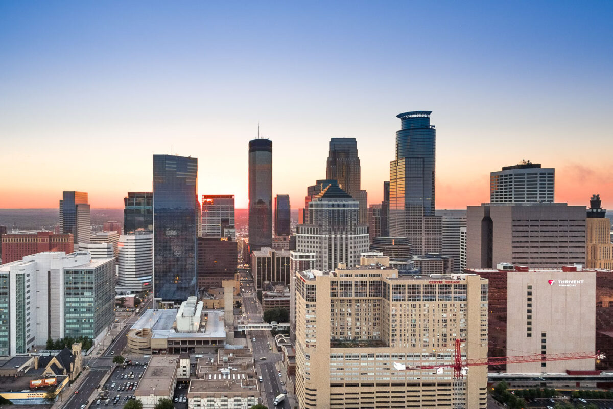
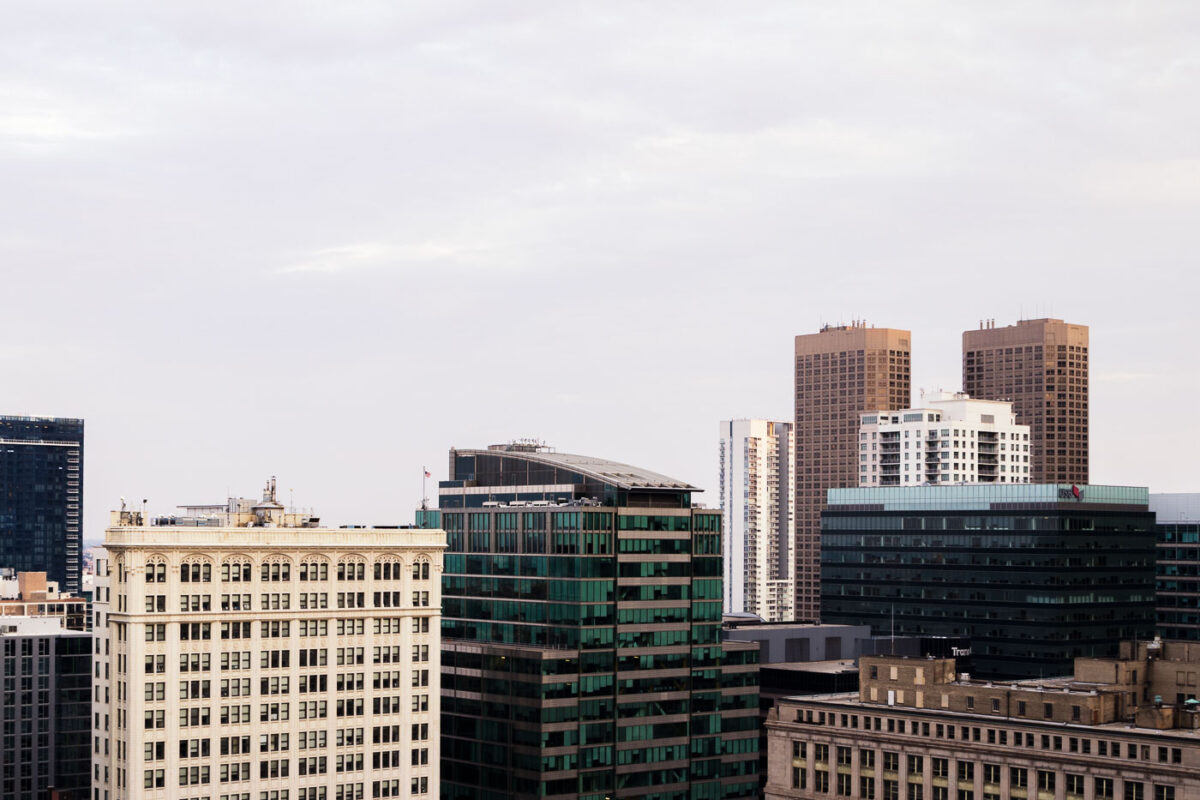
October 2015 — The Downtown Minneapolis core.
October 2015 — A firefighting training facility in Burnsville, Minnesota.
November 2015 —
December 2015 — The Wabasha Street Bridge in downtown St. Paul, Minnesota. The bridge is over the Mississippi River.
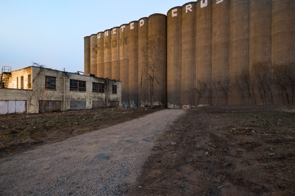
January 2016 — ADM Grain Elevator and Harris Machinery in the front. Harris Machinery covered in ice after a large fire gutted in the inside. Located in Prospect Park, Minneapolis.
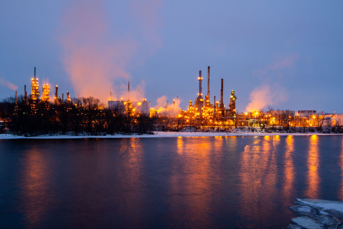
January 2016 — Marathon Petroleum Corporation in St. Paul Park, Minnesota

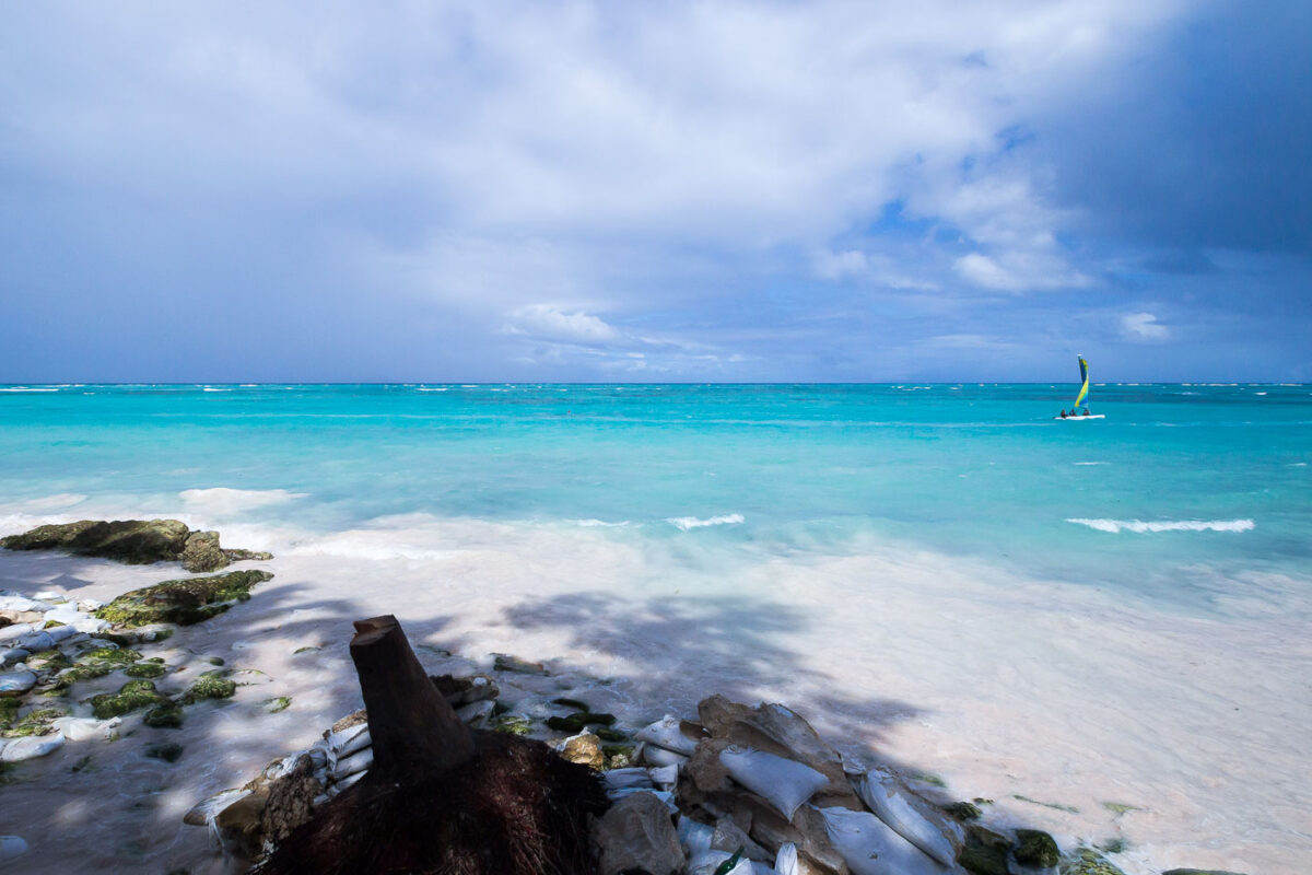
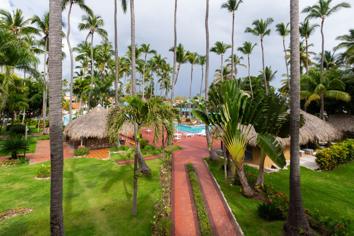
February 2016 — Along the eastern coast of Punta Cana in the Dominican Republic, a coastal tour boat rests against the pale sandy shore as shifting weather approaches over the Caribbean Sea. The turquoise shallows—characteristic of this stretch of the Atlantic coast lined by coral reefs—contrast sharply with a dense bank of darkening storm clouds moving inland. Beach excursions and snorkeling trips commonly depart from this area, where the water remains shallow and calm before the reef break. The photograph captures the transitional weather common to the region’s tropical maritime climate, highlighting the tension between the inviting clarity of the shoreline and the dramatic sky signaling an imminent rainfront.
February 2016 — A sailboat in Punta Cana, Dominican Republic
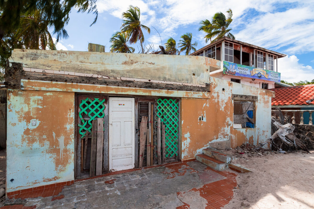
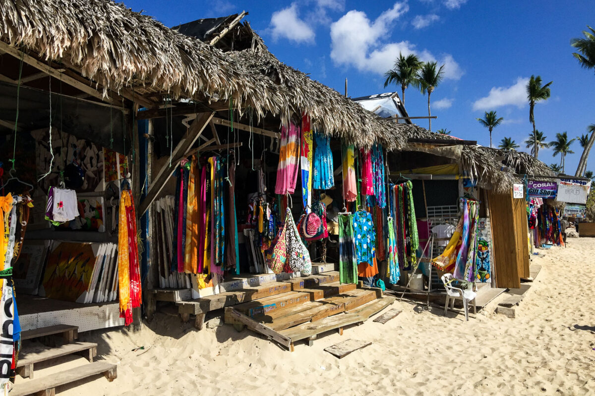
February 2016 — An abandoned gift shop in Punta Cana, Dominican Republic.
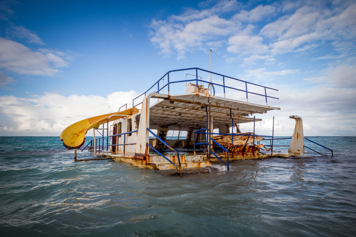
February 2016 — Abandoned boat off the coast in Punta Cana, Dominican Republic.
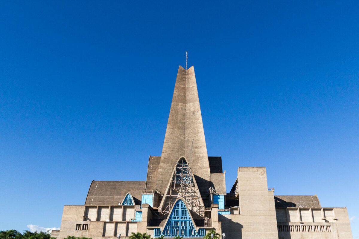
February 2016 — The Basílica Catedral Nuestra Señora de la Altagracia in Higüey, Dominican Republic, is one of the most significant Catholic pilgrimage destinations in the Caribbean. Completed in 1971, the church was designed by French architects André-Jacques Dunoyer de Segonzac and Pierre Dupré, who created a unique modernist interpretation of a basilica with towering concrete arches and geometric symmetry meant to evoke hands raised in prayer. The blue metal-framed windows contrast against the stark reinforced concrete, emphasizing both spiritual and structural purpose. The basilica was commissioned to honor the Virgin of Altagracia, protector of the Dominican people, and it officially received the status of Minor Basilica from Pope Paul VI. Known for its 80-meter bell tower and monumental entry arch, it attracts thousands of worshippers every January 21 during the Feast of Altagracia.
February 2016 — Hotel Cortecito Inn, Bavaro, Punta Cana, Dominican Republic
February 2016 — Hotel Cortecito Inn, Bavaro, Punta Cana, Dominican Republic
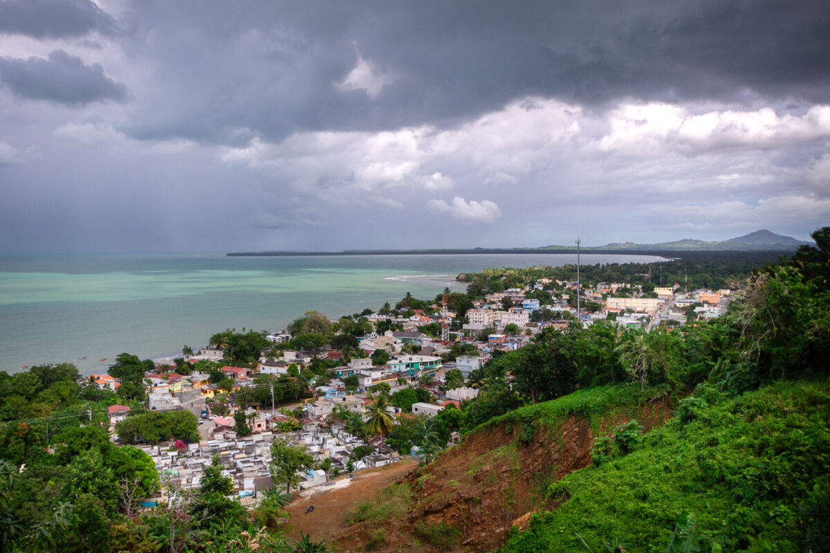
February 2016 — Elevated above the small town of Miches on the northeastern coast of the Dominican Republic, this vantage point offers a sweeping view of the Caribbean shoreline and the lush countryside of El Seibo Province. The town’s clustered homes, cemetery, and local roads sit beneath dramatic rain clouds moving in from the sea, while the pale turquoise water hints at the nearby shallow coastal shelf. Miches has historically relied on fishing and agriculture, but over the past decade it has become a gateway to expanding tourism projects along the coastal corridor toward Punta Cana and Samaná. From this hillside, the contrast between traditional local development and the region’s growing transformation is clearly visible against the backdrop of changing skies and the mountainous horizon.
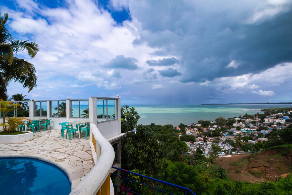
February 2016 — Perched high on one of the hills surrounding the coastal town of Miches in eastern Dominican Republic, Hotel La Loma offers a panoramic view of the shoreline, the town below, and the wide expanse of Laguna Redonda stretching toward the horizon. The hotel’s elevated terrace and pool area, with simple seating and curved white railings, reflects the region’s small-scale tourism development before large resort expansion began nearby in the late 2010s. From this vantage point, you can see Miches’ compact urban fabric, local cemetery, and fishing boats that support the town’s traditional economy—contrasting with growing interest in ecotourism and coastal resort projects along the north shore. The turquoise water of the protected lagoon and the dramatic storm clouds illustrate the area’s tropical climate, shaped by trade winds and sudden rainfall typical of the Dominican northeast.
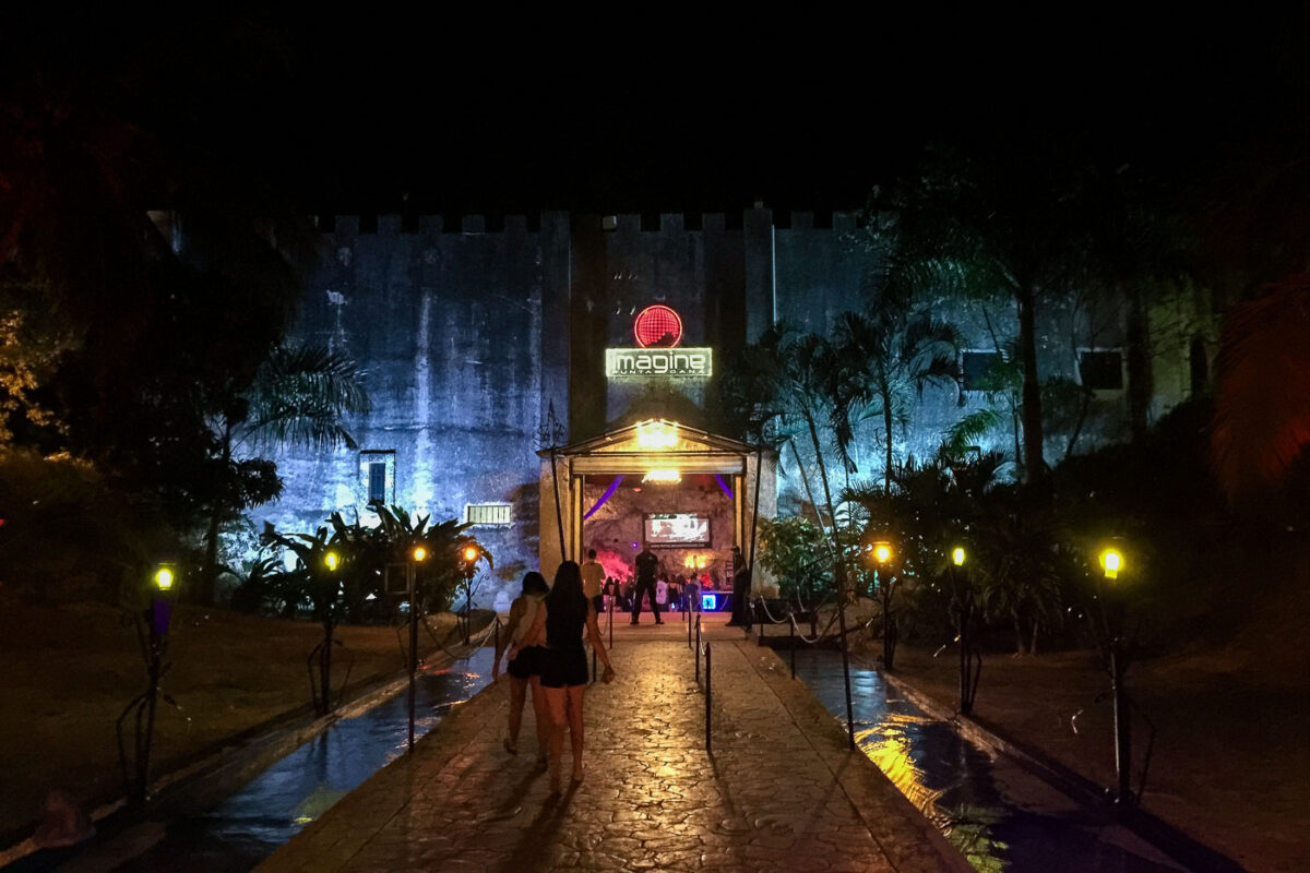
February 2016 — Imagine Nightclub in Punta Cana, Dominican Republic, occupies a repurposed limestone cave system, offering a distinctive nightlife experience shaped by the region’s natural geology. The venue retains the rugged cave façade and cavern-like interior, blending artificial lighting with tropical vegetation to accentuate its underground atmosphere. Guests enter through a torch-lit stone walkway surrounded by water channels, creating the impression of descending into a historic fortress or cavern retreat. The club became known for transforming these natural caves into themed dance halls, each room taking advantage of the acoustics and humidity of the rock chambers to host different music styles and events. This photograph shows the illuminated entrance structure against the cave wall at night, highlighting how modern entertainment adapted to local terrain rather than replacing it.
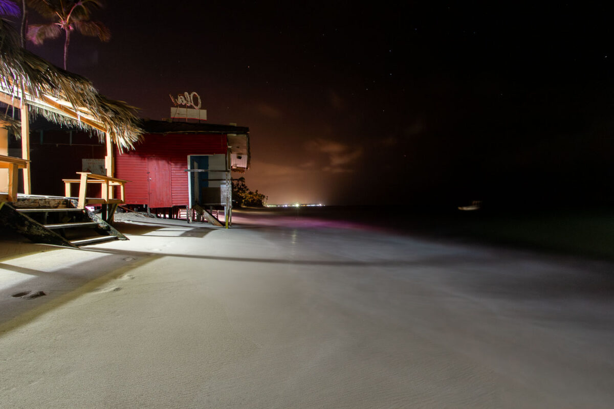
February 2016 — structure, with a palm-thatch roof and simple seating, reflects the informal beachfront culture of the region, where many bars operate just steps from the water. Captured at night with a long exposure, the Caribbean Sea appears smooth and misty as waves gently wash beneath the structure. In the distance, faint shoreline lights show the resort-lined coast of Punta Cana. The photo highlights the fragility of beachfront structures, many of which face increasing erosion and tidal encroachment due to coastal development and rising sea levels.
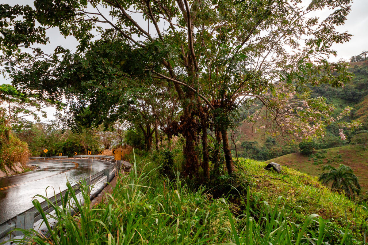
February 2016 — A winding mountain roadway in the eastern Dominican Republic cuts through lush tropical hillsides near the rural communities of Los Brazos and La Majagua in the El Seibo province. The wet pavement and reflective guardrails suggest a recent passing rain, a common occurrence in this humid, mountainous region known for its microclimates and dramatic vegetation changes. These hillside roads are vital connectors between interior farming settlements and coastal markets, often serving traffic ranging from motorcycles and produce trucks to occasional tourist excursions. Native trees and flowering plants cling to the embankment, typical of the region’s mix of hardwoods, palms, and secondary forest growth following decades of agricultural clearing.
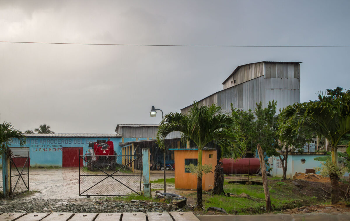
February 2016 — A small agricultural processing facility belonging to a local rice growers’ association in the rural district of La Gina, near Miches in eastern Dominican Republic. Buildings like this serve as cooperative hubs where farmers mill, store, and distribute rice harvested from nearby valleys and foothills. The corrugated steel structures, machinery shelters, and entry kiosk reflect a modest but functional rural agro-industrial operation supporting community-based farming. Rice cultivation has been an important part of the Dominican countryside economy for decades, particularly in the El Seibo and Hato Mayor provinces where smallholder producers rely on local cooperatives for processing and market access.
February 2016 —
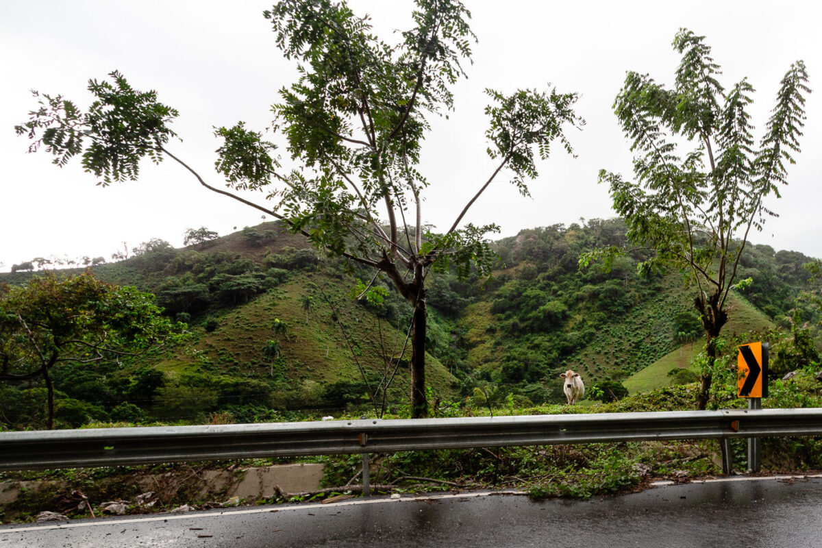
February 2016 — A solitary cow stands just beyond the guardrail along Highway 107 in the Dominican Republic’s El Seibo Province, an area defined by steep hillsides, grazing land, and dense tropical vegetation. This winding road connects the interior highlands with coastal towns like Miches and is known for its sharp curves, frequent landslides, and roadside pastures where livestock freely wander. The lush slopes in the background show typical small-scale hillside grazing patterns, where cattle and goats clear patches among naturally regenerating forest. Road markings and safety reflectors highlight the rural infrastructure, while the presence of the cow illustrates the everyday intermingling of agriculture and transportation in the Dominican countryside.
February 2016 —
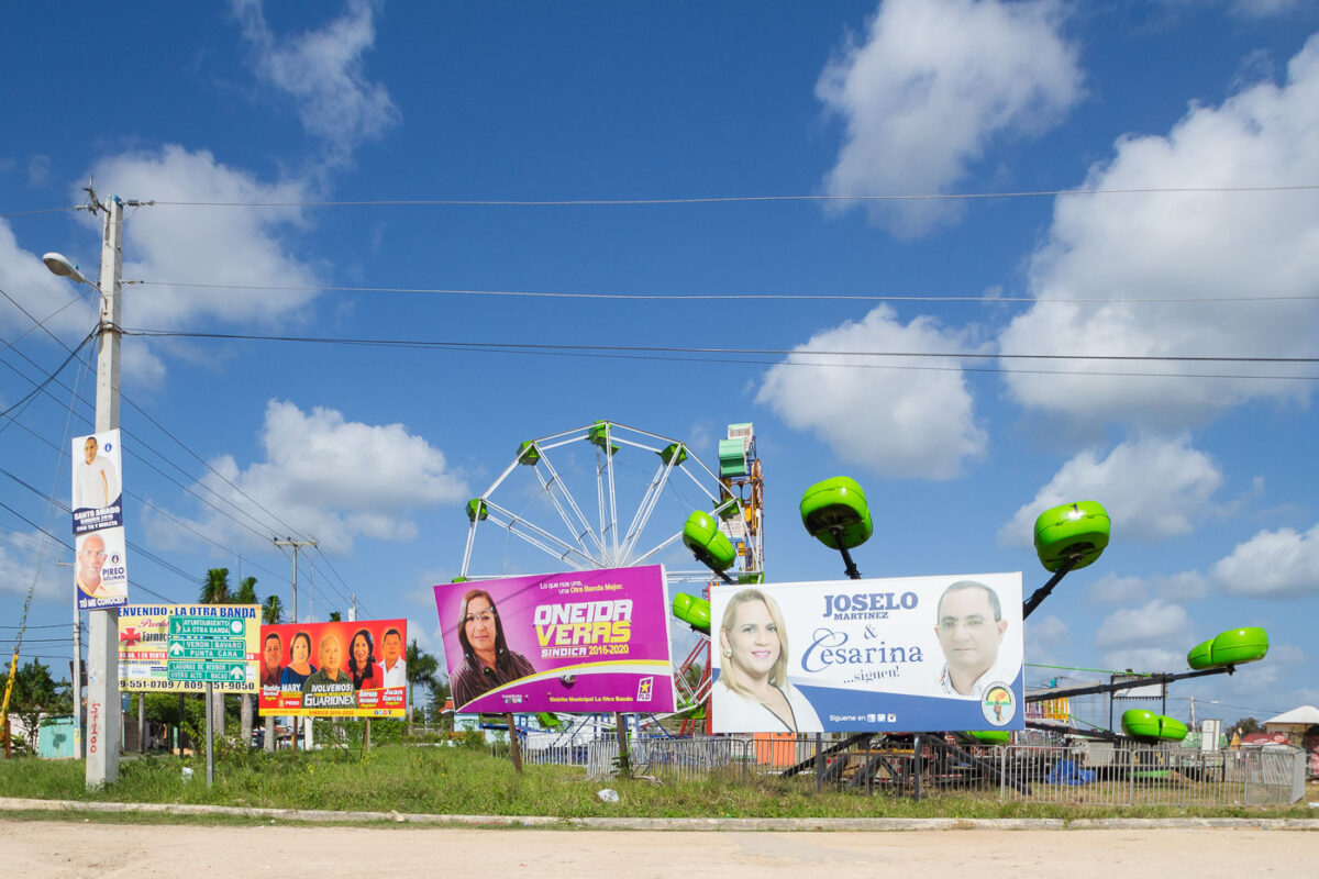
February 2016 — A roadside fairground in Laguna Verde, Dominican Republic, blends local entertainment with visible traces of the country’s political life. Temporary carnival rides—like a small Ferris wheel and green spinning pods—sit on an open lot beside major campaign billboards promoting municipal candidates, reflecting the country’s vibrant political culture leading up to local elections. Street signs point toward nearby towns including Punta Cana and Bávaro, while the signage and infrastructure hint at the influence of regional tourism development. The scene captures the intersection of rural festivities, political campaigning, and the growing transformation of communities in the eastern Dominican Republic.
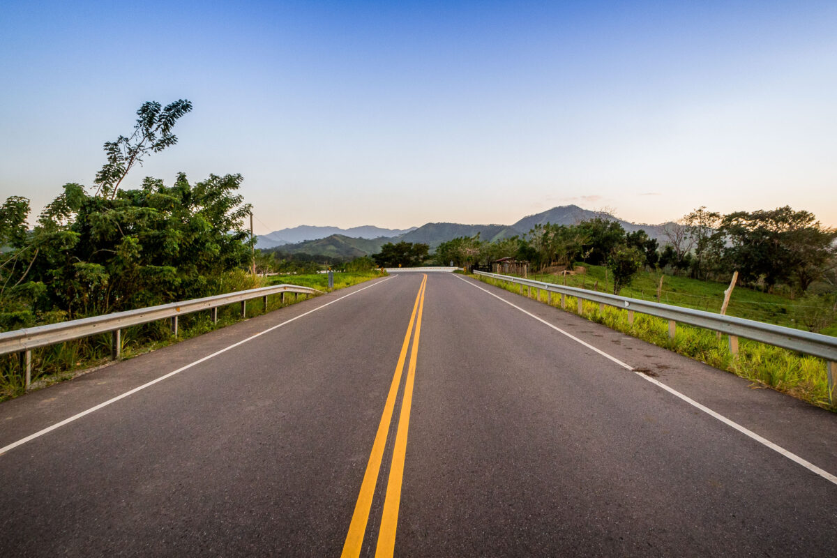
February 2016 — RD-104 Carretera Bavaro-Miches.
February 2016 — Parking lot at Cortecito Inn in Dominican Republic.
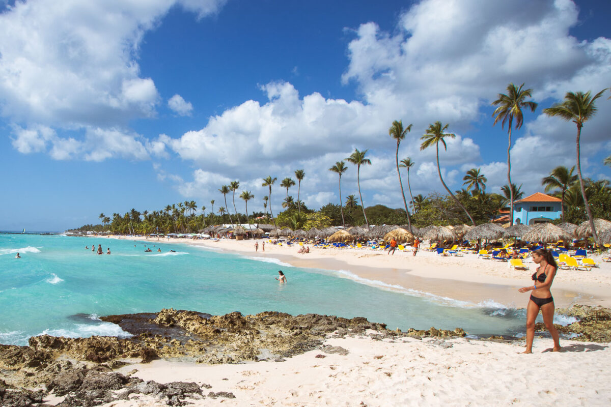
February 2016 — The beach at Iberostar Selection Hacienda Dominicus. Located in Bayahibe, Dominican Republic.
February 2016 — Beach vendors in the beach near Iberostar Selection Hacienda Dominicus.
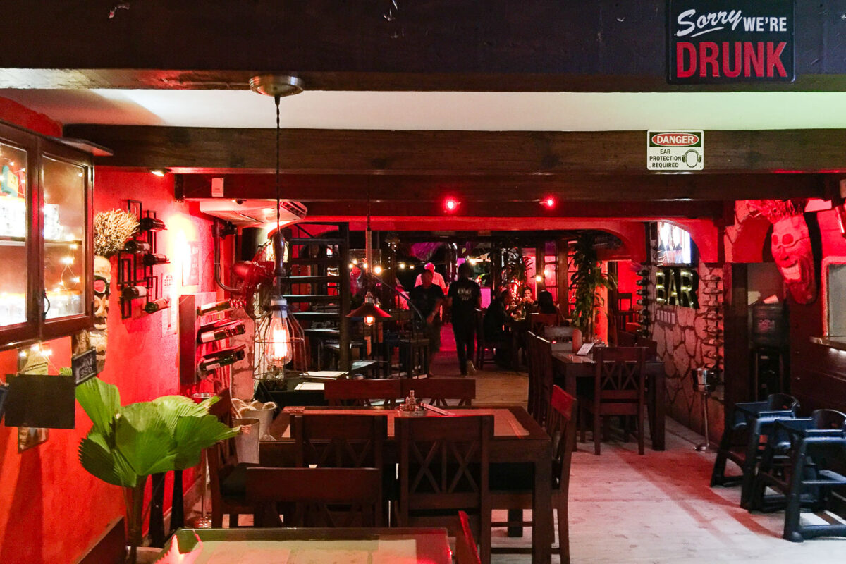
February 2016 — Onno's Bar & Restaurant near Punta Cana Dominican Republic.
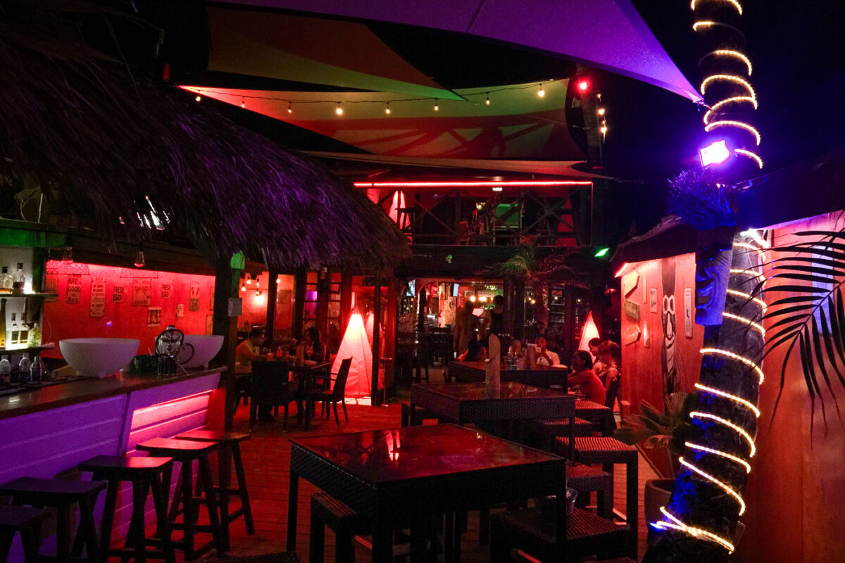
February 2016 — A bar and grill in Punta Cana Dominican Republic.

February 2016 — "Extreme Alka-Seltzer" in Dominican Republic.
February 2016 — Playa del Hotel Iberostar, Punta Cana, Dominican Republic
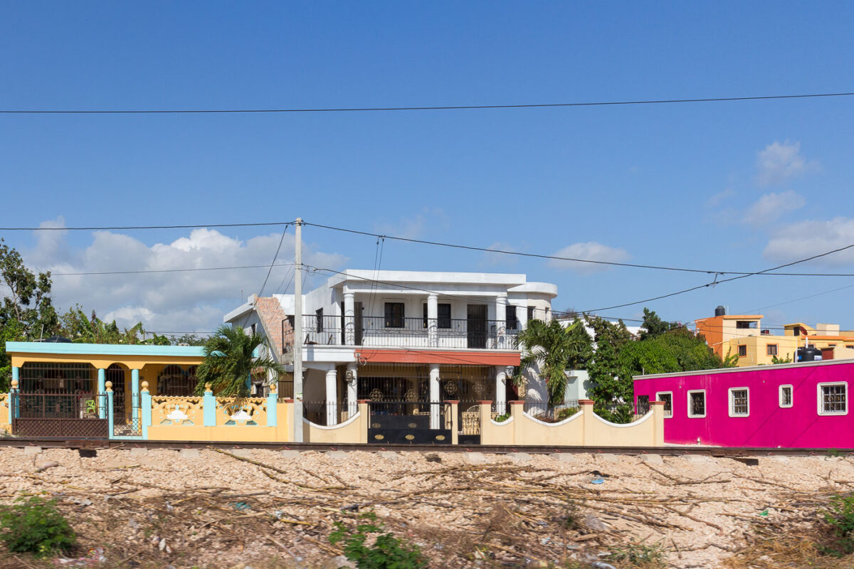
February 2016 — Architecture in La Romana, Dominican Republic.
February 2016 — A woman selling bread in La Romana, Dominican Republic
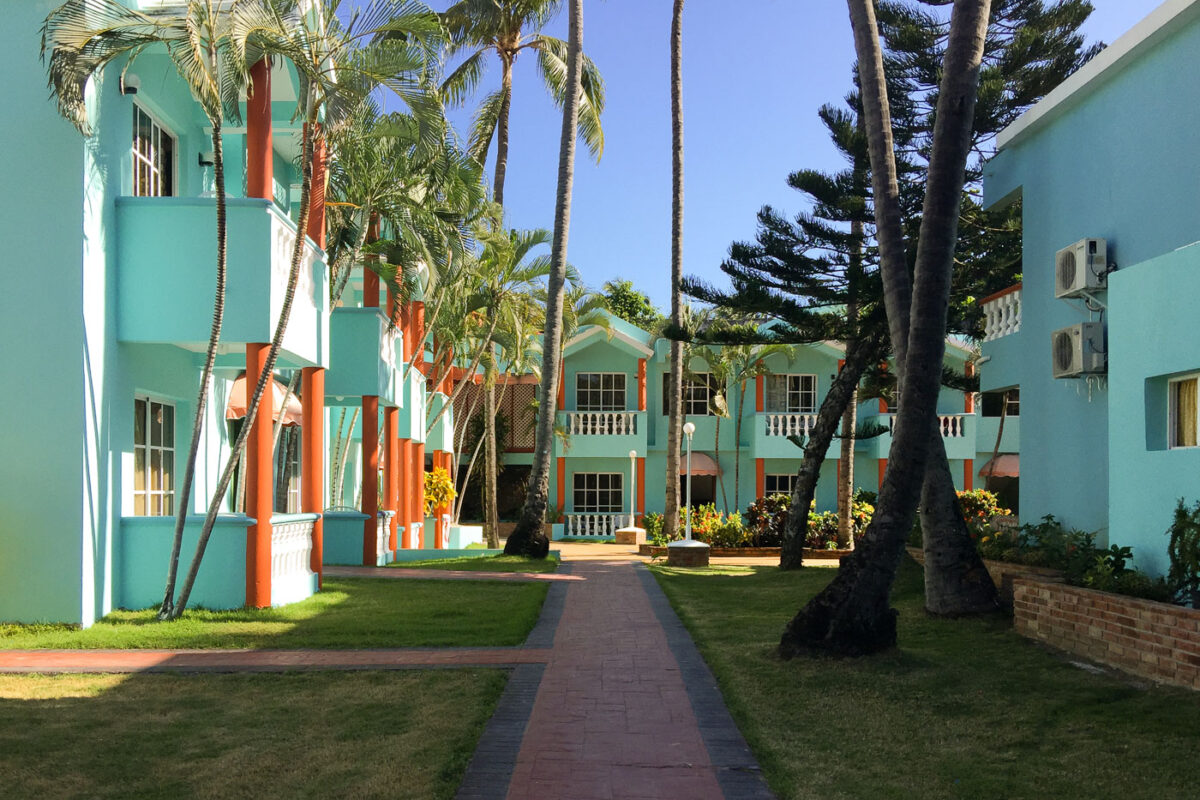
February 2016 — Colorful courtyard lodging buildings at Hotel El Cortecito in Punta Cana, Dominican Republic. Situated in the El Cortecito beach district—one of the earliest tourism hubs in the area—this hotel reflects the architectural style common in locally-owned coastal accommodations before the rise of large all-inclusive resorts. The turquoise and terracotta exterior, white balustrades, and open garden walkways offer a Caribbean vernacular blend intended for natural ventilation and communal outdoor space. El Cortecito developed through the 1980s and 1990s as a fishing village turned tourism enclave, with modest inns like this one often built and expanded in phases by local families, contrasting with the master-planned resort complexes that later defined Punta Cana’s international tourism growth.
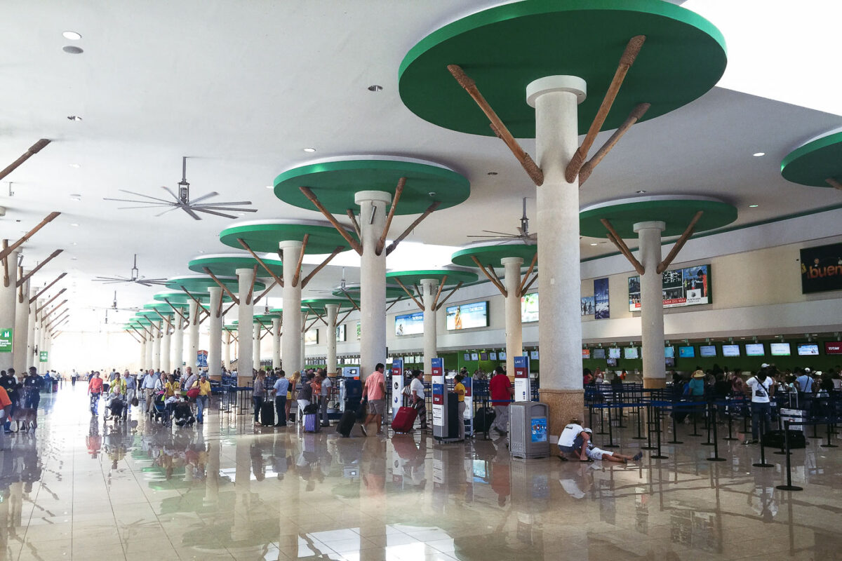
February 2016 — The departure terminal at Punta Cana International Airport (PUJ) features a distinctive architectural design that blends modern infrastructure with Caribbean-inspired elements. The high ceilings and large green circular structures atop the support columns are stylized to resemble palm tree canopies, echoing the surrounding tropical landscape. Natural wood accents and open, airy layout contribute to a resort-like atmosphere, distinguishing this airport as one of the Dominican Republic’s busiest gateways for international tourism. Travelers line up for check-in beneath oversized ceiling fans, highlighting the airport’s open-air concept, which was developed to harmonize with the region’s climate and tourism identity.
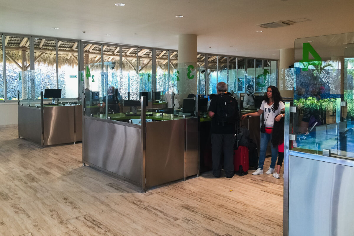
February 2016 — After landing at Punta Cana International Airport—one of the Caribbean’s busiest air hubs for international tourism—newly arrived passengers proceed through the customs and immigration area. The terminal architecture combines modern glass partitions, polished stone flooring, and views of exterior thatched roofing inspired by traditional Dominican palapas, blending tropical design with contemporary security infrastructure. The customs counters, marked with numbered green signage, are where visitors present passports and entry documents to border officers. The space reflects recent expansions that supported the airport’s growth, as Punta Cana became the Dominican Republic’s most visited destination starting in the 1990s and continuing into the 21st century, serving millions of tourists annually from Europe, North America, and Latin America.
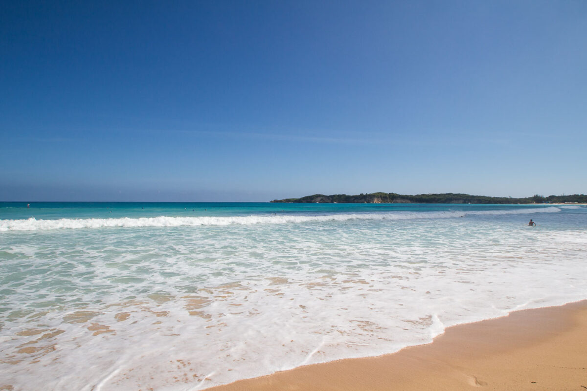
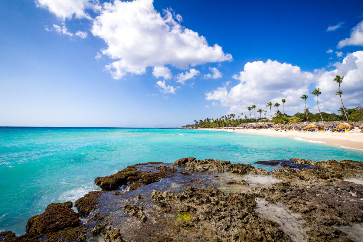
February 2016 — Along the northeastern coast of the Dominican Republic, Macao Beach is one of the rare stretches of undeveloped shoreline in the Punta Cana region. Unlike most resort-dominated beaches of the eastern coast, Macao has remained publicly accessible, attracting both local residents and visitors for its surfing conditions, expansive sands, and panoramic views of the Atlantic. The gently rolling waves seen here are typical of the beach’s surfable breaks, shaped by offshore currents and an open coastline without coral barriers. In the distance, the low, wooded hills form the edge of the Punta Cana–Miches coastal corridor, an area where farmland, mangroves, and small fishing communities meet tourism expansion. Known historically as a landing spot for local fishermen, Macao has also been a training and gathering place for Dominican surfing youth. Today it marks a contrast between traditional coastal use and the rapid rise of resort development across the eastern Dominican shoreline.
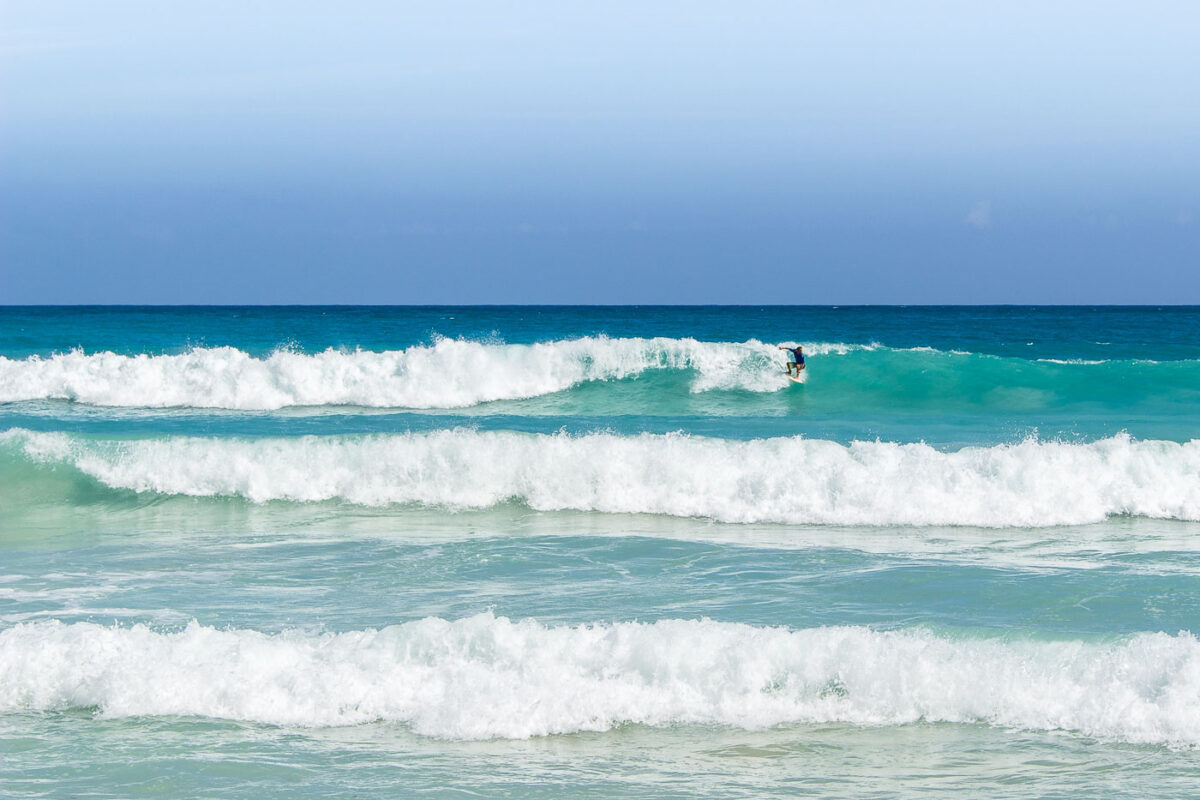
February 2016 — A surfer at Playa Macao in Dominican Republic near Punta Cana.
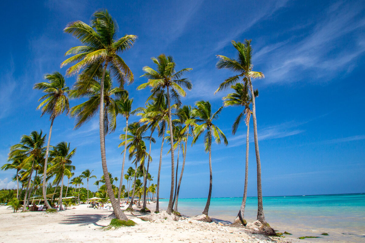
February 2016 — Playa Juanillo is known as one of Punta Cana’s most picturesque stretches of coastline, located within the gated Cap Cana development on the eastern edge of the Dominican Republic. Originally a quiet fishing shoreline, the area was transformed in the early 2000s into a planned resort community, balancing luxury development with preserved natural beachfront. The sweeping line of tall coconut palms in the photograph reflects the coastal vegetation typical of this part of Hispaniola, where sandy soils and salty ocean air support hardy palm species. The shallow turquoise water flows gently onto the white coral sand, demonstrating the calm conditions created by offshore reefs that protect much of the Dominican coastline. Today, Playa Juanillo remains both a public-access beach area and a popular gathering space for local events, weddings, and kiteboarding, offering a rare blend of untouched Caribbean scenery and curated resort amenities.
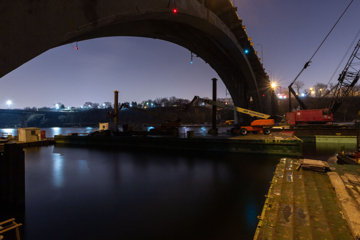
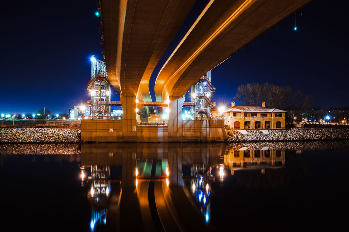
February 2016 — Repairs being done on the Franklin Avenue bridge in Minneapolis.
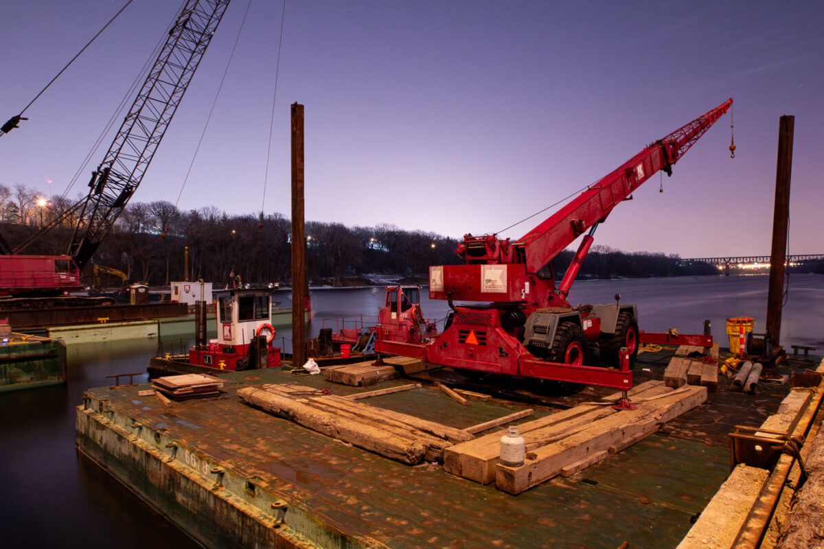
February 2016 — Repairs being done on the Franklin Avenue bridge in Minneapolis.
February 2016 — Demolition of the Ramsey County Jail in St. Paul, Minnesota.
February 2016 — Wabasha Street Bridge in St. Paul, Minnesota.
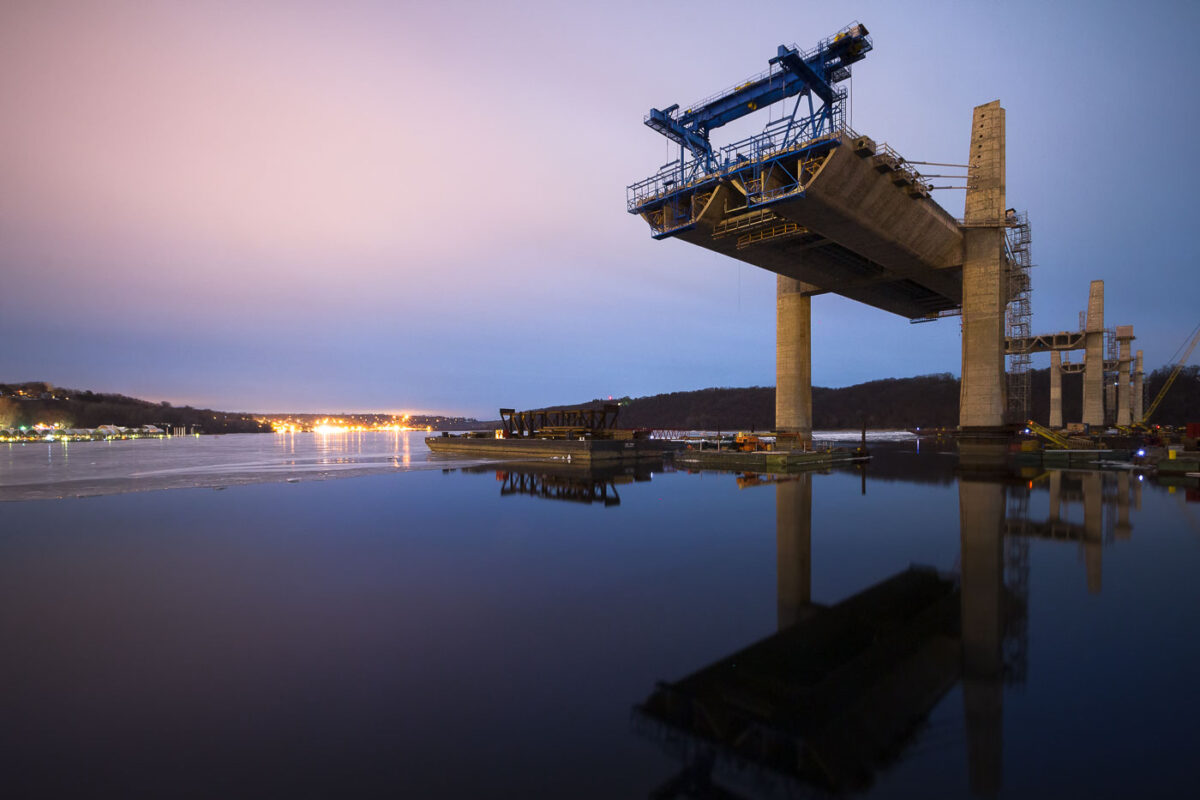
February 2016 — St. Croix Crossing bridge under construction.
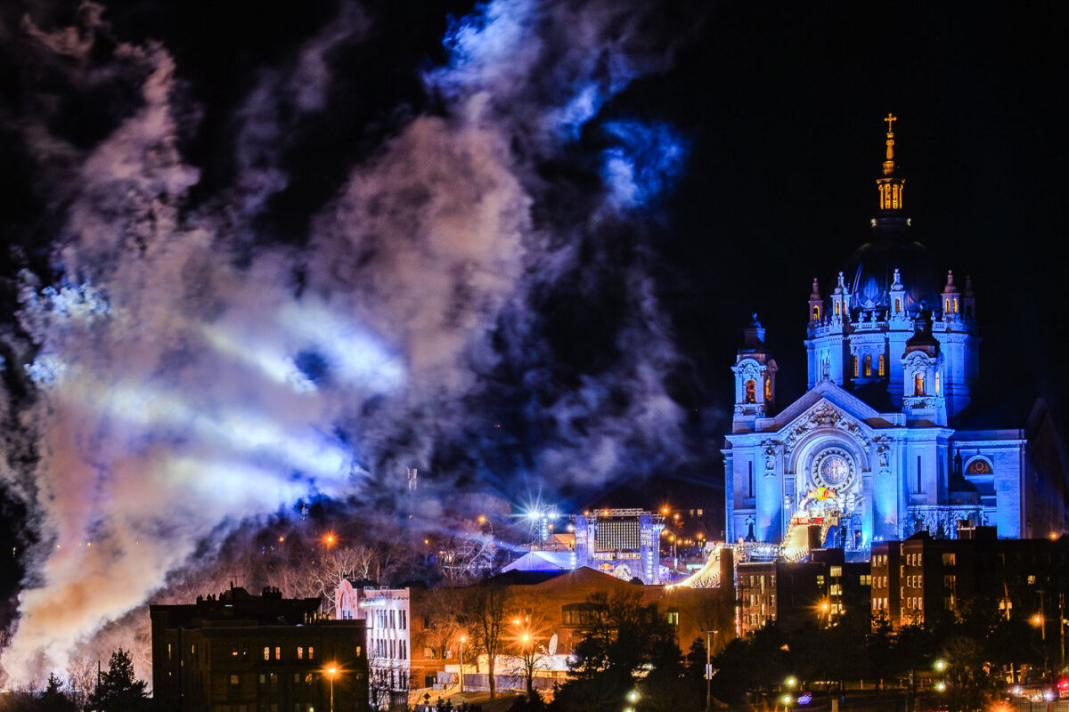
February 2016 — The Cathedral of Saint Paul during the 2017 Redbull Crashed Ice World Championship. February 2016.
April 2016 — The former Western Containers building in the North Loop of Minneapolis while it was being renovated.
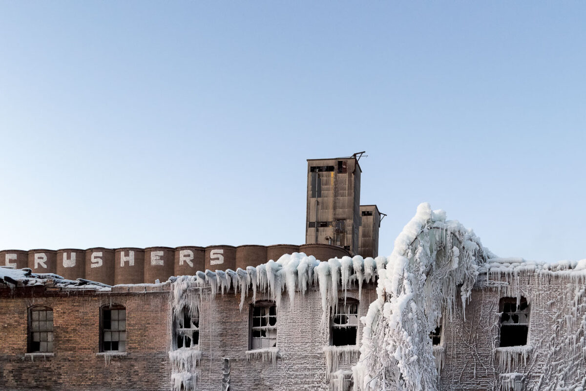
April 2016 — An abandoned ADM grain elevtor seen in Dinkytown Minneapolis.
April 2016 — Downtown East construction in Downtown Minneapolis. Construction came with all the work around the new US Bank Stadium.
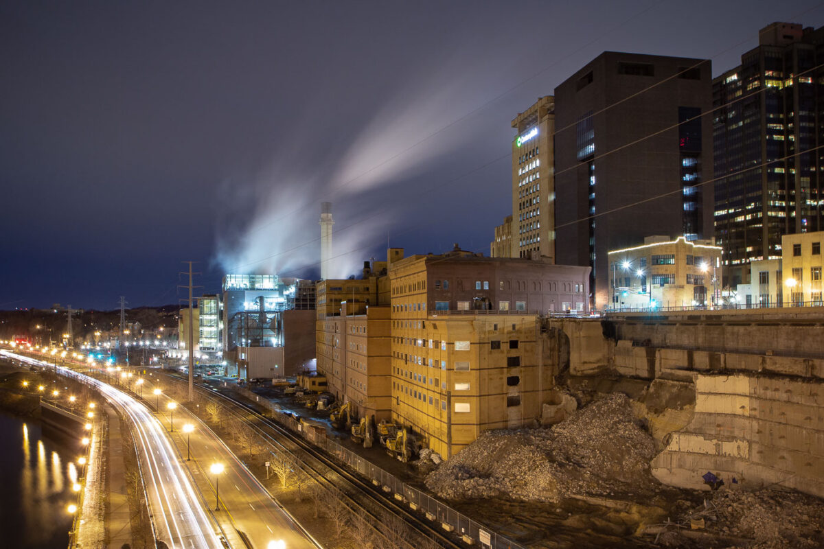
April 2016 — Downtown Minneapolis as seen from Upper Harbor Terminal in North Minneapolis. Riverside Generating Station on the left.
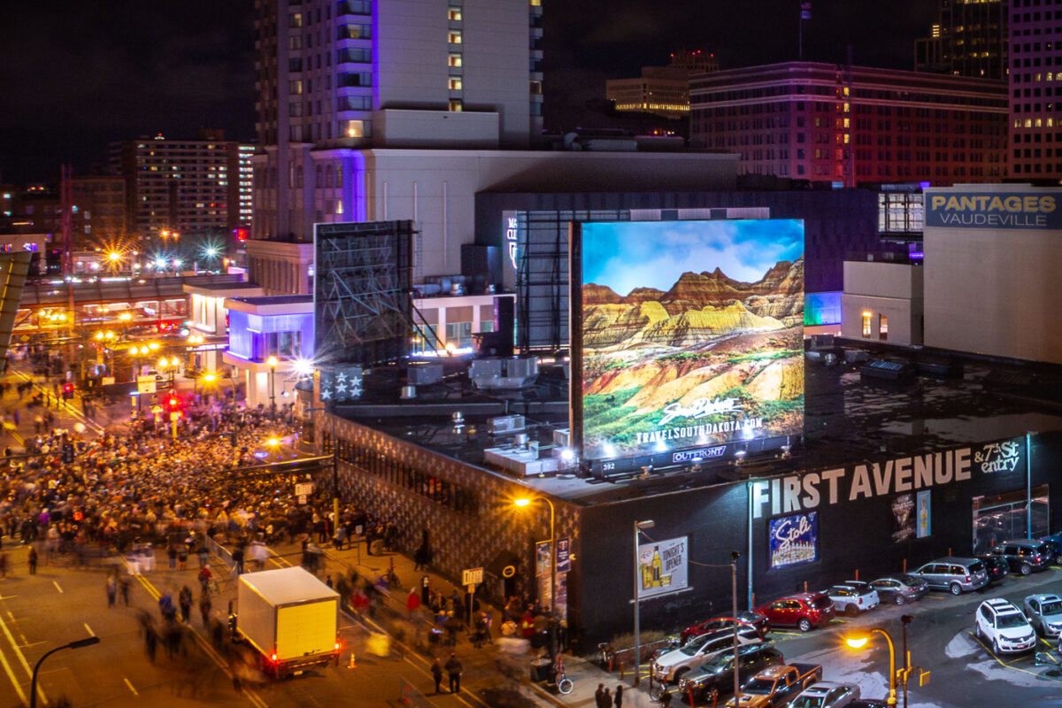
April 2016 — Crowds gather outside of First Avenue in downtown Minneapolis on the evening of Prince's death.
April 2016 — 7 Years ago today Prince died and the international media descended upon Paisley Park. Today MN lawmakers will discuss a bill that would rename Highway 5 from Mitchell Road in Eden Prairie to Hazeltine Blvd in Chanhassen to Prince Rogers Nelson Memorial Highway. (April 22, 2016)
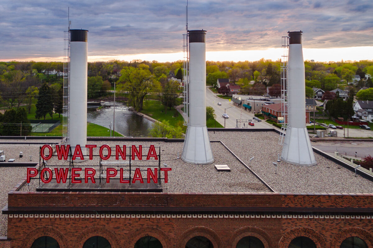
May 2016 — The Owatonna Power Plant in Owatonna, Minnesota
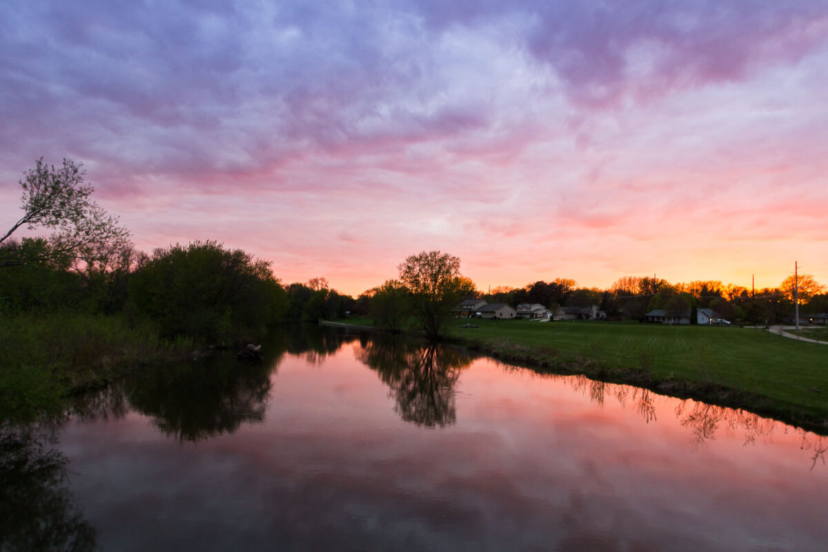
May 2016 — Sunset over the water in Owatonna Minnesota in May 2016.
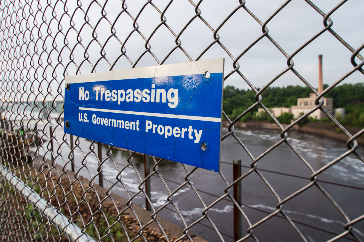
May 2016 — A sign reading "No Trespassing, US Government Property" in St. Paul, Minnesota.
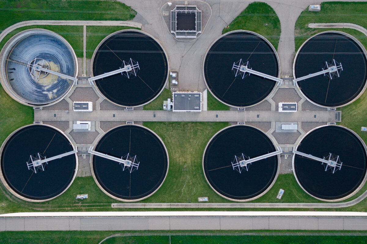
May 2016 — Blue Lake Wastewater Treatment Plant in Savage, Minnesota.
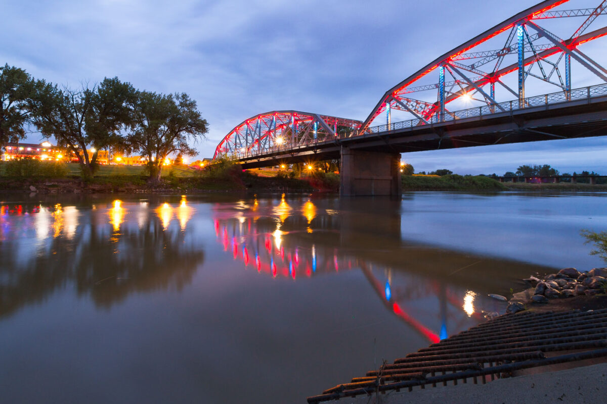
May 2016 — The Sorlie Memorial Bridge in Grand Forks, ND. The bridge is over the Red River.
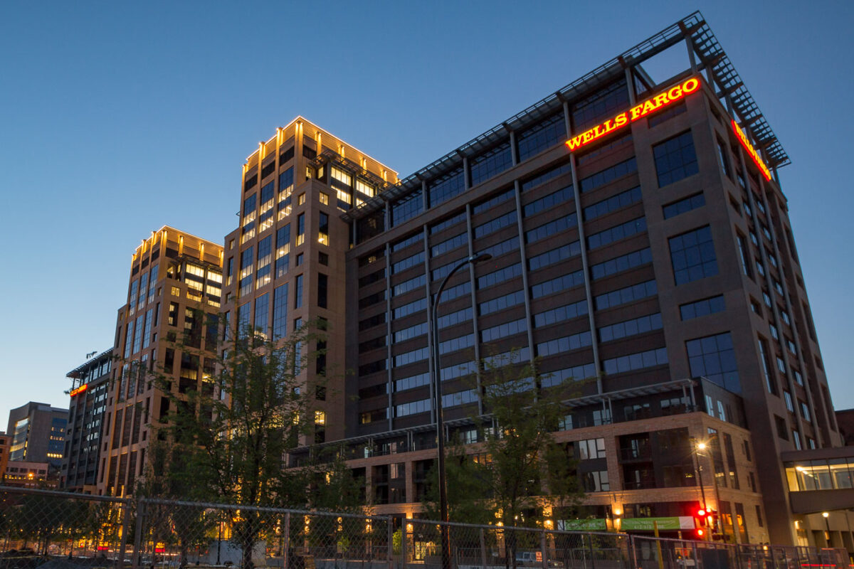
June 2016 — Wells Fargo towers as part of the Downtown East development in Minneapolis. The area was developed around the new US Bank Stadium.
June 2016 —
July 2016 — Bishop Henry Whipple Federal Building in St. Paul. The building is home to the Immigration Court.
October 2016 — The demolition of an 8 story office building on Nicollet Mall to make way for an expansion by Westminster Presbyterian Church.

October 2016 — Lowry Bridge as seen from an island on the Mississippi River in Minneapolis, Minnesota.
November 2016 —
November 2016 — Downtown East development in Minneapolis with US Bank Stadium on the right.
December 2016 — Iberostar Tucan-Quetzal resort pool in Playa Del Carmen.
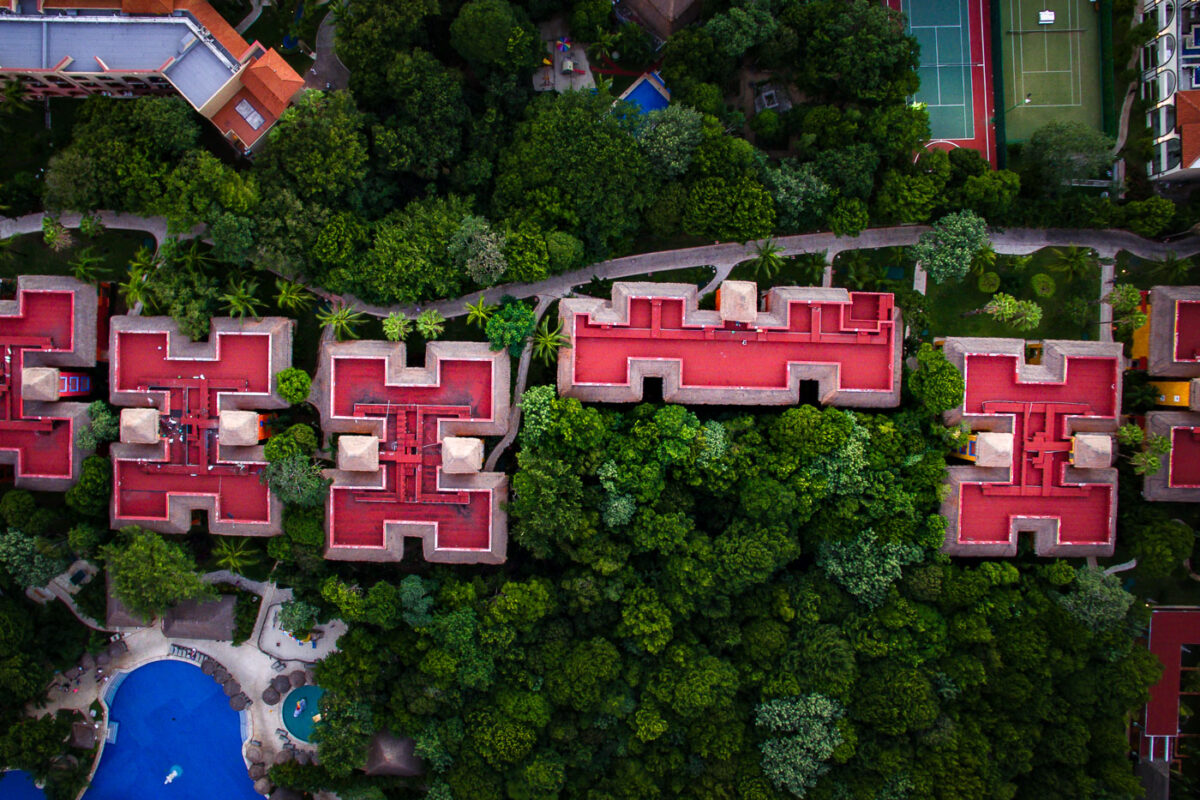
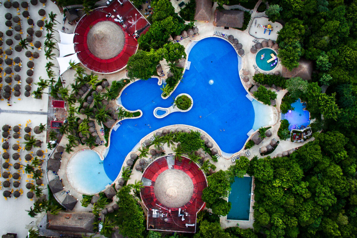
December 2016 — Aerial photo of the Iberrostar Tucan resort in Playa Del Carmen, Mexico.
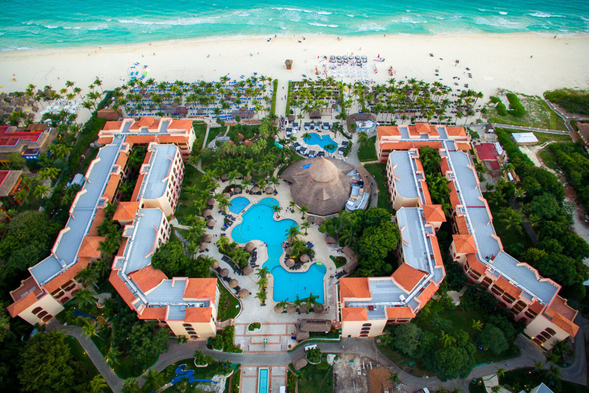
December 2016 — Sandos Playacar Beach Resort in Playa Del Carmen Mexico from above.

December 2016 — Tables setup on the beach outside Sandos Playacar Beach Resort.
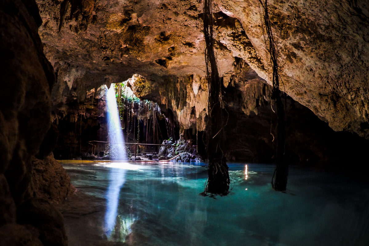
December 2016 — Inside a cenote near Playa Del Carmen, Mexico.
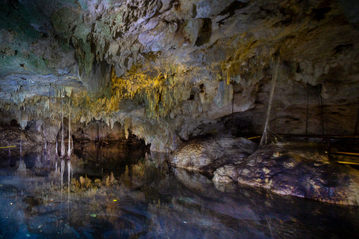
December 2016 — Diving in a cenote near Playa Del Carmen Mexico.
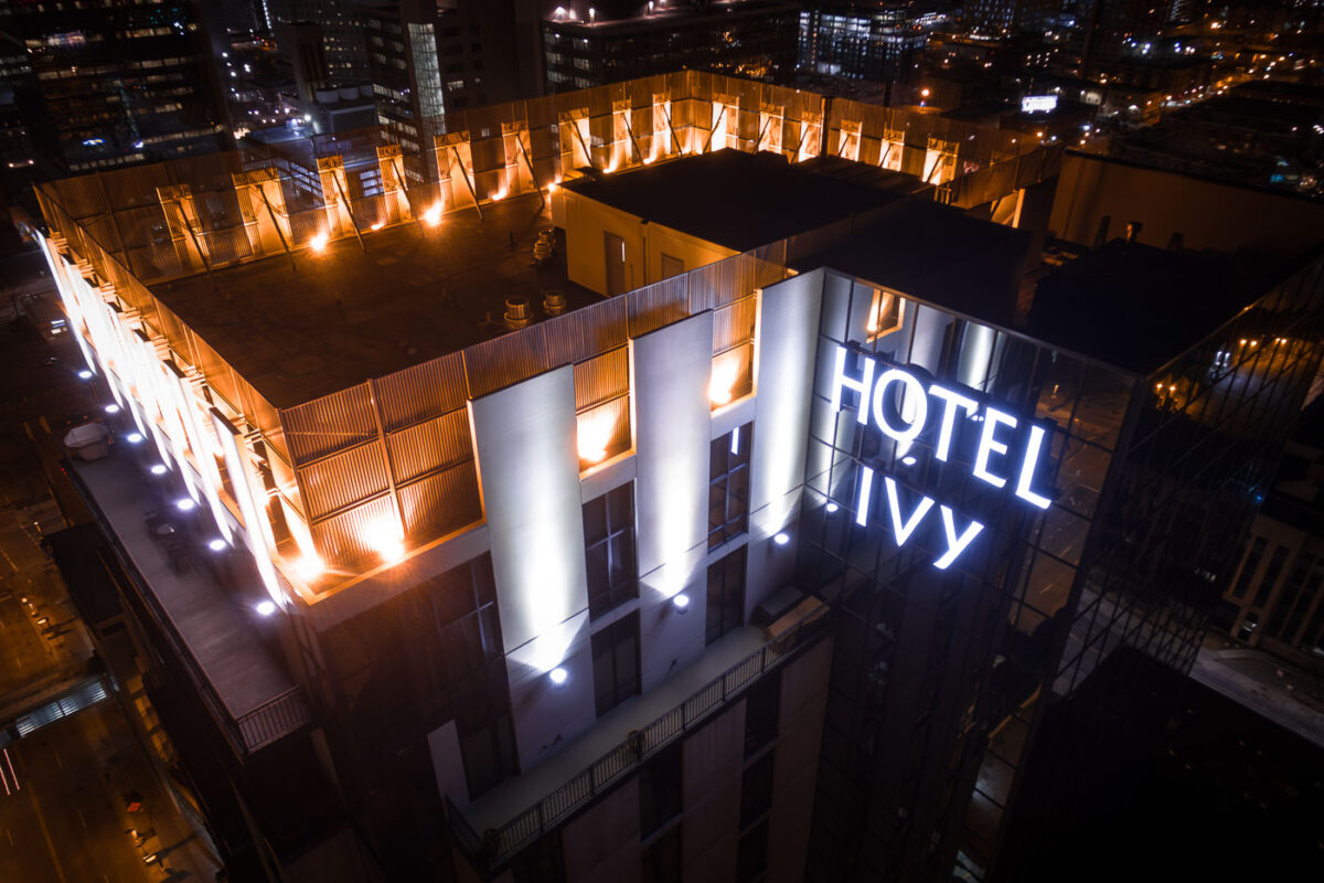
February 2017 — Hotel Ivy in Downtown Minneapolis.
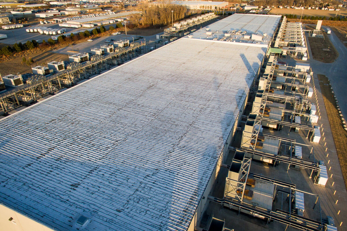
February 2017 — Google data center in Council Bluffs Iowa.
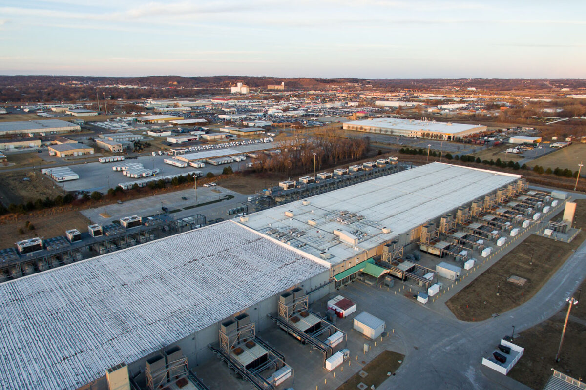
February 2017 — A Google data center in Council Bluffs, Iowa.
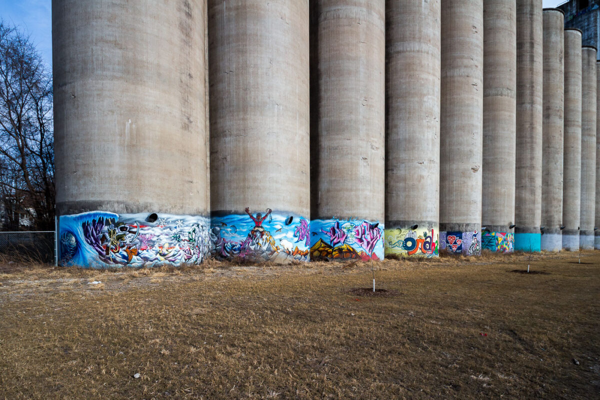
February 2017 — Mural on a concrete grain elevator in Omaha, Nebraska,
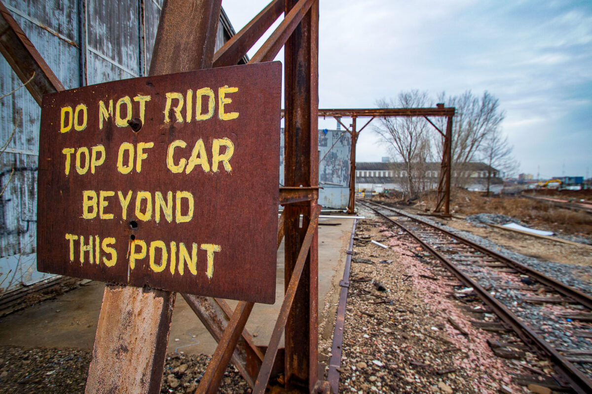
February 2017 — Sign that reads "Do not ride top of car beyond this point". Found in Omaha, NE.
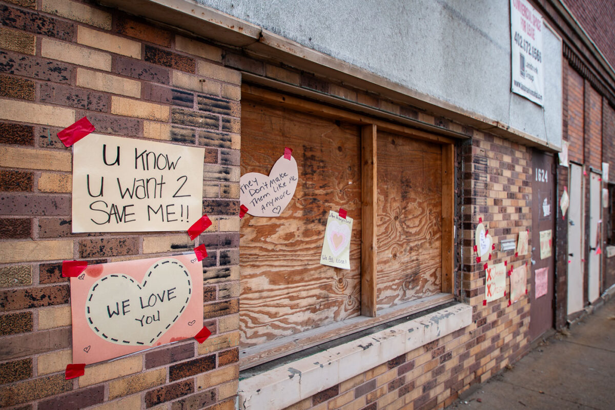
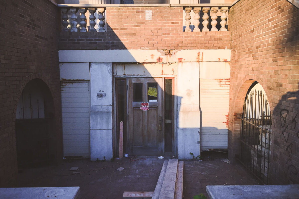
February 2017 — Signs hung on the historic building asking for it to be saved.
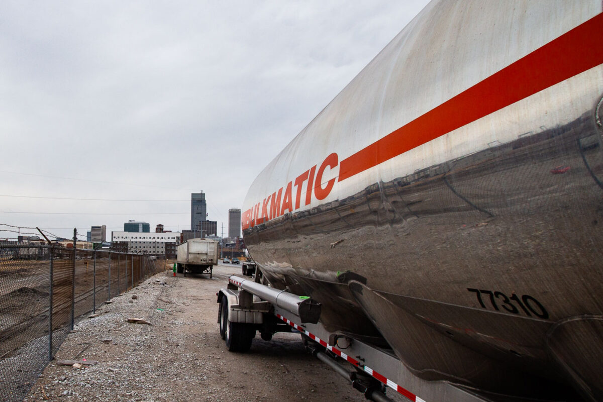
February 2017 — A bulkmatic semi in Omaha, Nebraska.
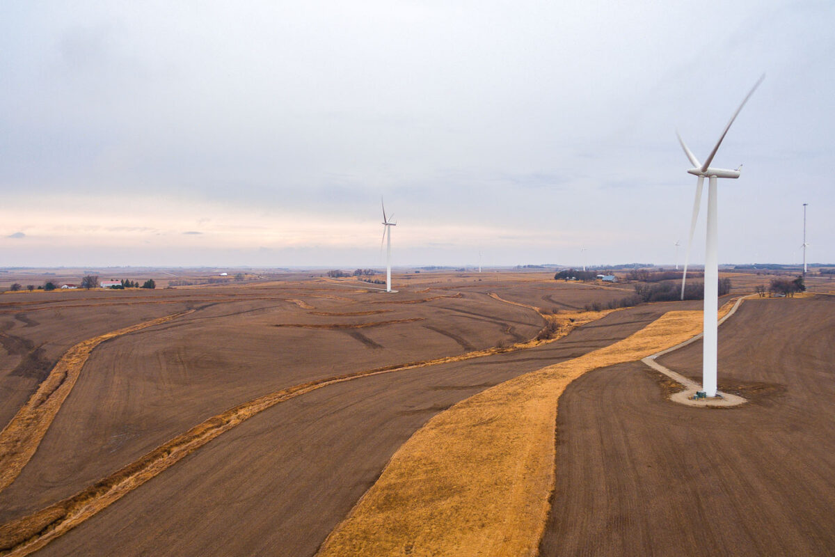
February 2017 — Windmills in Adair, Iowa.
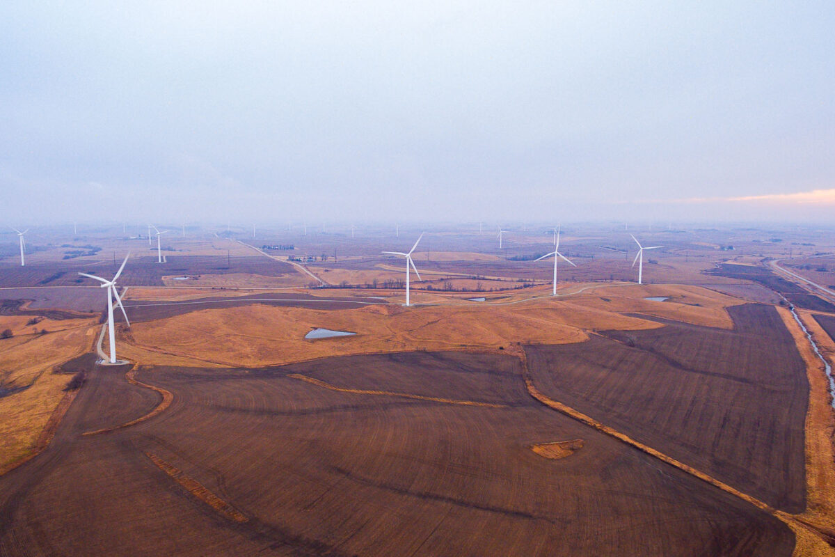
February 2017 — Windmills in Adair, Iowa.
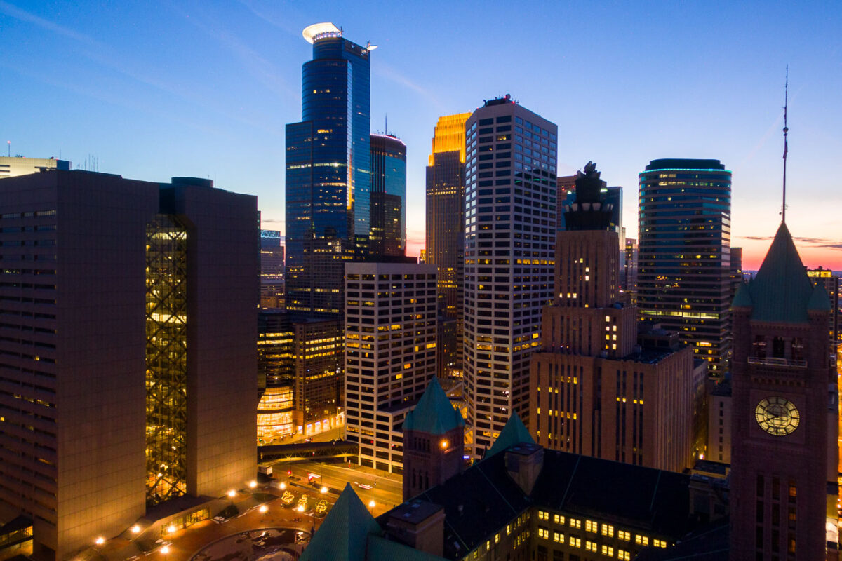
March 2017 — City Hall in the foreground with the Minneapolis Skyline behind it.