
Concrete Pillars Under St. Paul Bridge During Rainstorm
May 2017 — Underneath a bridge in Saint Paul Minnesota during a rainstorm.
Explore photos in Uncategorized.
May 2017 — Underneath a bridge in Saint Paul Minnesota during a rainstorm.
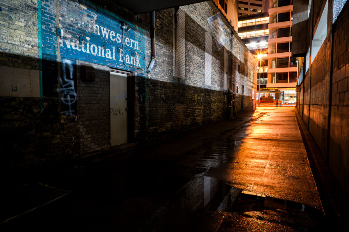
May 2017 — A Northwestern National Bank ghost sign seen in Downtown St. Paul.
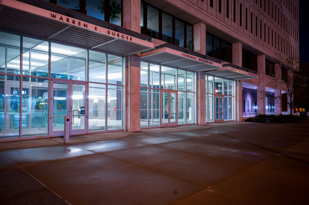
May 2017 — Warren E. Burger Federal Building United States Courthouse in downtown St Paul.
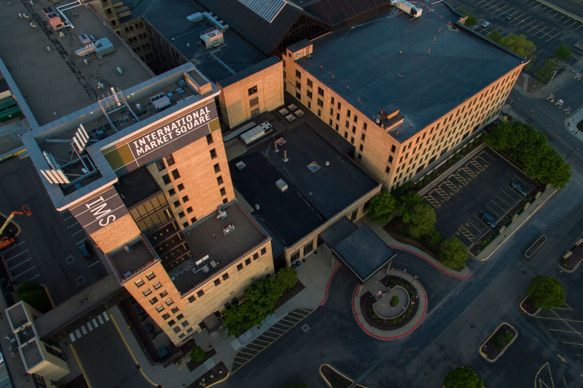
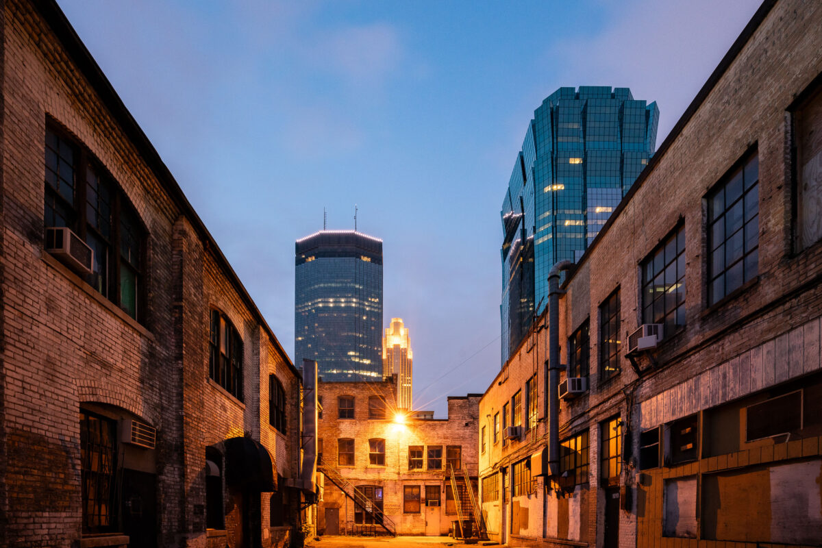
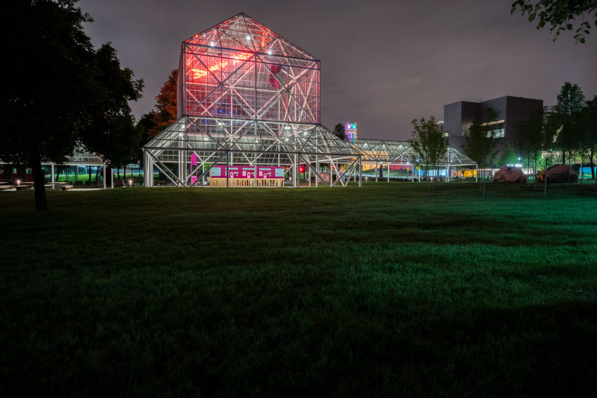
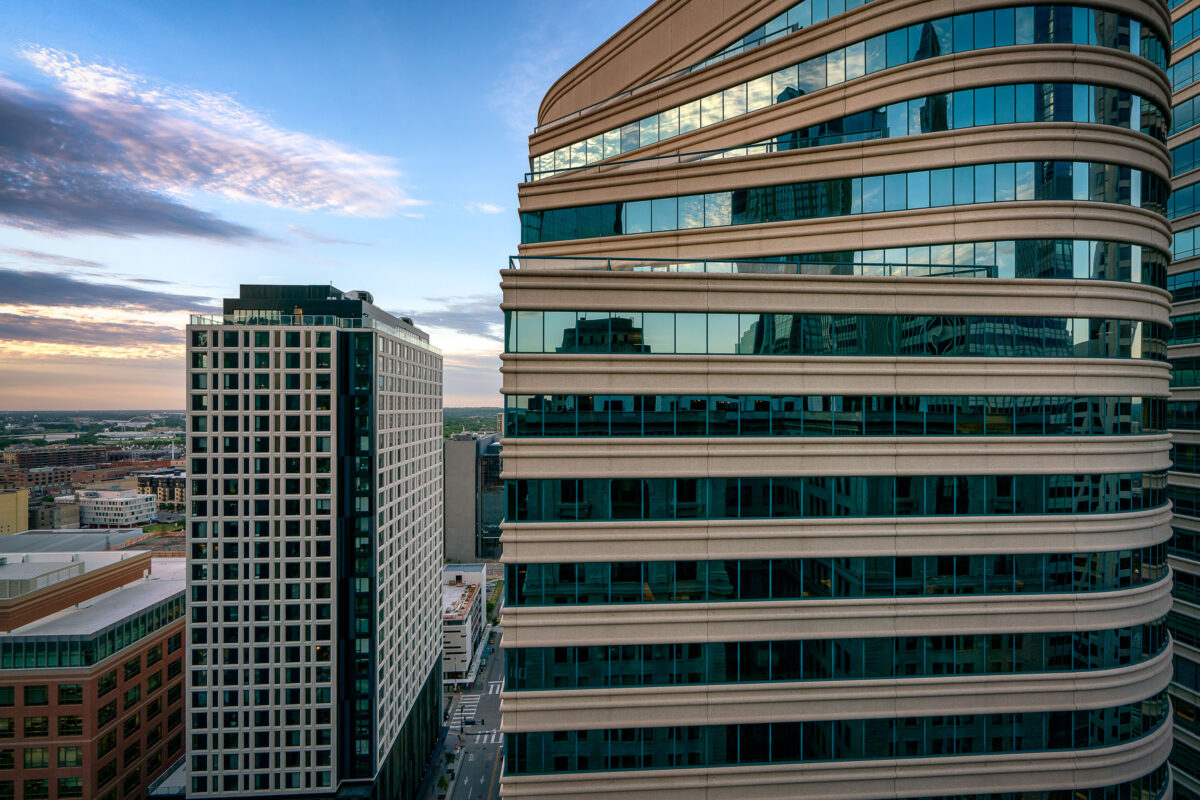
May 2017 — International Market Square, Minneapolis
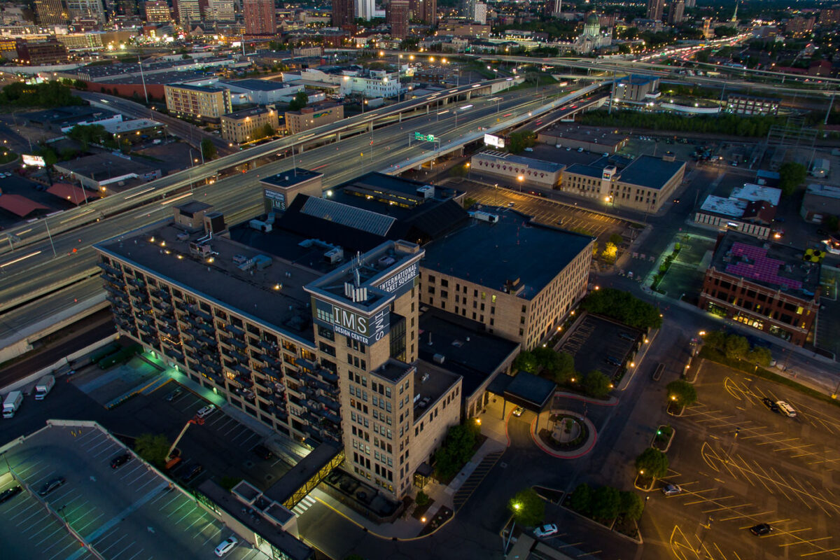
May 2017 — International Market Square, Minneapolis
May 2017 —
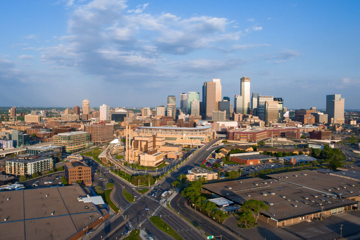
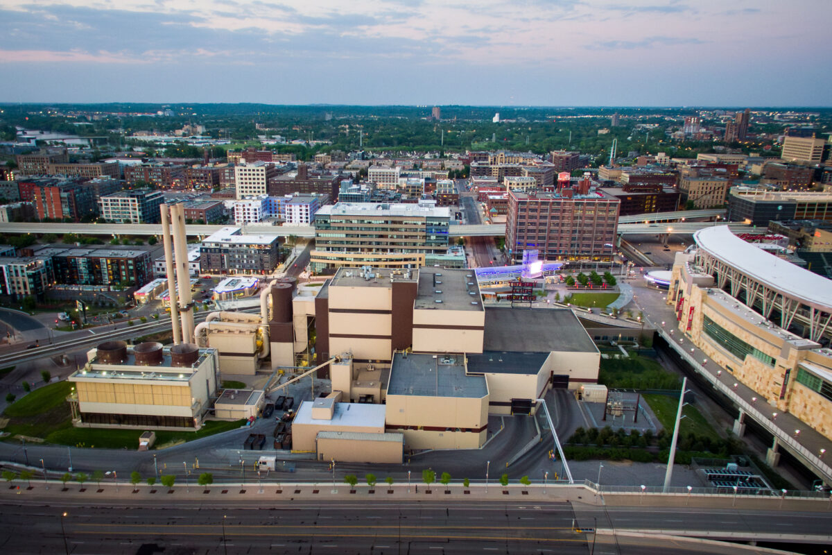
May 2017 — Downtown Minneapolis Skyline from the North
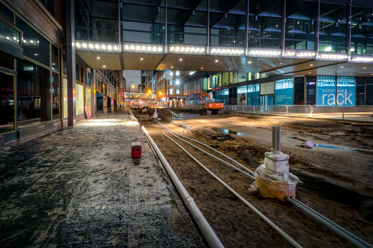
May 2017 — The middle of the multi-year construction on Nicollet Mall.
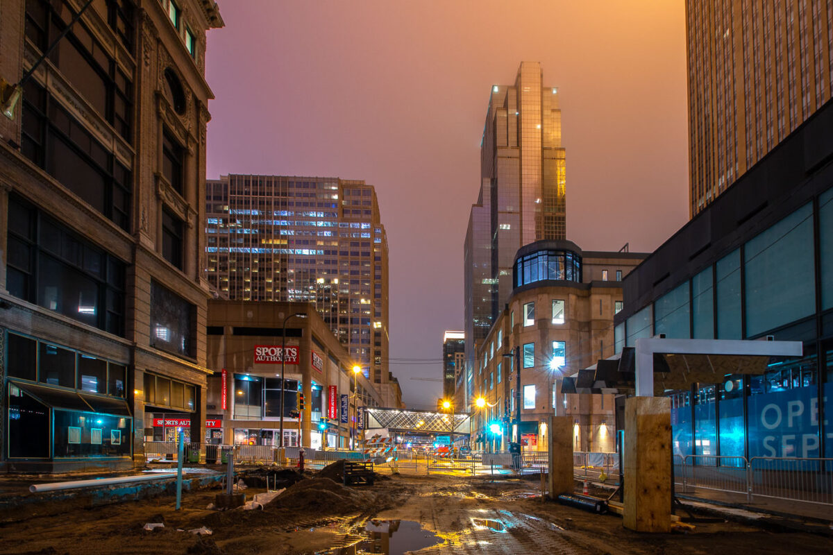
May 2017 — Nicollet Mall under construction in downtown Minneapolis. 2017
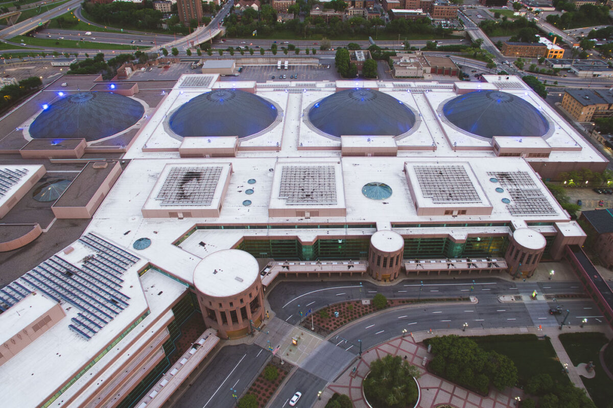
May 2017 — Minneapolis Convention Center in Downtown Minneapolis.
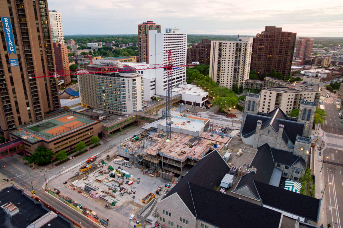
May 2017 — A tower crane outside a church where a large addition is being added on Nicollet Mall in Downtown Minneapolis.

May 2017 — Minikahda Club golf course in Minneapolis, Minnesota.
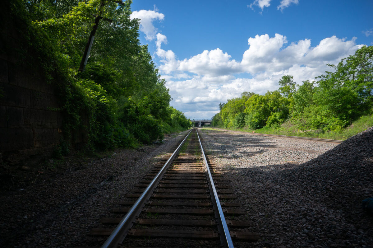
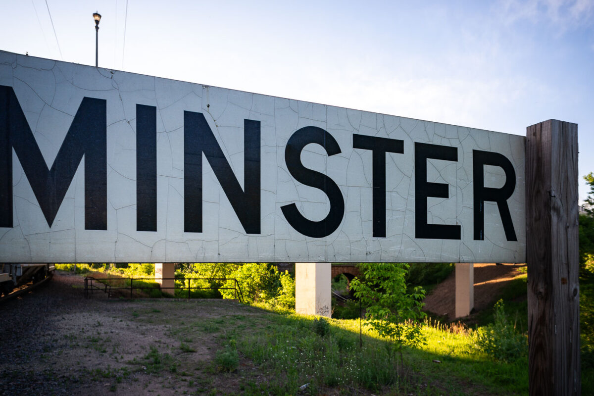
May 2017 — Once part of the historic rail convergence near Westminster Junction in St. Paul, this corridor reflects the city’s long-standing role as a freight and passenger gateway for the Upper Midwest. The junction has served multiple carriers over the decades, supporting connections to Chicago, Minneapolis, and broader national rail networks. The single-track line in the foreground sits alongside a broader multi-track right-of-way, characteristic of the region’s use for heavy rail traffic, including grain, intermodal, and freight hauling. Dense summer vegetation lines the route, showing how rail corridors often double as preserved green space, even amid active infrastructure. The distant bridge marks the approach toward downtown St. Paul, where several major rail yards historically managed traffic between river, road, and rail transport.
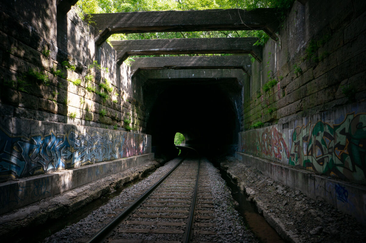
May 2017 — Built in the late 19th century, this rail tunnel sits near Bridal Veil Creek between Minneapolis and St. Paul and was constructed to accommodate expanding freight and passenger service for the Great Northern and Northern Pacific rail systems. Its heavy stone block walls and reinforced concrete beams reflect early railroad engineering adapted to the region’s steep ravines and waterways. The tunnel once served as a vital connector between Minneapolis rail yards and the Midway district, supporting grain, timber, and industrial shipments. Though still active today, it carries far lighter traffic and has become known for its weathered masonry, natural overgrowth, and layers of graffiti, showing where urban infrastructure meets forgotten industrial corridors.
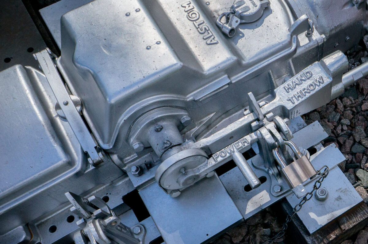
May 2017 — A close-up of an Alstom railway switch machine, showing the locked levers for power and hand-throw operation, used to control train track switches.
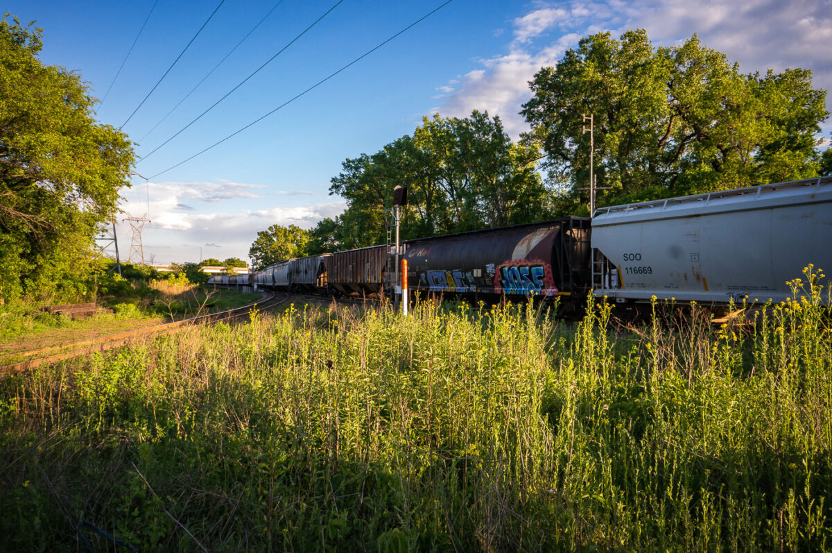
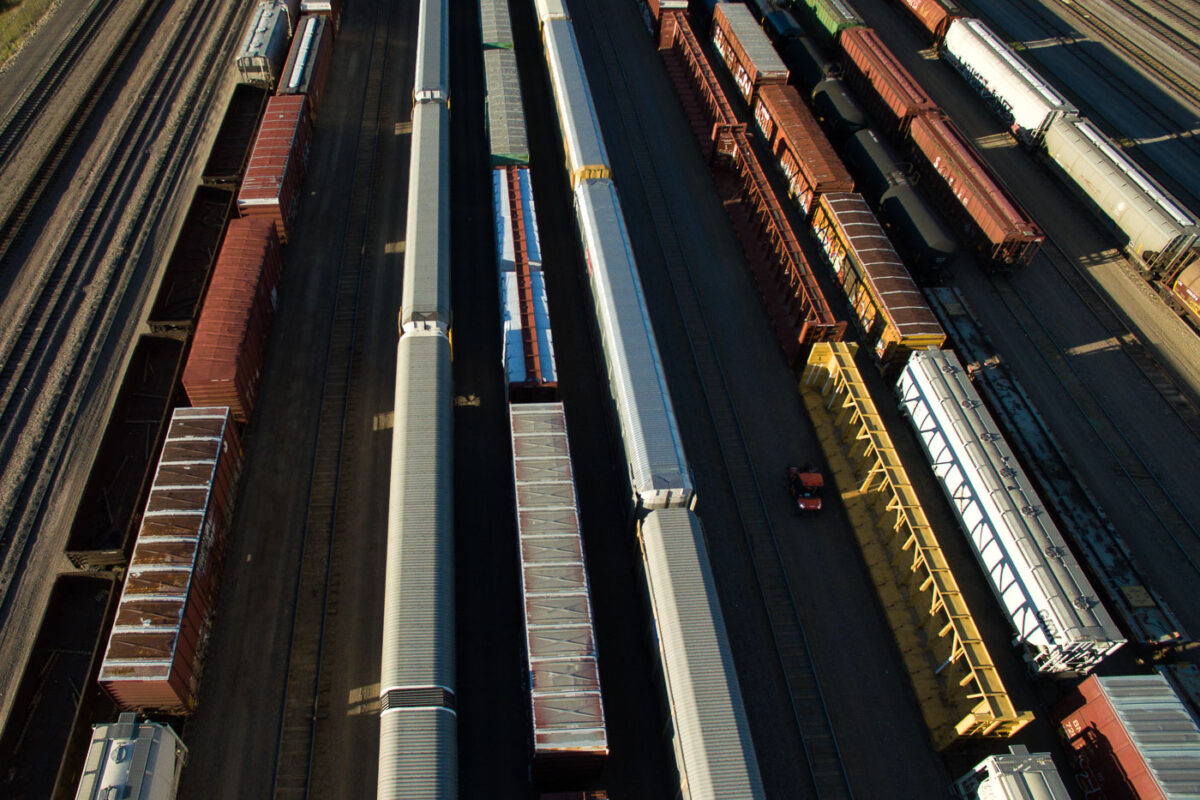
May 2017 — Freight trains rolling through St. Paul, MN.
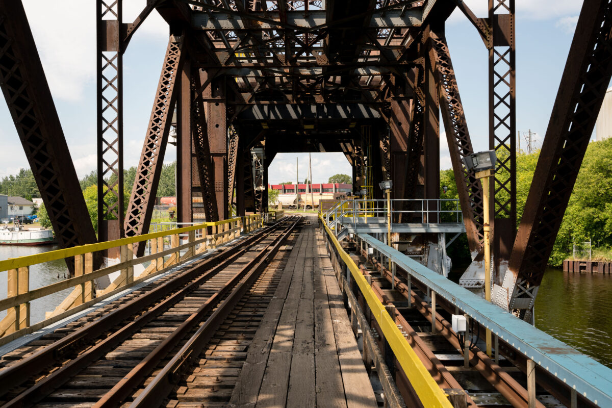
May 2017 — Westminster Junction in St. Paul, Minnesota
June 2017 — Prince's Paisley Park in Chanhassen, Minnesota.
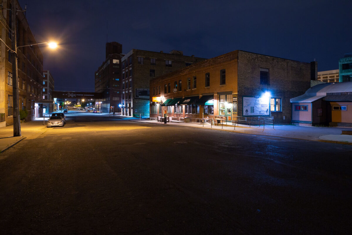
June 2017 — N 3rd Street in the North Loop in Minneapolis.
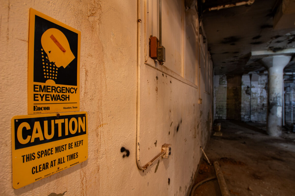
June 2017 — Emergency Eyewash sign found in an abandoned basement.
June 2017 —
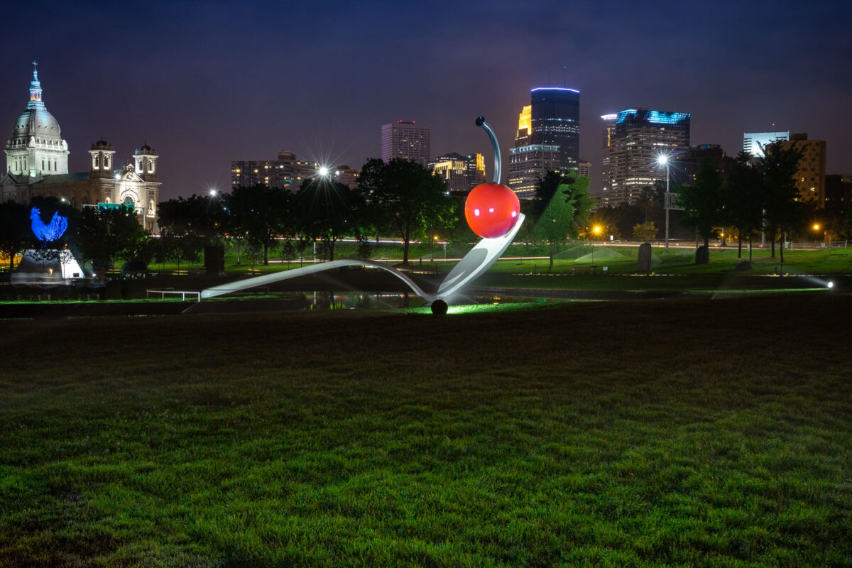
June 2017 — Located in the Walker's sculpture garden.
June 2017 — The back of a now demolished building in downtown Minneapolis.
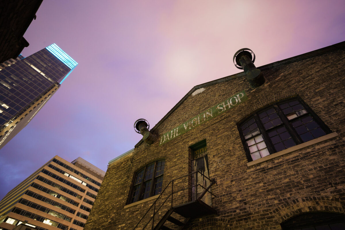
June 2017 — The now demolished Dahl Violin Shop building in downtown Minneapolis.
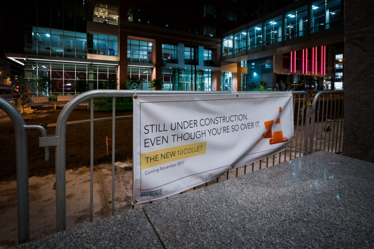
June 2017 — A sign on Nicollet Mall in downtown Minneapolis referring to it's construction. So over it is right.
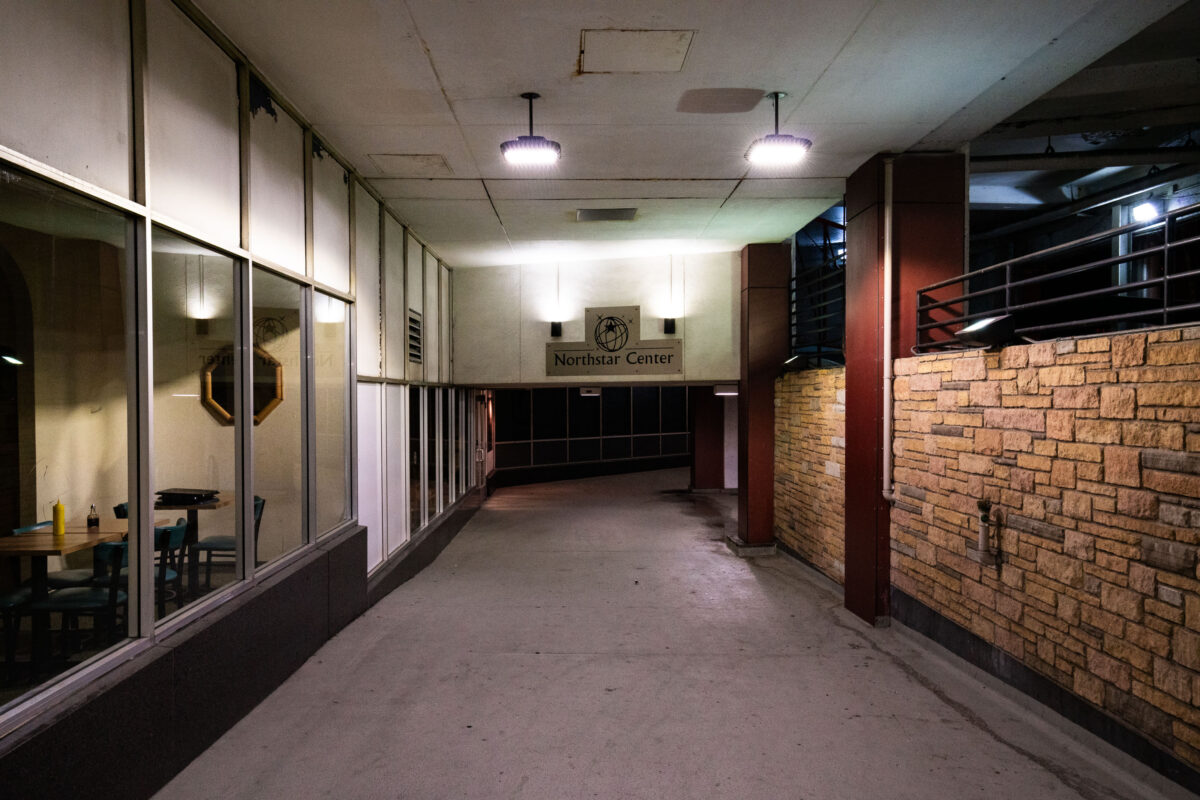
June 2017 — Northstar Center in downtown Minneapolis.
June 2017 — Walker Sculpture Garden in Minneapolis.
June 2017 — The Baker Center in downtown Minneapolis.
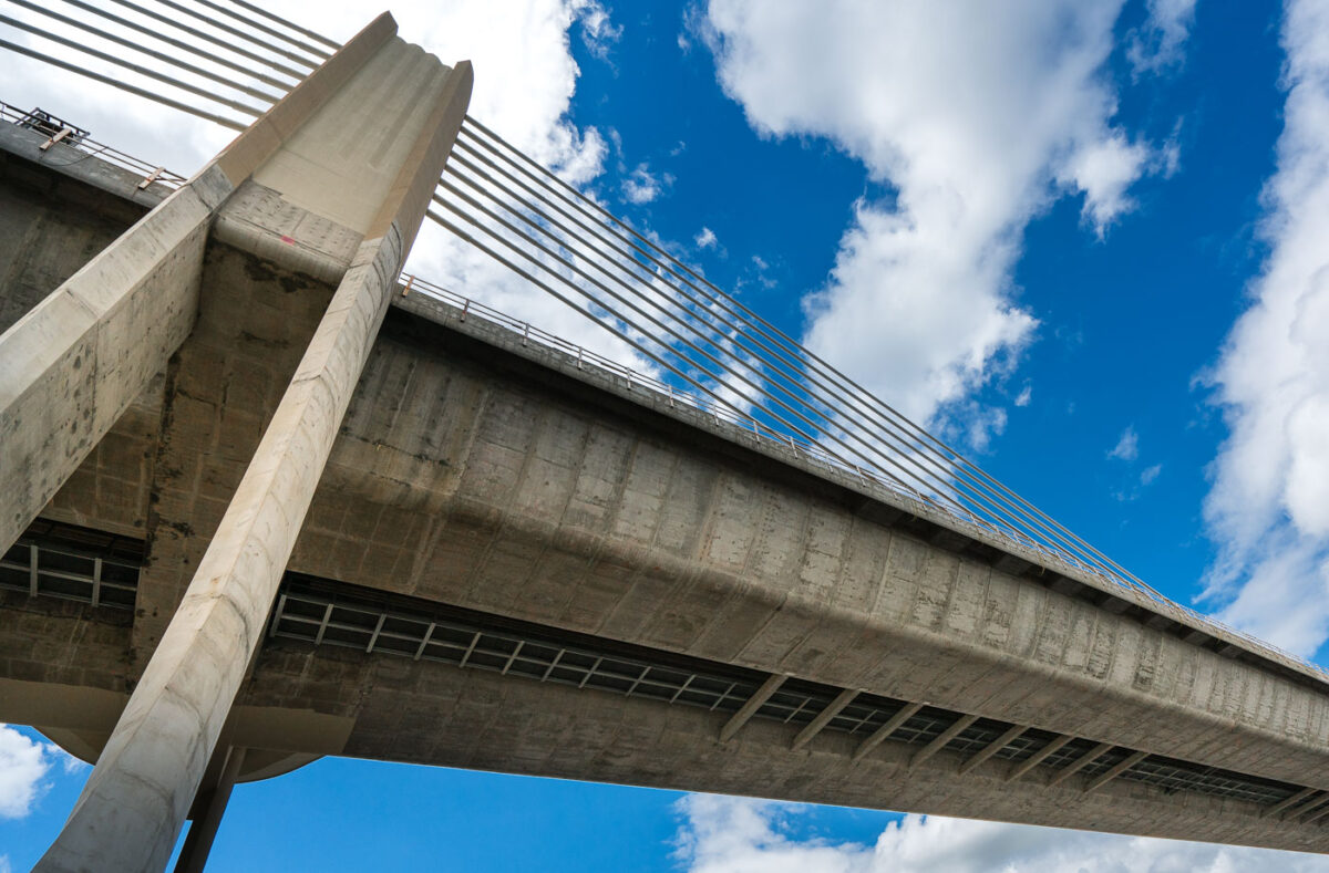
June 2017 — From Wiki: The St. Croix Crossing is an extradosed bridge that spans the St. Croix River, between Oak Park Heights, Minnesota and St. Joseph, Wisconsin. Connecting Minnesota State Highway 36 and Wisconsin State Highway 64, the bridge carries four lanes of traffic (two lanes in each direction), and includes a bike/pedestrian path on the north side
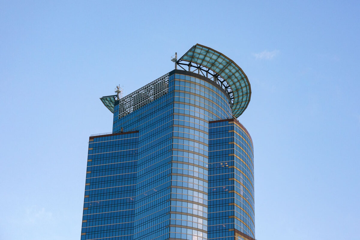
June 2017 — The crown on top of the Capella Tower. They recently switched the lighting over to LED lighting.
June 2017 — Fifth Street Towers in Downtown Minneapolis during sunset.
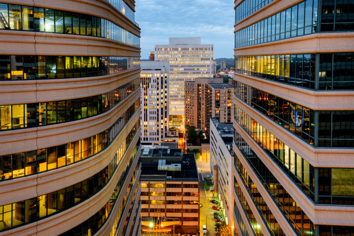
June 2017 — A look down between the Fifth Street Towers in Downtown Minneapolis.
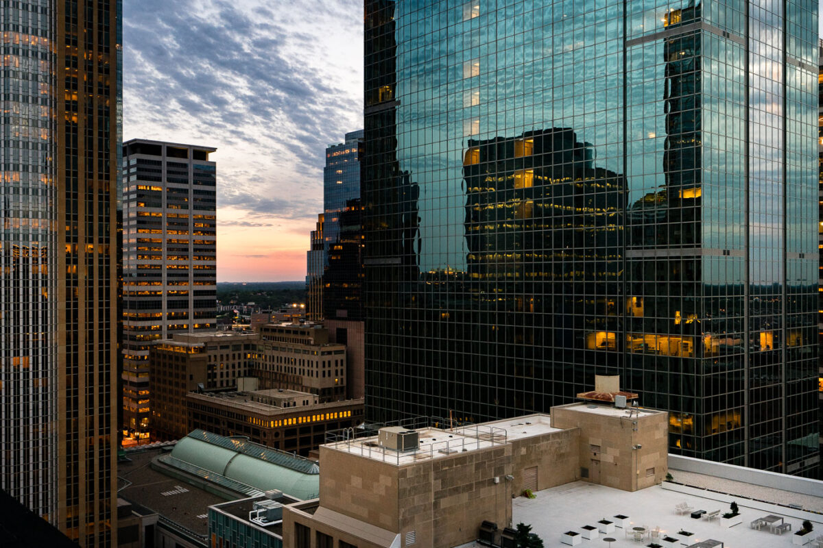
June 2017 — Sunset in Downtown Minneapolis.

June 2017 — Mississippi River, Minneapolis
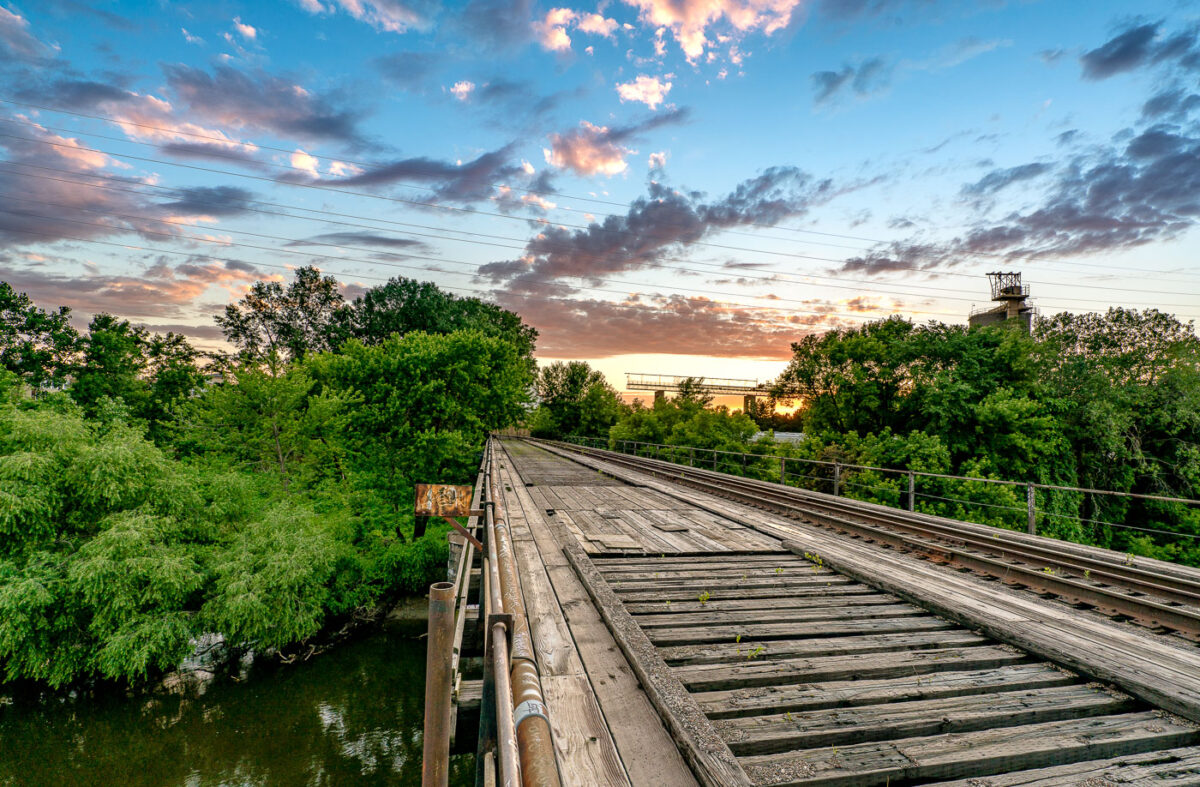
June 2017 — A wooden freight train bridge over the Mississippi River in Minneapolis.

June 2017 — A barge on the Minnesota River in Savage Minnesota.
June 2017 — Superior Minerals Company in Savage, MN

July 2017 — Bighorn Sheep at Buffalo Gap National Grassland in South Dakota.

July 2017 — Sunset at the Buffalo Gap National Grasslands.
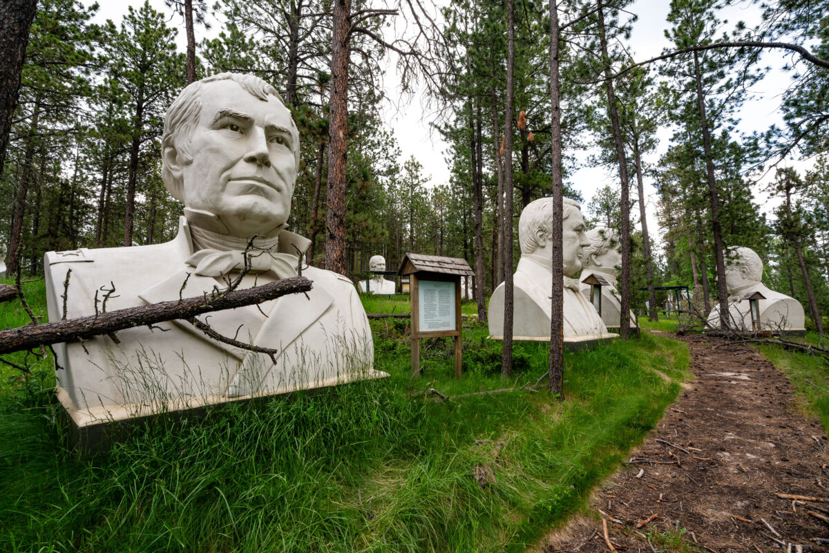
July 2017 — These towering concrete presidential busts sit hidden in the woods near Lead, South Dakota—remnants of a once-ambitious roadside attraction called Presidents Park. Conceived by Texas artist David Adickes and opened in 2003, the park showcased forty-three sculptures, each roughly 20 feet tall, depicting every U.S. president from Washington through George W. Bush. The attraction struggled to draw visitors and closed by 2010, leaving the massive heads stranded in the forest. Over time, nature reclaimed the site, with fallen branches, moss, and pine needles collecting around the statues. Today, the figures stand as haunting relics of early-2000s Americana tourism and the impermanence of grand civic art in private hands.
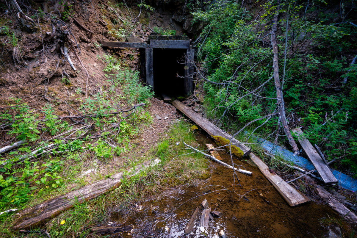
July 2017 — A long-forgotten mine entrance lies hidden in the forested slopes near the old gold mining town of Lead, South Dakota. The timber-framed portal, now partially collapsed and overtaken by vegetation, dates back to the late 19th or early 20th century—part of the Black Hills’ extensive network of small exploratory mines that sprang up after the 1876 gold rush. Streams like this one often run through or near these adits, carrying trace minerals that once drew prospectors to the region. Though many of these shafts were short-lived, they remain scattered reminders of South Dakota’s mining heritage and the rugged ambition that once fueled settlement in the Black Hills.
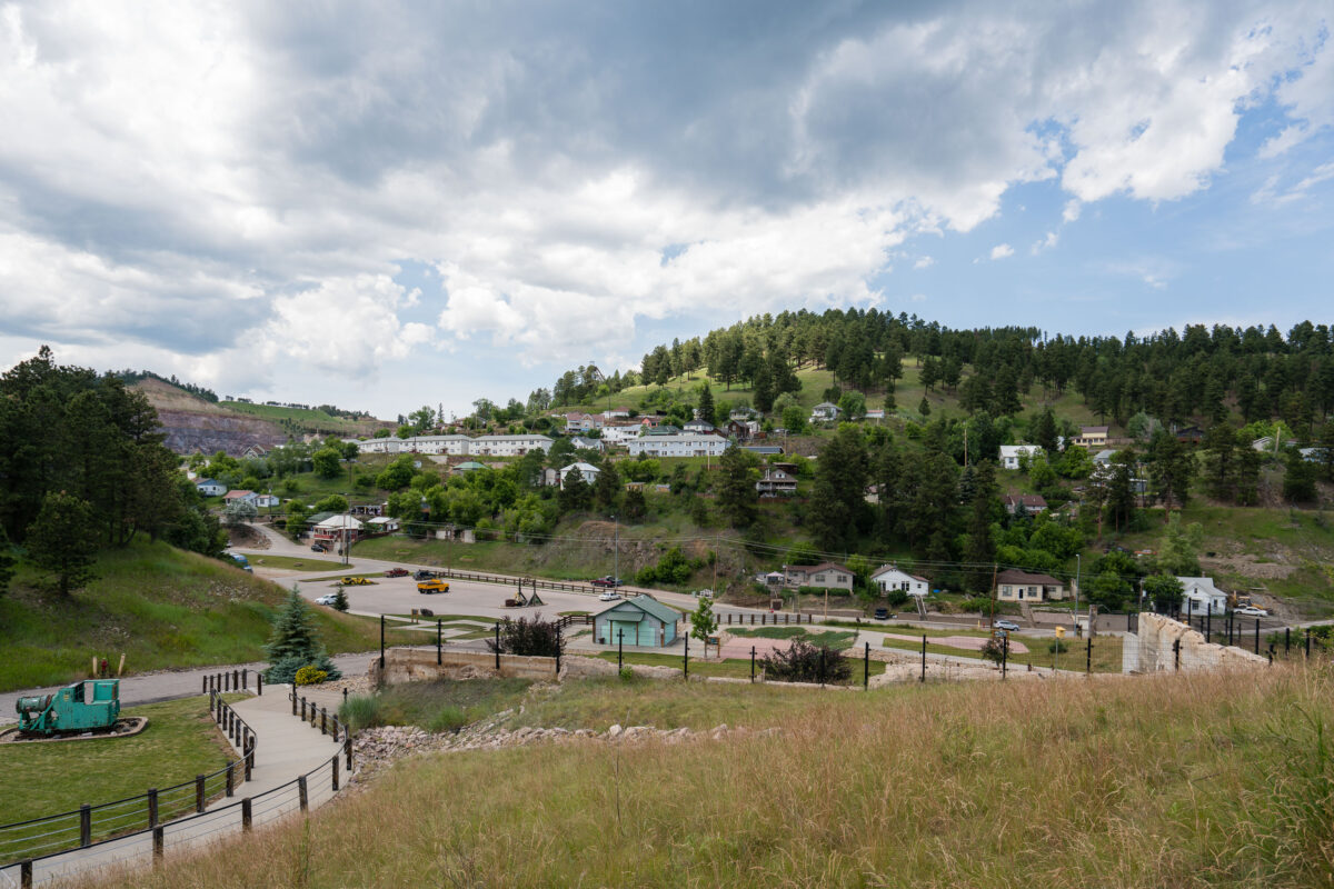
July 2017 — Gold Run Park in Lead, South Dakota.

July 2017 —
July 2017 — Sunrise over our tent at the Buffalo Gap National Grasslands. This Bureau of Land Management spot is one of our absolute favorite camping spots.

July 2017 — A beautiful rainbow at the Buffalo Gap National Grasslands. We camped here and woke up to this during the sunrise.

July 2017 —

July 2017 — CS36B off of Highway 240 near the Saddle Pass Trailhead. The trail is a short hike up the Badlands Wall giving views of the White River Valley.
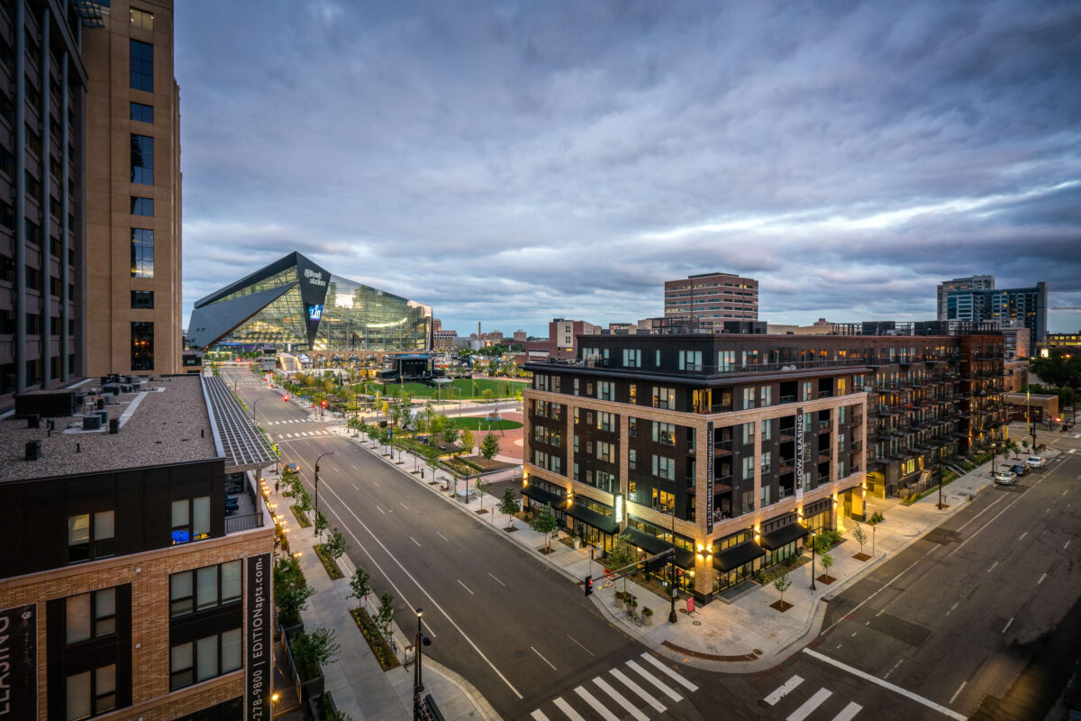
July 2017 — Edition Apartments and US Bank Stadium in Downtown East Minneapolis.
July 2017 — Seven Steakhouse in Downtown Minneapolis in June 2017. The restaurant closed for good in winter 2022.
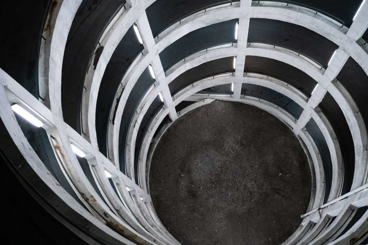
July 2017 — Spiral parking garage in downtown Minneapolis. These type of parking garages are so photogenic.
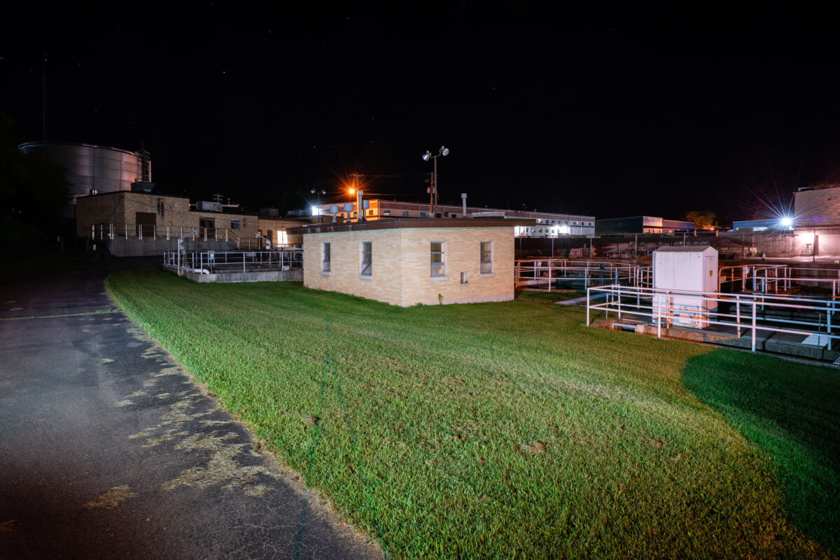
July 2017 — Marathon City Wastewater Treatment Plant
July 2017 — The Theodore Hamm's Brewing Company was an American brewing company established in 1865 in St. Paul, Minnesota. Becoming the 5th "largest brewery" in the United States, Hamm's expanded with additional breweries that were acquired in other cities, including San Francisco, Los Angeles, Houston, and Baltimore.

July 2017 — Evening settles over the North Shore as the moon rises above Lake Superior, seen from Silver Creek Township, Minnesota. The calm waters reflect the fading light of dusk along a rugged basalt shoreline shaped by ancient lava flows nearly a billion years old. This stretch of coast, north of Two Harbors, remains one of the most geologically significant and least developed sections of Minnesota’s Superior shoreline—where forests of spruce and pine meet one of the world’s largest freshwater lakes under an endless sky.
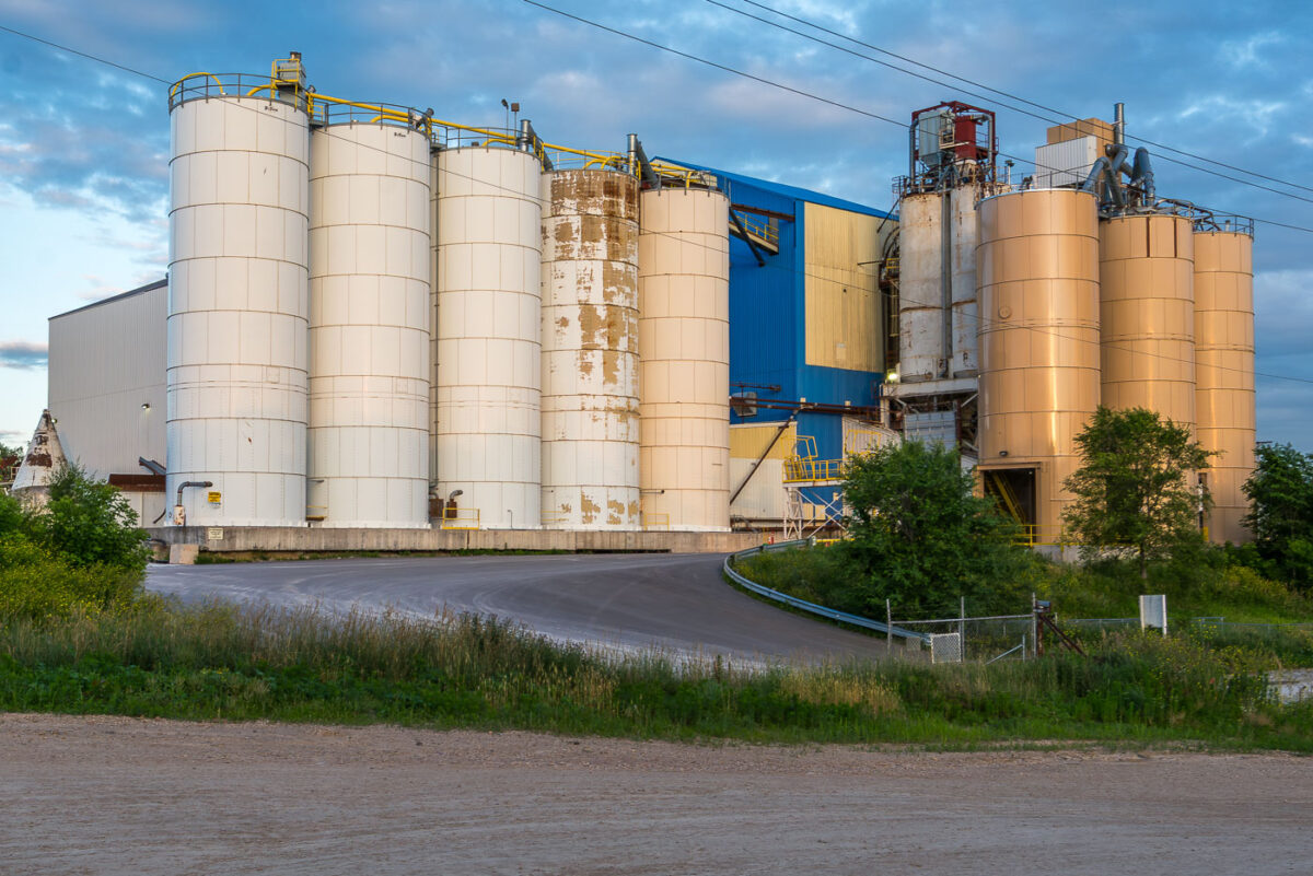
July 2017 — Grain Elevator in Thunder Bay, Canada.
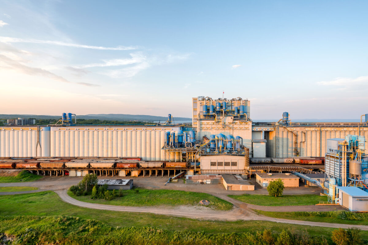
July 2017 — Grain Elevator in Thunder Bay, Canada.
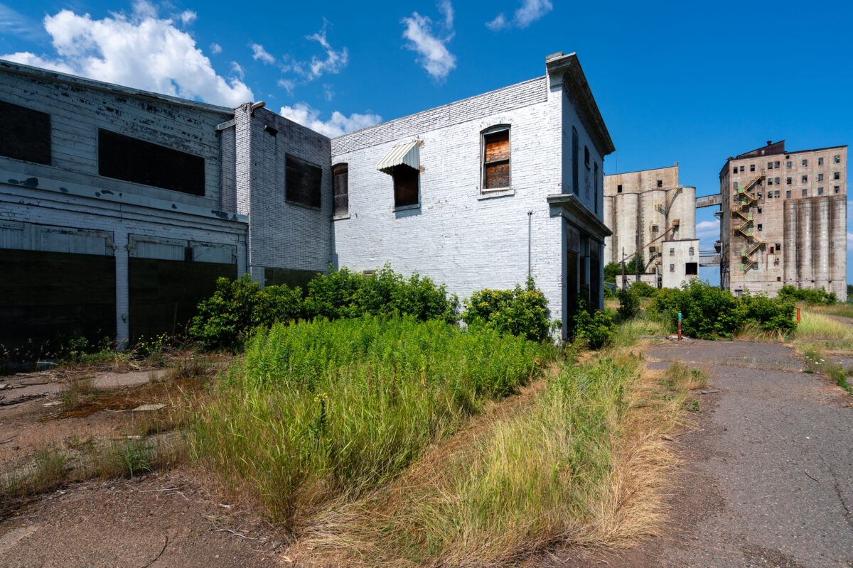
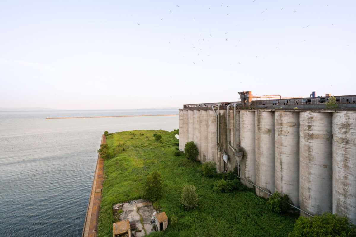
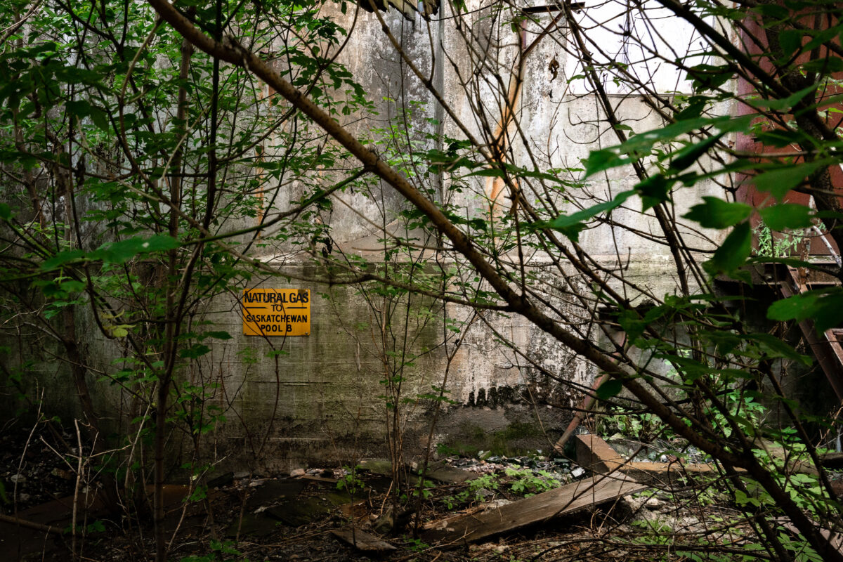
July 2017 — The remains of the Saskatchewan Pool B complex in Thunder Bay, Ontario, stand as a testament to the city’s industrial and maritime heritage. Once part of one of the largest grain handling networks on the Great Lakes, these structures were built in the early 20th century to serve the growing wheat trade flowing from the Canadian Prairies to Atlantic markets. Operations here slowed by the 1980s as newer, more efficient elevators replaced them. Today, the site lies silent along the waterfront, its silos and offices weathered by decades of Lake Superior winds.
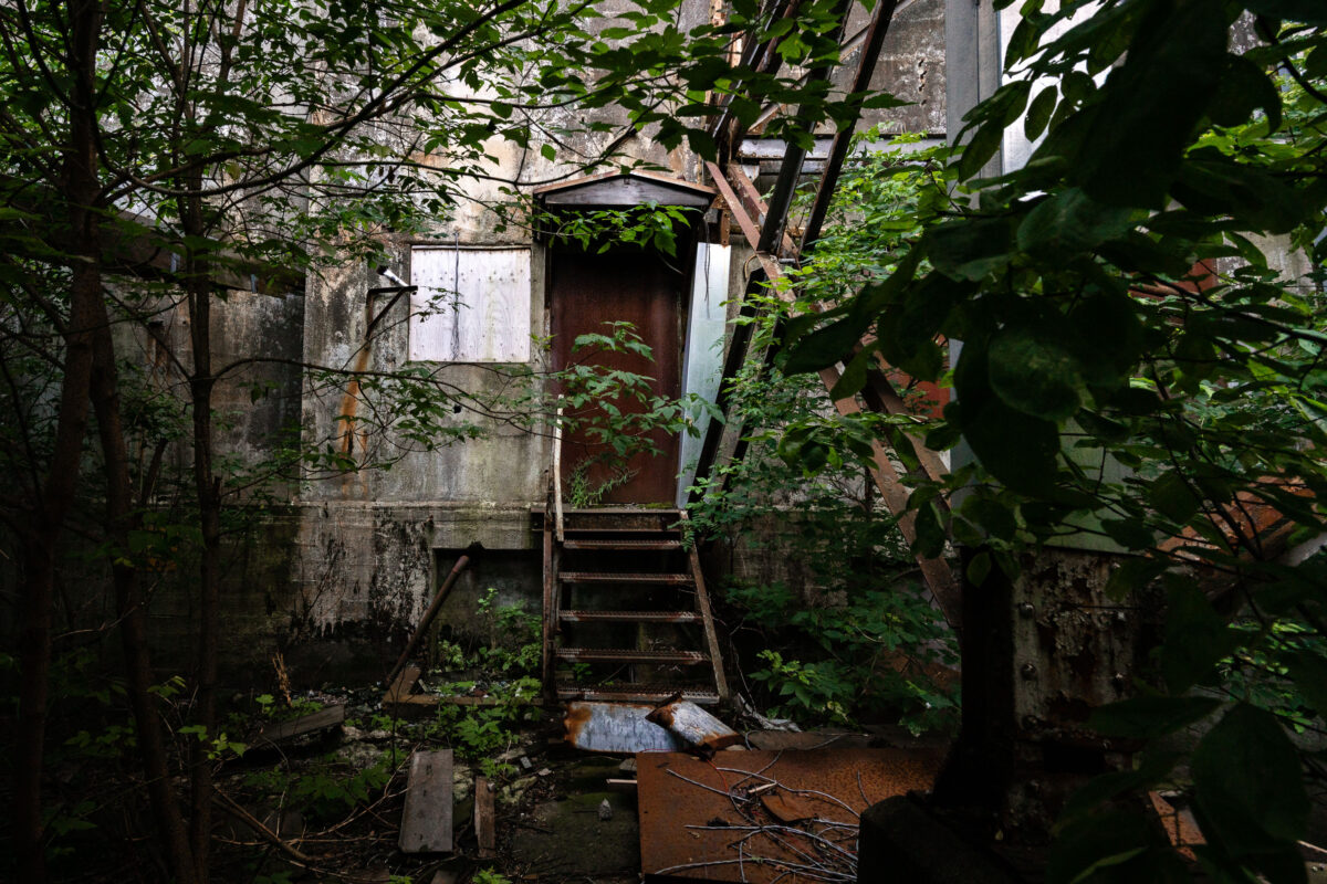
July 2017 — A rusted steel door and staircase, now surrounded by dense summer growth, mark one of the remaining entrances to the Saskatchewan Pool B grain elevator in Thunder Bay, Ontario. Completed in 1928, this concrete complex was once among the largest cooperative elevators on the Lakehead, operated by the Saskatchewan Wheat Pool to handle prairie grain for export through the Great Lakes. After the decline of Canada’s centralized grain trade, the elevator was shuttered and abandoned, leaving its reinforced concrete and steel framework to slowly merge with the encroaching forest.
July 2017 — Overgrown foliage surrounds the rusting stairway of the former Saskatchewan Pool B grain elevator in Thunder Bay, Ontario. Built in 1928 as part of the cooperative grain-handling network operated by the Saskatchewan Wheat Pool, the facility once stored and shipped millions of bushels of prairie wheat through the Lake Superior port. After decades of service under the Canadian Wheat Board era, the elevator was decommissioned and left to decay, its concrete silos and steel infrastructure now reclaimed by vegetation and time along the industrial waterfront.
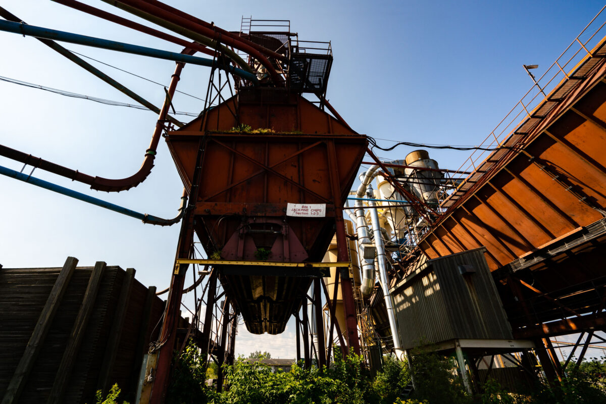
July 2017 — The rusting conveyor systems and storage bins of the former Great West Lumber Sawmill stand as remnants of Thunder Bay’s once-thriving forest industry. Established near the Lake Superior waterfront in the early 20th century, the mill was part of a vast network that processed and shipped lumber across North America. Its maze of steel ducts and conveyors once carried sawdust, chips, and milled timber, feeding the region’s economic boom. Today, the overgrown machinery reflects a post-industrial landscape—silent evidence of a city that helped fuel Canada’s forestry trade for generations.
July 2017 — This steel swing bridge in Thunder Bay, Ontario, carries the Canadian Pacific Railway line across the Kaministiquia River near the city’s grain terminals. Built in the early 20th century, the structure allowed both rail and maritime traffic to pass through the busy industrial waterfront—pivoting open for ships bound to and from Lake Superior. The bridge remains an important relic of Thunder Bay’s era as one of Canada’s foremost grain-shipping hubs, linking prairie rail lines to Great Lakes freighters and global export routes.
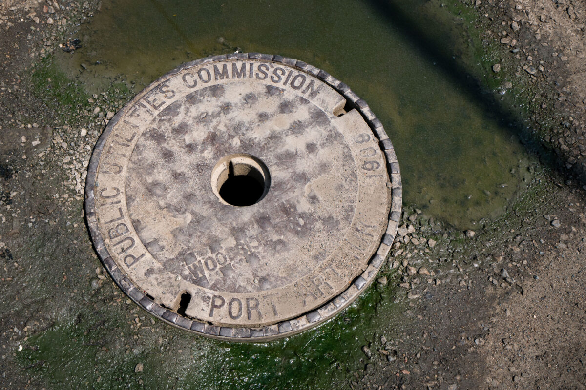
July 2017 — A 1906 manhole cover from the former Port Arthur Public Utilities Commission, now part of Thunder Bay’s unified public works system. Before amalgamating with Fort William in 1970, Port Arthur operated its own water, sewer, and electrical services, reflecting the industrial ambitions of this Lake Superior port. Cast in iron more than a century ago, the cover remains a tangible remnant of early municipal engineering in northwestern Ontario.

July 2017 — The rocky shoreline at Taconite Harbor, Minnesota, once served as a vital shipping point for the state’s iron mining industry. Built in the early 1950s by the Erie Mining Company, the harbor was designed to handle massive shipments of processed taconite pellets from the Mesabi Iron Range, transported by a private 74-mile rail line to the Lake Superior coast. The harbor’s docks, loading equipment, and nearby company housing formed a self-contained industrial community that thrived for decades. The surrounding area was developed during a period of postwar expansion when Minnesota’s natural resources fueled North American manufacturing. Taconite Harbor operated until the early 2000s, when global shifts in steel production led to its closure. What remains today—crumbling concrete piers, rusted transmission towers, and wind-swept rock formations—speaks to both the resilience of the landscape and the region’s deep connection to the rise and fall of heavy industry along the North Shore.
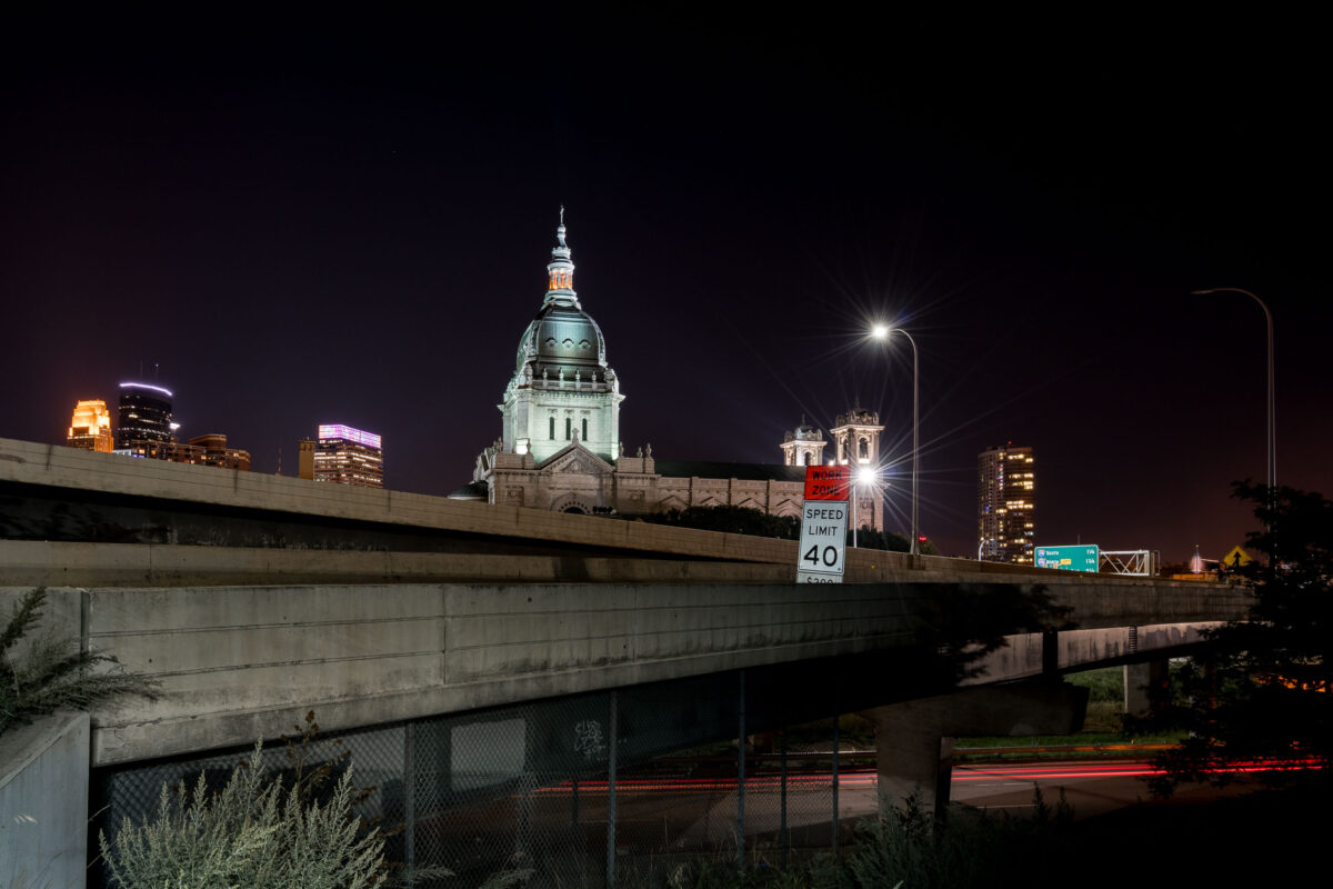
August 2017 — Basilica of Saint Mary near downtown Minneapolis as seen from the other side of Interstate 94.
August 2017 — Looking out of AT&T Tower in Downtown Minneapolis.
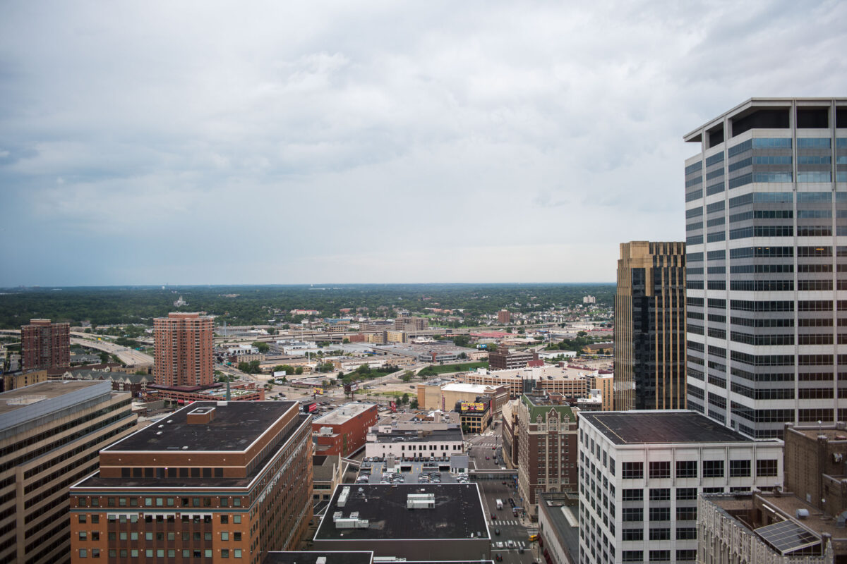
August 2017 — Minneapolis as seen from around the 25th floor of the AT&T Tower in downtown Minneapolis.
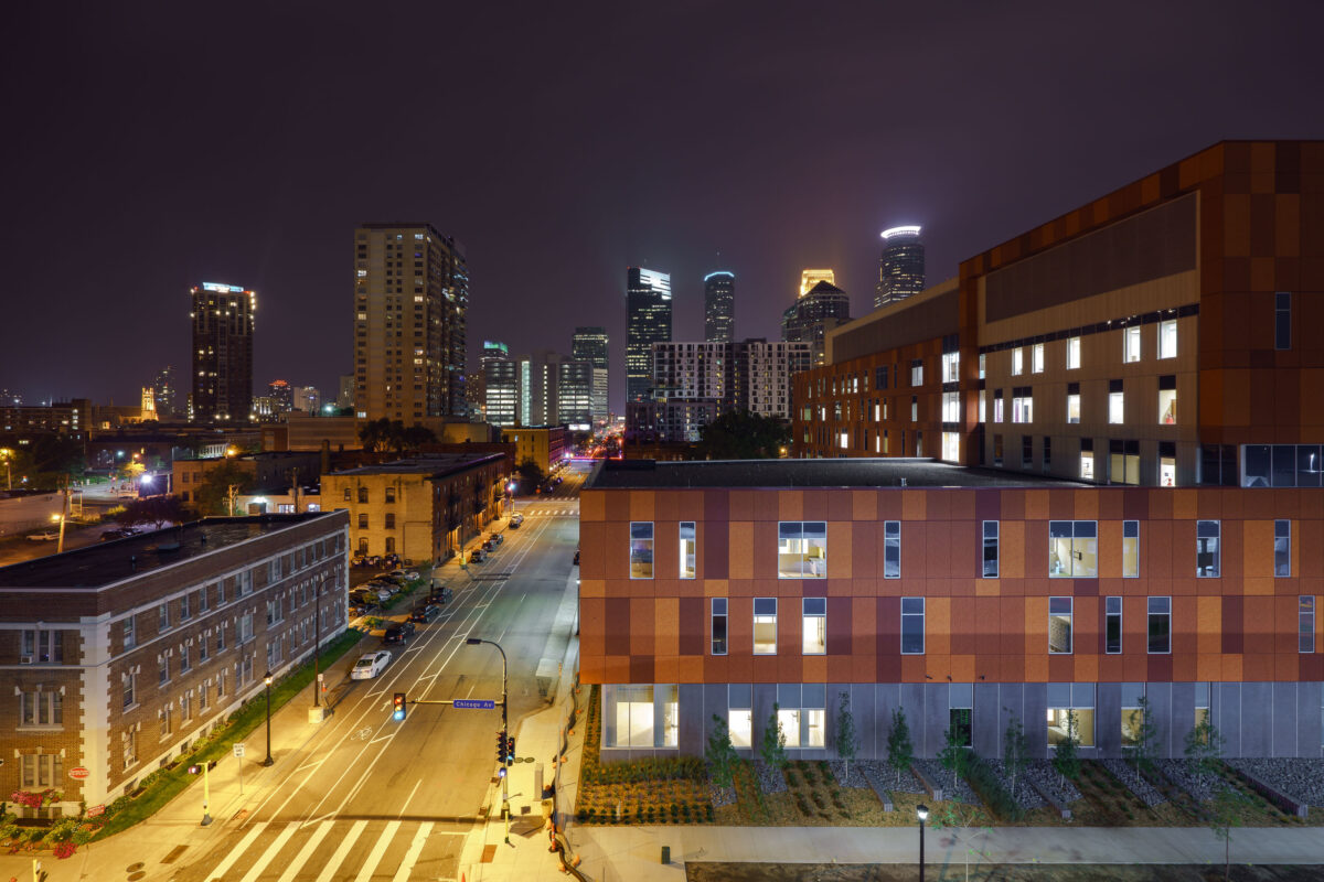
September 2017 — Hennepin Healthcare in downtown Minneapolis.
September 2017 — Chicago Avenue in Downtown Minneapolis on September 1, 2017.
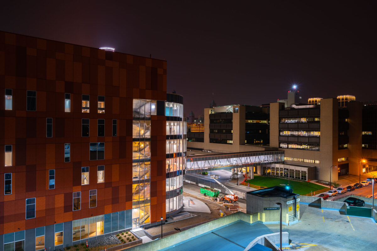
September 2017 — Hennepin County Medical Center in downtown Minneapolis. September 2017.
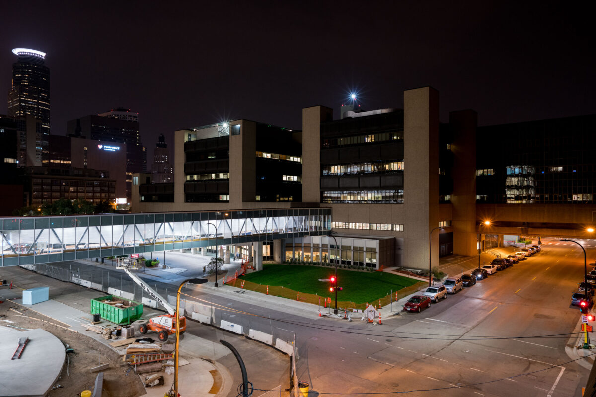
September 2017 — HCMC, Hennepin County Medical Center in downtown Minneapolis
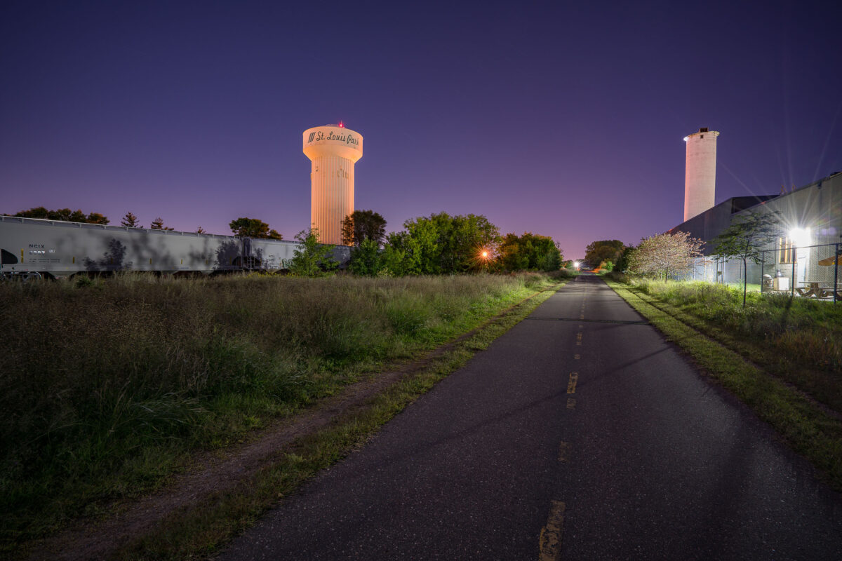
September 2017 — The Cedar Lake Trail passes through the industrial district of St. Louis Park, Minnesota, illuminated here by the community’s water tower and nearby grain elevators. This segment of the trail follows a former railroad right-of-way once used by the Minneapolis & St. Louis Railway, which connected local industries to the region’s freight network. The corridor’s transformation into one of the country’s first bicycle “freeways” in the 1990s marked a major milestone in urban redevelopment and sustainable transportation planning. Once lined with lumberyards, steel fabricators, and mills, the area surrounding the trail reflects the industrial origins of St. Louis Park—a community that grew rapidly in the early 20th century due to its proximity to both Minneapolis and key rail junctions. The trail today bridges that history, offering cyclists and commuters a route through a landscape where freight trains, utility towers, and legacy industry remain active reminders of the city’s manufacturing past.
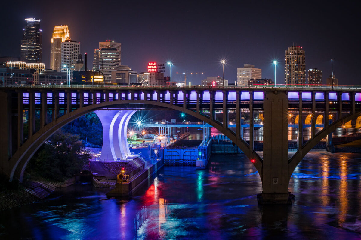
September 2017 — Downtown Minneapolis Skyline with I35W bridge crossing the Mississippi River.
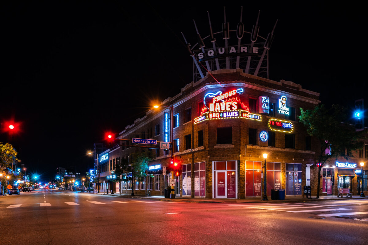
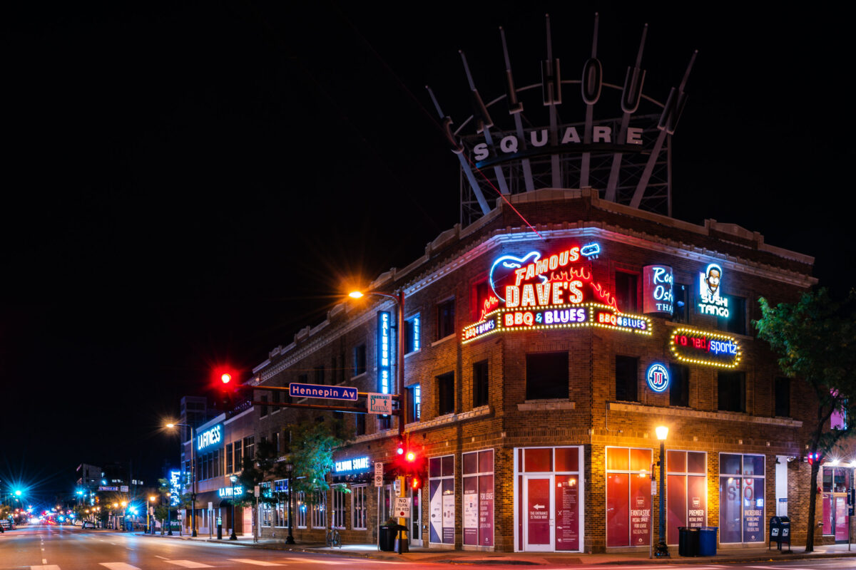
September 2017 — Calhoun Square at Hennepin/Lake in Uptown Minneapolis.
September 2017 —
September 2017 — General Mills elevator in Minneapolis.
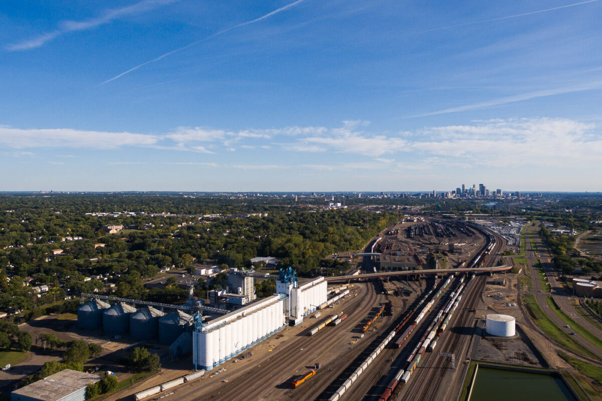
September 2017 — Northtown Yard in North Minneapolis.
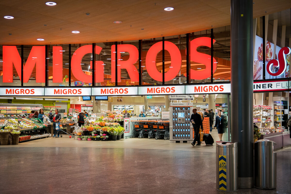
September 2017 — The entrance of a Migros supermarket in Zurich, Switzerland, is shown in this photo. The large, illuminated red sign spelling 'MIGROS' dominates the storefront, with smaller signs repeating the name above the entrance. Inside, shoppers are seen browsing various sections, including fresh produce and flowers, with shopping carts and self-scanning kiosks visible. The setting appears to be during daytime or early evening, with a lively atmosphere typical of a busy retail location in Switzerland.
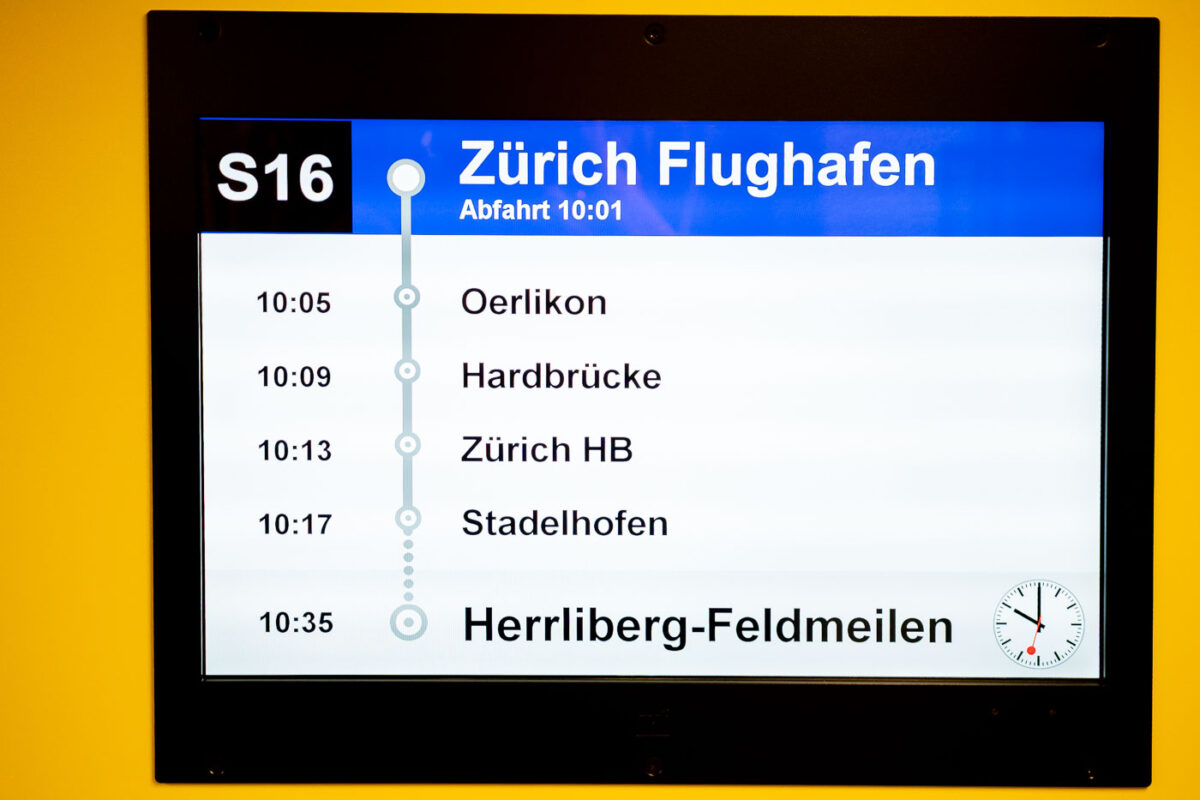
September 2017 — A digital train schedule display at Zurich Airport showing the departure times and stops for the S16 Light Rail train service. The screen indicates the train departs at 10:01, with stops including Oerlikon, Hardbrücke, Zürich HB, and Stadelhofen, before arriving at Herrliberg-Feldmeilen at 10:35. The display is mounted on a yellow wall, and a small analog clock is visible in the bottom right corner of the screen.
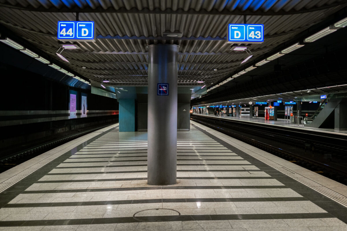
September 2017 — An underground train platform at Zürich Airport station, with tracks 43 and 44 visible. The station features striped tile flooring, overhead signage, and modern lighting. Few passengers are present, and escalators can be seen in the background leading to the upper levels.
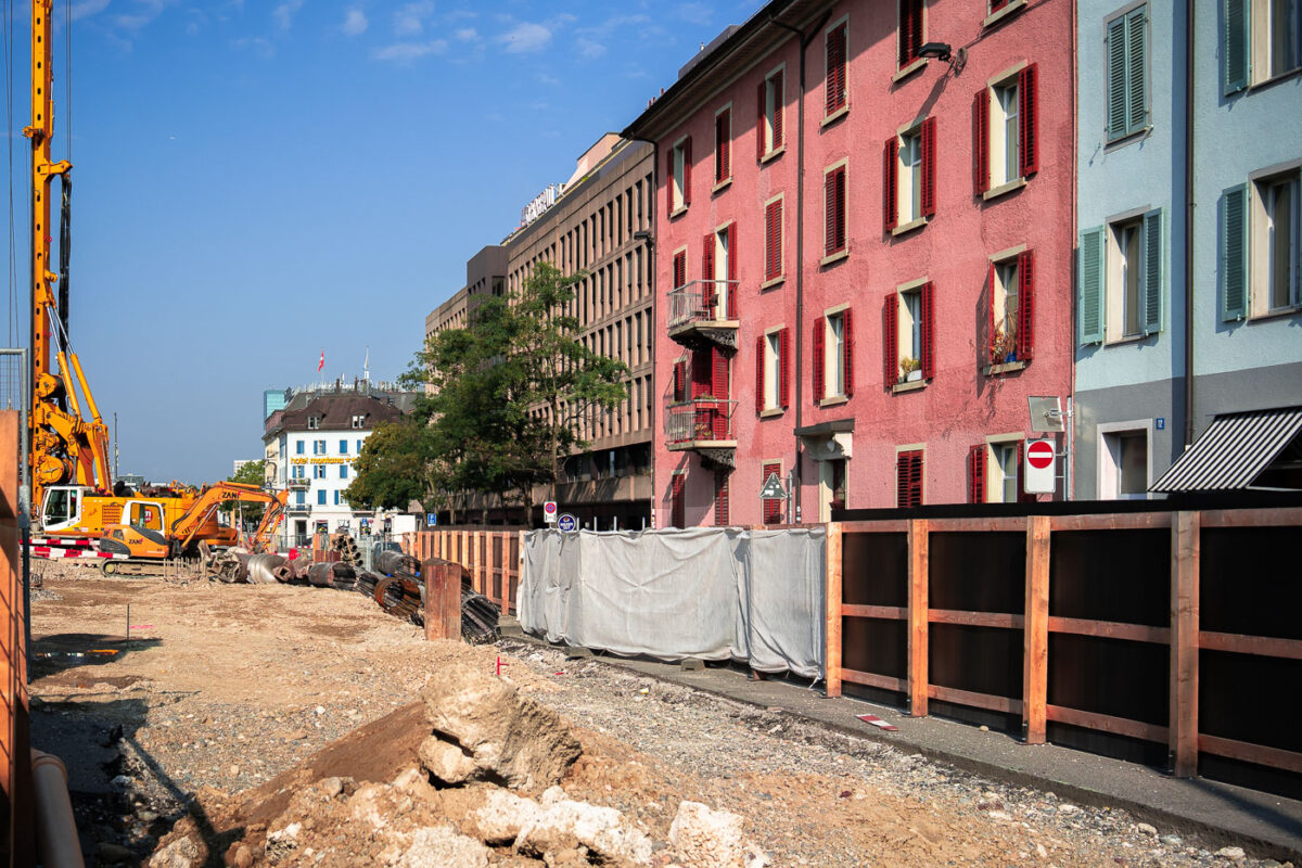
September 2017 — Construction work is underway along a street in Zurich, Switzerland, with several construction vehicles and materials visible in the foreground. The site is fenced off with wooden barriers, and the street is lined with colorful residential buildings, including a pink building with red shutters and a small balcony. In the background, modern office buildings and a hotel can be seen, indicating ongoing development in the area. The weather is clear with a bright blue sky, suggesting a sunny day during the development project.
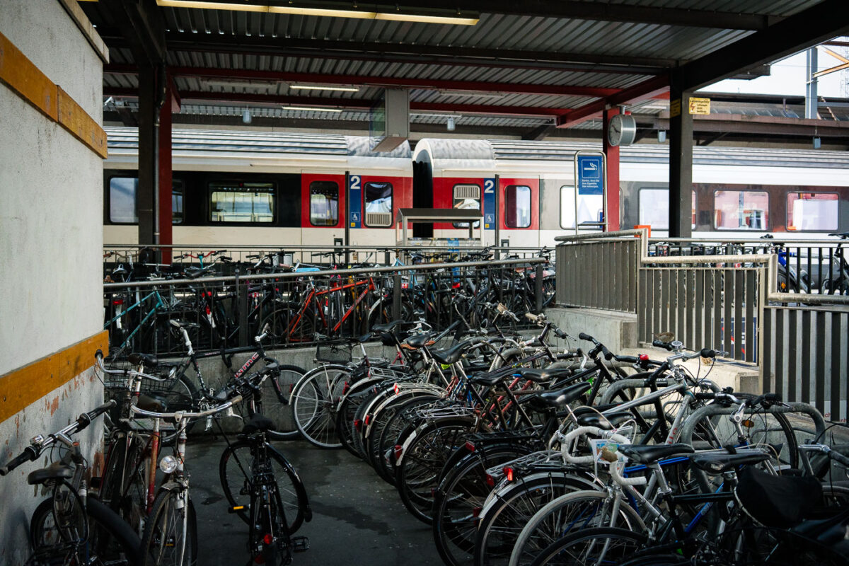
September 2017 — Rows of bicycles fill the parking area beside Zürich Hauptbahnhof, one of Europe’s busiest railway stations. The extensive bike racks serve daily commuters who combine cycling with train travel, a common practice in Swiss cities emphasizing sustainable urban mobility. Behind the bicycles, a Swiss Federal Railways (SBB) regional train waits at the platform, reflecting the integration of rail and cycling infrastructure within Zürich’s public transit system.
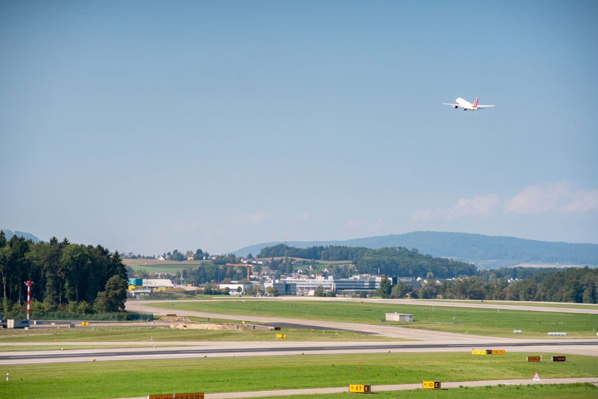
September 2017 — A Swiss International Air Lines jet climbs into the clear summer sky after takeoff from Zurich Airport (Flughafen Zürich), leaving behind the rolling green hills of Kloten in the background. The well-marked taxiways and precise runway layout reflect Switzerland’s meticulous approach to aviation infrastructure. Beyond the airport, clusters of small homes and industrial buildings blend into the forested landscape — a typical Swiss juxtaposition of modern efficiency and natural calm.
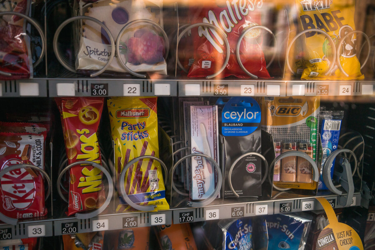
September 2017 — A vending machine found on the streets of Zurich, Switzerland
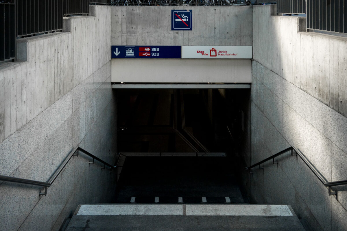
September 2017 — Entrance to the underground level of Zürich Hauptbahnhof (Zurich Central Station), one of Europe’s busiest railway hubs, serving over 400,000 passengers daily. The signage indicates access to the SBB national rail network and SZU suburban lines, along with the underground shopping complex “ShopVille.” Built into the heart of the city, Zürich HB’s design integrates modern transport infrastructure with pedestrian access and retail spaces, showcasing Switzerland’s efficiency in urban transit engineering.

September 2017 — Two blue-and-white Zürich trams move through a broad, tree-lined avenue near the city center, a familiar sight in the Swiss metropolis where public transport defines the pace of daily life. Operated by VBZ, the Zürich tram network dates back to the 1880s and remains one of Europe’s most efficient urban systems, linking every corner of the city with clockwork precision. The clean lines of the vehicles, the restrained architecture, and the soft autumn light together reflect the city’s balance of historic character and modern functionality — a seamless integration of movement, order, and urban calm.
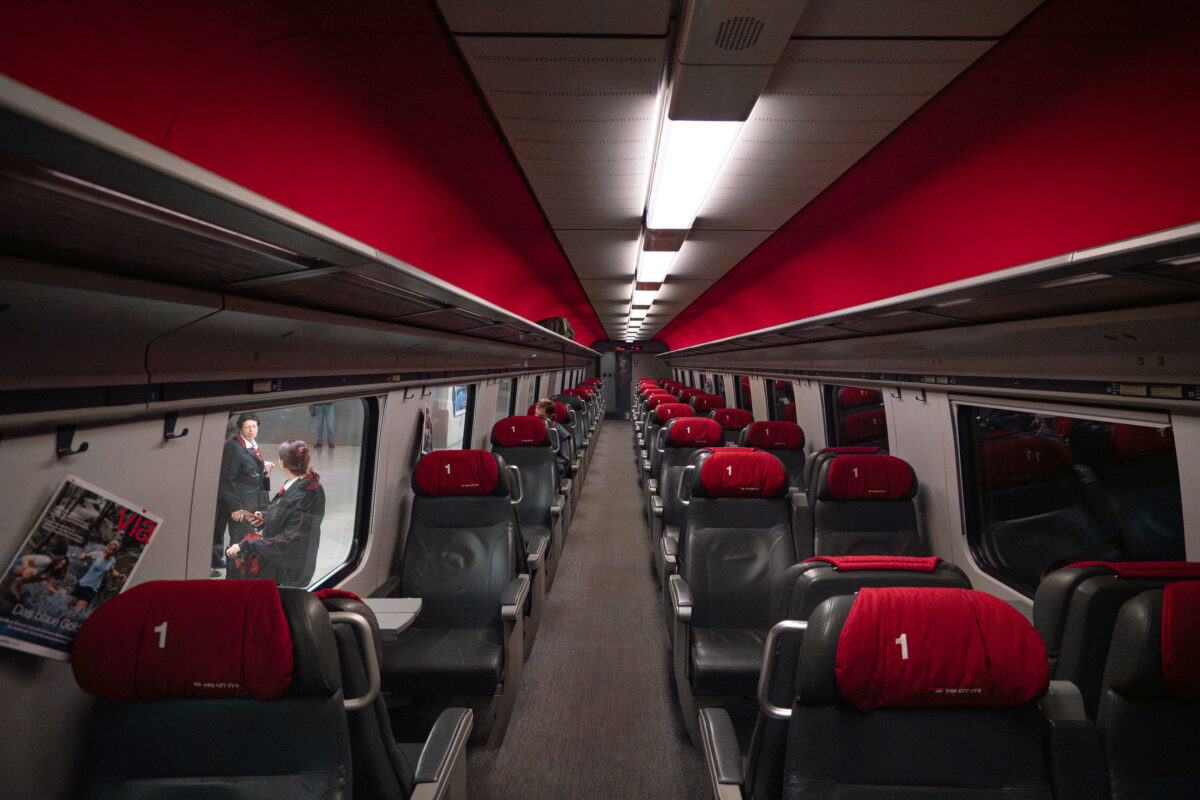
September 2017 — Inside a Swiss Federal Railways (SBB) first-class carriage, red headrest covers and subdued lighting create an atmosphere of quiet precision. The leather seating, overhead racks, and narrow aisle reflect the efficient use of space characteristic of Swiss design. Through the window, conductors confer on the platform, moments before departure — a scene that captures the punctual rhythm of Switzerland’s rail network. Since its founding in 1902, SBB has become one of Europe’s most respected operators, moving hundreds of thousands daily with near-perfect reliability across a network that links mountain towns, lakeside cities, and international hubs.
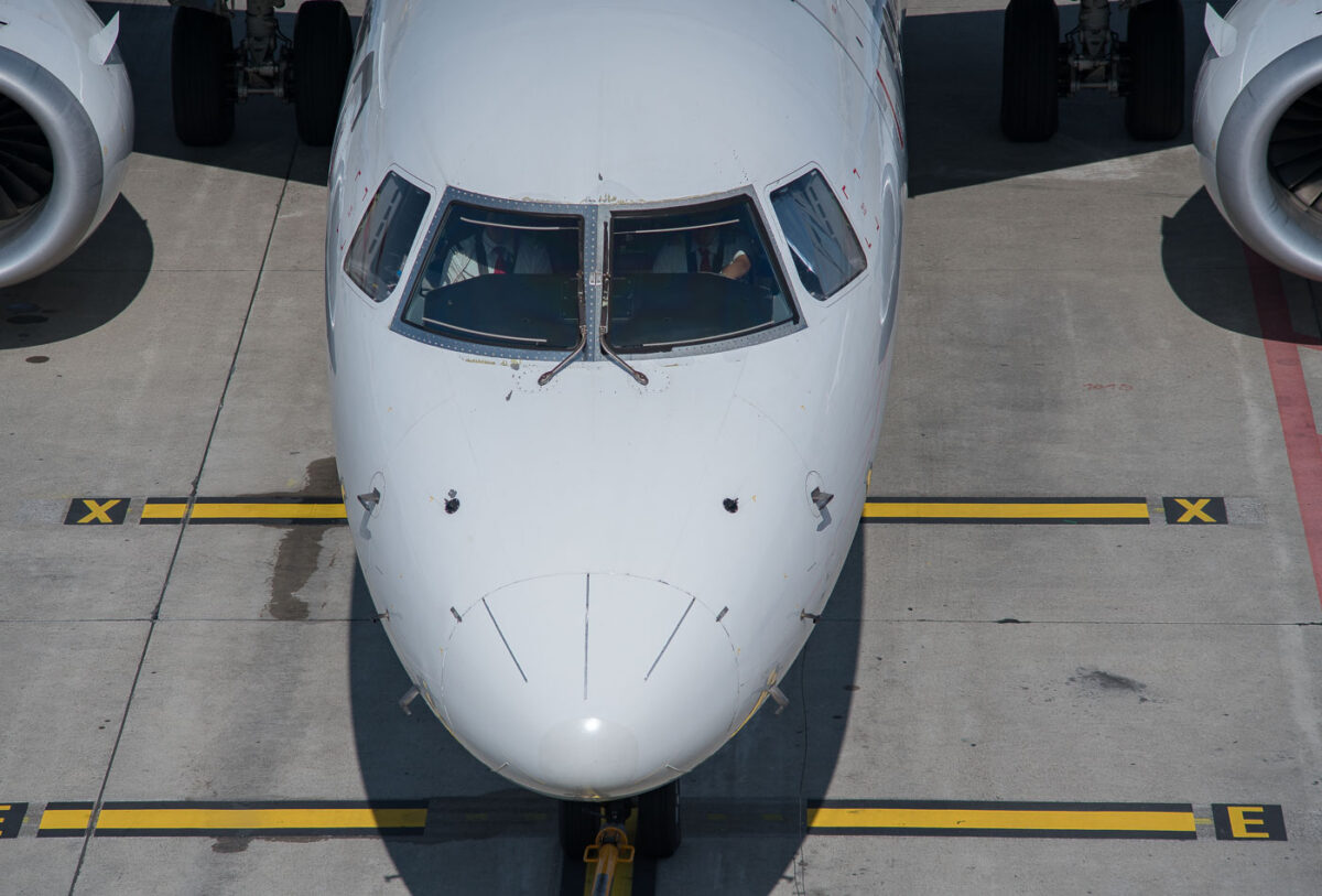
September 2017 — An Airbus narrow-body jet prepares for departure on a bright afternoon, its cockpit crew performing preflight procedures before pushback. The aircraft’s clean nose profile reveals pitot tubes, static ports, and the angular geometry typical of the A320 family. Yellow taxiway markings and the tow bar connection below hint at the precision choreography of ground operations—where every motion, from refueling to final clearance, is timed to the minute. Captured from above, the composition highlights the symmetry and order that define modern commercial aviation.
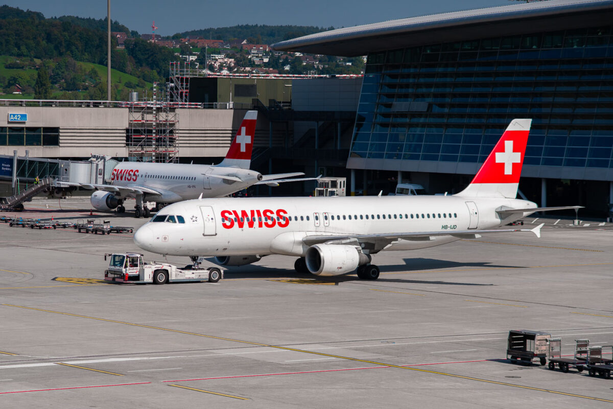
September 2017 — Two Swiss International Air Lines Airbus A320 aircraft sit on the ramp at Zurich Airport, their red and white tails bearing the iconic Swiss cross. The foreground jet, registration HB-IJD, is being towed toward its gate while another prepares for boarding nearby. Behind them, the glass façade of the terminal reflects the surrounding hills of Kloten, a reminder of Switzerland’s seamless integration of precision engineering and alpine landscape. The scene captures the calm efficiency of Swiss aviation — clean, orderly, and unmistakably national in character.
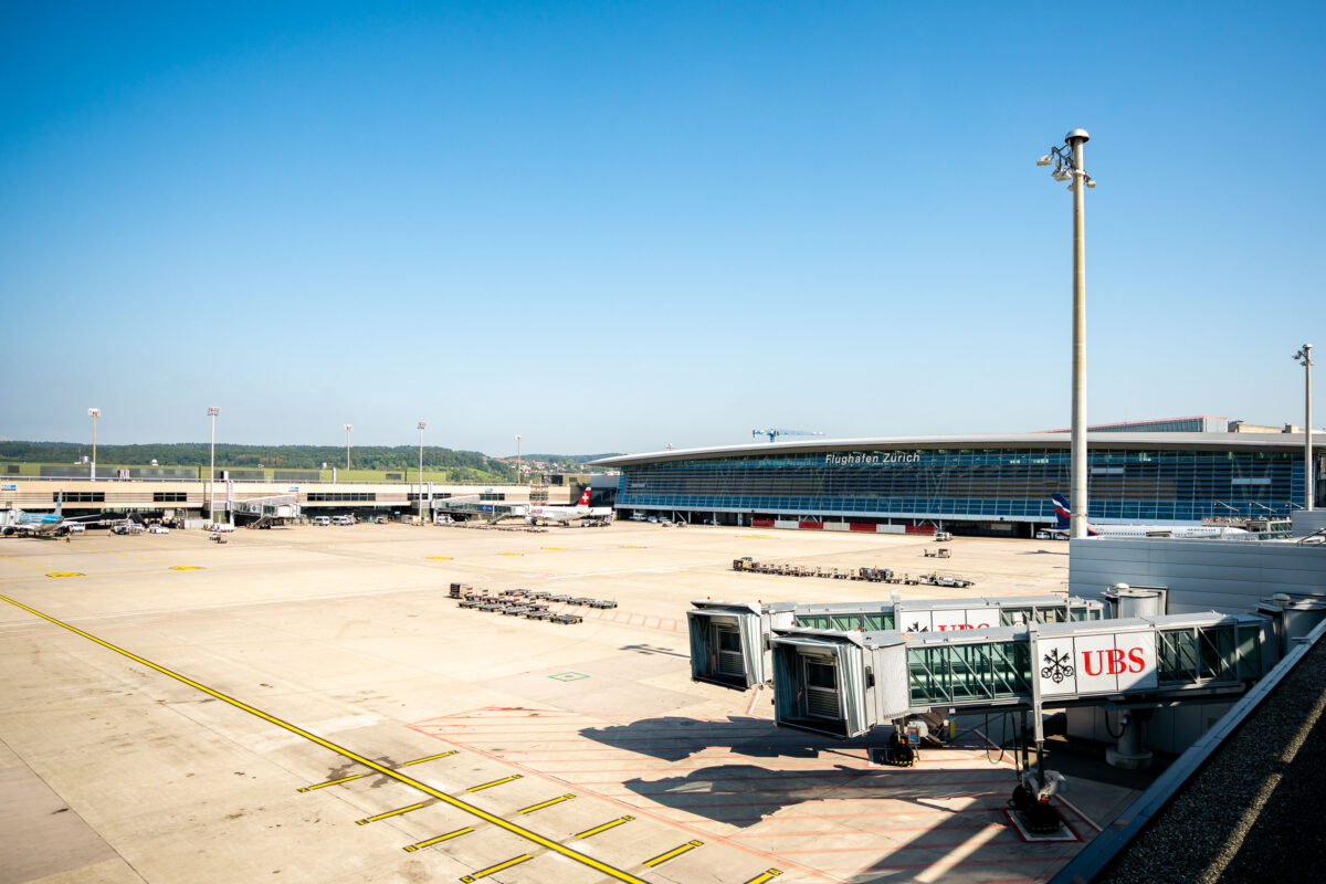
September 2017 — The main terminal complex of Zürich Airport (Flughafen Zürich) sits under a clear blue sky, its modern glass façade reflecting the activity of Switzerland’s busiest air hub. Completed in stages through the early 2000s, the airport serves as the primary gateway for Swiss International Air Lines and one of Europe’s most efficient transfer points. The wide apron and UBS-branded jet bridges foreground the balance between Swiss precision, aviation infrastructure, and corporate presence that defines Zürich’s role in global travel.
September 2017 — A view from the window of an Air Berlin aircraft shows the wing slicing through dense cloud layers, with a narrow band of golden light marking the horizon. Once a major German airline founded in 1978, Air Berlin operated routes across Europe before ceasing operations in 2017. The image captures both the serenity and impermanence of flight — a quiet moment over the continent that the airline once connected so extensively.

September 2017 —
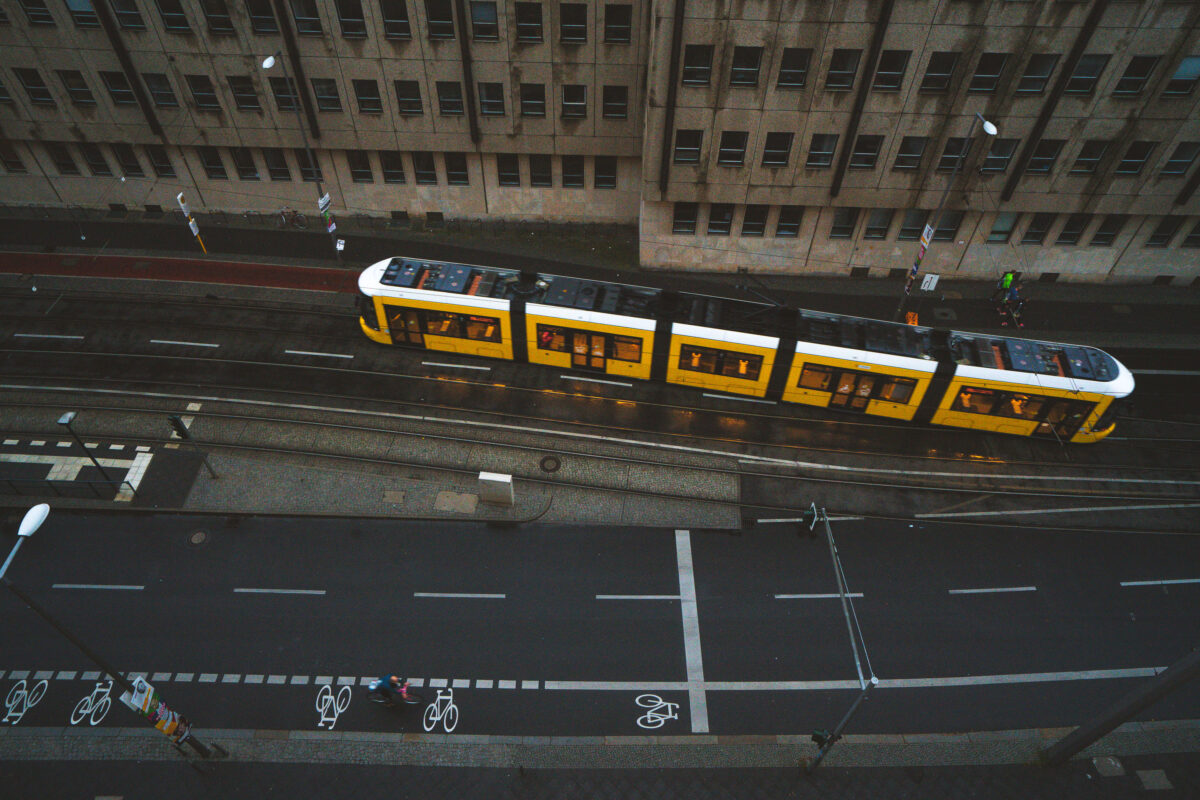
September 2017 — A yellow BVG tram glides through the wet streets of Berlin at dusk, its reflection faintly shimmering on the rain-darkened tracks. The city’s extensive tram system, one of the oldest in the world, continues to serve as a vital part of daily life — connecting neighborhoods across the capital with quiet precision. Cyclists share the street below, a hallmark of Berlin’s commitment to sustainable urban transport and rhythmically layered street design.
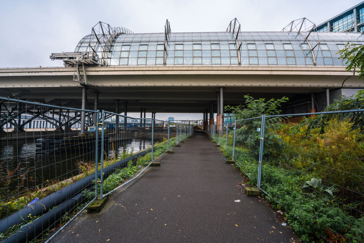
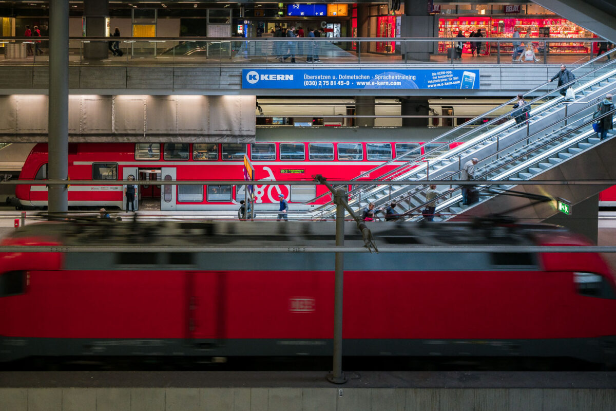
September 2017 — A narrow, fenced pathway runs beneath the towering structure of Berlin Hauptbahnhof — Germany’s largest and most complex railway station — where elevated train lines stretch above the Spree River. The gleaming glass panels and steel framework of the upper platforms contrast sharply with the damp pavement and industrial underpass below. Puddles glisten from a recent rain, while construction barriers and wild greenery frame the scene, hinting at the city’s perpetual state of transformation. Built as a symbol of reunified Berlin, the Hauptbahnhof connects north to south, east to west — a convergence of architecture, engineering, and history that mirrors Berlin’s layered identity. The stillness here beneath the trains creates a hidden perspective on one of Europe’s busiest transport hubs, where modern motion meets quiet decay.
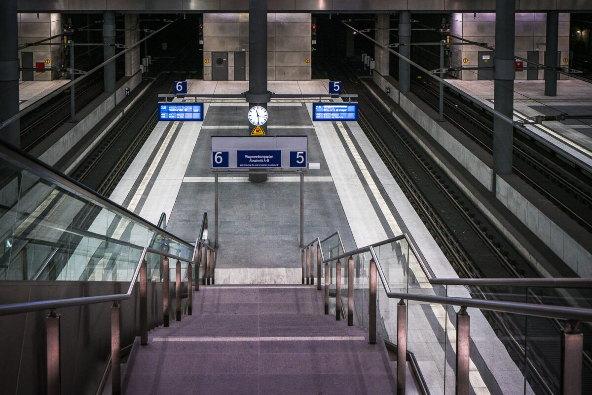
September 2017 — The lower platforms of Berlin Hauptbahnhof, serving tracks 5 and 6, form part of the deep-level north–south route opened with the station in 2006. This subterranean level, approximately 15 meters below ground, connects long-distance ICE services between Hamburg, Leipzig, and Munich through the Tiergarten Tunnel. The design reflects the precision and uniformity of modern German rail architecture—clean concrete forms, stainless steel fixtures, and bright LED signage. The symmetrical layout, glass partitions, and central clock emphasize efficiency and clarity, key elements of the Hauptbahnhof’s function as Europe’s largest crossing-station hub.
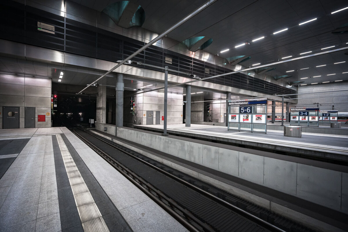
September 2017 — Berlin Hauptbahnhof’s lower-level platforms, located roughly 15 meters below street level, form part of Germany’s central north–south high-speed rail corridor. The underground section, opened in 2006 alongside the completion of the station’s glass-and-steel main hall, accommodates long-distance and regional trains running through the Tiergarten tunnel. The design emphasizes polished concrete, steel, and indirect lighting—elements typical of the Deutsche Bahn architectural style of the early 2000s. Platforms 1 through 8 serve ICE and IC services linking Berlin with cities such as Munich, Frankfurt, and Hamburg, while upper levels connect to the S-Bahn and U-Bahn networks.
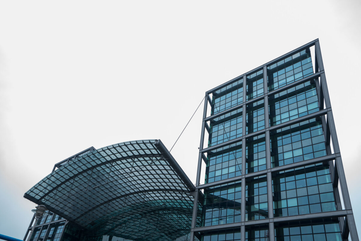
September 2017 — The Berlin Central Station in Berlin, Germany.
September 2017 — The Berlin Central Station in Berlin, Germany.
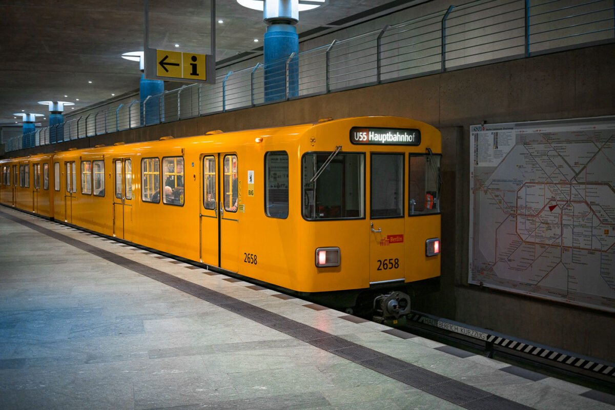
September 2017 — A bright yellow BVG U-Bahn train marked “U55 Hauptbahnhof” stands at the underground platform of Berlin Hauptbahnhof. An information sign with an arrow hangs above the platform, while a large network map of the S- and U-Bahn lines is mounted on the concrete wall to the right. Through the windows, a few seated passengers are visible inside the multi-door carriage numbered 2658. The U55 operated as a short shuttle between Berlin Hauptbahnhof and Brandenburger Tor, opened in 2009 to link the new central station with the government quarter. In December 2020 the shuttle was integrated into the extended U5 line, a major step in Berlin’s east‑west metro connection.
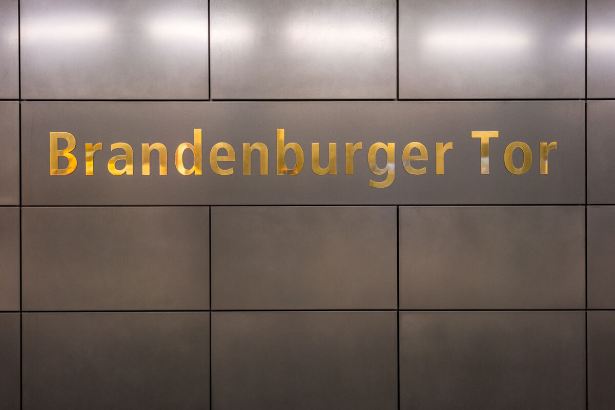
September 2017 — The Brandenburger Tor station in Berlin, Germany.
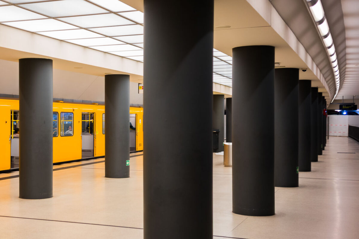
September 2017 — The Brandenburger Tor station in Berlin, Germany.
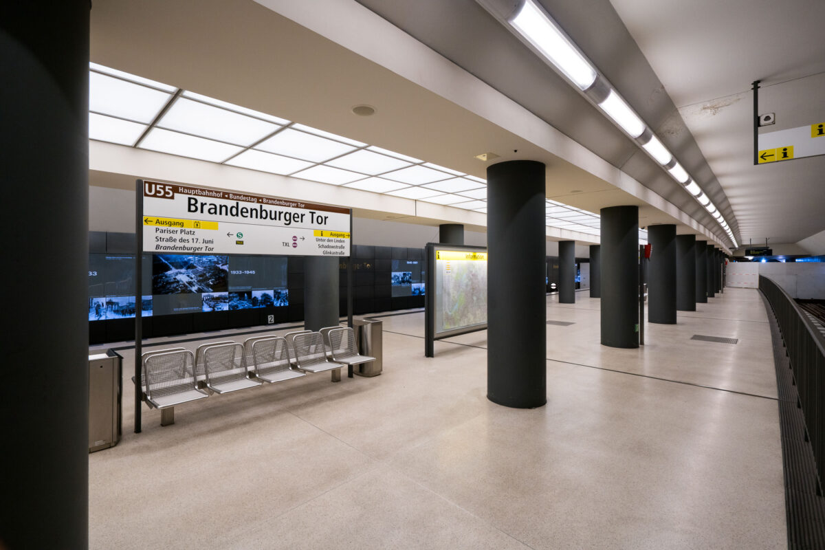
September 2017 — The Brandenburger Tor station in Berlin, Germany.
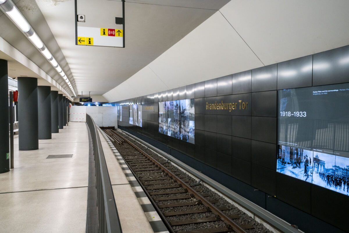
September 2017 — The Brandenburger Tor station on Berlin’s U5 line sits directly beneath Pariser Platz, adjacent to the Brandenburg Gate. The interior features dark composite wall panels inlaid with gold lettering and a series of illuminated displays tracing Berlin’s 20th-century history, including the city’s division and post-reunification development. Originally opened in 2009 as part of the short U55 shuttle between Hauptbahnhof and Bundestag, the station became a through stop in December 2020 when the U5 extension to Alexanderplatz was completed, reconnecting the eastern and western portions of the U-Bahn network after nearly six decades of separation.
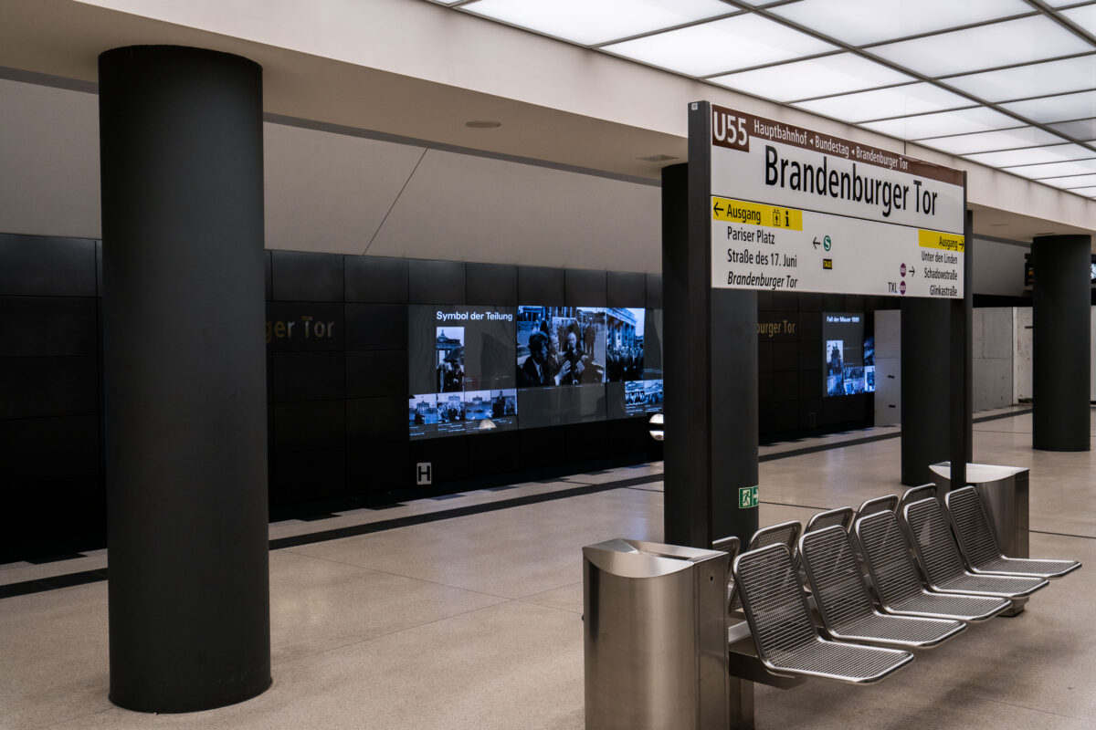
September 2017 — The Brandenburger Tor station in Berlin, Germany. Metal benches on the train platform.
September 2017 — Looking down Invalidenstraße street in Berlin Germany.
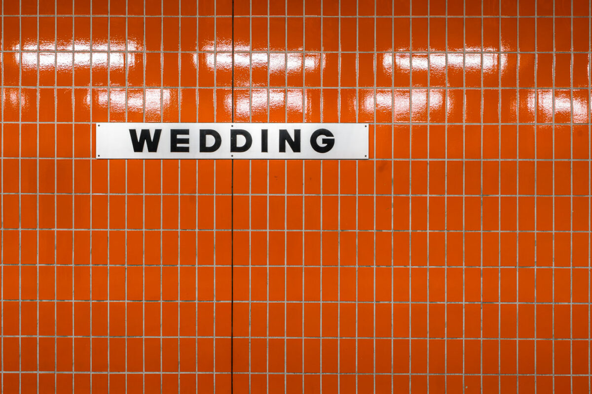
September 2017 — A white station sign reading “Wedding” in black block letters is mounted on an orange, small-rectangle tiled wall inside Wedding station in Berlin, Germany. The station serves the Wedding neighborhood in the Mitte district and functions as an interchange between the U6 U‑Bahn line and the Berlin Ringbahn S‑Bahn. The stark typography and modular tiles reflect the practical design found across much of Berlin’s postwar transit architecture. Operated by BVG for the U‑Bahn and S‑Bahn Berlin GmbH for suburban rail, Wedding is a local hub for commuters moving between the north of the city and central Berlin. No passengers are visible in the frame, emphasizing the graphic clarity of the station’s wayfinding.

September 2017 — A train passes through the Wedding station in Berlin Germany.
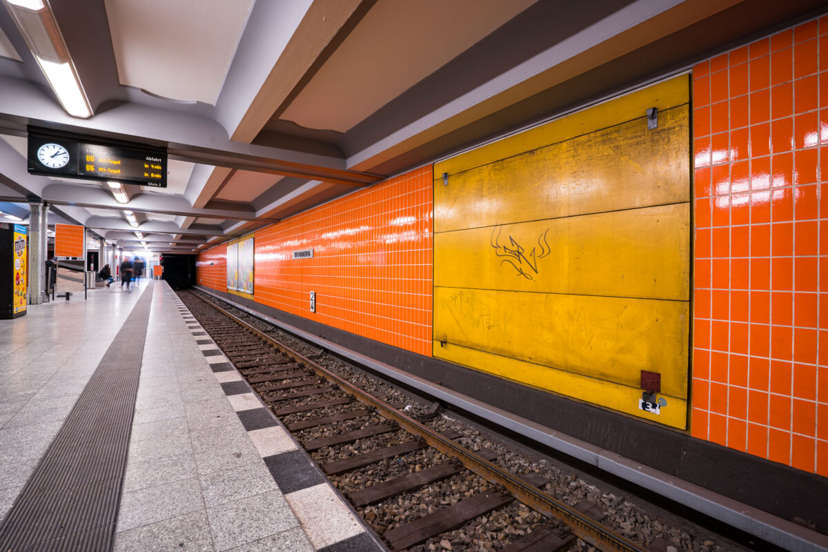
September 2017 — Berlin-Wedding station S-Bahn station in Berlin, Germany
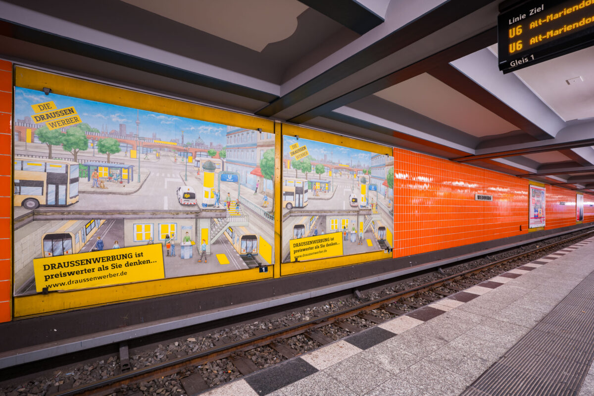
September 2017 — Wittenbergplatz station on Berlin’s U2 line features a distinctive orange-tiled design characteristic of the city’s postwar modernization of U-Bahn interiors. The platform level seen here includes advertising panels with hand-illustrated city scenes, part of a campaign promoting outdoor advertising (“Draussenwerbung”) by Wall GmbH, a longtime transit advertising company in Berlin. Opened in 1902 as part of the city’s first underground railway, Wittenbergplatz is one of Berlin’s oldest stations and a key junction serving the U1, U2, and U3 lines. The orange tiles were installed during mid-20th-century refurbishments to brighten the subterranean space, contrasting with the original Jugendstil architecture preserved at the main hall above. The modern signage displays U6 connections, while the station’s layout—with three island platforms—continues to serve one of the busiest interchange points in Berlin’s U-Bahn network.
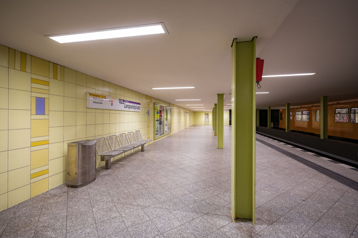
September 2017 — The Leopoldplatz U-Bahn Station in Berlin Germany.
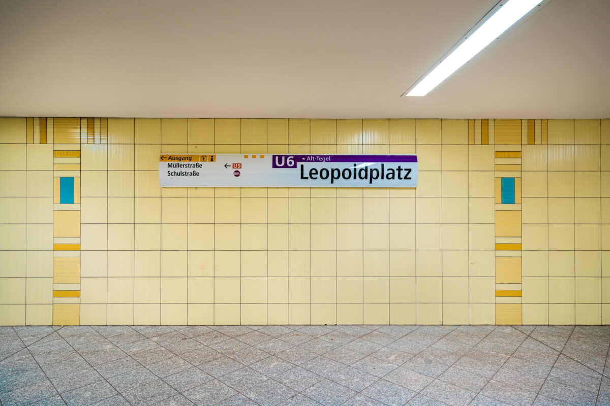
September 2017 — The Leopoldplatz U-Bahn Station in Berlin Germany.
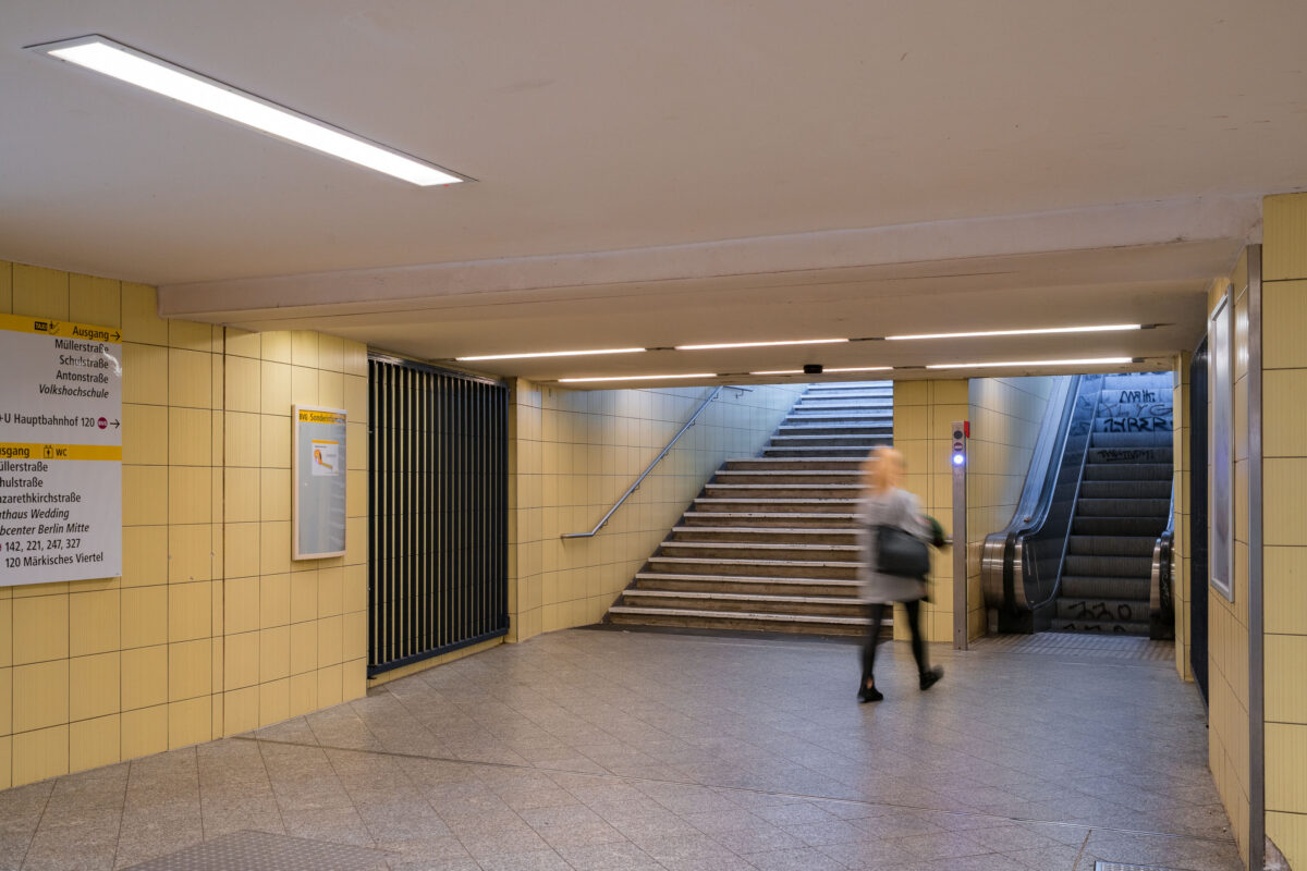
September 2017 — An underground passageway connects the platforms of Wedding U-Bahn station to its street-level exits on Müllerstraße in Berlin’s Mitte district. The corridor is tiled in light yellow ceramic, part of the BVG’s standardized postwar design used throughout many West Berlin stations rebuilt or renovated in the 1960s and 1970s. Directional signage guides passengers toward exits, connecting bus routes, and public facilities, while an escalator and stairway lead to the main entrance. The faint graffiti on the walls and motion blur of a passing commuter emphasize the station’s everyday function within Berlin’s public transport network. Wedding station serves both the U6 line and the S-Bahn Ring, forming a key interchange point in the city’s northern transit system.
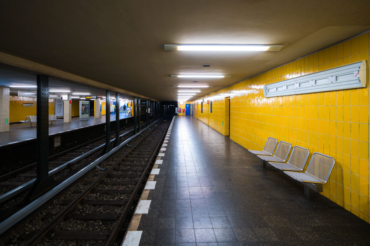
September 2017 — Seestraße U-Bahn Station, Berlin Germany
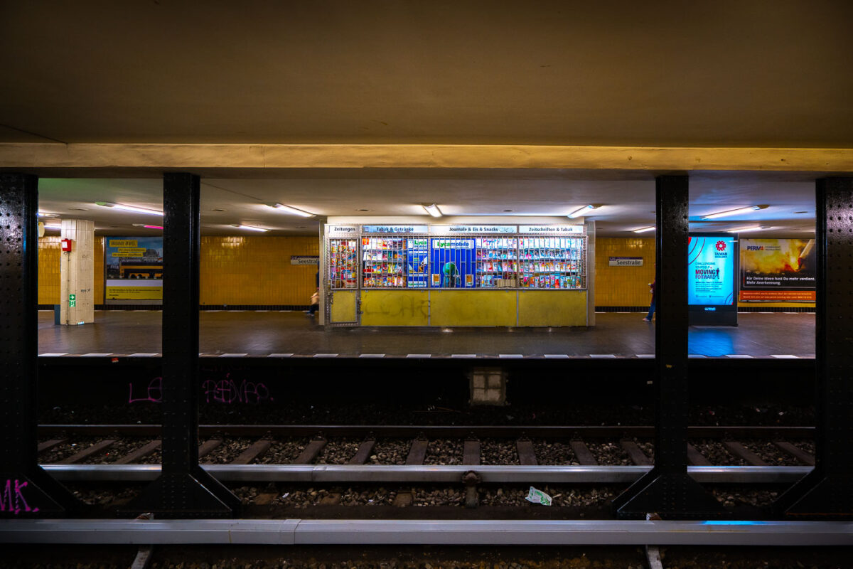
September 2017 — A store at the Seestrabe Station in Berlin.
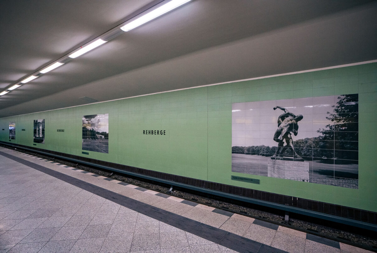
September 2017 — Rehberge U-Bahn Station, Berlin
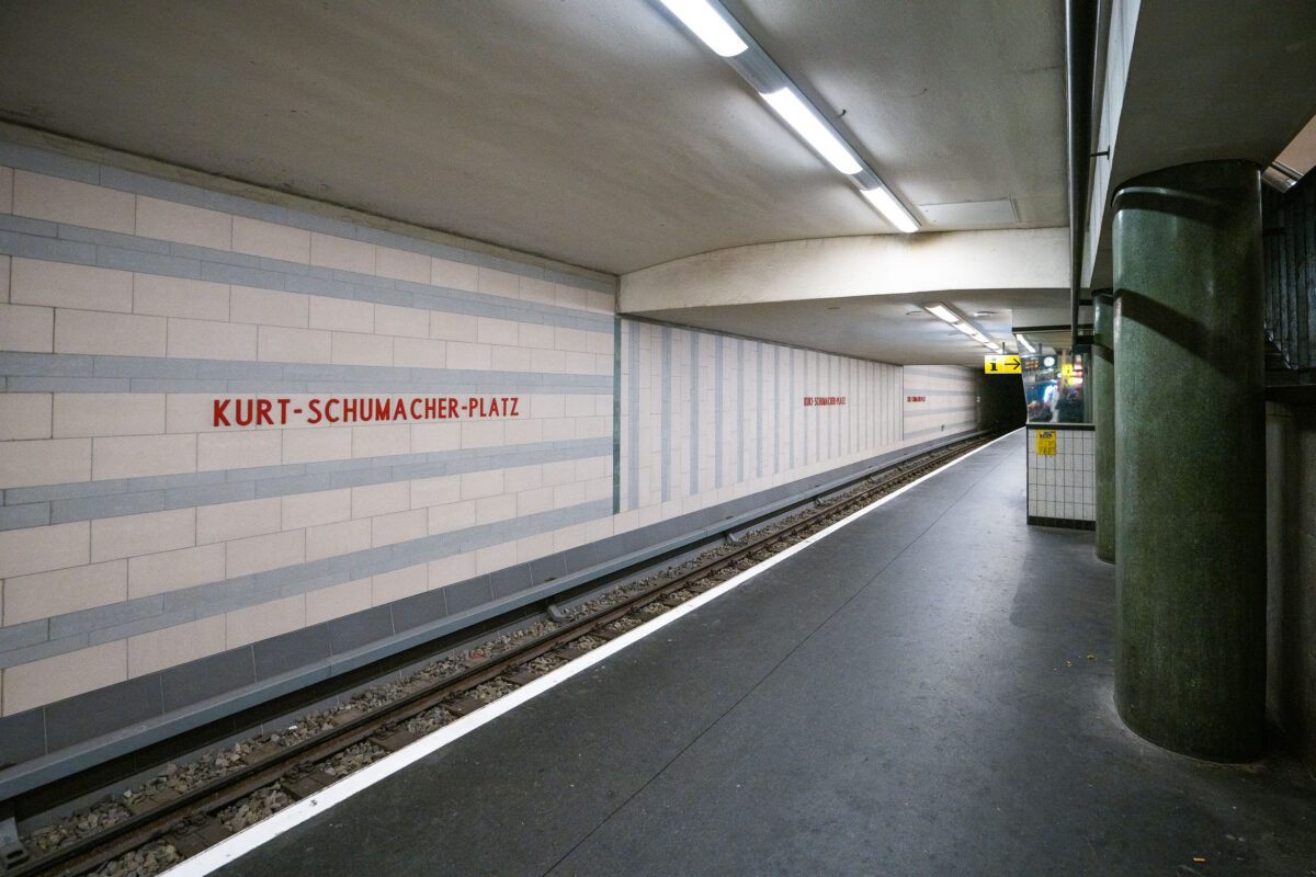
September 2017 — Kurt-Schumacher-Platz station serves Berlin’s U6 U-Bahn line in the Reinickendorf district, located in the city’s northwest. Opened on May 3, 1956, the station was part of the first postwar U-Bahn expansion and named after German statesman Kurt Schumacher, a key figure in rebuilding the Social Democratic Party after World War II. The station features light-colored wall tiles with horizontal gray stripes and minimalist red lettering, reflecting mid-1950s West Berlin design. It includes a central island platform and two tracks, serving as an important stop between Afrikanische Straße and Scharnweberstraße. Above ground, the station connects to several bus routes and lies near the approach to the U6 tunnel under the former Tegel Airport area. Today, it remains a key link for northern Berlin commuters traveling toward the city center.
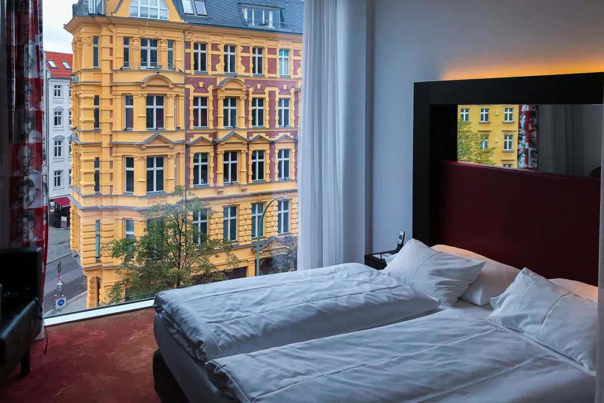
September 2017 — Looking out from a room at the Arcotel Velvet Berlin.
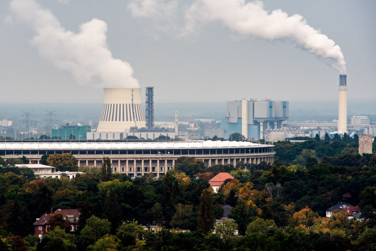
September 2017 — The Olympiastadion in Berlin stands in the foreground, framed by the dense tree cover of the Westend district. Behind it, the cooling towers and chimneys of the Reuter power plants dominate the skyline — part of Berlin’s long-standing energy infrastructure along the Spree River. The large natural-draft cooling tower at left belongs to the Reuter West plant, commissioned in the late 1980s and operated by Vattenfall, while the taller stack at right is part of the older Reuter facility dating back to 1930, later converted to modern combined-heat-and-power operation. The contrast between the stone colonnades of the 1936 Olympic Stadium and the industrial silhouettes in the distance captures the layered character of Berlin’s western edge — where historic architecture, post-war redevelopment, and ongoing energy production coexist within a few kilometers. The area remains one of the city’s key power-generation corridors, supplying electricity and district heating to much of central and western Berlin.
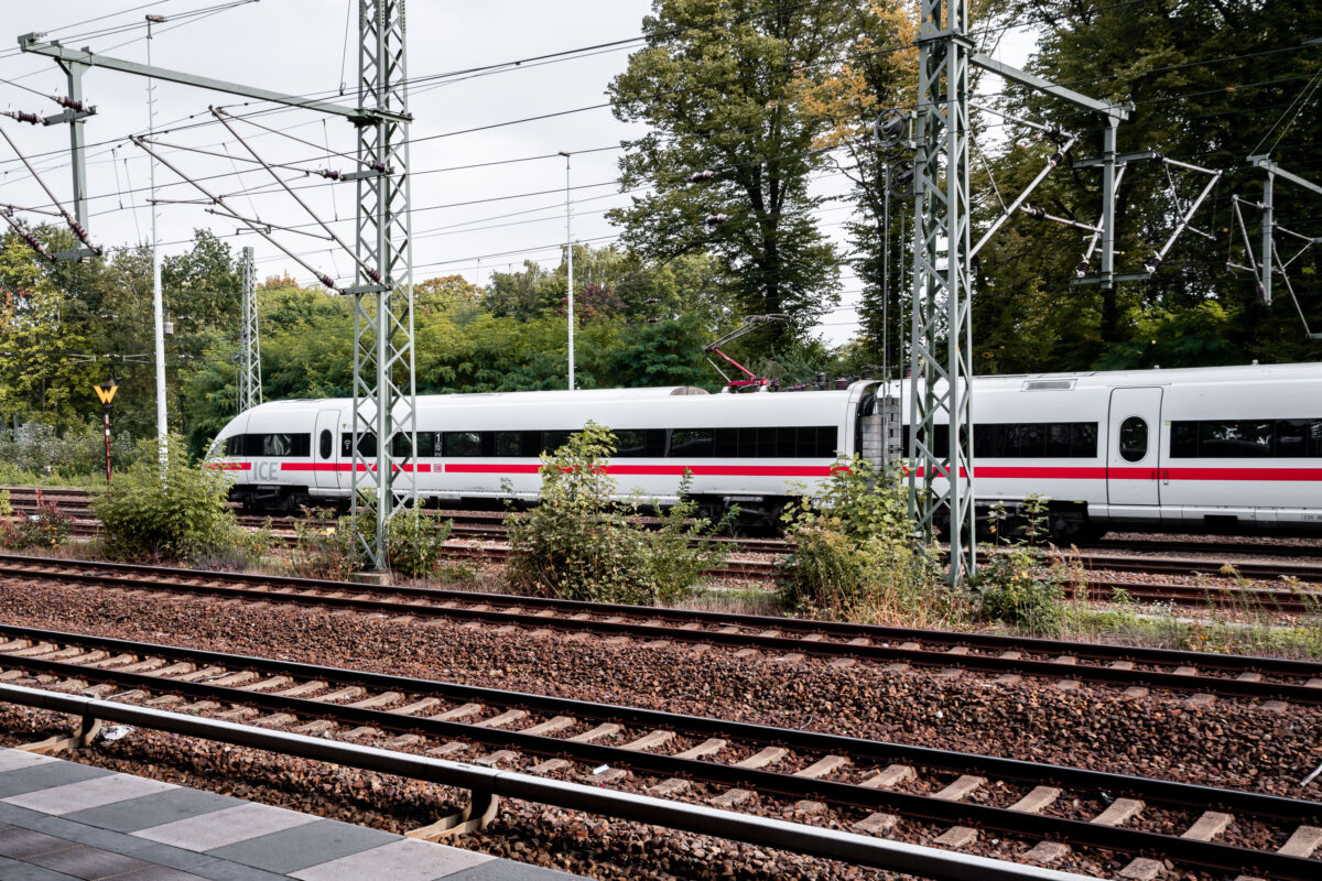
September 2017 — A Deutsche Bahn Intercity-Express (ICE) train moves through the rail network, distinguished by its white body and red horizontal stripe. The train belongs to the ICE 3 or ICE T family, units designed for high-speed operation up to 300 km/h and used on long-distance routes across Germany and neighboring countries. Overhead catenary lines supported by lattice-steel gantries deliver 15 kV AC power, the standard for Germany’s electrified mainlines. The ICE network, launched in the early 1990s, forms the backbone of long-distance rail travel in the country, linking cities such as Berlin, Frankfurt, Cologne, and Munich. These trains are built for both speed and efficiency, with lightweight aluminum bodies, regenerative braking, and pressure-sealed cabins for tunnel travel. The scene reflects the characteristic organization of German rail infrastructure—multiple tracks, overhead power, and vegetation at the margins—where local and international services share one of Europe’s busiest and most interconnected systems.
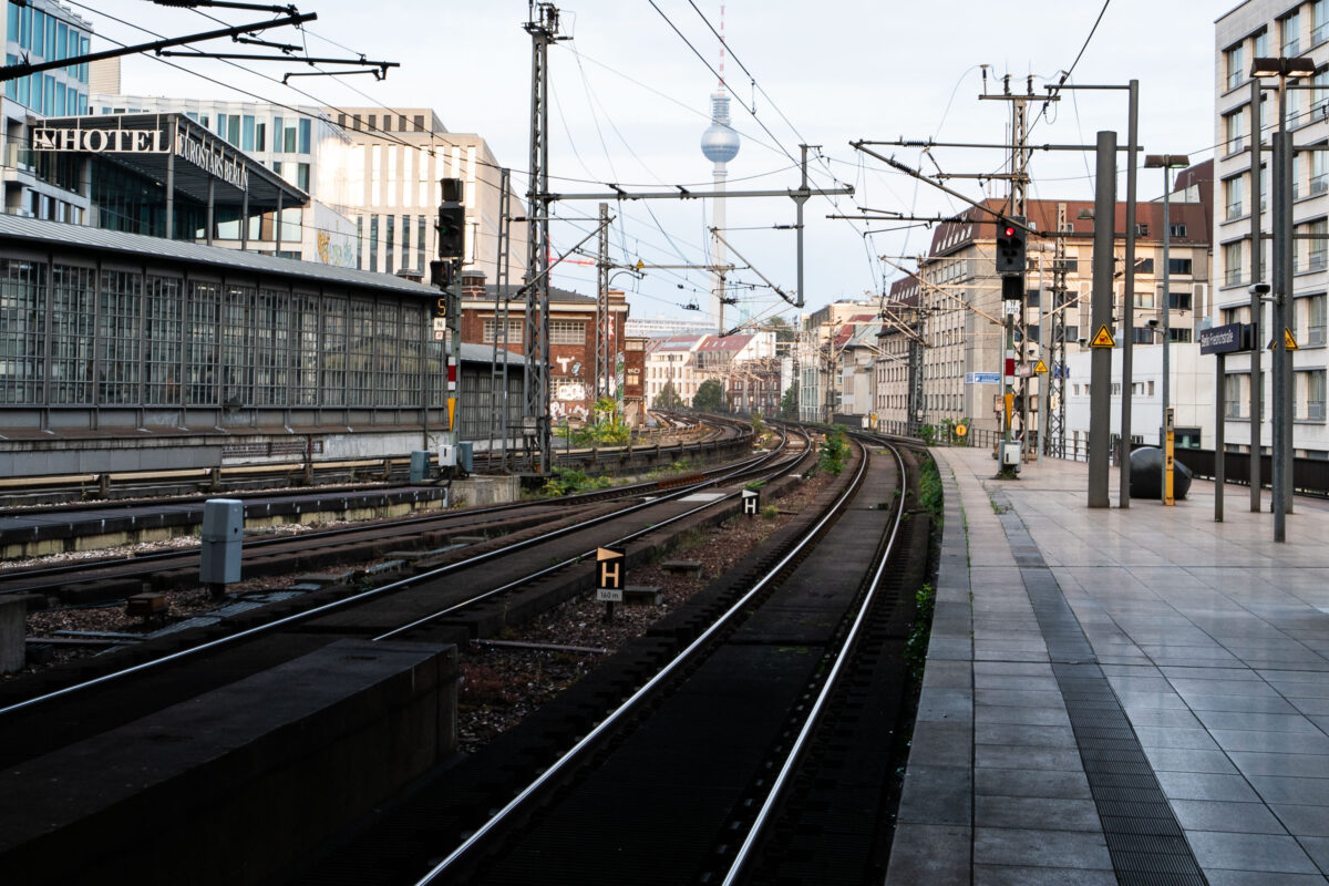
September 2017 — Tracks curve eastward from Berlin Friedrichstraße station, one of the city’s busiest S-Bahn and regional rail interchanges. The elevated viaduct carries multiple lines, including the S3, S5, S7, and S9, which link central Berlin with its outer districts and neighboring cities. The view looks toward Alexanderplatz, with the Fernsehturm television tower visible in the distance — a defining landmark of the former East Berlin skyline. Friedrichstraße station opened in 1882 and served as a symbolic and logistical border crossing during the Cold War, when it connected both East and West Berlin rail networks. Today, the station remains a major transit hub, handling thousands of passengers daily and sitting at the junction of the north–south and east–west S-Bahn corridors. The surrounding area has since been redeveloped with modern offices, hotels, and shops while retaining its role as one of Berlin’s central transport arteries.
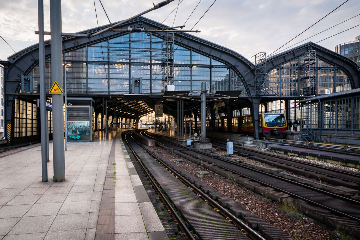
September 2017 — Berlin Friedrichstraße station in the early evening, with an S-Bahn BR 481 series train stopped under the steel and glass canopy. The curved elevated tracks lead into the main hall, a design characteristic of the city’s prewar rail architecture. Overhead wires and support structures frame the scene, while a few commuters move along the quiet platform as daylight fades into artificial light.
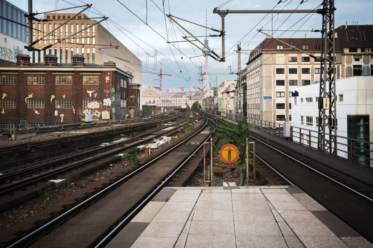
September 2017 — View east from Berlin Friedrichstraße station showing the elevated S-Bahn tracks leading toward Alexanderplatz. Overhead wires and supporting steel structures frame the route, with graffiti-covered industrial buildings on the left and mid-century offices on the right. The Berlin TV Tower (Fernsehturm) rises in the distance, a landmark visible across the city skyline.