Dirt Road Through Grasslands Near Sheep Mountain, Badlands National Park
Taken July 2019
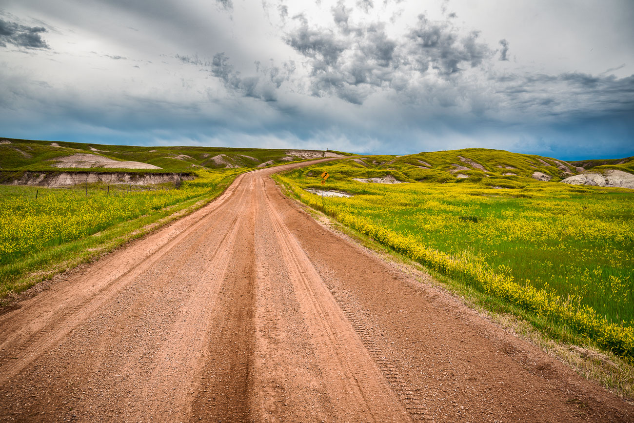
Badlands National Park's south unit is laced with unpaved roads like this one, which wind through mixed-grass prairie between the park's eroded buttes. The park covers roughly 244,000 acres and was established in 1978, though the striated hills visible along routes near Sheep Mountain have been taking shape for nearly half a million years as wind and water strip away layers of Oligocene-era sediment. This part of the park overlaps the Pine Ridge Reservation and is co-managed with the Oglala Sioux Tribe, whose ancestral homeland extends across the surrounding grasslands. Bighorn sheep and bison range through this section of prairie, and black-footed ferrets were reintroduced to the area in the 1990s after the species was once thought extinct in the wild.
Taken July 2019
More from
South Dakota
 Sylvan Lake Fog, Black Hills, South Dakota
Early morning fog blankets Sylvan Lake in South Dakota's Black Hills, obscuring the surrounding granite formations. Created in 1891 by…
 Sylvan Lake, Custer State Park, South Dakota
Sylvan Lake, located within Custer State Park in South Dakota's Black Hills, was formed in 1881 by Theodore Reder's construction…
 Foggy Trail to Black Elk Peak, Black Hills, South Dakota
Black Elk Peak, formerly named Harney Peak, rises to 7,244 feet in South Dakota's Black Hills, making it the highest…
 Needles Eye Tunnel Along Needles Highway, Custer State Park
The Needles Eye Tunnel carries South Dakota Highway 87 through a granite spire along the Needles Highway in Custer State…
 Needles Eye Tunnel, Custer State Park, South Dakota
The Needles Eye Tunnel, completed in 1922, is a narrow, one-lane passage carved through a granite spire in Custer State…
 Mixed-Grass Prairie Along Badlands National Park's Northern Boundary
Badlands National Park sits at the edge of a mixed-grass prairie ecosystem, one of the largest protected tracts of this…

