Woven Fence Path Through Santa Cruz La Laguna
Taken March 2020
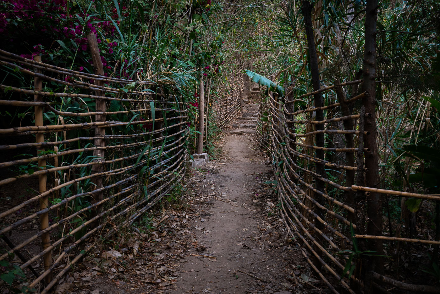
Santa Cruz La Laguna sits on the northern shore of Lake Atitlán, a crater lake formed roughly 84,000 years ago in the wake of a massive volcanic eruption. The village is reachable mainly by boat or footpath, since no road connects it directly to Panajachel, and hillside trails like this one remain the main link between homes, gardens, and the shoreline docks below. Woven cane and bamboo fencing of this type is a traditional, low-cost way to mark property lines and keep livestock off footpaths in the Kaqchikel Maya communities around the lake.
Taken March 2020
More from
Santa Cruz
 Trail Above Santa Cruz La Laguna Toward the Highlands
Santa Cruz La Laguna sits on the northern shore of Lake Atitlán, a volcanic lake formed roughly 84,000 years ago…
 Agave-Lined Stone Steps in Santa Cruz La Laguna
Santa Cruz La Laguna sits on a steep hillside above Lake Atitlán, reachable mainly by boat or footpath rather than…
 Hillside Village Above Lake Atitlán Near Santa Cruz La Laguna
Santa Cruz La Laguna sits on the northern shore of Lake Atitlán, built into terrain so steep that many homes…
 Hillside Village of Santa Cruz La Laguna Above Lake Atitlán
Santa Cruz La Laguna sits on a steep slope above the northern shore of Lake Atitlán, a volcanic crater lake…
 A Garden Lodge in Santa Cruz La Laguna
Santa Cruz La Laguna sits on the northern shore of Lake Atitlán in Guatemala's Sololá Department, reachable mainly by boat…
 Footpath Descending Toward Santa Cruz La Laguna
Santa Cruz La Laguna sits on the northern shore of Lake Atitlán, a caldera lake formed roughly 84,000 years ago…


