Map
More from Superior National Forest

BWCA Wilderness Entry Points Sign, Superior National Forest
A sign for the Boundary Waters Canoe Area Wilderness entry points for Snake River and Little Isabella River stands along…

1958 Forest Service Bridge Plaque, Superior National Forest
The U.S. Forest Service, part of the Department of Agriculture, builds and maintains bridges, culverts, and other infrastructure across the…

Fall Colors Along the Arrowhead Trail, Cook County
The Arrowhead Trail runs roughly 27 miles north from Minnesota Highway 61 at Hovland to South Fowl Lake on the…

Island River in the Superior National Forest
Island River in Superior National Forest in Northern Minnesota. The river runs through the Pagami Creek Fire zone.
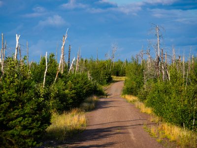
Tomahawk Road, Pagami Creek Burn Area, Superior National Forest
Tomahawk Road runs through the Superior National Forest near Isabella, Minnesota, within the area burned by the 2011 Pagami Creek…
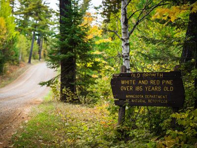
Old Growth Trees Sign in Minnesota
"Old growth white and red pine over 185 years old. Minnesota department of natural resources".
Nearby Photos