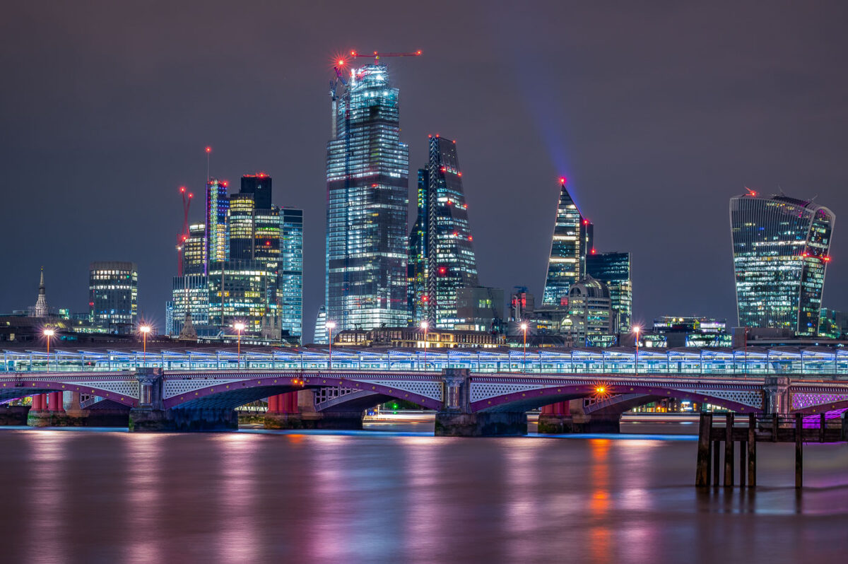
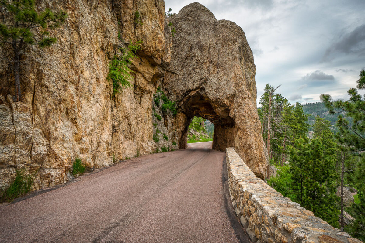
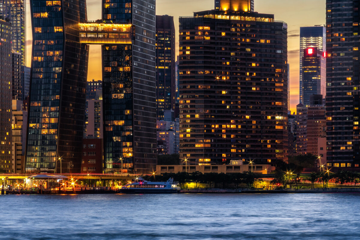
Blackfriars Bridge and City of London Skyline at Night
May 2019
—
A night view across the River Thames captures Blackfriars Bridge illuminated in cool tones beneath the glass towers of London’s financial district. The skyline features some of the city’s most recognizable modern landmarks — including the Leadenhall Building (the “Cheesegrater”), 22 Bishopsgate, and the distinctive curved façade of 20 Fenchurch Street, known as the “Walkie-Talkie.” Red aviation lights and construction cranes trace the ongoing vertical growth of the Square Mile, while reflections shimmer on the Thames below. The composition underscores the contrast between Victorian bridge engineering and the contemporary architecture reshaping London’s historic core.
Royal Mail Post Bus: Combined Mail and Passenger Service
May 2019
—
A preserved Royal Mail Post Bus, once a familiar sight across rural Britain, is seen here on display with its signature red and gold livery. Introduced in 1967, the Post Bus service was an innovative hybrid of public transport and postal logistics, providing passenger seats on vehicles that also delivered mail along remote routes where dedicated bus services were uneconomical. Operated by Royal Mail in partnership with local councils, these vehicles—often based on small vans or minibuses—served isolated villages across Scotland, Wales, and the English countryside.
Each bus carried both letters and up to a dozen passengers, connecting rural communities to larger towns while ensuring that even the most remote addresses received daily mail service. The scheme ran for over four decades before its gradual discontinuation by 2017, marking the end of a uniquely British solution to the challenges of rural mobility and communication.
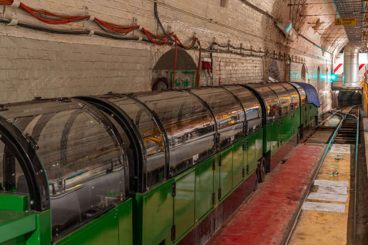
London Mail Rail at the Postal Museum
May 2019
—
Beneath the streets of central London lies one of the city’s lesser-known engineering feats—the Post Office Railway, more commonly known as the Mail Rail. Built in the early 20th century and officially opened in 1927, the driverless electric railway carried letters and parcels between key sorting offices and railway stations, including Paddington, Mount Pleasant, and Liverpool Street. The tunnels, only 2 feet wide and running for over six miles, allowed mail to move across the capital in a fraction of the time it took above ground, unaffected by London’s constant congestion.
The trains, such as the preserved unit pictured here, were designed to operate automatically, hauling specially built mail containers along narrow tracks deep below the city. Each train could carry up to 12 tons of post at speeds of up to 40 miles per hour, operating 22 hours a day at the network’s peak. The system remained in service until 2003, when changing logistics and new road systems made it redundant.
Today, visitors to the Postal Museum in Clerkenwell can ride a restored section of the railway and see the machinery that once kept London’s communication network in motion. The preserved infrastructure—brick tunnels, signal systems, and compact rolling stock—stands as a rare example of early automation in transport history, reflecting Britain’s long-standing innovation in engineering and urban logistics.
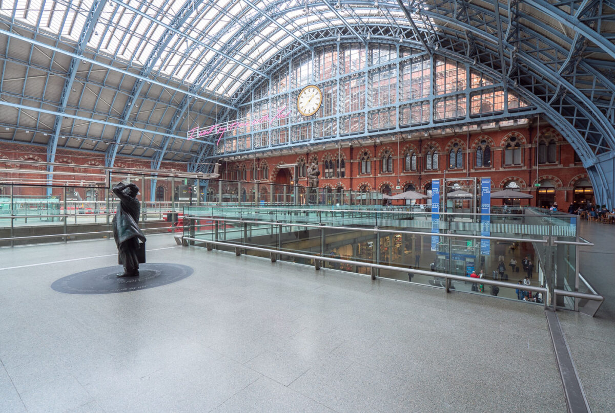
King’s Cross St Pancras Station Interior, London
May 2019
—
King's Cross St. Pancras (formerly King's Cross) is a London Underground station on Euston Road in the Borough of Camden, Central London. It serves King's Cross and St Pancras main line stations in fare zone 1, and is an interchange between six Underground lines. The station was one of the first to open on the network; as of 2017, it is the most used station on the network for passenger entrances and exits combined.
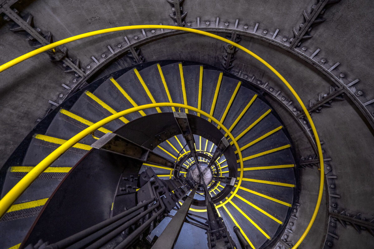
Clapham North Underground Station Spiral Emergency Staircase
May 2019
—
A view inside one of the distinctive spiral staircases of Clapham North Underground Station on the Northern Line, part of London’s deep-level tube network completed in the 1920s. The cast-iron stairwell descends nearly 120 feet below ground, wrapping tightly around a central ventilation column used to regulate air pressure and temperature within the tunnels. The staircase, equipped with yellow anti-slip edges and a steel handrail, was designed as an emergency exit and maintenance access route for the deep-bore platforms below.
Stations like Clapham North, along with its twin Clapham Common, are known for their rare narrow island platforms and compact circular shafts — relics of early tube engineering when space and construction methods were limited. The robust riveted metalwork and industrial geometry of the stairwell reflect the period’s emphasis on function and endurance, forming part of London’s complex subterranean infrastructure still in use more than a century later.
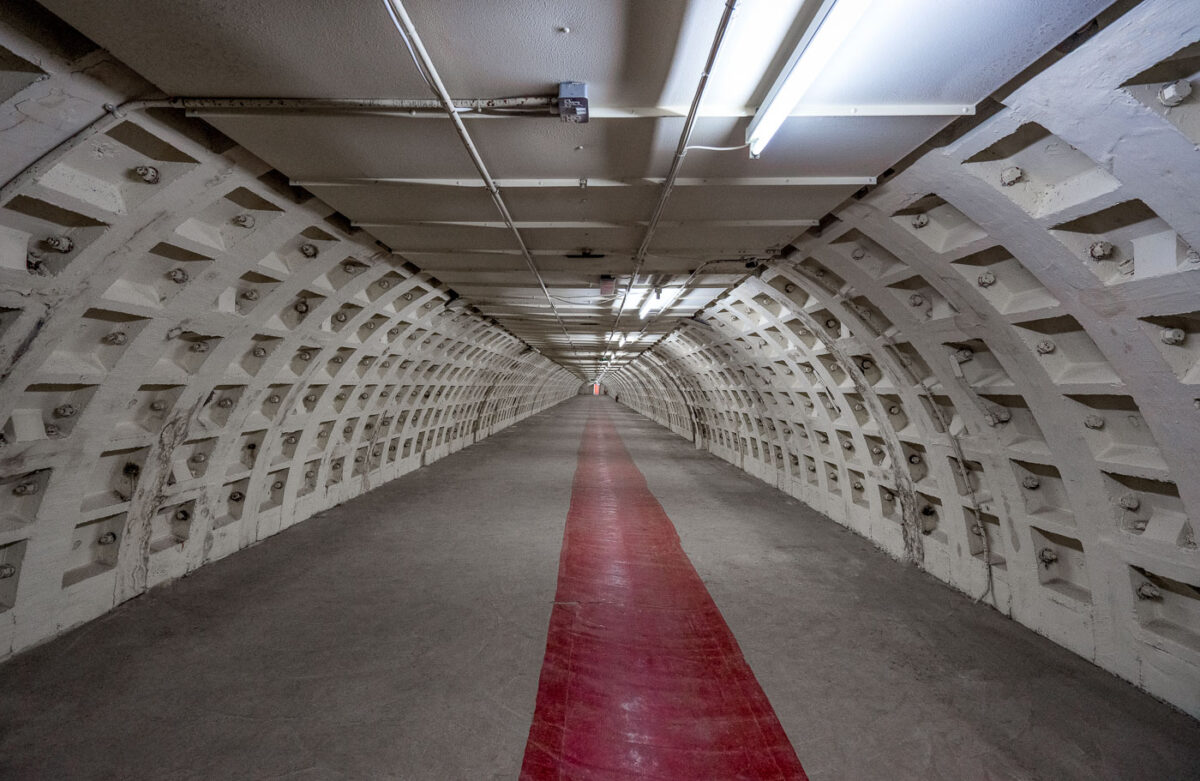
Clapham North WWII Deep Shelter Tunnel
May 2019
—
A deep-level shelter tunnel beneath Clapham North, one of eight such subterranean structures built during World War II as civilian air-raid refuges along the London Underground. Constructed between 1940 and 1942, these reinforced cylindrical passages were designed to house up to 8,000 people during bombing raids, each equipped with bunks, lavatories, and medical posts. The distinctive bolted cast-iron lining — a hallmark of wartime tunnel construction — remains intact, illuminated by fluorescent fixtures added decades later.
After the war, the tunnels were repurposed for various uses, including temporary accommodation for Commonwealth immigrants and later as part of London Transport’s secure archival storage. Today, the Clapham North tunnels represent one of the most intact examples of London’s wartime civil engineering — a hidden layer beneath the active Northern Line that reveals the city’s dual legacy of transit innovation and wartime resilience.
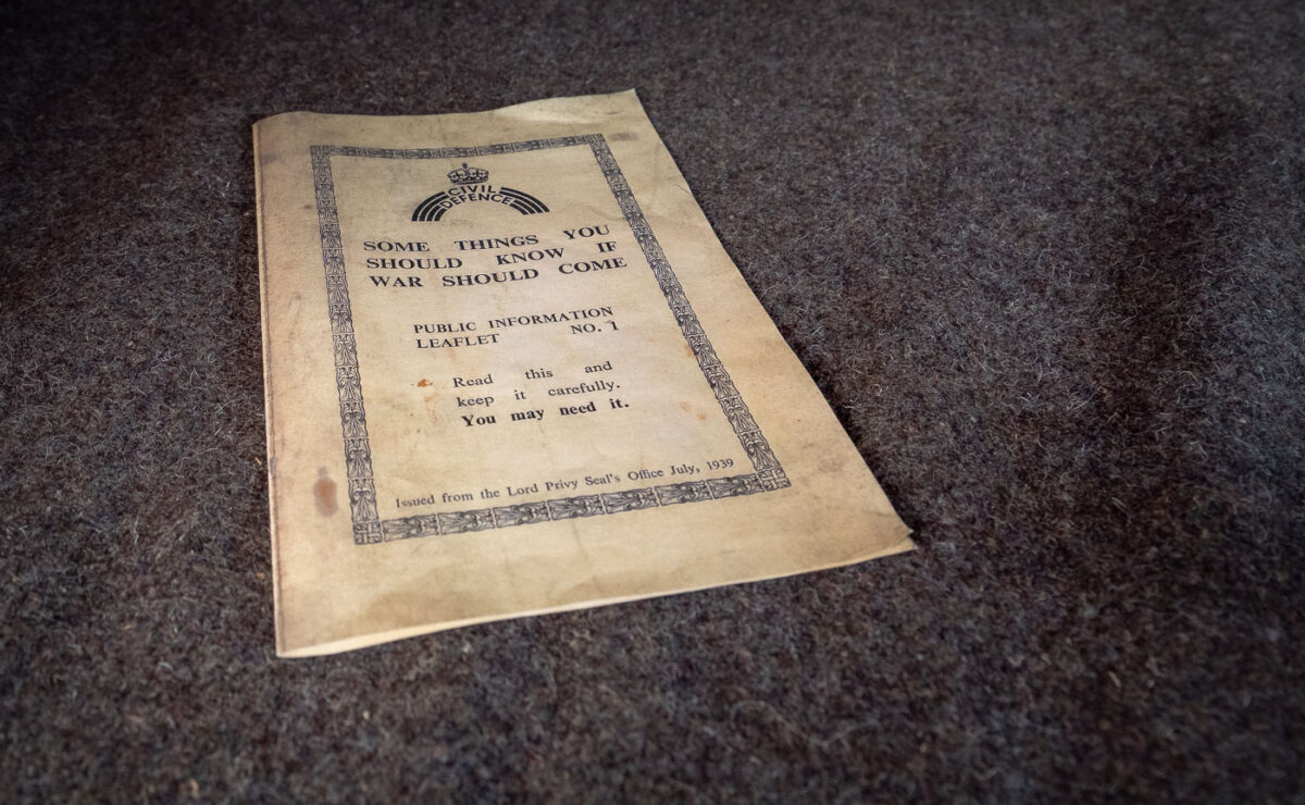
1939 Civil Defence Leaflet: “Some Things You Should Know if War Should Come”
May 2019
—
A British Civil Defence leaflet issued in July 1939, weeks before the outbreak of World War II, titled “Some Things You Should Know if War Should Come.” Distributed by the Lord Privy Seal’s Office, it was the first in a series of public information pamphlets intended to prepare civilians for air raids, blackout regulations, and the use of gas masks. The leaflet’s sober directive — “Read this and keep it carefully. You may need it.” — reflects the government’s attempt to balance reassurance with realism as Europe edged toward conflict.
Millions of these leaflets were delivered to homes across Britain as part of an unprecedented civil preparedness campaign. Surviving examples like this one, often yellowed and worn with age, stand as historical evidence of the anxious months before September 1939, when the nation braced for the total war that would soon arrive.
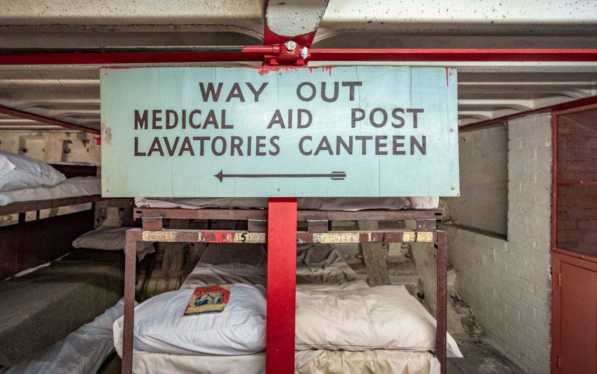
Clapham North Deep Shelter Sign: Medical Aid, Lavatories, Canteen
May 2019
—
A wartime directional sign inside the Clapham North deep-level shelter, one of eight civilian bunkers built beneath the London Underground during World War II. Constructed in 1940–1942 and located over 100 feet below ground, these tunnels were designed to protect thousands of civilians from German air raids during the Blitz. The painted wooden sign directs occupants toward vital amenities — medical aid, lavatories, and the canteen — illustrating the organized, self-contained nature of these subterranean refuges.
Rows of bunk beds once lined these tunnels, each assigned a number for families or individuals. The close quarters, reinforced concrete linings, and utilitarian signage evoke the claustrophobic yet crucial life-saving environment that became a hallmark of London’s wartime resilience. Today, Clapham North’s deep-level shelter stands preserved as a powerful reminder of the capital’s civil defence network and the endurance of its citizens under bombardment.
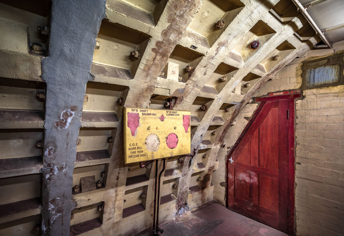
Clapham South Shelter: WWII Pressure Control Panel
May 2019
—
A surviving pressure control and alarm panel from the Clapham South deep-level shelter, part of London’s extensive subterranean civil defence network built during World War II. Marked for Shafts 9 and 10 — Balham Hill and Clapham Common — this steel and cast-iron tunnel section reflects the industrial engineering that underpinned the capital’s wartime infrastructure.
The shelter, completed in 1942, was constructed 36 meters below ground to house up to 8,000 civilians during Luftwaffe air raids. Panels like this one were integral to the shelter’s life-support and safety systems, monitoring air pressure, fire mains, and CO₂ levels to maintain breathable air and protect against smoke or gas intrusion. The utilitarian design, reinforced bolted segments, and residual wartime paintwork remain as tangible reminders of Britain’s wartime engineering precision and the resilience of Londoners forced to seek refuge deep beneath the city’s streets.
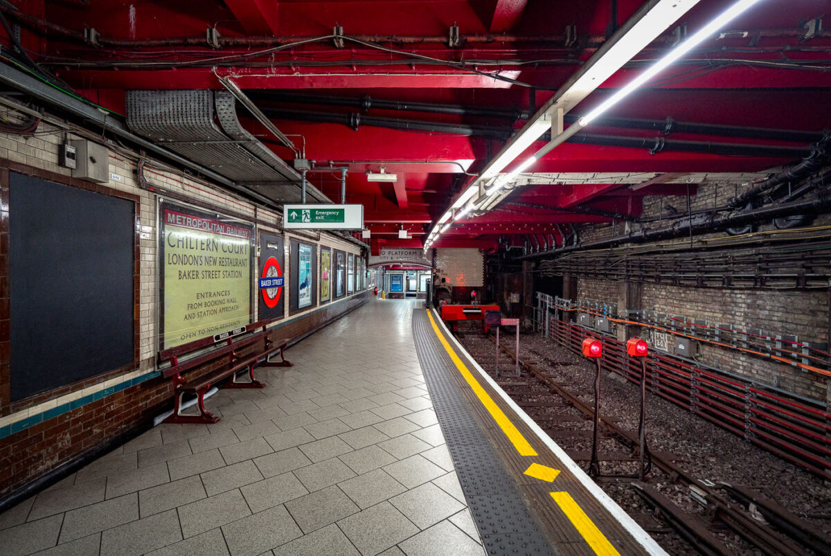
Baker Street Station: Metropolitan Line Victorian Platforms
May 2019
—
Baker Street Station’s Metropolitan Line platforms represent one of the oldest sections of the London Underground, opened in 1863 as part of the world’s first subterranean railway. The terminus platforms, seen here, retain their cut-and-cover Victorian brickwork paired with modern safety updates and striking red-painted steel reinforcements added during later refurbishments.
The station originally served the Metropolitan Railway’s steam-hauled trains running between Paddington and Farringdon before electrification in the early 20th century transformed the network. Period signage advertising “Chiltern Court” and the original Metropolitan Railway branding pay homage to its heritage, contrasting with the exposed wiring, signal lights, and tiling that reveal more than 160 years of evolving underground infrastructure. Today, Baker Street remains a key interchange, connecting five Underground lines while preserving much of the industrial atmosphere that defined London’s pioneering approach to mass transit.
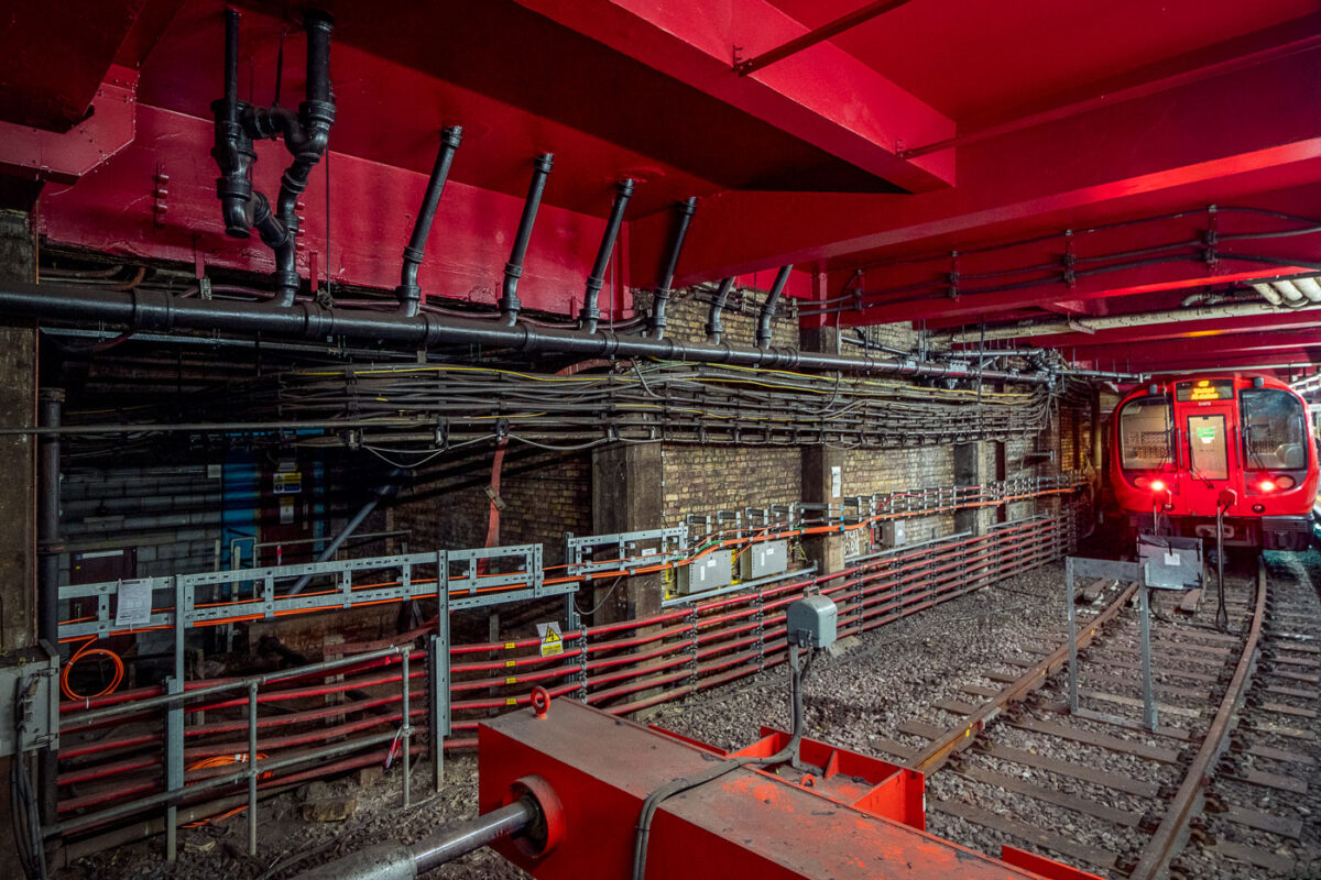
Baker Street Station: Victorian Tunnels and Modern Infrastructure
May 2019
—
Deep beneath central London, Baker Street’s Metropolitan Line platforms reveal the layered engineering of one of the oldest functioning railway systems in the world. The exposed brick tunnel and steel framing date back to the Victorian “cut-and-cover” era of the 1860s, when steam locomotives first ran through these very corridors. The heavy red girders seen above were reinforced during modern refurbishments, supporting the city streets above while housing utilities and cable conduits that power today’s Underground network.
The train at the far end belongs to the S8 Stock series, introduced in 2010 by Bombardier for the Metropolitan Line, equipped with air conditioning and regenerative braking. The dense web of cables and control boxes along the wall carries signal, communication, and traction power circuits, all vital to the line’s safe operation. Baker Street’s infrastructure embodies London Transport’s continual evolution—from soot-covered tunnels to precision-controlled, electrically powered systems still running along the same 19th-century alignments.
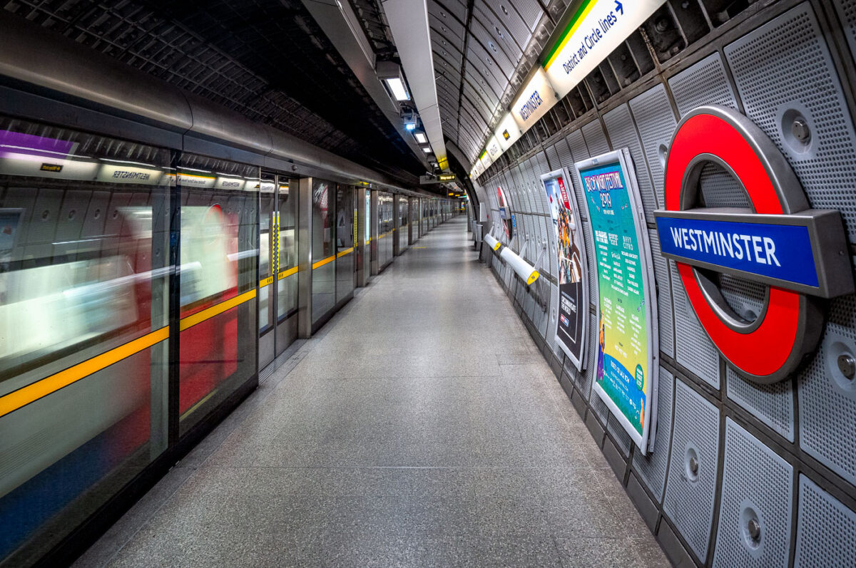
Westminster Station Jubilee Line Platform, London Underground
May 2019
—
The Jubilee Line platforms at Westminster Underground Station represent the deep-level engineering and modernist design of London’s late-20th-century transit expansion. Constructed as part of the 1999 Jubilee Line Extension, these platforms sit approximately 30 meters below ground, directly beneath the District and Circle line tunnels. Designed by Foster + Partners, the station features full-height platform screen doors — a safety innovation uncommon on most of the Underground — and a sleek system of acoustic panels and perforated aluminum cladding that enhance both sound control and visual uniformity.
Every structural and material detail reflects the project’s dual purpose: to manage immense passenger flow serving Parliament and Whitehall above, while preserving architectural clarity within a highly constrained urban site. The smooth curvature of the platform walls, precision lighting, and isolation of mechanical systems behind layered steel panels highlight the station’s integration of industrial functionality with the aesthetics of modern infrastructure.
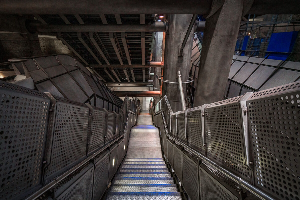
Westminster Station Stairwell, London Underground
May 2019
—
The angular steel and concrete design of Westminster Underground Station represents one of the most ambitious architectural undertakings of London’s Jubilee Line Extension, opened in 1999. Designed by Foster + Partners, the station descends more than 30 meters below ground beside the Houses of Parliament, requiring deep excavation and advanced structural engineering to stabilize the surrounding historic area.
The stairwell seen here showcases the station’s signature industrial aesthetic — exposed concrete ribs, perforated metal panels, and massive supporting beams that evoke the look of a subterranean cathedral of infrastructure. Built within a massive box excavated beneath Bridge Street, Westminster’s layout integrates vertical circulation through lifts, escalators, and these steep stairways connecting the ticket hall to multiple underground levels. The design not only accommodates heavy passenger volumes but celebrates the raw mechanics of public transit, merging utility with architectural expression.
Westminster Station: London Underground Architecture
May 2019
—
Westminster is a London Underground station in the City of Westminster. It is served by the Circle, District and Jubilee lines. On the Circle and District lines, the station is between St. James's Park and Embankment, and on the Jubilee line it is between Green Park and Waterloo. It is in Travelcard Zone 1. The station is located at the corner of Bridge Street and Victoria Embankment and is close to the Houses of Parliament, Westminster Abbey, Parliament Square, Whitehall, Westminster Bridge, and the London Eye. Also close by are Downing Street, the Cenotaph, Westminster Millennium Pier, the Treasury, the Foreign and Commonwealth Office, and the Supreme Court.
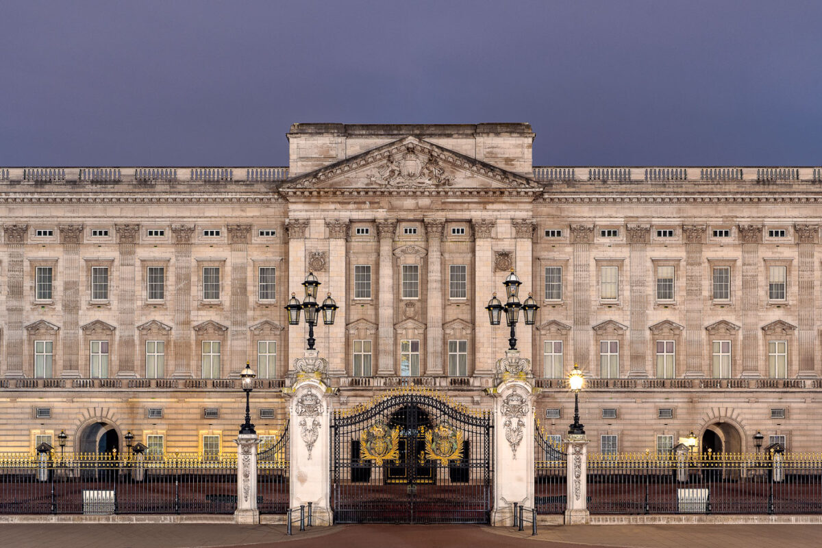
Buckingham Palace East Facade at Dusk, London
May 2019
—
The east front of Buckingham Palace, photographed at dusk, displays the neoclassical grandeur of Britain’s royal residence. Designed by architect Sir Aston Webb and completed in 1913, the symmetrical limestone facade is illuminated softly against a violet evening sky. Ornate wrought-iron gates adorned with gilded royal crests frame the main entrance, while gas-style lamps evoke the palace’s Edwardian-era detailing. The balanced rhythm of Corinthian pilasters and sash windows underscores the building’s enduring place as both a functioning royal residence and an architectural symbol of the British monarchy.
Buckingham Palace Gates: Royal Coat of Arms Detail
May 2019
—
The ornate front gates of Buckingham Palace display the Royal Coat of Arms of the United Kingdom, rendered in gilded bronze against black wrought iron. The emblem—featuring a crowned lion and a chained unicorn supporting a quartered shield—symbolizes the unity of England, Scotland, and Ireland under the Crown. Each detail of the design, from the gilded laurel bursts to the scrollwork on the surrounding ironwork, reflects both heraldic tradition and the craftsmanship of early twentieth-century metalworkers. These gates form one of the most photographed entrances in the world, standing as a ceremonial threshold to Britain’s royal residence.
Target HQ Minneapolis: Collaborative Lounge and Corridor
May 2019
—
An interior lounge and corridor at Target Corporation’s headquarters in Minneapolis, designed to encourage informal meetings, employee collaboration, and visitor reception. The space reflects Target’s post-2010 modern workplace philosophy — blending minimalist corporate architecture with hospitality-inspired interiors. Curved ceiling soffits, accent lighting, and red brand-themed wall panels soften the otherwise sleek office environment, while modular seating and large communal tables support group discussions and mobile work. This type of open, flexible workspace became increasingly common in large corporate campuses in the 2010s, as U.S. companies shifted away from traditional cubicle layouts toward collaborative, design-driven environments influenced by retail and tech sectors. The Target brand’s signature red is subtly integrated throughout, reinforcing corporate identity within the workspace’s architecture.
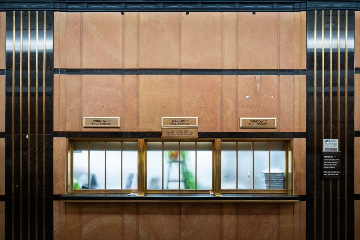
Minneapolis Main Post Office Art Deco Service Windows
May 2019
—
The historic Minneapolis Main Post Office features these brass-framed service windows, emblematic of the city’s 1930s Art Deco architecture. Completed in 1933 as part of a federal building initiative, the structure was designed by architect Léon Eugene Arnal of Magney & Tusler and remains one of the finest Depression-era public works in the Upper Midwest. The marble-clad lobby and geometric metal detailing reflect the influence of the Works Progress Administration’s design aesthetic—modern yet monumental—built to symbolize reliability and civic pride during a period of national recovery.
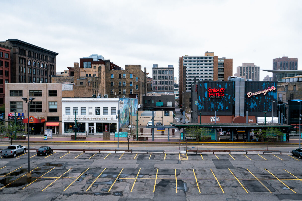
Sneaky Pete’s and Dreamgirls, Downtown Minneapolis
May 2019
—
Sneaky Pete's bar in downtown Minneapolis.
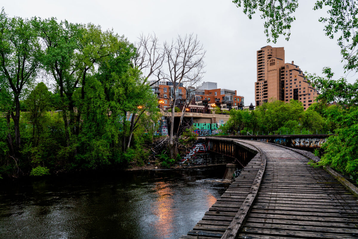
Abandoned Railroad Bridge, Nicollet Island, Minneapolis
May 2019
—
An abandoned wooden railroad bridge curves over the Mississippi River at Nicollet Island in Minneapolis, a quiet remnant of the city’s industrial past. Once part of a freight spur serving nearby mills and factories, the structure now stands unused, adorned with graffiti and framed by spring foliage. In the background, the tan brick towers of Riverplace and surrounding condominium developments reflect the area’s transformation from rail and river commerce to modern urban living.
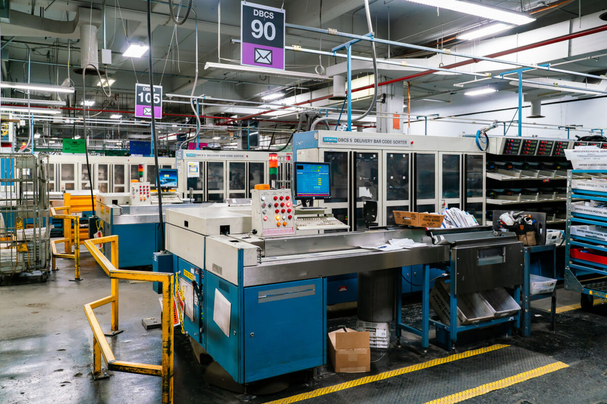
USPS Mail Sorting Facility with Siemens DBCS Machines
May 2019
—
A U.S. Postal Service mail processing facility with Siemens Delivery Bar Code Sorter (DBCS) machines used for automated letter sorting. These machines scan barcodes, read addresses, and direct mail to the correct output trays for delivery. Introduced widely in the late 1980s and 1990s, DBCS systems modernized postal operations by improving speed and reducing manual handling. Facilities like this remain an essential part of national logistics, processing millions of mail pieces daily through computer-controlled sorting and routing systems.
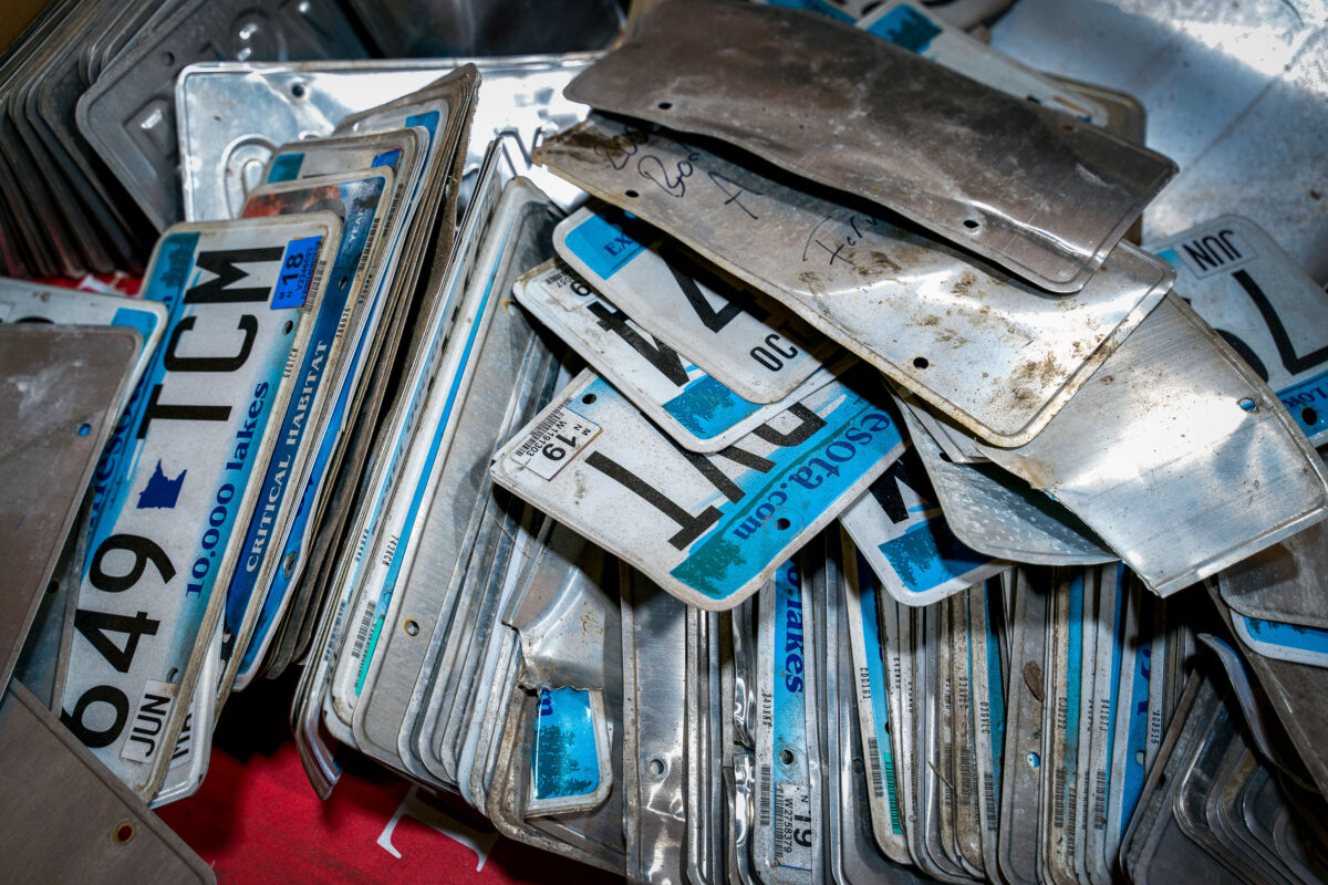
Minnesota License Plates Ready for Recycling at K&K Metals
May 2019
—
Stacks of discarded Minnesota license plates sit ready for recycling at K&K Metals in Minneapolis. The familiar “10,000 Lakes” slogan and blue gradient design peek through layers of grime and bent aluminum, remnants of years of use on the road. Facilities like this one reclaim the aluminum from expired or damaged plates, melting it down for reuse—part of a statewide effort to reduce waste and recover valuable materials from the transportation system.
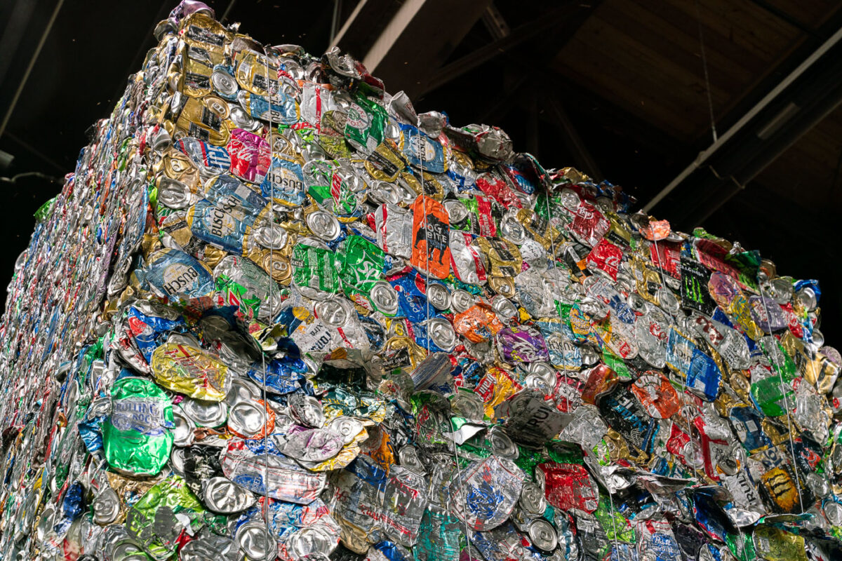
Crushed Aluminum Cans at K&K Metal Recycling, Minneapolis
May 2019
—
A massive cube of crushed aluminum cans stands ready for processing at K&K Metal Recycling in Minneapolis. The dense block, held together by steel wires, contains thousands of cans—each once part of the city’s daily consumption cycle. Aluminum is among the most efficiently recycled materials, requiring only a fraction of the energy needed to produce new metal. Facilities like K&K play a vital role in returning this material to circulation, turning everyday waste into reusable industrial feedstock.
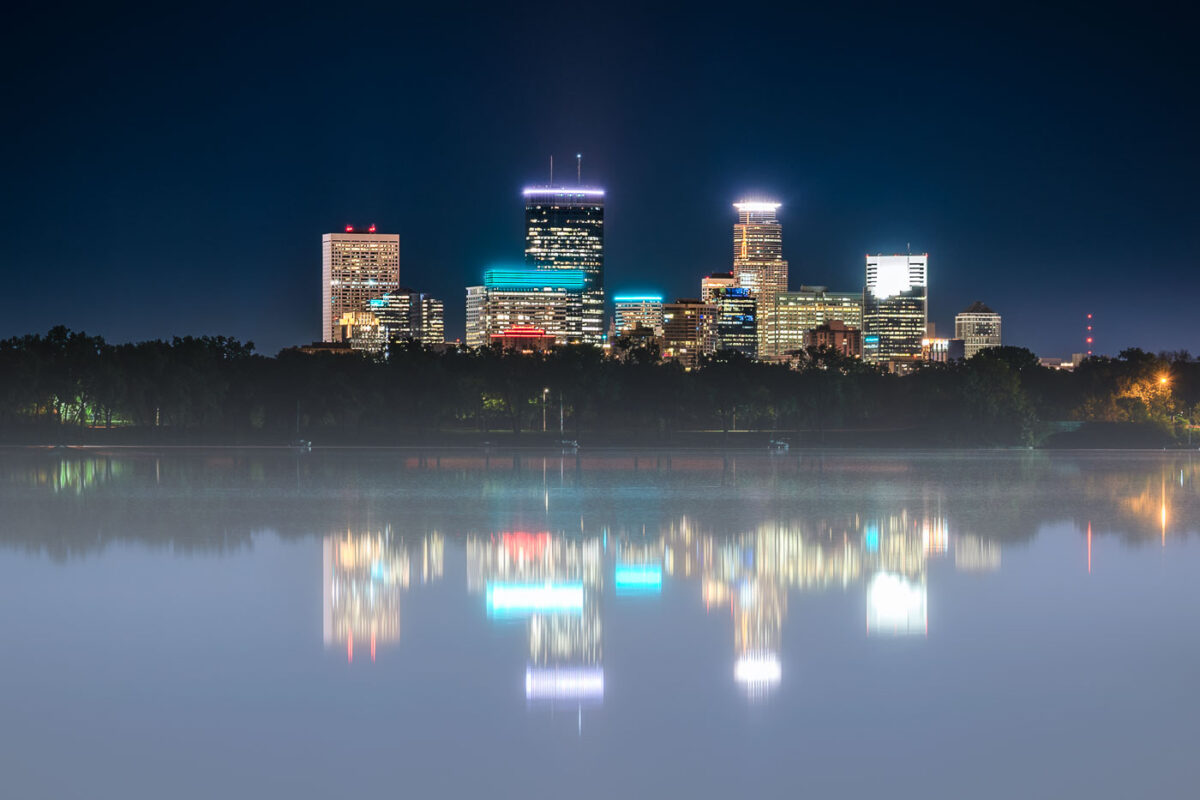
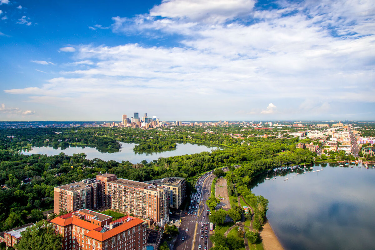
Minneapolis Skyline and Bde Maka Ska at Night
May 2019
—
The illuminated Minneapolis skyline rises behind a fog-covered Bde Maka Ska, its towers mirrored in the lake’s still surface. Buildings like the IDS Center, Capella Tower, and Wells Fargo Center shine through the mist, their neon accents reflecting off the calm water. Captured at night, the photograph contrasts the cool, modern glow of downtown with the serene, natural quiet of the city’s largest lake—a reminder of how Minneapolis balances its urban form with its deep connection to water and landscape.
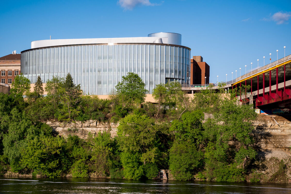
Bruininks Hall, UMN East Bank Campus, Minneapolis
May 2019
—
Bruininks Hall, with its curved glass facade and modernist profile, stands prominently on the bluffs of the Mississippi River at the University of Minnesota’s East Bank campus. The building, named after former university president Robert Bruininks, houses student services and administrative offices while serving as a visual landmark along the riverfront. The structure’s sleek transparency contrasts with the limestone layers of the bluff below, emphasizing the union between natural geology and contemporary academic architecture that defines much of the university’s riverfront setting.
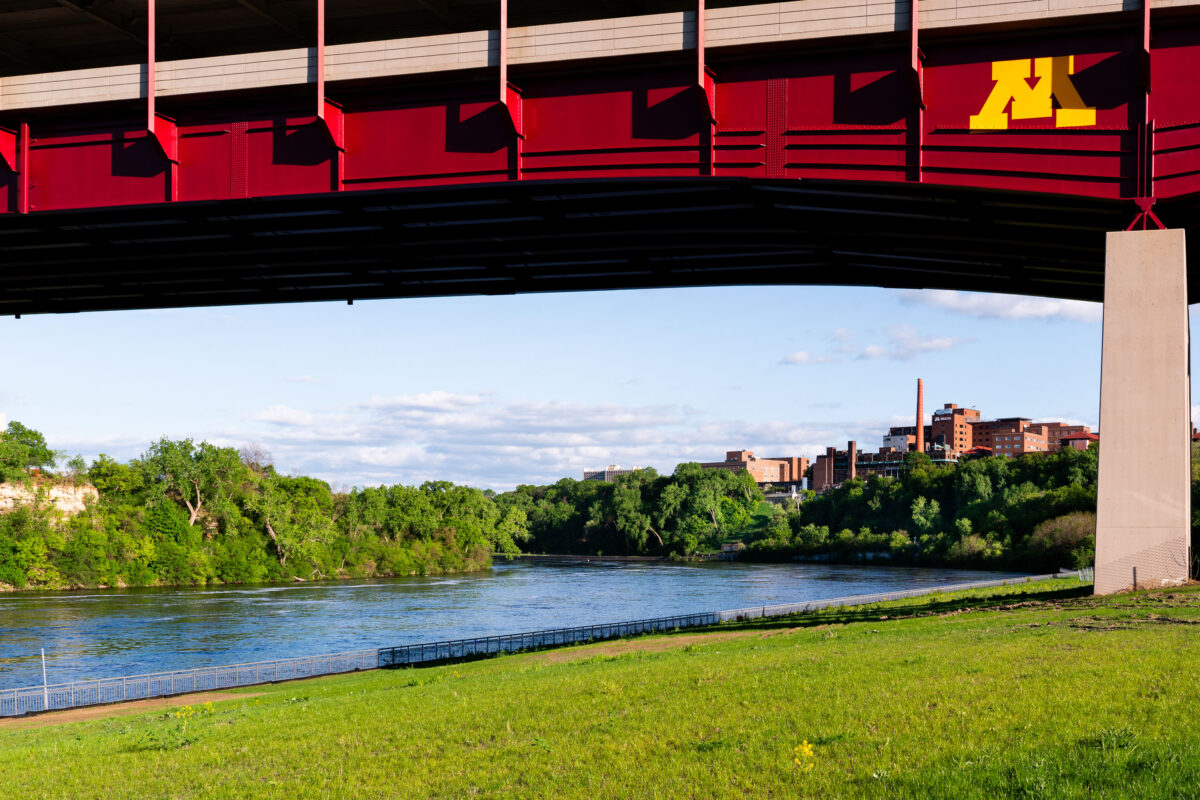
Washington Avenue Bridge over Mississippi River, Minneapolis
May 2019
—
The maroon and gold Washington Avenue Bridge spans the Mississippi River, linking the University of Minnesota’s East and West Bank campuses. Seen from below, the bridge’s bold steel trusses frame the calm river and limestone bluffs, while the university’s West Bank buildings rise in the background. The bridge, completed in 1965, carries both vehicular and pedestrian traffic—including the campus’s light rail line—and serves as one of the most recognizable landmarks connecting the university’s two halves across the river.
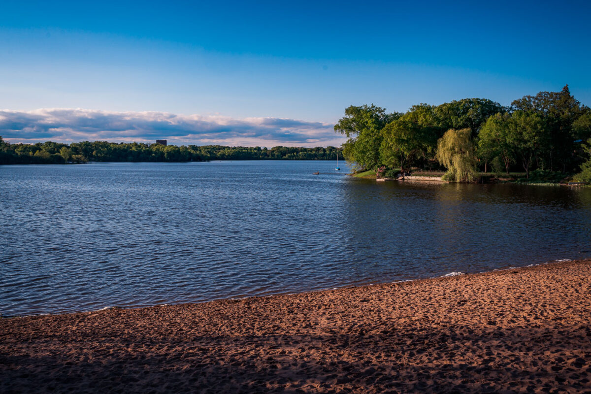
Cedar Lake South Beach, Minneapolis, Evening Light
May 2019
—
Cedar Lake South Beach in Minneapolis, photographed in the evening light, captures one of the city’s quieter public beaches along the Chain of Lakes. Located west of Bde Maka Ska, Cedar Lake is known for its natural shoreline and tree-lined surroundings, offering a more secluded experience compared to the busier neighboring lakes. The sandy beach, calm water, and sailboats anchored offshore highlight Minneapolis’s integration of recreation, nature, and urban life within a few miles of downtown.
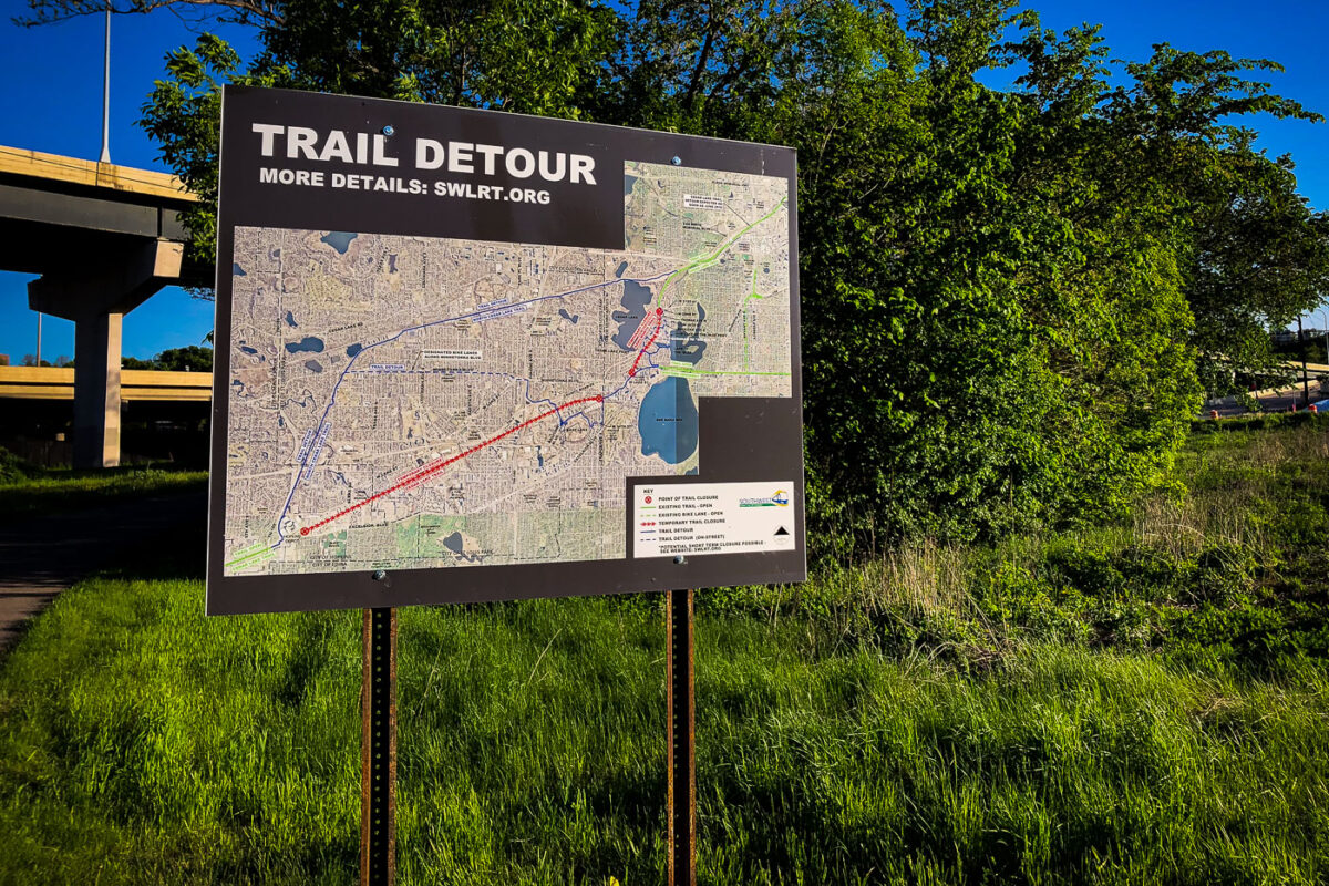
Southwest LRT Trail Detour Sign, Minneapolis
May 2019
—
A detour sign for the Southwest Light Rail Transit (SWLRT) project stands beside a bike trail in Minneapolis, showing the rerouted path for cyclists and pedestrians during construction of the Green Line Extension. The detailed map outlines temporary closures through the Kenilworth Corridor and Cedar Lake areas, where new light rail tracks are being installed to connect downtown Minneapolis with the southwestern suburbs. The project, one of the largest public works efforts in Minnesota history, has significantly altered popular urban trails like the Midtown Greenway and Cedar Lake Trail since construction began in the late 2010s.
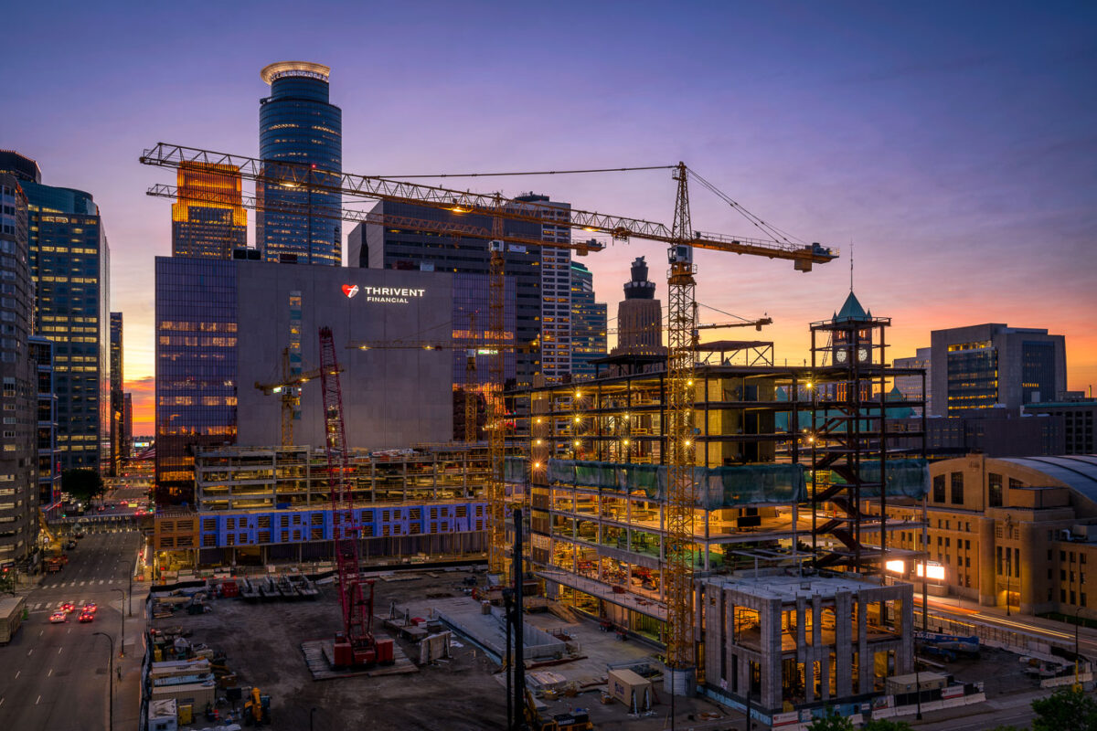
Thrivent Financial Construction Downtown Minneapolis at Sunset
May 2019
—
Thrivent Financial's current building and their new building going up.
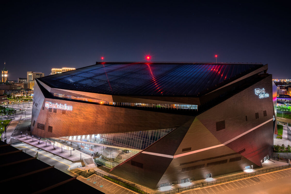
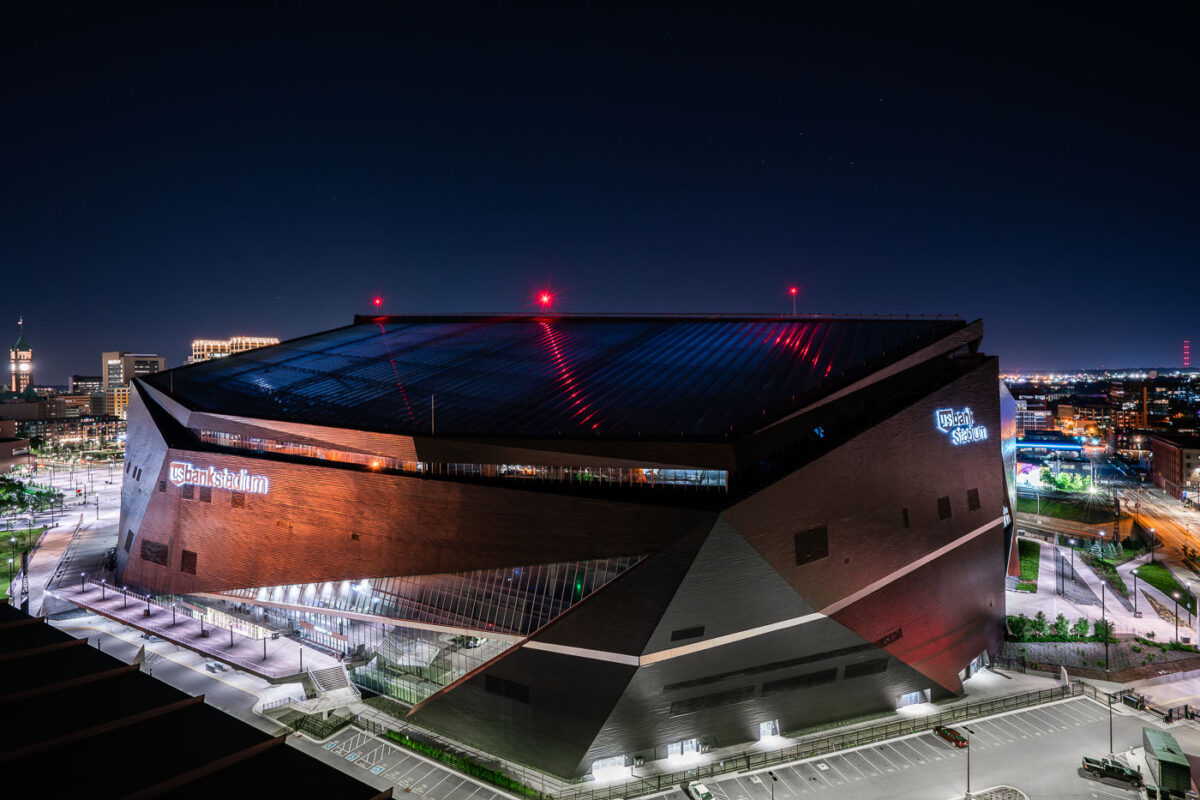
U.S. Bank Stadium at Night, Minneapolis
June 2019
—
US Bank Stadium at Night, Downtown East Minneapolis
June 2019
—
U.S. Bank Stadium in downtown Minneapolis, photographed under a clear night sky, showcases its striking angular design illuminated by the city’s glow. Opened in 2016 and designed by HKS Architects, the venue serves as the home of the Minnesota Vikings and a premier multi-purpose arena for concerts, major sporting events, and conventions. Its faceted steel and glass shell evokes the prow of a Viking ship, a nod to the team’s heritage, while its translucent ETFE roof allows natural light by day and reflects ambient light by night. This structure replaced the collapsed Metrodome and now anchors the eastern edge of the Minneapolis skyline as one of the most distinctive modern stadiums in the United States.
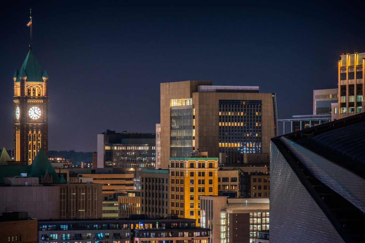
Minneapolis City Hall Clock Tower at Night
June 2019
—
The Minneapolis City Hall Clock Tower in downtown Minneapolis.
June 2019
—
Downtown Minneapolis glows under a clear night sky, with Target’s illuminated headquarters on the left displaying its signature red and white colors across the rooftop screens. To the right stands the Campbell Mithun Tower, its reflective glass façade mirroring the surrounding city lights. The historic Foshay Tower, crowned with its bright beacon, anchors the scene in the background—a reminder of the city’s architectural evolution from early 20th-century art deco to modern corporate design.
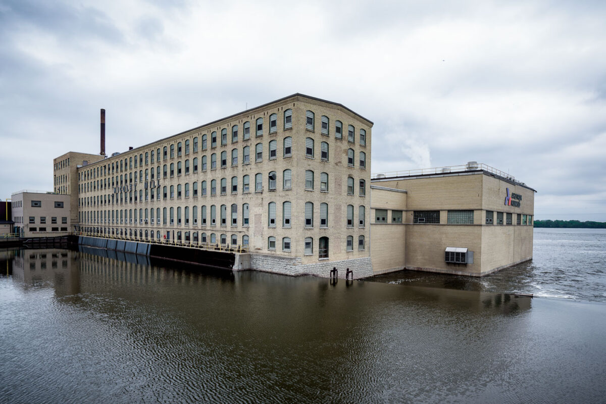
Nicolet Mill on Fox River, De Pere, Wisconsin
June 2019
—
The Nicolet Mill complex in De Pere, Wisconsin, stands alongside the Fox River, a remnant of the region’s historic paper-making industry that once defined the economy of the Green Bay area. The long, brick mill structure—now operated by American Nippon Papers—dates back to the early 20th century, when Wisconsin’s waterways powered dozens of mills along the Fox River. Still active today, the facility reflects the enduring legacy of papermaking in the Midwest, blending vintage industrial architecture with modern manufacturing extensions visible on the river-facing side.
Wisconsin State Reformatory Main Entrance, Green Bay
June 2019
—
Built in 1898, the Wisconsin State Reformatory in Green Bay is a monumental example of early 20th-century correctional architecture, designed to project authority through its Romanesque Revival stonework and fortress-like symmetry. The façade, constructed from locally quarried gray limestone, features narrow arched windows, heavy masonry, and a commanding central pediment above the main entryway. Originally intended as a progressive institution focused on rehabilitation rather than punishment, the reformatory combined rigid design with reform-era ideals. The weathered sign above the entrance—still reading “Wisconsin State Reformatory”—marks one of the few remaining intact examples of this architectural period in the state’s penal history.
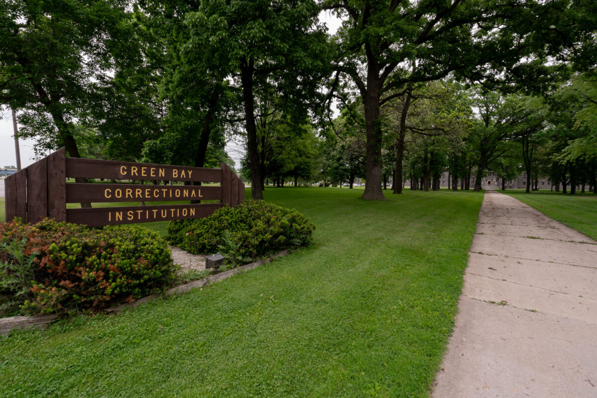
Green Bay Correctional Institution Entrance, Allouez, Wisconsin
June 2019
—
The entrance to Green Bay Correctional Institution in Allouez, Wisconsin, shows the tree-lined approach to one of the state’s oldest operating prisons. Opened in 1898 as the Wisconsin State Reformatory, the facility was designed during an era emphasizing reform and rehabilitation, reflected in its spacious campus and classical stone buildings visible in the distance. Today, the institution remains part of the Wisconsin Department of Corrections system, standing as a significant piece of the state’s correctional history and architectural heritage.
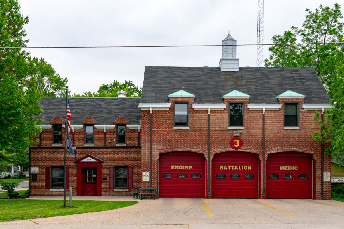
Green Bay Fire Station No. 3, Shawano Ave, Wisconsin
June 2019
—
Green Bay Fire Station No. 3, located in Green Bay, Wisconsin, represents a classic mid-20th-century firehouse design with its red brick façade, steep rooflines, and distinctive arched bay doors. Serving the west side of the city, this station houses an engine company, battalion chief, and medic unit, providing rapid response coverage to nearby residential and commercial areas. The building’s architecture reflects an era when civic structures balanced functionality with traditional craftsmanship, embodying a sense of permanence and community trust.
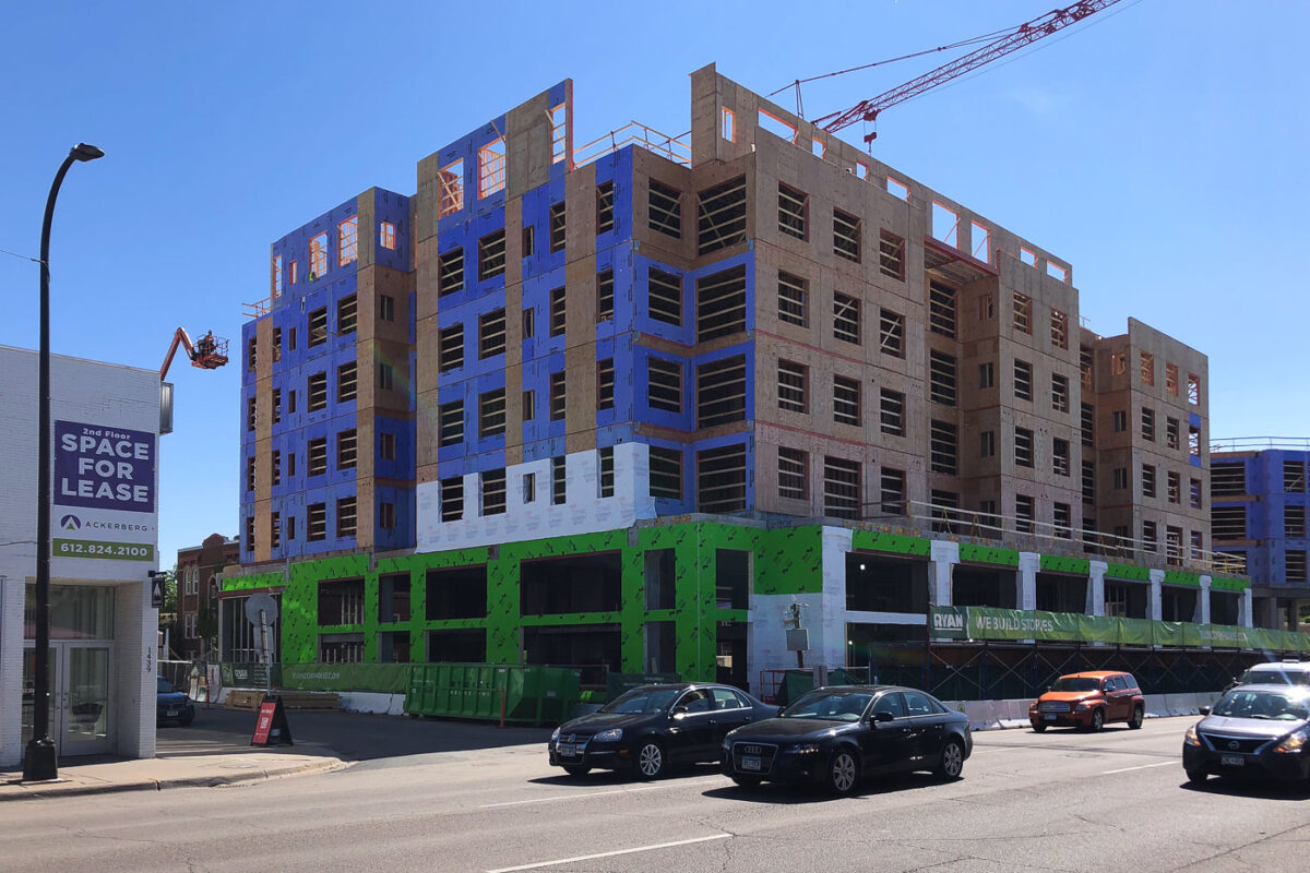
Daymark Apartments Under Construction, Uptown Minneapolis
June 2019
—
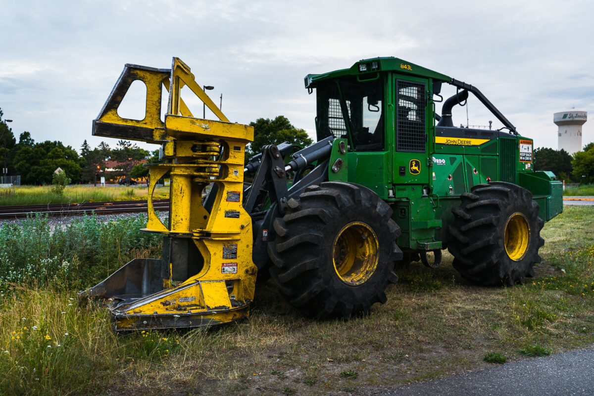
John Deere 843L Feller Buncher – Southwest LRT Construction
June 2019
—
A John Deere 843L feller buncher sits parked near the railway tracks in St. Louis Park, Minnesota, during the early stages of construction for the Southwest Light Rail Transit (LRT) project. Designed primarily for forestry work, this heavy-duty machine—with its massive front grapple and thick treaded tires—was adapted for clearing brush and trees along the rail corridor. The mix of heavy equipment, rail infrastructure, and suburban backdrop highlights the region’s ongoing transformation as the light rail expansion reshapes Minneapolis’s western suburbs.
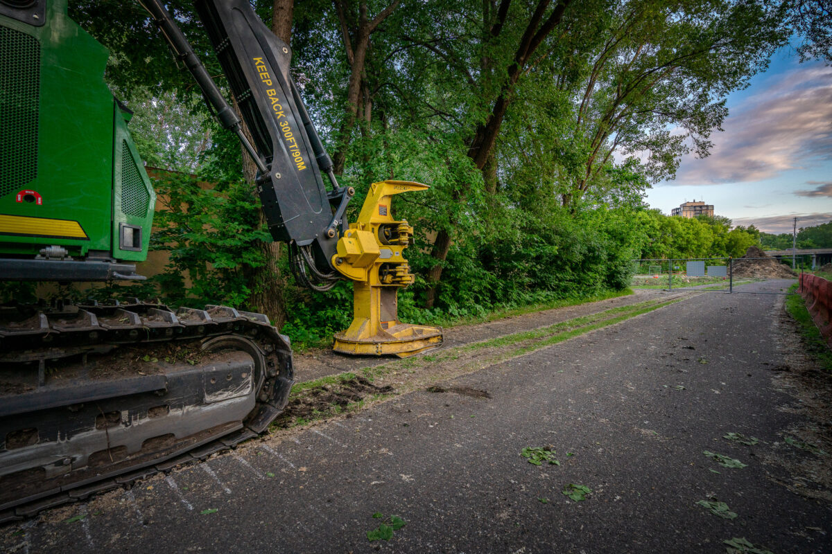
John Deere Feller Buncher at Southwest LRT Construction, St. Louis Park
June 2019
—
A tracked John Deere feller buncher with a yellow cutting head sits idle beside the Cedar Lake Trail in St. Louis Park, Minnesota, during early site preparation for the Southwest Light Rail Transit (LRT) extension. The machine’s “KEEP BACK 300 FT / 90 M” arm warning and the trail’s closed fencing mark the transition from a popular cycling route to an active construction corridor. In the distance, the bridge approach and industrial structures hint at the scale of redevelopment that reshaped the rail and trail landscape through Minneapolis’s western suburbs.
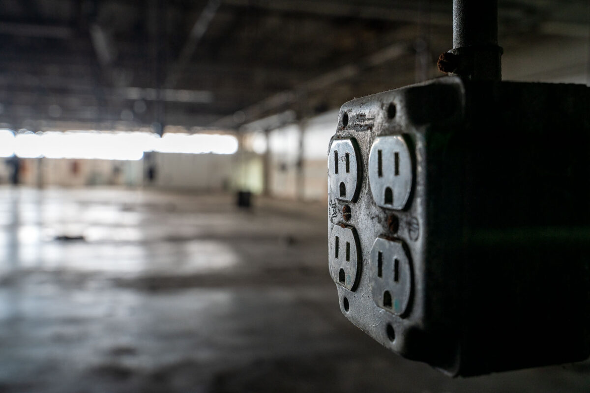
Hopkins, MN: Electrical Outlet in Abandoned Warehouse
June 2019
—
An electrical outlet inside an empty warehouse.
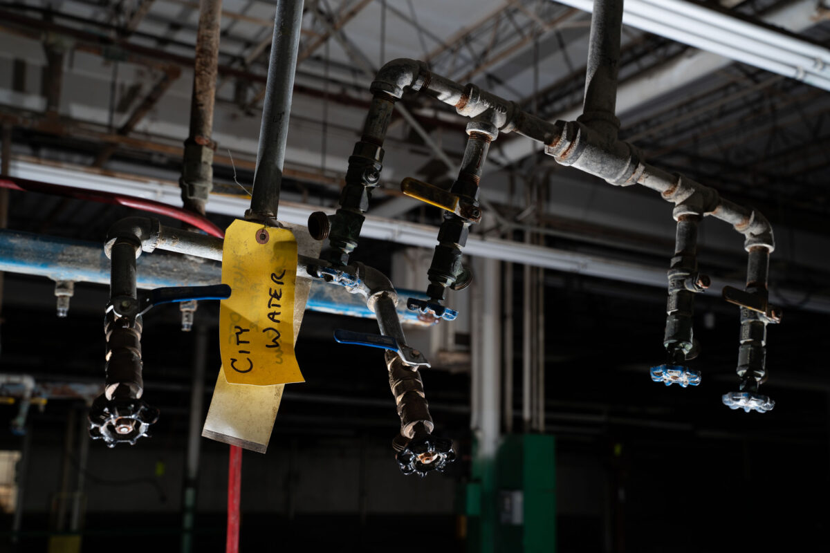
Minneapolis Industrial Water Valves and Pipes
June 2019
—
Inside an abandoned industrial building, a set of corroded water valves and pipes hangs overhead, marked with a fading yellow tag reading “City Water.” The scene captures the quiet afterlife of urban infrastructure—where once-busy mechanical systems now sit dormant beneath exposed rafters and dim fluorescent tubes. These remaining fixtures, wrapped in aging insulation and patched tape, reveal the skeletal logic of a space once dependent on pressurized networks, maintenance routines, and municipal supply lines that connected the factory to the city’s hidden circulatory systems.
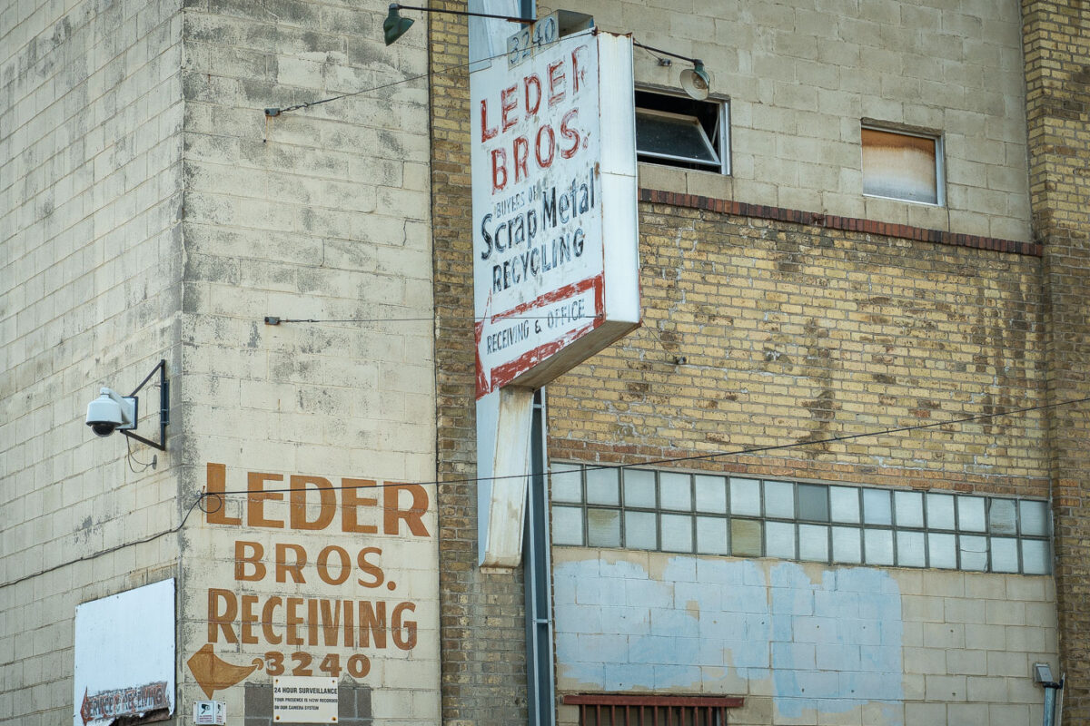
Leder Bros. Scrap Metal Recycling, North Minneapolis
June 2019
—
The weathered brick façade of Leder Bros. Scrap Metal Recycling reflects a century of small-scale industrial life in north Minneapolis. Faded hand-painted lettering and a rusting mid-century sign mark the receiving entrance for what was once a busy recycling yard, a place where scrap from the city’s rail lines and factories found new purpose. The combination of concrete block, yellow brick, and glass block windows speaks to a utilitarian design typical of the post-war industrial boom. Today, its aging surfaces and surveillance cameras evoke a district in transition, where traces of heavy industry linger amid redevelopment and adaptive reuse.
Stone Arch Bridge, Minneapolis, Evening Light
June 2019
—
Stone Arch Bridge, Minneapolis
Pillsbury A-Mill Historic Building at Sunset, Minneapolis
June 2019
—
The Pillsbury A-Mill is a former flour mill located on the east bank of the Mississippi River in Minneapolis, Minnesota. It held the distinction of being the world's largest flour mill for 40 years. Completed in 1881, it was owned by the Pillsbury Company and operated two of the most powerful direct-drive waterwheels ever built, each capable of generating 1,200 horsepower (895 kW). The mill was named a National Historic Landmark in 1966 and has since been converted into resident artist lofts.
Downtown Minneapolis as seen from Cedar Lake Trail
June 2019
—
Downtown Minneapolis seen from near the Cedar Lake Trail.
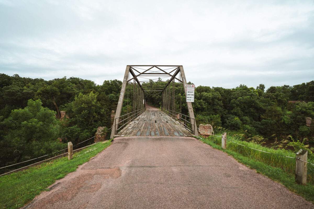
Garretson Truss Bridge Over Split Rock Creek, South Dakota
July 2019
—
An old steel truss bridge spans Split Rock Creek near the town of Garretson, South Dakota, carrying a narrow, weathered wooden deck over the rocky gorge below. Built in the early 20th century, this Pratt through truss design reflects an era when such riveted steel frameworks connected small Midwestern towns before the advent of modern concrete spans. Its utilitarian geometry and riveted latticework remain intact, framed by the lush, tree-lined valley of Split Rock Creek—a setting that once hosted flour mills, quarries, and river crossings essential to the region’s early development. The bridge now stands as a quiet relic of rural American engineering, linking history and landscape on the edge of the prairie.
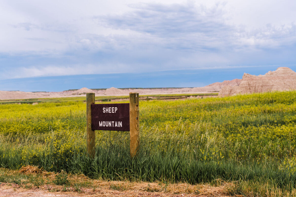
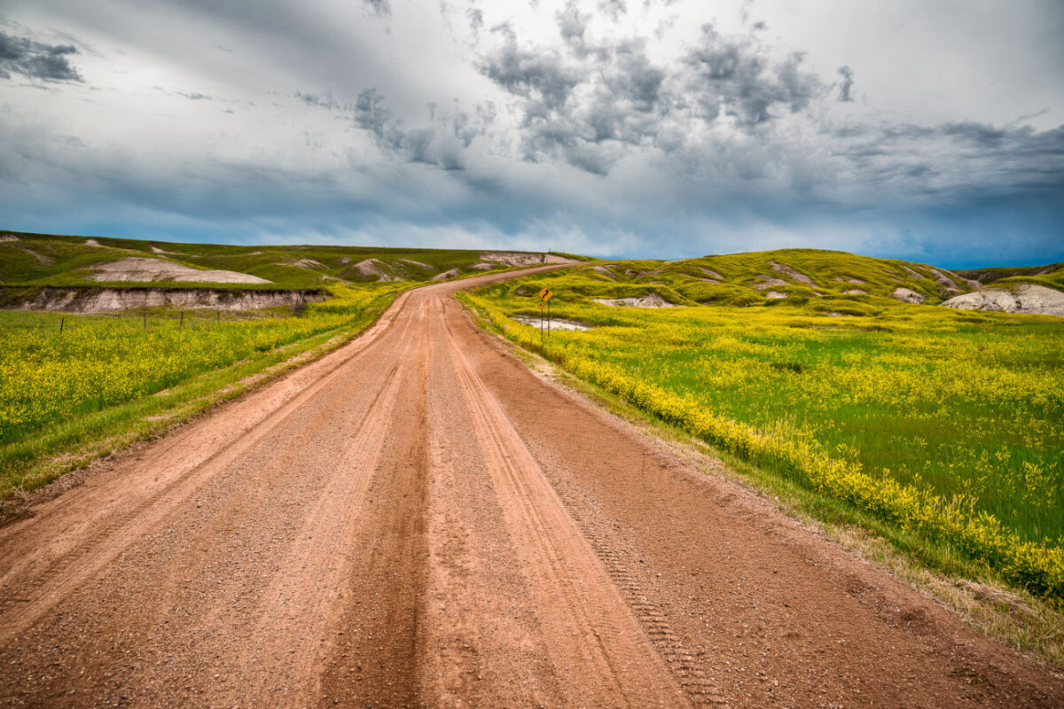
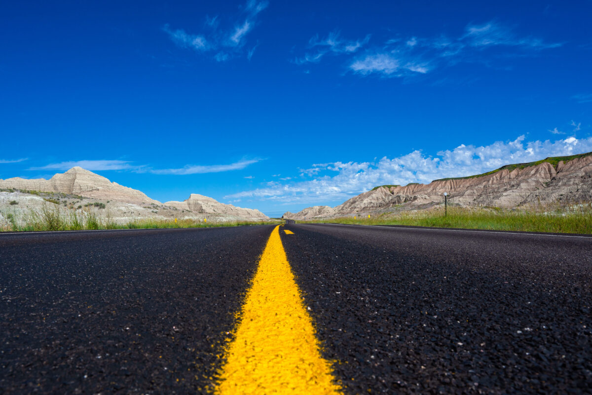
Sheep Mountain Road, Badlands National Park, South Dakota
July 2019
—
A weathered wooden sign marks the rugged entrance to Sheep Mountain in the southern reaches of Badlands National Park, South Dakota. This remote area, surrounded by the sweeping prairies of Buffalo Gap National Grassland, offers one of the park’s most dramatic and less-visited overlooks. The region sits within Oglala Lakota lands, where erosion has sculpted colorful buttes and steep ridges over millions of years. Accessible by an unpaved road, Sheep Mountain remains a quiet, untamed corner of the Badlands, revealing the deep geologic and cultural layers of the Northern Plains.
Sheep Mountain Sign, Badlands National Park, South Dakota
July 2019
—
Sheep Mountain in South Dakota near the Badlands National Park.
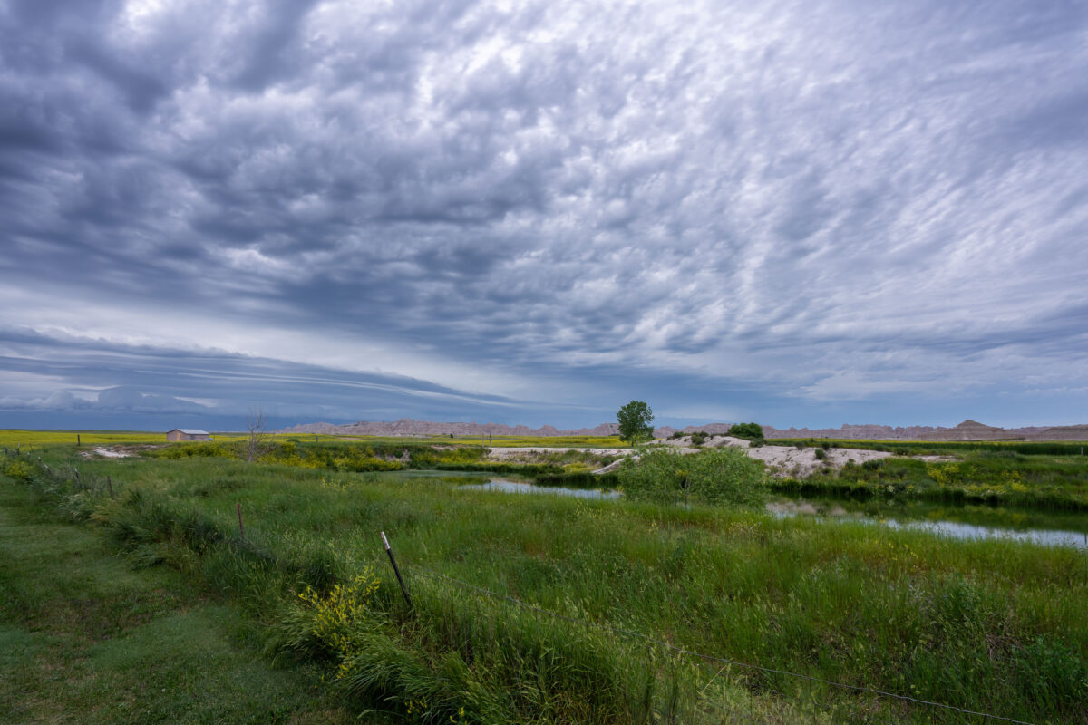
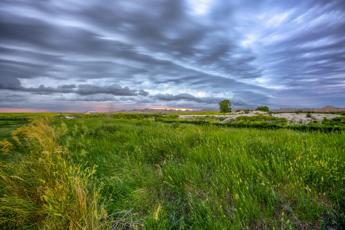
Storm Clouds Over Badlands National Park, South Dakota
July 2019
—
An approaching storm looms over the rolling grasslands near Interior, South Dakota, at the edge of Badlands National Park. The layered clouds form dramatic bands above the wetland and open prairie, where a small structure and fence line mark the human presence in this otherwise vast and untamed landscape. From this vantage point near the White River, the eroded formations of the Badlands rise faintly in the distance, emphasizing the contrast between the lush foreground and the arid, sculpted terrain beyond.
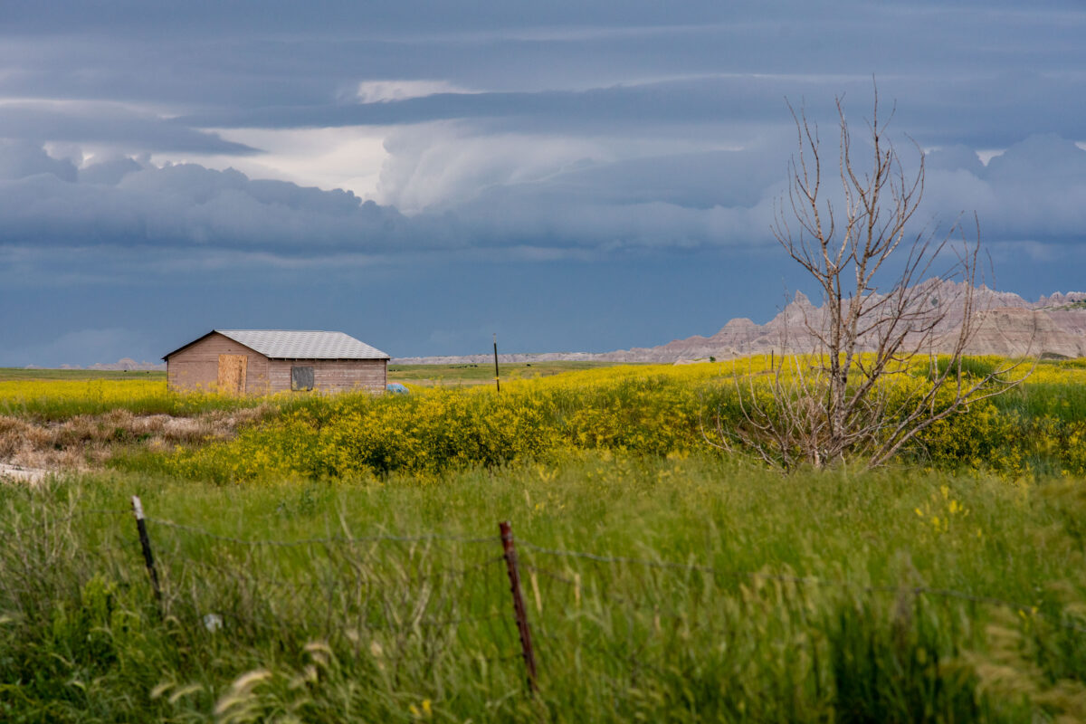
Badlands National Park: Storm Approaching Shed
July 2019
—
A lone wooden shed stands among fields of wild grasses and yellow blooms as storm clouds gather near Interior, South Dakota, on the outskirts of Badlands National Park. The layered sky hints at an incoming summer storm sweeping across the plains, with the rugged formations of the Badlands visible on the horizon. The muted colors and boarded windows evoke both isolation and endurance, capturing the tension between human settlement and the vast, unpredictable prairie environment.
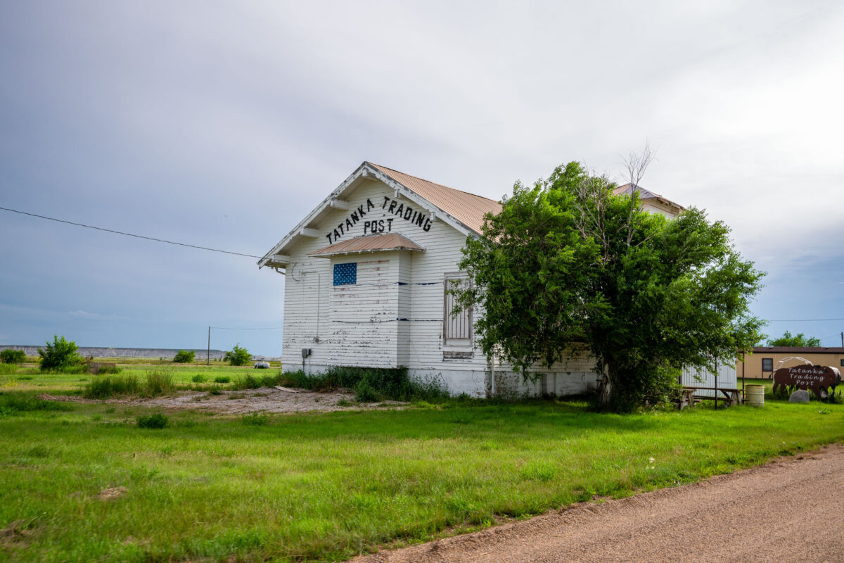
Tatanka Trading Post, Scenic, South Dakota
July 2019
—
The Tatanka Trading Post in Scenic, South Dakota, stands as a weathered relic of roadside commerce along the gateway to Badlands National Park. Once a small but lively hub for travelers and locals, the post’s peeling white paint and simple gabled design speak to decades of wind, sun, and changing times on the Great Plains. The name Tatanka—Lakota for “bison”—reflects the deep cultural ties of the region’s Indigenous heritage and the area’s rugged frontier identity. Today, the building endures as a quiet landmark of rural South Dakota’s layered history.
Indian Creek Drive, Badlands National Park, South Dakota
July 2019
—
A dirt road cuts through the rolling prairie of Indian Creek Drive in the western reaches of Badlands National Park, near the small town of Scenic, South Dakota. Storm clouds build over the mixed-grass plains, casting dramatic light on the green hills and wildflower fields typical of the park’s early summer landscape. This remote section of the Badlands, less traveled than the main loop road, reveals the quieter beauty of the park—where erosion-carved ridges and open grasslands merge under a vast and changeable sky.
Badlands National Park, South Dakota: Storm Clouds Over Grasslands
July 2019
—
Amazing storm clouds rolling into Interior, South Dakota at our camp site near the Badlands National Park. It seems every year we get at least one really great thunderstorm when camping.
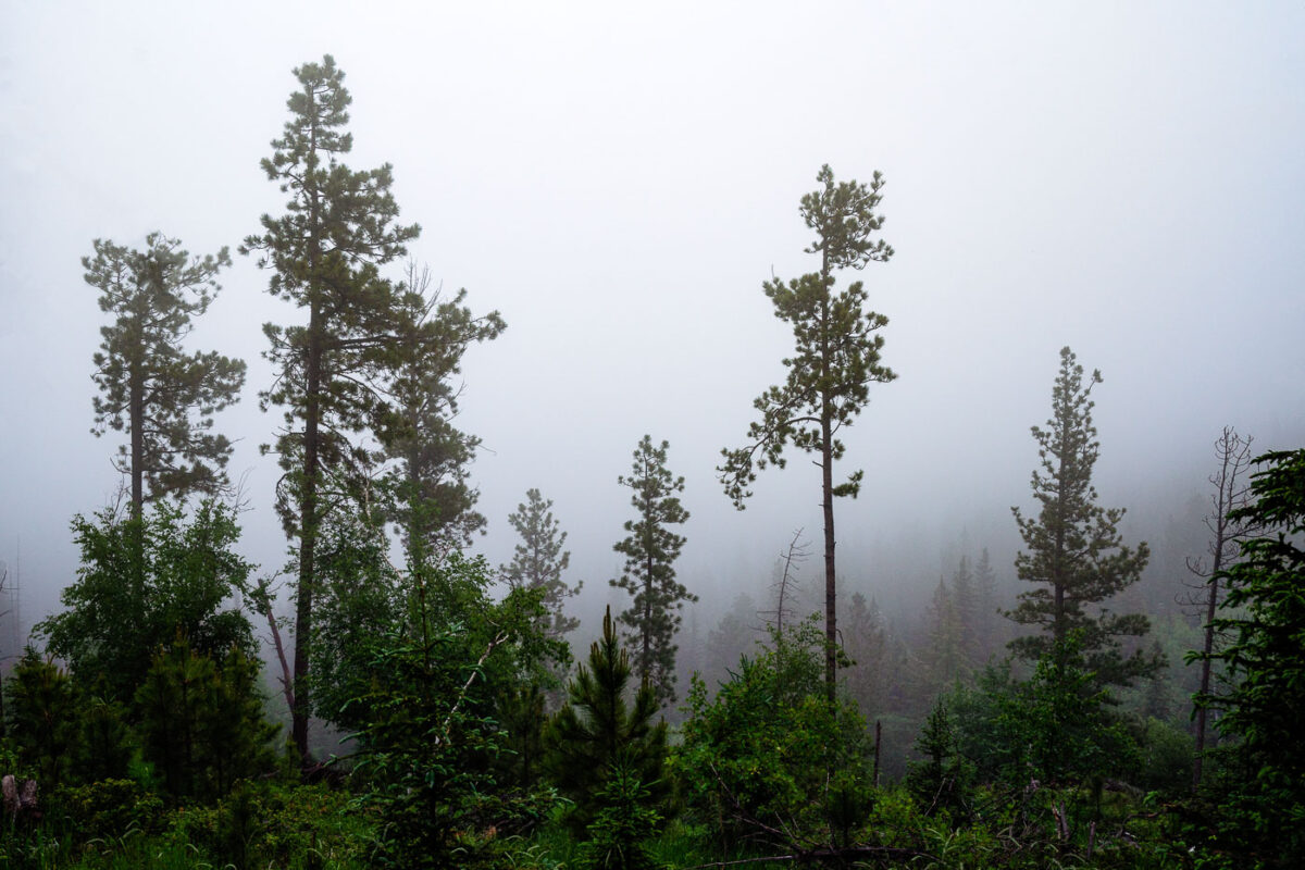
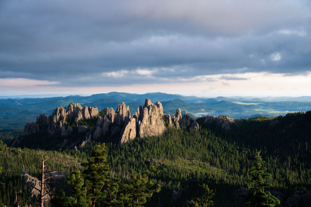
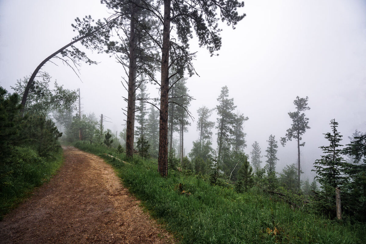
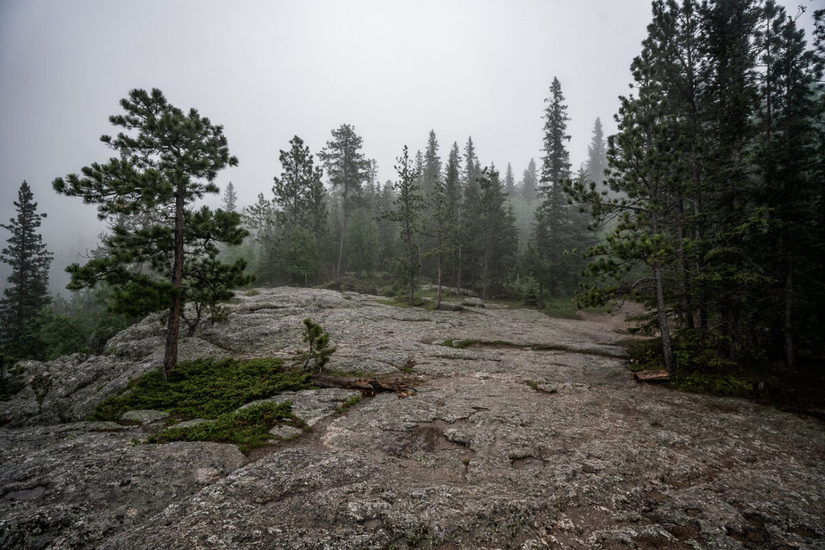
Black Elk Peak Fog, Black Hills, South Dakota
July 2019
—
A dense morning fog envelops the Ponderosa pines of the Black Hills in South Dakota, softening the outlines of the forest and muting the green tones of early summer. The moisture-laden air clings to the tall trunks, creating an atmosphere of quiet stillness and mystery. This type of fog commonly forms in the higher elevations near Custer State Park and the Needles Highway, where rapid temperature shifts cause mist to settle among the rugged hillsides and conifer stands, briefly transforming the landscape into an ethereal woodland veil.
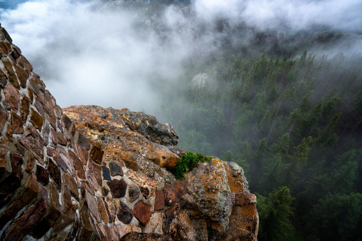
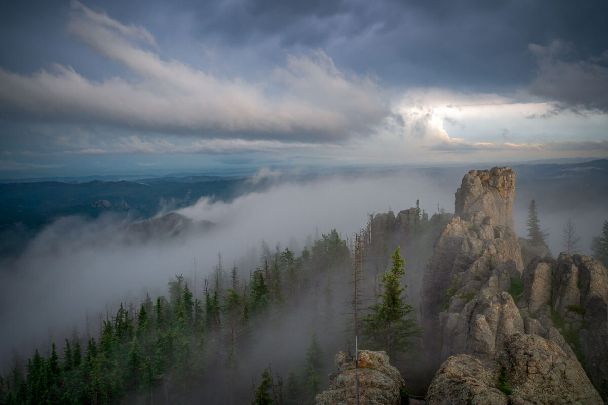
Black Elk Peak Summit Fog and Stone Tower
July 2019
—
At the summit of Black Elk Peak, low clouds roll through the granite spires and dense pine forest below, wrapping the mountain in a shifting veil of fog. The historic stone fire tower, built by the Civilian Conservation Corps in the 1930s, stands as a testament to early forest conservation in the Black Hills. From this vantage point—the highest in South Dakota—views often stretch into Wyoming and Nebraska, but on misty mornings like this one, the world feels confined to the mountaintop itself, suspended between rock and cloud.
The Needles at Sunset, Custer State Park, South Dakota
July 2019
—
Evening light breaks through heavy clouds to illuminate the Needles, a cluster of towering granite spires rising above dense pine forest in the Black Hills of South Dakota. The sharp pinnacles, part of Custer State Park’s Cathedral Spires formation, are composed of eroded granite that dates back more than a billion years, sculpted by time and weather into their distinctive vertical forms. This region, accessible by the winding Needles Highway, is both a geological marvel and a spiritual landscape—its rugged skyline long revered by the Lakota Sioux and later celebrated by photographers, climbers, and travelers drawn to the surreal beauty of South Dakota’s mountain heartland.
Highway 44 Through Badlands National Park, South Dakota
July 2019
—
A newly paved stretch of Highway 44 cuts through the rugged formations near Scenic, South Dakota, beneath a vivid summer sky. This east–west route skirts the southern boundary of Badlands National Park, where blacktop meets eroded buttes carved by millennia of wind and water. The low-angle view emphasizes the contrast between the engineered precision of the highway and the raw geologic textures of the surrounding landscape—an enduring symbol of travel through one of the Great Plains’ most striking natural corridors.
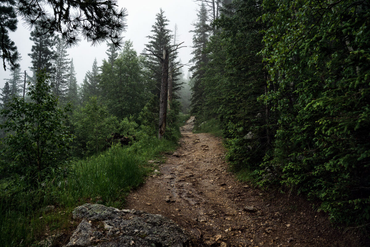
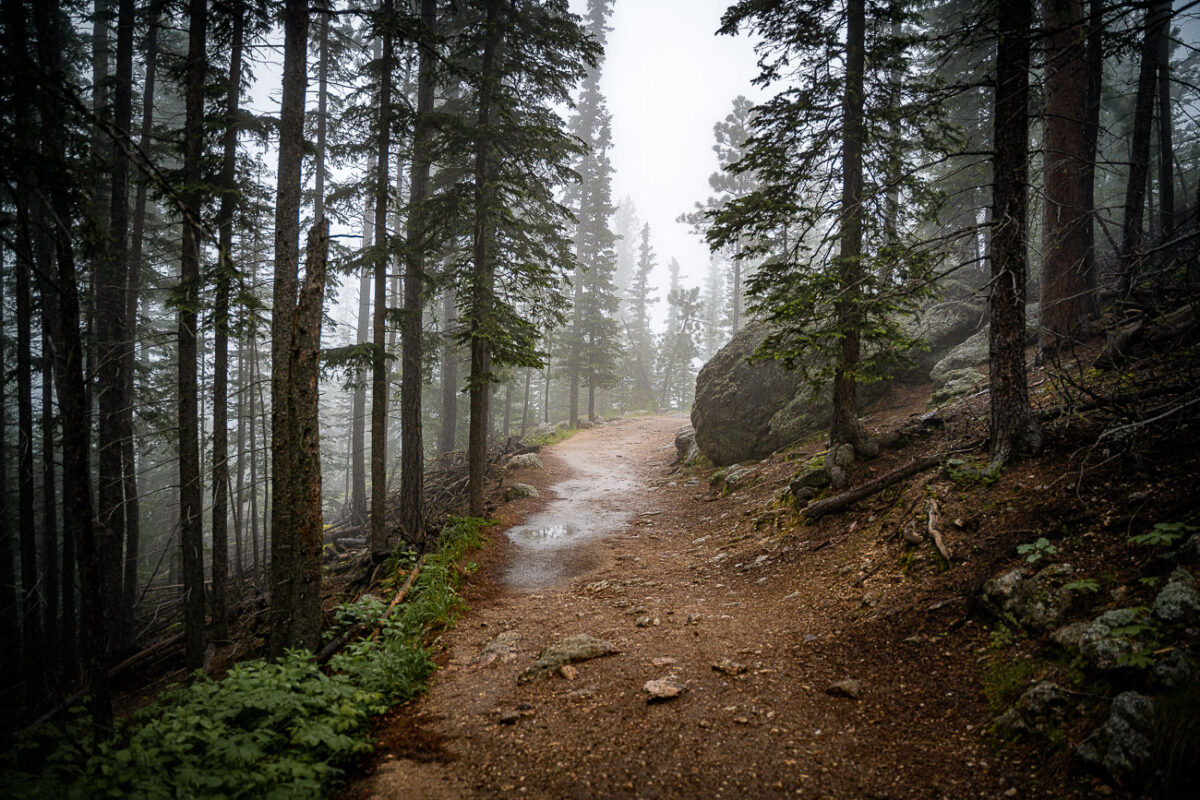
Black Elk Peak Trail in Fog, Black Hills, South Dakota
July 2019
—
A mist-laden trail winds through the ponderosa pine forest near the summit of Black Elk Peak in the Black Hills of South Dakota. The fog softens the rugged terrain, reducing the visibility of distant ridges and creating a quiet, atmospheric stillness in the morning air. This area, once known as Harney Peak, stands as the highest point east of the Rocky Mountains and is a sacred place to the Lakota Sioux, where natural beauty and cultural heritage converge in the clouds.
Black Elk Peak Trail in Fog, Black Hills, South Dakota
July 2019
—
A fog-covered hiking trail winds through the dense pines and granite slopes of Black Elk Peak in South Dakota’s Black Hills. The path, slick with rain and scattered with stones, climbs steadily toward the summit through ponderosa pine, birch, and spruce. This mountain—sacred to the Lakota and once called Harney Peak—rises to 7,244 feet, making it the highest natural point between the Rockies and the Pyrenees. In the early morning fog, the quiet forest and damp earth lend the trail a timeless stillness, recalling centuries of spiritual and geological history beneath the mist.
Black Elk Peak Summit in Fog, Black Hills, South Dakota
July 2019
—
A dense fog envelops the granite summit area of Black Elk Peak, the highest natural point in South Dakota at 7,242 feet. The rocky terrain and scattered pines of the Black Hills fade into the mist, creating an ethereal atmosphere above Custer State Park. Once known as Harney Peak, the mountain holds deep spiritual significance for the Lakota Sioux and remains a striking natural landmark where weather and history intertwine in quiet solitude.
Black Elk Peak Trail in Fog, South Dakota
July 2019
—
A narrow trail winds through the fog-drenched forest of Black Elk Peak, South Dakota, as light rain dampens the granite path and pine needles. The area—part of the rugged Black Hills—sits at over 7,200 feet, the highest elevation east of the Rockies. The mist settles among ponderosa pines and spruce, creating a hushed, atmospheric climb through terrain sacred to the Lakota people and known for its sweeping, often cloud-hidden views.
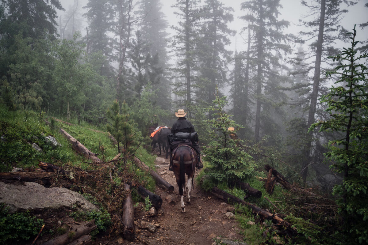
Horseback riders on Black Elk Peak trail, South Dakota
July 2019
—
Horseback riders navigate a mist-covered trail near the summit of Black Elk Peak in South Dakota’s Black Hills. The fog clings to the ponderosa pines, softening the rugged landscape that rises above Custer State Park. This peak—renamed in 2016 to honor Lakota spiritual leader Black Elk—has long served as both a place of pilgrimage and a vantage point over the vast granite formations and pine forests of the region.
Cathedral Spires, Black Hills, South Dakota, Morning Fog
July 2019
—
Low clouds sweep across the granite pinnacles of the Cathedral Spires in the Black Hills of South Dakota, wrapping the rugged landscape in drifting fog just after dawn. These towering formations—some rising more than 5,000 feet above sea level—are part of the Needles range within Custer State Park, a region shaped by millions of years of erosion and uplift. The rock spires, composed primarily of Harney Peak granite, are a hallmark of the park’s dramatic geology and a favorite destination for climbers and photographers. On mornings like this, the fog often settles in the valleys below, creating a fleeting illusion of islands floating above the forest, while the peaks catch the first light breaking through the storm-heavy sky.
Black Elk Peak Trail Descent at Dusk, Black Hills, South Dakota
July 2019
—
A hiker descends the rugged granite path from Black Elk Peak, the highest summit in South Dakota, as the evening light softens over the Cathedral Spires. The trail—part of the Norbeck Wildlife Preserve within Custer State Park—winds through a landscape shaped by ancient uplift and erosion, where ponderosa pines cling to stone outcrops and fire-scarred trunks bear witness to the region’s cycles of renewal. From this vantage point, the Black Hills stretch endlessly toward the horizon, a place sacred to the Lakota people and enduringly wild in its beauty.
Abandoned Gold Rush Mine Entrance, Black Hills, SD
July 2019
—
Carved into a rugged slope of weathered schist and limestone, this small mine entrance sits near the historic mining corridors west of Custer, South Dakota — a remnant of the Black Hills’ 19th-century gold rush. The opening, likely hand-dug or expanded with early blasting techniques, leads into mineral-rich rock layers once prospected for gold, silver, and iron sulfides that fueled the regional boom of the 1870s. Surrounding the portal are piles of tailings and fractured quartz veins that reveal the area’s geologic complexity — part of an ancient mountain uplift more than 1.8 billion years old. Today, the forest has begun to reclaim the site, with pines and brush growing over the spoil heaps, blending traces of human industry back into the Black Hills landscape.
Abandoned Mine Entrance, Black Hills, South Dakota
July 2019
—
An abandoned mine in South Dakota near the Black Hills.
Granite Outcrops Along Highway 87, Black Hills National Forest
July 2019
—
Along Highway 87 in the central Black Hills National Forest, this view captures the rugged landscape typical of the region’s granite highlands. Massive weathered outcrops rise sharply from the forest floor, remnants of the ancient Harney Peak granite formation that underlies much of this terrain. Scattered ponderosa pines cling to crevices in the rock, while fallen trunks and new saplings trace the slow recovery of the forest from past fires. The setting lies near the scenic Needles Highway corridor—an area known for its narrow tunnels, steep grades, and ever-changing mountain light that defines the wilderness character of western South Dakota.
Sylvan Lake, Custer State Park, South Dakota
July 2019
—
Sylvan Lake is a lake located in Custer State Park, in the Black Hills of South Dakota, United States. It was created in 1881 when Theodore Reder built a dam (the Sylvan Lake Water Dam) across Sunday Gulch Creek. The lake area offers picnic places, rock climbing, small rental boats, swimming, and hiking trails. It is also popular as a starting point for excursions to Black Elk Peak and The Needles. -- Wikipedia
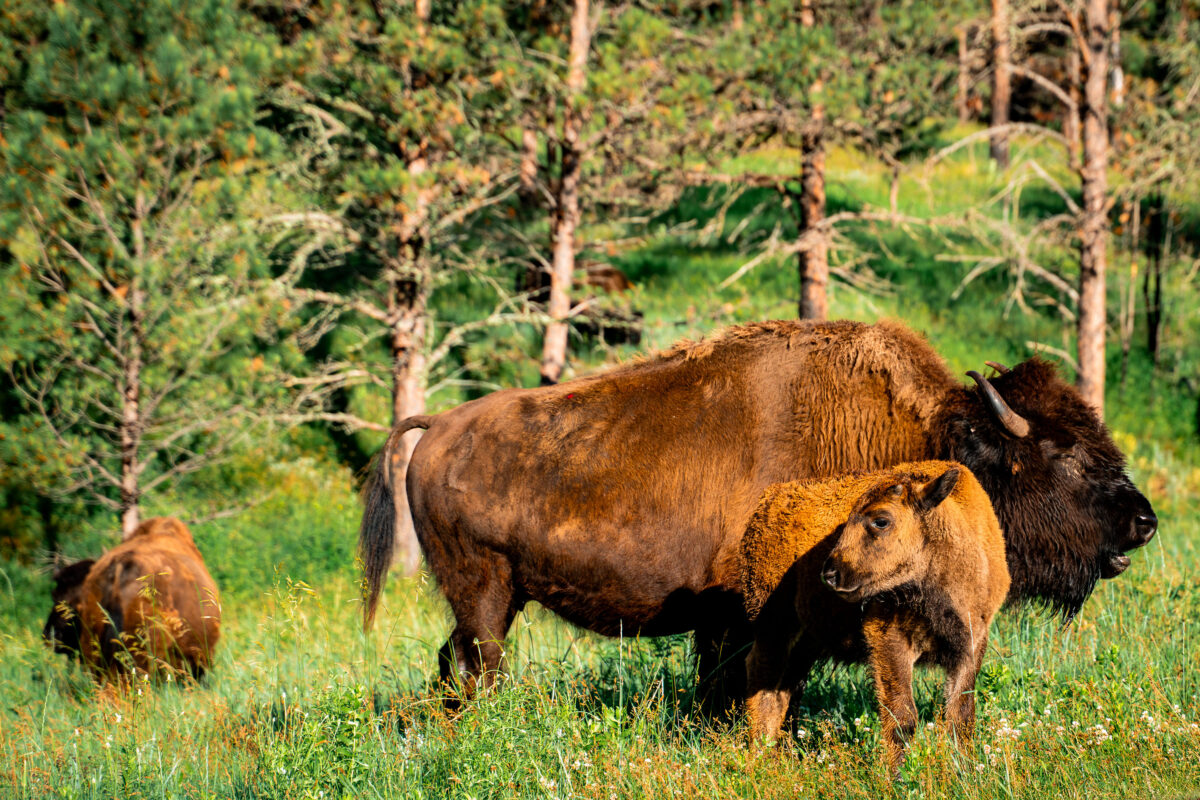
Bison Cow and Calf in Custer State Park, South Dakota
July 2019
—
A bison cow stands watch over her calf in the rolling meadows of Custer State Park, South Dakota. Each spring, the park’s herd welcomes hundreds of reddish-brown calves, often called “red dogs,” whose lighter coats gradually darken as they mature. The park maintains roughly 1,300 animals within its 71,000-acre reserve, a landscape of prairie and ponderosa pine forest that mirrors the natural habitat once spanning the Great Plains. This scene reflects both the resilience of the American bison and the conservation success that brought the species back from near extinction in the early 20th century.
Bison Herd in Custer State Park, South Dakota
July 2019
—
Bison in Custer State Park in Custer, South Dakota.
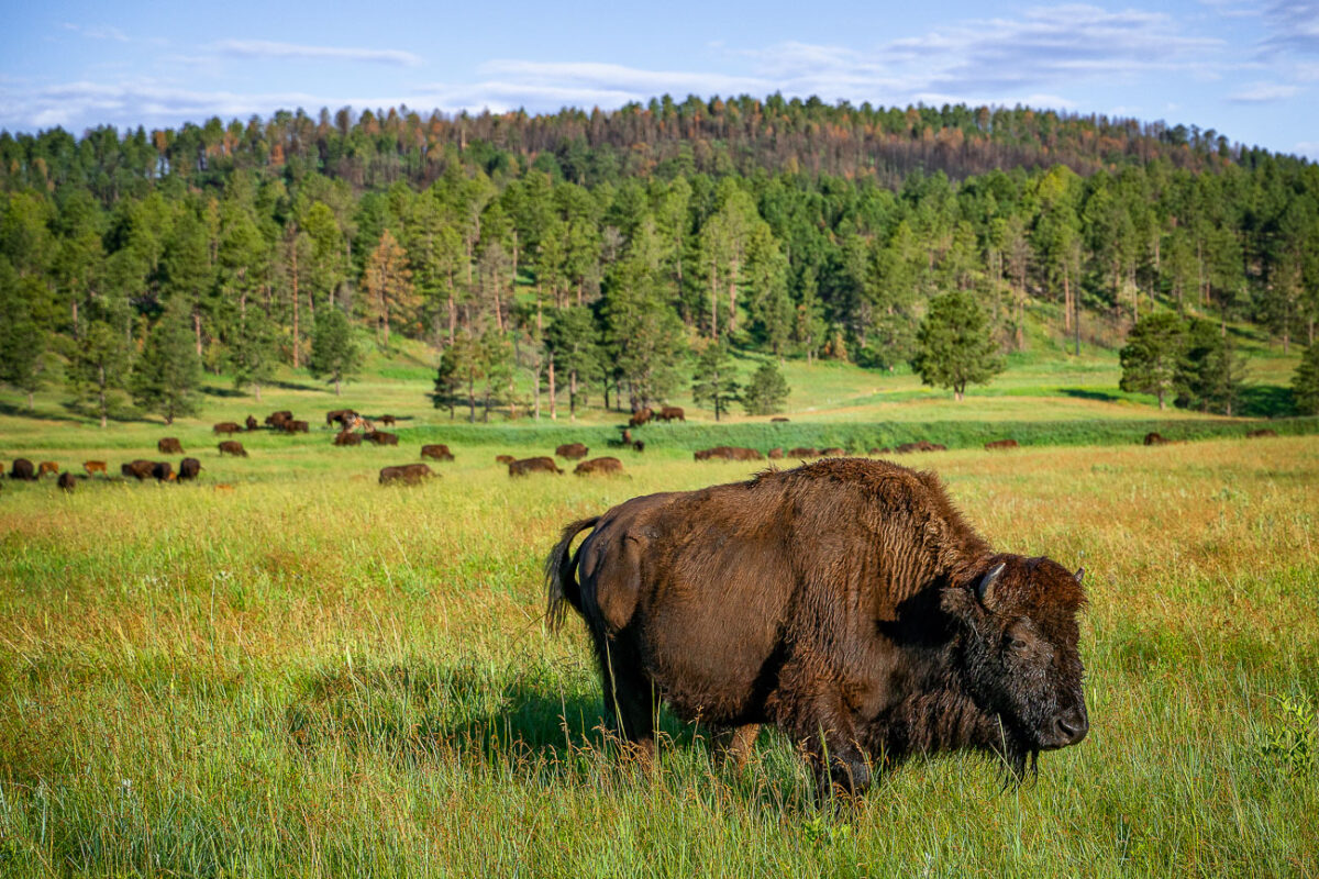
American Bison in Custer State Park, South Dakota
July 2019
—
A mature American bison grazes in the rolling prairie of Custer State Park in South Dakota, part of one of the largest publicly owned herds in the United States. Once on the brink of extinction, the park’s bison herd—established in 1914—now numbers more than a thousand animals, representing a critical effort in the preservation of the species. These massive mammals, capable of weighing over a ton, roam freely across the park’s 71,000 acres of mixed-grass prairie and ponderosa pine forest. The setting reflects both the ecological restoration of the Great Plains and the enduring legacy of America’s native megafauna, which has been tied to the land for millennia.
Bison on Wildlife Loop Road, Custer State Park
July 2019
—
An American bison stands along the Wildlife Loop Road in Custer State Park, South Dakota, illuminated by the first light of morning. The park’s herd, one of the largest managed populations in the country, roams freely across a landscape that mirrors the open grasslands once dominated by millions of these animals before the 19th-century decline. Bison are a keystone species of the Great Plains ecosystem, their grazing patterns shaping the prairie’s biodiversity. At Custer, annual roundups and controlled management preserve both the health of the land and the continuation of a lineage deeply tied to Native history and American conservation.
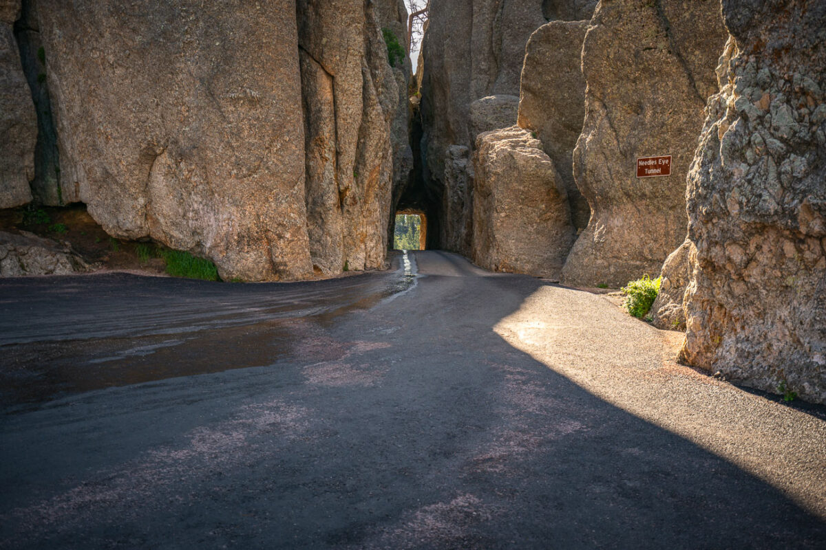
Needles Eye Tunnel, Needles Highway, Custer State Park, South Dakota
July 2019
—
The Needles of the Black Hills of South Dakota are a region of eroded granite pillars, towers, and spires within Custer State Park. Popular with rock climbers and tourists alike, the Needles are accessed from the Needles Highway, which is a part of Sylvan Lake Road (SD 87/89). The Cathedral Spires and Limber Pine Natural Area, a 637-acre portion of the Needles containing six ridges of pillars as well as a disjunct stand of limber pine, was designated a National Natural Landmark in 1976. -- Wikipedia
Needles Eye Tunnel, Custer State Park, South Dakota
July 2019
—
Carved directly through a narrow granite spire in the Black Hills, the Needles Eye Tunnel stands as one of South Dakota’s most distinctive engineering feats. Completed in 1922 as part of the Needles Highway (SD 87), the one-lane tunnel measures just 8 feet 4 inches wide and 11 feet 3 inches high, requiring careful navigation by passing vehicles. Its name comes from the adjacent rock formation, where centuries of wind and water erosion sculpted a sharp, needle-like opening. Surrounded by dense ponderosa pine forest and sheer stone walls, this section of the highway offers one of the most dramatic mountain drives in the American Midwest, linking the spire formations of Custer State Park with the scenic byways leading toward Sylvan Lake and Mount Rushmore.
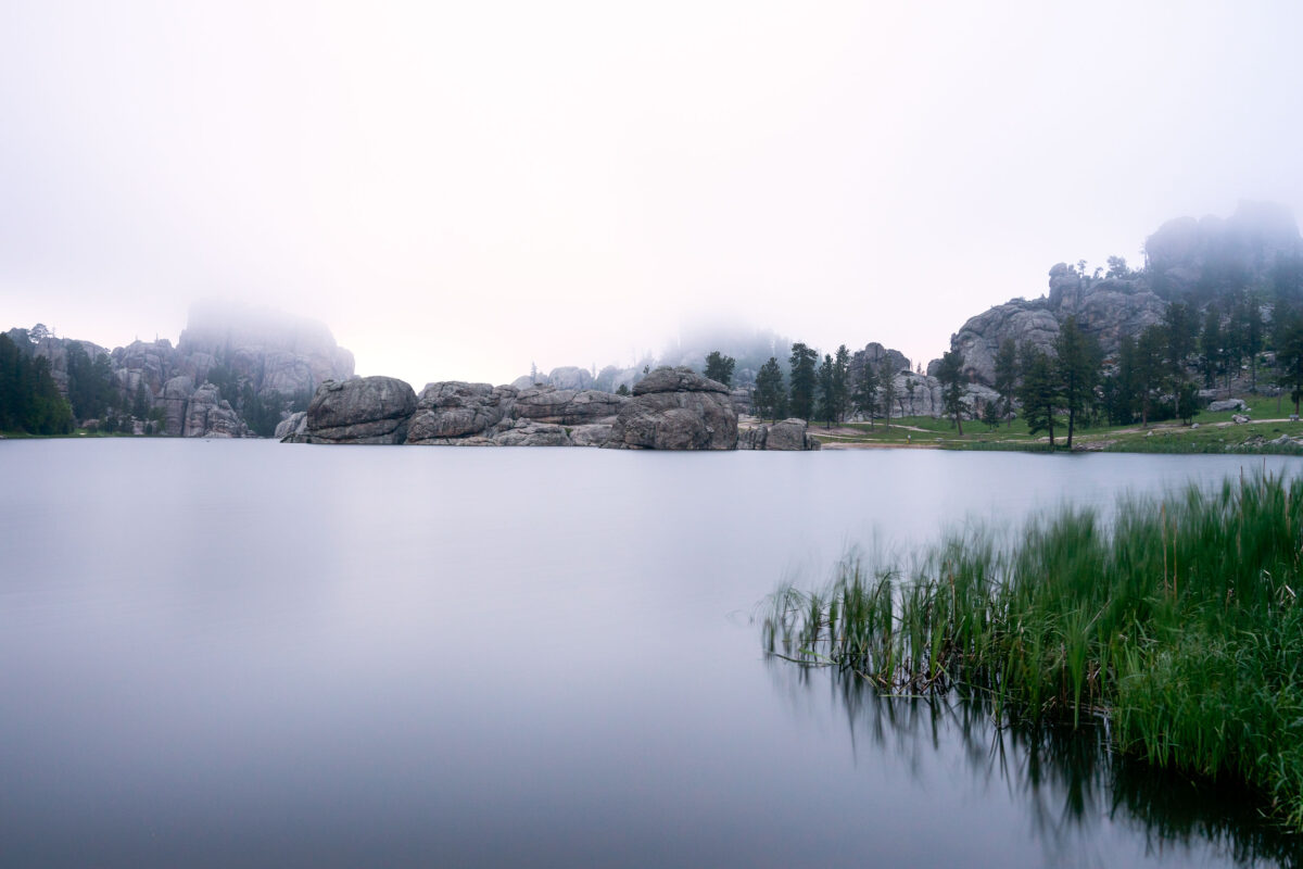
Sylvan Lake Fog, Black Hills, South Dakota
July 2019
—
Early morning fog drifts across Sylvan Lake in the Black Hills of South Dakota, softening the granite spires and reflecting still light off the water’s surface. Created in 1891 by Theodore Reder’s dam, the lake sits at the head of the scenic Needles Highway and is surrounded by granite formations that attract climbers, photographers, and hikers. On this mist-covered morning, visibility narrows to the immediate shoreline, turning the familiar outcrops into shadowed silhouettes. The calm water and diffused light capture a rare quiet moment in one of Custer State Park’s most iconic and photographed landscapes.
Minneapolis Skyline and Bde Maka Ska Lake Aerial View
July 2019
—
Lake of the Isles and Bde Maka Ska in Minneapolis.
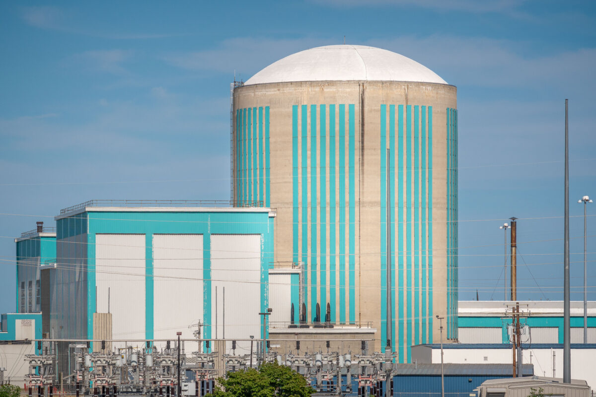
Kewaunee Nuclear Power Plant on Lake Michigan
July 2019
—
The Kewaunee Power Station is a decommissioned nuclear power plant, located on a 900 acres (360 ha) plot in the town of Carlton, Wisconsin, 27 miles (43 km) southeast of Green Bay, Wisconsin in Kewaunee County, and south of the city of Kewaunee.
KPS was the fourth nuclear power plant built in Wisconsin, and the 44th built in the United States. Due to falling electricity prices resulting from the falling price of natural gas, the plant ceased operation May 7, 2013.
Kewaunee Power Station on Lake Michigan, Wisconsin
July 2019
—
Lake Michigan in Kewaunee, Wisconsin outside the Kewaunee Power Station nuclear power plant.
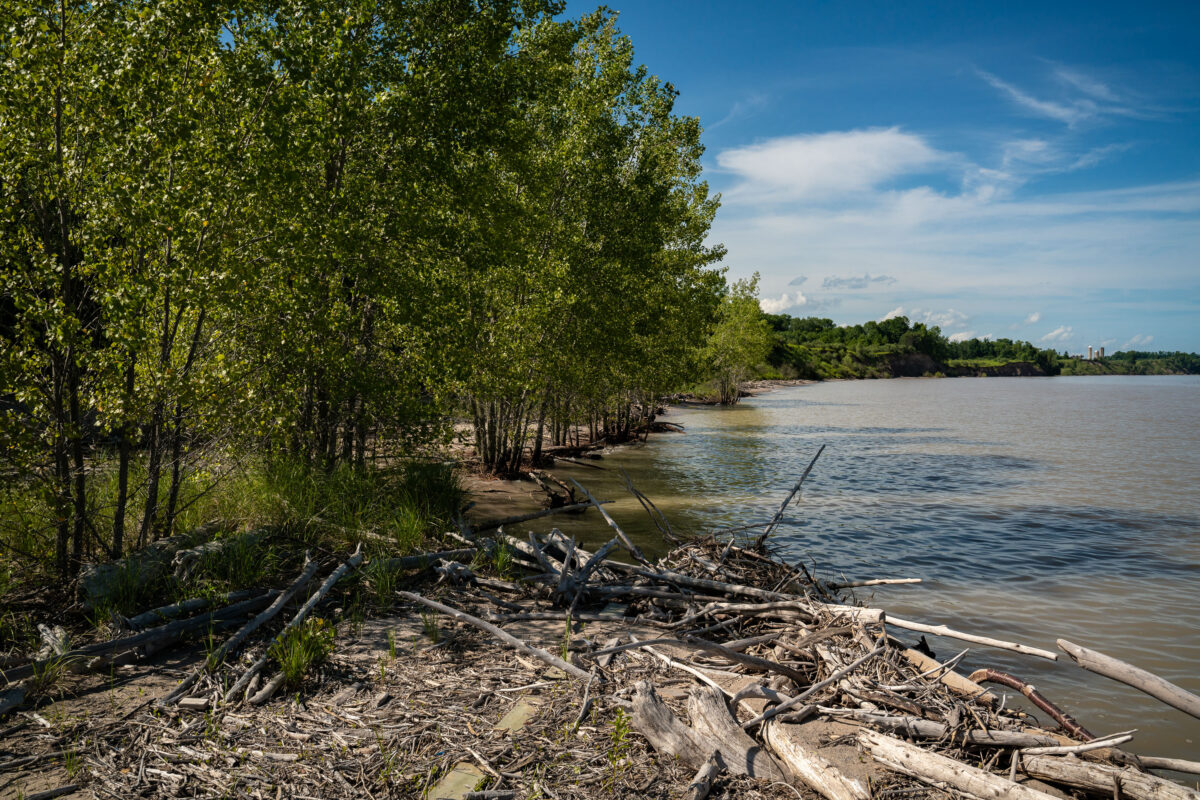
Kewaunee Shoreline with Driftwood and Nuclear Plant
July 2019
—
Wood floats up onto the shore in Kewaunee near the Nuclear Power Plant.
Kewaunee Nuclear Power Plant Cooling Tower, Wisconsin
July 2019
—
Located in Kewaunee, Wiscomnsin, the plant is in the middle of a 50 year decomissioning process.
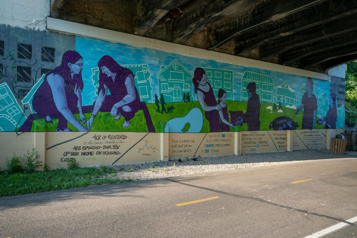
Cori Nakamura Lin & Tori Hong Mural on Midtown Greenway, Minneapolis
July 2019
—
Mural by Cori Nakamura Lin, and Tori Hong on the Midtown Greenway in South Minneapolis.
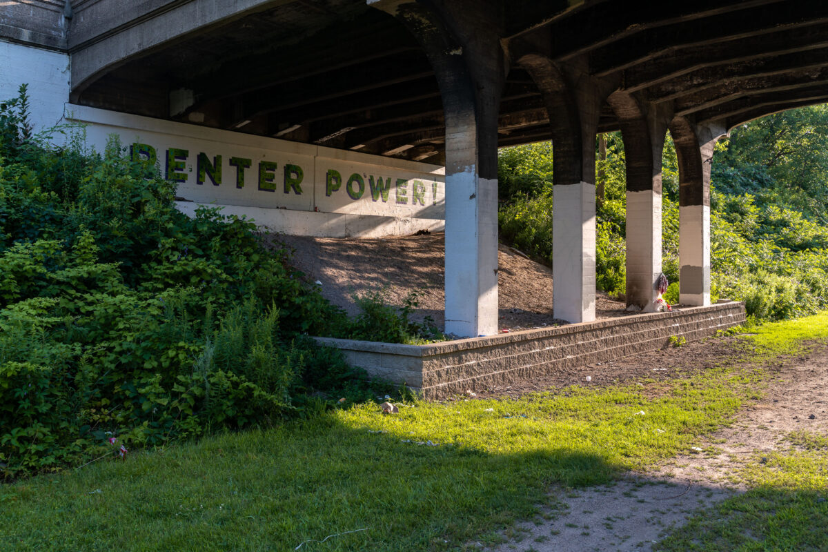
Renter Power! Mural on Midtown Greenway, Minneapolis
July 2019
—
Renter Power! Seen on the Midtown Greenway in Minneapolis, MN
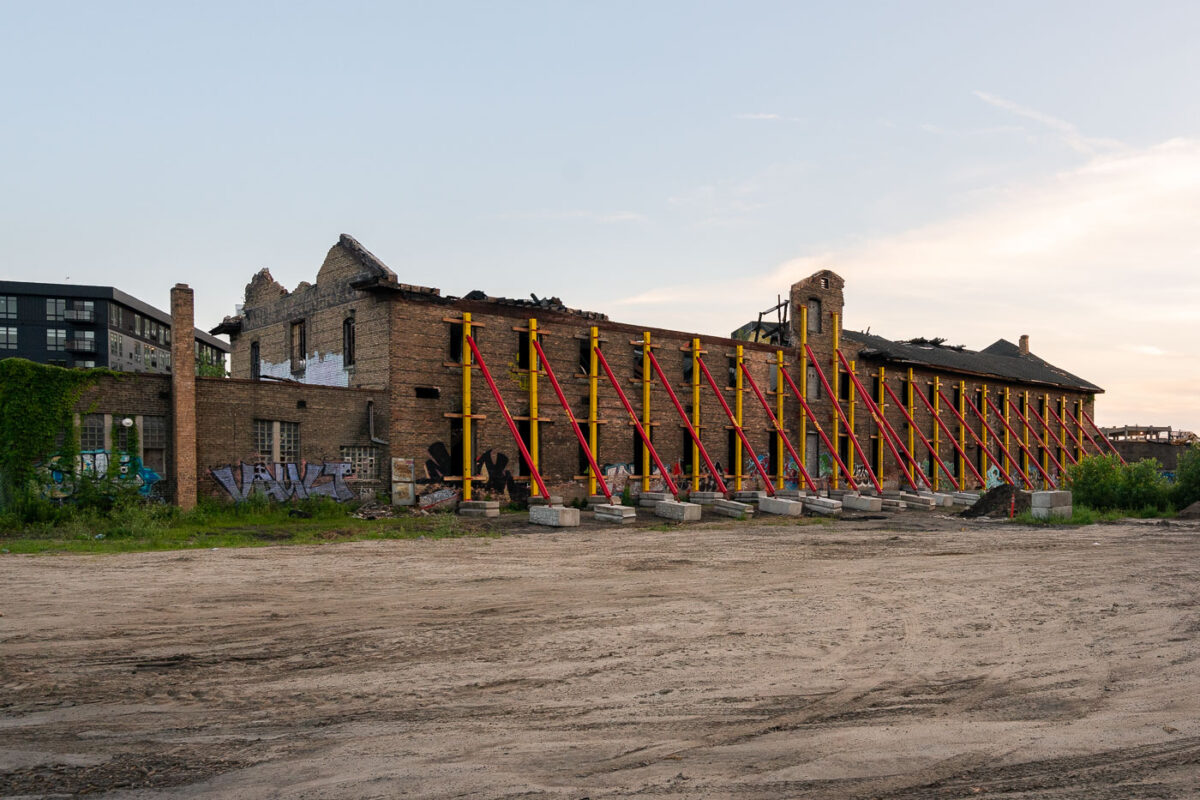
Harris Machinery Building Undergoing Redevelopment in Minneapolis
July 2019
—
Formerly the Harris Machinery building has since been renovated into The Market at Malcolm Yards.
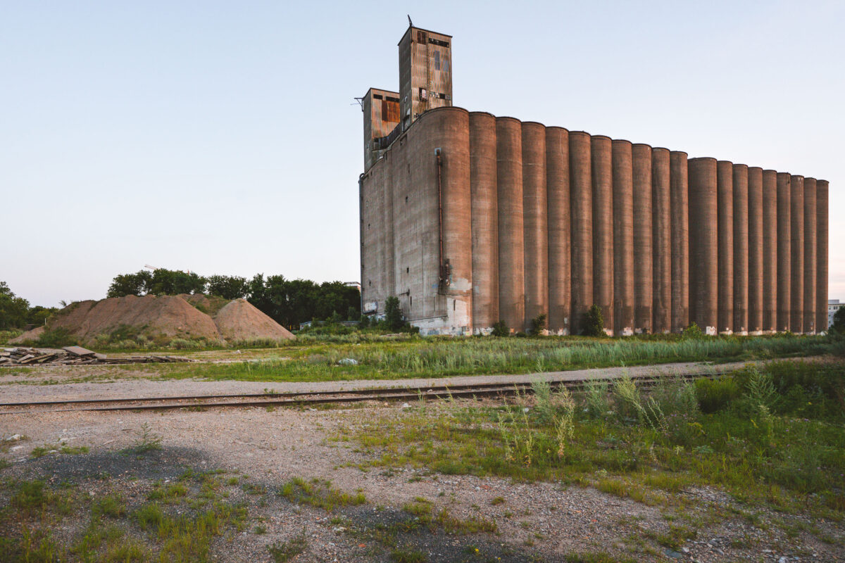
Archer Daniels-Midland Delmar Elevator No 7
July 2019
—
The long abandoned massive concrete Archer-Daniels-Midland Delmar Elevator No. 7 in Minneapolis.
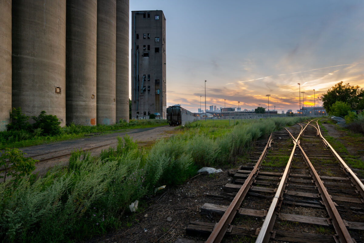
Tracks at Archer Daniels Midland Elevator
July 2019
—
Train tracks outside the long abandoned massive concrete Archer-Daniels-Midland Delmar Elevator No. 7 in Minneapolis.
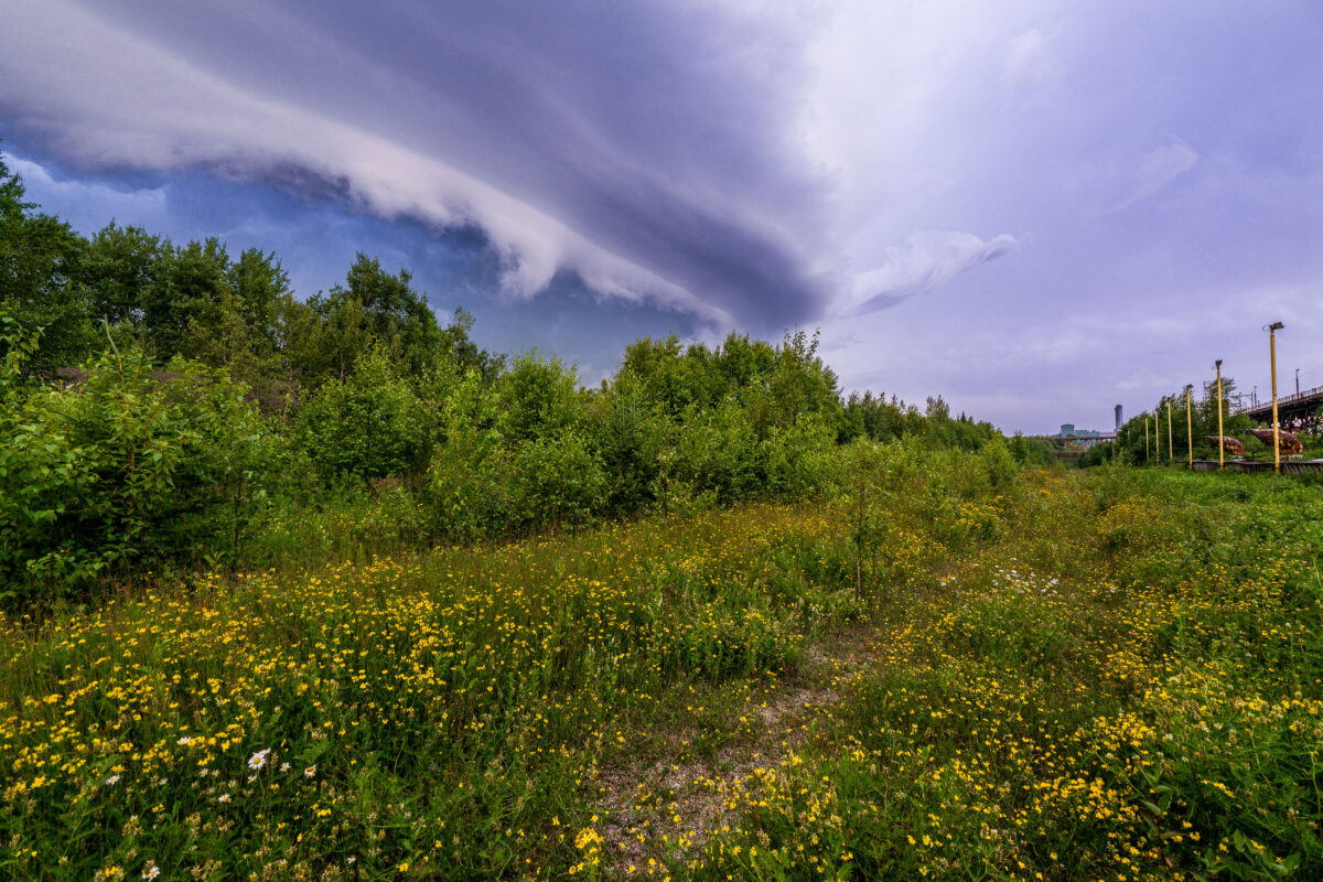
Wild clouds in Taconite Harbor Minnesota
July 2019
—
Storm clouds rolling into Taconite Harbor and Lake Superior. The storm didn't last long but provided some incredible clouds.
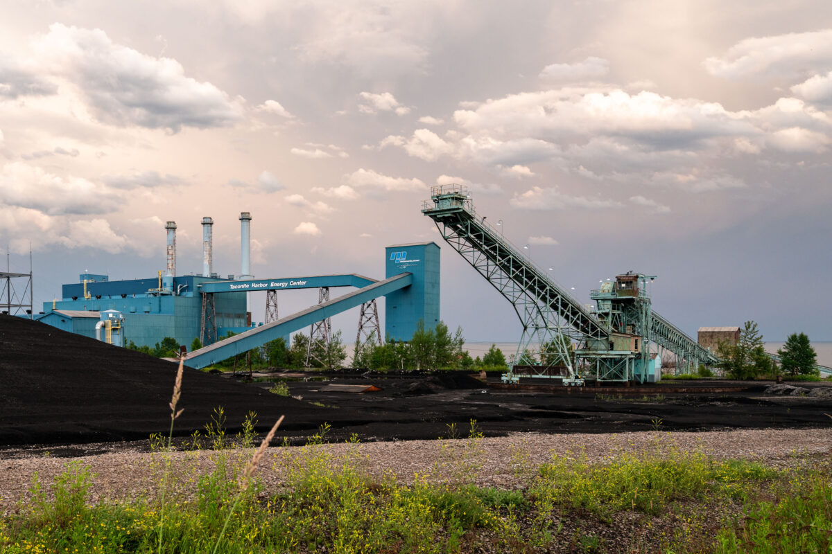
Taconite Harbor Energy Center in Schroeder MN
July 2019
—
Taconite Harbor Energy Center in Schroeder, Minnesota
Cramer Tunnel in Minnesota
July 2019
—
Cramer Tunnel in Cramer Minnesota. The tunnel operated from 1957 to 2001. The tunnel connect the LTV Steel taconite plant in Hoyt Lakes to the ore dock at Taconite Harbor.
Knife Falls Dam in Cloquet MN
July 2019
—
The Knife Falls Dam in Cloquet, MN. The hydro plant produces an output of 2.4-megawatts.
Former Brothel in Downtown Minneapolis
July 2019
—
Built circa 1889, this building in Downtown Minneapolis on 11th Avenue used to operate as a brothel per historical records.
Cute Cavalier King Charles Spaniel
August 2019
—
Cavalier King Charles Spaniel laying on a couch.
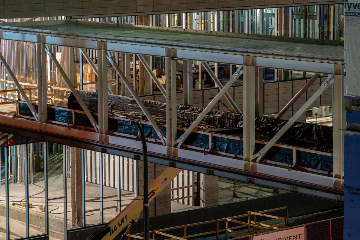
Minneapolis Skyway Construction 2019
August 2019
—
Skyway under construction in downtown Minneapolis.
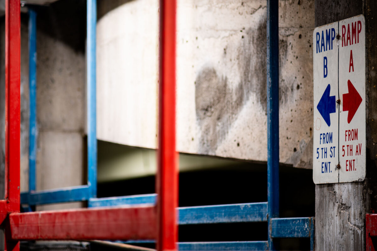
Ramp B and Ramp A sign in Minneapolis
August 2019
—
Signs in a Minneapolis parking ramp.
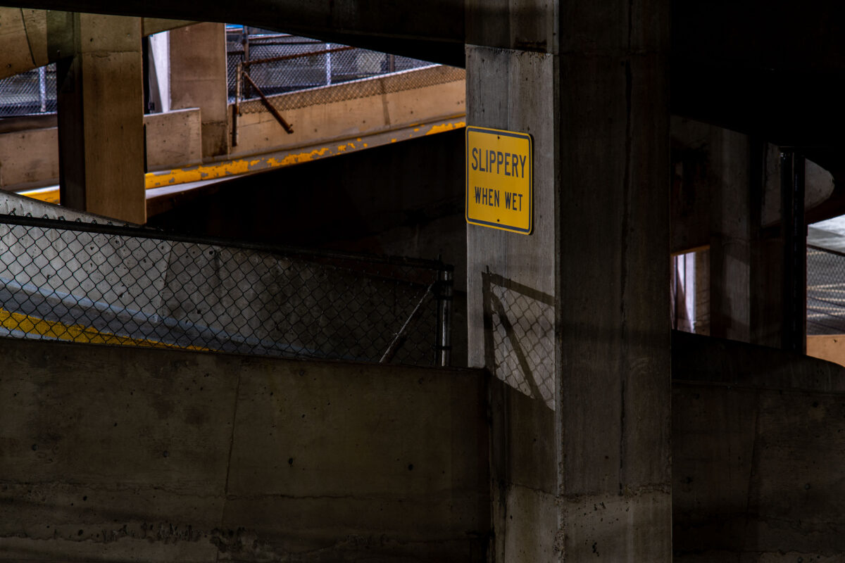
Slippery When Wet sign in Parking Ramp
August 2019
—
A "Slippery When Wet" sign in a downtown Minneapolis parking garage.
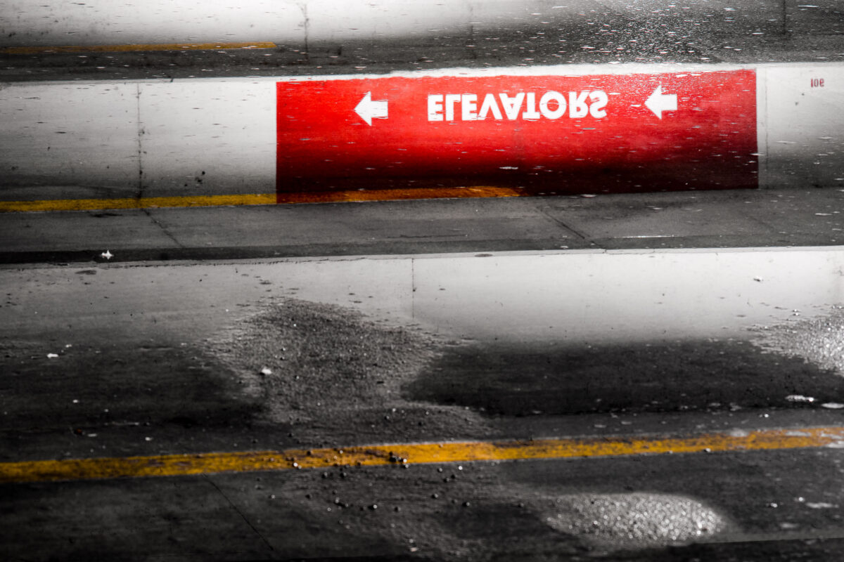
Elevators sign reflection
August 2019
—
Reflection in a Minneapolis parking garage.
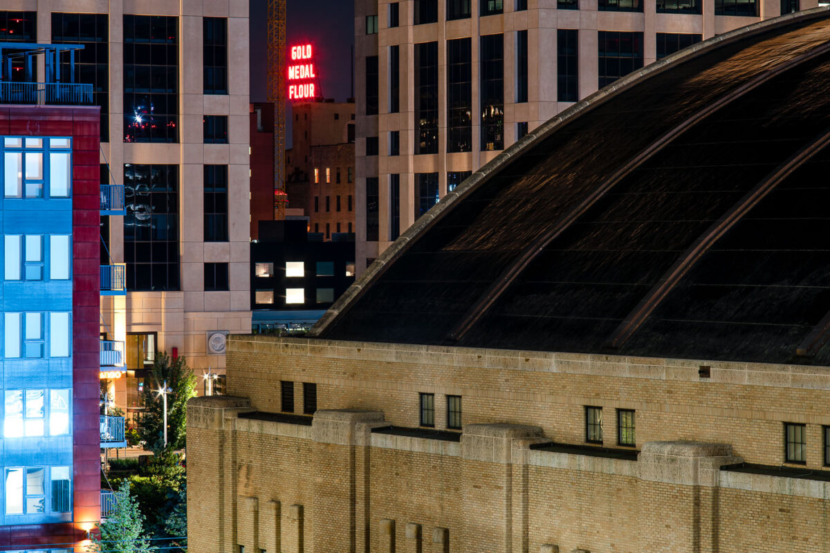
The Armory and Gold Medal Flour sign in Downtown Minneapolis
August 2019
—
Gold Medal Flour sign seen from Downtown East.
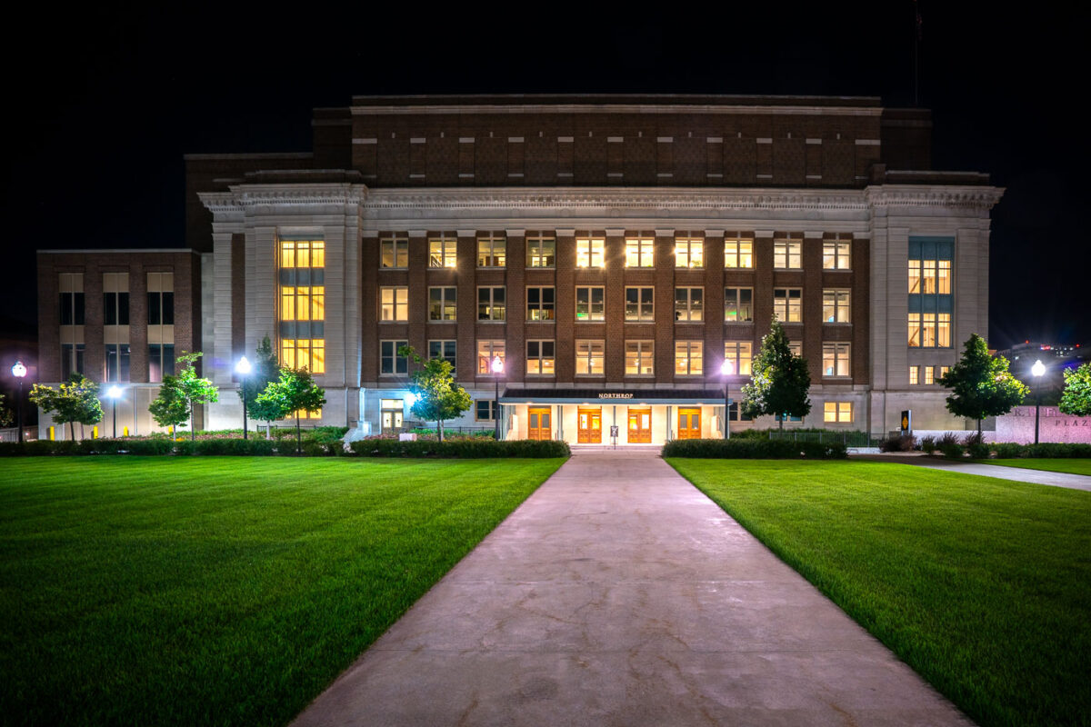
Cyrus Northrop Memorial Auditorium, Minneapolis, MN
August 2019
—
Located on the University of Minnesota campus at 84 Church Street SE, the Cyrus Northrop Memorial Auditorium is a performing arts venue. It is named after the Universities second president.
Ameriprise Financial Center Building
August 2019
—
498 foot high rise at 707 2nd Avenue South, Minneapolis, MN
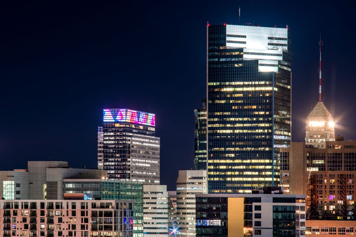
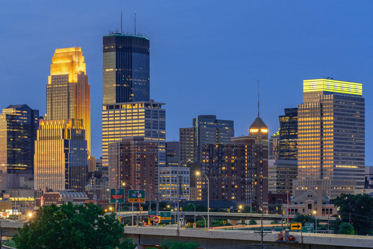
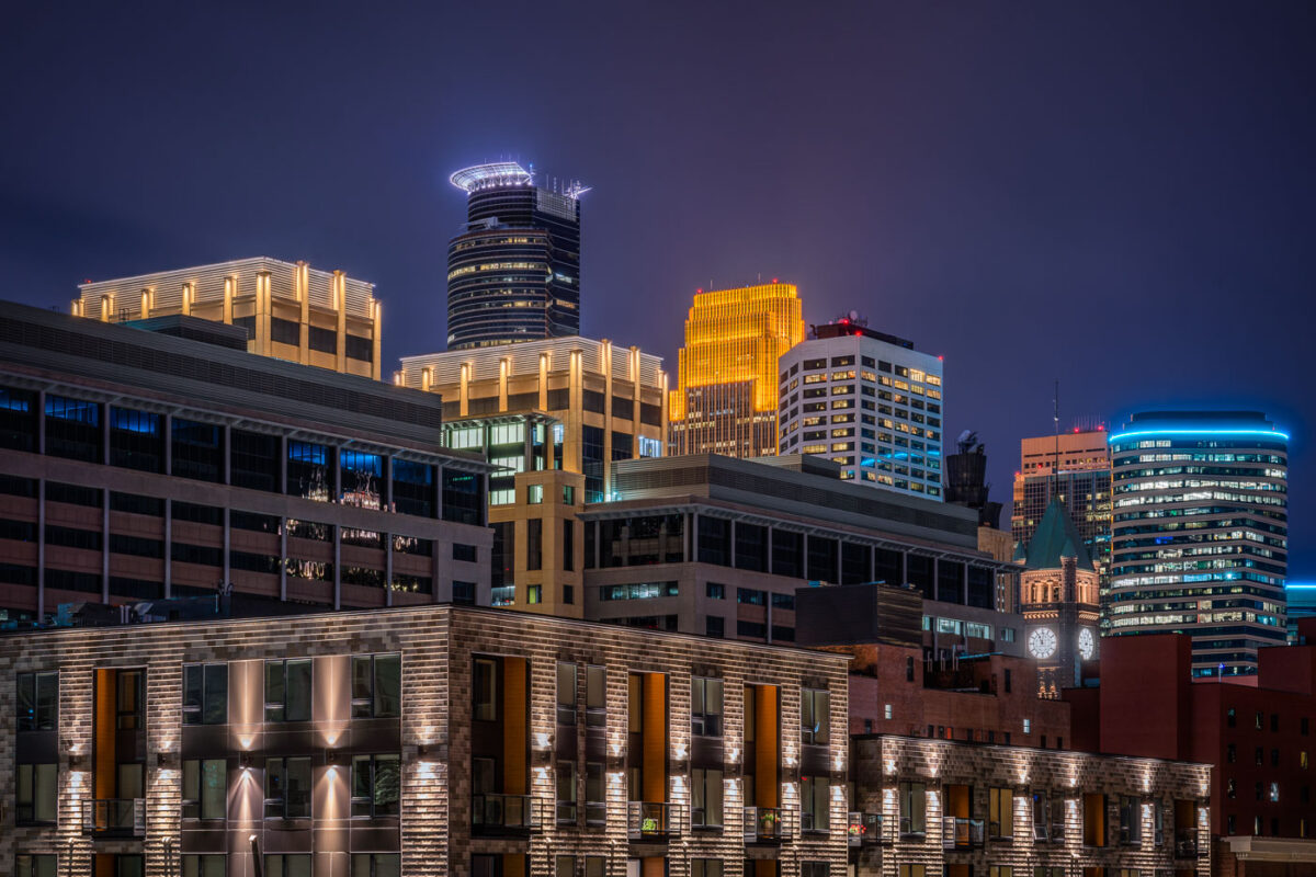
Minneapolis Skyline Viewed At Night From Downtown East
August 2019
—
A night view of downtown Minneapolis glows with vibrant hues from its illuminated skyline. The IDS Center and Wells Fargo Tower stand prominently among the city’s modern high-rises, their lights reflecting the urban energy below. New residential buildings in the foreground contrast with the historic clock tower in the distance, highlighting the city’s mix of old and new architecture.
Sweet Martha Cookie Jar at State Fair
August 2019
—
A brightly painted cookie shop features bold signage advertising chocolate chip cookies, ice cold milk, and hot coffee. The storefront, with its yellow siding, red-and-white awnings, and whimsical design, captures the festive atmosphere typical of fairgrounds and boardwalk-style concessions.
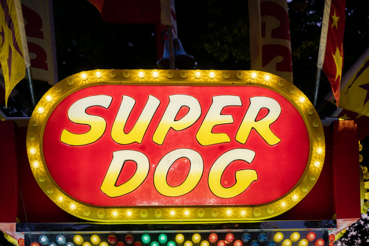
Super Dog State Fair Vendor Sign
August 2019
—
A brightly lit “Super Dog” food stand sign glows with yellow bulbs at a carnival or fairground. Surrounded by flags and festive colors, the concession stand evokes the classic atmosphere of American fairs where hot dogs and snacks are a staple of the midway.
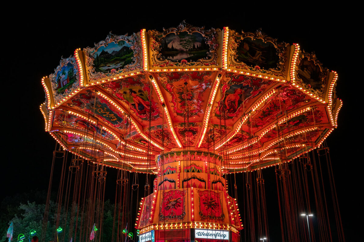
Amusement Park Swings
August 2019
—
Brightly lit with rows of orange and yellow bulbs, a vintage-style swing carousel glows against the night sky at a fairground. The ornate ride features hand-painted panels depicting alpine landscapes and traditional figures, creating a striking contrast between old-world artistry and modern amusement park energy.
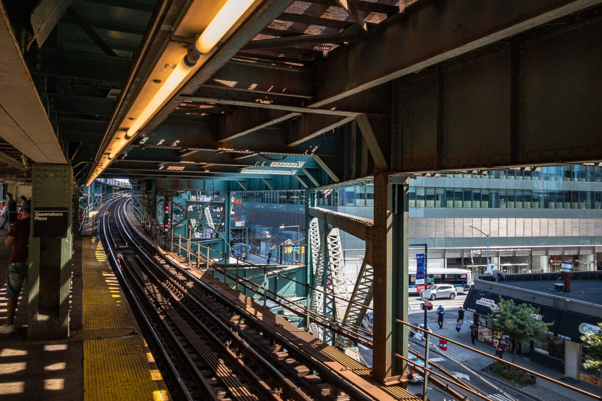
Queensboro Plaza Elevated Train Station, NYC
August 2019
—
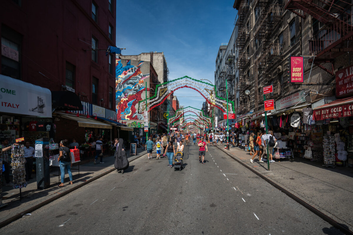
Mulberry Street Little Italy Manhattan
August 2019
—
People walk along Mulberry Street in Manhattan’s Little Italy under rows of simple festive arches. Shops and cafés line the street as vendors sell food and souvenirs to passersby. The scene reflects the neighborhood’s everyday rhythm and long-standing cultural roots.
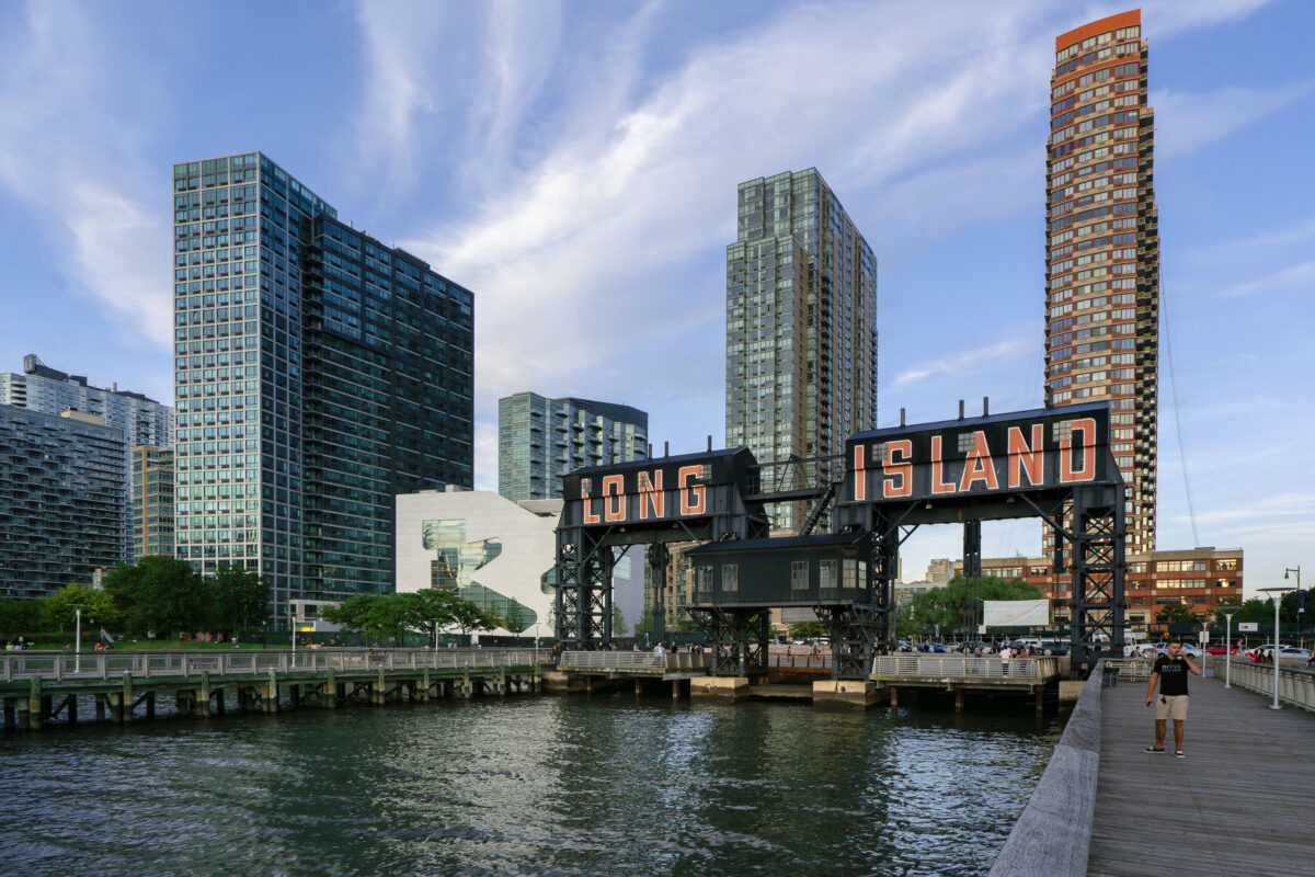
Long Island Sign, East River, Queens
August 2019
—
The iconic Long Island sign towers over the East River waterfront in Queens as evening light reflects off the glassy high-rises of Long Island City. Once a gritty industrial dock, the area has transformed into one of New York City’s fastest-growing neighborhoods.
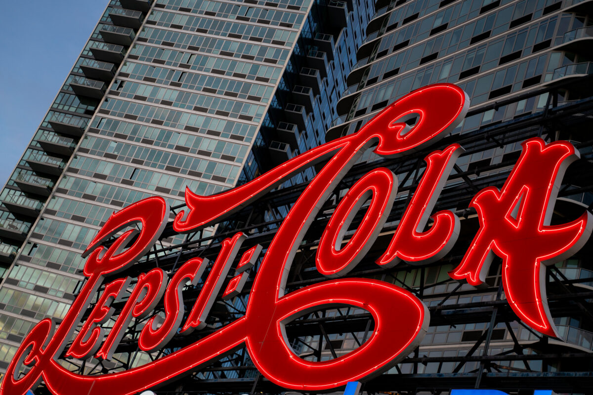
Pepsi-Cola Sign, Long Island City
August 2019
—
The iconic Pepsi-Cola sign glows in red neon along the East River waterfront in Long Island City, Queens. The landmark sign, originally installed in 1936, now stands in front of modern residential towers and remains a prominent feature of the New York City skyline.
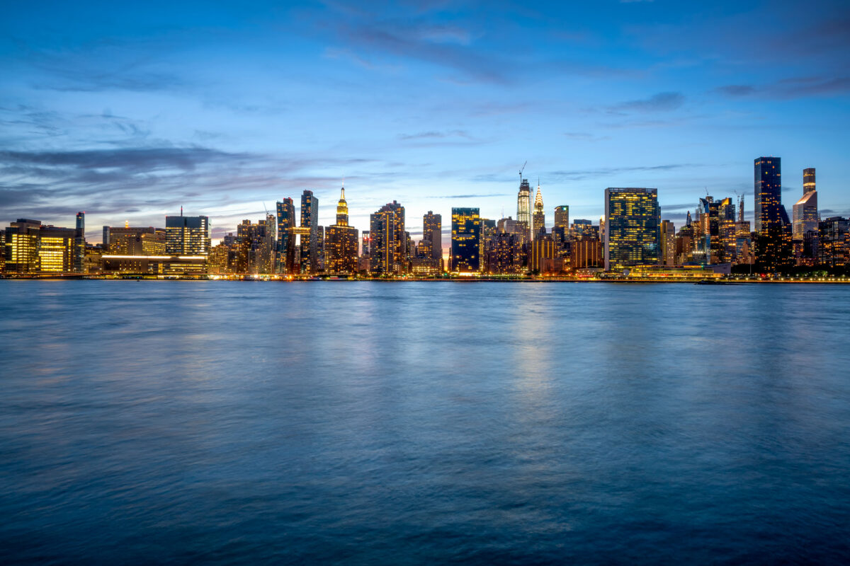
Manhattan Skyline from Long Island City at Dusk
August 2019
—
Manhattan as seen from Long Island City
Manhattan Skyline from Long Island City
August 2019
—
Manhattan as seen from Long Island City
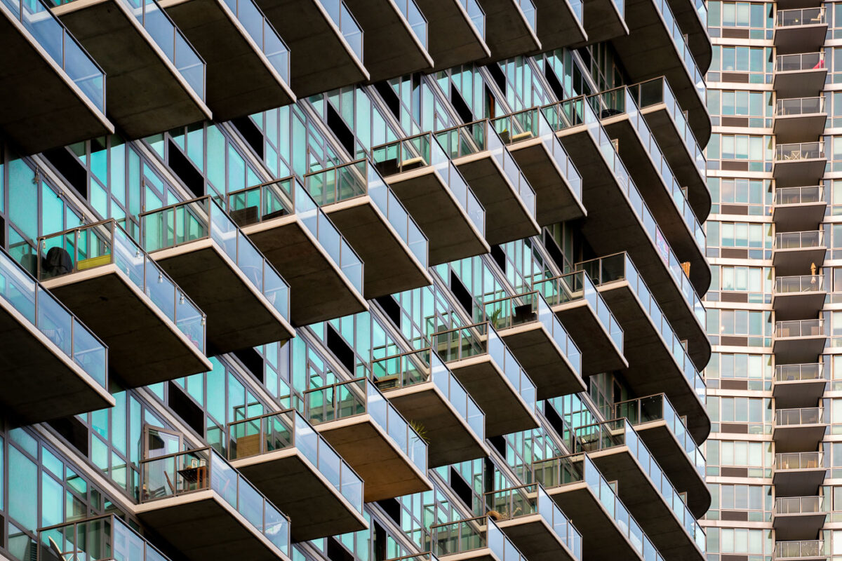
Long Island City Architecture
August 2019
—
High rises in Long Island City, NY.
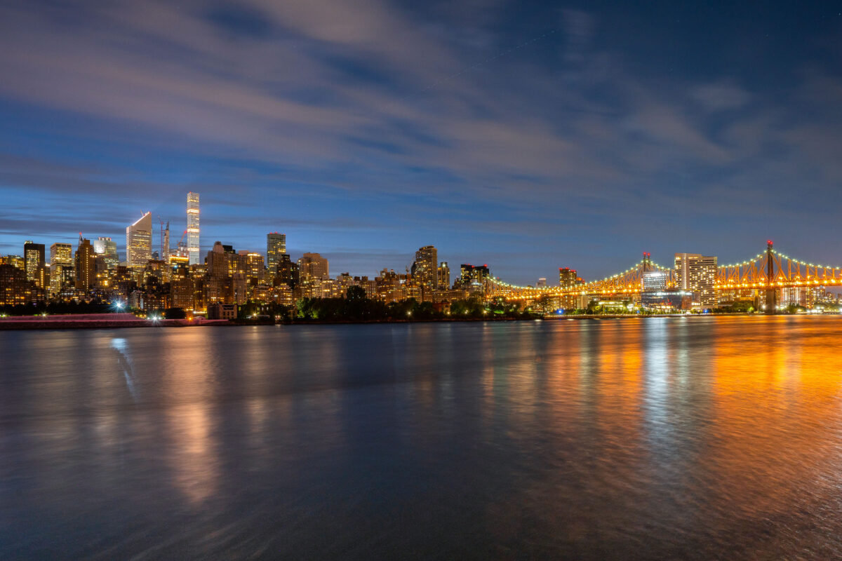
East River and Manhattan Blue Hour
August 2019
—
Manhattan as seen from across the East River.
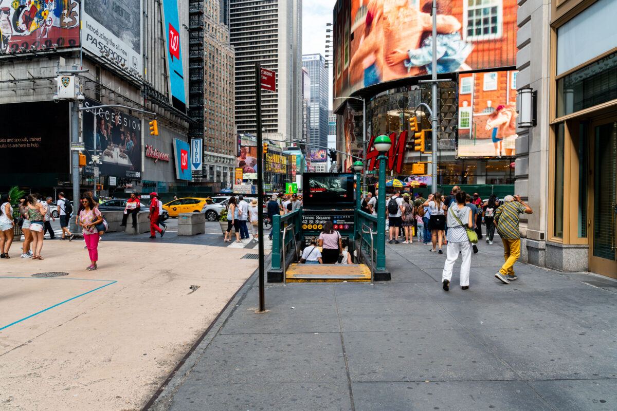
Times Square Subway Entrance, Manhattan
September 2019
—
Pedestrians crowd the sidewalks around a subway entrance in Times Square, Manhattan. The 42nd Street–Times Square station, one of the busiest in New York City, connects multiple subway lines beneath the bright billboards, storefronts, and heavy traffic of the theater district.
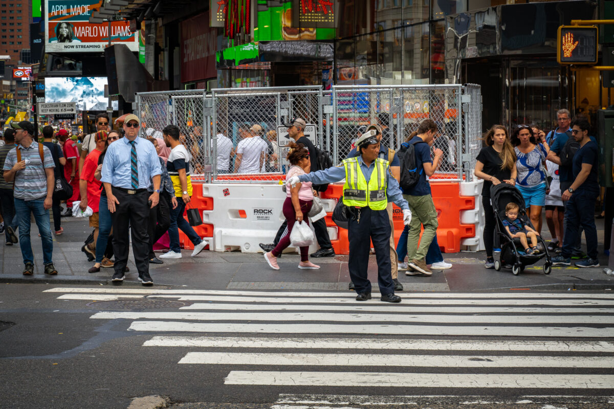
NYPD Traffic Officer in Times Square
September 2019
—
A traffic officer directs pedestrians at a crosswalk in Times Square, Manhattan. Crowds move past construction barriers and street signage in the busy tourist district, where theaters, billboards, and entertainment venues draw thousands of visitors daily.
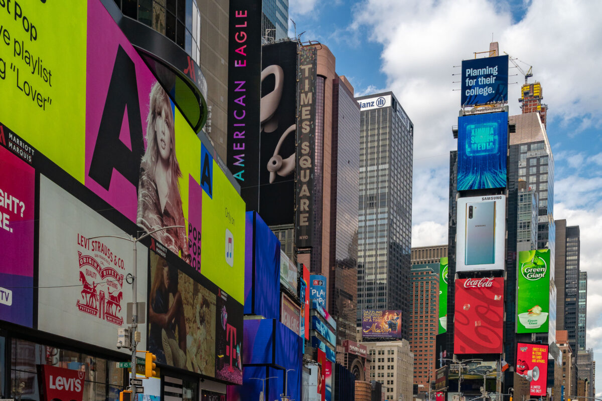
Times Square Advertising Displays, Manhattan
September 2019
—
A dense vertical corridor of advertising light and architecture defines Times Square, seen here at 47th Street and Broadway in Midtown Manhattan. Towering LED billboards and commercial facades—featuring brands from Levi’s to Samsung—create one of the world’s most iconic visual environments. Once a gritty crossroads of theaters and print media, the area was redeveloped in the late 20th century into a symbol of global commerce and digital spectacle, blending entertainment, marketing, and architecture into a single overwhelming urban experience.
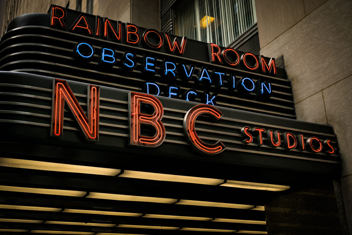
NBC Studios Rainbow Room Neon Sign, 30 Rockefeller Plaza
September 2019
—
The neon marquee of NBC Studios glows outside 30 Rockefeller Plaza in Midtown Manhattan. The sign, also advertising the Rainbow Room and the building’s observation deck, marks the entrance to the historic headquarters of the television network.
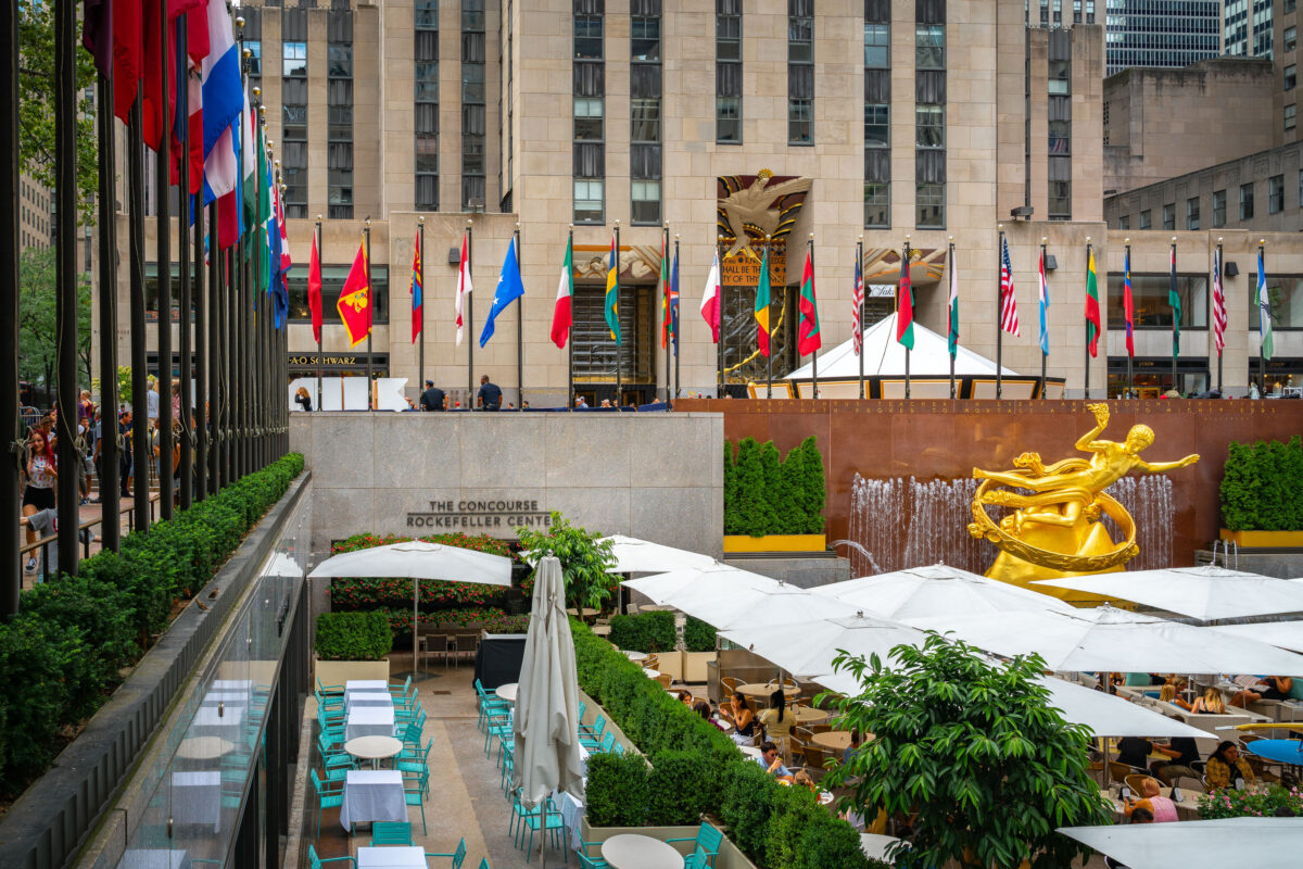
Prometheus Statue and Flags, Rockefeller Center
September 2019
—
The Lower Plaza at Rockefeller Center in Midtown Manhattan is seen with the golden statue of Prometheus overlooking the outdoor dining area. Rows of international flags line the upper concourse, while crowds gather around the landmark complex that is home to shops, offices, and seasonal attractions.
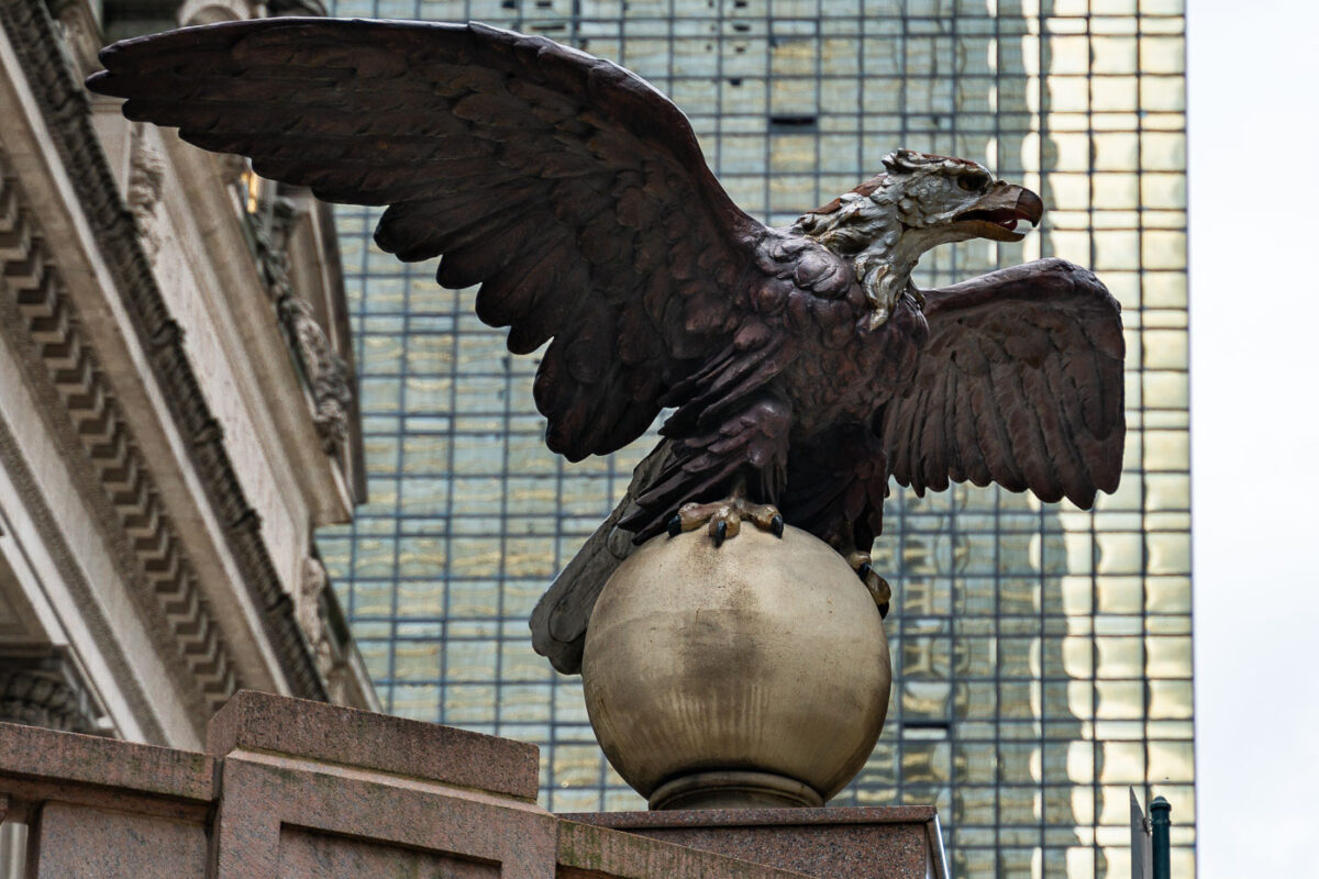
Vanderbilt Eagle at Grand Central Terminal
September 2019
—
An eagle statue perched on a globe stands outside Grand Central Terminal in Manhattan. The bronze sculpture, one of several around the historic landmark, looks out over Midtown with the glass facade of the MetLife Building rising in the background.
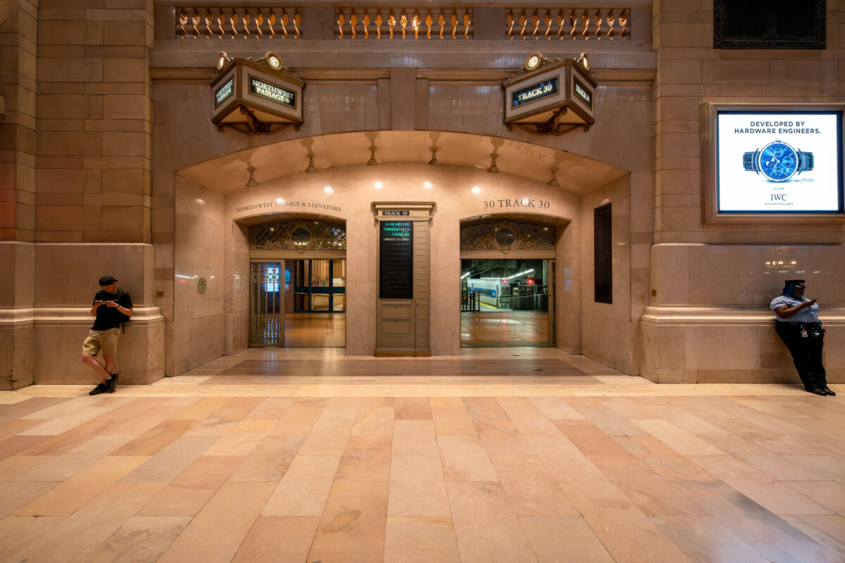
NYPD at Grand Central Terminal, NYC
September 2019
—
The entrance to Track 30 inside Grand Central Terminal in Manhattan is seen at night. The marble hallways of the landmark station lead to the train platforms below, as a commuter and a security officer stand near the archways beneath illuminated signs.
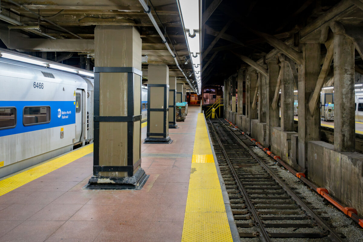
Metro-North Train at Grand Central Terminal
September 2019
—
A Metro-North Railroad train waits at a platform inside Grand Central Terminal in Manhattan. The concrete pillars and exposed beams of the underground station frame the tracks, where the yellow warning strip lines the edge of the platform.
Metro-North Railroad Train at NYC Station
September 2019
—
A Metro-North Railroad train is seen at a station platform, its blue-and-white exterior bearing the MTA logo. The commuter rail line, operated by the Metropolitan Transportation Authority, connects New York City with suburbs across New York State and Connecticut.
Built in Minneapolis
Photographs showcasing change over time
Browse by location, move through long-running series, or start with recent work.