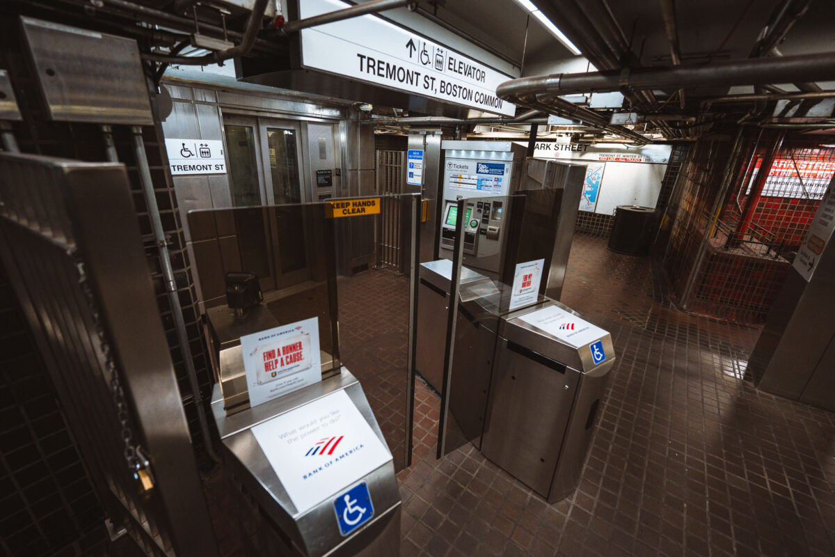
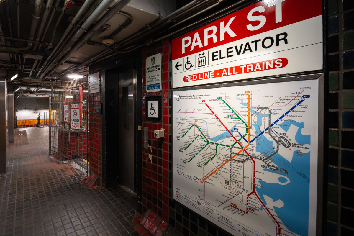
Park Street Station Fare Gates, Boston
April 2025 —
Explore photos tagged Boston.
April 2025 —
April 2025 —
April 2025 —
April 2025 —
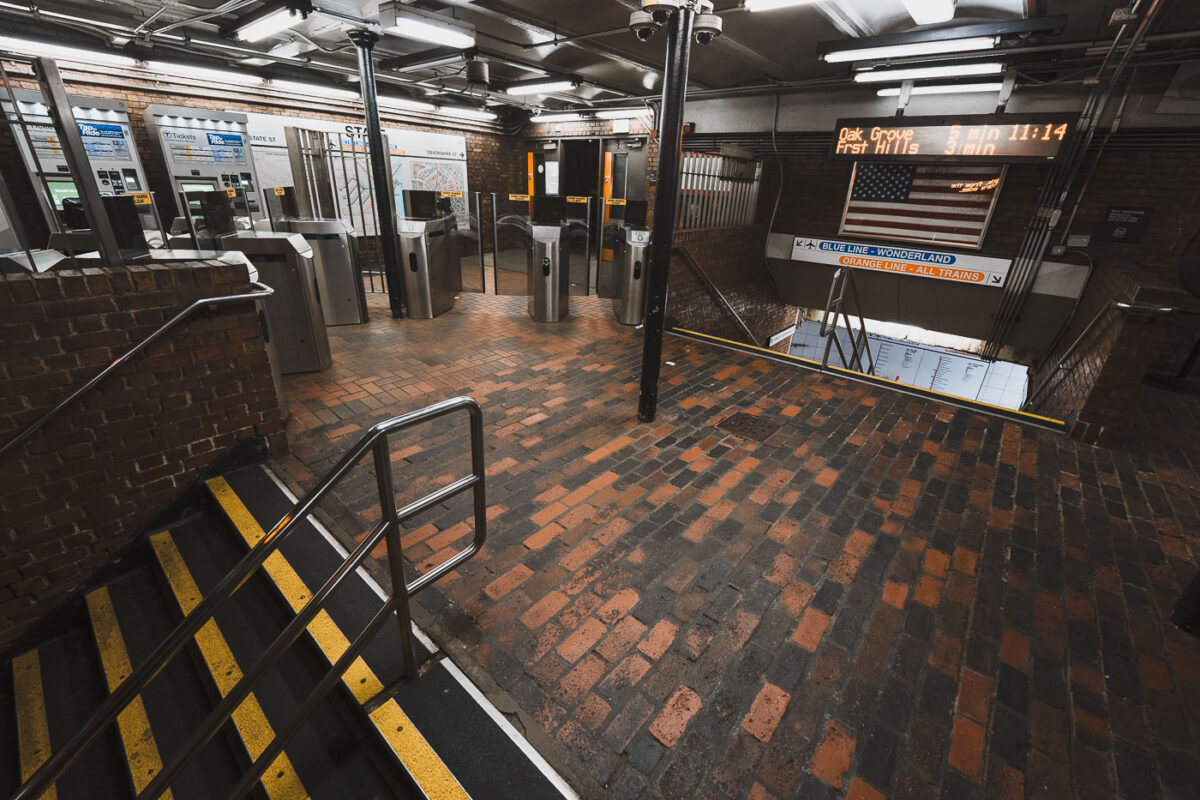
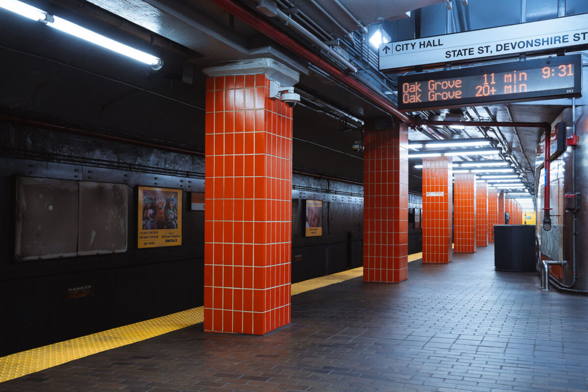
April 2025 — The entrance and fare control area at State Street Station, a key interchange in downtown Boston where the Orange Line and Blue Line intersect. The station opened in 1908 as part of the Washington Street Tunnel and remains one of the MBTA’s oldest continuously operating rapid transit facilities. Brick flooring, steel columns, and low ceilings reflect early 20th-century subway construction, while modern fare gates and electronic arrival boards show later upgrades layered onto the original structure. The signage directing riders to Oak Grove, Forest Hills, and Wonderland highlights the station’s role as a transfer point connecting North Shore riders, downtown commuters, and the broader MBTA network.
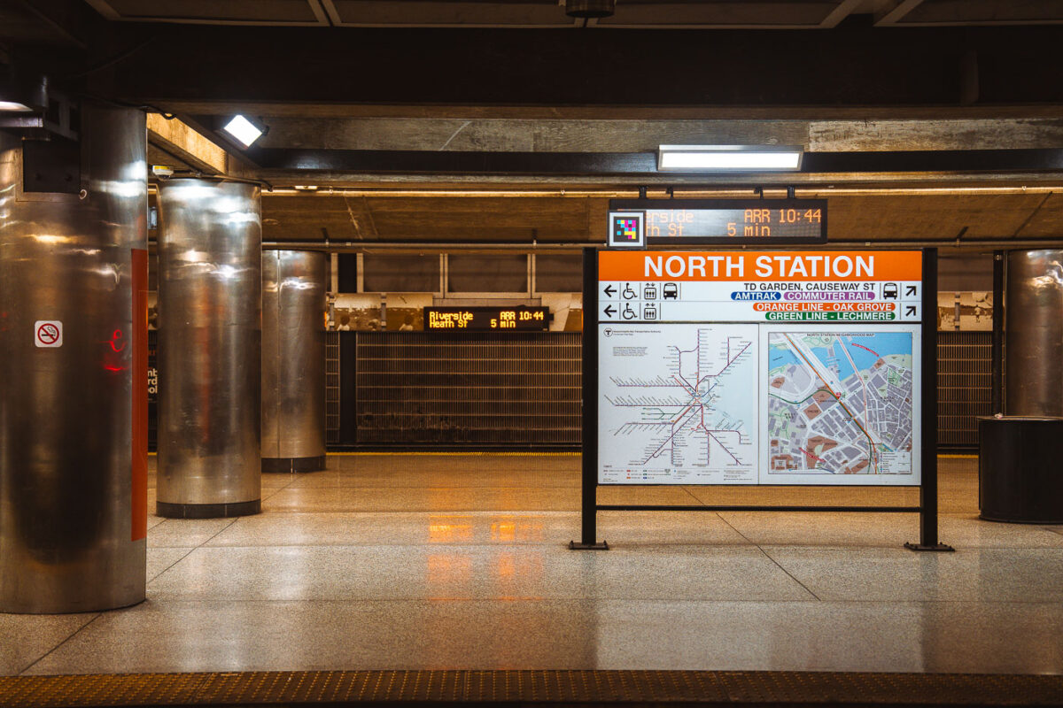
April 2025 — Interior signage at North Station, one of Boston’s oldest and most complex transit hubs. The station sits beneath TD Garden and serves as a major interchange between the MBTA Orange Line, Green Line (north branches), Amtrak Downeaster, and MBTA Commuter Rail. The current underground rapid-transit facilities date largely to the late 20th-century rebuilds, following the demolition of the original above-ground North Station headhouse in the 1920s and subsequent reconstructions tied to Boston’s evolving rail network. The platform wayfinding reflects this layered role: subway lines, regional rail, and intercity service are all integrated into a single information system. Electronic arrival boards and map panels emphasize transfer efficiency in a station that functions as the northern rail gateway to downtown Boston and the broader New England rail network.
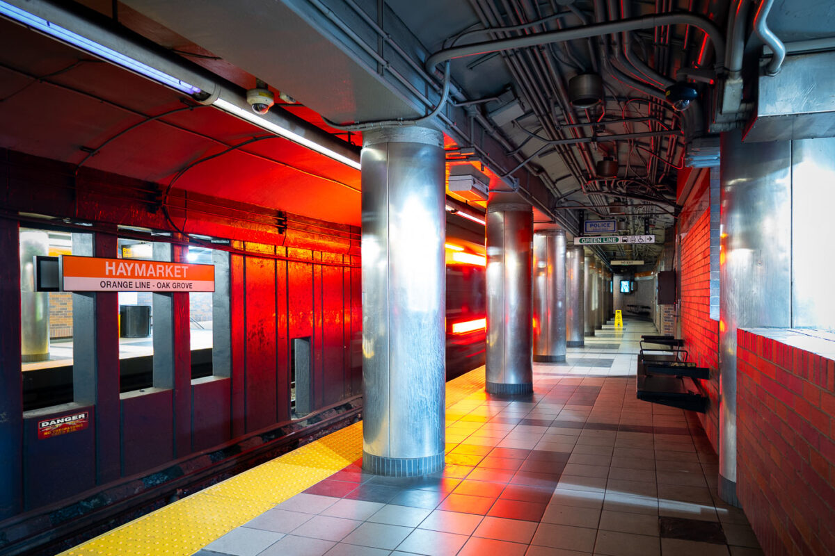
April 2025 — Haymarket Station in downtown Boston, one of the oldest transit locations in the city, serving riders since the late 19th century in various forms. The current underground station opened in 1971 as part of the MBTA’s modernization of the Orange Line, replacing earlier elevated structures that once ran through the area. The station sits at the edge of the historic Haymarket district, long associated with public markets and transportation links between downtown and Boston’s North End. The cylindrical steel columns and low-ceilinged platforms reflect mid-20th-century transit design, while the signage and lighting document decades of incremental updates to keep the station functional within one of the system’s busiest transfer points.
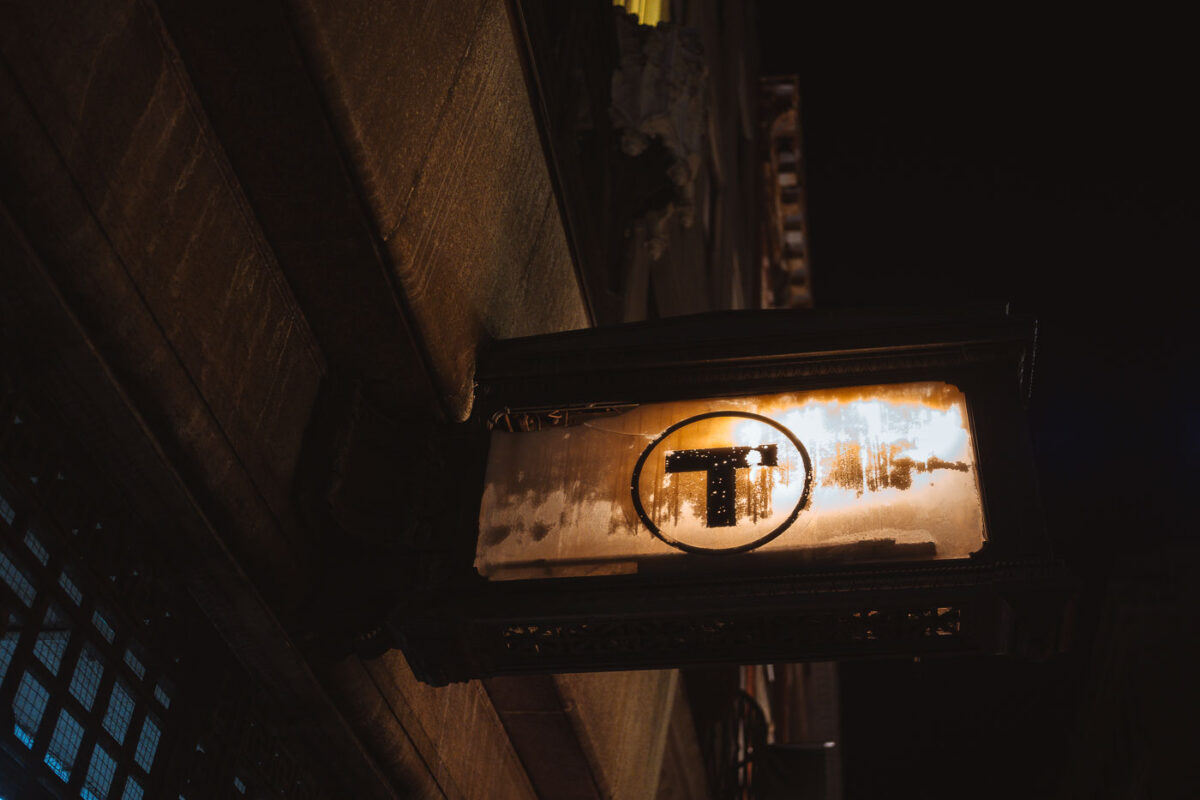
April 2025 — An illuminated MBTA roundel mounted beneath a streetscape, marking an entrance to Boston’s subway system. The simple black “T” inside a white circle has been used in various forms since the mid-20th century and became the unified symbol of the MBTA in the 1960s, replacing a mix of earlier streetcar and rapid-transit branding. Designed for quick recognition in dense urban conditions, the sign’s placement below street level reflects how much of Boston’s transit infrastructure is woven directly into older masonry buildings and narrow rights-of-way. The weathered lightbox and surrounding stonework show decades of exposure, maintenance, and adaptation as the system has evolved while keeping its most recognizable identifier largely unchanged.
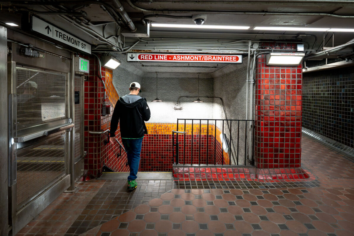
April 2025 — Inside Park Street station, one of the oldest active subway stations in the United States. Opened in 1897 as part of the Tremont Street Subway, the station has long served as a central transfer point beneath Boston Common. The tiled corridors and low ceilings reflect early subway construction techniques, with later renovations layering modern lighting, signage, and safety systems onto the original structure. Directional signage for the Ashmont and Braintree branches marks this passage as part of the MBTA Red Line, which continues to use Park Street as a key junction between downtown Boston and the city’s southern neighborhoods.
April 2025 — Boston's MBTA Park Street Red Line train station.
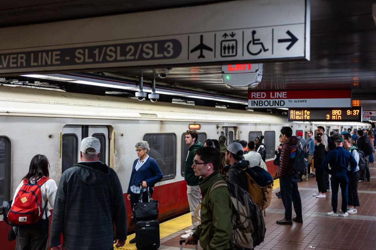
April 2025 — Passengers wait alongside an inbound MBTA Red Line train, headed toward Alewife, on a busy underground platform in downtown Boston. The Red Line is the system’s oldest rapid transit route, opening in 1912 and forming the backbone of east–west and north–south travel through the city. The high-floor cars shown here reflect decades of incremental fleet updates, while the tiled platforms, overhead wayfinding, and digital countdown signs illustrate how the MBTA has layered modern passenger information systems onto early-20th-century station infrastructure. The crowding and luggage visible on the platform highlight the line’s dual role serving both daily commuters and airport-bound travelers via transfers to bus and rail connections.
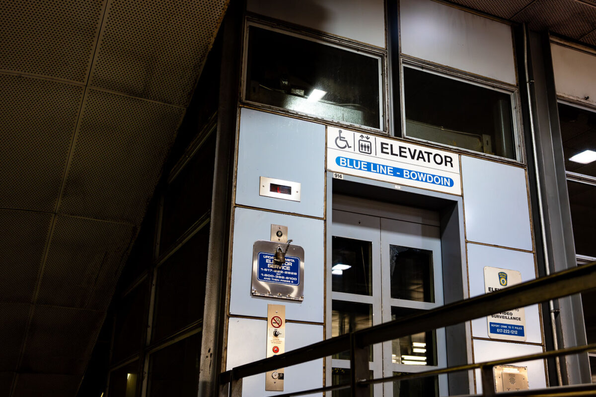
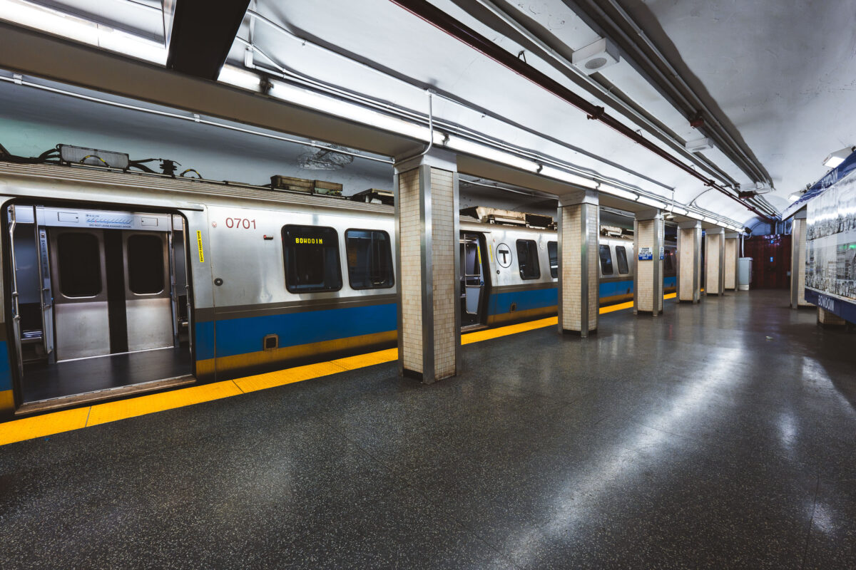
April 2025 — An elevator entrance at Bowdoin station, the downtown terminal of Boston’s Blue Line. Bowdoin Station opened in 1916 as part of the East Boston Tunnel, one of the earliest underwater rapid-transit tunnels in North America. The station is notable for its compact footprint, tight curves, and historically limited accessibility compared to newer MBTA stations. This elevator provides step-free access between street level and the platform, reflecting later retrofits required by accessibility standards rather than original station design. The utilitarian signage, metal paneling, and enclosed structure are characteristic of mid-to-late 20th century upgrades layered onto early 20th century transit infrastructure, illustrating how legacy subway systems have been incrementally adapted to modern accessibility and safety requirements.
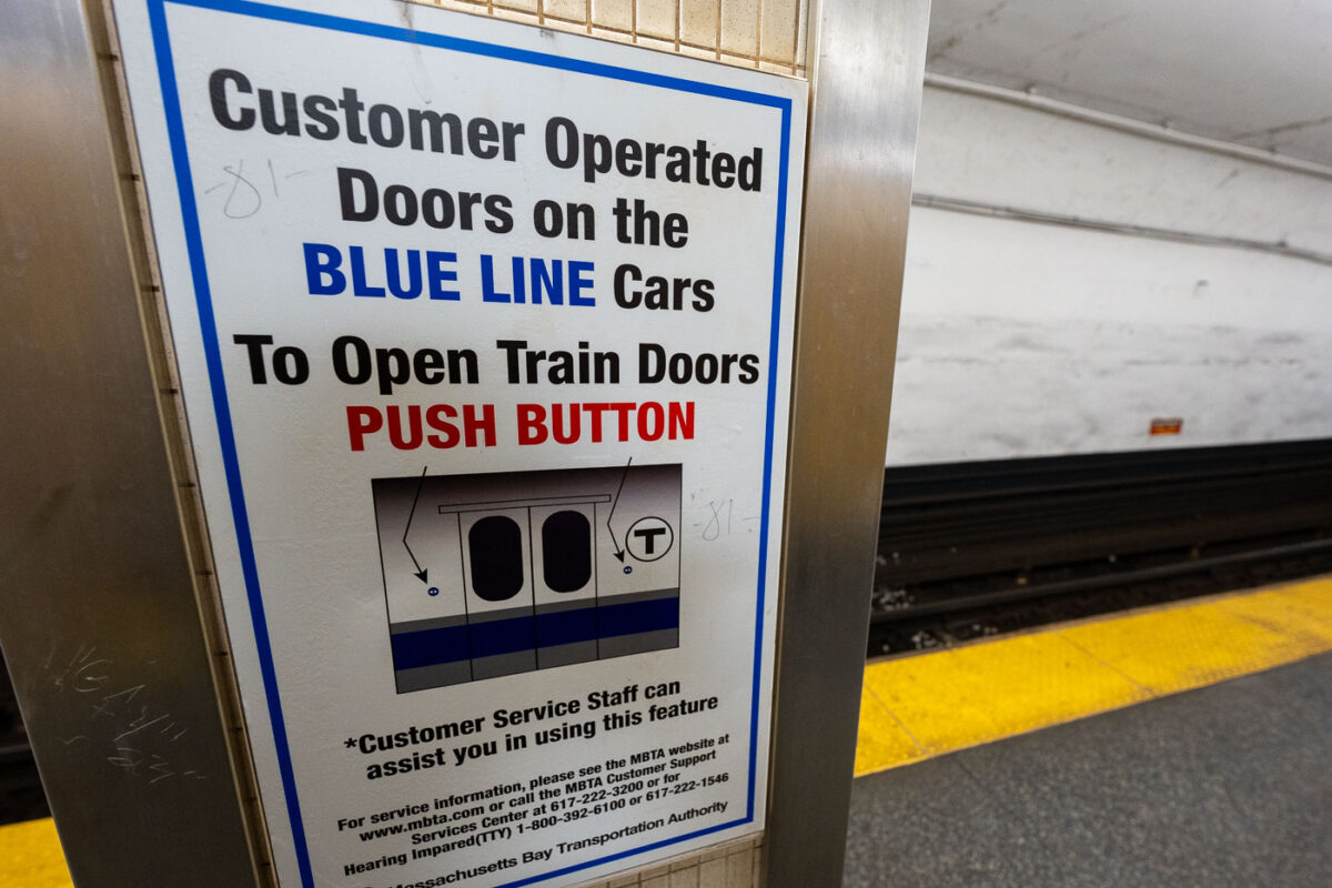
April 2025 — A platform sign explaining customer-operated doors on Blue Line trains of the Massachusetts Bay Transportation Authority. Unlike many rapid-transit systems where doors open automatically at every stop, portions of the MBTA Blue Line fleet require passengers to press a button to open the doors once the train is stopped. This practice dates back to older car designs and cold-weather operating considerations, helping retain heat in winter and reduce unnecessary door cycling. The sign reflects the MBTA’s continued reliance on legacy rolling stock and the need for clear, standardized instructions in stations with high passenger turnover.
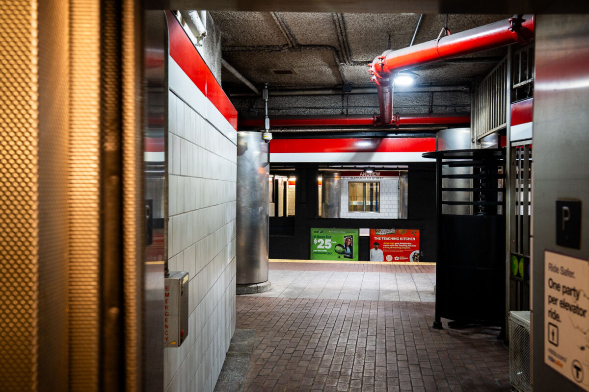
April 2025 — Getting off an elevator at Andrew Station on the red line in Boston.
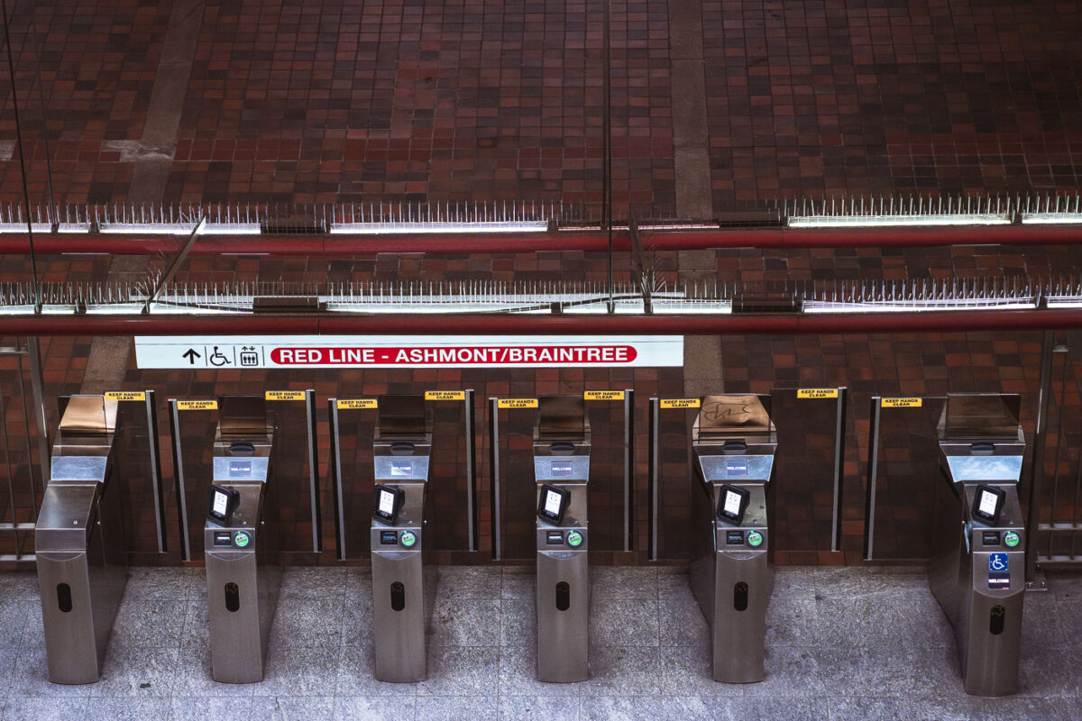
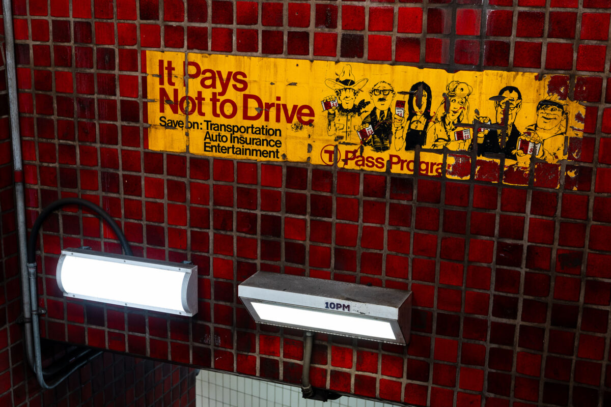
April 2025 — Fare gates line the paid entrance to the Massachusetts Bay Transportation Authority Red Line, directing riders toward Alewife-bound service. This northbound branch terminates at Alewife, the line’s northern endpoint, and serves as a primary commuter gateway for Cambridge and the Route 2 corridor. The stainless-steel fare control equipment reflects systemwide upgrades rolled out during the 2010s to improve ADA accessibility, reliability, and compatibility with modern fare media. Above the gates, the brick-vaulted ceiling and exposed utilities reflect the durable, utilitarian architecture common to many core Boston subway stations built and expanded in the mid-20th century, prioritizing longevity and fire resistance in high-traffic underground spaces.
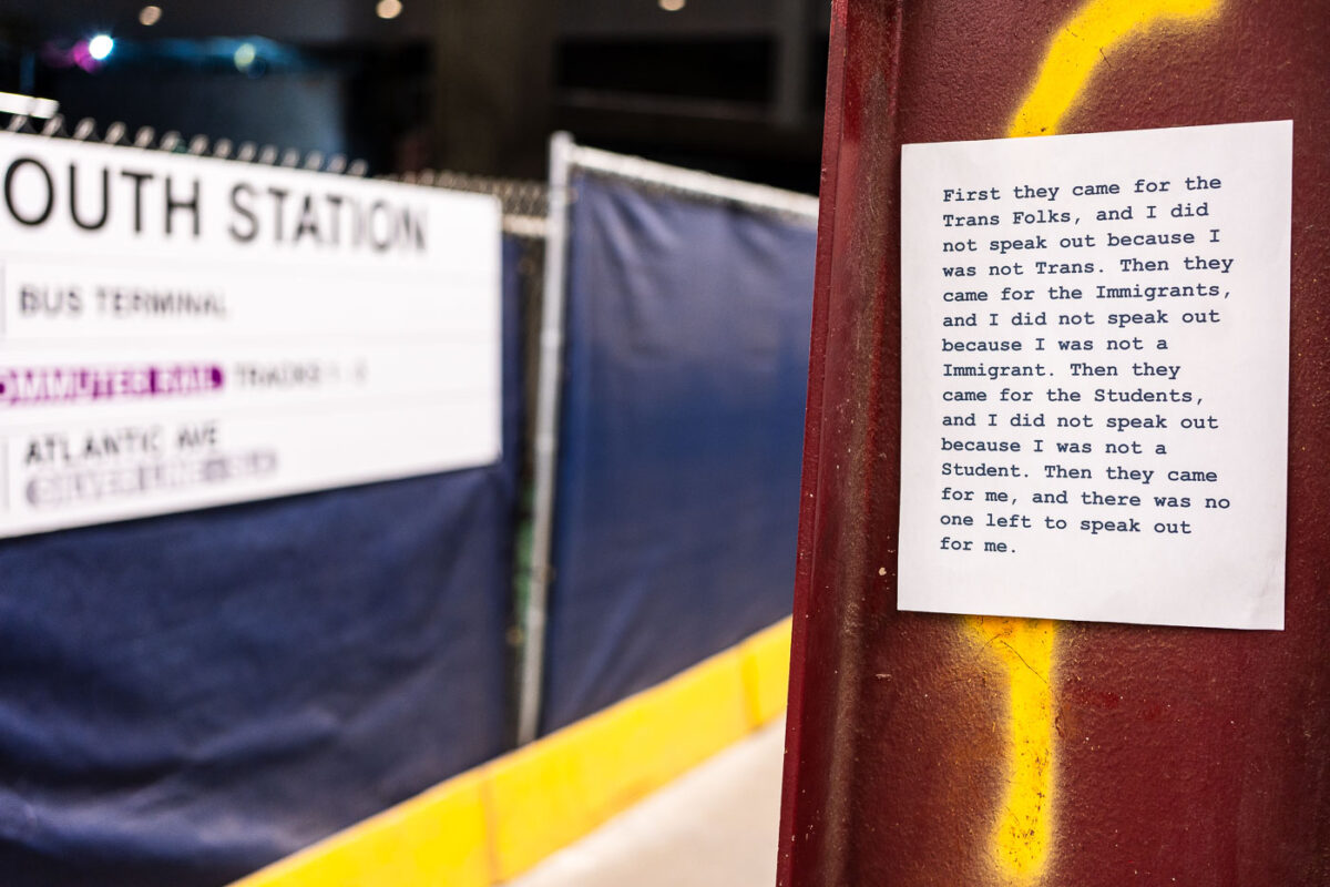
April 2025 — Sign seen at South Station in Boston: "First they came for the Trans Folks, and I did not speak out because I was not Trans. Then they came for the Immigrants, and I did not speak out because I was not a Immigrant. Then they came for the Students, and I did not speak out because I was not a Student. Then they came for me, and there was no one left to speak out for me."
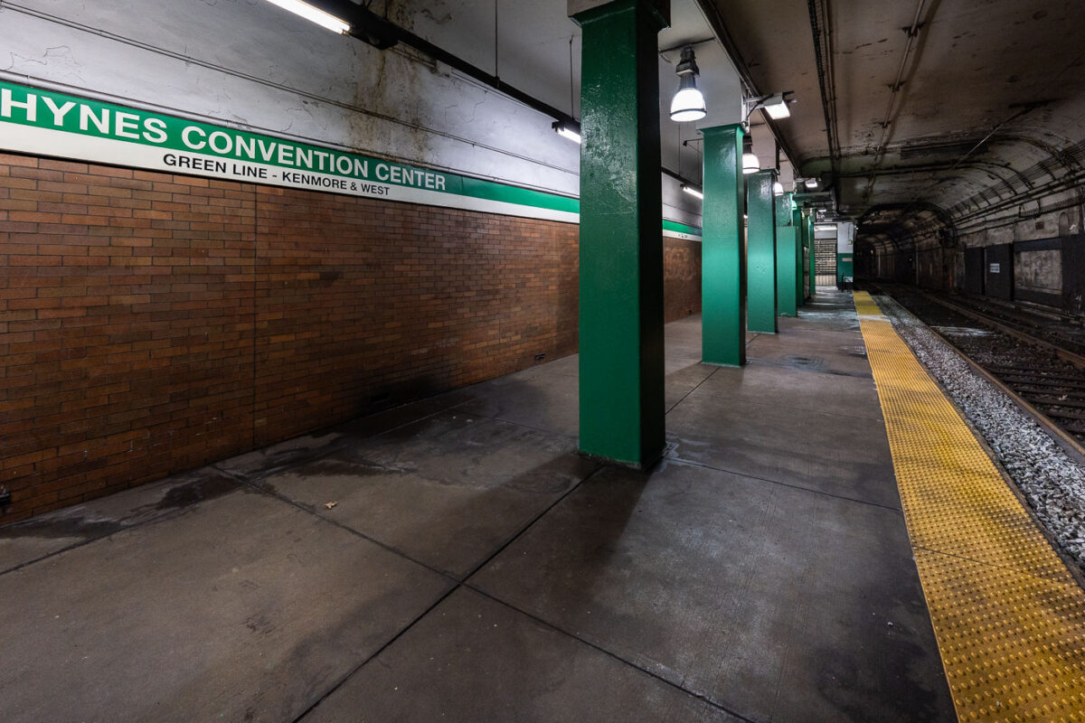
April 2025 — MBTA Green Line train platform at Hynes Convention Center.
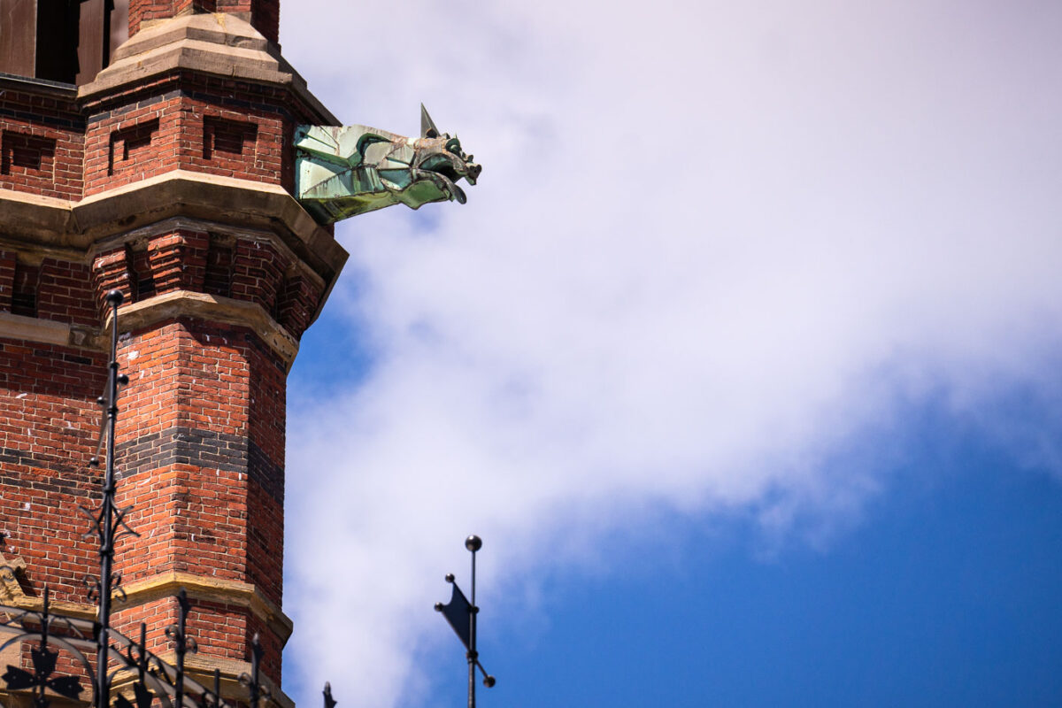
April 2024 — A copper gargoyle juts from the ornate brick tower of Harvard’s Memorial Hall in Cambridge, Massachusetts—a striking detail of the Gothic Revival architecture completed in the late 19th century. Designed by Ware & Van Brunt, the hall commemorates Harvard alumni who fought for the Union in the Civil War. The gargoyle’s oxidized green patina and sharp geometric form contrast against the red brick and open sky, blending medieval-inspired craftsmanship with the American collegiate Gothic style that defines much of Harvard’s architectural legacy.
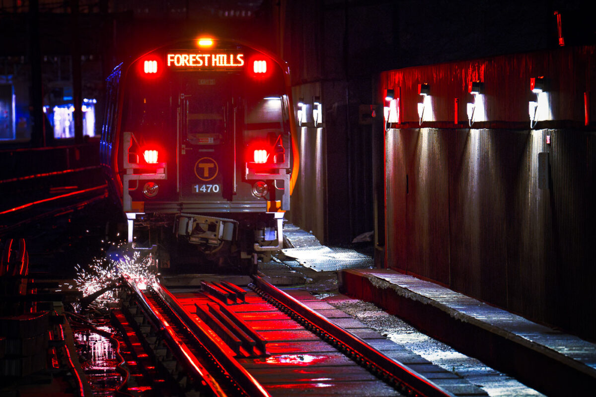
April 2024 — Sparks under a Forest Hills Orange Line train in Boston.
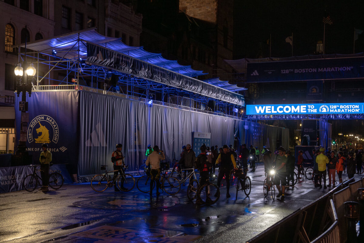
April 2024 — Tonight I learned there’s an unsanctioned “Midnight Marathon” bike ride each year the night before the Boston Marathon. Thousands of bikers ride the mostly empty streets and today was the 16th year.
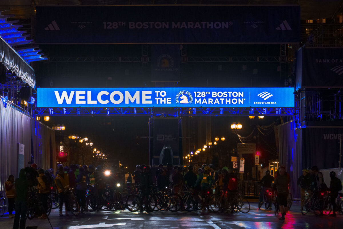
April 2024 — Tonight I learned there’s an unsanctioned “Midnight Marathon” bike ride each year the night before the Boston Marathon. Thousands of bikers ride the mostly empty streets and today was the 16th year.
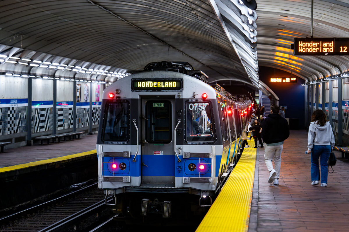
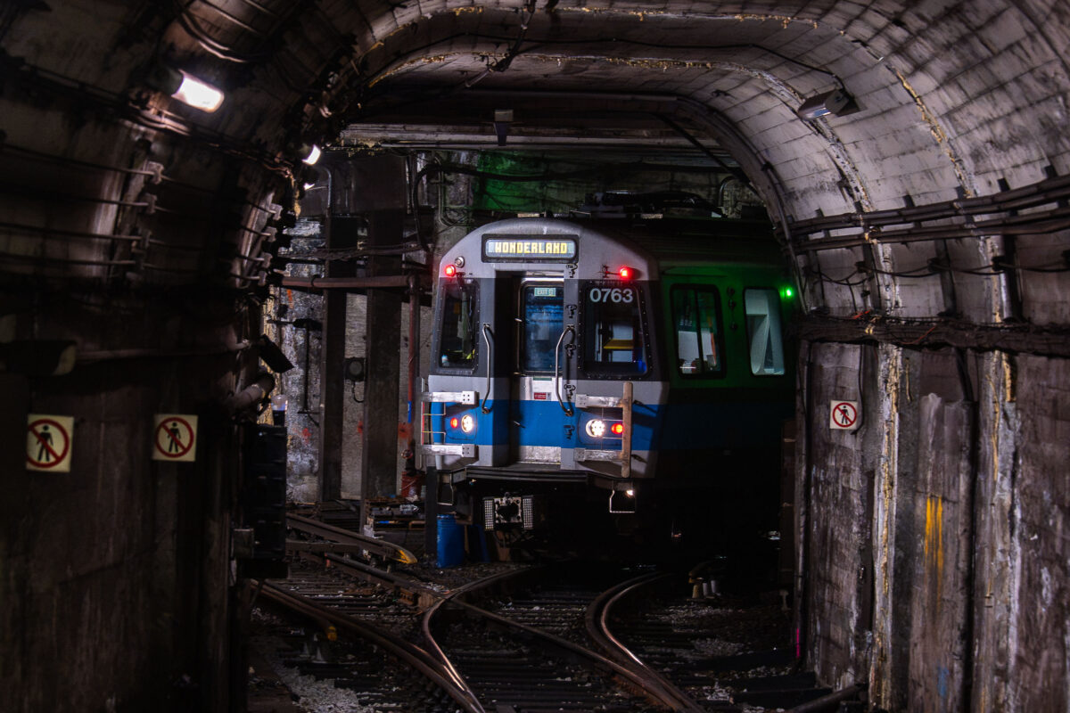
April 2024 — MBTA Wonderland bound train from the Aquarium Station. Passengers on the platform getting on the train.
April 2024 — Massachusetts Bay Transportation Authority (MBTA) State Station on the Orange Line in Boston.

April 2024 — A U.S. Coast Guard response boat moves steadily across Boston Harbor on a calm, overcast day, with Logan International Airport visible in the distance. The aluminum and orange-hulled vessel, equipped with mounted security equipment, is part of routine maritime patrol operations ensuring the safety of one of New England’s busiest ports. Behind it, commercial ships and aircraft highlight the harbor’s strategic role as a hub for both air and sea transport serving the Greater Boston area.
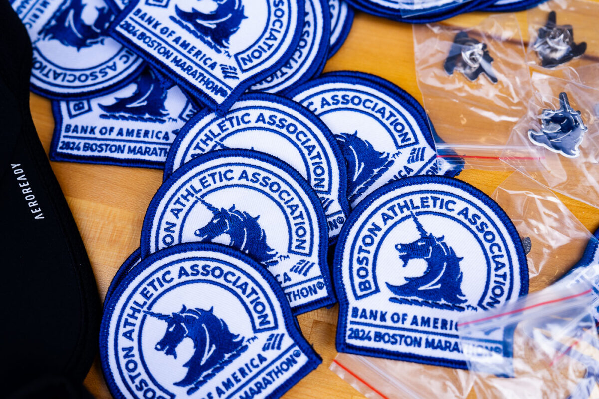
April 2024 — 2024 Boston Marathon Patches for sale at the Marathon Expo in 2024.
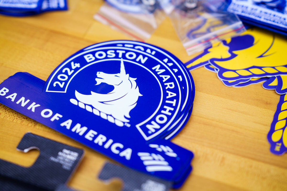
April 2024 — 2024 Boston Marathon stickers for sale at the Expo.
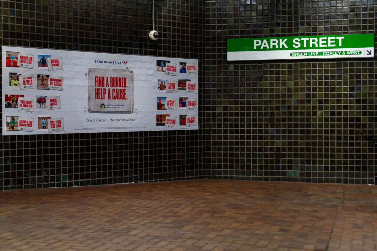
April 2024 — Inside Boston’s Park Street Station, a tiled corridor displays a Bank of America advertisement for the Boston Marathon’s charity initiative. The green and white MBTA sign directs riders toward the Green Line platforms for Copley and westbound service. Park Street—one of the oldest subway stations in the United States—sits beneath the Boston Common, serving as a major interchange for the city’s transit system since 1897.
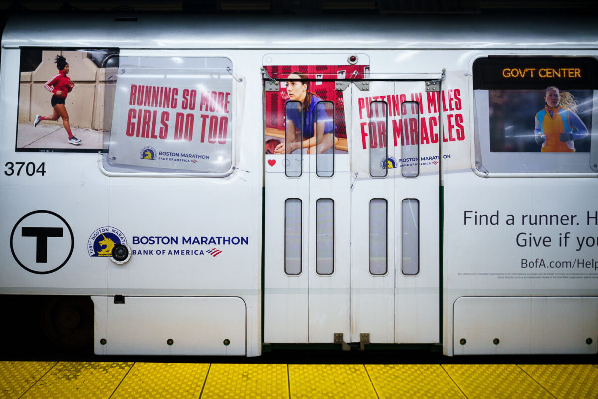
April 2024 — A train with Bank of America Boston Marathon wrap.
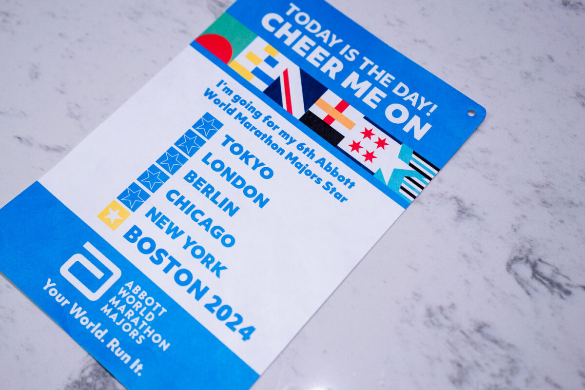
April 2024 — A runner’s bib card for the 2024 Boston Marathon celebrates a milestone in the Abbott World Marathon Majors series, listing all six legendary races: Tokyo, London, Berlin, Chicago, New York, and Boston. Completing all six earns participants the coveted Six Star Medal, recognizing one of distance running’s most challenging global achievements. The card’s bright design, set on a marble surface, captures the excitement and prestige surrounding Boston’s historic 26.2-mile race — the oldest annual marathon in the world.
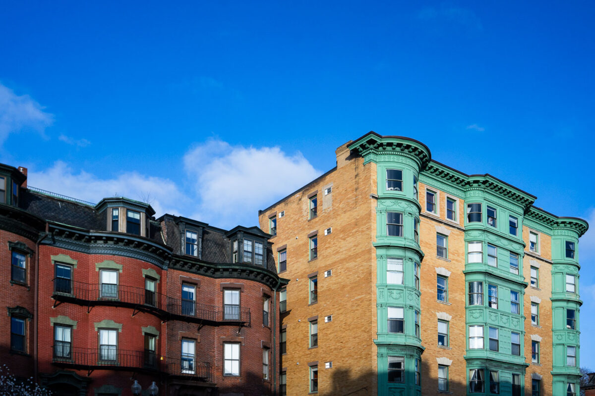
April 2024 — Along Massachusetts Avenue in Boston’s South End, these adjoining brownstones showcase the neighborhood’s signature Victorian-era architecture—ornate bay windows, intricate cornices, and rich brickwork that reflect the city’s 19th-century building boom. The red and tan façades, accented with distinctive green trim, represent the area’s architectural diversity, where Italianate and Renaissance Revival influences meet. Once part of a working-class district and now one of Boston’s most carefully preserved historic neighborhoods, the South End’s rowhouses remain a defining feature of the city’s urban identity and charm.
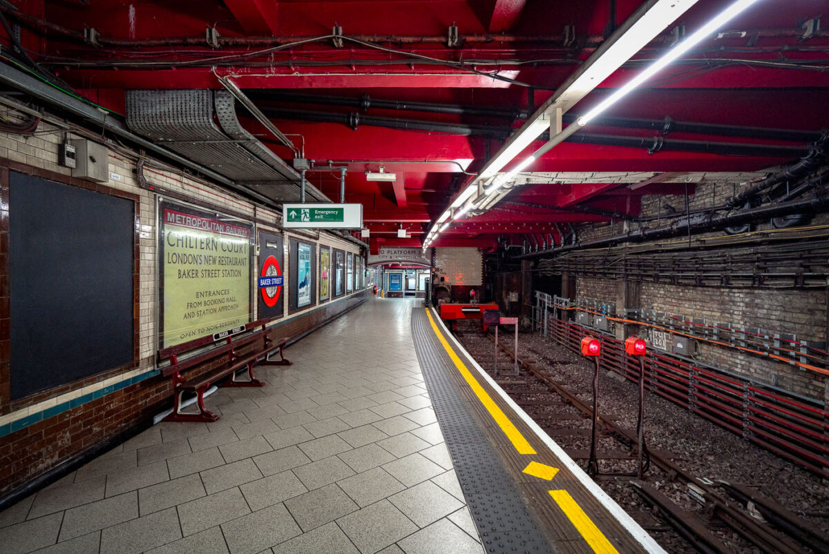
May 2019 — Baker Street Station’s Metropolitan Line platforms represent one of the oldest sections of the London Underground, opened in 1863 as part of the world’s first subterranean railway. The terminus platforms, seen here, retain their cut-and-cover Victorian brickwork paired with modern safety updates and striking red-painted steel reinforcements added during later refurbishments. The station originally served the Metropolitan Railway’s steam-hauled trains running between Paddington and Farringdon before electrification in the early 20th century transformed the network. Period signage advertising “Chiltern Court” and the original Metropolitan Railway branding pay homage to its heritage, contrasting with the exposed wiring, signal lights, and tiling that reveal more than 160 years of evolving underground infrastructure. Today, Baker Street remains a key interchange, connecting five Underground lines while preserving much of the industrial atmosphere that defined London’s pioneering approach to mass transit.
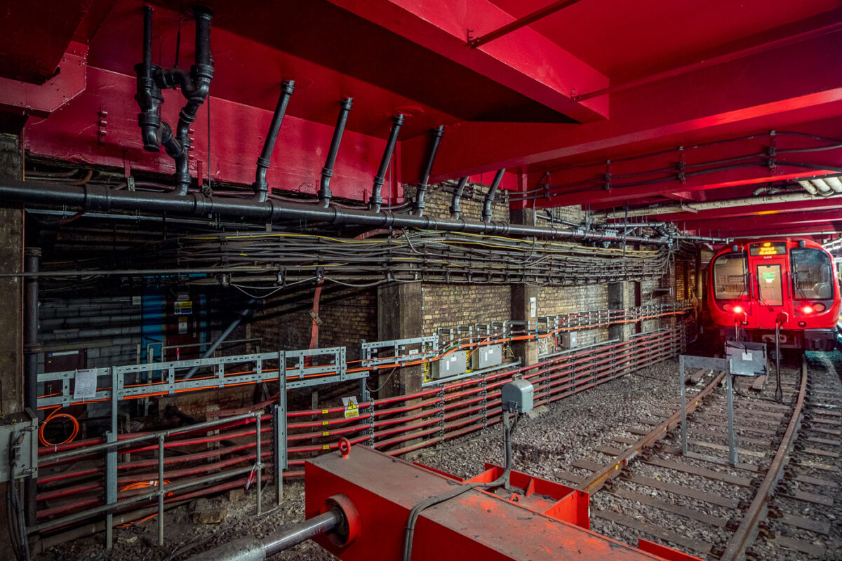
May 2019 — Deep beneath central London, Baker Street’s Metropolitan Line platforms reveal the layered engineering of one of the oldest functioning railway systems in the world. The exposed brick tunnel and steel framing date back to the Victorian “cut-and-cover” era of the 1860s, when steam locomotives first ran through these very corridors. The heavy red girders seen above were reinforced during modern refurbishments, supporting the city streets above while housing utilities and cable conduits that power today’s Underground network. The train at the far end belongs to the S8 Stock series, introduced in 2010 by Bombardier for the Metropolitan Line, equipped with air conditioning and regenerative braking. The dense web of cables and control boxes along the wall carries signal, communication, and traction power circuits, all vital to the line’s safe operation. Baker Street’s infrastructure embodies London Transport’s continual evolution—from soot-covered tunnels to precision-controlled, electrically powered systems still running along the same 19th-century alignments.