Los Angeles

11 photos · 2011–2015

11 photographs tagged Los Angeles, 2011–2015.
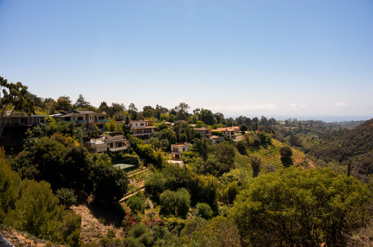
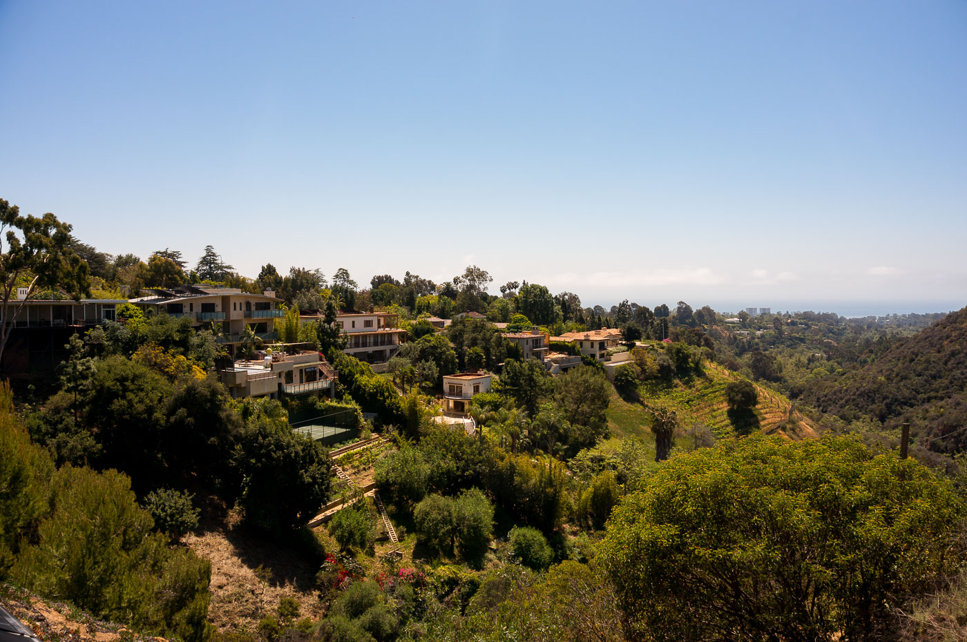
Hillside homes nestled among dense vegetation in Pacific Palisades, Los Angeles.
Pacific Palisades sits in the Santa Monica Mountains on Los Angeles's Westside, tucked between the coastline and Topanga State Park. Methodist settlers founded the community in the 1920s, and it later grew into one of the city's wealthiest enclaves, prized for large hillside lots and unobstructed ocean views. The same canyon terrain and dense chaparral that give the neighborhood its ry have also made it one of the more fire-prone areas in Los Angeles, a risk that culminated in the January 2025 Palisades Fire, which destroyed thousands of homes across the hills.

Hillside Estates Overlooking the Pacific in Pacific Palisades
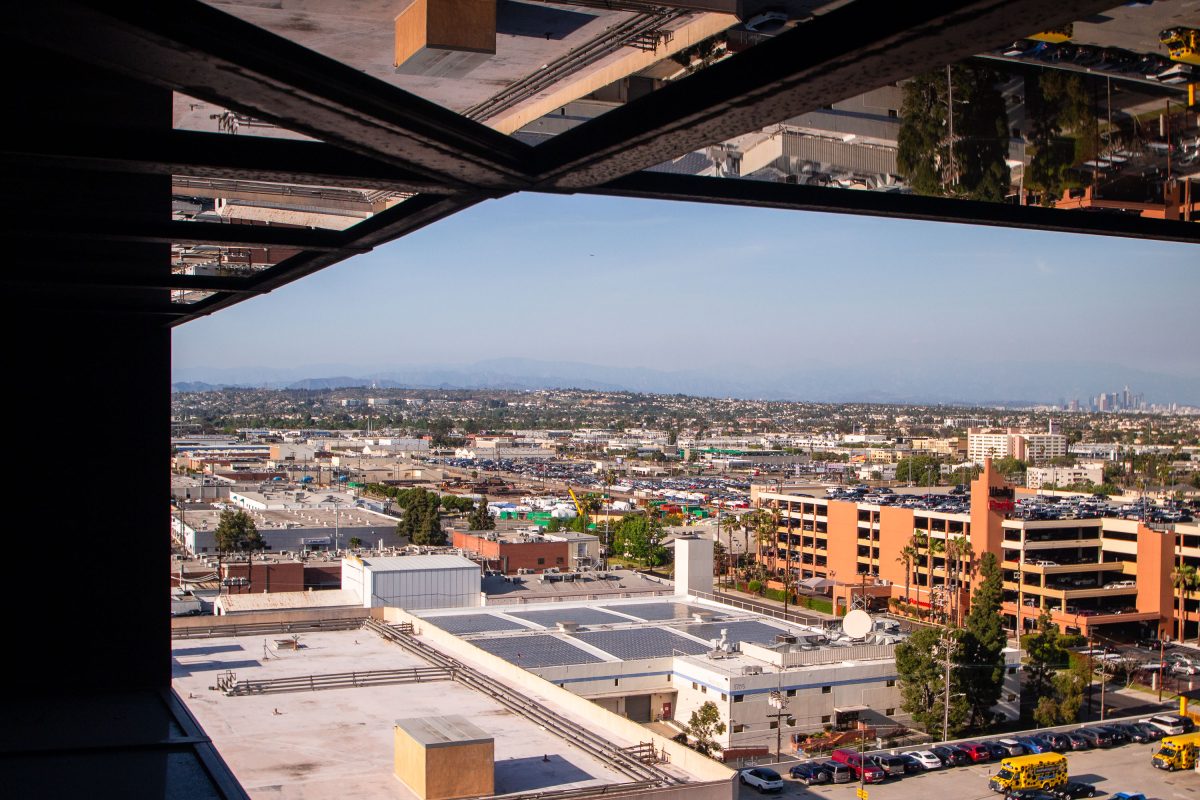
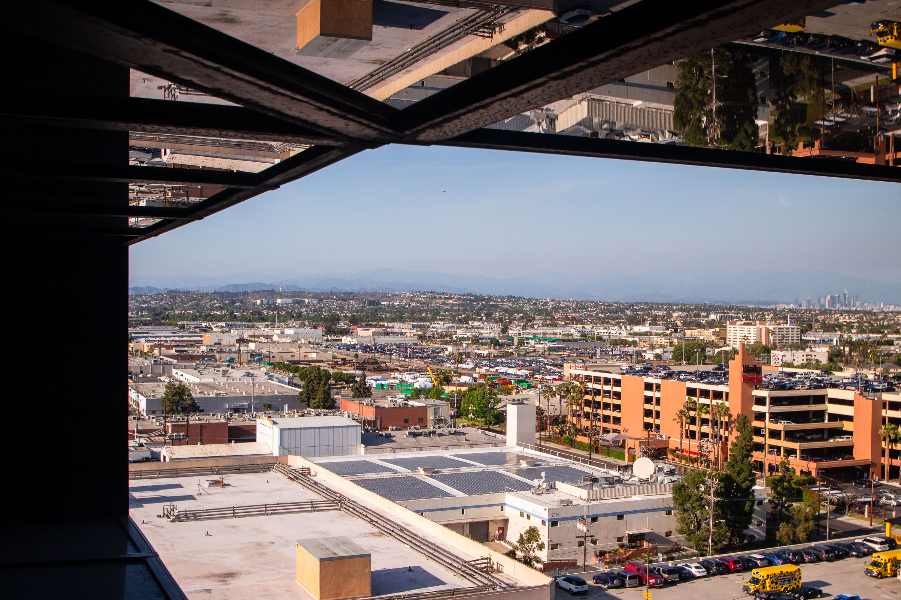
View from Hyatt Regency Los Angeles International Airport showing Westchester neighborhood toward downtown Los Angeles skyline.
The Hyatt Regency Los Angeles International Airport rises near LAX along Century Boulevard, a stretch that became the airport's hotel row after commercial jet travel took off at LAX in the 1960s. Downtown Los Angeles sits roughly 15 miles to the northeast, with the San Gabriel Mountains forming the edge of the Los Angeles Basin beyond it. The neighborhoods of Westchester and Inglewood fill the gap between the airport corridor and the city center.

Downtown LA Skyline from the Hyatt Regency on Century Boulevard
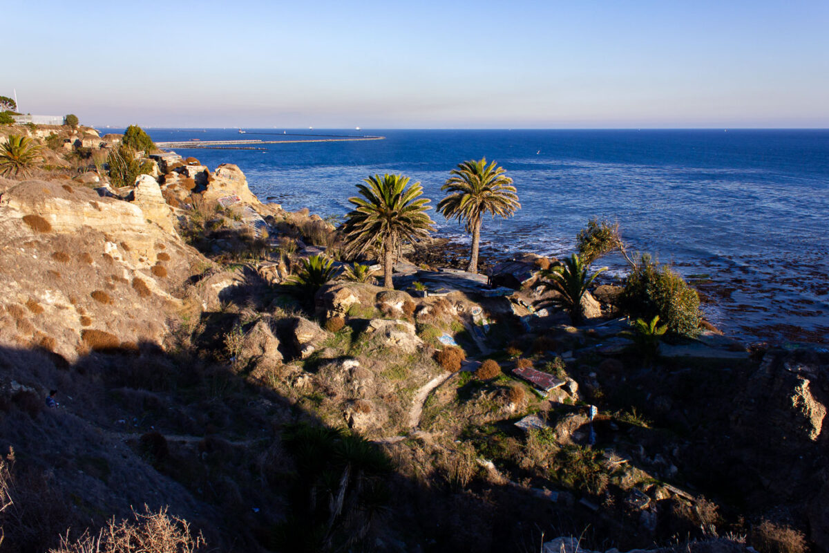
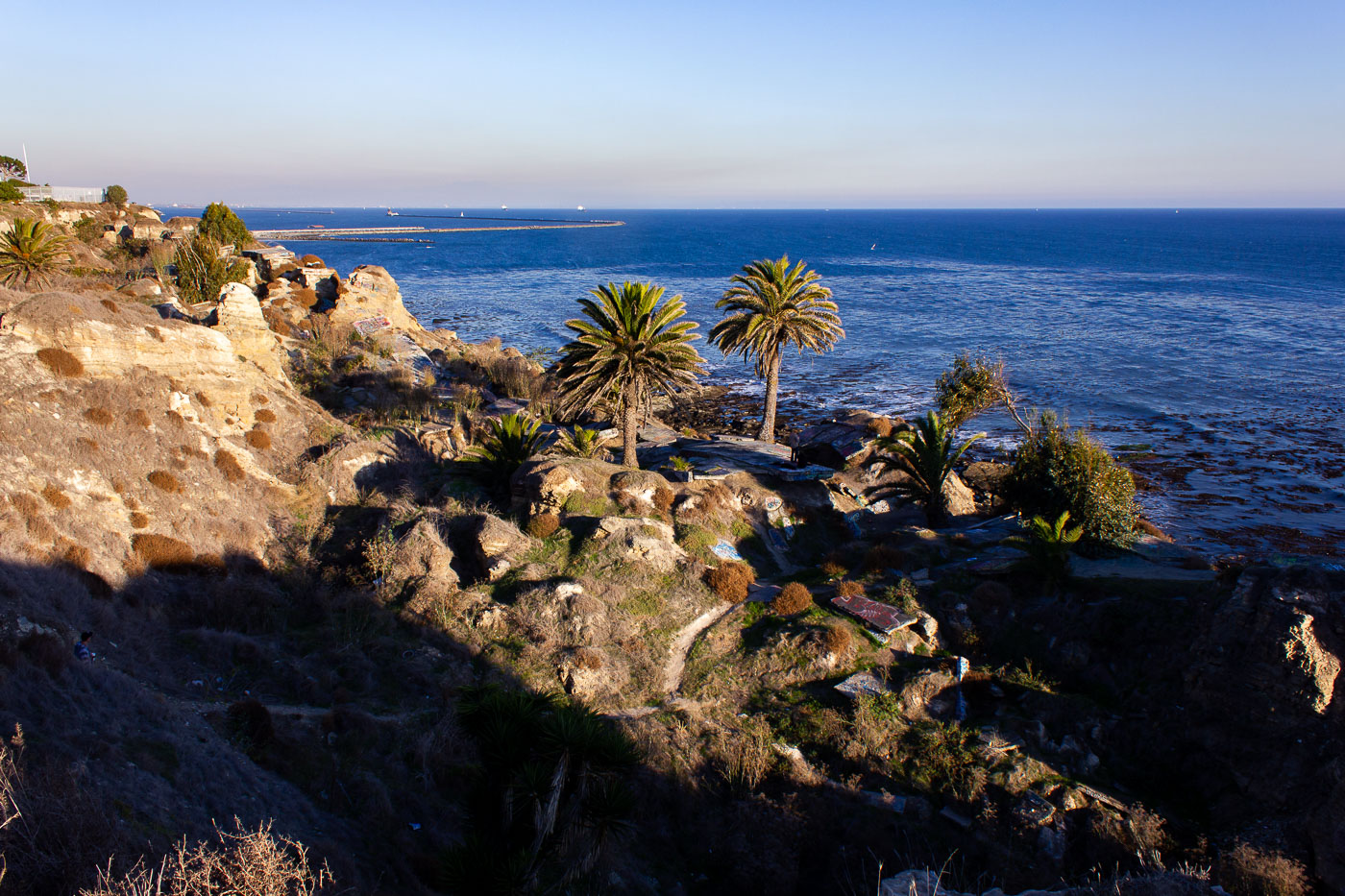
Palm trees grow on eroded cliffs at Sunken City in San Pedro, Los Angeles.
Sunken City occupies a stretch of collapsed bluff at Point Fermin in San Pedro, a Los Angeles neighborhood at the tip of the Palos Verdes Peninsula. A 1929 landslide fractured the streets and foundations of what had been a residential subdivision, dropping chunks of pavement and building slabs toward the shoreline and prompting the city to condemn the land. Geologists attribute the ongoing slippage to unstable shale and sandstone layers beneath the bluffs, a movement that continues today at a slow but measurable pace. Los Angeles kept the area fenced off for decades before opening it to the public in 2016 under a supervised-access program. The breakwater visible offshore shelters the Port of Los Angeles, one of the busiest container ports in the country.

Sunken City’s Cliffside Ruins Above the Pacific in San Pedro
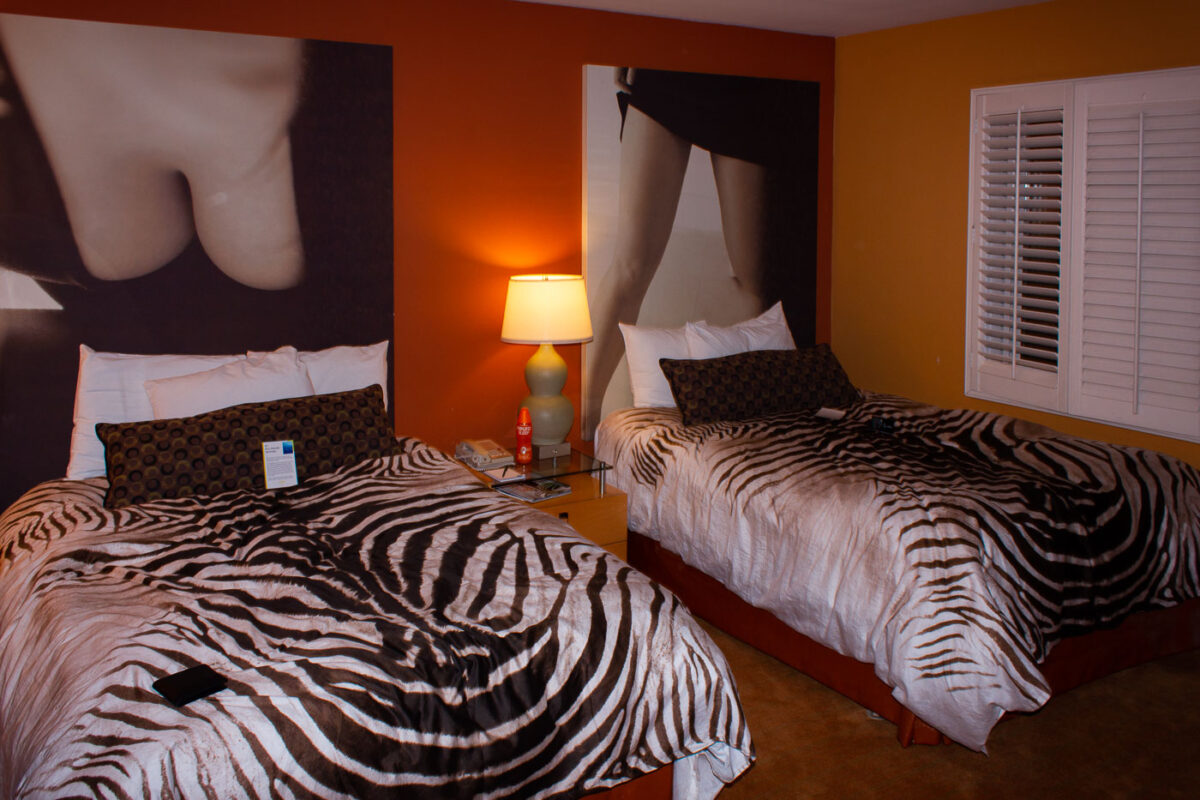
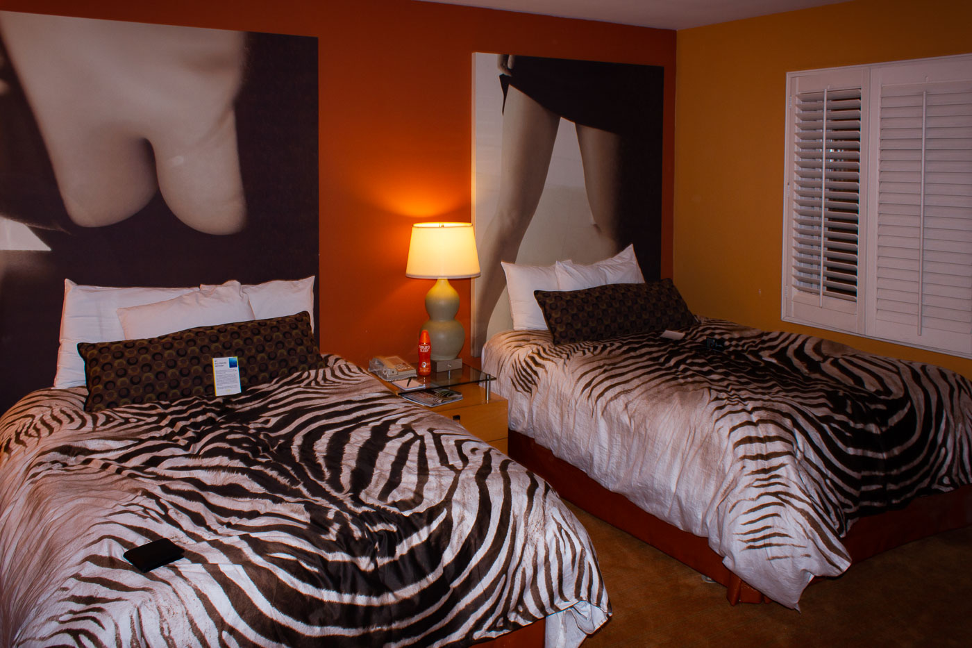
Two beds with zebra-print bedspreads in an orange-walled hotel room at the Grafton on Sunset.
The Grafton on Sunset is a boutique hotel on the Sunset Strip in West Hollywood, within walking distance of the Whisky a Go Go and the Roxy Theatre. Guest rooms carry a retro, pop-art theme, pairing patterned bedding with oversized black-and-white photo prints. Zebra-striped bedspreads are a recurring motif throughout the property's rooms.

A Zebra-Print Guest Room at the Grafton on Sunset
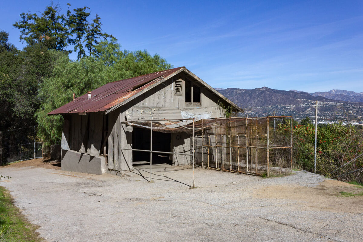
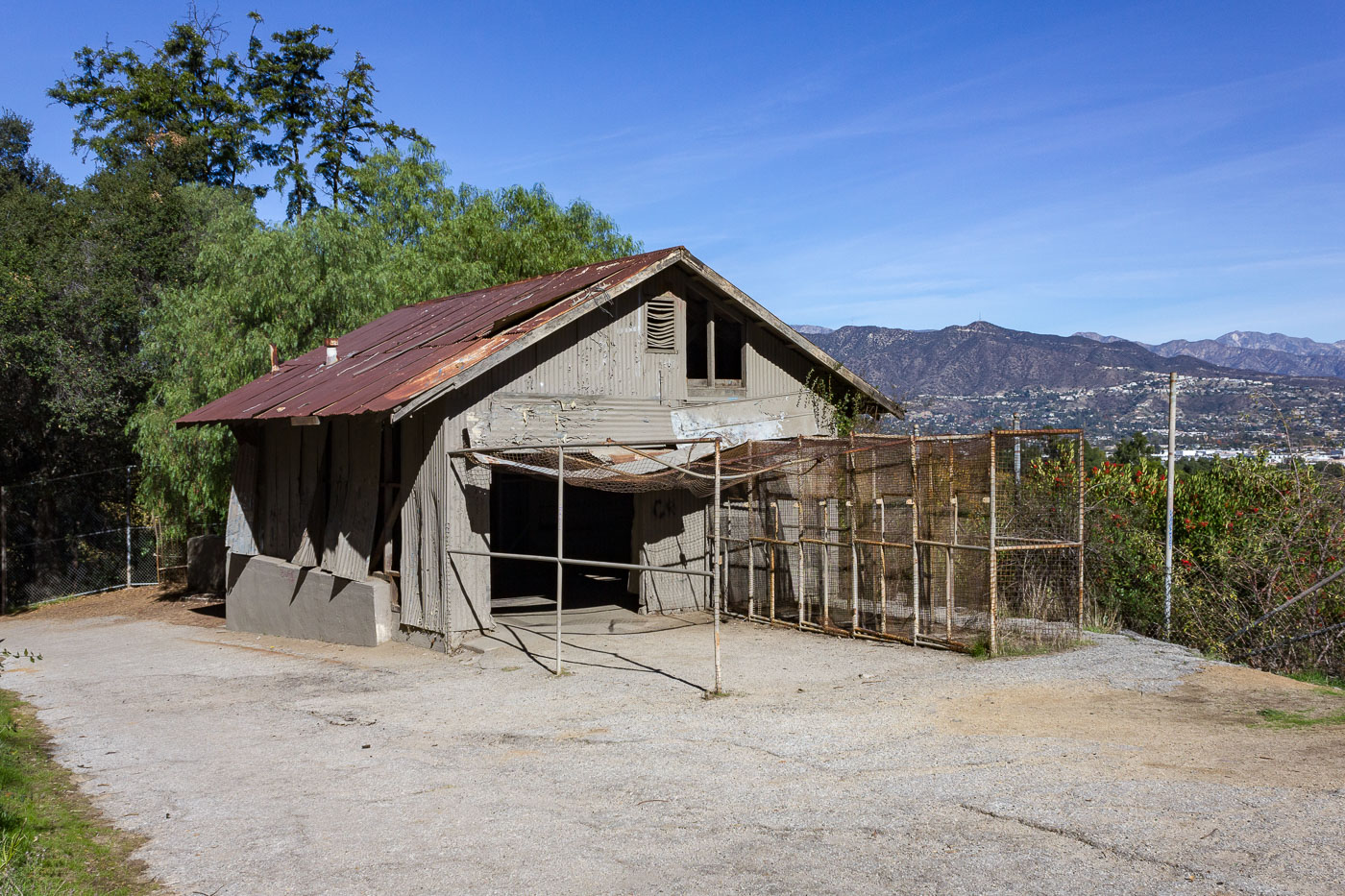
Abandoned animal enclosure from the original Los Angeles Zoo in Griffith Park, operating 1912–1965.
This former animal enclosure is a remnant of the old Griffith Park Zoo, which operated from 1912 to 1965 on the eastern side of the park. The zoo closed when its animals were relocated to the newly built Los Angeles Zoo in the adjacent hills, and the original grounds were left largely intact. Several of the old cages and dens still stand along the park's trails, built from wire mesh, wood, and concrete rather than the steel-reinforced enclosures used in modern zoos. The site is now open to hikers and picnickers as part of Griffith Park's public parkland.

Abandoned Animal Cage at the Old Griffith Park Zoo
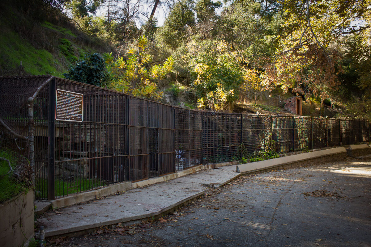
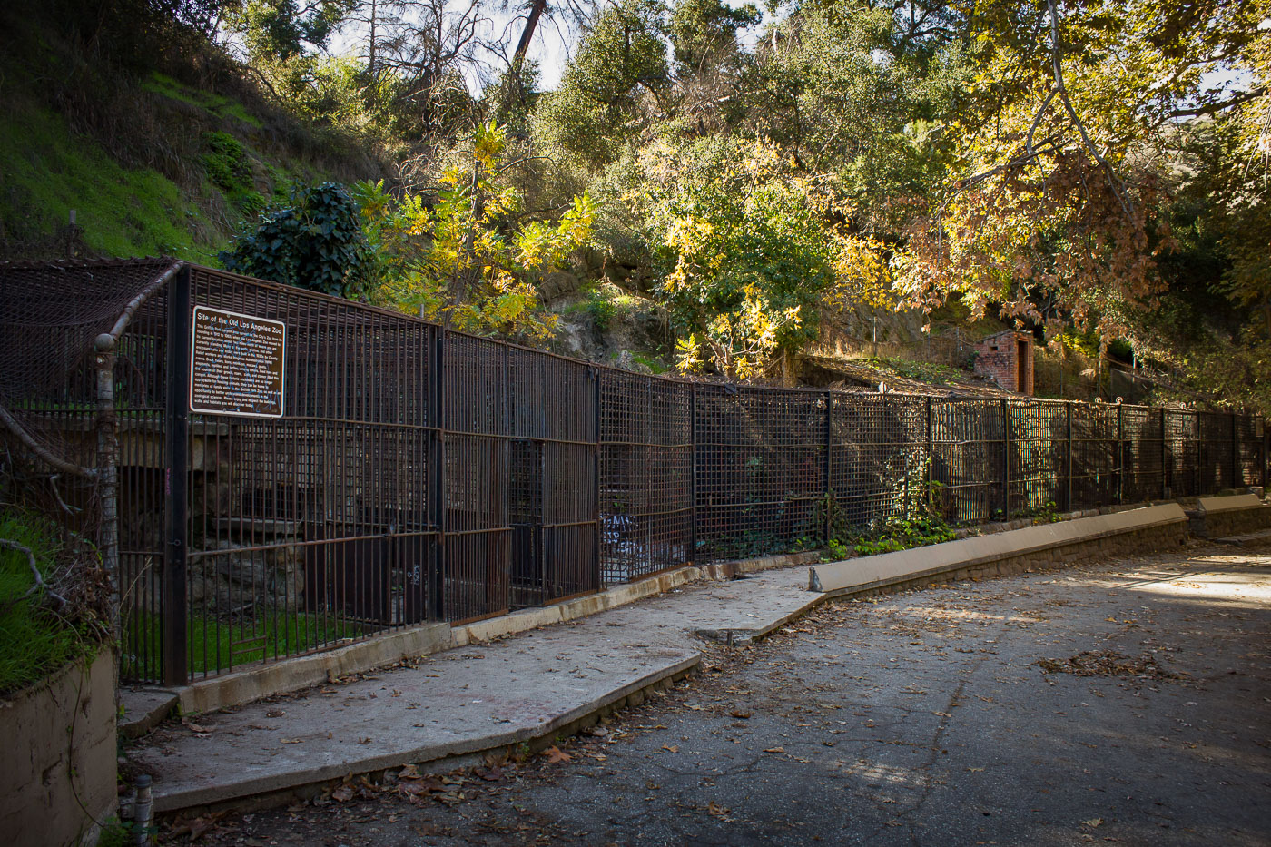
Abandoned animal enclosure with metal fencing and informational sign at the former Griffith Park Zoo, Los Angeles.
The old Griffith Park Zoo operated on this site from 1912 until 1966, when the animals moved to the newly built Los Angeles Zoo nearby. Many of the barred enclosures along this stretch date to the 1930s, when Works Progress Administration crews rebuilt much of the zoo's infrastructure. After closure, the grounds were absorbed into Griffith Park, and the old cages were left standing rather than demolished. Today the site is known informally as the Old Zoo, a picnic and hiking area where visitors can walk past the original enclosures.

Old Cages Along the Path at the Former Griffith Park Zoo
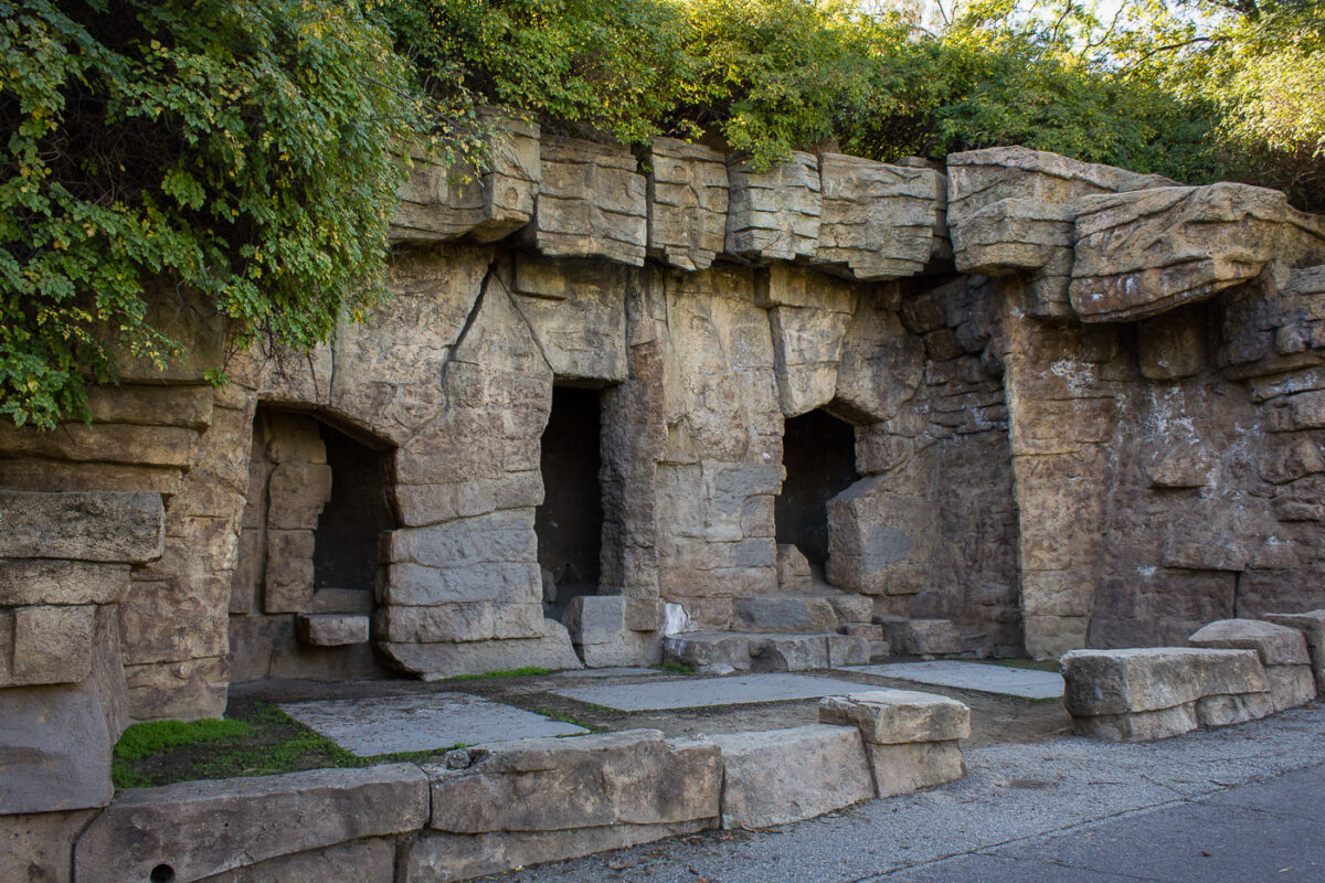
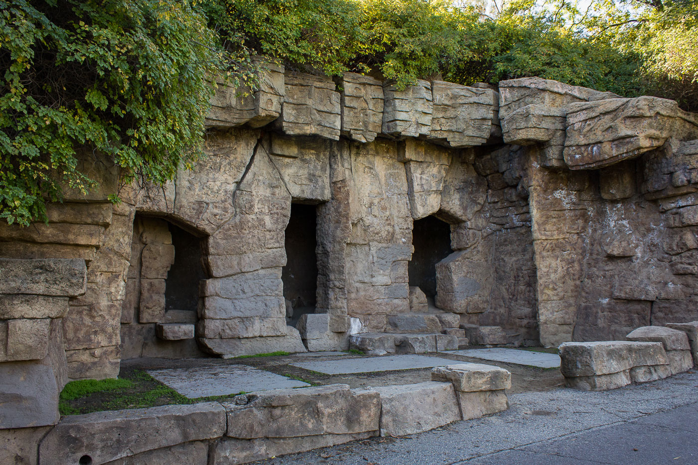
Abandoned stone bear enclosure with arched openings at the original Griffith Park Zoo, Los Angeles, 1912–1965.
These stone grottos are remnants of the original Griffith Park Zoo, which operated from 1912 until 1966. The zoo's bear dens were built into artificial rock formations meant to suggest a more natural enclosure than the barred cages common at the time. When the Los Angeles Zoo opened nearby in 1966, the old zoo grounds were left in place rather than demolished. The enclosures now sit along a paved walking path in Griffith Park, open to visitors as a historic ruin rather than a functioning exhibit.

Old Bear Grottos at the Original Griffith Park Zoo
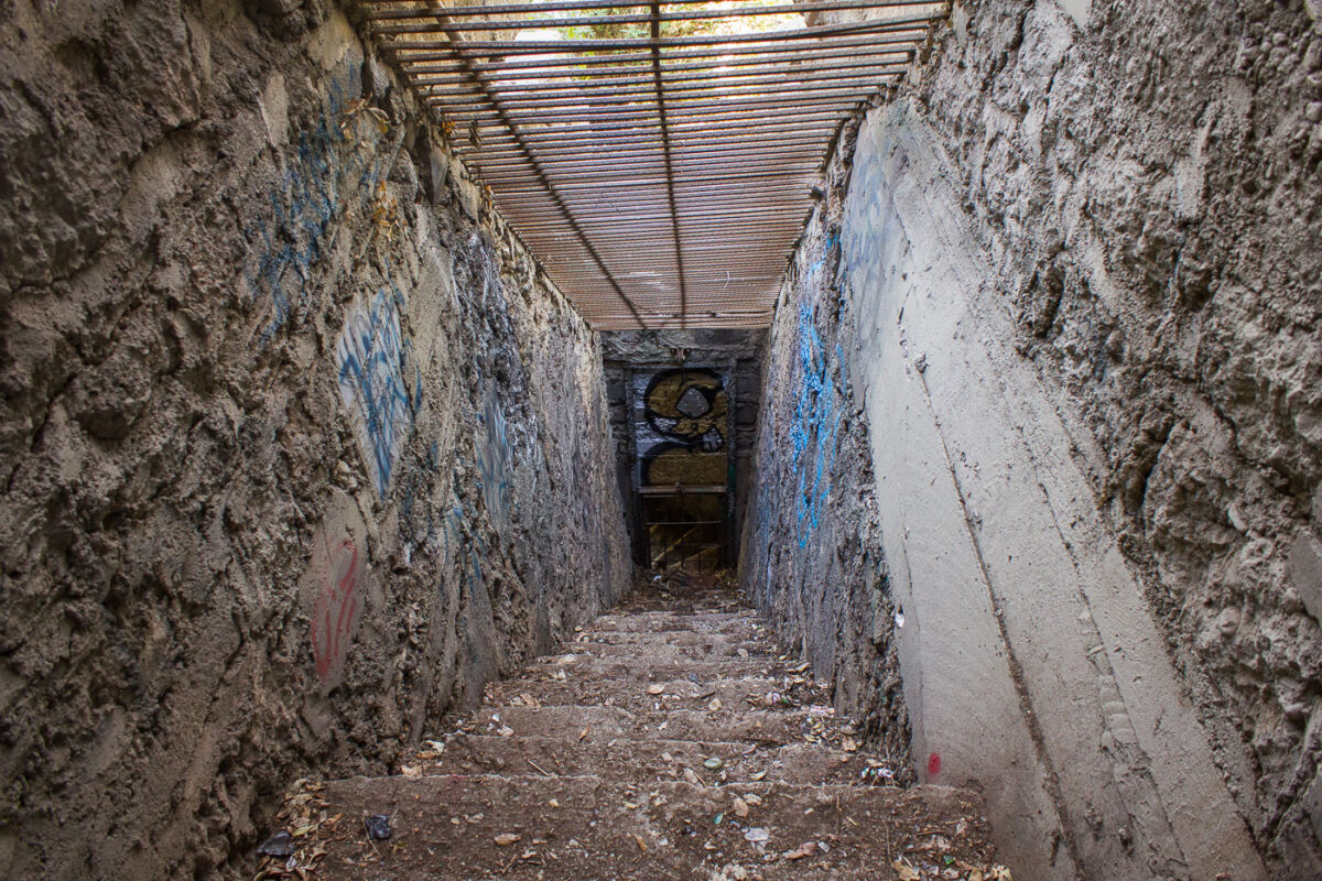
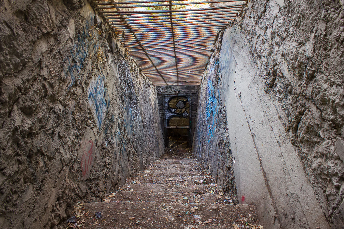
Deteriorated concrete animal enclosure with corrugated metal roof inside the abandoned Griffith Park Zoo, Los Angeles.
Griffith Park Zoo operated from 1912 until 1965, when the Los Angeles Zoo relocated to a new site elsewhere in the park. This stairway once led into one of the old animal enclosures, which held bears, lions, monkeys, and other species during the zoo's five decades of operation. The abandoned structures were left in place after closure and now sit within Griffith Park's Old Zoo Picnic Area, accessible to hikers and visitors. Layers of graffiti have accumulated on the concrete walls in the decades since the enclosures were emptied.

Stairway Into an Old Cage at Griffith Park Zoo
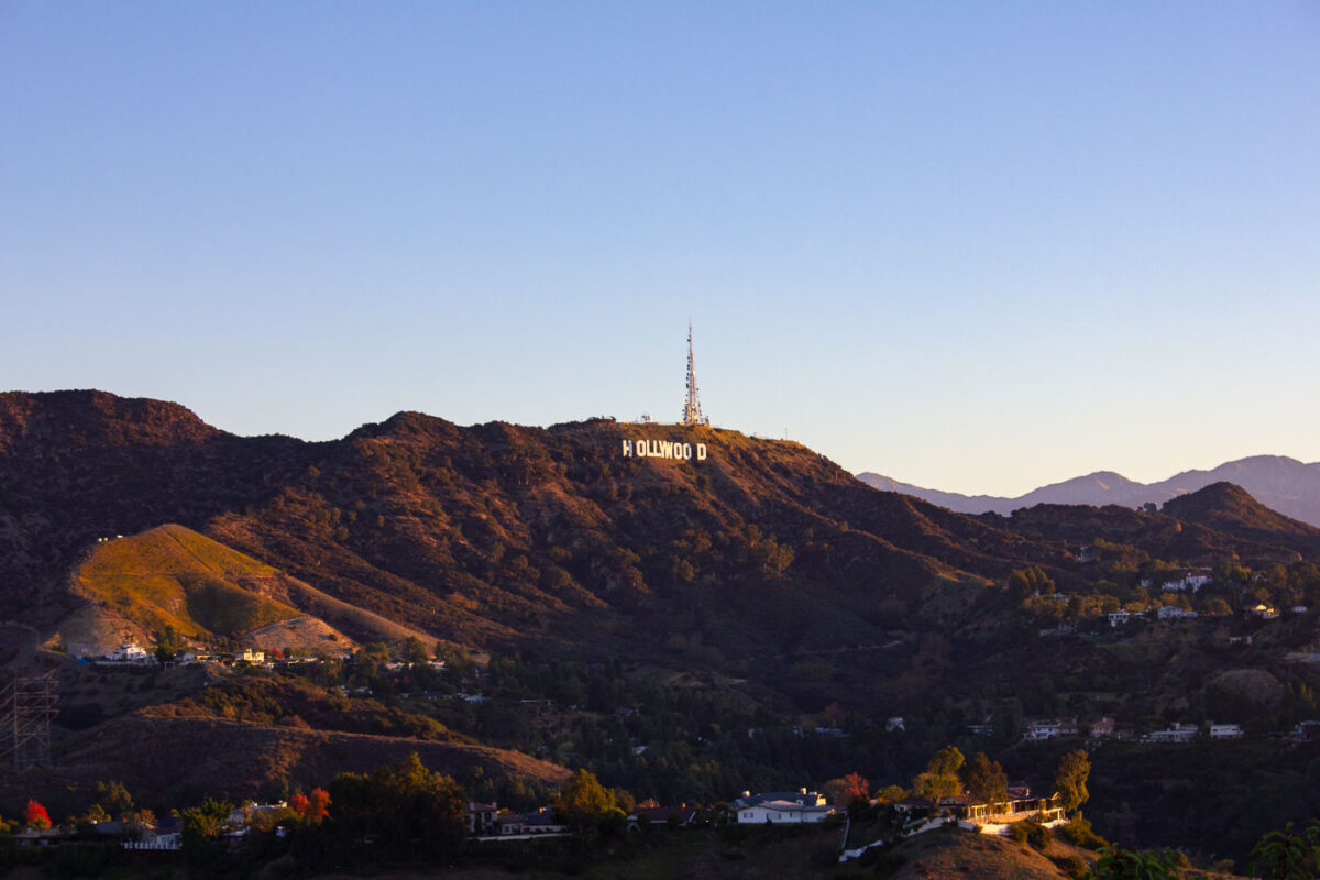
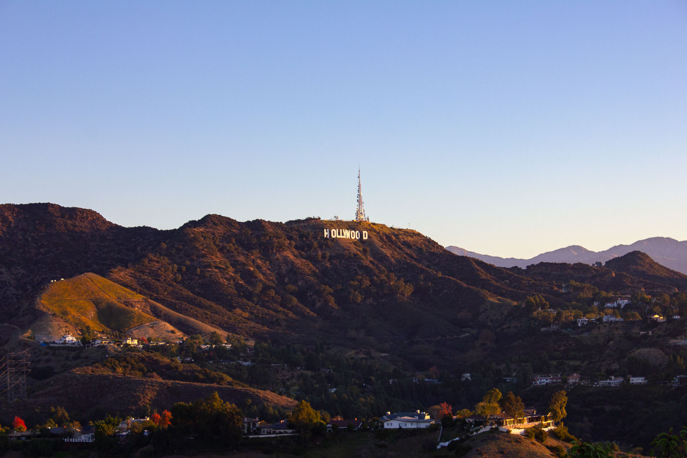
Hollywood Sign on hillside above residential area with Griffith Observatory tower in background, Los Angeles.
The Hollywood Sign sits on Mount Lee in Griffith Park, overlooking Los Angeles. It was built in 1923 as "HOLLYWOODLAND" to advertise a new real estate development in the hills above the city. The Hollywood Chamber of Commerce shortened it to "HOLLYWOOD" in 1949, and the current metal letters date to a 1978 reconstruction funded by donors including Hugh Hefner and Gene Autry. The sign runs 350 feet across the hillside, with each letter standing 45 feet tall. A broadcast tower beside the sign transmits signals for several Los Angeles television and radio stations.

The Hollywood Sign Above Mount Lee at Dusk
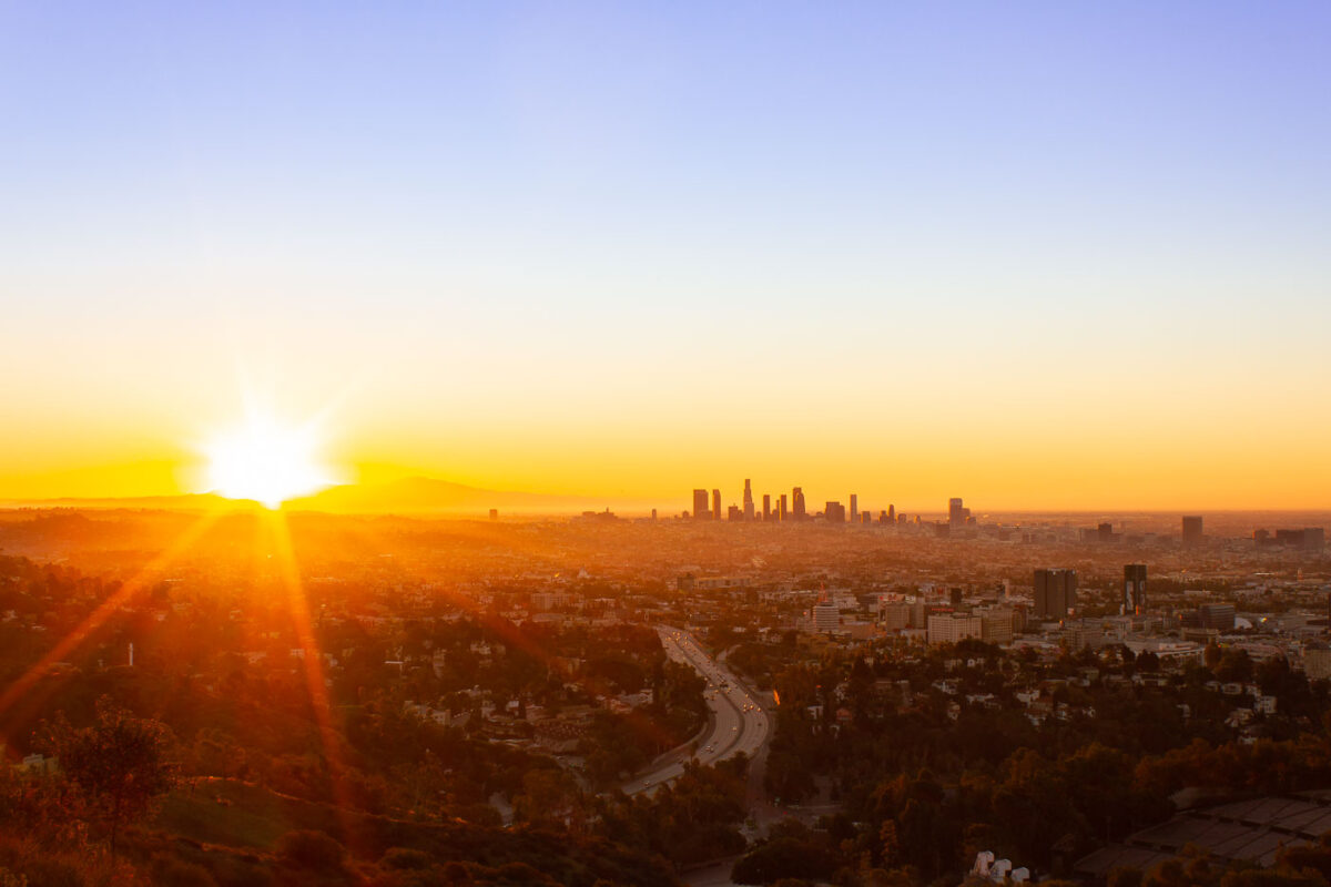
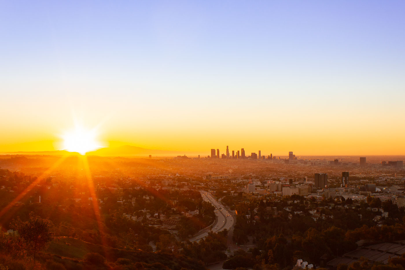
Los Angeles downtown skyline at sunrise from Mulholland Drive overlook, with winding freeway below.
Mulholland Drive runs roughly 21 miles along the ridgeline of the Santa Monica Mountains and Hollywood Hills, linking the Cahuenga Pass area to the Pacific Coast Highway. Named for civil engineer William Mulholland, the road opened in 1924 as part of efforts to connect the growing city with the San Fernando Valley. Its position along the ridge gives it a long sightline over the Los Angeles Basin, with the downtown skyline sitting roughly ten miles to the southeast. That skyline is anchored by the U.S. Bank Tower, completed in 1989 and, for years, the tallest building west of Chicago.

Downtown Los Angeles Skyline at Sunrise from Mulholland Drive
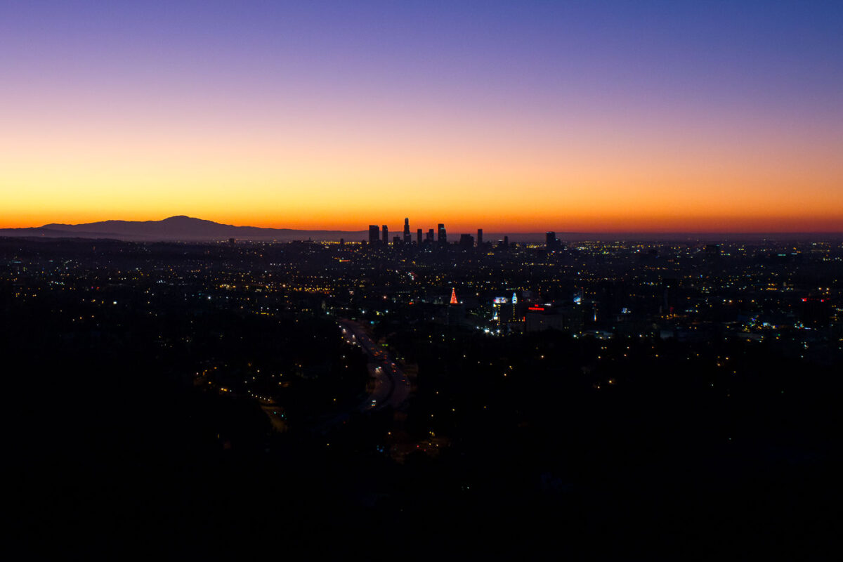
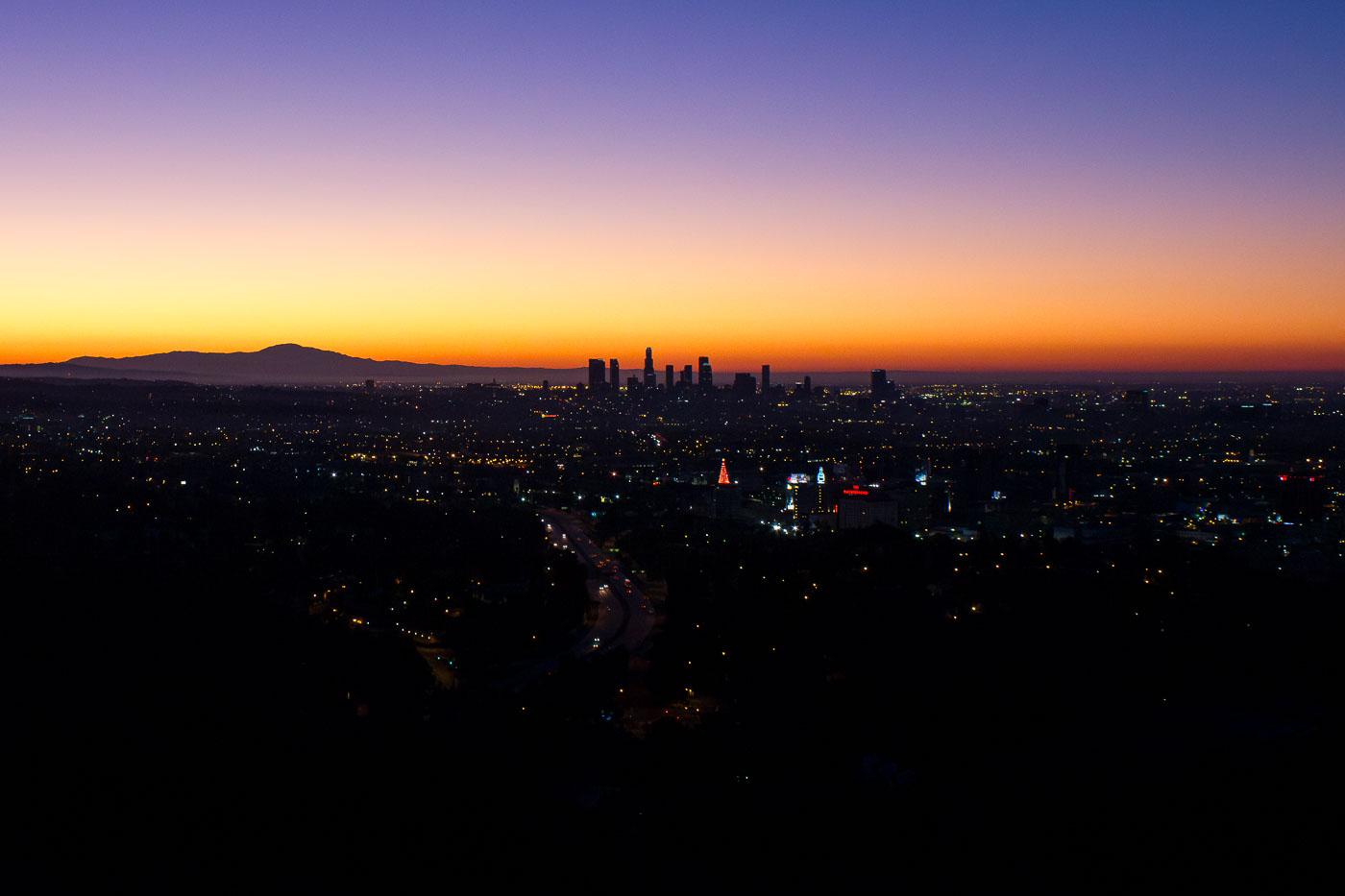
Los Angeles downtown skyline silhouetted against an orange and purple sunrise sky.
Downtown Los Angeles anchors the region's financial, legal, and entertainment industries, with its skyline visible for miles across the Los Angeles Basin. The US Bank Tower, completed in 1989 and standing 1,018 feet tall, was the tallest building west of Chicago until the Wilshire Grand Center surpassed it in 2017. The district's modern high-rise cluster took shape mostly after the city lifted height restrictions tied to earthquake concerns in the 1950s, allowing construction beyond the earlier 150-foot limit set by City Hall's height. The Santa Monica Mountains, including sections of Griffith Park, rise to the north and west of the skyline.

First Light Over the Downtown Los Angeles Skyline