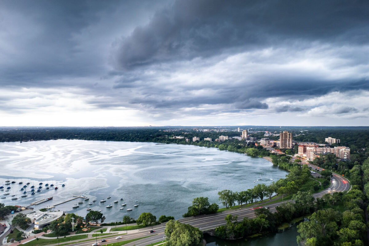
Thunderstorm over Bde Maka Ska, Minneapolis, July 2025
July 2025 — Thunderstorm rolling in over Bde Maka Ska in Minneapolis on July 27, 2025.
Explore photos tagged Clouds.
July 2025 — Thunderstorm rolling in over Bde Maka Ska in Minneapolis on July 27, 2025.
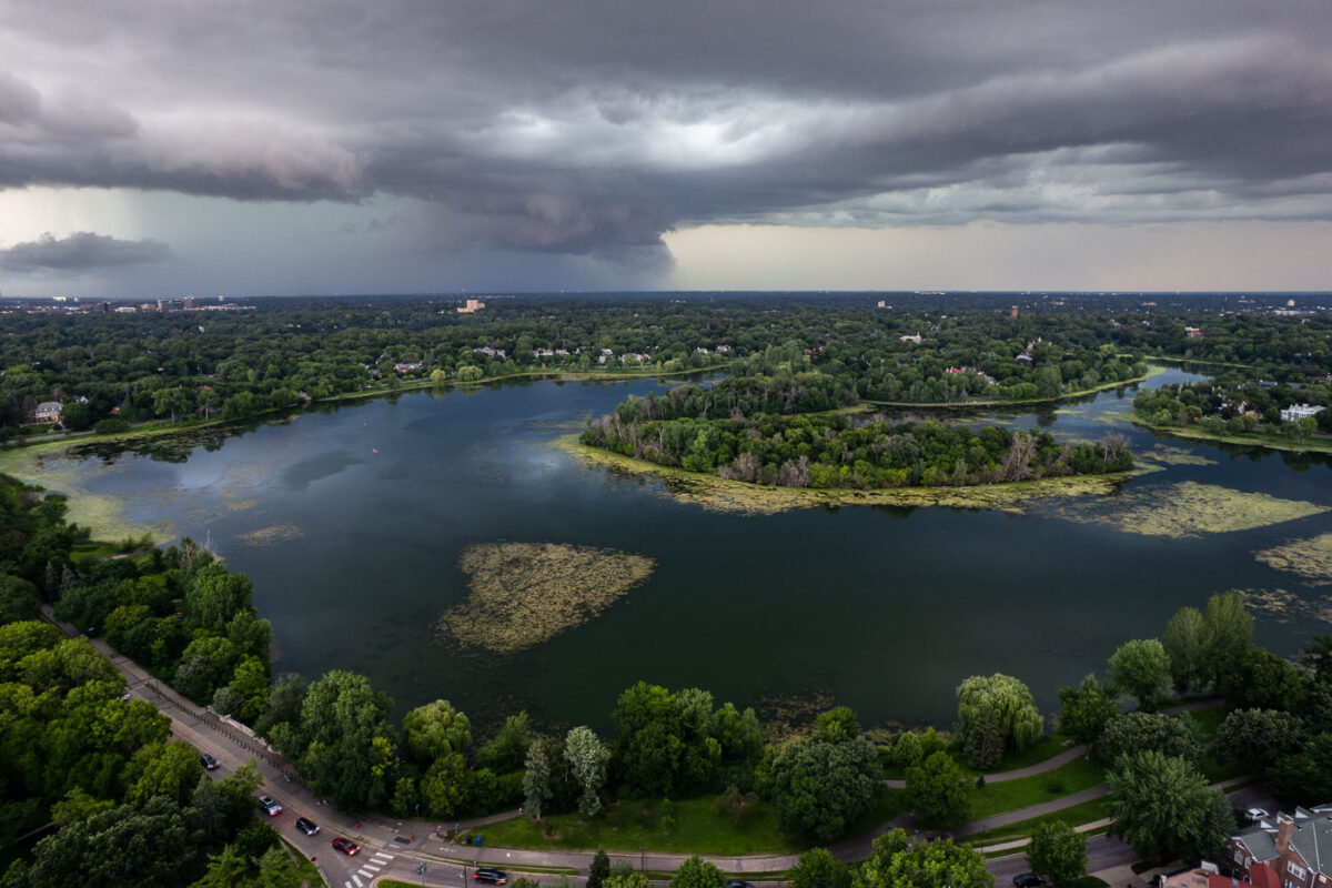
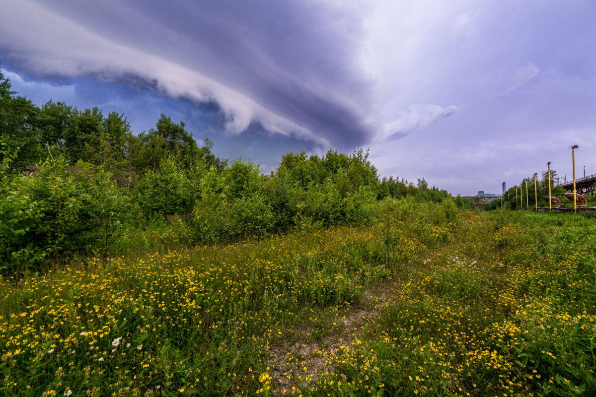
July 2025 — A large thunderstorm rolling in over Lake of the Isles in Minneapolis in July 2025.
July 2025 — Large thunderstorms move in during a weather warning over Lake of the Isles. Downtown Minneapolis visible.
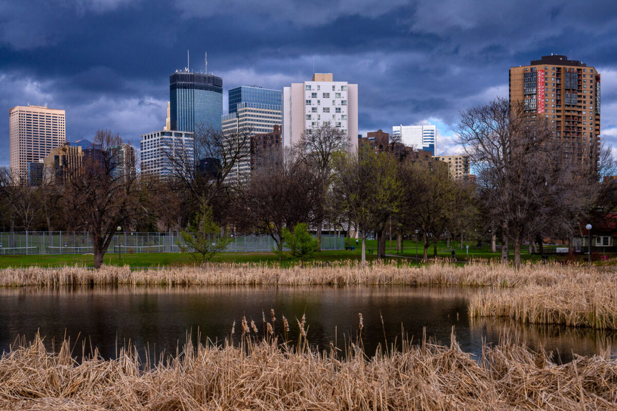
April 2024 — Dark storm clouds roll over downtown Minneapolis in this view from Loring Park, where the skyline’s mix of glass towers and historic brick buildings rises beyond the park’s quiet pond and reeds. The IDS Center, Capella Tower, and other high-rises dominate the horizon, their reflections muted in the pre-storm light. Taken during early spring, the trees remain bare while the surrounding grass begins to green, creating a striking contrast between nature’s seasonal transition and the geometric permanence of the city skyline.
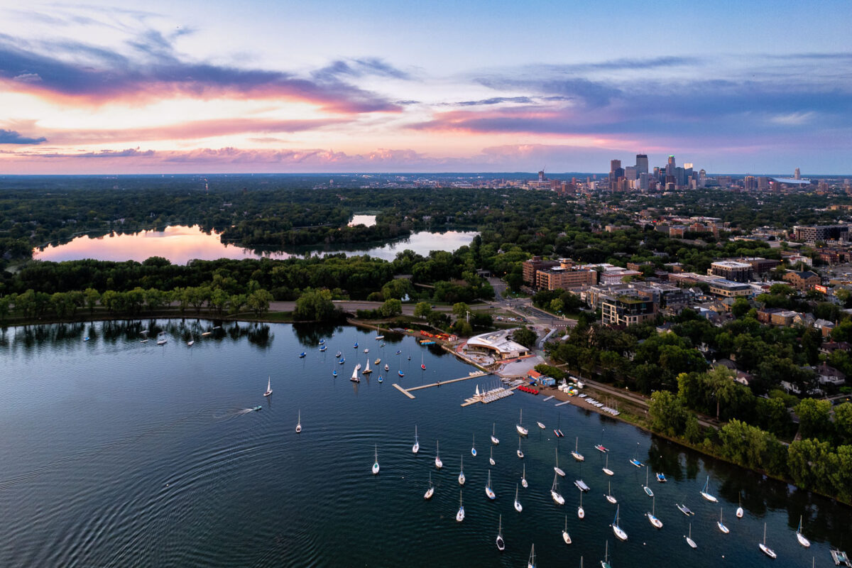
August 2023 — Sailboats on Bde Maka Ska in Minneapolis during sunset. Lake of the Isles seen in the distance.
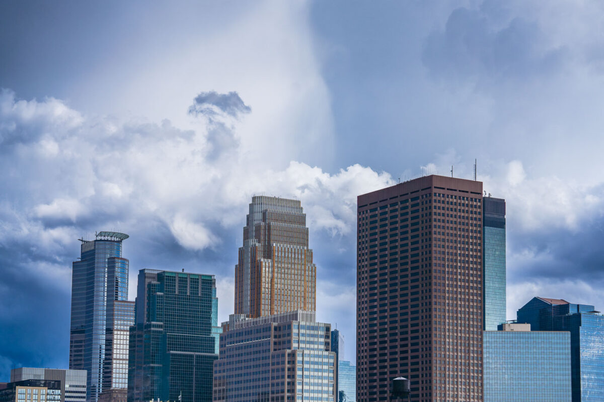
August 2023 — Caught some real funky clouds behind downtown Minneapolis.
August 2023 — Big clouds in downtown Minneapolis on August 3, 2023.
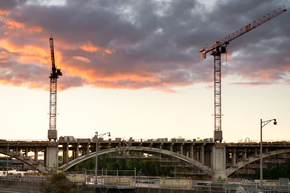
July 2022 — Construction cranes are visible over the Third Avenue Bridge in Minneapolis during a sunset. This bridge is a critical link between downtown Minneapolis and the Northeast community, spanning the Mississippi River. The ongoing reconstruction project aims to modernize the structure, which was originally built in the early 20th century and has served as a key piece of the city's transportation network.
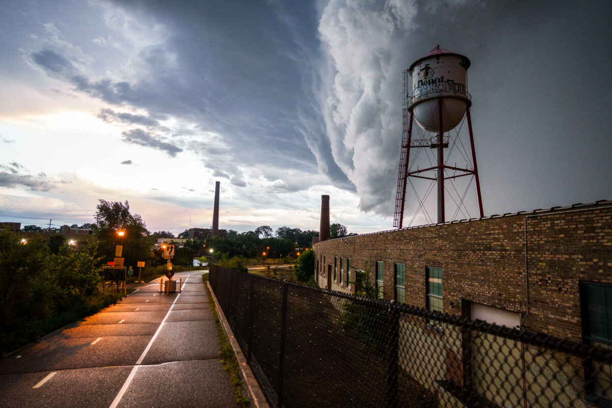
July 2022 — A massive storm front approaches Minneapolis on July 12, 2022, casting dark clouds over the city's industrial landscape. The photograph features a prominent water tower, labeled "Depot," and a brick industrial building, likely part of a former manufacturing or processing facility given the presence of smokestacks in the background. Water towers like this were essential for providing water pressure for industrial processes and fire suppression in urban and industrial areas. This particular tower, with its distinctive "Depot" marking, may have served a specific industrial complex or transportation hub within Minneapolis.

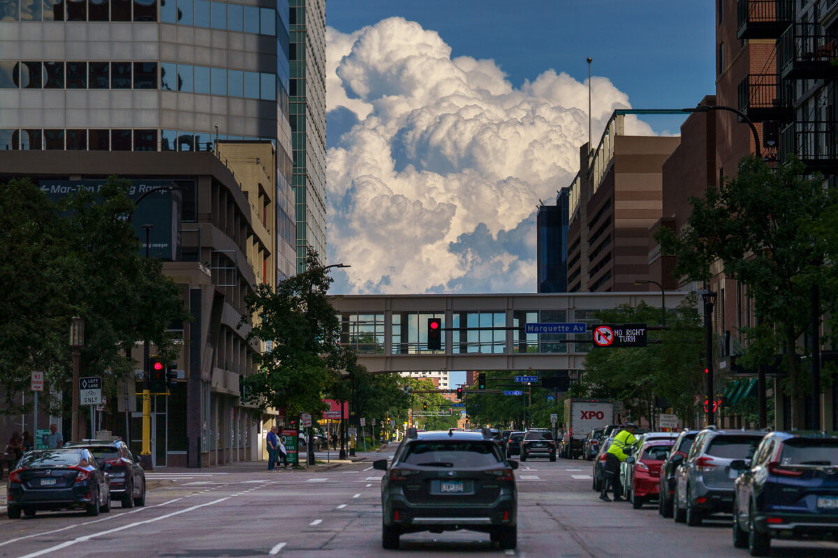
July 2022 — A severe thunderstorm approaches the Minneapolis skyline on July 12, 2022. The city's downtown core, with its characteristic modern architecture, is visible in the distance under a dramatic, dark cloud formation. The foreground shows a wet roadway, indicating recent rainfall, with traffic continuing despite the approaching weather. This image captures a moment of atmospheric intensity over a major Midwestern urban center, highlighting the dynamic relationship between weather and the built environment.

July 2022 — A powerful storm front approaches Minneapolis, Minnesota, on July 12, 2022. The image captures the city's skyline under a dramatic sky, with traffic moving along a wet highway. The presence of construction barrels suggests ongoing infrastructure work, a common characteristic of urban environments. This type of weather event is typical for the region during the summer months, impacting daily life and transportation.
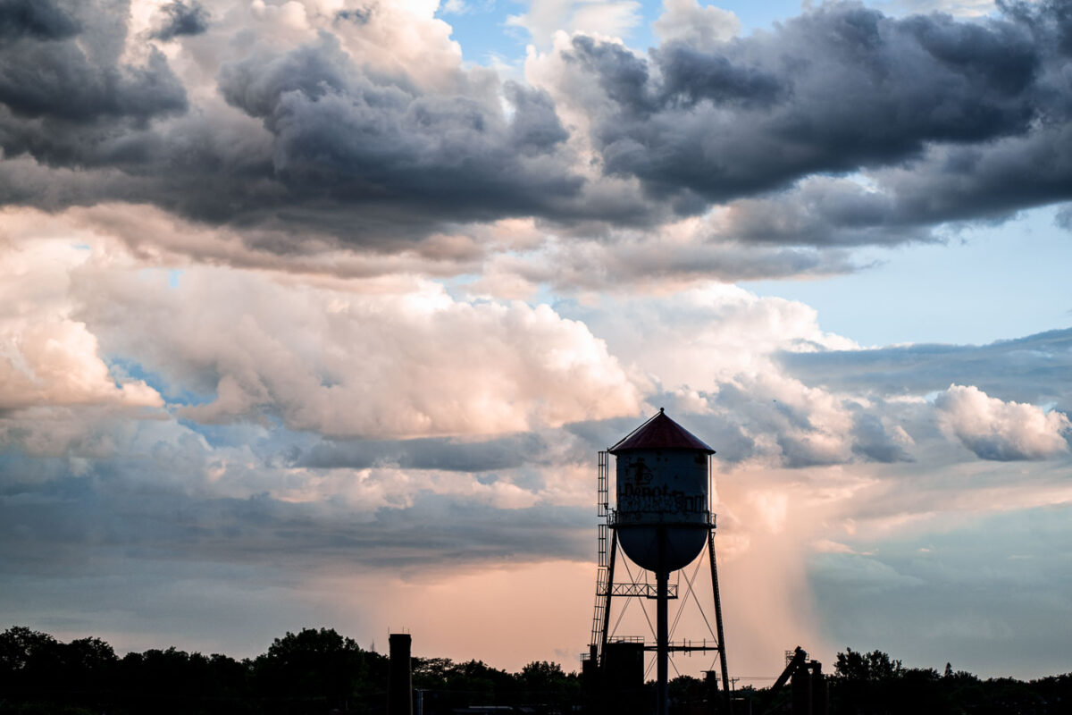
July 2022 — The Roof Depot water tower stands silhouetted against a dramatic sky in Minneapolis. Water towers like this one were essential for providing consistent water pressure to industrial and residential areas, particularly before the widespread adoption of modern pumping systems. This structure, likely built in the early to mid-20th century, served the needs of the surrounding industrial district. Its presence signifies a period of significant urban and industrial development in Minneapolis.
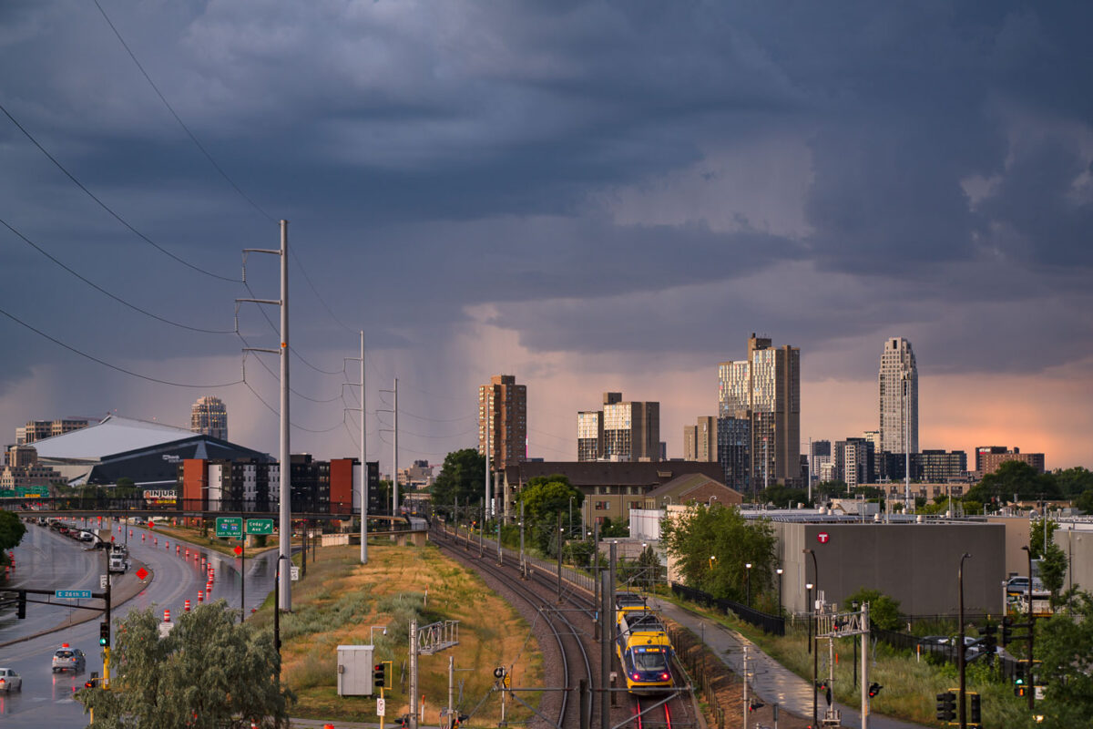
July 2022 — Storm clouds loom over the Minneapolis skyline on July 12, 2022, with the U.S. Bank Stadium visible on the left. The image also features the Metro Blue Line light rail, a key component of public transit in the Twin Cities. Opened in 2004, the Blue Line connects Minneapolis-Saint Paul International Airport and the Mall of America to downtown Minneapolis, serving as a vital link for commuters and visitors. The infrastructure facilitates access to the city's core employment centers and cultural attractions.
September 2021 —
July 2019 — Storm clouds rolling into Taconite Harbor and Lake Superior. The storm didn't last long but provided some incredible clouds.
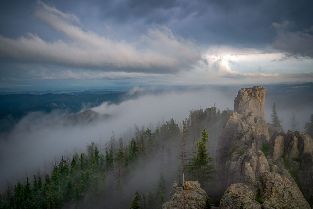
July 2019 — Low clouds sweep across the granite pinnacles of the Cathedral Spires in the Black Hills of South Dakota, wrapping the rugged landscape in drifting fog just after dawn. These towering formations—some rising more than 5,000 feet above sea level—are part of the Needles range within Custer State Park, a region shaped by millions of years of erosion and uplift. The rock spires, composed primarily of Harney Peak granite, are a hallmark of the park’s dramatic geology and a favorite destination for climbers and photographers. On mornings like this, the fog often settles in the valleys below, creating a fleeting illusion of islands floating above the forest, while the peaks catch the first light breaking through the storm-heavy sky.
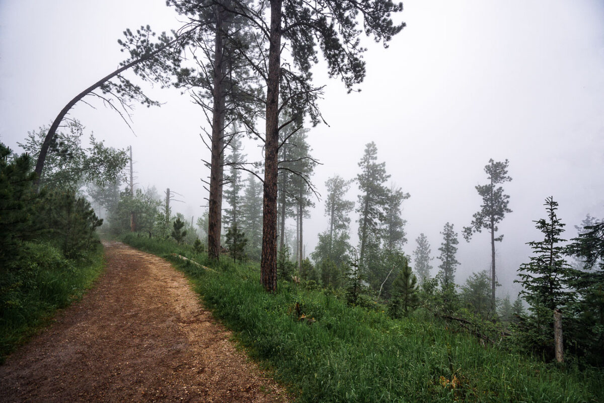
July 2019 — A mist-laden trail winds through the ponderosa pine forest near the summit of Black Elk Peak in the Black Hills of South Dakota. The fog softens the rugged terrain, reducing the visibility of distant ridges and creating a quiet, atmospheric stillness in the morning air. This area, once known as Harney Peak, stands as the highest point east of the Rocky Mountains and is a sacred place to the Lakota Sioux, where natural beauty and cultural heritage converge in the clouds.
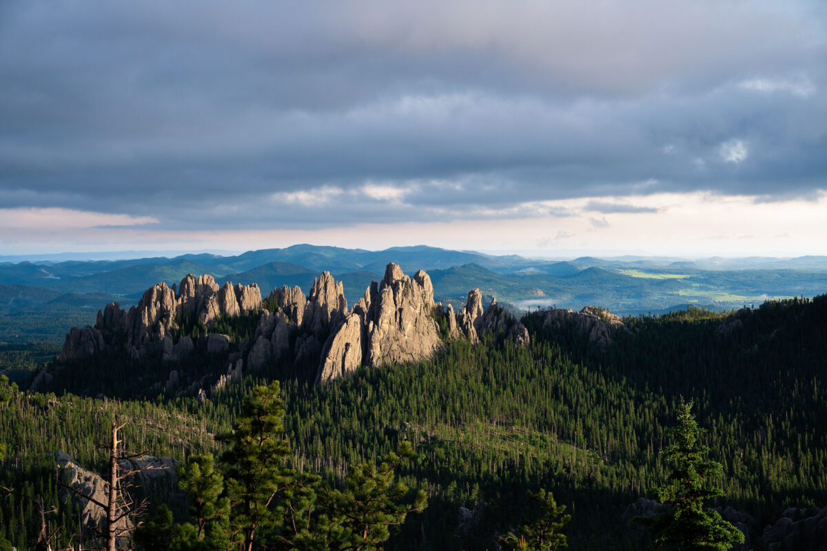
July 2019 — Evening light breaks through heavy clouds to illuminate the Needles, a cluster of towering granite spires rising above dense pine forest in the Black Hills of South Dakota. The sharp pinnacles, part of Custer State Park’s Cathedral Spires formation, are composed of eroded granite that dates back more than a billion years, sculpted by time and weather into their distinctive vertical forms. This region, accessible by the winding Needles Highway, is both a geological marvel and a spiritual landscape—its rugged skyline long revered by the Lakota Sioux and later celebrated by photographers, climbers, and travelers drawn to the surreal beauty of South Dakota’s mountain heartland.
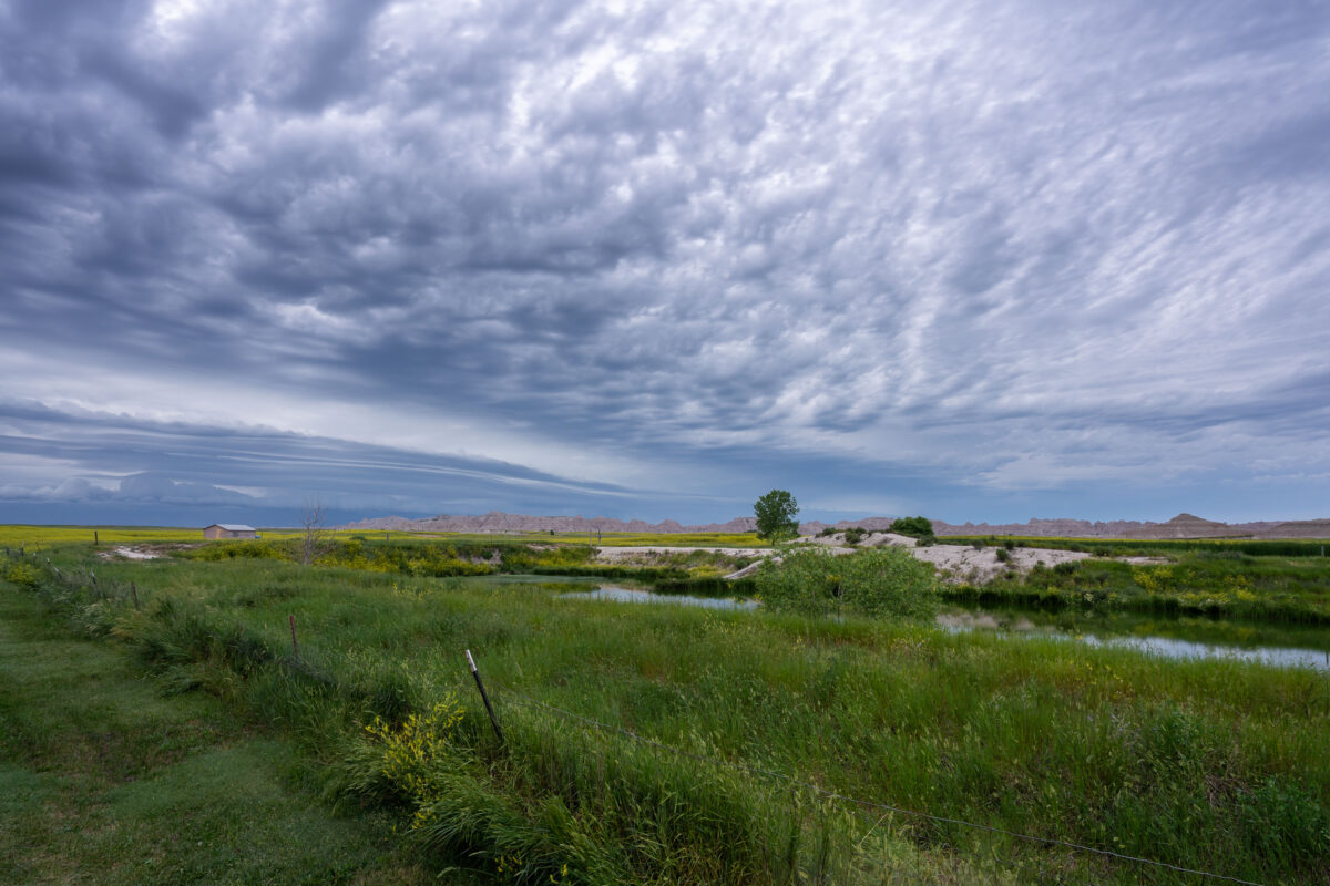
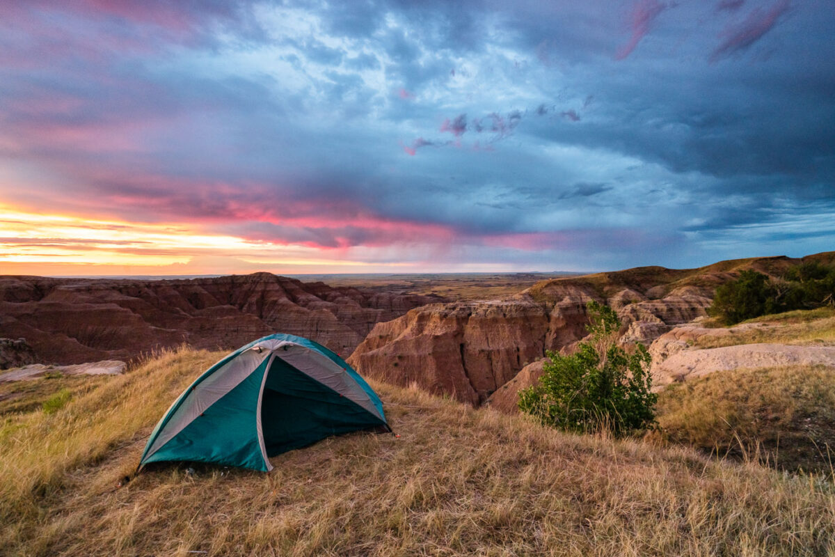
July 2019 — Amazing storm clouds rolling into Interior, South Dakota at our camp site near the Badlands National Park. It seems every year we get at least one really great thunderstorm when camping.
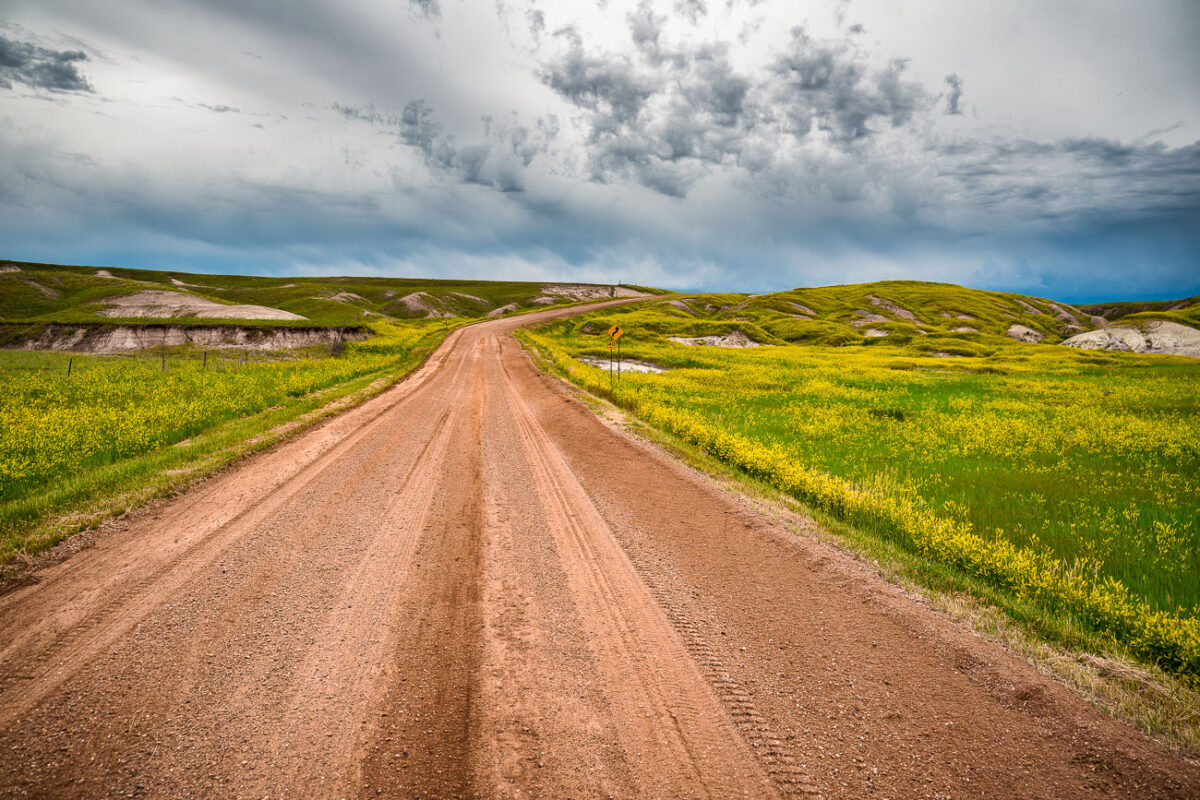
July 2019 — A dirt road cuts through the rolling prairie of Indian Creek Drive in the western reaches of Badlands National Park, near the small town of Scenic, South Dakota. Storm clouds build over the mixed-grass plains, casting dramatic light on the green hills and wildflower fields typical of the park’s early summer landscape. This remote section of the Badlands, less traveled than the main loop road, reveals the quieter beauty of the park—where erosion-carved ridges and open grasslands merge under a vast and changeable sky.
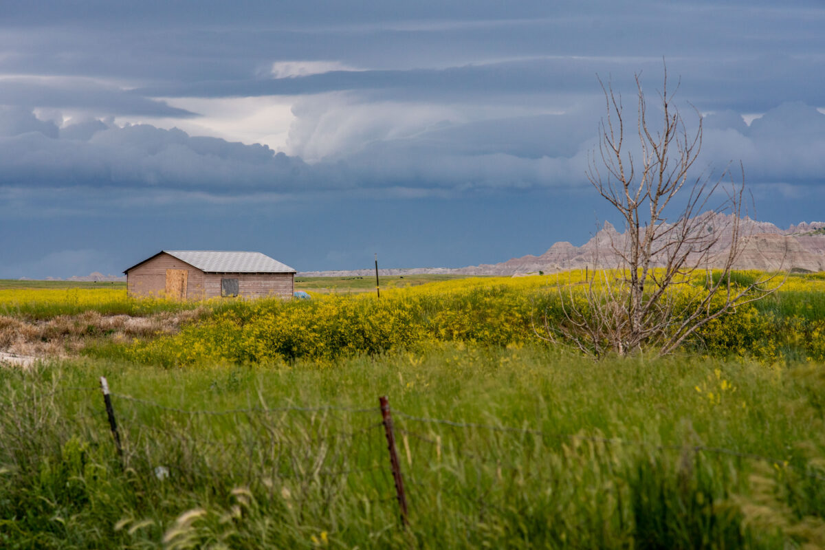
July 2019 — A lone wooden shed stands among fields of wild grasses and yellow blooms as storm clouds gather near Interior, South Dakota, on the outskirts of Badlands National Park. The layered sky hints at an incoming summer storm sweeping across the plains, with the rugged formations of the Badlands visible on the horizon. The muted colors and boarded windows evoke both isolation and endurance, capturing the tension between human settlement and the vast, unpredictable prairie environment.
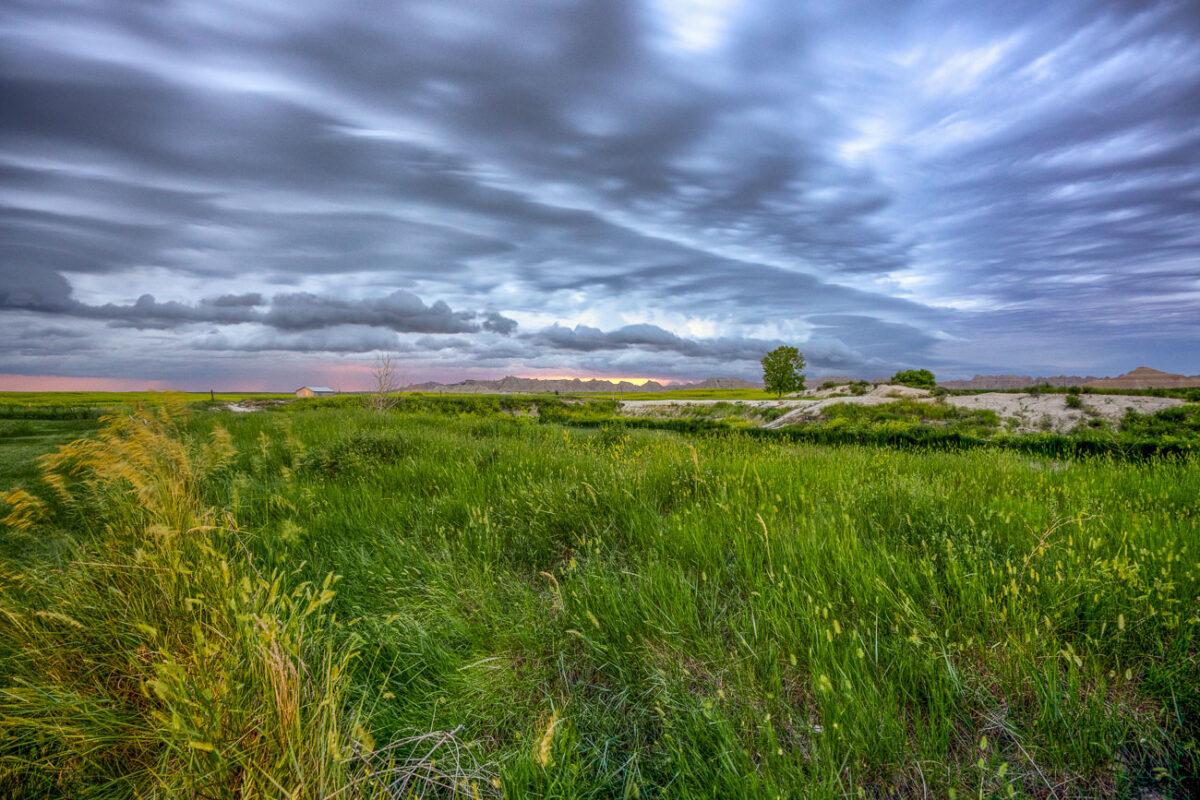
July 2019 — An approaching storm looms over the rolling grasslands near Interior, South Dakota, at the edge of Badlands National Park. The layered clouds form dramatic bands above the wetland and open prairie, where a small structure and fence line mark the human presence in this otherwise vast and untamed landscape. From this vantage point near the White River, the eroded formations of the Badlands rise faintly in the distance, emphasizing the contrast between the lush foreground and the arid, sculpted terrain beyond.
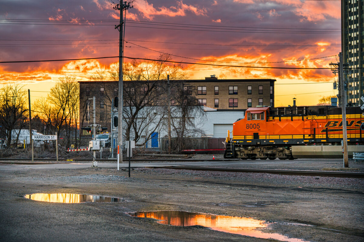
April 2019 — BNSF train goes through intersection at Harrison Sreet in Northeast Minneapolis during sunset.
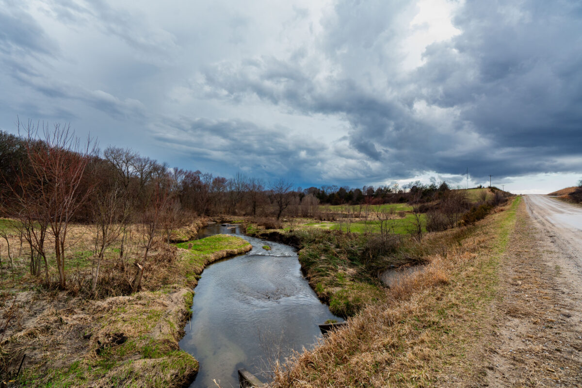
April 2019 — A winding stretch of Bear Creek cuts through farmland near Roland, Iowa, beneath a brooding Midwestern sky. The narrow gravel road parallels the stream, leading the viewer’s eye toward the horizon where dark storm clouds gather. Early spring growth is visible along the banks, with fields just beginning to emerge from winter dormancy. This rural scene captures the quiet tension between stillness and the coming weather typical of Iowa’s open countryside.
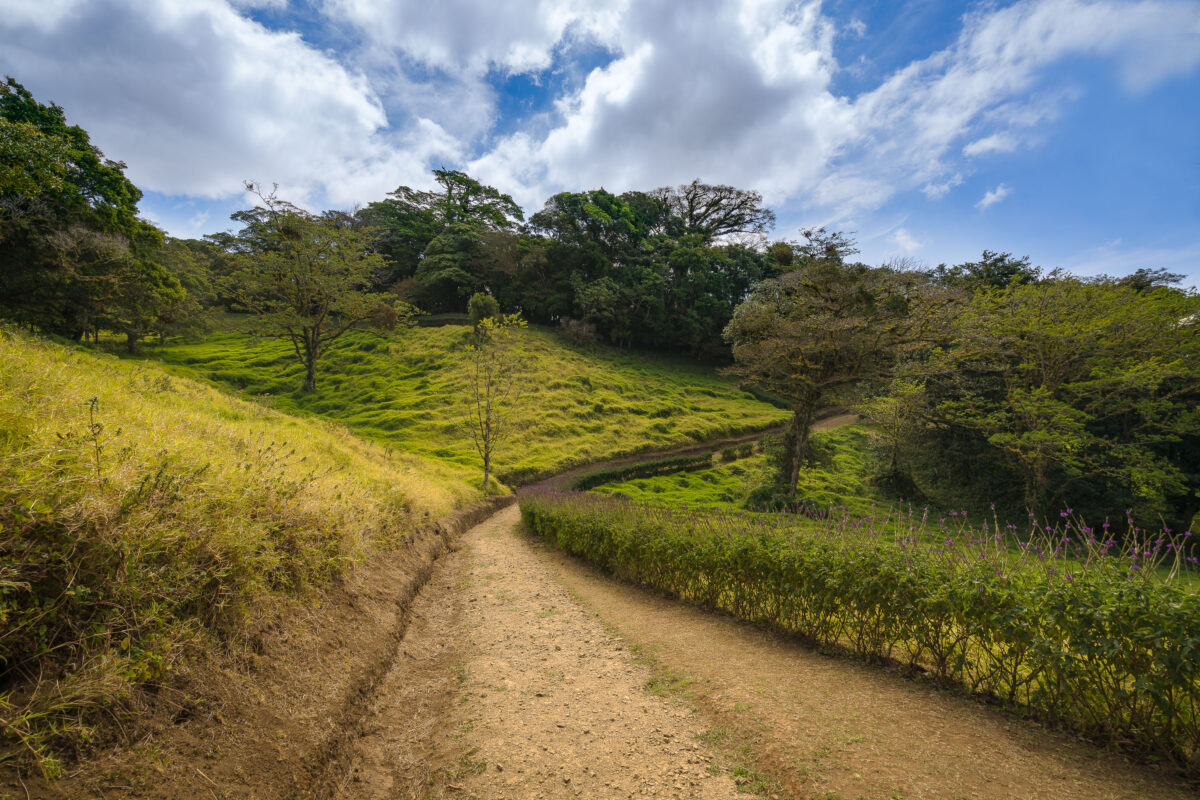
February 2019 — A walking path in a Monteverde cloud forest.
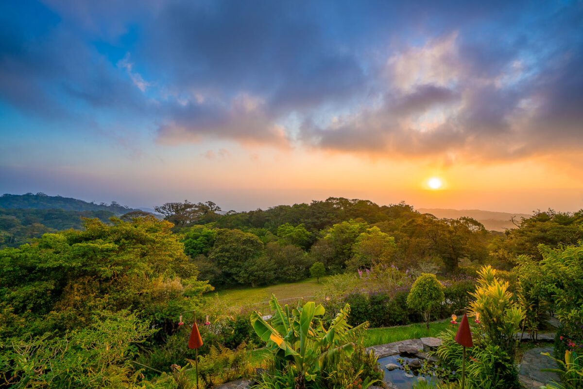
February 2019 — Monteverde Costa Rica Sunset from Hidden Canopy treehouses.
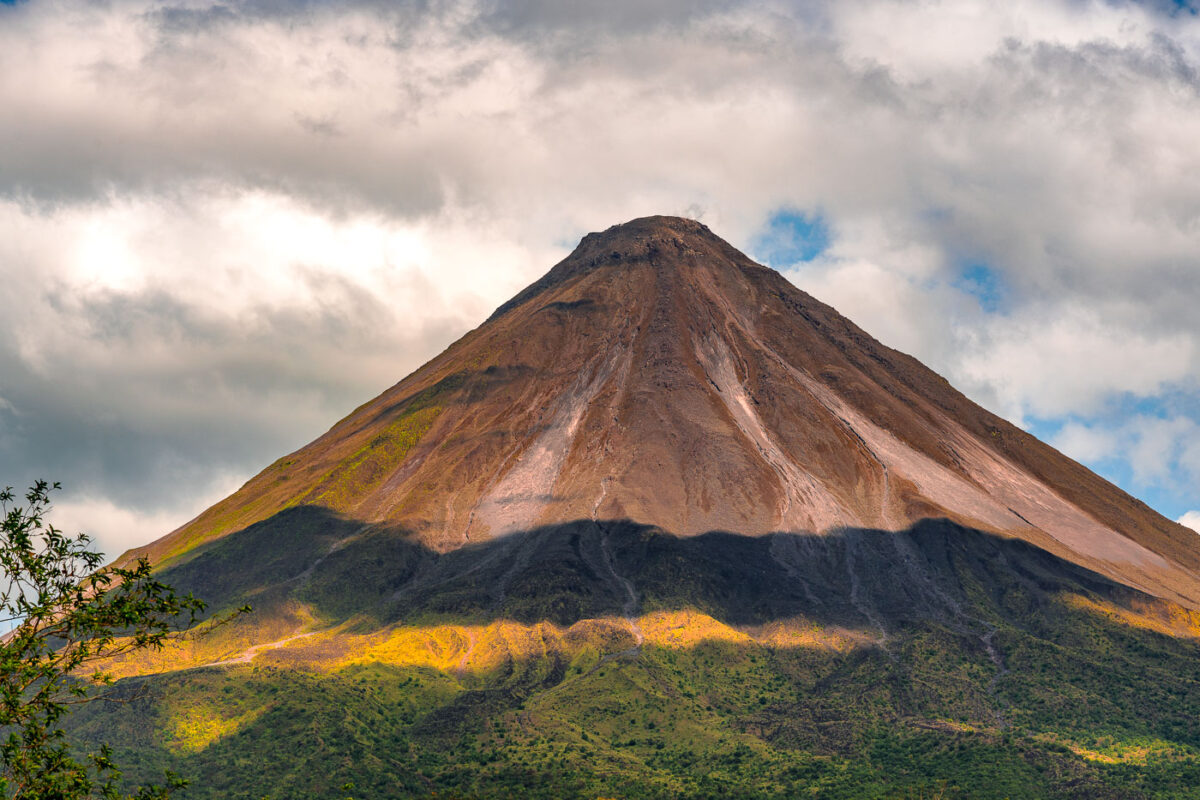
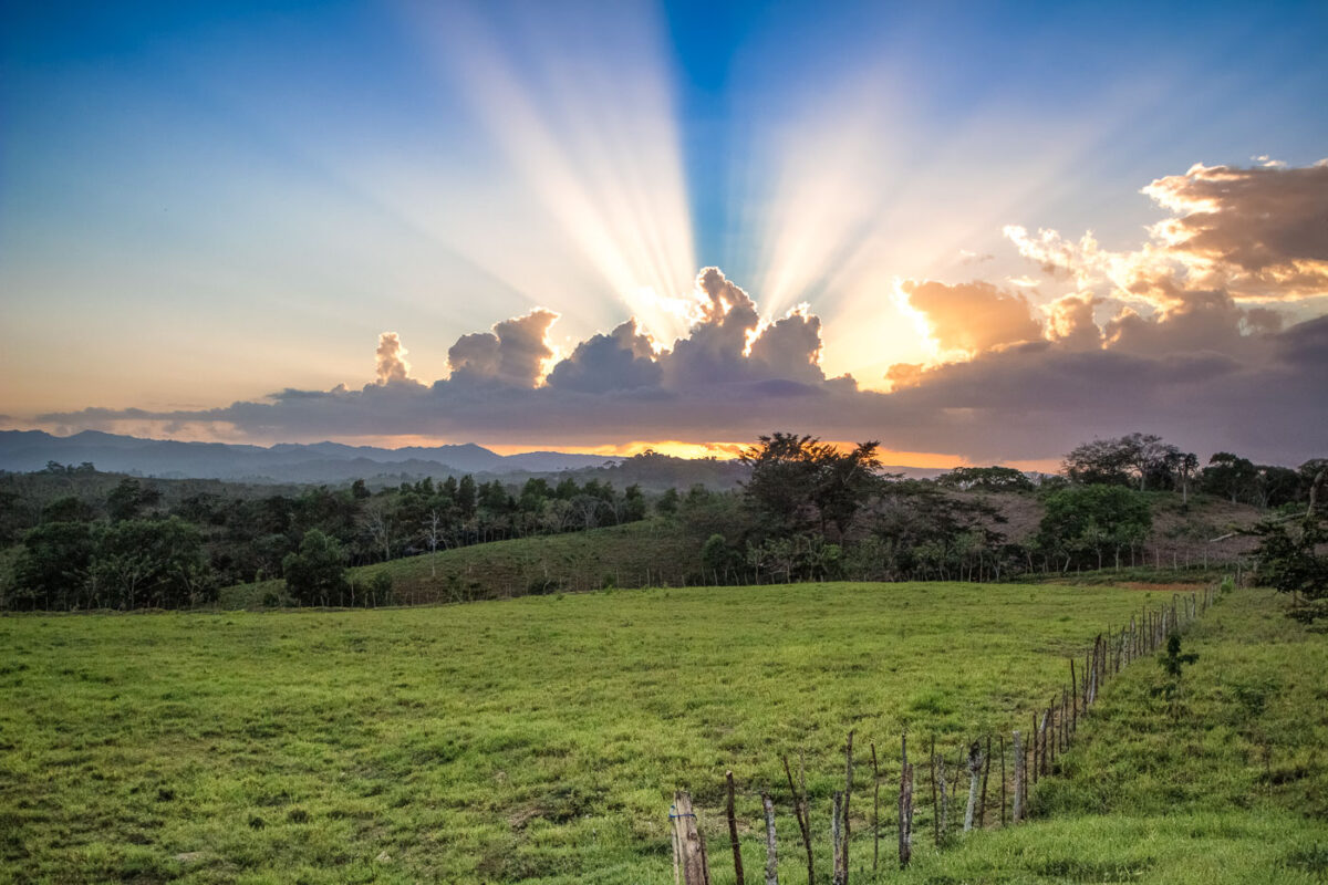
February 2019 — Arenal Volcano in Costa Rica with shadows from the clouds.
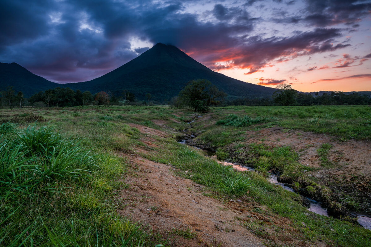
February 2019 — The sun sets behind the Arenal Volcano from La Fortuna in Costa Rica.
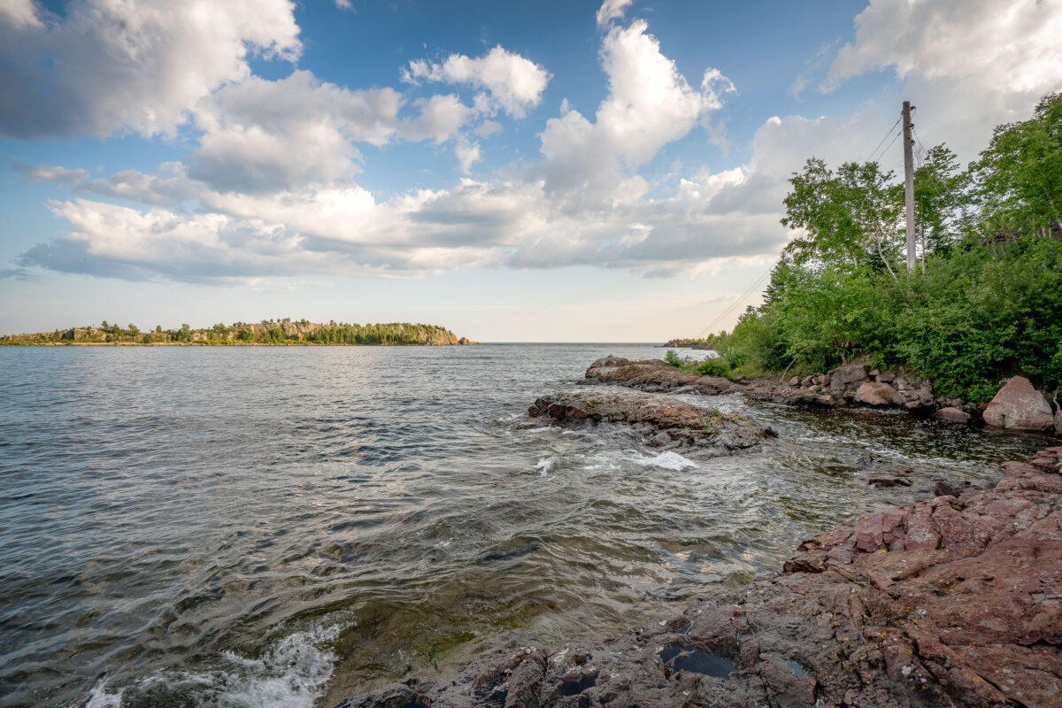
July 2017 — The rocky shoreline at Taconite Harbor, Minnesota, once served as a vital shipping point for the state’s iron mining industry. Built in the early 1950s by the Erie Mining Company, the harbor was designed to handle massive shipments of processed taconite pellets from the Mesabi Iron Range, transported by a private 74-mile rail line to the Lake Superior coast. The harbor’s docks, loading equipment, and nearby company housing formed a self-contained industrial community that thrived for decades. The surrounding area was developed during a period of postwar expansion when Minnesota’s natural resources fueled North American manufacturing. Taconite Harbor operated until the early 2000s, when global shifts in steel production led to its closure. What remains today—crumbling concrete piers, rusted transmission towers, and wind-swept rock formations—speaks to both the resilience of the landscape and the region’s deep connection to the rise and fall of heavy industry along the North Shore.
July 2017 —
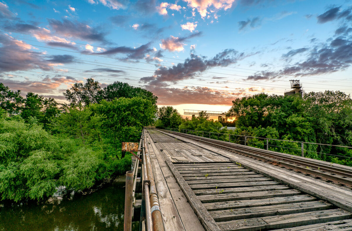
June 2017 — A wooden freight train bridge over the Mississippi River in Minneapolis.
February 2016 —
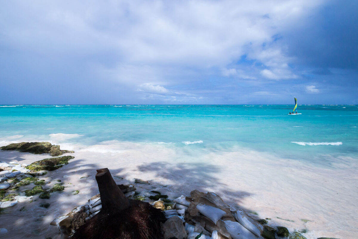
February 2016 — A sailboat in Punta Cana, Dominican Republic