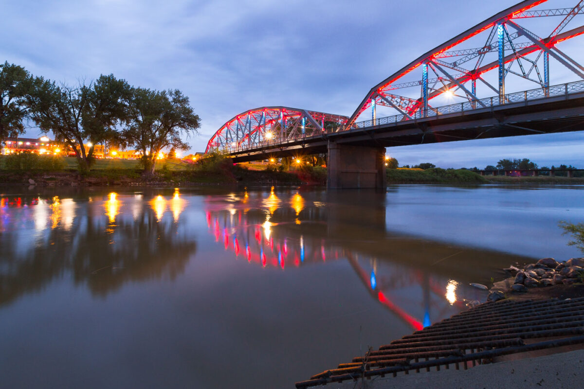
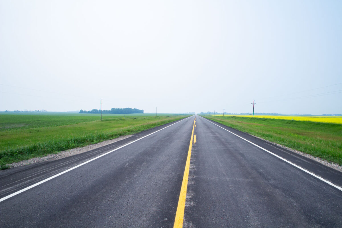
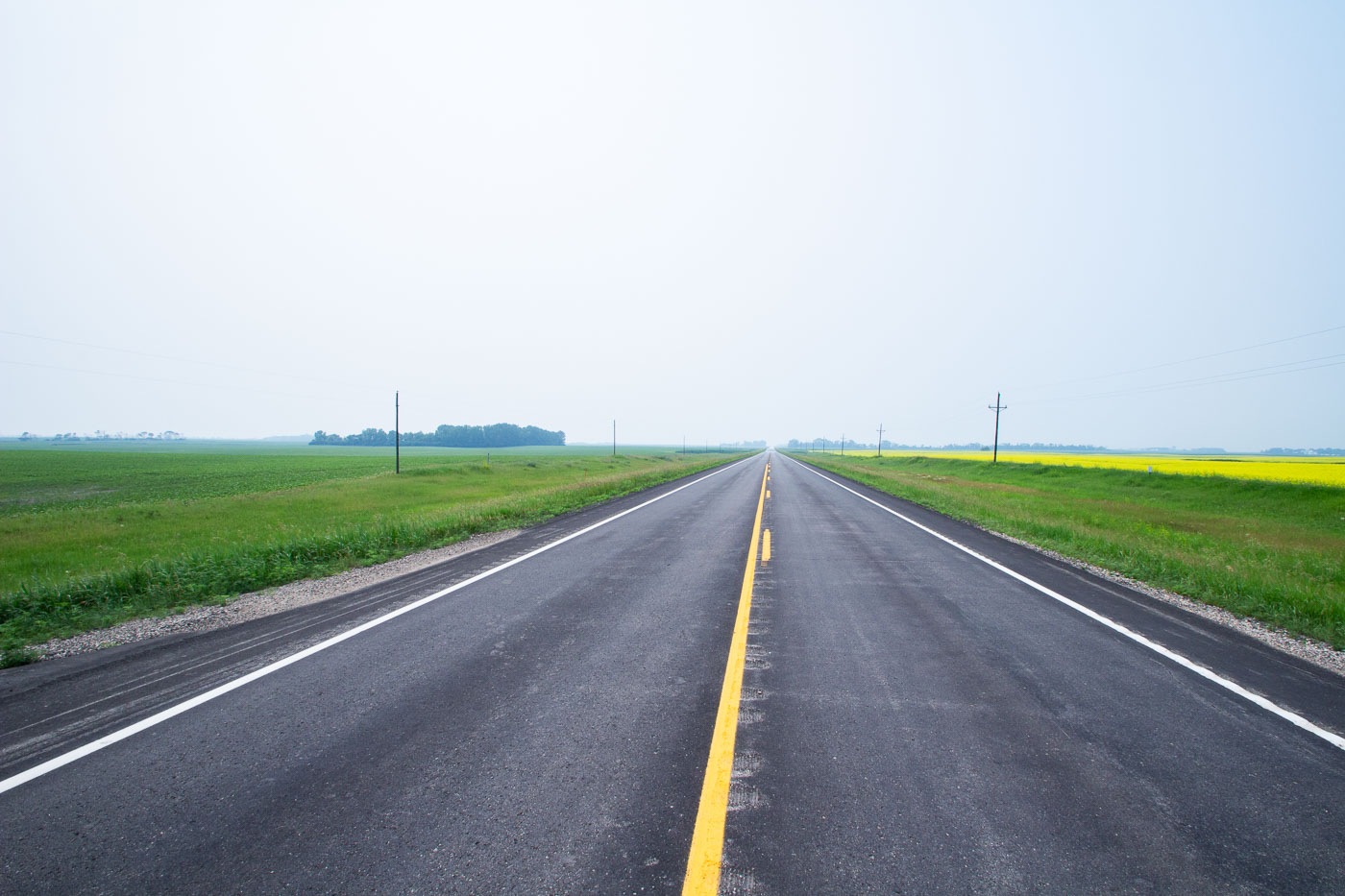
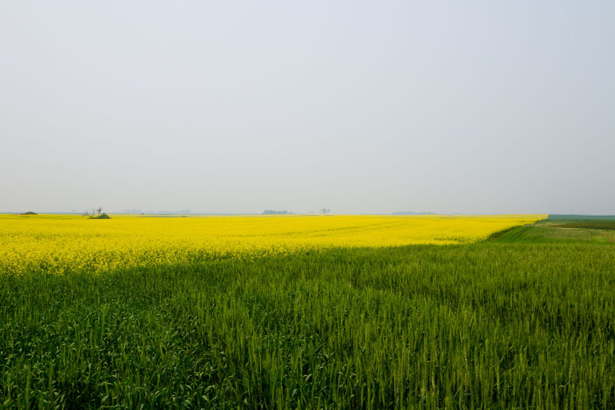
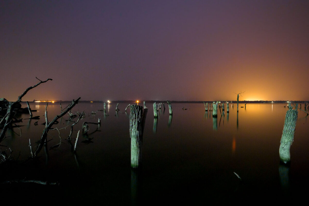
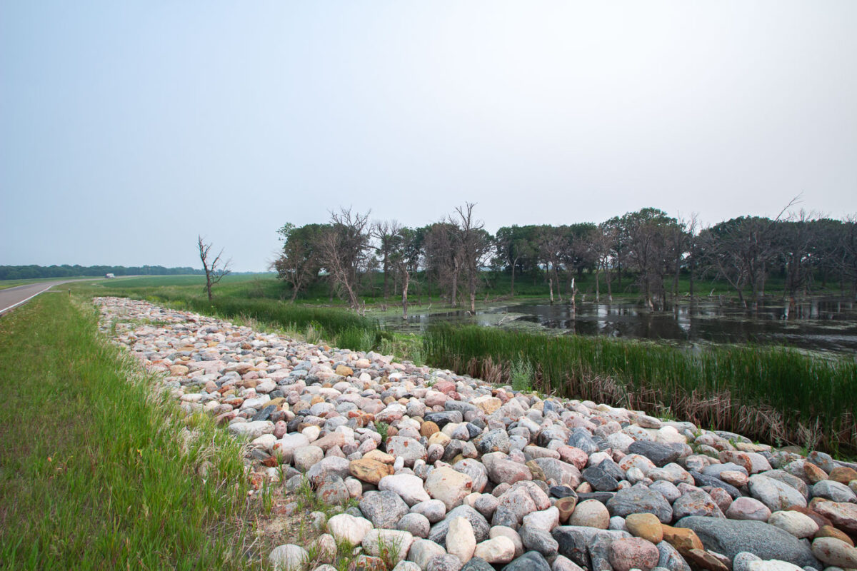
May 28, 2016 — The Sorlie Memorial Bridge, spanning the Red River in Grand Forks, North Dakota, is illuminated at dusk. This truss bridge, a significant piece of local transportation infrastructure, connects Grand Forks with East Grand Forks, Minnesota. It was constructed in 1974, replacing an earlier bridge that had served the community. The bridge continues to facilitate daily commutes and commerce across the state line.July 3, 2015 — Highway 17, a state highway in North Dakota, traverses agricultural landscapes near Starkweather. The road serves as a vital artery for transporting goods and connecting rural communities to larger centers. The surrounding fields, likely planted with crops such as canola given the yellow bloom visible, highlight the region's agricultural significance. This stretch of highway is representative of the transportation network that supports North Dakota's economy, facilitating the movement of agricultural products from farms to markets.July 3, 2015 — Vast fields of wheat and canola stretch across the North Dakota landscape near Starkweather. The bright yellow canola flowers contrast with the deep green of the developing wheat crop, showcasing the agricultural productivity of the region. North Dakota is a leading producer of both wheat and canola, with these crops forming the backbone of the state's economy and rural identity. The cultivation of these grains has been central to the area's development since settlement, supporting farming communities and contributing to national food supplies.July 2, 2015 — Remnants of the Woodland Resort stand in Devils Lake, North Dakota, silhouetted against the twilight sky. The resort, once a popular destination, was submerged by rising lake levels in the early 2000s. These pilings and submerged structures serve as a stark reminder of the lake's fluctuating water levels and the impact on the surrounding community and its infrastructure. The lights in the distance indicate the continued presence of development along the lake's shores, contrasting with the submerged past.July 2, 2015 — Devils Lake State Park in North Dakota features a shoreline reinforced with riprap, a protective layer of large stones designed to prevent erosion. This area also encompasses a wetland, a vital habitat for diverse flora and fauna. The park's landscape is shaped by the fluctuating water levels of Devils Lake, a phenomenon that has historically impacted the surrounding environment and infrastructure.
Built in Minneapolis
Photographs made over time, focused on place, public life, and ongoing reporting.
Browse by location, move through long-running series, or start with recent work.