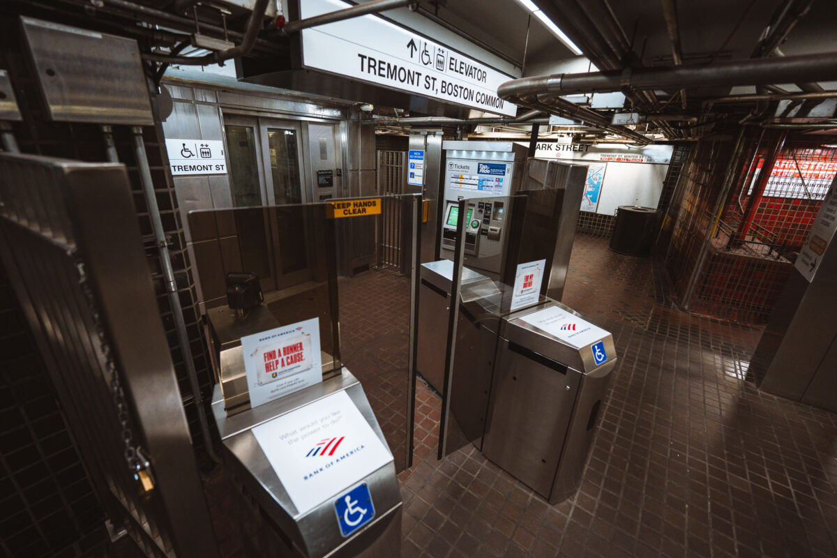
Park Street Station Fare Gates, Boston
April 2025 —
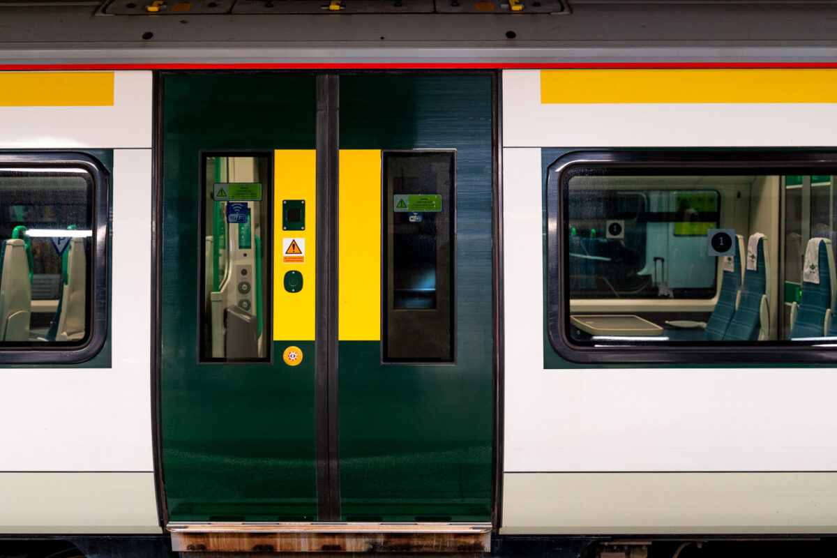
Explore photos tagged Subway.
April 2025 —
April 2025 —
April 2025 —
April 2025 —
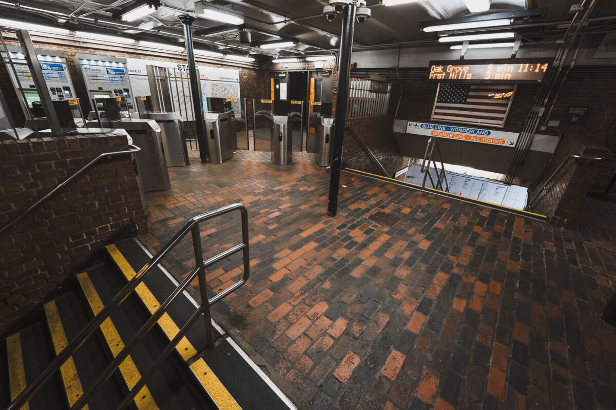
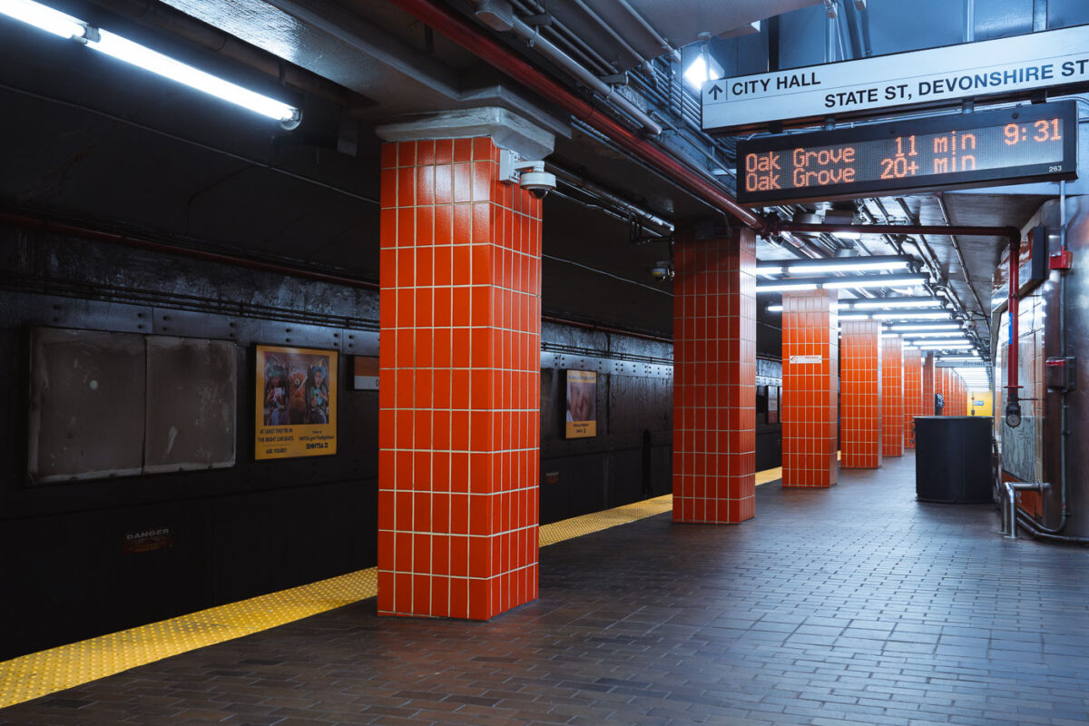
April 2025 — The entrance and fare control area at State Street Station, a key interchange in downtown Boston where the Orange Line and Blue Line intersect. The station opened in 1908 as part of the Washington Street Tunnel and remains one of the MBTA’s oldest continuously operating rapid transit facilities. Brick flooring, steel columns, and low ceilings reflect early 20th-century subway construction, while modern fare gates and electronic arrival boards show later upgrades layered onto the original structure. The signage directing riders to Oak Grove, Forest Hills, and Wonderland highlights the station’s role as a transfer point connecting North Shore riders, downtown commuters, and the broader MBTA network.
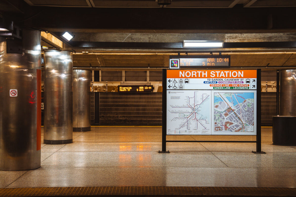
April 2025 — Interior signage at North Station, one of Boston’s oldest and most complex transit hubs. The station sits beneath TD Garden and serves as a major interchange between the MBTA Orange Line, Green Line (north branches), Amtrak Downeaster, and MBTA Commuter Rail. The current underground rapid-transit facilities date largely to the late 20th-century rebuilds, following the demolition of the original above-ground North Station headhouse in the 1920s and subsequent reconstructions tied to Boston’s evolving rail network. The platform wayfinding reflects this layered role: subway lines, regional rail, and intercity service are all integrated into a single information system. Electronic arrival boards and map panels emphasize transfer efficiency in a station that functions as the northern rail gateway to downtown Boston and the broader New England rail network.
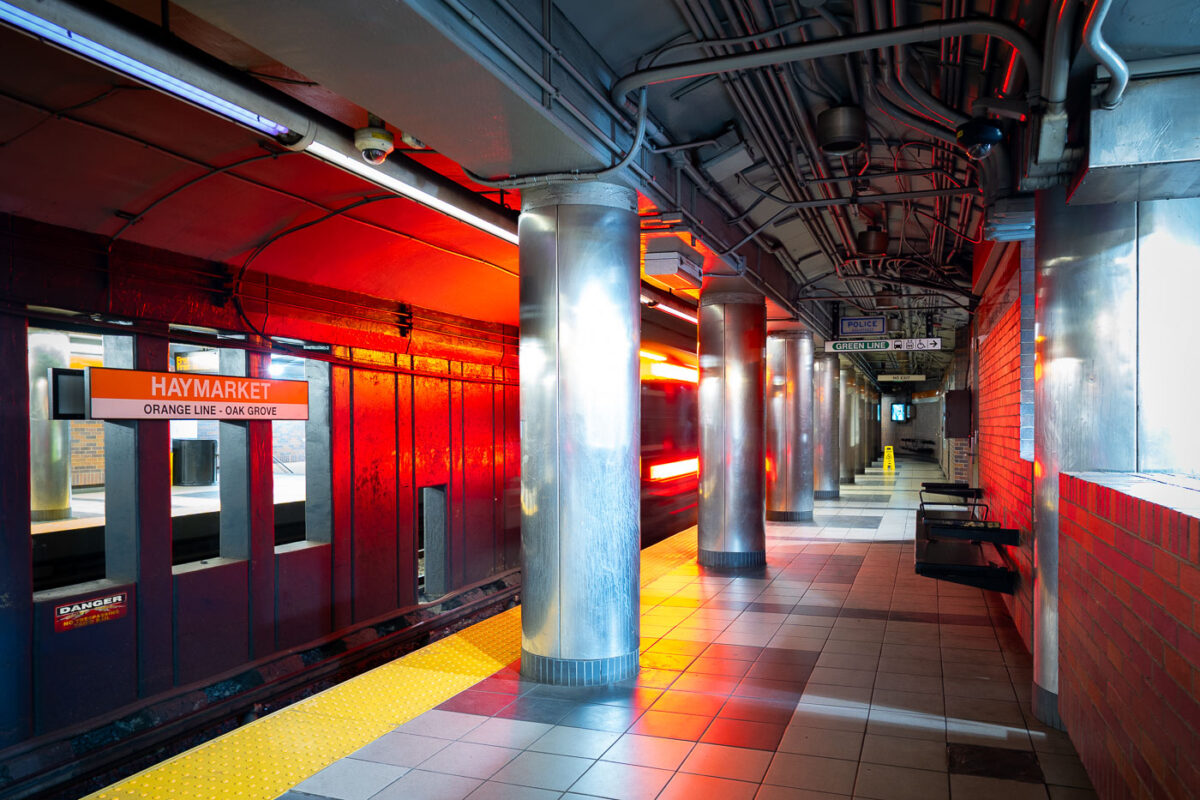
April 2025 — Haymarket Station in downtown Boston, one of the oldest transit locations in the city, serving riders since the late 19th century in various forms. The current underground station opened in 1971 as part of the MBTA’s modernization of the Orange Line, replacing earlier elevated structures that once ran through the area. The station sits at the edge of the historic Haymarket district, long associated with public markets and transportation links between downtown and Boston’s North End. The cylindrical steel columns and low-ceilinged platforms reflect mid-20th-century transit design, while the signage and lighting document decades of incremental updates to keep the station functional within one of the system’s busiest transfer points.
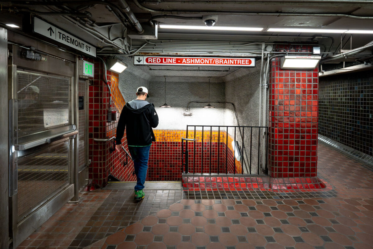
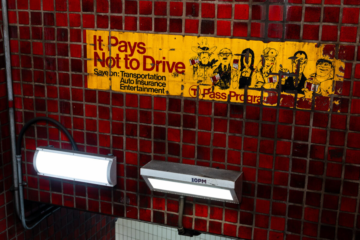
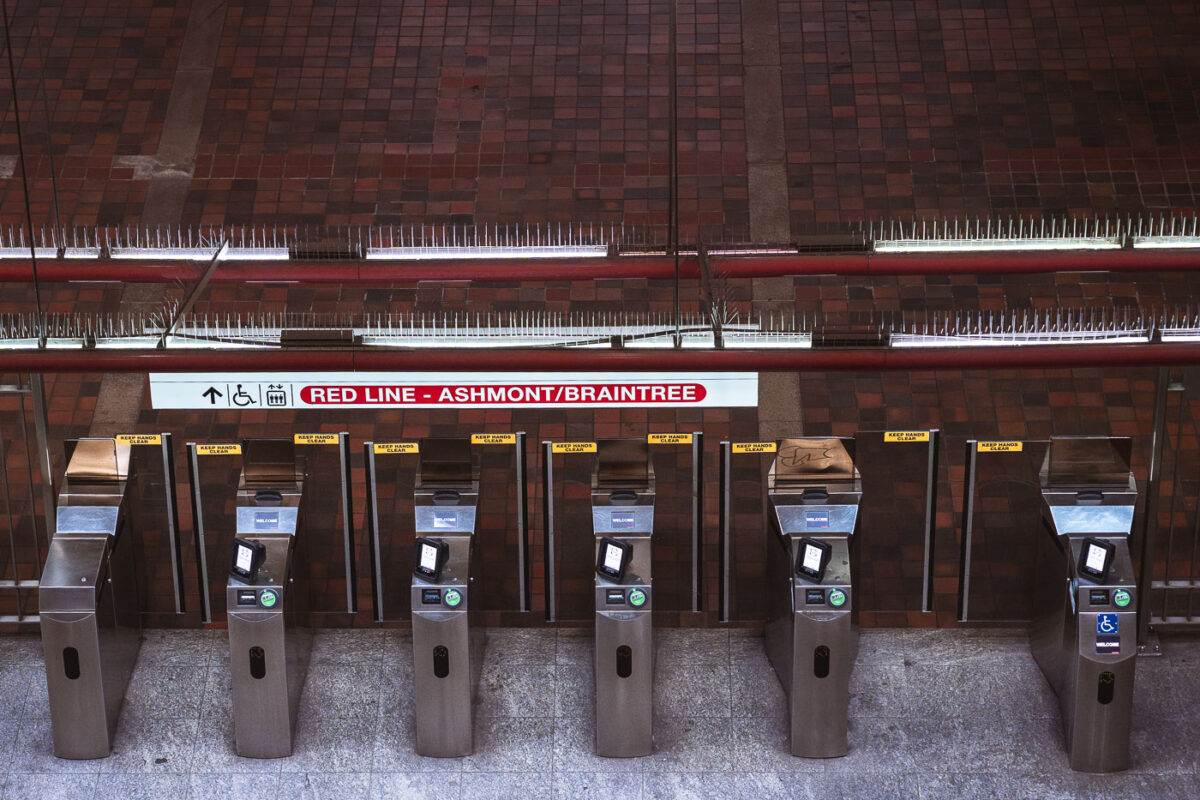
April 2025 — Inside Park Street station, one of the oldest active subway stations in the United States. Opened in 1897 as part of the Tremont Street Subway, the station has long served as a central transfer point beneath Boston Common. The tiled corridors and low ceilings reflect early subway construction techniques, with later renovations layering modern lighting, signage, and safety systems onto the original structure. Directional signage for the Ashmont and Braintree branches marks this passage as part of the MBTA Red Line, which continues to use Park Street as a key junction between downtown Boston and the city’s southern neighborhoods.
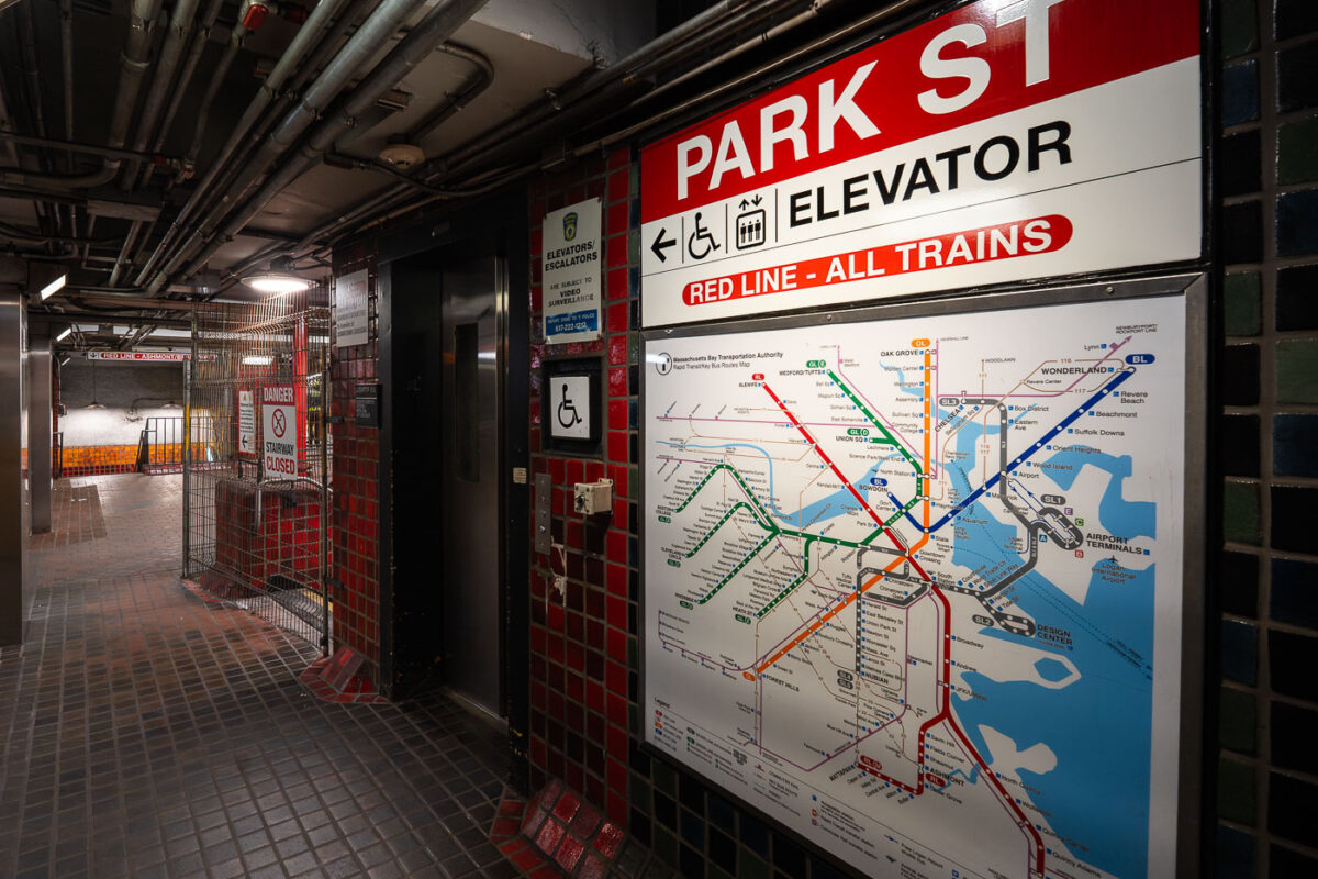
April 2025 — Boston's MBTA Park Street Red Line train station.
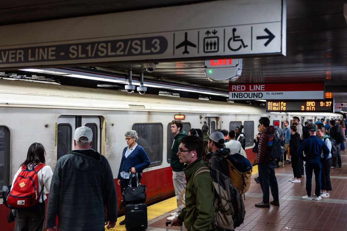
April 2025 — Passengers wait alongside an inbound MBTA Red Line train, headed toward Alewife, on a busy underground platform in downtown Boston. The Red Line is the system’s oldest rapid transit route, opening in 1912 and forming the backbone of east–west and north–south travel through the city. The high-floor cars shown here reflect decades of incremental fleet updates, while the tiled platforms, overhead wayfinding, and digital countdown signs illustrate how the MBTA has layered modern passenger information systems onto early-20th-century station infrastructure. The crowding and luggage visible on the platform highlight the line’s dual role serving both daily commuters and airport-bound travelers via transfers to bus and rail connections.
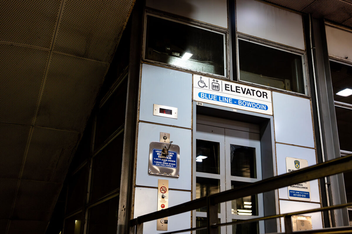
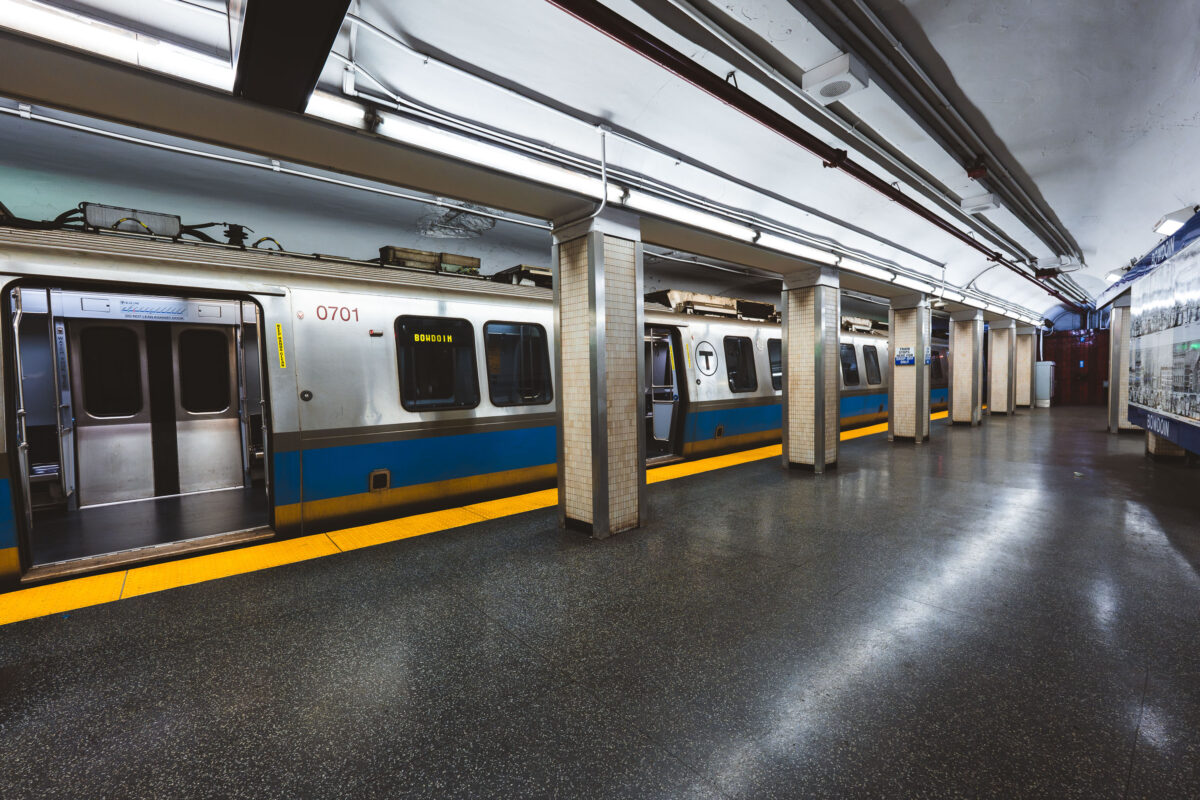
April 2025 — An elevator entrance at Bowdoin station, the downtown terminal of Boston’s Blue Line. Bowdoin Station opened in 1916 as part of the East Boston Tunnel, one of the earliest underwater rapid-transit tunnels in North America. The station is notable for its compact footprint, tight curves, and historically limited accessibility compared to newer MBTA stations. This elevator provides step-free access between street level and the platform, reflecting later retrofits required by accessibility standards rather than original station design. The utilitarian signage, metal paneling, and enclosed structure are characteristic of mid-to-late 20th century upgrades layered onto early 20th century transit infrastructure, illustrating how legacy subway systems have been incrementally adapted to modern accessibility and safety requirements.
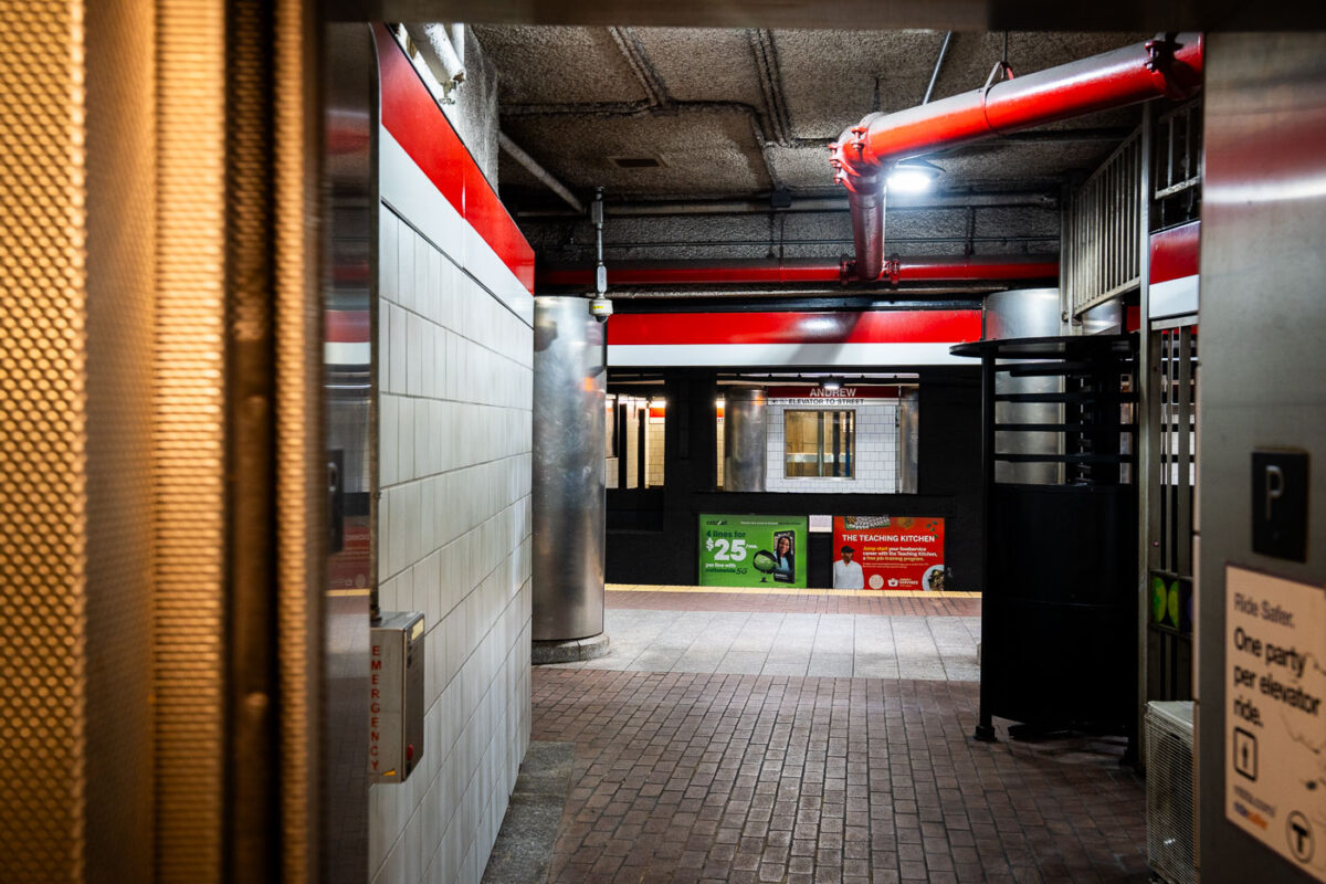
April 2025 — Getting off an elevator at Andrew Station on the red line in Boston.
April 2025 — Fare gates line the paid entrance to the Massachusetts Bay Transportation Authority Red Line, directing riders toward Alewife-bound service. This northbound branch terminates at Alewife, the line’s northern endpoint, and serves as a primary commuter gateway for Cambridge and the Route 2 corridor. The stainless-steel fare control equipment reflects systemwide upgrades rolled out during the 2010s to improve ADA accessibility, reliability, and compatibility with modern fare media. Above the gates, the brick-vaulted ceiling and exposed utilities reflect the durable, utilitarian architecture common to many core Boston subway stations built and expanded in the mid-20th century, prioritizing longevity and fire resistance in high-traffic underground spaces.
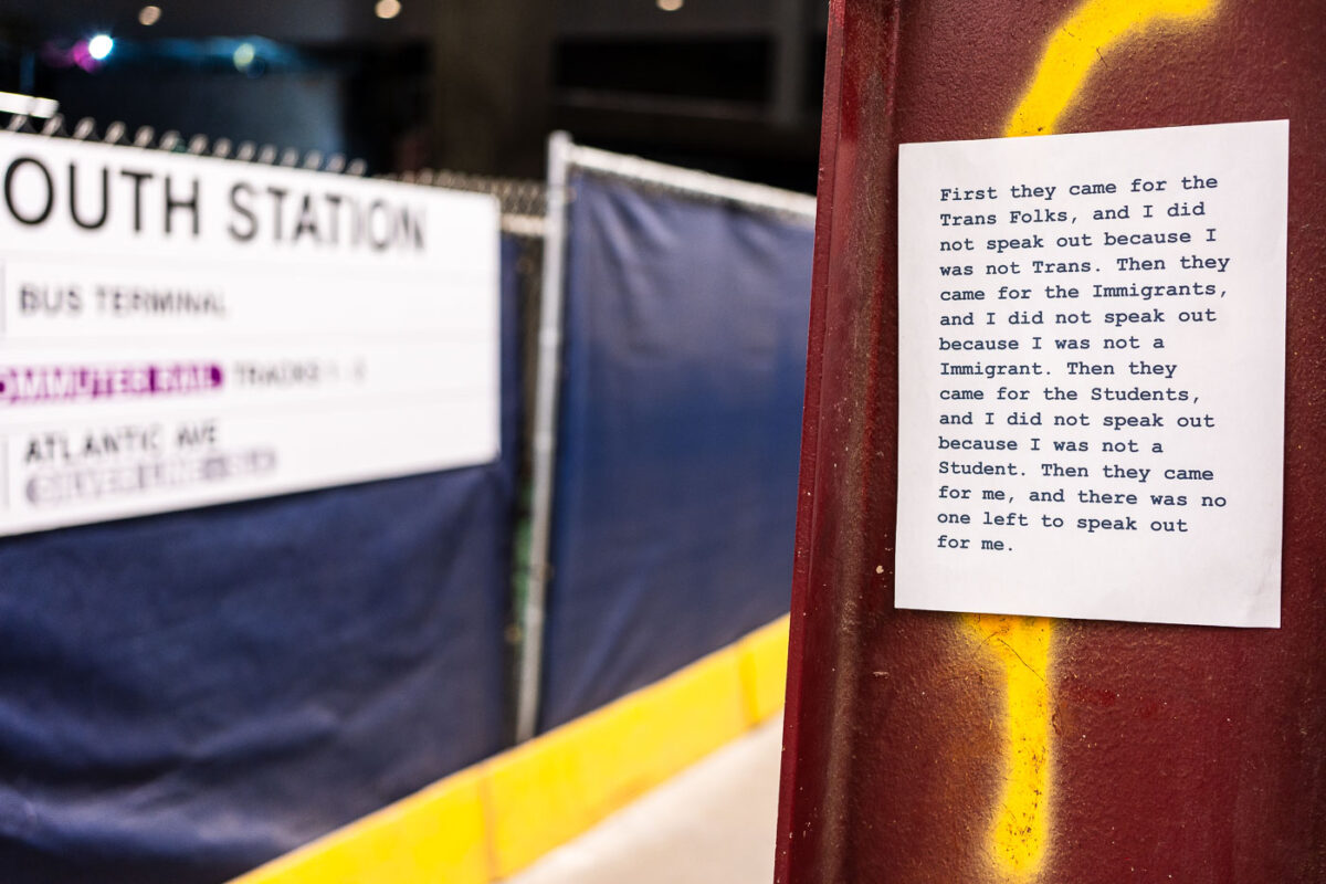
April 2025 — Sign seen at South Station in Boston: "First they came for the Trans Folks, and I did not speak out because I was not Trans. Then they came for the Immigrants, and I did not speak out because I was not a Immigrant. Then they came for the Students, and I did not speak out because I was not a Student. Then they came for me, and there was no one left to speak out for me."
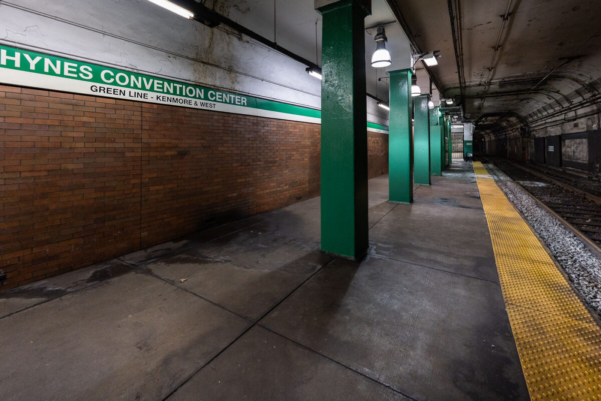
April 2025 — MBTA Green Line train platform at Hynes Convention Center.
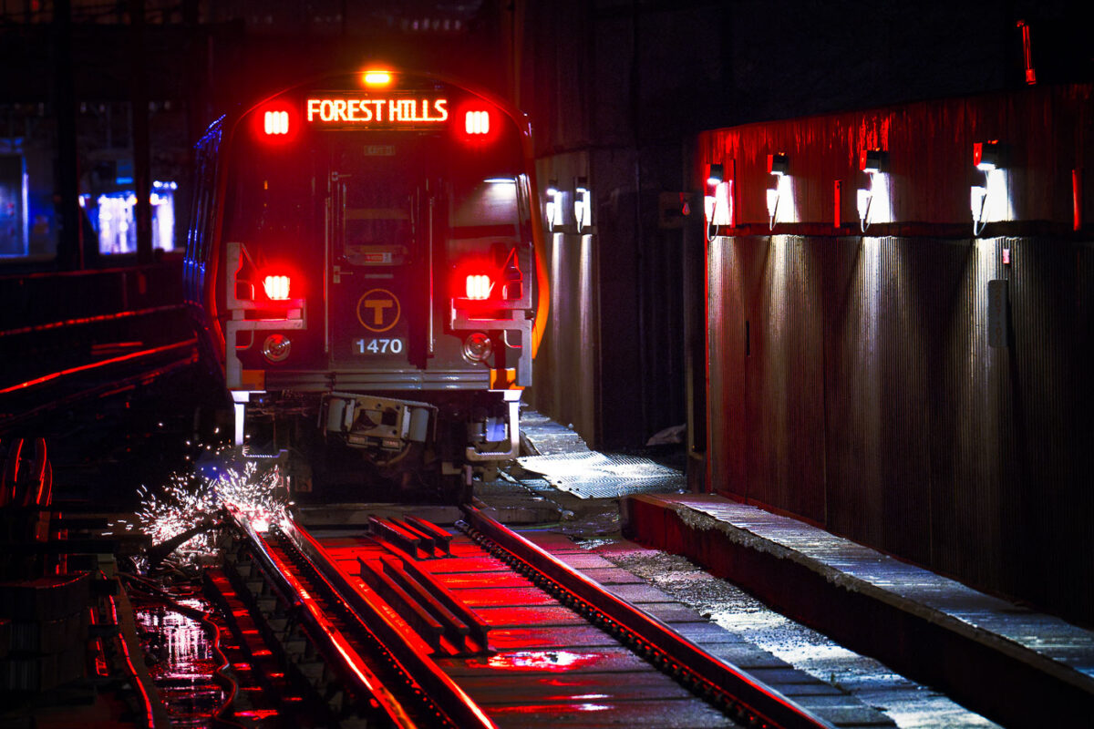
April 2024 — Sparks under a Forest Hills Orange Line train in Boston.
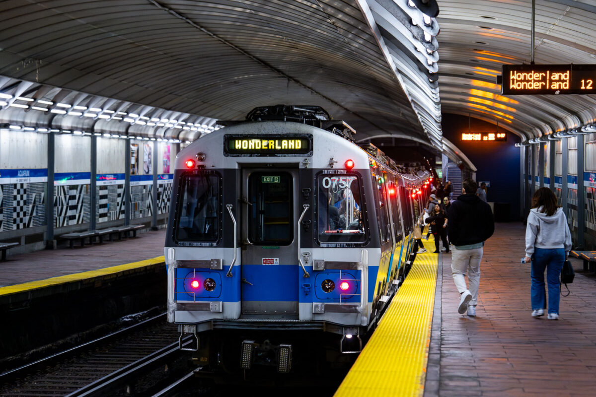
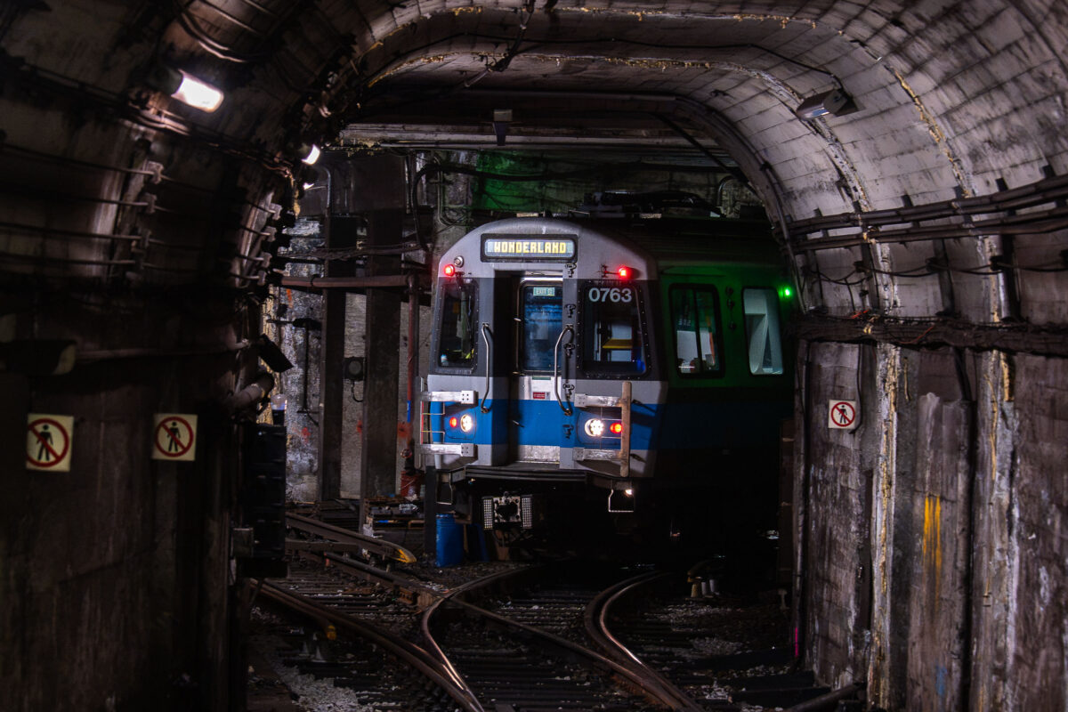
April 2024 — MBTA Wonderland bound train from the Aquarium Station. Passengers on the platform getting on the train.
April 2024 — Massachusetts Bay Transportation Authority (MBTA) State Station on the Orange Line in Boston.
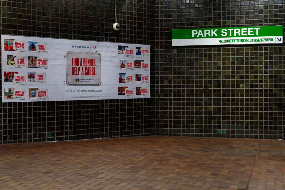
April 2024 — Inside Boston’s Park Street Station, a tiled corridor displays a Bank of America advertisement for the Boston Marathon’s charity initiative. The green and white MBTA sign directs riders toward the Green Line platforms for Copley and westbound service. Park Street—one of the oldest subway stations in the United States—sits beneath the Boston Common, serving as a major interchange for the city’s transit system since 1897.
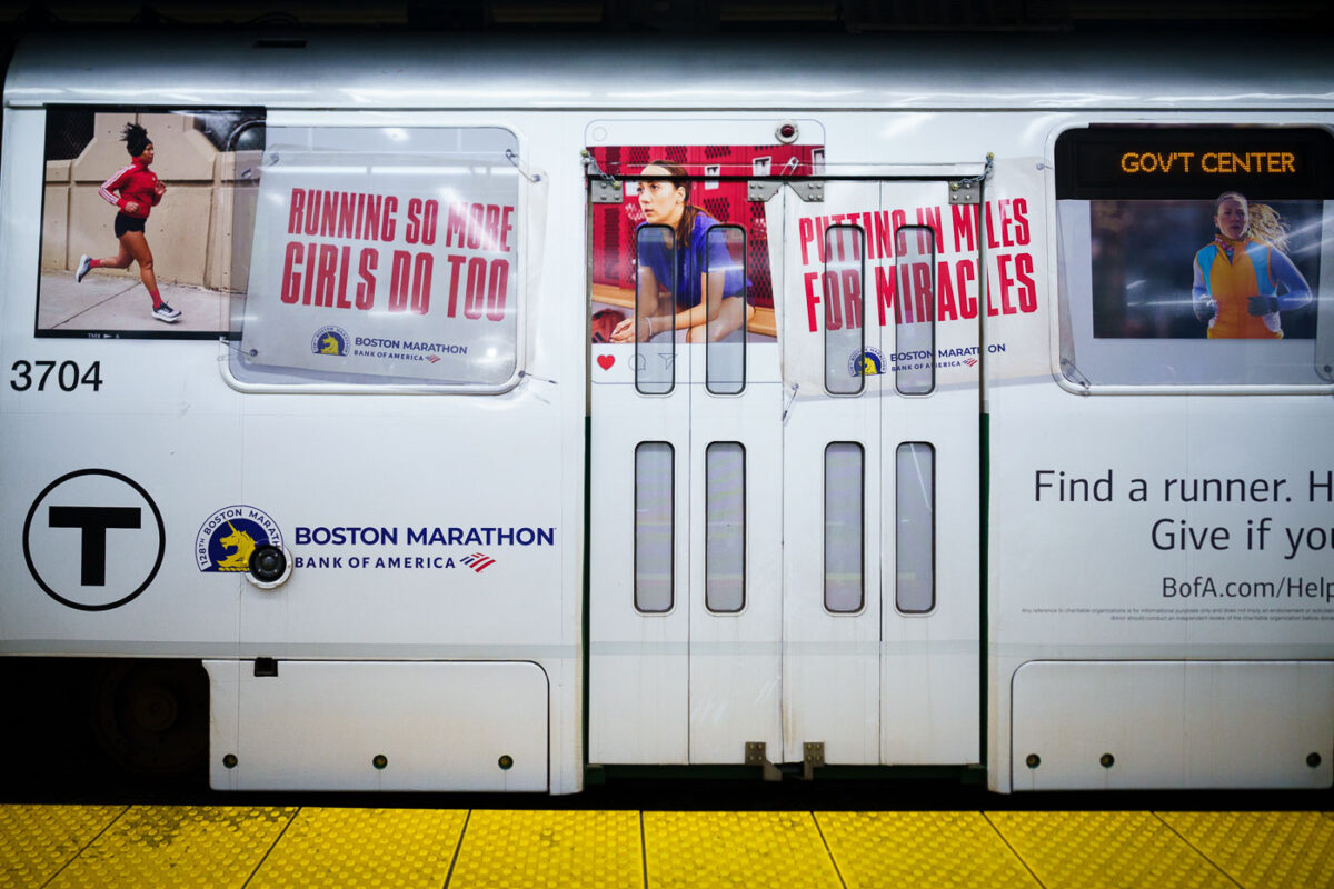
April 2024 — A train with Bank of America Boston Marathon wrap.
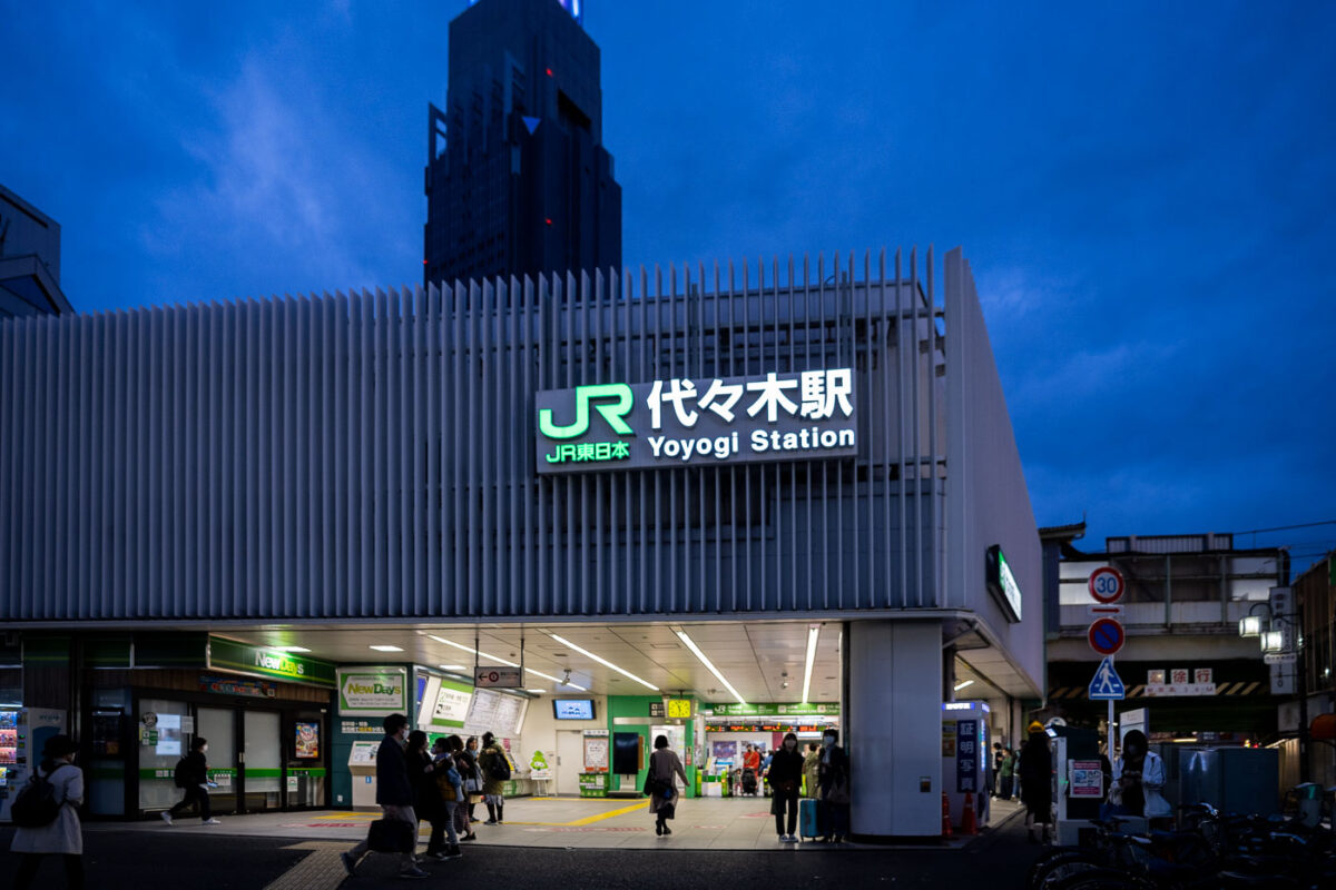
March 2023 — As dusk settles over Shibuya, the illuminated sign of Yoyogi Station (代々木駅) glows against a deep indigo sky, marking one of Tokyo’s key JR East commuter hubs. Opened in 1906, Yoyogi serves both the Yamanote and Chuo-Sobu lines, connecting thousands of travelers daily between Shinjuku and Harajuku. The cool blue hour lighting highlights the crisp white façade and the green JR branding, captured here with a balanced exposure to preserve both architectural detail and ambient light reflections. Taken in early evening with a 35mm f/1.8 lens, this frame emphasizes the quiet rhythm of Tokyo’s rush hour just before nightfall.
March 2023 —
March 2023 —
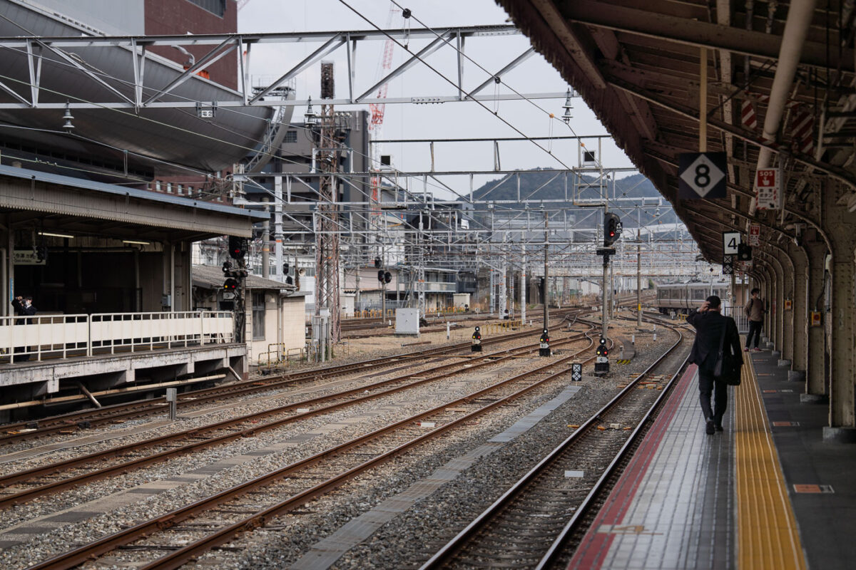
March 2023 — Multiple sets of railway tracks converge toward the distance beneath a grid of steel catenary supports. A man in a dark suit walks along the yellow tactile line on Platform 4, while another commuter waits across the tracks. Overhead signs mark platform numbers, and signal lights display red and amber. The station canopy and surrounding buildings form an industrial backdrop, with a faint view of hills beyond the city.
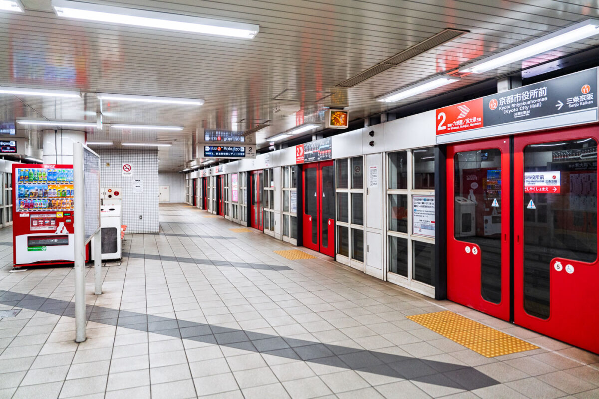
March 2023 — A quiet moment inside the Kyoto City Subway at Shiyakusho-mae Station, where the red-lined doors and bright vending machines reflect the city’s clean, orderly transit design. The tiled floors, yellow tactile paving, and minimalist signage embody the practical beauty of Japanese public infrastructure. Empty corridors like this highlight the calm rhythm of off-peak urban life in Kyoto.
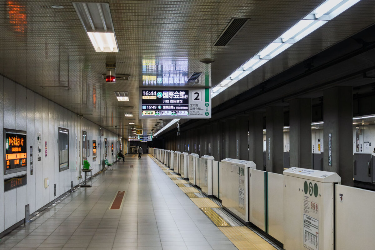
March 2023 — A quiet moment on the platform at Karasuma Oike Station, one of the key interchange points within the Kyoto Municipal Subway system. Opened in 1981 as part of the Karasuma Line, the station later became a transfer hub when the Tōzai Line opened in 1997, creating a central east–west and north–south connection beneath Kyoto’s urban core. The platform features platform-edge doors—introduced across Kyoto’s subway network to improve safety and accessibility—along with digital signage that displays through-service connections toward the northern suburbs and toward the International Conference Center. Located beneath the intersection of Karasuma-dōri and Oike-dōri, the station plays an important role in linking government offices, business districts, and cultural areas throughout central Kyoto.
March 2023 — A Tokyo Metro Marunouchi Line train approaches its terminal platforms during a March 2023 visit. The Marunouchi Line, one of Tokyo’s earliest postwar subway routes, opened in 1954 and played a key role in connecting the expanding Yamanote district centers with government and commercial areas in central Tokyo. Its distinctive red livery has remained a defining visual identity for decades, even as the rolling stock has undergone multiple modernizations. Ikebukuro, the northern terminus of the line, is one of Tokyo’s busiest rail hubs, jointly served by JR East, the Seibu and Tobu railway networks, and several Metro lines. The station complex was heavily rebuilt throughout the late 20th century to handle increasing commuter volumes, resulting in the multi-level platform and passageway layout still in use today.
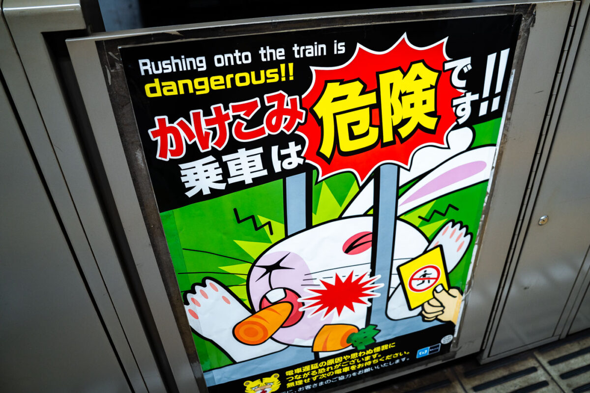
March 2023 — A safety poster inside a Tokyo Metro station warns passengers not to rush onto closing trains—a longstanding focus of the network’s passenger-safety campaigns. Tokyo’s subway operators, including Tokyo Metro and Toei, use a mix of mascots and bold graphic styles to discourage last-second boarding, which remains one of the most common causes of platform accidents and door malfunctions. These posters are typically placed on or near platform screen doors, which have been installed progressively across the network since the early 2000s to reduce injuries and improve train-dwell consistency. The messaging reflects Japan’s broader public-transportation safety culture: preventing delays, protecting passengers, and maintaining precise headways in some of the most heavily used rail corridors in the world. This particular design features a cartoon warning style common in Metro stations along lines such as the Marunouchi, Yamanote interchanges, and the Keisei connection points at Ueno and Nippori.
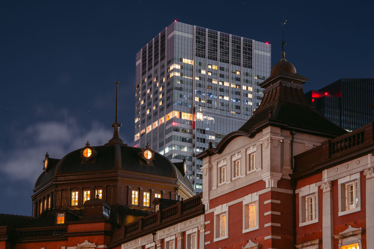
March 2023 — The historic Marunouchi side of Tokyo Station glows warmly at dusk, its red-brick exterior and copper domes standing in contrast to the modern skyscrapers of the surrounding Marunouchi business district. Opened in 1914 and designed by architect Tatsuno Kingo, the station served as the central gateway for Japan’s expanding rail network during the early 20th century. The dramatic juxtaposition in this March 2023 photograph highlights more than a century of architectural evolution: the restored station building—meticulously reconstructed after wartime damage—foregrounds the sleek high-rise towers that define contemporary central Tokyo. Together, they illustrate how Tokyo layers historic preservation and modern development within one of the busiest transport hubs in the world.
March 2023 — A passageway leading down to the Tokyo Metro Marunouchi Line, part of one of Tokyo’s oldest surviving subway corridors. The Marunouchi Line began opening in stages between 1954 and 1962, making it the second-oldest subway line in the city after the Ginza Line. Many stations along the route—especially the early central segments—retain architectural and material choices from Japan’s postwar reconstruction period, including ceramic wall tile, exposed conduit, and compact stairways built before modern accessibility standards were introduced. The dense overhead wiring found in older Marunouchi Line interchanges reflects decades of retrofits to accommodate improved lighting, ventilation, fire-suppression systems, and communication networks, all integrated into the original structural envelope. These spaces remain essential transfer points connecting central Tokyo’s commercial districts with major JR East hubs such as Shinjuku, Tokyo Station, and Ochanomizu. Although the Marunouchi Line has undergone rolling upgrades—including new rolling stock (02 series replacements), platform screen doors, and improved wayfinding—the underlying layout in many stations still conveys the functional, space-efficient design philosophy of mid-20th-century Japanese subway engineering.
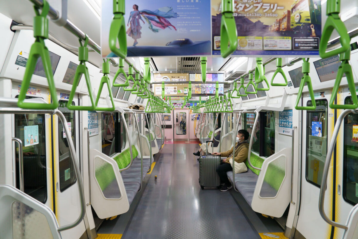
March 2023 — An interior view of a JR East E235 series train on the Yamanote Line, photographed in March 2023. Introduced beginning in 2015, the E235 fleet modernized one of Tokyo’s busiest rail corridors with full-width LCD displays, energy-efficient systems, and redesigned seating meant to improve passenger flow during peak congestion. The Yamanote Line has operated as Tokyo’s central loop since 1925, linking major districts such as Shinjuku, Shibuya, Ueno, and Tokyo Station. Its frequent headways—often under three minutes—make it a fundamental component of the city’s rail network. In this off-peak moment, the largely empty car highlights features typical of contemporary JR East design: bright color-coded grab handles, platform-screen door alignment, and extensive in-car advertising screens catering to both commuters and visitors navigating the metropolitan loop.
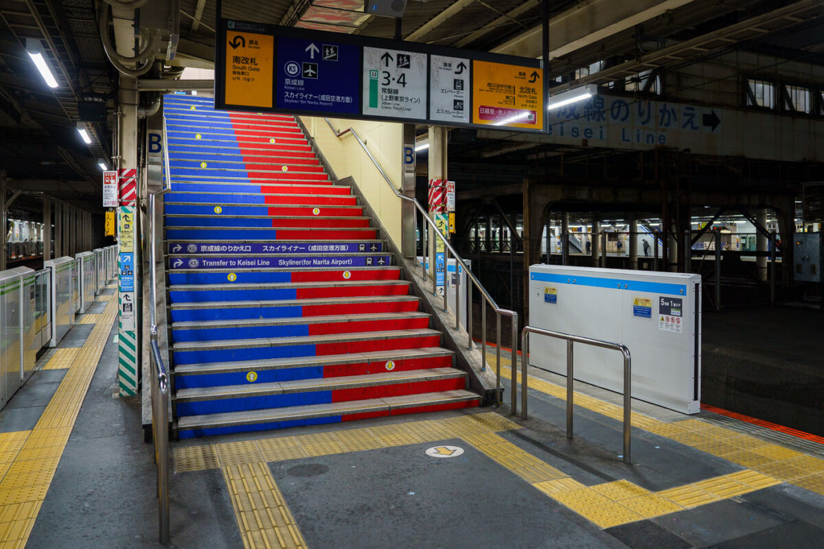
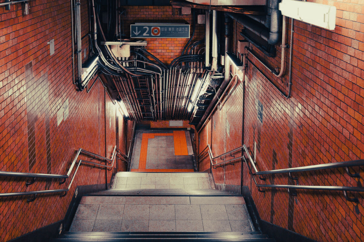
March 2023 — A color-coded stairway inside Nippori Station directs passengers to the Keisei Line platforms, the primary transfer point for travelers heading to Narita Airport on the high-speed Skyliner. Nippori serves as a major interchange between JR East lines, the Keisei Main Line, and the Nippori–Toneri Liner, linking northern Tokyo neighborhoods to the broader regional network. The mixed architecture—older steel passageways alongside newer safety upgrades like platform-edge barriers—reflects the station’s layered development since its opening in 1905. Today, Nippori remains one of Tokyo’s most important cross-rail transfer nodes, especially for airport-bound passengers navigating the city’s extensive transit system.
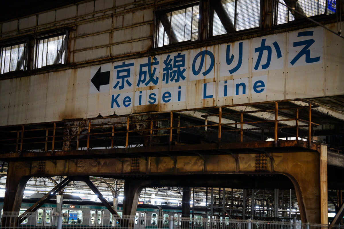
March 2023 — A weathered overhead passage at Nippori Station directs passengers toward the Keisei Line, one of Tokyo’s key links to Narita Airport via the Skyliner service. Nippori has served as a major interchange since the early 20th century, connecting JR East’s Yamanote, Keihin-Tōhoku, and Jōban lines with the private Keisei network. The aging steelwork and faded signage reflect the layered construction of the station complex, where older elevated structures remain in daily use alongside modernized ticketing halls and platform edge barriers. Despite its utilitarian appearance, this transfer point moves thousands of airport-bound travelers each day, making it one of Tokyo’s busiest cross-rail connections.
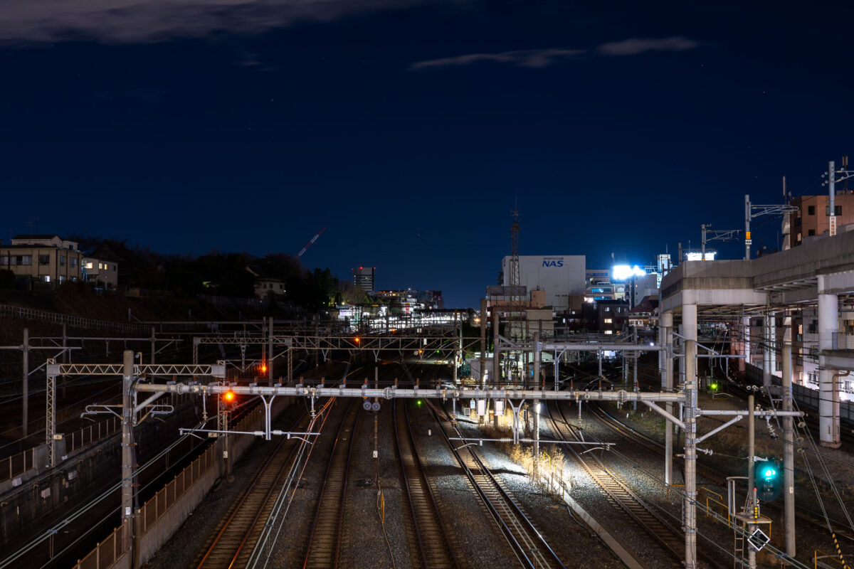
March 2023 — Multiple rail lines converge near Nippori Station in Tokyo, a key junction connecting the JR Yamanote, Keisei, and Joban lines. The illuminated signals and overhead power lines reveal the complexity of the city’s rail infrastructure as it weaves through residential and industrial zones. To the right, elevated expressway supports and nearby buildings frame the corridor, emphasizing Tokyo’s dense layering of transport systems and urban development.
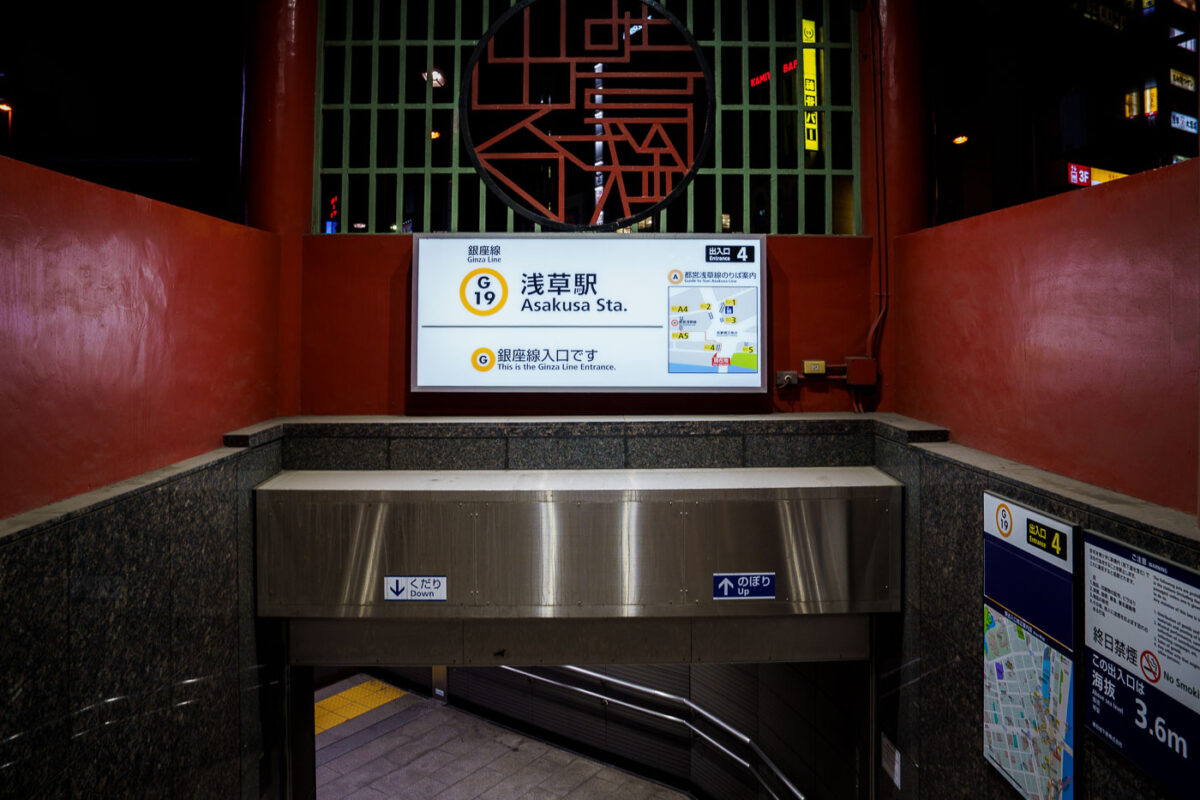
March 2023 — An entrance to Tokyo Metro’s Asakusa Station on the Ginza Line, marked with the station code G-19, leads commuters down a clean, tiled stairway under the red-painted gateway structure. The illuminated signage displays route maps and directional guidance, combining modern wayfinding with the surrounding area’s traditional aesthetic. Located near Sensō-ji Temple, this entrance reflects Asakusa’s balance of old Tokyo charm and contemporary transit design.
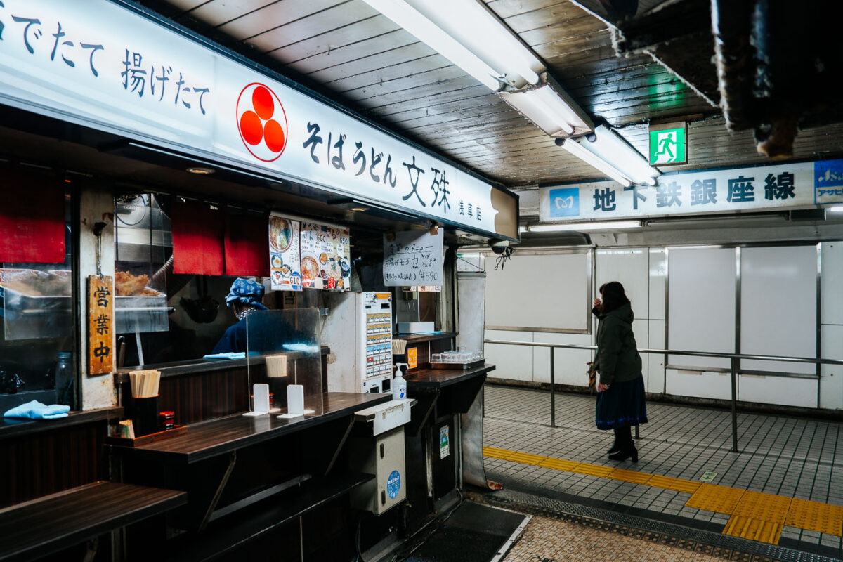
March 2023 — A small soba counter operates inside Asakusa Underground Street, one of Tokyo’s oldest surviving subterranean shopping arcades. Tucked beneath the streets near Asakusa Station, these compact eateries serve quick bowls of soba and udon to commuters and visitors moving between the metro and the surrounding neighborhood. Opened in 1955, Asakusa Underground Street is considered the oldest underground shopping street in Japan. Its narrow corridors, low ceilings, and tightly packed storefronts preserve a postwar atmosphere that has largely vanished from Tokyo as major stations modernized. The passageway originally developed as a practical connection point for transit riders, but it evolved into a lively network of bars, snack counters, tobacconists, and small service shops. Today, despite gradual renovation, it remains one of the city’s most atmospheric relics of mid-20th-century urban life—an example of how Tokyo’s underground spaces doubled as both transportation infrastructure and neighborhood social hubs.
March 2023 — Tokyo’s Marunouchi Line is one of Japan’s oldest and busiest subway routes, linking major commercial and governmental districts through a network that dates back to 1954. This view shows the Series 2000 rolling stock, a modernized fleet introduced by Tokyo Metro beginning in 2019 to replace aging Series 02 cars. The trains feature energy-efficient LED lighting, regenerative braking, and improved accessibility through wider doorways and level boarding. Their bright yellow exterior, trimmed with red and blue stripes, preserves the line’s traditional color while emphasizing the sleek, minimalist design typical of contemporary Japanese transit engineering. Inside, the cabin layout prioritizes capacity and passenger flow, with longitudinal bench seating covered in patterned orange upholstery and overhead digital route displays in both Japanese and English. The Marunouchi Line operates on a 1,500 V DC overhead catenary and runs entirely underground except for a brief surface section near Nakano-Sakaue, connecting Ikebukuro to Ogikubo over a 24.2-kilometer route that handles hundreds of thousands of passengers daily.
March 2023 — Shiodome Station in Minato Tokyo Japan.
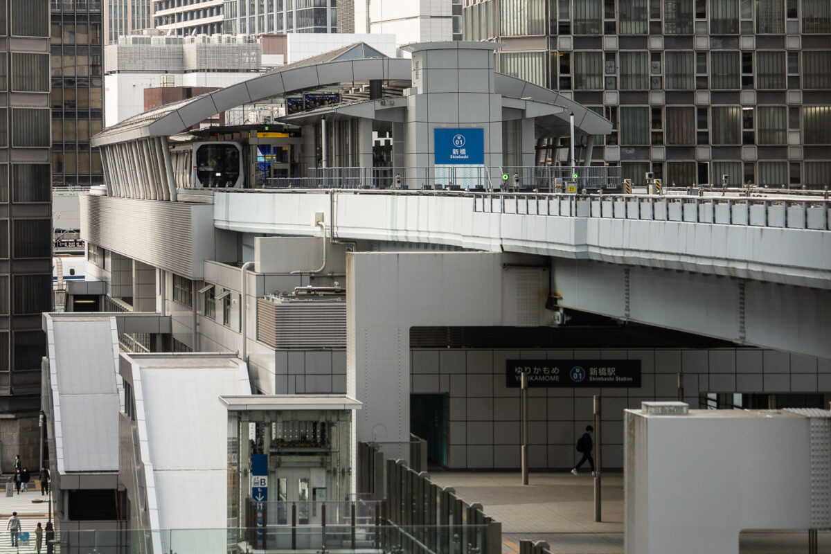
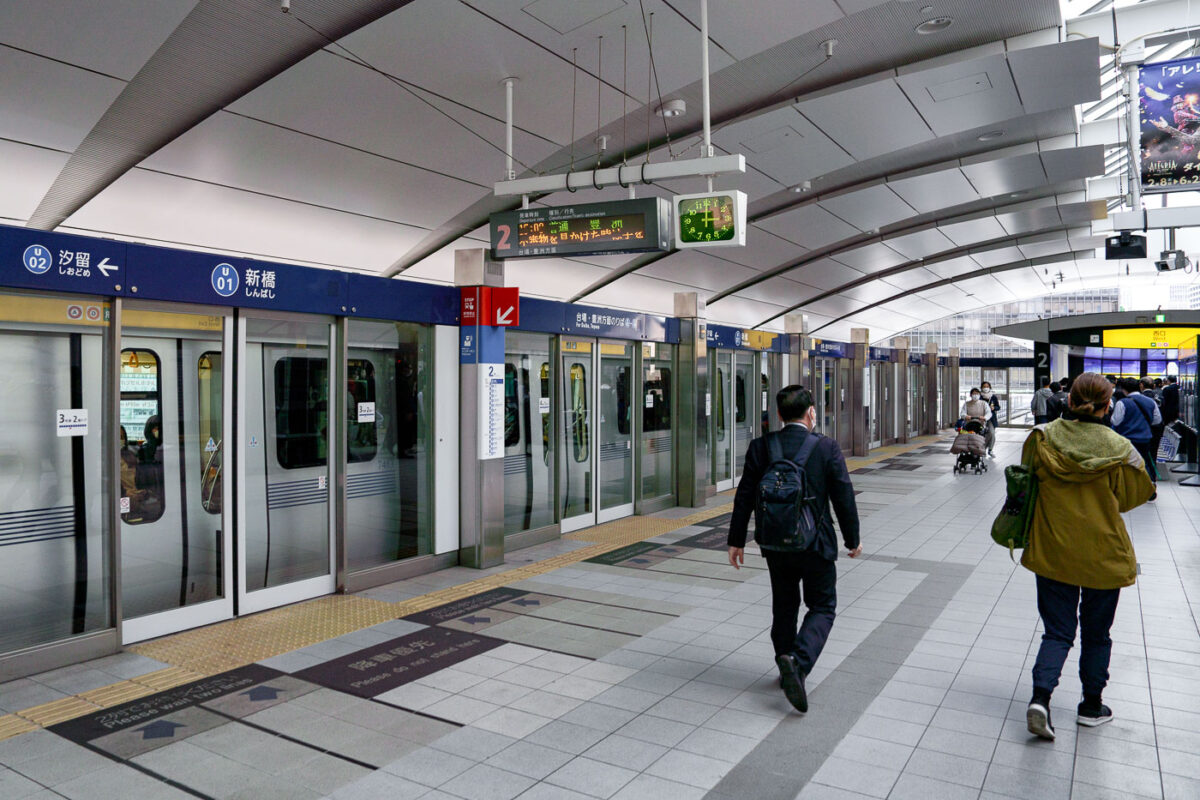
March 2023 — Shimbashi Station serves as a key interchange between Tokyo’s dense urban rail systems, connecting JR East lines with the Yurikamome automated transit route to Odaiba. The elevated Yurikamome track, seen here curving above the city streets, is a fully driverless, rubber-tired train line that opened in 1995 to link Tokyo’s central business districts with its reclaimed waterfront developments. This structure’s sleek metallic architecture and tiered design reflect Japan’s approach to maximizing space efficiency in high-density transport corridors. The network below includes the JR Yamanote Line, Tokyo Metro Ginza Line, and the Toei Asakusa Line, making Shimbashi one of the most vertically integrated transit hubs in Japan.
August 2020 — Subway on East Lake Street. Boarded up since protests following the May 25th, 2020 death of George Floyd.
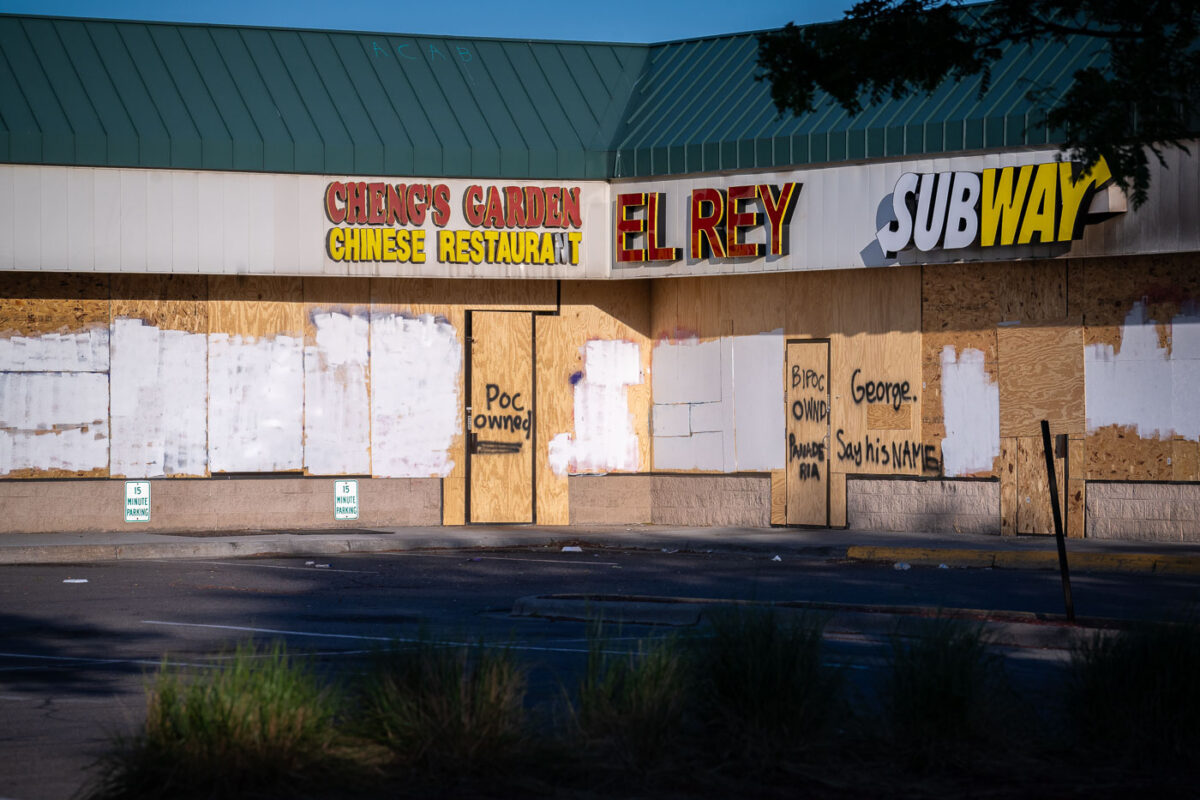
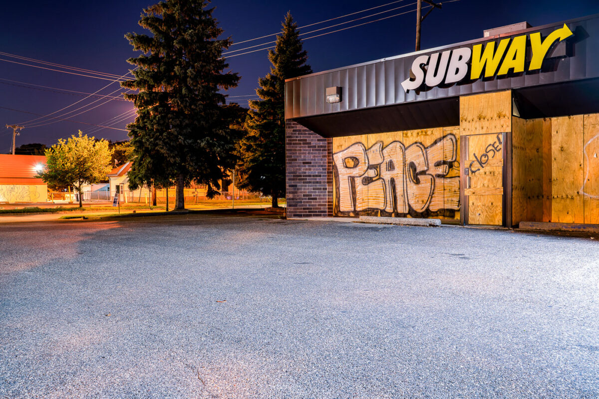
June 2020 — Boards on a strip mall in South Minneapolis during unrest in Minneapolis following the May 25th, 2020 death of George Floyd. Boards reading “Say His Name” “POC Owned” “BIPOC Owned”
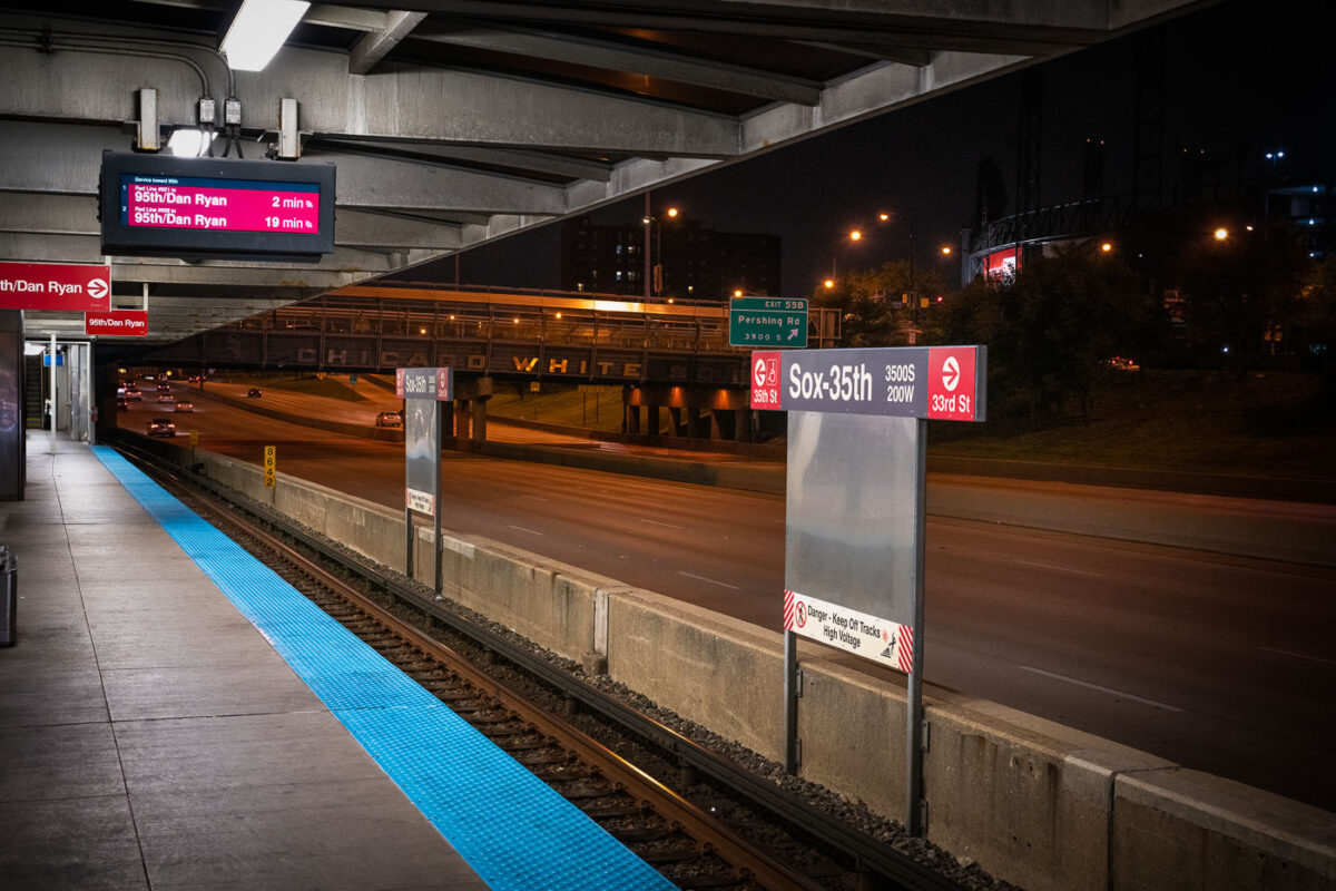
October 2019 — The Chicago Transit Authority’s Sox–35th station serves the Red Line on the city’s South Side, positioned above the Dan Ryan Expressway near Pershing Road. The station provides direct access to Guaranteed Rate Field, home of the Chicago White Sox, whose name can be seen across the pedestrian bridge in the background. Opened in 1969 as part of the Dan Ryan branch of the Red Line, the elevated structure was designed for efficiency amid highway traffic, symbolizing mid-century Chicago’s integration of mass transit and freeway infrastructure.
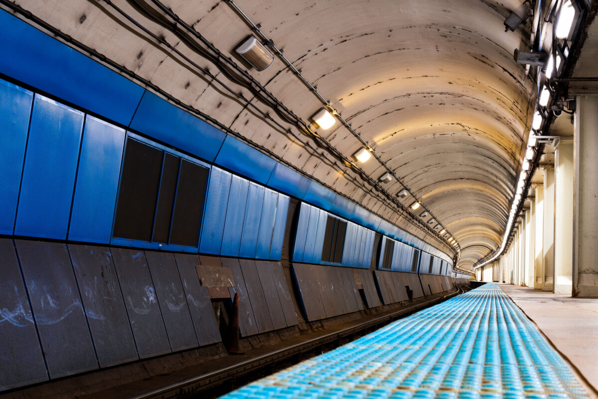
October 2019 — The curved platform of a Chicago Transit Authority Blue Line station reveals the utilitarian design of the city’s subway infrastructure, part of the Milwaukee–Dearborn subway opened in 1951. The tunnel’s tiled blue panels and low arched ceiling reflect the postwar engineering era that brought rapid transit beneath the Loop and the West Side, connecting O’Hare International Airport to downtown. Despite its age, this corridor remains a vital artery in Chicago’s daily commuter network, a symbol of mid-century urban mobility still in constant motion beneath the city streets.
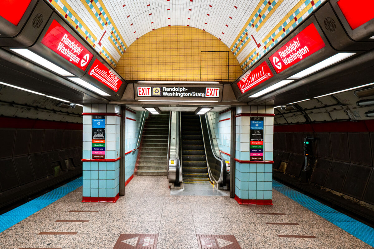
October 2019 — Randolph/Washington station sits beneath the heart of downtown Chicago, forming part of the CTA Red Line that runs through the State Street subway. Opened in 1943 as part of the city’s ambitious subway expansion, the station connects directly to the extensive Chicago Pedway system, linking offices, retail centers, and civic buildings underground. Its tiled vault and distinctive 1940s-era design remain largely intact, representing the Art Moderne phase of Chicago’s transit infrastructure.
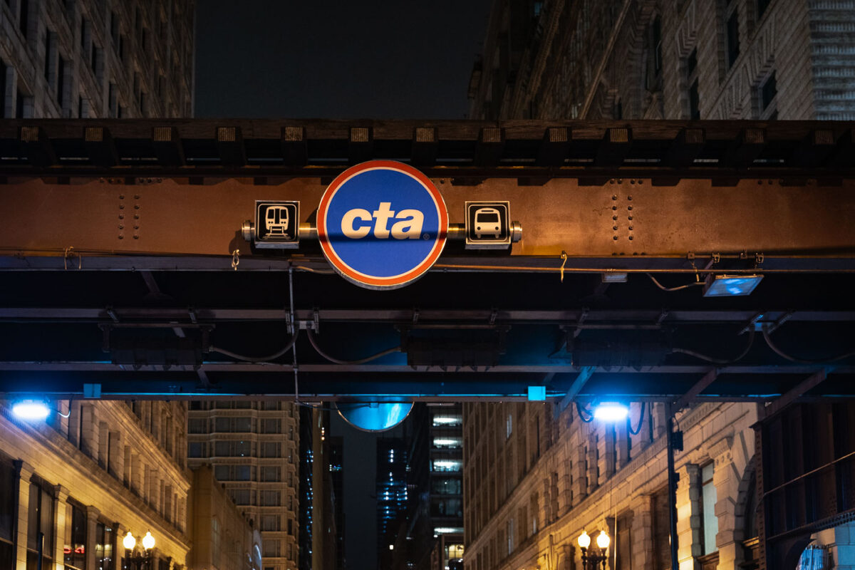
October 2019 — The Chicago Transit Authority (CTA) logo is displayed beneath the steel elevated tracks that define the Loop, the city’s central business district. The structure, part of the “L” system first built in the late 19th century, remains one of Chicago’s most enduring symbols of urban mobility. Overhead girders and riveted beams—many still original to the early 1900s—carry trains above streets lined with early skyscrapers and historic facades. The CTA continues to operate one of the largest and oldest public transit networks in the United States, moving more than a million riders daily through Chicago’s interconnected system of rail and bus lines.
October 2019 — Inside a tiled subway passageway, light blue and red accents curve along the walls, leading commuters toward the platform below. The design is distinctly retro, with polished tiles and fluorescent lighting evoking a mid-20th-century aesthetic found in older metro systems. The turn of the corridor reveals a glimpse of signage and station names, grounding the space in the everyday flow of city life.
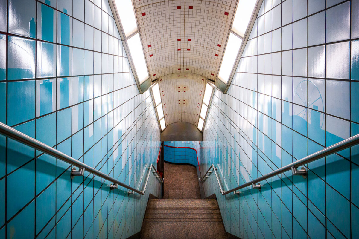
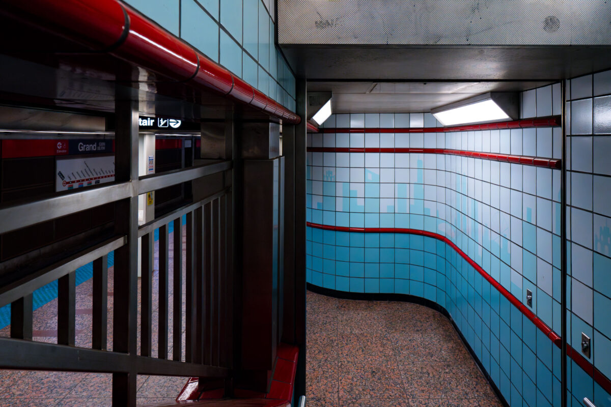
October 2019 — A stairway leads down to the platform at the Chicago Transit Authority’s Grand Station on the Red Line. The tiled corridor—lined with blue ceramic panels and stainless-steel railings—reflects the late-20th-century design style common to CTA subway renovations, emphasizing functionality and durable materials. The bright fluorescent lighting and tiled curvature guide commuters from street level into the subterranean rail network that connects Chicago’s North Side, Loop, and South Side neighborhoods. The subtle skyline motif on the tiles pays homage to the city’s architectural identity while marking one of the Red Line’s busiest downtown access points.
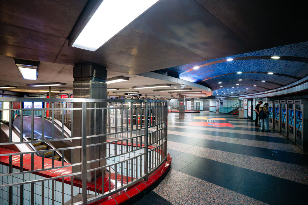
October 2019 — Passengers purchase tickets inside the Grand/State train station in Chicago.
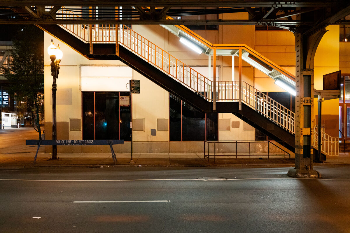
October 2019 — An illuminated stairway leads up to one of Chicago’s iconic “L” (elevated) train platforms in the Loop at night. The steel structure, marked with the system’s signature riveted beams, is part of the century-old elevated rail network that defines the city’s core transit identity. Below, a “Police Line – Do Not Cross” barricade and the quiet, empty street evoke a rare moment of stillness in an area usually dominated by the hum of trains and late-night traffic. This view highlights the utilitarian geometry and enduring presence of the Chicago Transit Authority’s elevated system, still serving as the backbone of the city’s rapid transit since the late 19th century.
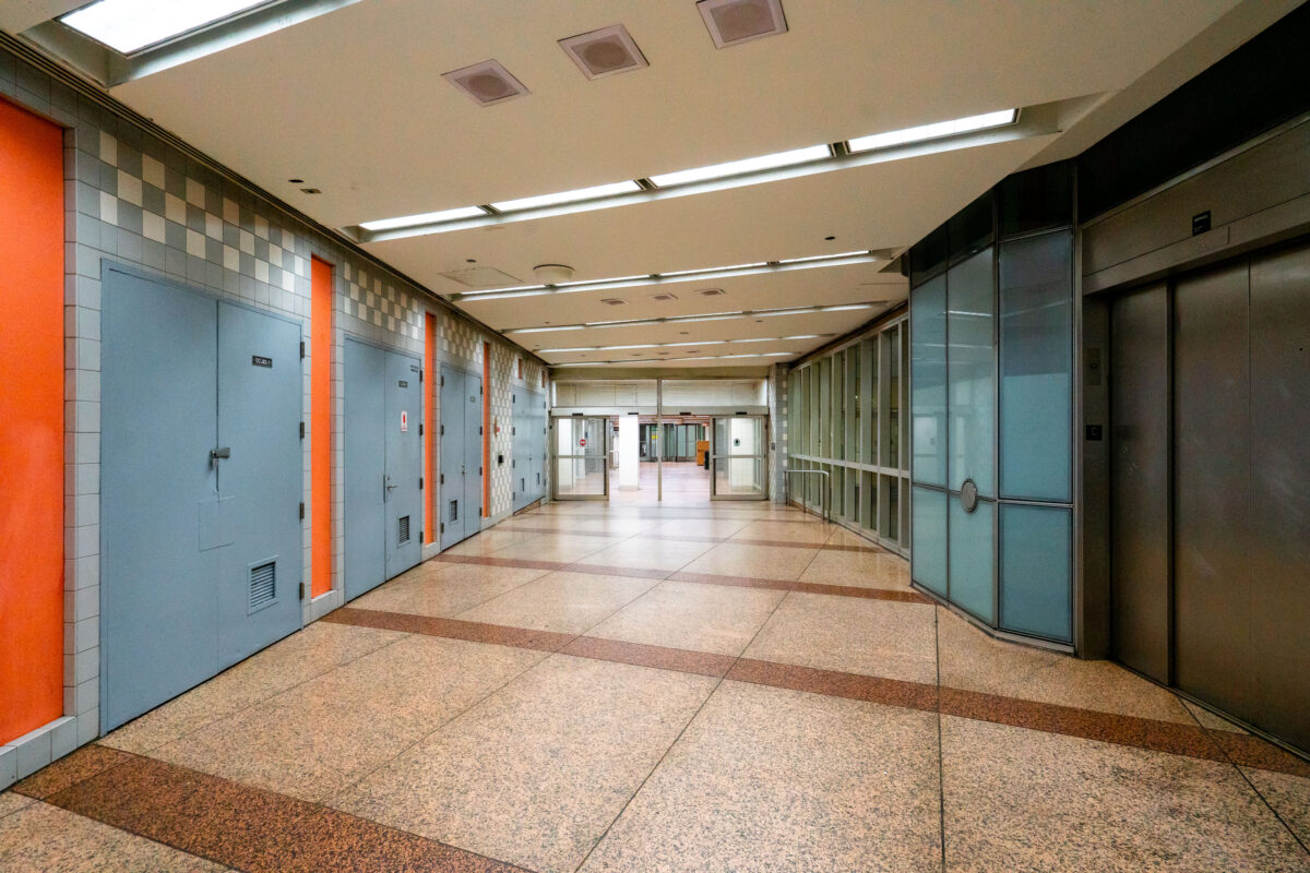
October 2019 — An empty corridor of the Chicago Pedway connects the Randolph/Washington subway station to surrounding office buildings and shopping centers beneath the Loop. The Pedway system, developed beginning in the 1950s, extends for more than 40 city blocks, linking major transit lines with civic and commercial spaces. Its mid-century design—terrazzo floors, tiled walls, and fluorescent lighting—reflects the city’s practical approach to all-weather pedestrian infrastructure, a defining feature of downtown Chicago’s urban core.
September 2019 —
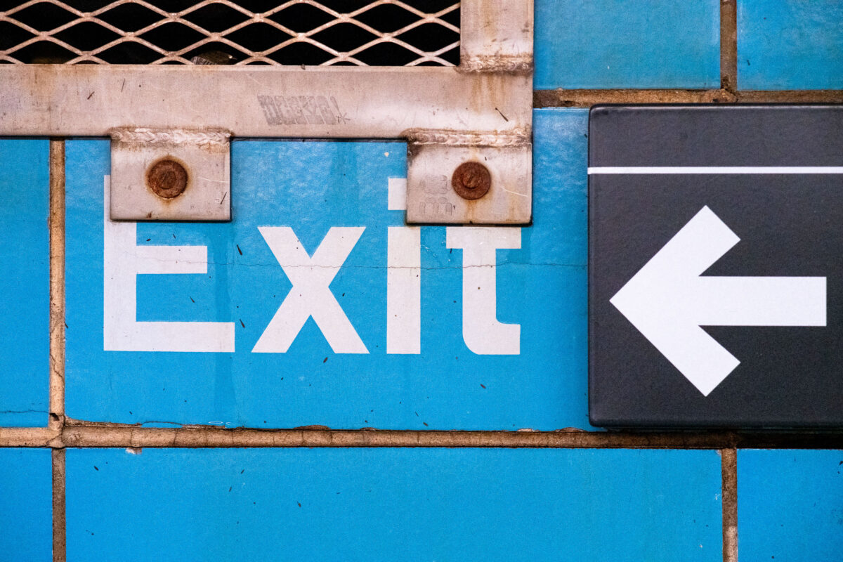
September 2019 — Exit signage at the Rector Street subway station in Manhattan New York City.
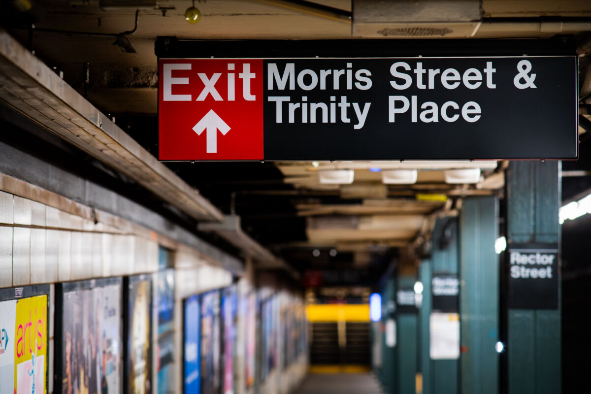
September 2019 — Rector Street subway station in Manhattan New York City.
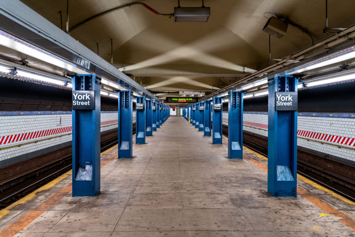
September 2019 — The York Street Station in Brooklyn, New York.
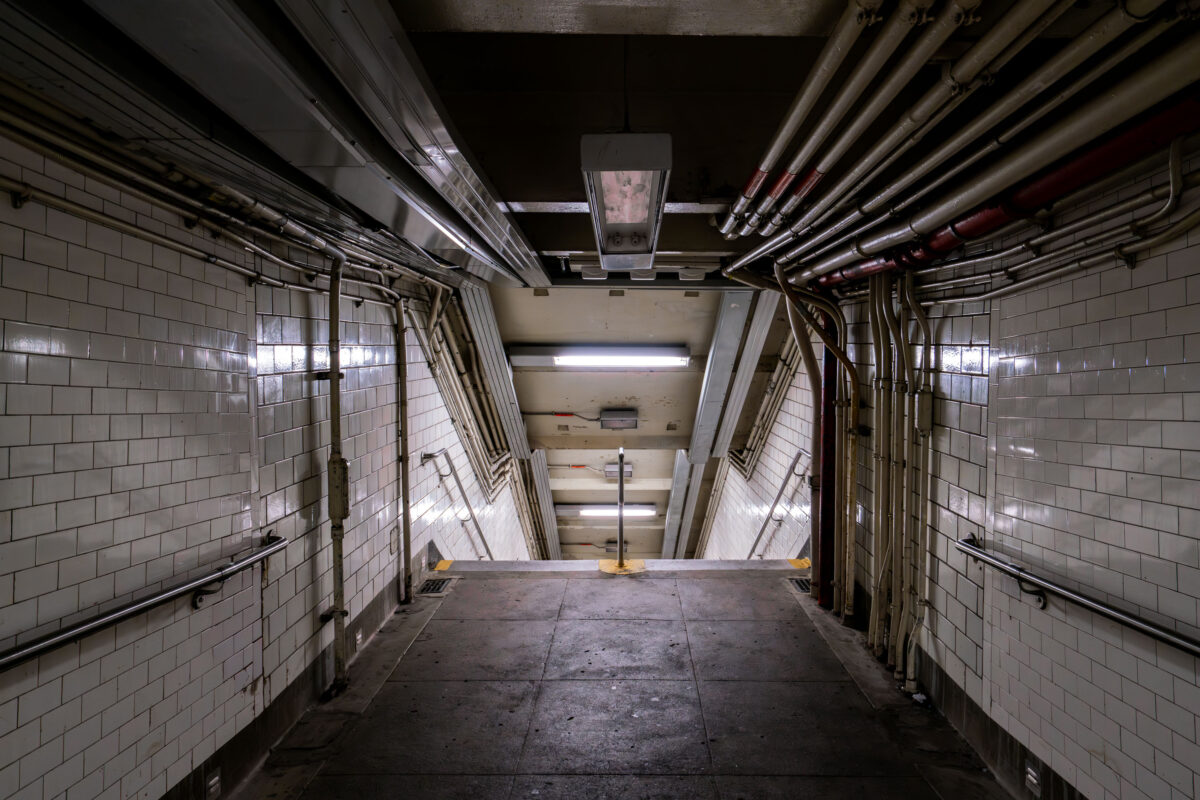
September 2019 — A dimly lit stairway leads down into a New York City subway station on Sunday, Sept. 14, 2025. Aging infrastructure and exposed piping are visible along the tiled walls.
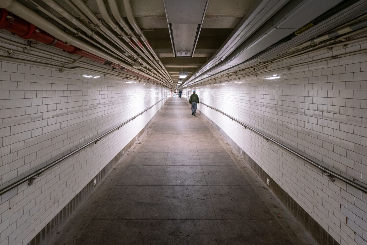
September 2019 — A man walks down a long hallway in the New York City Subway system.
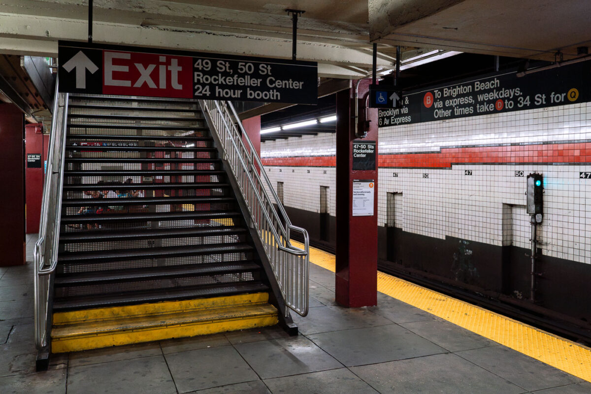
September 2019 — A staircase leads to the exit at the 47–50 Streets Rockefeller Center subway station in Manhattan. The station serves the B, D, F, and M lines.
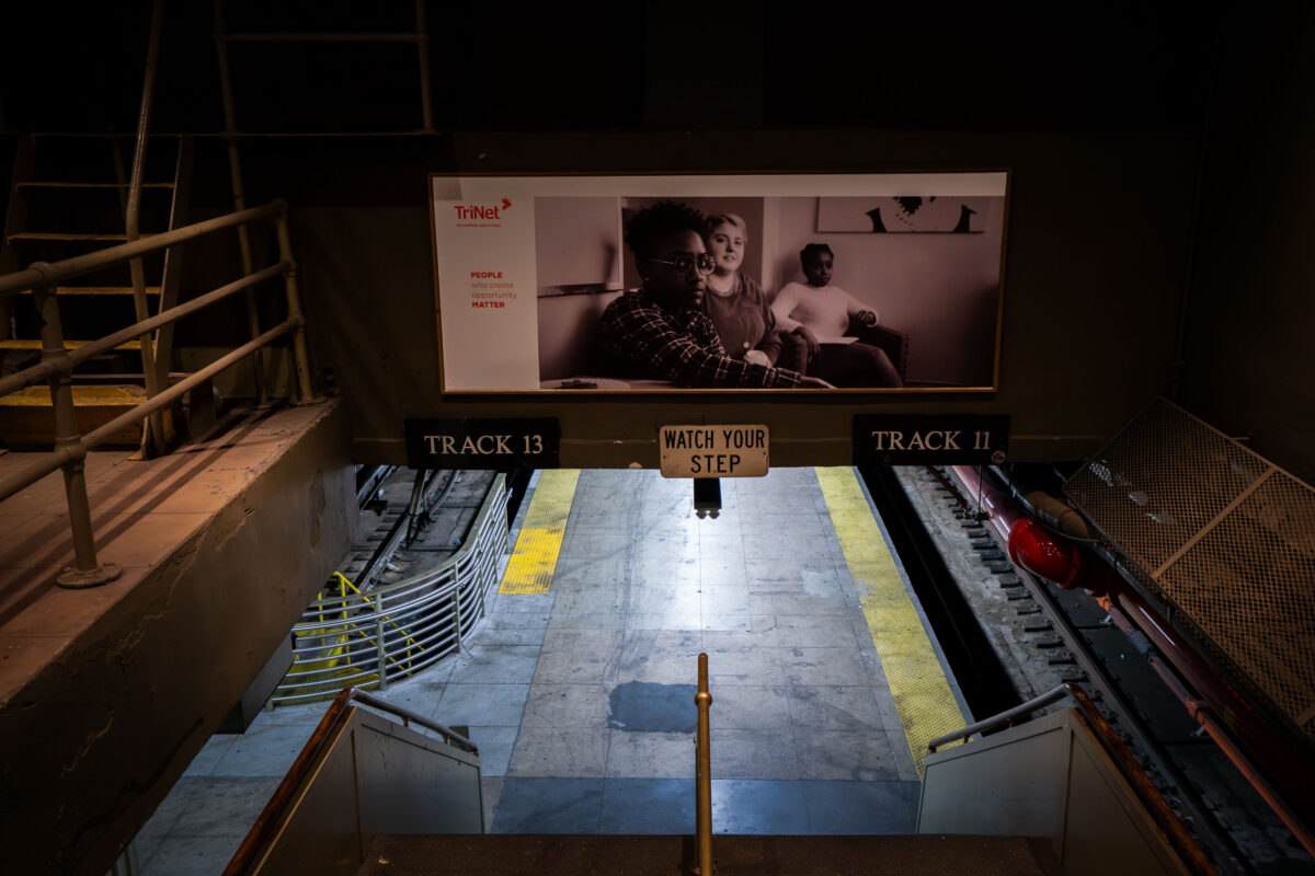
September 2019 — A stairway leads down to the train platforms for Tracks 11 and 13 at Penn Station in Manhattan. A sign reading “Watch Your Step” hangs above the stairs, while a black-and-white advertisement looms over the tracks in the busy transit hub.
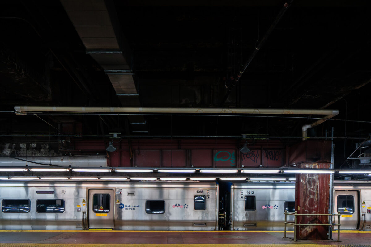
September 2019 — A Metro-North Railroad train sits at a platform inside Grand Central Terminal in Manhattan. The stainless-steel cars reflect the dim lighting of the underground station, where exposed pipes and graffiti-marked beams highlight the aging infrastructure of the busy commuter hub.
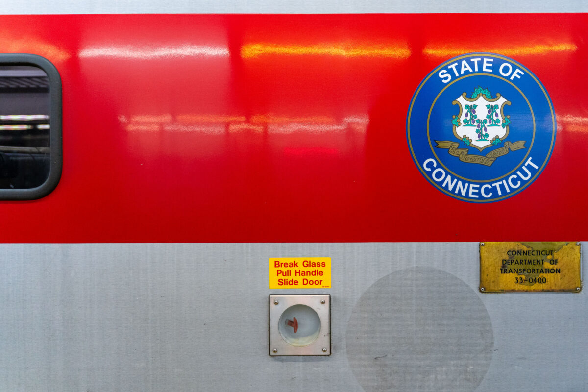
September 2019 — A Connecticut state seal is displayed on the side of a Metro-North Railroad train car, operated in partnership with the Connecticut Department of Transportation. The red-and-silver exterior includes safety instructions and signage, highlighting the regional rail system that connects commuters between New York and Connecticut.
September 2019 — A Metro-North Railroad train is seen at a station platform, its blue-and-white exterior bearing the MTA logo. The commuter rail line, operated by the Metropolitan Transportation Authority, connects New York City with suburbs across New York State and Connecticut.
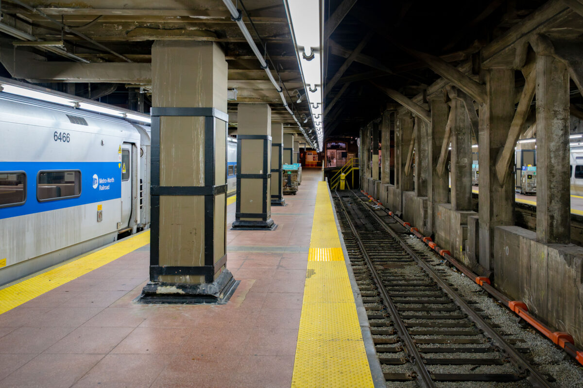
September 2019 — A Metro-North Railroad train waits at a platform inside Grand Central Terminal in Manhattan. The concrete pillars and exposed beams of the underground station frame the tracks, where the yellow warning strip lines the edge of the platform.
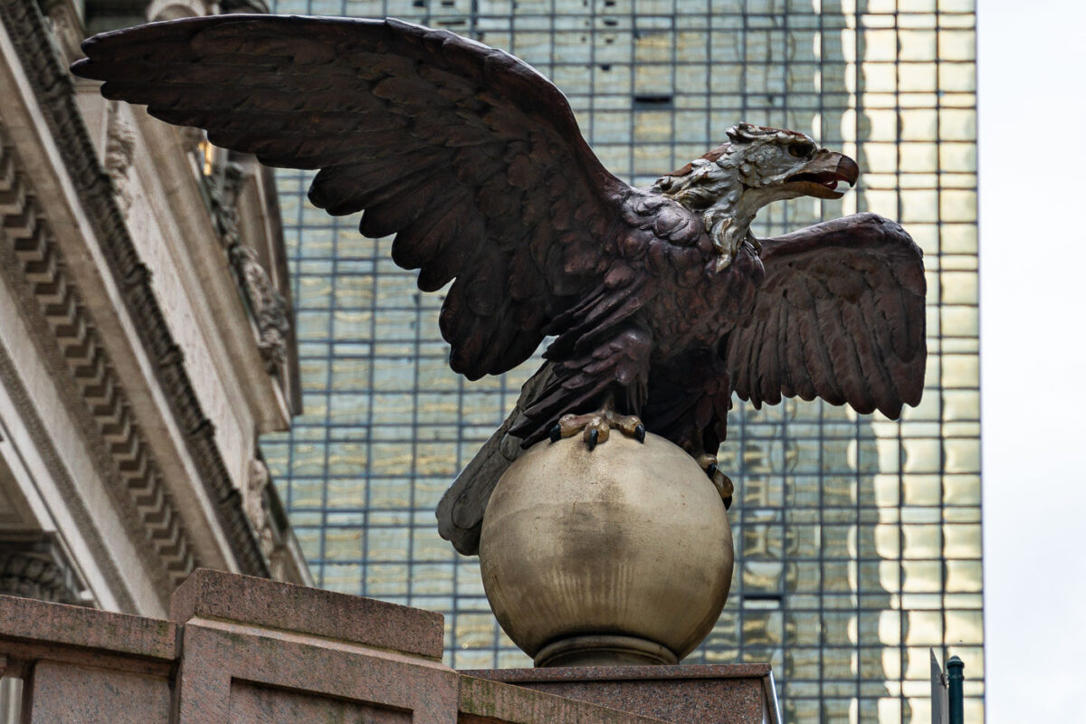
September 2019 — An eagle statue perched on a globe stands outside Grand Central Terminal in Manhattan. The bronze sculpture, one of several around the historic landmark, looks out over Midtown with the glass facade of the MetLife Building rising in the background.
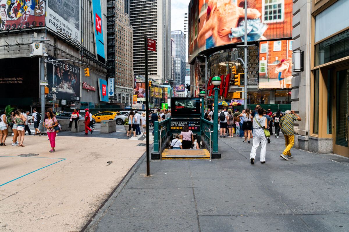
September 2019 — Pedestrians crowd the sidewalks around a subway entrance in Times Square, Manhattan. The 42nd Street–Times Square station, one of the busiest in New York City, connects multiple subway lines beneath the bright billboards, storefronts, and heavy traffic of the theater district.
August 2019 —
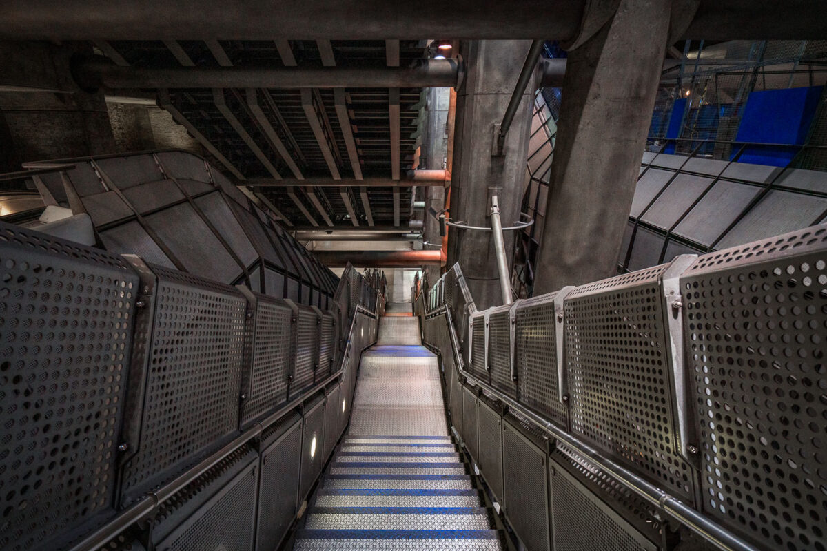
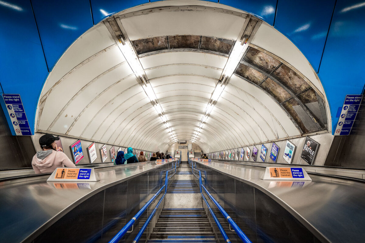
May 2019 — The angular steel and concrete design of Westminster Underground Station represents one of the most ambitious architectural undertakings of London’s Jubilee Line Extension, opened in 1999. Designed by Foster + Partners, the station descends more than 30 meters below ground beside the Houses of Parliament, requiring deep excavation and advanced structural engineering to stabilize the surrounding historic area. The stairwell seen here showcases the station’s signature industrial aesthetic — exposed concrete ribs, perforated metal panels, and massive supporting beams that evoke the look of a subterranean cathedral of infrastructure. Built within a massive box excavated beneath Bridge Street, Westminster’s layout integrates vertical circulation through lifts, escalators, and these steep stairways connecting the ticket hall to multiple underground levels. The design not only accommodates heavy passenger volumes but celebrates the raw mechanics of public transit, merging utility with architectural expression.
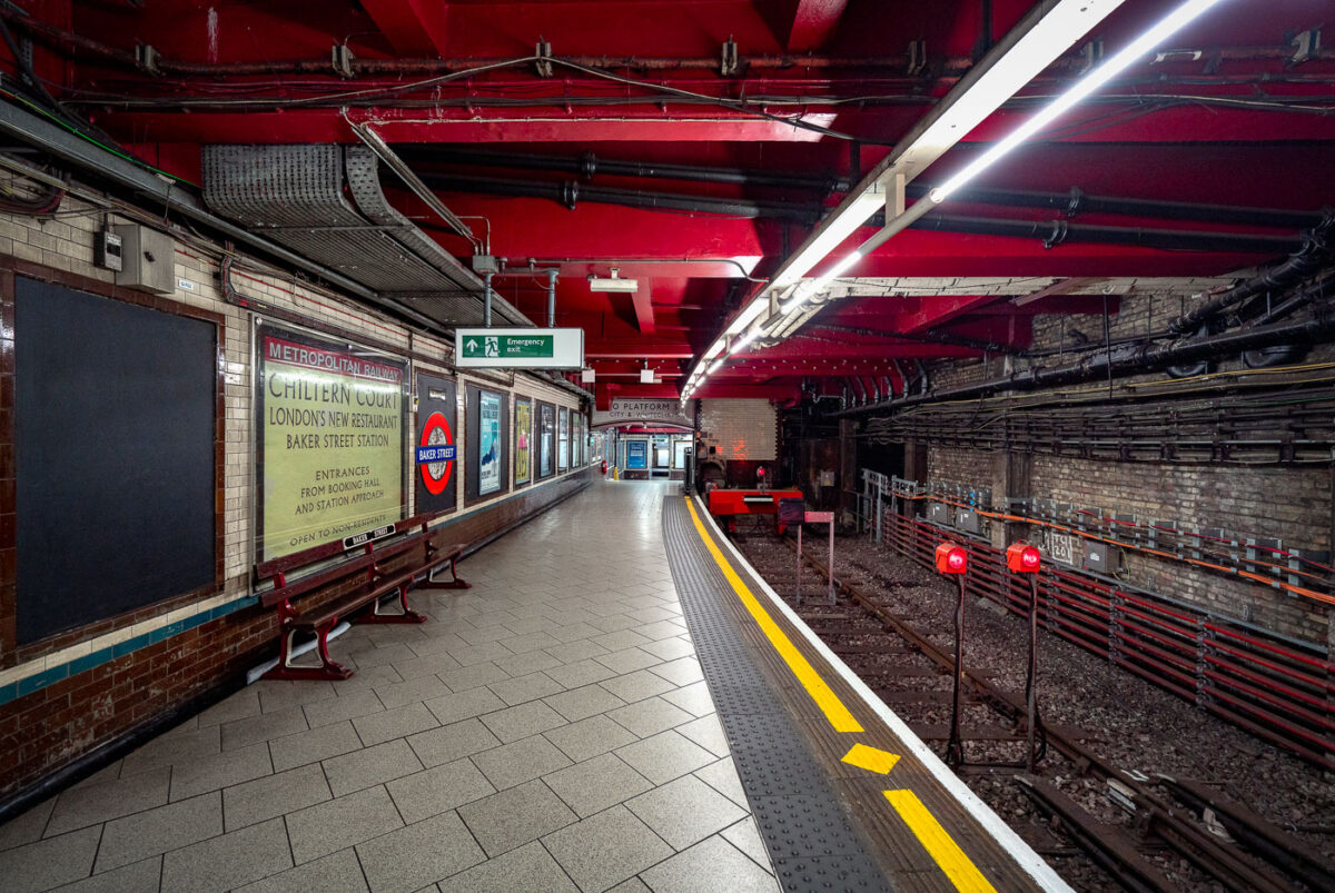
May 2019 — Baker Street Station’s Metropolitan Line platforms represent one of the oldest sections of the London Underground, opened in 1863 as part of the world’s first subterranean railway. The terminus platforms, seen here, retain their cut-and-cover Victorian brickwork paired with modern safety updates and striking red-painted steel reinforcements added during later refurbishments. The station originally served the Metropolitan Railway’s steam-hauled trains running between Paddington and Farringdon before electrification in the early 20th century transformed the network. Period signage advertising “Chiltern Court” and the original Metropolitan Railway branding pay homage to its heritage, contrasting with the exposed wiring, signal lights, and tiling that reveal more than 160 years of evolving underground infrastructure. Today, Baker Street remains a key interchange, connecting five Underground lines while preserving much of the industrial atmosphere that defined London’s pioneering approach to mass transit.
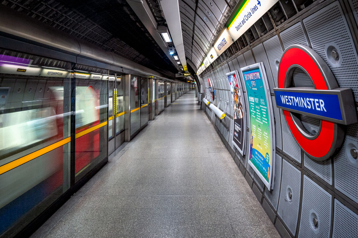
May 2019 — The Jubilee Line platforms at Westminster Underground Station represent the deep-level engineering and modernist design of London’s late-20th-century transit expansion. Constructed as part of the 1999 Jubilee Line Extension, these platforms sit approximately 30 meters below ground, directly beneath the District and Circle line tunnels. Designed by Foster + Partners, the station features full-height platform screen doors — a safety innovation uncommon on most of the Underground — and a sleek system of acoustic panels and perforated aluminum cladding that enhance both sound control and visual uniformity. Every structural and material detail reflects the project’s dual purpose: to manage immense passenger flow serving Parliament and Whitehall above, while preserving architectural clarity within a highly constrained urban site. The smooth curvature of the platform walls, precision lighting, and isolation of mechanical systems behind layered steel panels highlight the station’s integration of industrial functionality with the aesthetics of modern infrastructure.
May 2019 — Westminster is a London Underground station in the City of Westminster. It is served by the Circle, District and Jubilee lines. On the Circle and District lines, the station is between St. James's Park and Embankment, and on the Jubilee line it is between Green Park and Waterloo. It is in Travelcard Zone 1. The station is located at the corner of Bridge Street and Victoria Embankment and is close to the Houses of Parliament, Westminster Abbey, Parliament Square, Whitehall, Westminster Bridge, and the London Eye. Also close by are Downing Street, the Cenotaph, Westminster Millennium Pier, the Treasury, the Foreign and Commonwealth Office, and the Supreme Court.
May 2019 — Deep beneath central London, Baker Street’s Metropolitan Line platforms reveal the layered engineering of one of the oldest functioning railway systems in the world. The exposed brick tunnel and steel framing date back to the Victorian “cut-and-cover” era of the 1860s, when steam locomotives first ran through these very corridors. The heavy red girders seen above were reinforced during modern refurbishments, supporting the city streets above while housing utilities and cable conduits that power today’s Underground network. The train at the far end belongs to the S8 Stock series, introduced in 2010 by Bombardier for the Metropolitan Line, equipped with air conditioning and regenerative braking. The dense web of cables and control boxes along the wall carries signal, communication, and traction power circuits, all vital to the line’s safe operation. Baker Street’s infrastructure embodies London Transport’s continual evolution—from soot-covered tunnels to precision-controlled, electrically powered systems still running along the same 19th-century alignments.
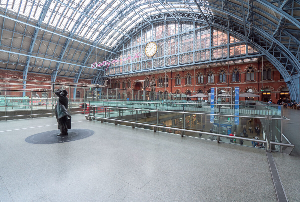
May 2019 — King's Cross St. Pancras (formerly King's Cross) is a London Underground station on Euston Road in the Borough of Camden, Central London. It serves King's Cross and St Pancras main line stations in fare zone 1, and is an interchange between six Underground lines. The station was one of the first to open on the network; as of 2017, it is the most used station on the network for passenger entrances and exits combined.
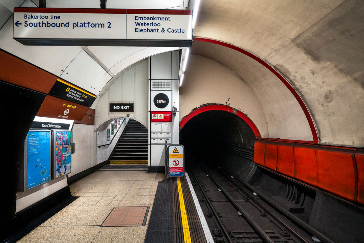
April 2019 — The southbound Bakerloo line platform at Charing Cross Underground Station in central London, showing the distinctive narrow tube tunnel built in the early 1900s. The red-edged lining around the tunnel mouth and the tiled passageway reflect classic London Transport design standards. Opened in 1906, the Bakerloo line was one of the early deep-level “tube” lines, and this station once served as its southern terminus before extensions carried it to Elephant & Castle. The signage and steep staircases illustrate the compact engineering that defined London’s early subterranean railways.
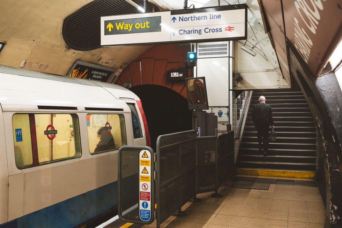
April 2019 — A Bakerloo Line train rests at Charing Cross Underground Station, beneath the heart of central London. Once a junction for both the Bakerloo and Jubilee lines, Charing Cross now functions as the southern terminus for Bakerloo services, connecting to the mainline station above. The photograph highlights the tunnel portal with its characteristic red tiles and the clean signage pointing toward the Northern line and the National Rail concourse. Opened in 1906 and expanded through the 1970s, the station remains an emblem of the Underground’s architectural layering—where Edwardian infrastructure meets modern transit demands.
April 2019 — Commuters ride the long escalators inside Charing Cross Underground Station in central London. The station, a busy interchange on the Northern and Bakerloo lines, is known for its deep tunnels, heavy foot traffic, and role as a gateway to Trafalgar Square and the West End. Rows of posters line the walls, while bright fluorescent lighting and metallic finishes highlight the stark, utilitarian design typical of the London Tube.
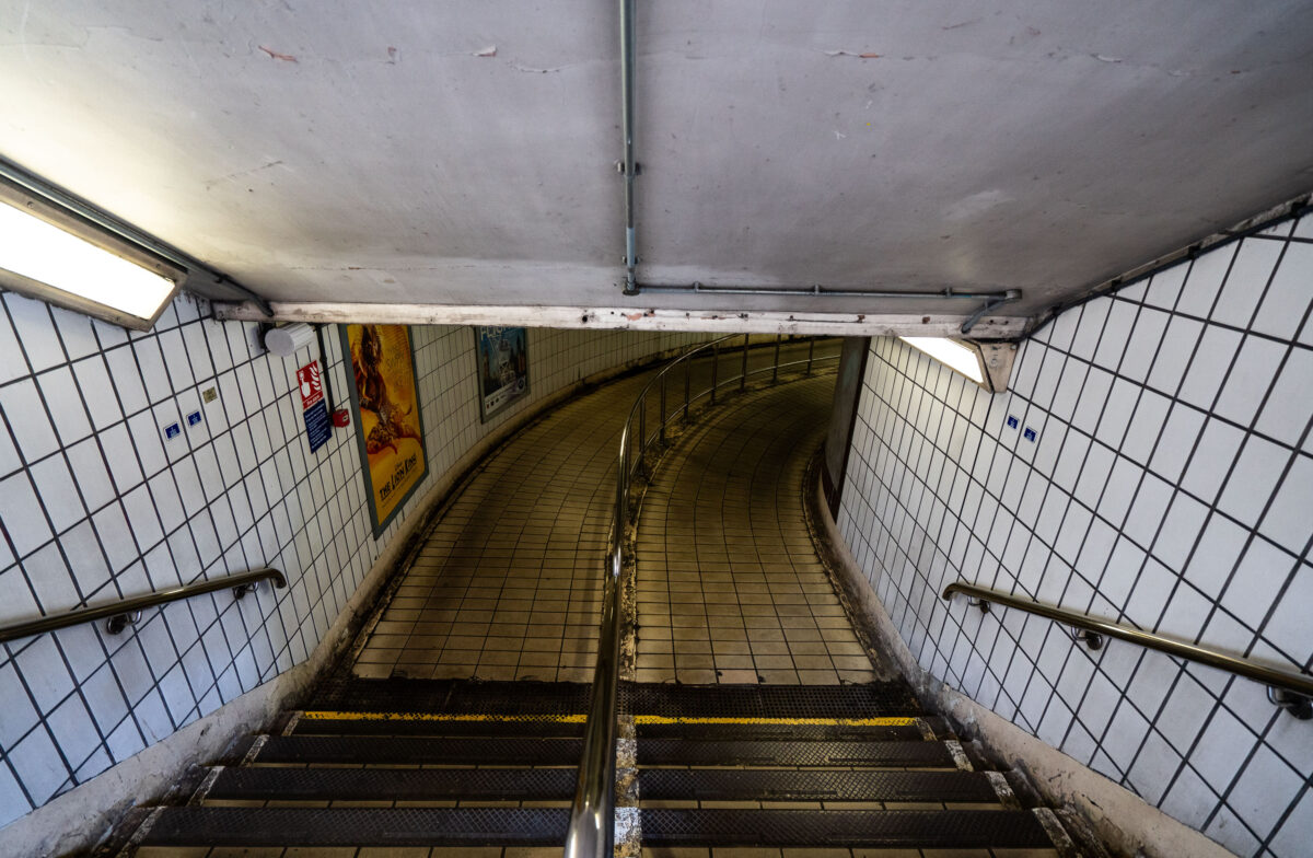
April 2019 — Descending into the tiled corridors of Charing Cross Station, this curved passageway reflects the classic utilitarian design of the London Underground’s mid-20th-century refurbishments. The white-tiled walls, stainless-steel handrails, and fluorescent lighting form a distinctly familiar aesthetic across the network, guiding travelers toward the Northern and Bakerloo lines. Once part of the original terminus for trains entering central London, Charing Cross remains a vital interchange linking rail and Tube services near Trafalgar Square—its passages echoing the constant rhythm of London commuters.
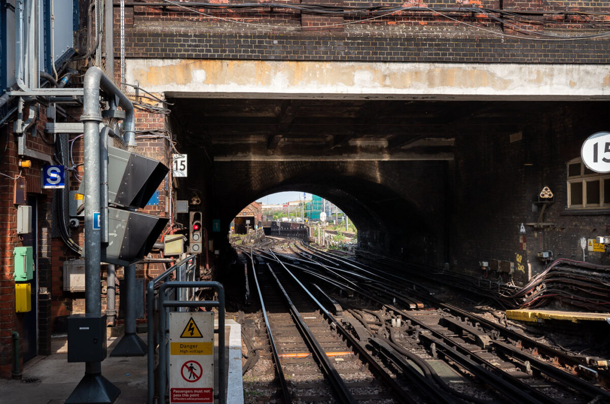
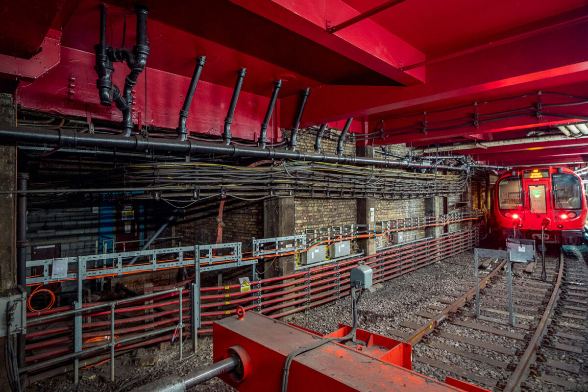
April 2019 — The intricate trackwork and tunnel entrance at Queen’s Park Station in northwest London reveal the dual identity of this site as both a passenger stop and a key depot for the Bakerloo Line. Opened in 1915, Queen’s Park serves as the operational transition point where London Underground trains share Network Rail tracks toward Harrow & Wealdstone. The junction’s dense web of points, signals, and electrified rails embodies over a century of continuous modernization—bridging early 20th-century tube engineering with today’s integrated mainline-underground operations.
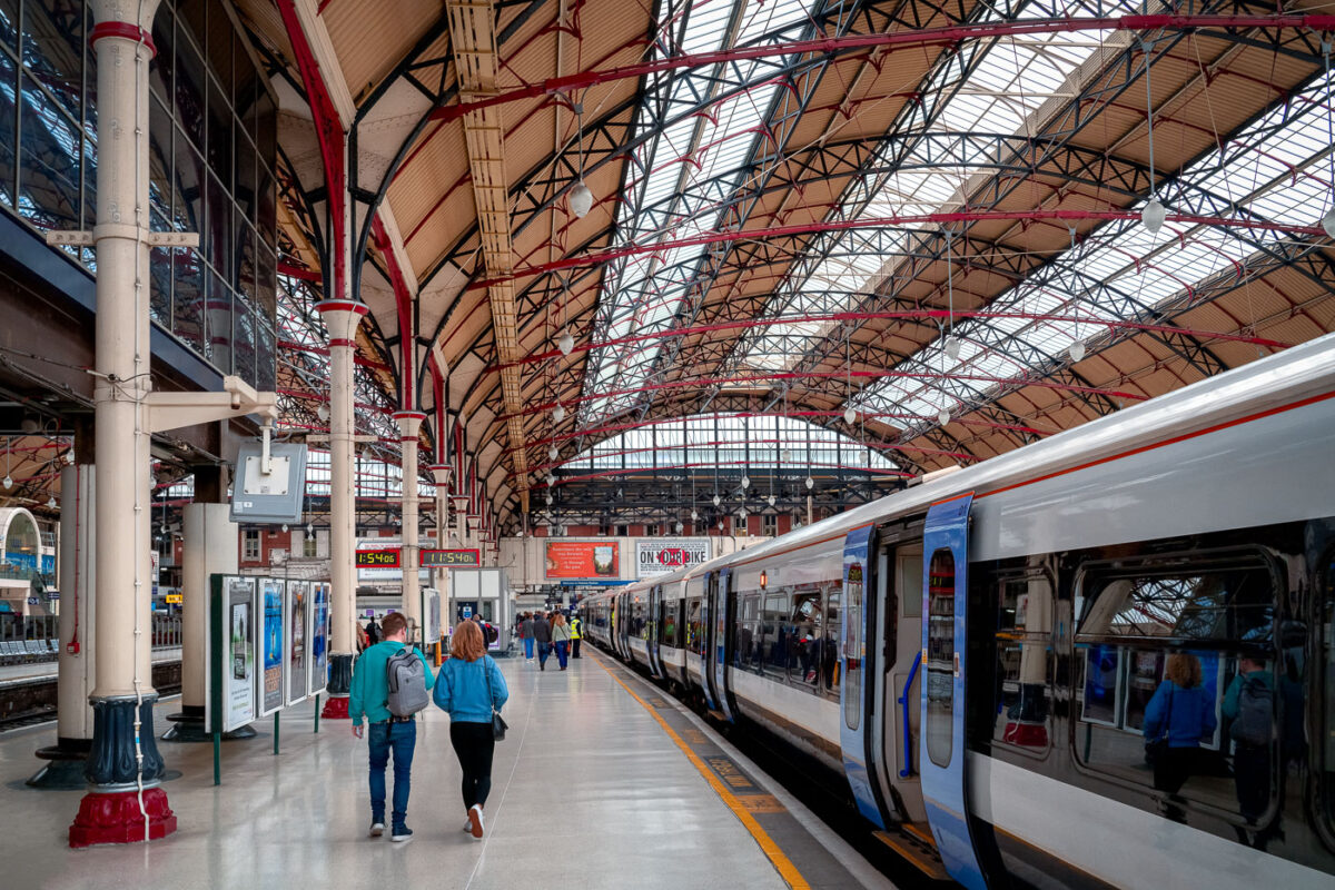
April 2019 — The platforms of London Victoria Station stretch beneath an ornate iron-and-glass roof, a hallmark of late 19th-century railway engineering. The intricate red and black trusses, designed for both strength and elegance, frame the soft natural light filtering through the skylights above. Commuters move toward the waiting trains of the Southern and Southeastern networks, a daily rhythm set against one of London’s most architecturally distinctive termini, where Victorian design continues to serve the modern rail era.
April 2019 — A pair of London Underground trains pass through Piccadilly Circus Station, one of the most recognizable stops in the network’s deep-level system. The curved platforms and distinctive cream-colored tilework reflect the 1920s modernization that gave the station its Art Deco influence, while the red, white, and blue train livery remains a symbol of the city’s transport identity. The platform’s polished floor and yellow safety line guide passengers along the busy interchange, located beneath the heart of London’s West End.
April 2019 — An underground corridor at London’s Piccadilly Circus Station connects the Bakerloo and Piccadilly line platforms deep beneath central London. Opened in 1906, the station sits directly under the city’s busiest intersection and handles tens of millions of passengers each year. The tunnels were rebuilt in the 1920s to improve crowd circulation, creating a complex network of escalators and passages like this one that channel travelers toward exits under Shaftesbury Avenue and Regent Street. Despite its age, the station remains one of the Underground’s most recognizable and heavily trafficked transport hubs in the West End.
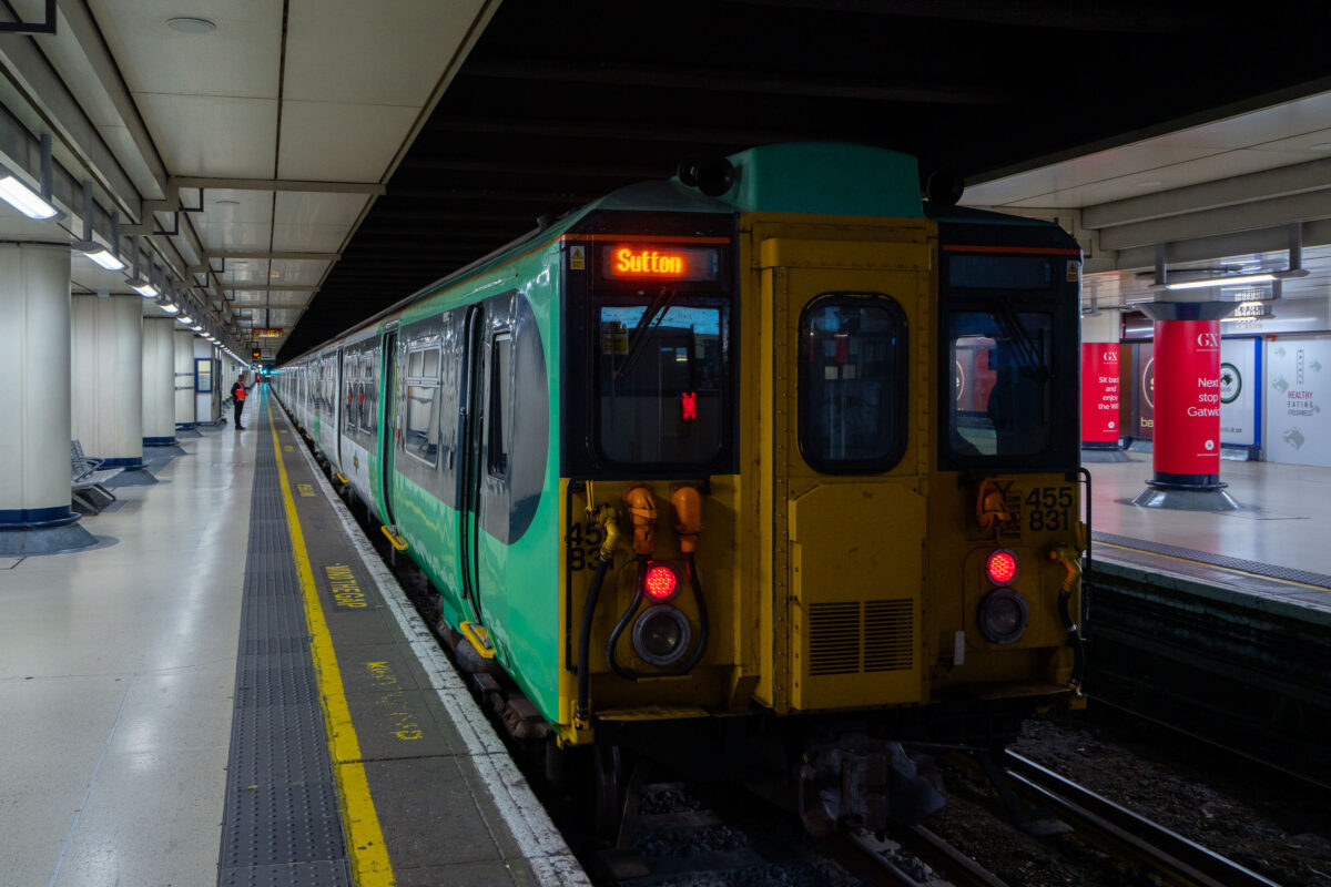
April 2019 — A Southern Railway Class 455 electric multiple unit prepares to depart from London Victoria station on a suburban service bound for Sutton. These 1980s-era trains, built by British Rail Engineering Limited, have long served the dense commuter corridors of South London and Surrey. The terminal’s subterranean platforms, seen here beneath the main concourse, handle both Gatwick Express and local Southern services, linking central London with its southern suburbs through one of the busiest rail hubs in Britain.
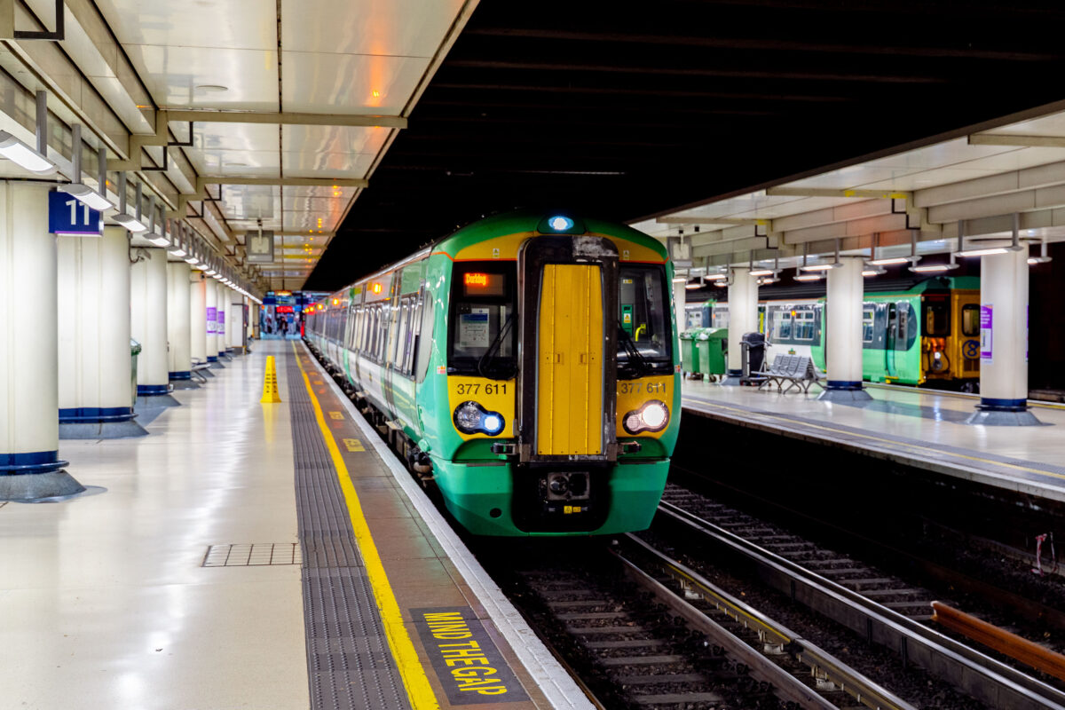
April 2019 — A Southern Railway Class 377 electric multiple unit pauses at one of the below-ground platforms of London Victoria, one of the busiest rail termini in the United Kingdom. Victoria Station serves as a major gateway for commuters and regional travelers across southern England, hosting both suburban services and longer-distance connections toward Sussex, Surrey, and the south coast. The station, originally opened in 1860, has undergone numerous renovations to accommodate modern passenger capacity, yet retains its functional layout with wide concourses, numbered platforms, overhead signage, and the familiar “Mind the Gap” platform warning. The photo highlights the integration of historic rail infrastructure with contemporary rolling stock, reflecting the continuing importance of national rail in London’s transit network.
April 2019 — A close-up view of a Southern Railway Class 377 Electrostar unit, part of the modern suburban fleet serving routes across South London and the southern counties. The green and yellow livery, with sliding central doors and Wi-Fi signage visible through the window, reflects the operator’s current design standard for high-frequency commuter service. These electric multiple units, built by Bombardier, form the backbone of Southern’s network—efficiently linking London with Brighton, Gatwick, and the South Coast. The clean, modular profile emphasizes function and accessibility typical of post-2000 British rolling stock.
April 2019 — An S7 Stock train stands at Tower Hill Station on the District and Circle lines, its doors open beneath the curved tunnel roof. These Bombardier-built trains, introduced between 2010 and 2017, form part of London Underground’s Sub-Surface Railway modernization program—featuring wider gangways, air conditioning, and regenerative braking. The tiled walls and bright signage retain the visual identity of the Underground, while the yellow safety line and tactile paving mark the boundary of one of London’s busiest commuter platforms. Tower Hill’s proximity to the Tower of London and the Thames makes it both a vital interchange for daily travelers and a gateway for millions of visitors exploring the city’s historic core.
April 2019 — The eastbound platform at Tower Hill Underground Station, serving the District and Circle lines, curves gently beneath the City of London’s historic core. The tiled walls, layered advertising panels, and utilitarian ceiling panels reflect the practical design language of the post-war London Underground system. Located adjacent to Tower Gateway DLR and just steps from the Tower of London, this interchange is one of the busiest tourist-access stations in central London. Its narrow curvature and close tunnel clearances are characteristic of legacy sub-surface lines built in the 19th century—still forming the backbone of the modern network more than 150 years later.
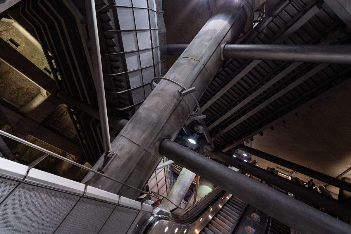
April 2019 — Passengers ascend and descend the deep escalator shafts of London Bridge Underground Station, one of the busiest interchanges in the capital’s rail network. Rebuilt and expanded during the Jubilee Line Extension project of the 1990s, the station’s concrete-lined tunnels and exposed mechanical framework represent a fusion of industrial engineering and modern architectural design. At nearly 26 meters below ground, these escalators connect the Northern and Jubilee lines with the mainline concourse above, handling tens of thousands of passengers daily. The structural bracing and utilitarian lighting were deliberately retained as visual elements, emphasizing the monumental scale of London’s deep-level transport infrastructure.
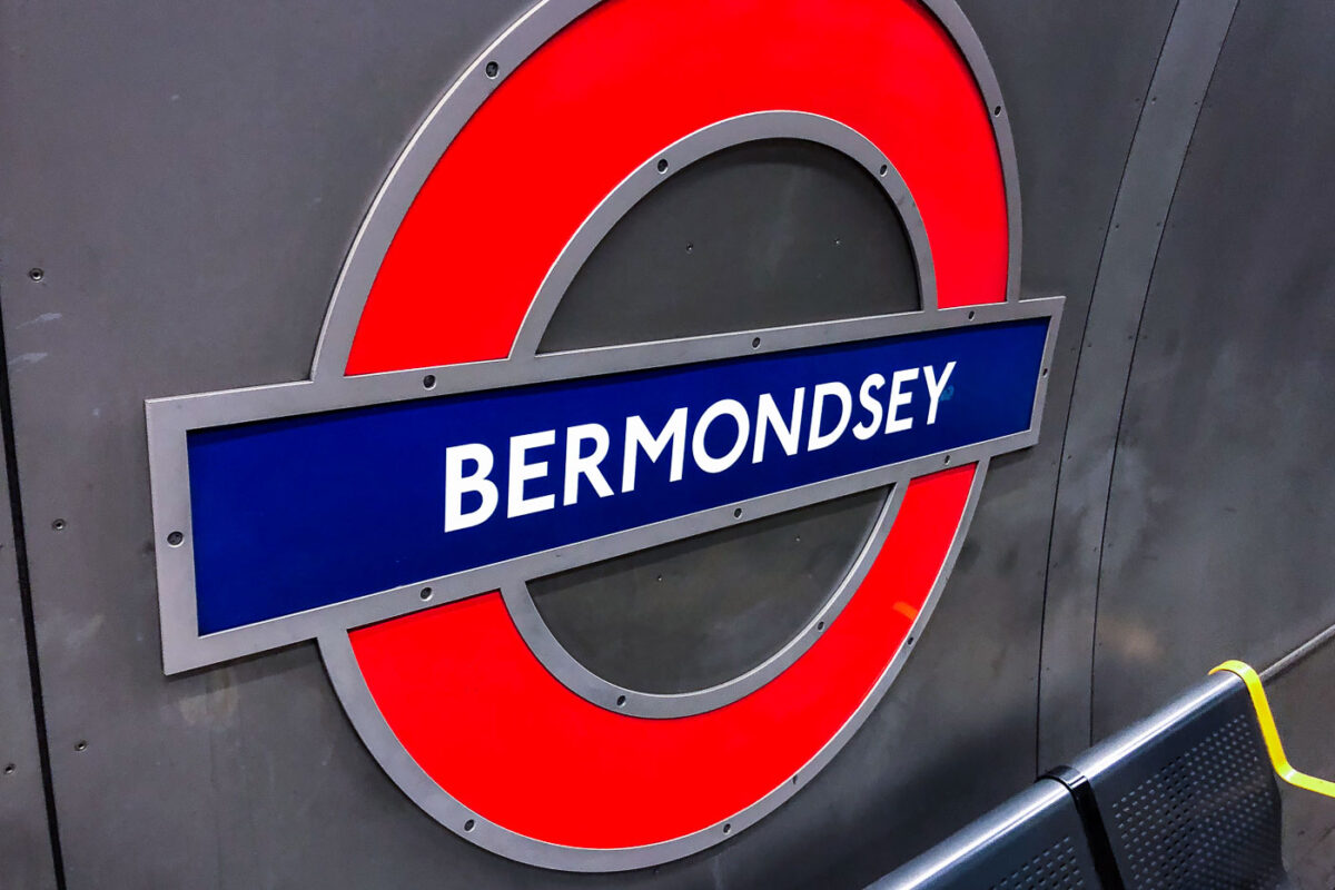
April 2019 — The distinctive red-and-blue roundel of Bermondsey Station marks one of the Jubilee Line’s most modern stops in southeast London. Opened in 1999 as part of the Jubilee Line Extension, the station features stainless steel panels, subdued lighting, and a minimalist aesthetic typical of late-20th-century London Transport design. The bold signage, designed to the original Transport for London typographic standards, stands out against the brushed metal backdrop—an enduring emblem of the Underground’s fusion of history and modern engineering.
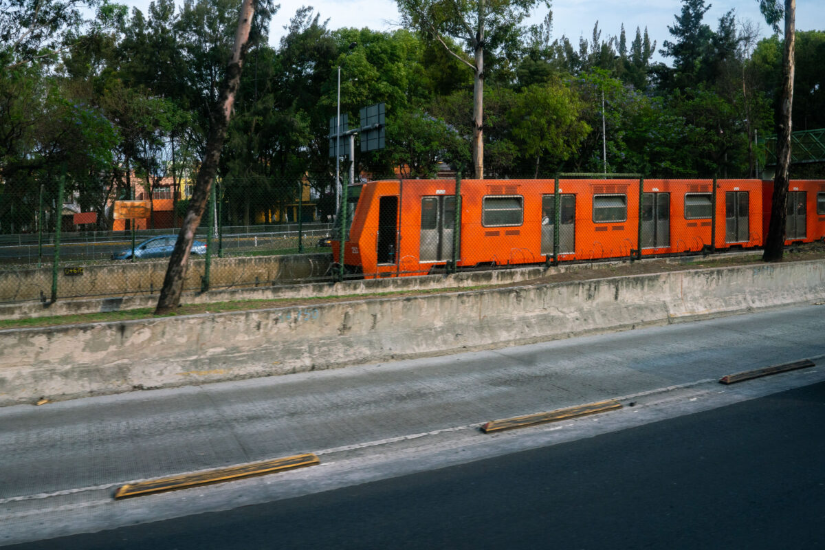
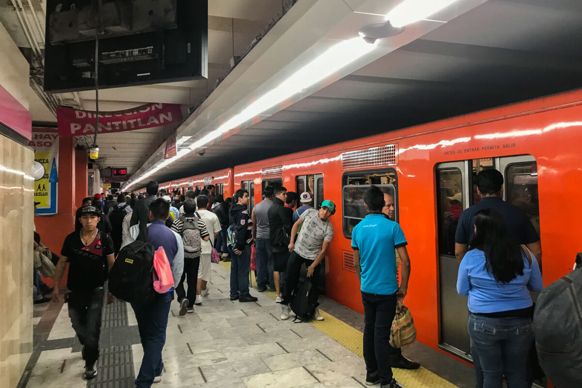
May 2018 — A bright orange Mexico City Metro train runs alongside the Viaducto highway, partially framed by trees and fencing that separate it from the busy traffic corridor. The train’s distinctive color has become a visual emblem of the city’s vast and aging transit network, originally launched in 1969. These rubber-tired trains serve millions of riders daily, threading through tunnels and elevated sections across the capital. Here, the contrast between greenery, concrete, and the orange carriages underscores the Metro’s integration into the urban landscape—an ever-moving artery of one of the world’s largest cities.
April 2018 —
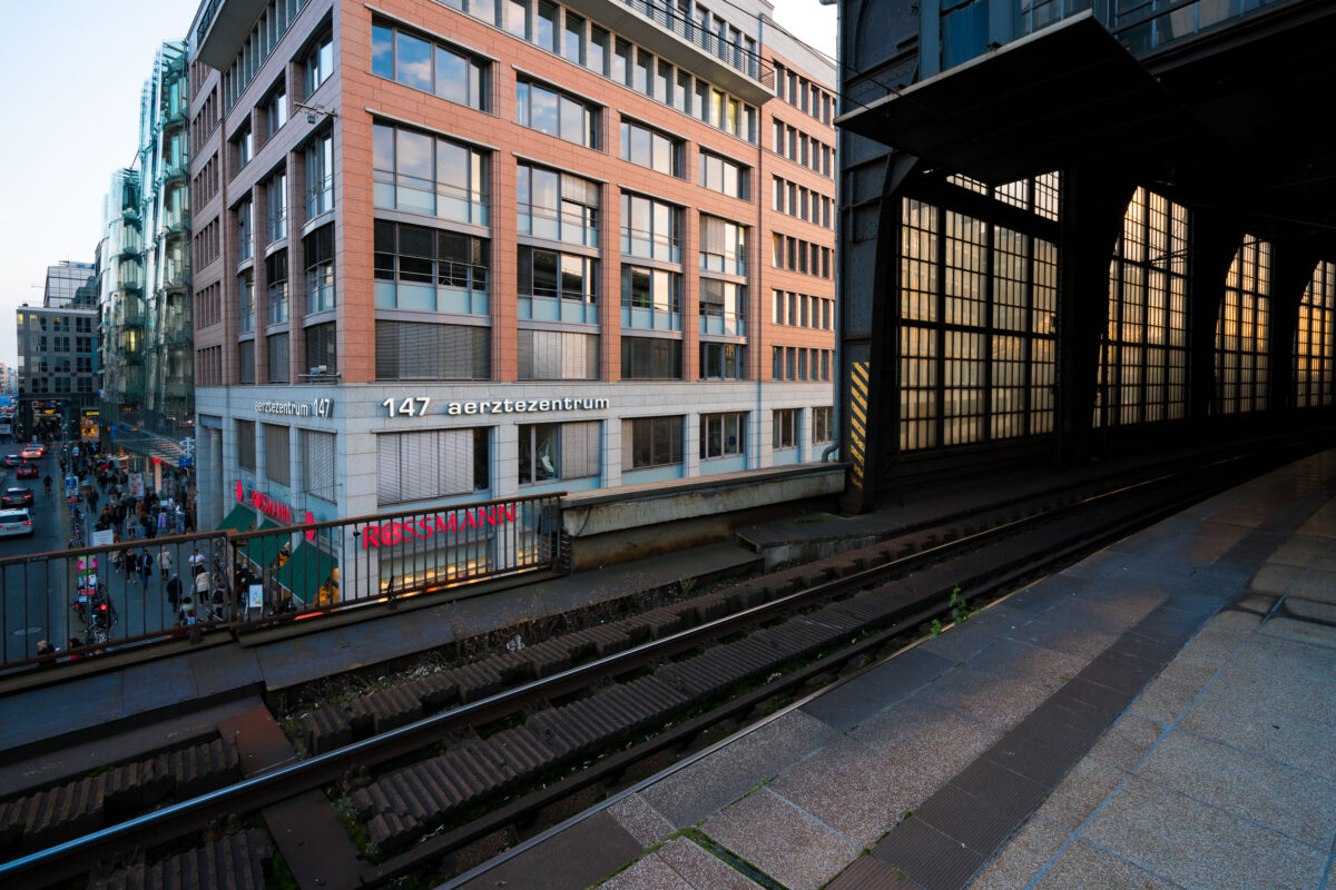
September 2017 — View from the platform at Berlin Friedrichstraße station overlooking Georgenstraße below. The elevated tracks run alongside a mix of modern and postwar office buildings, including the Aerztezentrum at No. 147. Pedestrians and cyclists move through the busy commercial street beneath, while the station’s glass and steel structure reflects the late-day light.
September 2017 — Berlin Friedrichstraße station in the early evening, with an S-Bahn BR 481 series train stopped under the steel and glass canopy. The curved elevated tracks lead into the main hall, a design characteristic of the city’s prewar rail architecture. Overhead wires and support structures frame the scene, while a few commuters move along the quiet platform as daylight fades into artificial light.
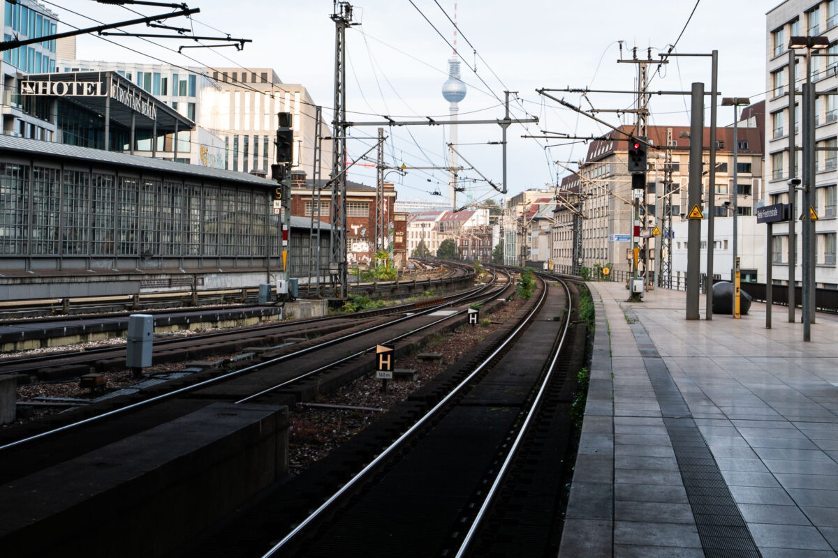
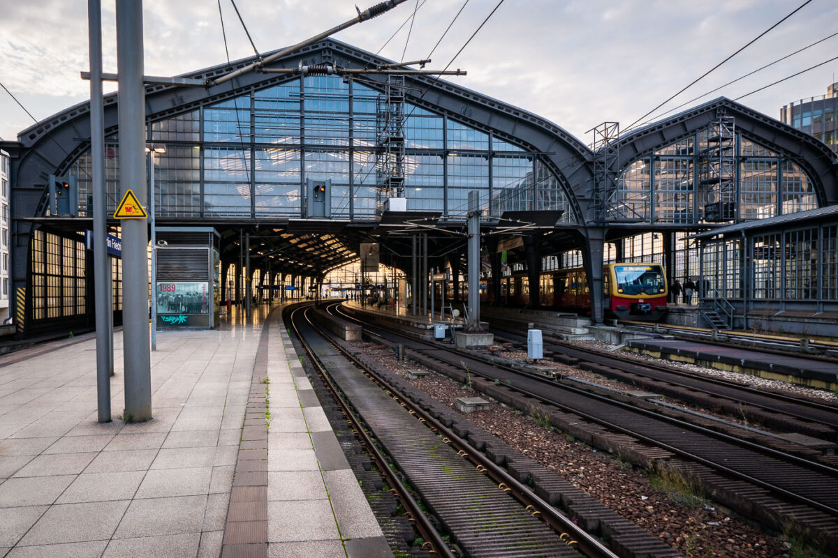
September 2017 — Tracks curve eastward from Berlin Friedrichstraße station, one of the city’s busiest S-Bahn and regional rail interchanges. The elevated viaduct carries multiple lines, including the S3, S5, S7, and S9, which link central Berlin with its outer districts and neighboring cities. The view looks toward Alexanderplatz, with the Fernsehturm television tower visible in the distance — a defining landmark of the former East Berlin skyline. Friedrichstraße station opened in 1882 and served as a symbolic and logistical border crossing during the Cold War, when it connected both East and West Berlin rail networks. Today, the station remains a major transit hub, handling thousands of passengers daily and sitting at the junction of the north–south and east–west S-Bahn corridors. The surrounding area has since been redeveloped with modern offices, hotels, and shops while retaining its role as one of Berlin’s central transport arteries.
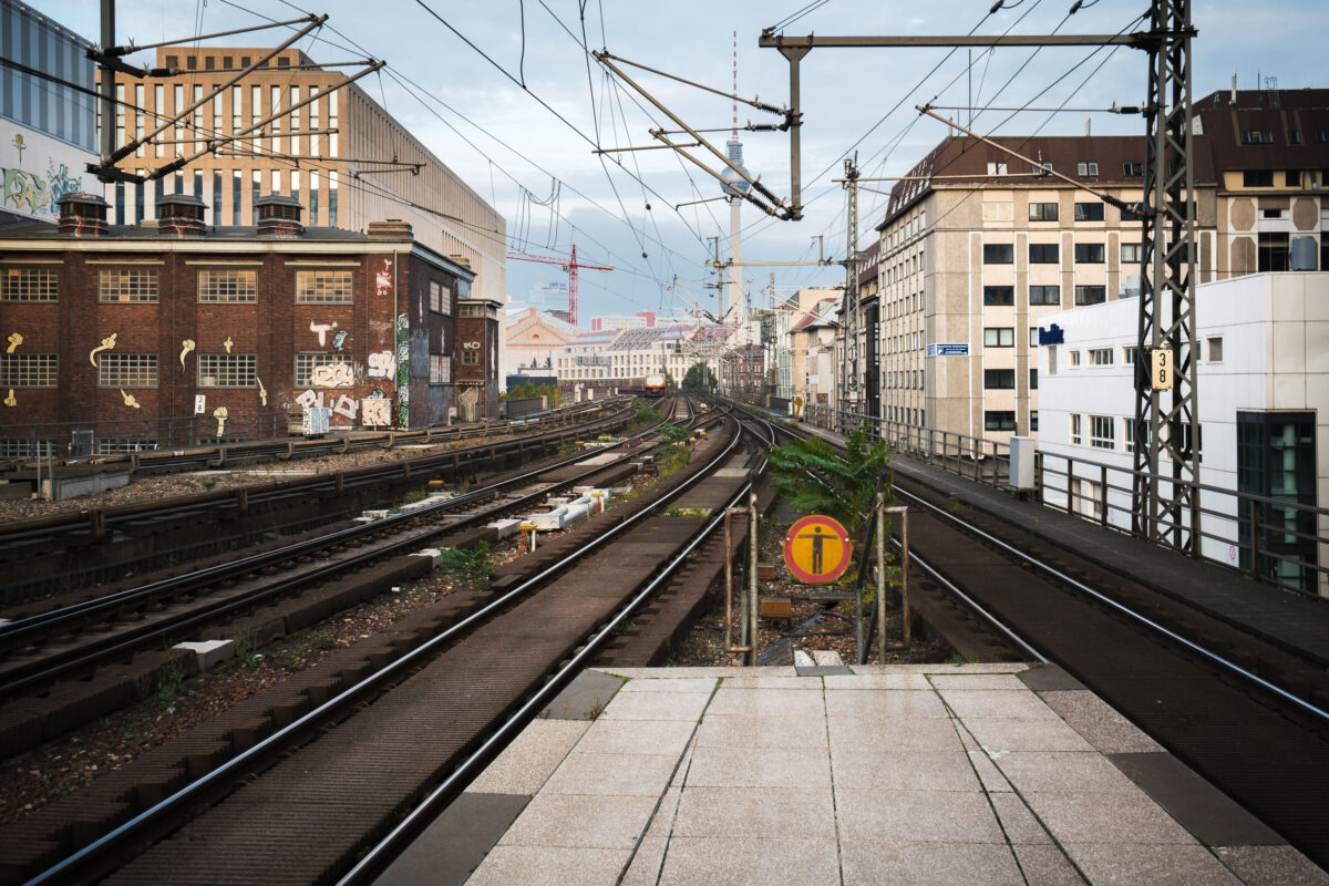
September 2017 — View east from Berlin Friedrichstraße station showing the elevated S-Bahn tracks leading toward Alexanderplatz. Overhead wires and supporting steel structures frame the route, with graffiti-covered industrial buildings on the left and mid-century offices on the right. The Berlin TV Tower (Fernsehturm) rises in the distance, a landmark visible across the city skyline.
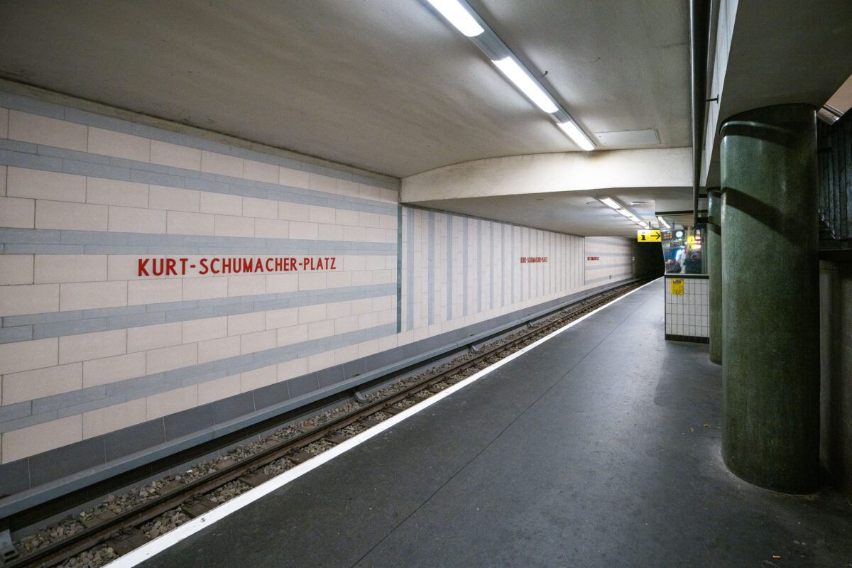
September 2017 — Kurt-Schumacher-Platz station serves Berlin’s U6 U-Bahn line in the Reinickendorf district, located in the city’s northwest. Opened on May 3, 1956, the station was part of the first postwar U-Bahn expansion and named after German statesman Kurt Schumacher, a key figure in rebuilding the Social Democratic Party after World War II. The station features light-colored wall tiles with horizontal gray stripes and minimalist red lettering, reflecting mid-1950s West Berlin design. It includes a central island platform and two tracks, serving as an important stop between Afrikanische Straße and Scharnweberstraße. Above ground, the station connects to several bus routes and lies near the approach to the U6 tunnel under the former Tegel Airport area. Today, it remains a key link for northern Berlin commuters traveling toward the city center.
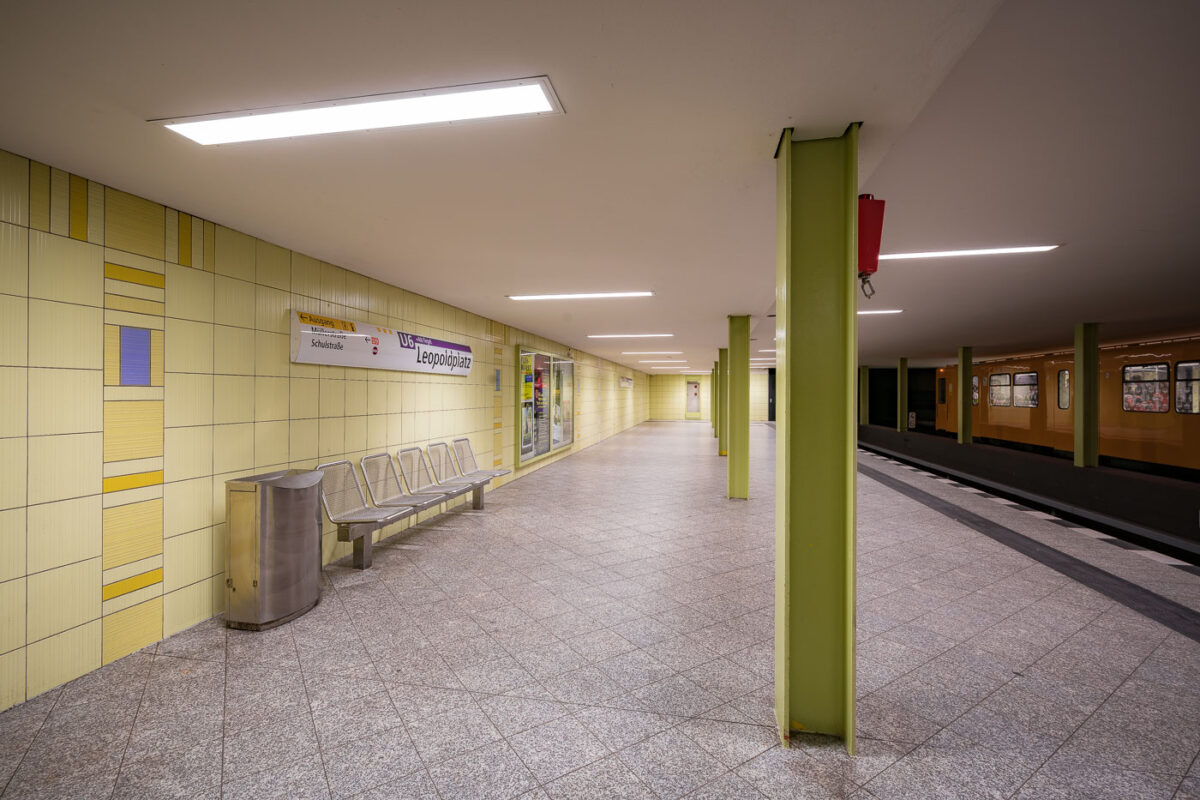
September 2017 — The Leopoldplatz U-Bahn Station in Berlin Germany.
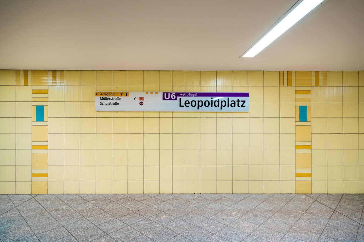
September 2017 — The Leopoldplatz U-Bahn Station in Berlin Germany.
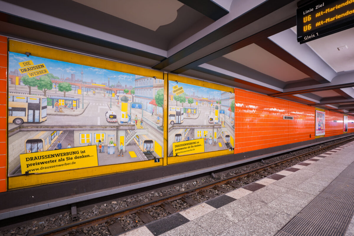
September 2017 — Wittenbergplatz station on Berlin’s U2 line features a distinctive orange-tiled design characteristic of the city’s postwar modernization of U-Bahn interiors. The platform level seen here includes advertising panels with hand-illustrated city scenes, part of a campaign promoting outdoor advertising (“Draussenwerbung”) by Wall GmbH, a longtime transit advertising company in Berlin. Opened in 1902 as part of the city’s first underground railway, Wittenbergplatz is one of Berlin’s oldest stations and a key junction serving the U1, U2, and U3 lines. The orange tiles were installed during mid-20th-century refurbishments to brighten the subterranean space, contrasting with the original Jugendstil architecture preserved at the main hall above. The modern signage displays U6 connections, while the station’s layout—with three island platforms—continues to serve one of the busiest interchange points in Berlin’s U-Bahn network.
September 2017 — Seestraße U-Bahn Station, Berlin Germany
September 2017 — Berlin-Wedding station S-Bahn station in Berlin, Germany

September 2017 — A train passes through the Wedding station in Berlin Germany.
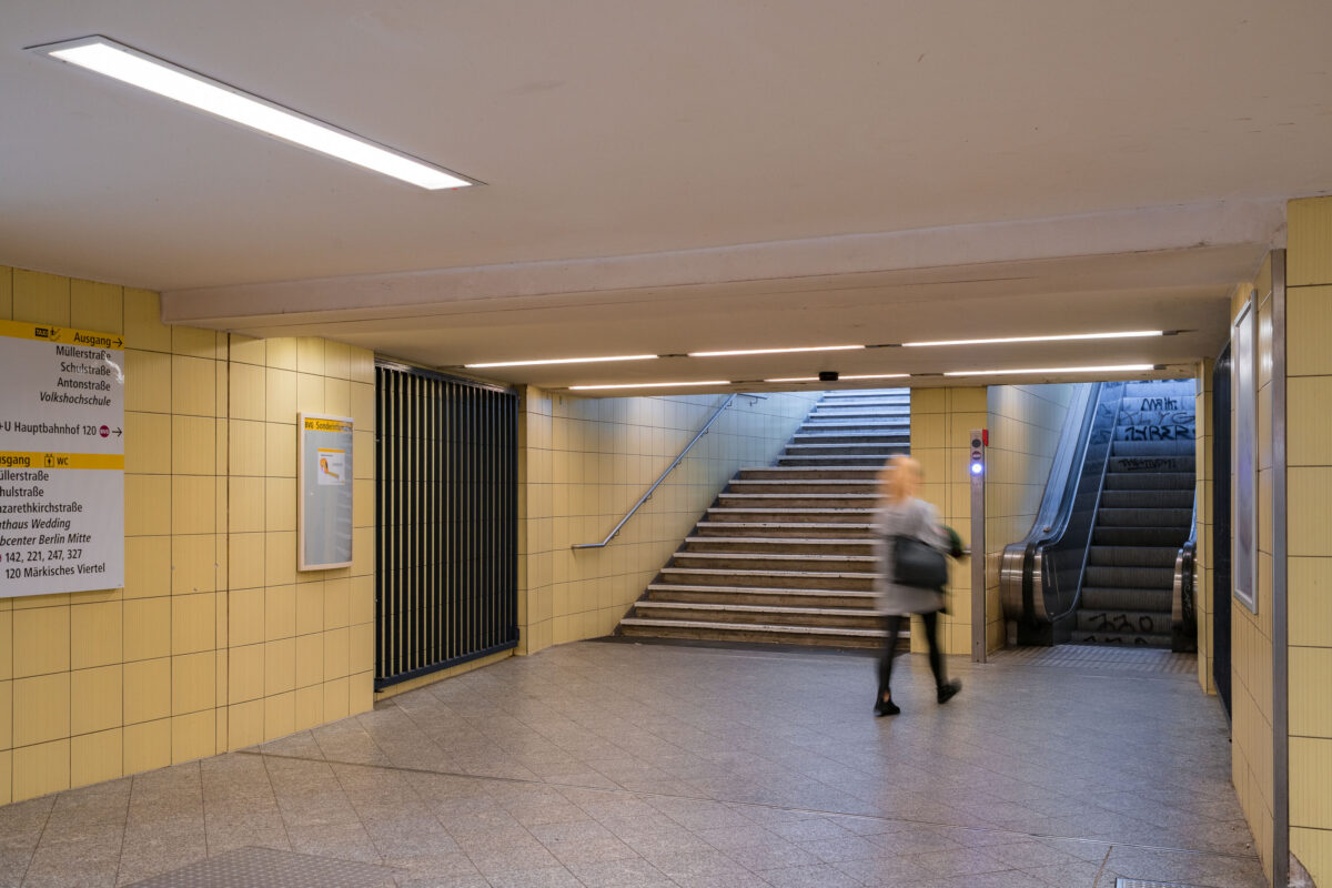
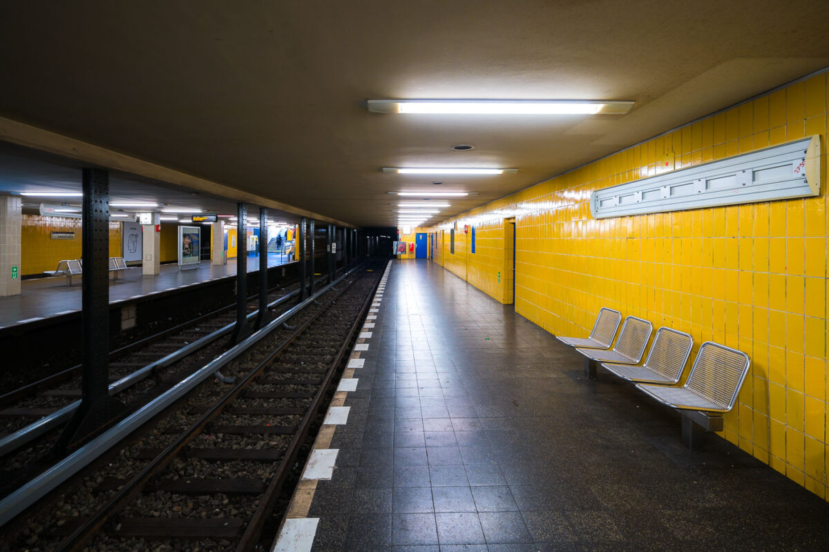
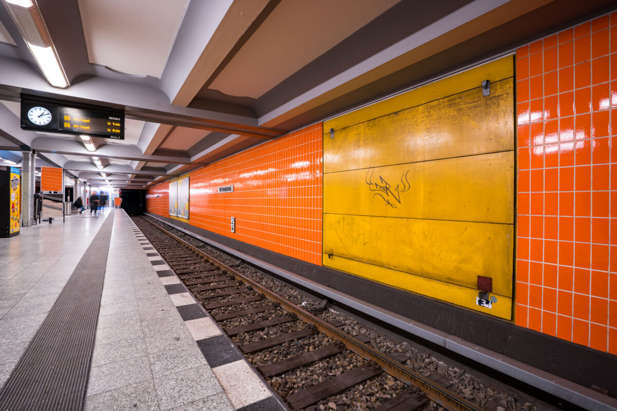
September 2017 — An underground passageway connects the platforms of Wedding U-Bahn station to its street-level exits on Müllerstraße in Berlin’s Mitte district. The corridor is tiled in light yellow ceramic, part of the BVG’s standardized postwar design used throughout many West Berlin stations rebuilt or renovated in the 1960s and 1970s. Directional signage guides passengers toward exits, connecting bus routes, and public facilities, while an escalator and stairway lead to the main entrance. The faint graffiti on the walls and motion blur of a passing commuter emphasize the station’s everyday function within Berlin’s public transport network. Wedding station serves both the U6 line and the S-Bahn Ring, forming a key interchange point in the city’s northern transit system.
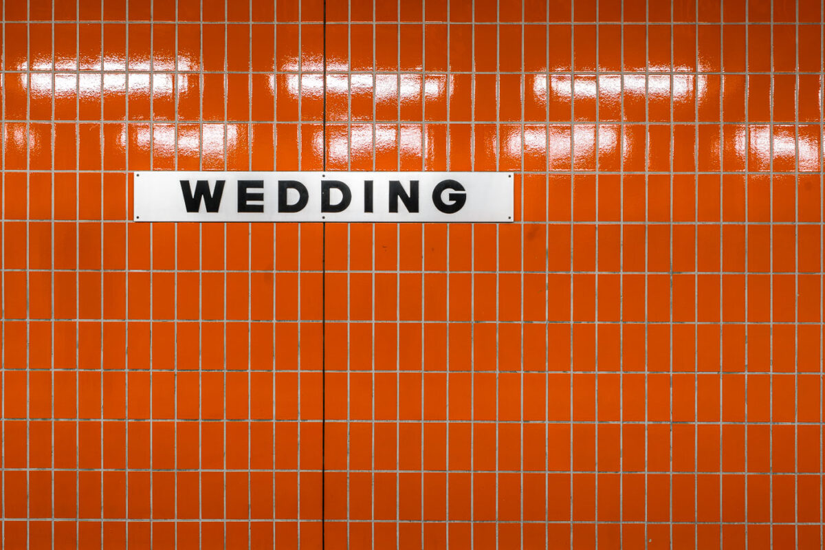
September 2017 — A white station sign reading “Wedding” in black block letters is mounted on an orange, small-rectangle tiled wall inside Wedding station in Berlin, Germany. The station serves the Wedding neighborhood in the Mitte district and functions as an interchange between the U6 U‑Bahn line and the Berlin Ringbahn S‑Bahn. The stark typography and modular tiles reflect the practical design found across much of Berlin’s postwar transit architecture. Operated by BVG for the U‑Bahn and S‑Bahn Berlin GmbH for suburban rail, Wedding is a local hub for commuters moving between the north of the city and central Berlin. No passengers are visible in the frame, emphasizing the graphic clarity of the station’s wayfinding.
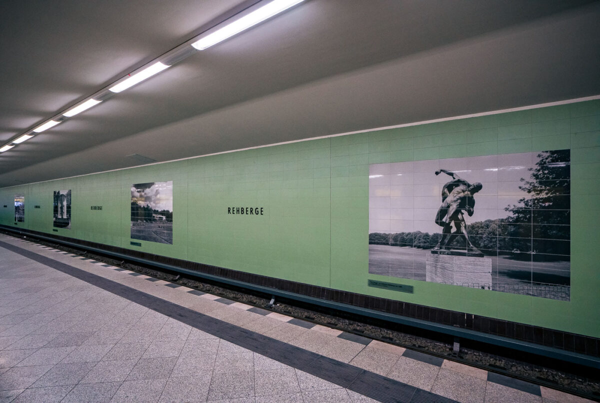
September 2017 — Rehberge U-Bahn Station, Berlin
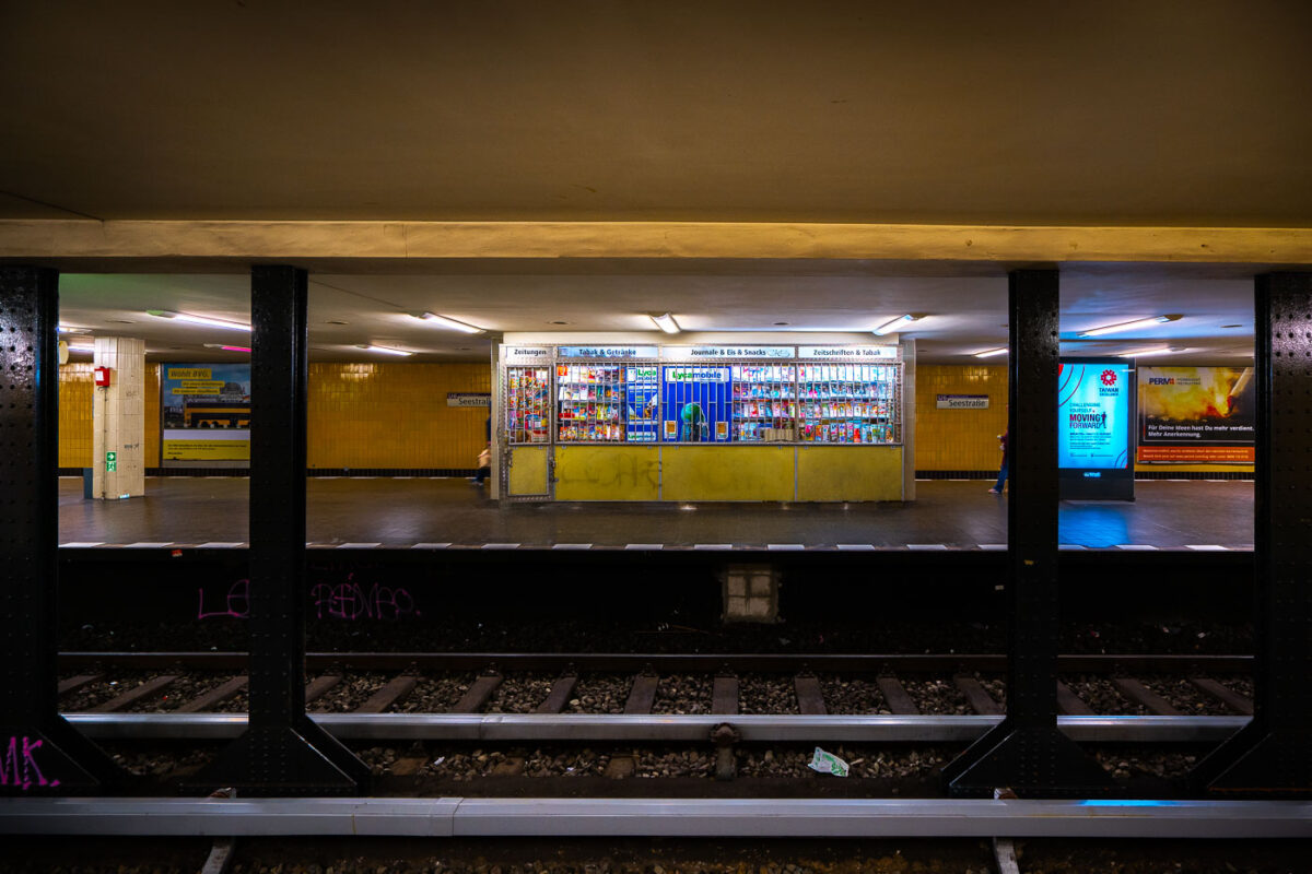
September 2017 — A store at the Seestrabe Station in Berlin.
September 2017 — The Brandenburger Tor station in Berlin, Germany. Metal benches on the train platform.
September 2017 — The Brandenburger Tor station in Berlin, Germany.
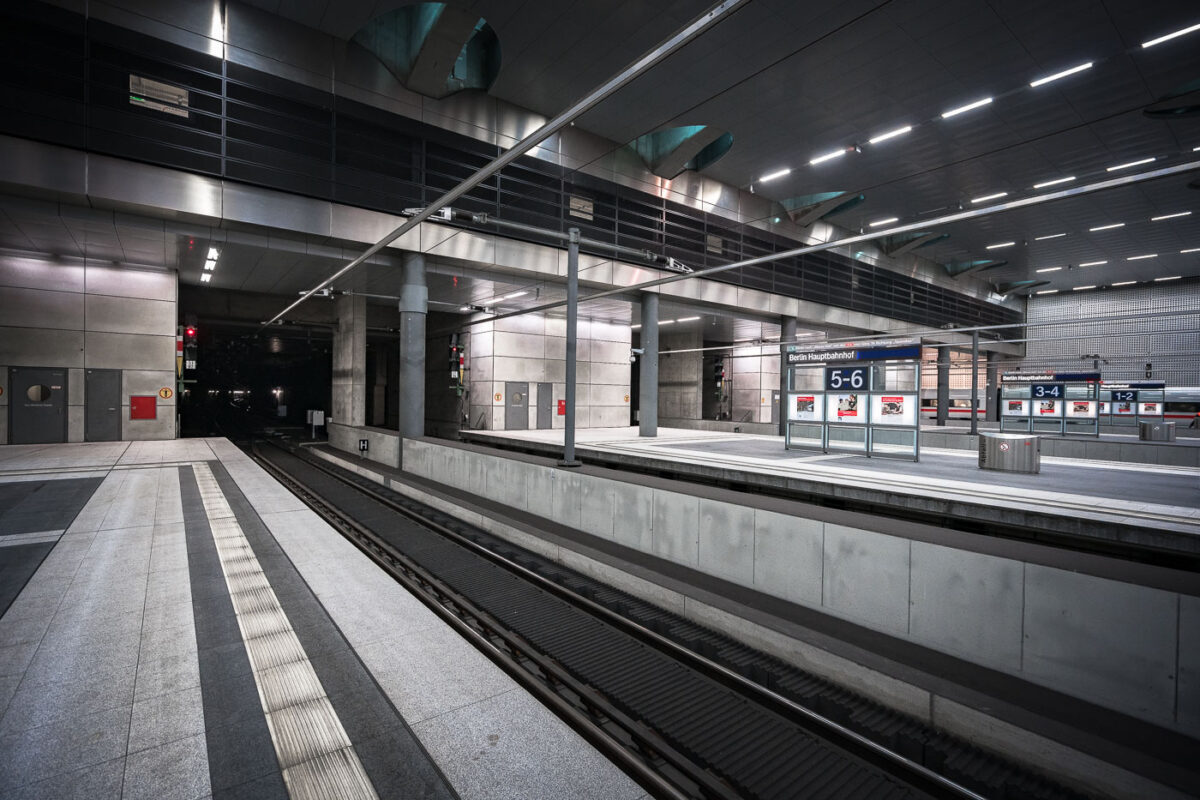
September 2017 — Berlin Hauptbahnhof’s lower-level platforms, located roughly 15 meters below street level, form part of Germany’s central north–south high-speed rail corridor. The underground section, opened in 2006 alongside the completion of the station’s glass-and-steel main hall, accommodates long-distance and regional trains running through the Tiergarten tunnel. The design emphasizes polished concrete, steel, and indirect lighting—elements typical of the Deutsche Bahn architectural style of the early 2000s. Platforms 1 through 8 serve ICE and IC services linking Berlin with cities such as Munich, Frankfurt, and Hamburg, while upper levels connect to the S-Bahn and U-Bahn networks.
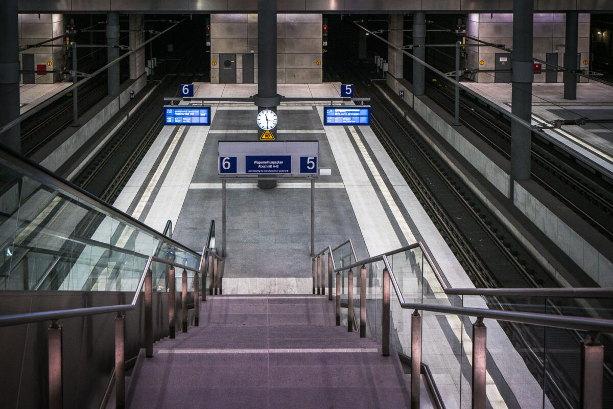
September 2017 — The lower platforms of Berlin Hauptbahnhof, serving tracks 5 and 6, form part of the deep-level north–south route opened with the station in 2006. This subterranean level, approximately 15 meters below ground, connects long-distance ICE services between Hamburg, Leipzig, and Munich through the Tiergarten Tunnel. The design reflects the precision and uniformity of modern German rail architecture—clean concrete forms, stainless steel fixtures, and bright LED signage. The symmetrical layout, glass partitions, and central clock emphasize efficiency and clarity, key elements of the Hauptbahnhof’s function as Europe’s largest crossing-station hub.
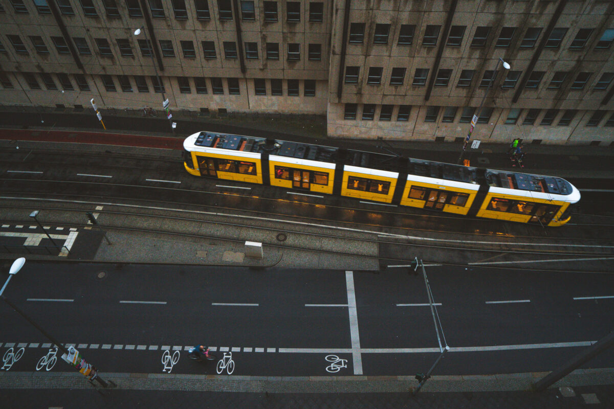
September 2017 — A yellow BVG tram glides through the wet streets of Berlin at dusk, its reflection faintly shimmering on the rain-darkened tracks. The city’s extensive tram system, one of the oldest in the world, continues to serve as a vital part of daily life — connecting neighborhoods across the capital with quiet precision. Cyclists share the street below, a hallmark of Berlin’s commitment to sustainable urban transport and rhythmically layered street design.
September 2017 — The Berlin Central Station in Berlin, Germany.

September 2017 —
September 2017 — The Berlin Central Station in Berlin, Germany.
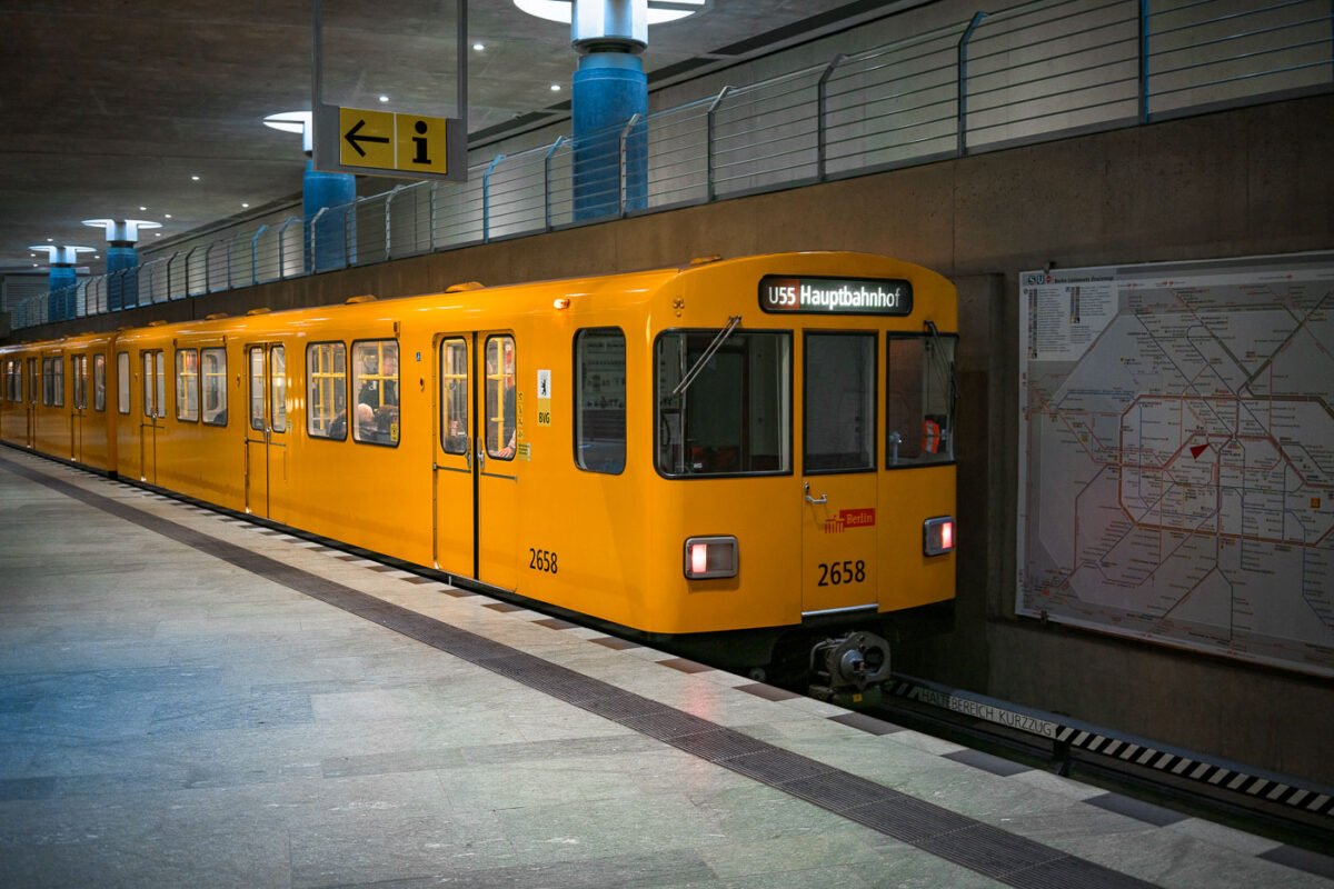
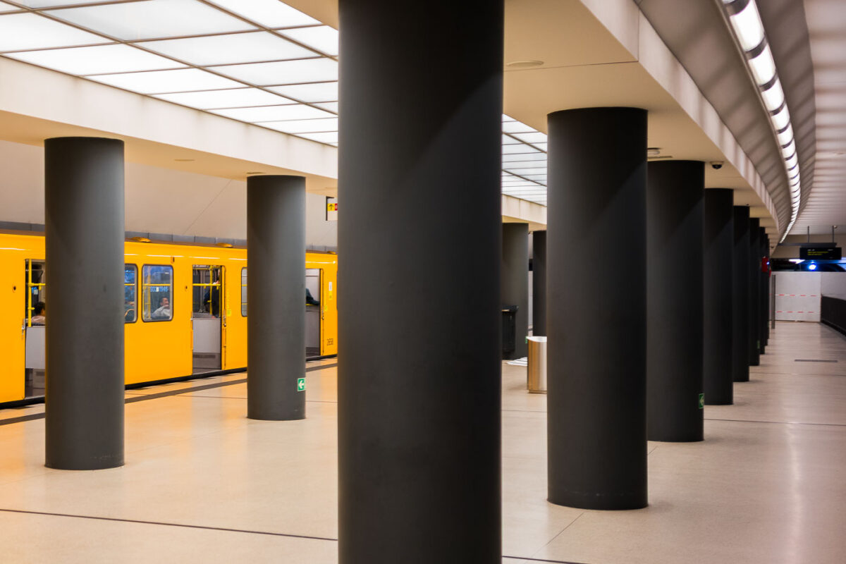
September 2017 — A bright yellow BVG U-Bahn train marked “U55 Hauptbahnhof” stands at the underground platform of Berlin Hauptbahnhof. An information sign with an arrow hangs above the platform, while a large network map of the S- and U-Bahn lines is mounted on the concrete wall to the right. Through the windows, a few seated passengers are visible inside the multi-door carriage numbered 2658. The U55 operated as a short shuttle between Berlin Hauptbahnhof and Brandenburger Tor, opened in 2009 to link the new central station with the government quarter. In December 2020 the shuttle was integrated into the extended U5 line, a major step in Berlin’s east‑west metro connection.
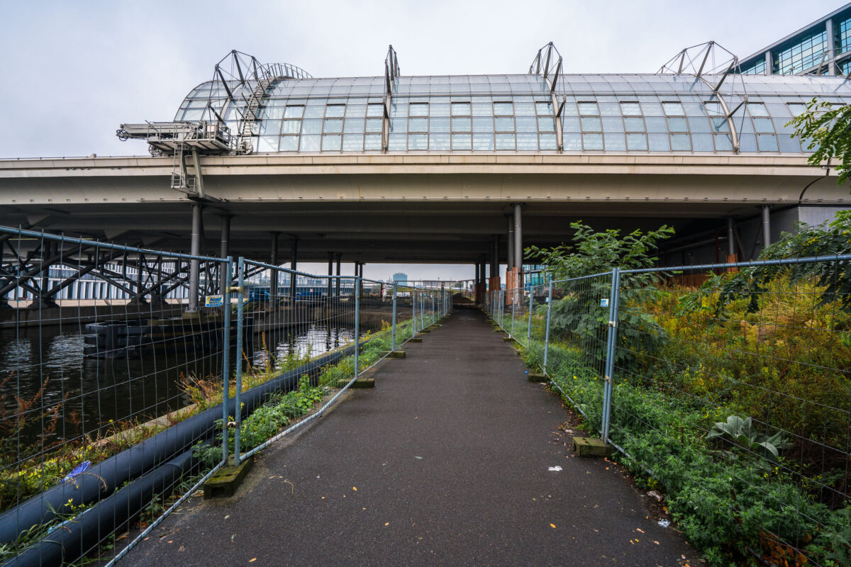
September 2017 — A narrow, fenced pathway runs beneath the towering structure of Berlin Hauptbahnhof — Germany’s largest and most complex railway station — where elevated train lines stretch above the Spree River. The gleaming glass panels and steel framework of the upper platforms contrast sharply with the damp pavement and industrial underpass below. Puddles glisten from a recent rain, while construction barriers and wild greenery frame the scene, hinting at the city’s perpetual state of transformation. Built as a symbol of reunified Berlin, the Hauptbahnhof connects north to south, east to west — a convergence of architecture, engineering, and history that mirrors Berlin’s layered identity. The stillness here beneath the trains creates a hidden perspective on one of Europe’s busiest transport hubs, where modern motion meets quiet decay.
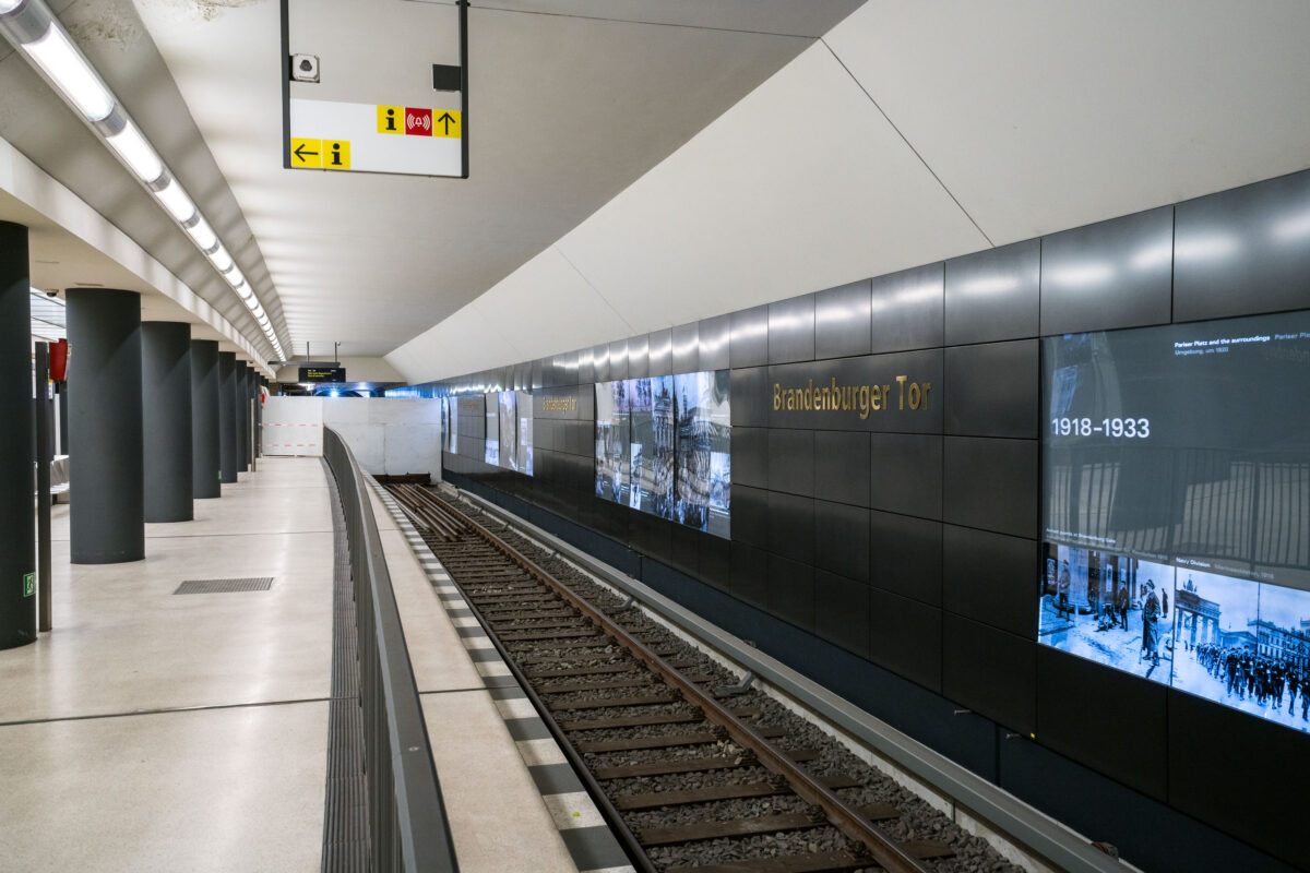
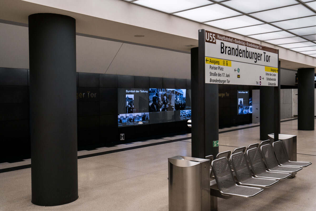
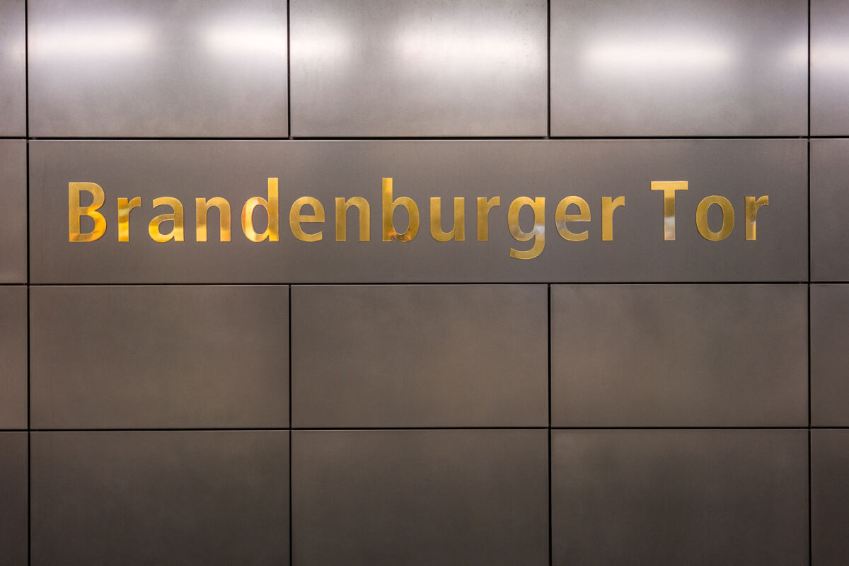
September 2017 — The Brandenburger Tor station on Berlin’s U5 line sits directly beneath Pariser Platz, adjacent to the Brandenburg Gate. The interior features dark composite wall panels inlaid with gold lettering and a series of illuminated displays tracing Berlin’s 20th-century history, including the city’s division and post-reunification development. Originally opened in 2009 as part of the short U55 shuttle between Hauptbahnhof and Bundestag, the station became a through stop in December 2020 when the U5 extension to Alexanderplatz was completed, reconnecting the eastern and western portions of the U-Bahn network after nearly six decades of separation.
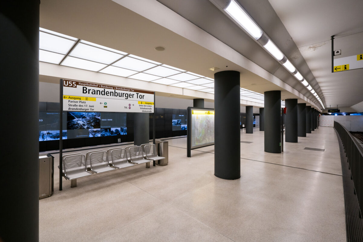
September 2017 — The Brandenburger Tor station in Berlin, Germany.
September 2017 — The Brandenburger Tor station in Berlin, Germany.
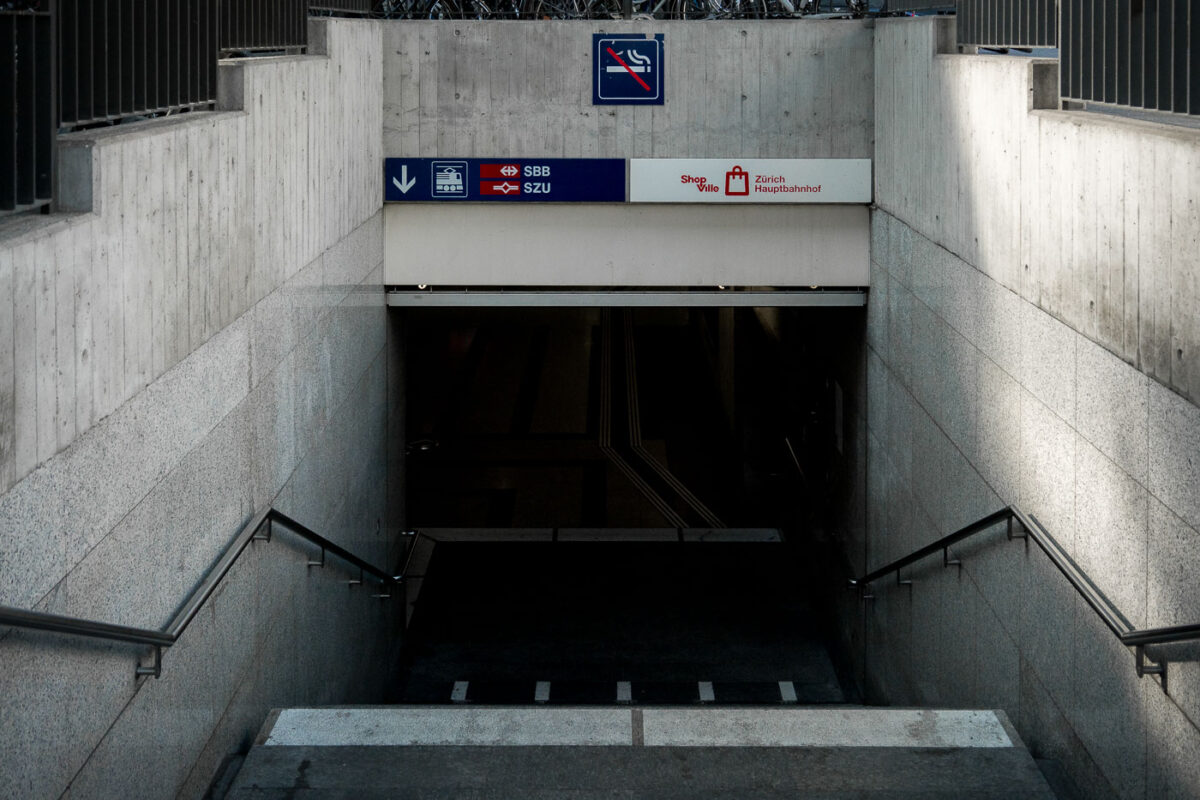
September 2017 — Entrance to the underground level of Zürich Hauptbahnhof (Zurich Central Station), one of Europe’s busiest railway hubs, serving over 400,000 passengers daily. The signage indicates access to the SBB national rail network and SZU suburban lines, along with the underground shopping complex “ShopVille.” Built into the heart of the city, Zürich HB’s design integrates modern transport infrastructure with pedestrian access and retail spaces, showcasing Switzerland’s efficiency in urban transit engineering.
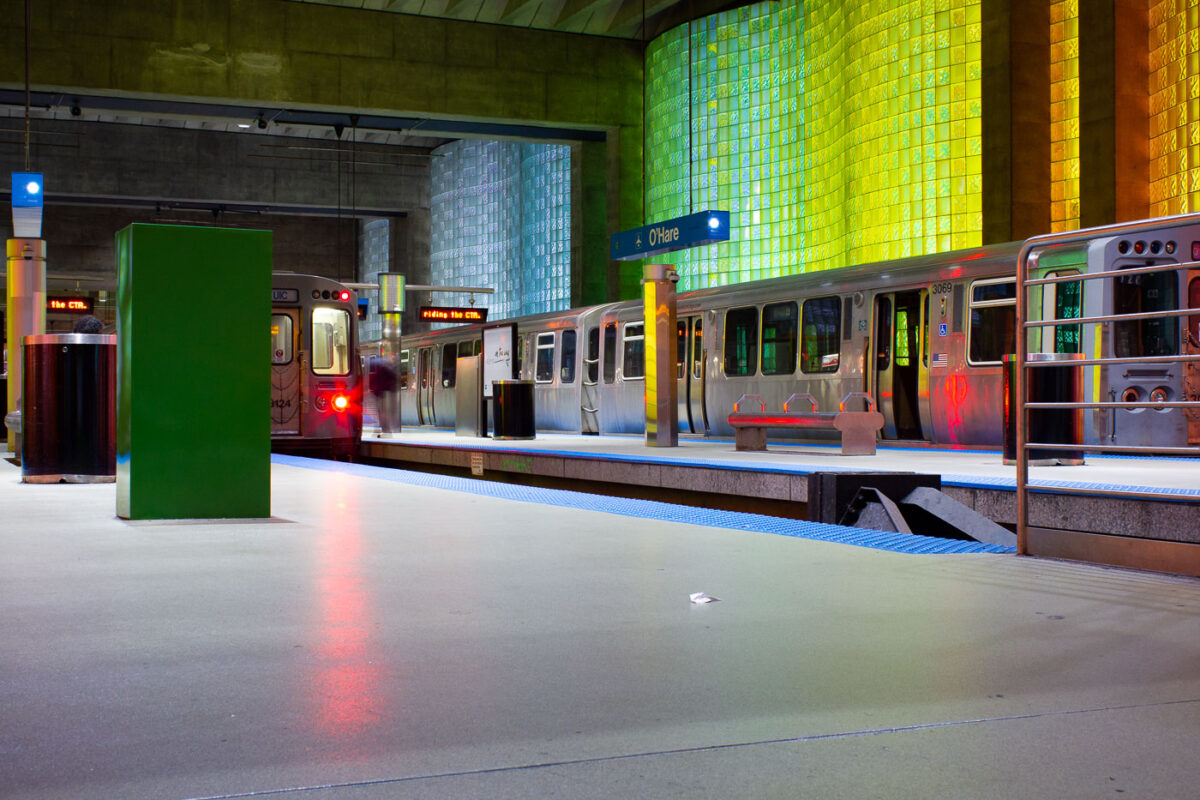
December 2012 — Trains at O'Hare International Airport in Chicago.
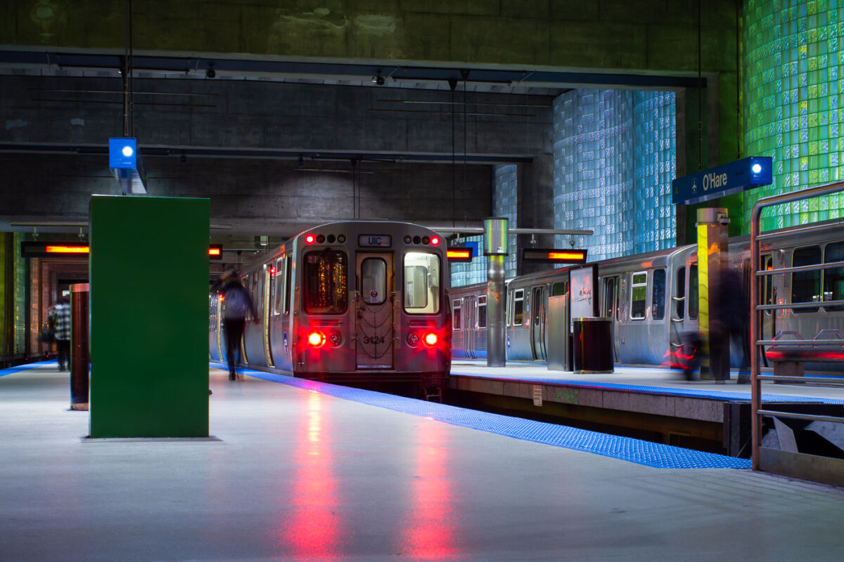
December 2012 — The O'Hare Train Station in Chicago.
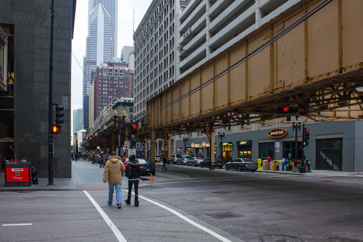
December 2012 — Lake Street and Dearborn in downtown Chicago in December 2012.