
Map
More from Superior National Forest
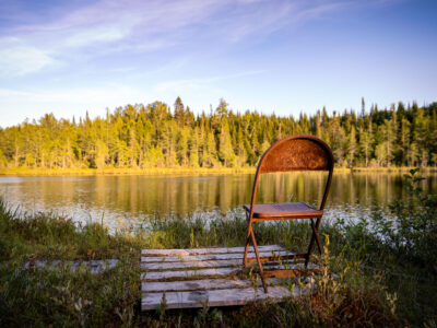
Jouppi Lake, Minnesota
A chair at Jouppi Lake near Isabella, Minnesota.

Milky Way Over Superior National Forest, Minnesota
The Milky Way galaxy is visible above the treeline of the Superior National Forest in Minnesota, near the Boundary Waters…

Dewy Aspen Leaf in Superior National Forest
A dewy aspen leaf lies among pine needles and moss in Superior National Forest, Minnesota. The close-up shows water droplets…

Superior National Forest, Minnesota: Forest Floor Detail
The Superior National Forest in Minnesota is a vast protected area known for its extensive boreal forests and numerous lakes.…

Foggy Road in Superior National Forest, Minnesota
A gravel road winds through the dense coniferous forest of Superior National Forest near Isabella, Minnesota. Signs indicate Route 172…
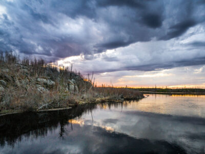
Stony River at Tomahawk Road in the Superior National Forest
Stony River at Tomahawk Road in the Superior National Forest in Northern Minnesota.
Nearby Photos


