
Map
More from Minneapolis Uprising – May 2022
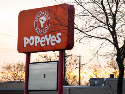
Popeyes Sign, Chicago Ave, Minneapolis
A Popeyes Louisiana Kitchen sign stands on Chicago Avenue in Minneapolis. This location was among the businesses damaged during the…

Mural sketch at Target, East Lake Street, Minneapolis
A mural sketch is underway on the exterior wall of the Target store located on East Lake Street in Minneapolis.…

George Floyd marker at Say Their Names Cemetery, Minneapolis
A marker bearing the name George Floyd and the date of his murder, May 25, 2020, is displayed at the…

Minneapolis Skyway and IDS Center Pedestrian Walkway
The Minneapolis Skyway, a network of enclosed pedestrian bridges, connects buildings throughout downtown Minneapolis. This particular walkway links the IDS…

Graffiti on Chicago-Lake Liquors Shutters, Minneapolis
Graffiti covers the metal shutters of Chicago-Lake Liquors on Lake Street in Minneapolis. The store, which advertises "We Feature All…

Mayor Frey at George Floyd Square with Agape Movement
Mayor Jacob Frey visits George Floyd Square in Minneapolis in May 2022, engaging with members of The Agape Movement. The…
Nearby Photos


