Sunrise

12 photos · 2011–2021

12 photographs tagged Sunrise, 2011–2021.
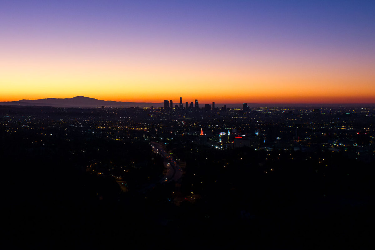
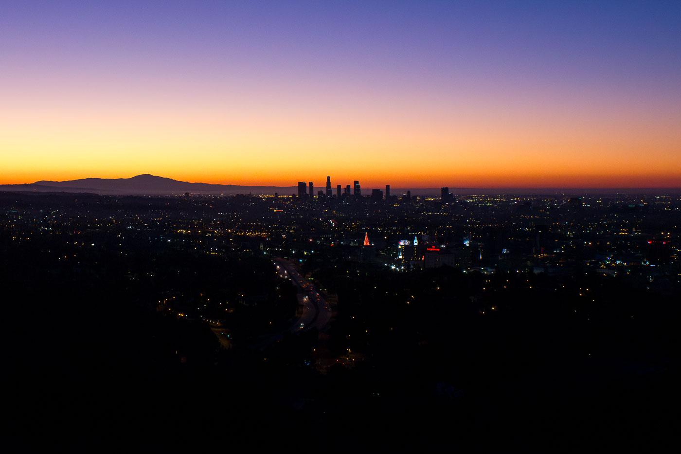
Los Angeles downtown skyline silhouetted against an orange and purple sunrise sky.
Downtown Los Angeles anchors the region's financial, legal, and entertainment industries, with its skyline visible for miles across the Los Angeles Basin. The US Bank Tower, completed in 1989 and standing 1,018 feet tall, was the tallest building west of Chicago until the Wilshire Grand Center surpassed it in 2017. The district's modern high-rise cluster took shape mostly after the city lifted height restrictions tied to earthquake concerns in the 1950s, allowing construction beyond the earlier 150-foot limit set by City Hall's height. The Santa Monica Mountains, including sections of Griffith Park, rise to the north and west of the skyline.

First Light Over the Downtown Los Angeles Skyline
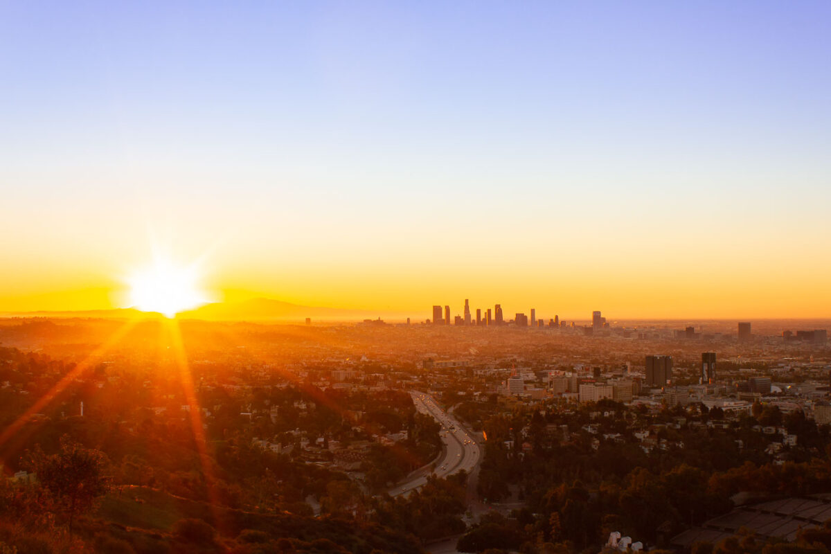
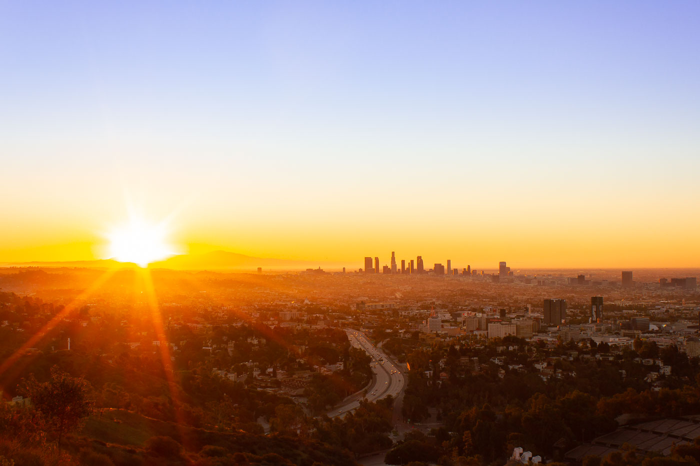
Los Angeles downtown skyline at sunrise from Mulholland Drive overlook, with winding freeway below.
Mulholland Drive runs roughly 21 miles along the ridgeline of the Santa Monica Mountains and Hollywood Hills, linking the Cahuenga Pass area to the Pacific Coast Highway. Named for civil engineer William Mulholland, the road opened in 1924 as part of efforts to connect the growing city with the San Fernando Valley. Its position along the ridge gives it a long sightline over the Los Angeles Basin, with the downtown skyline sitting roughly ten miles to the southeast. That skyline is anchored by the U.S. Bank Tower, completed in 1989 and, for years, the tallest building west of Chicago.

Downtown Los Angeles Skyline at Sunrise from Mulholland Drive
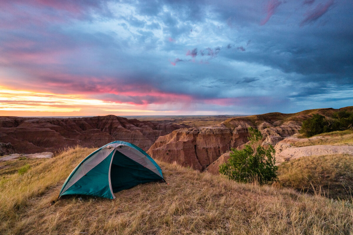
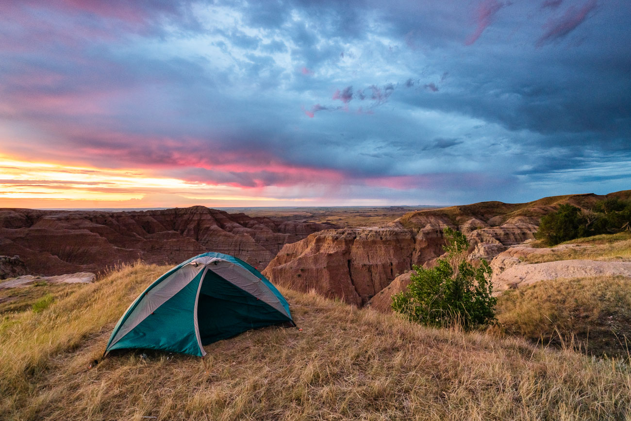
Tent pitched on grassland overlook at Buffalo Gap National Grasslands, South Dakota, at sunrise.
A tent is pitched on a grassy overlook within the Buffalo Gap National Grasslands in South Dakota, as a dramatic sunrise paints the sky with vibrant colors. This area, managed by the Bureau of Land Management, is known for its rugged badlands topography and expansive prairie landscapes. The grasslands were established in 1960 to conserve and manage the natural grasslands and associated wildlife habitats. Today, it remains a significant area for grazing, conservation, and public enjoyment of its natural beauty.

Tent Camping Above the Badlands at Sunrise
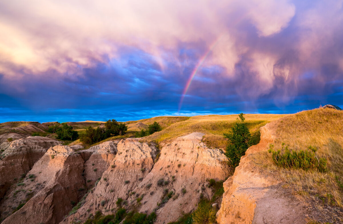
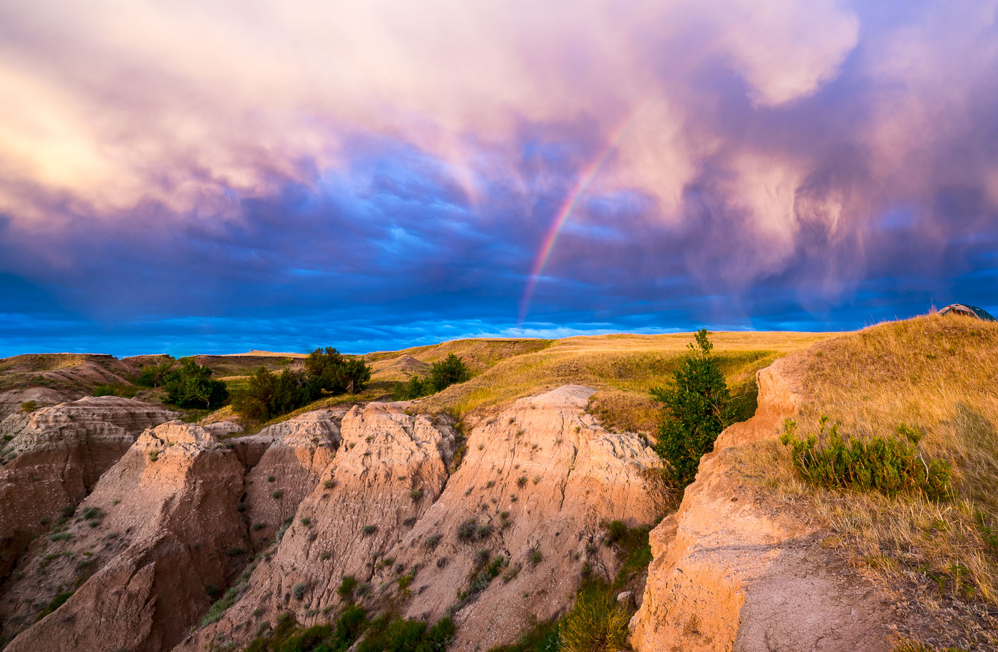
Rainbow arcs over eroded badlands formations and grasslands in Buffalo Gap National Grasslands, South Dakota.
A rainbow arcs across a dramatic sky over the Buffalo Gap National Grasslands in South Dakota. This area, managed by the U.S. Forest Service, preserves a vast expanse of mixed-grass prairie and badlands topography. Established in 1960, the grasslands are a remnant of the Great Plains' natural landscape, supporting diverse wildlife and offering opportunities for dispersed recreation. The unique geological formations visible are the result of millions of years of erosion, creating a rugged and visually striking environment.

Rainbow Over Badlands National Park at Sunrise
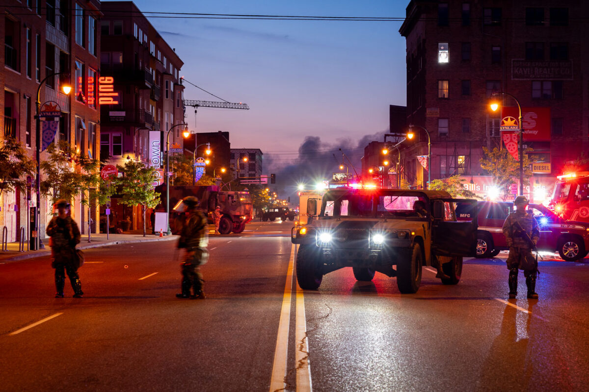
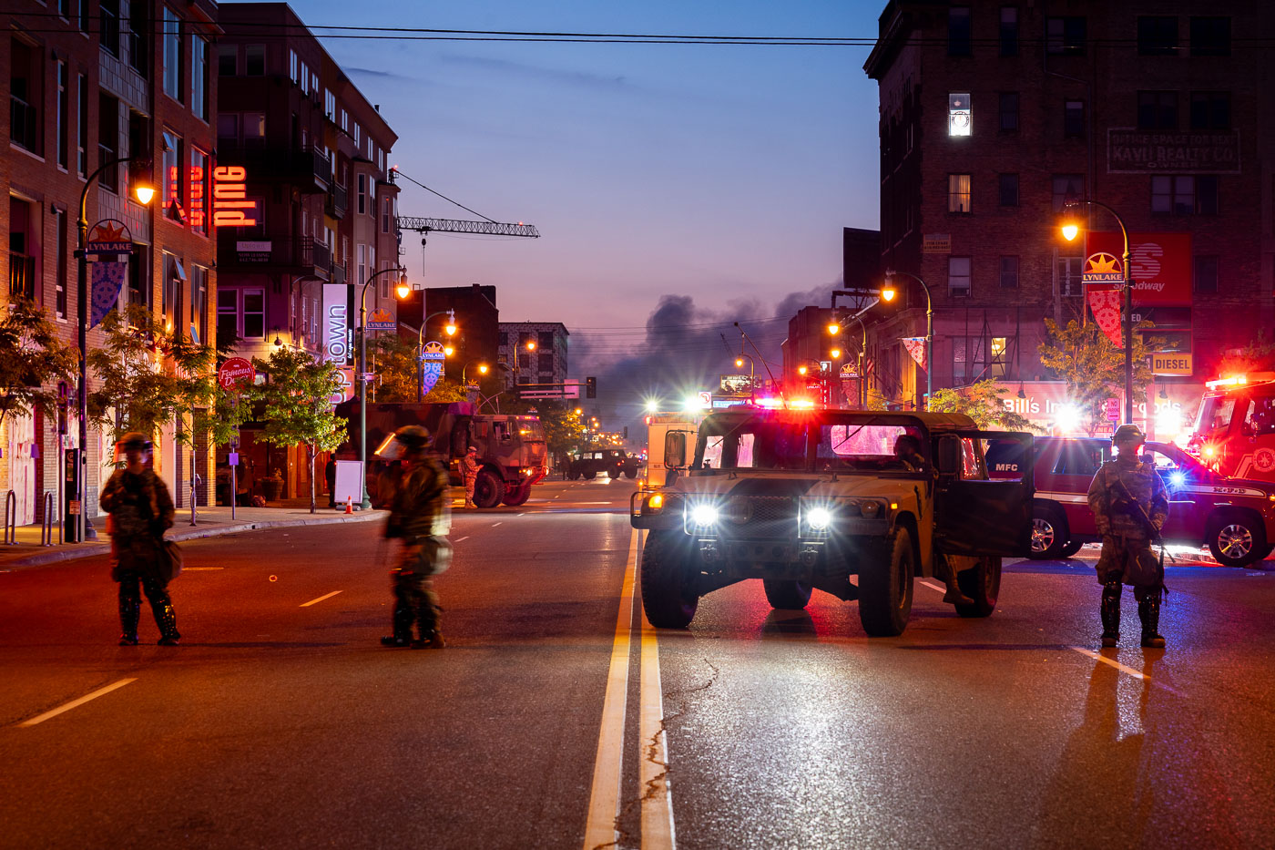
National Guard vehicles block Lake Street in Minneapolis before sunrise as smoke rises in the distance.
Minnesota National Guard troops and military vehicles block Lake Street in the LynLake area of Uptown Minneapolis before sunrise on May 30, 2020. The deployment came during protests and unrest following the killing of George Floyd by Minneapolis police, with smoke from fires visible in the distance along the commercial corridor. Lake Street, a major east-west route lined with apartments, shops, and businesses, was heavily affected during the unrest and remained under a strong security presence as day broke.

National Guard on Lake Street, Minneapolis Uprising
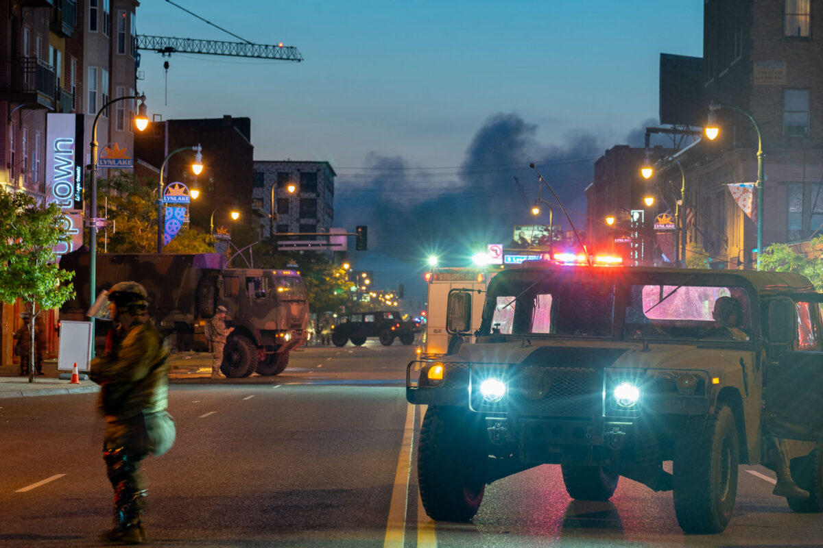
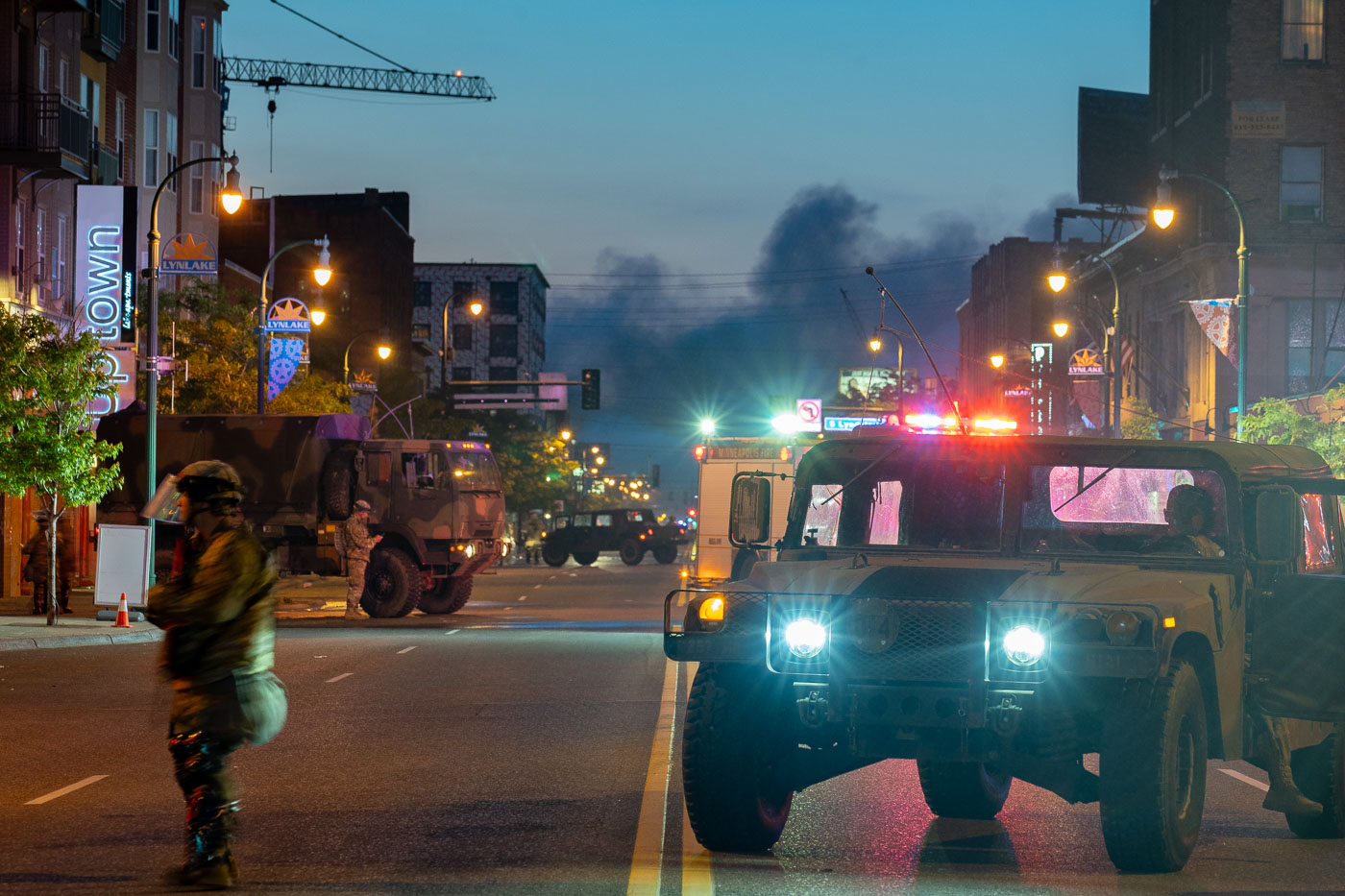
Minnesota National Guard vehicles on Lake Street in Minneapolis as smoke rises near LynLake at dawn.
Minnesota National Guard vehicles and personnel are stationed on Lake Street in Minneapolis near the LynLake district on May 30, 2020. Smoke rises in the distance at dawn as military and emergency vehicles line the commercial corridor after several nights of unrest following the killing of George Floyd. Lake Street is a major east-west route through South Minneapolis, lined with businesses, housing, and neighborhood landmarks.

National Guard on Lake Street, Minneapolis

Burned debris blocks Pillsbury Avenue in South Minneapolis after protests.
Burned debris and overturned shopping carts block Pillsbury Avenue in South Minneapolis at sunrise on May 30, 2020. The photograph was made on the fourth day of protests following the killing of George Floyd, with smoke still visible in the distance and traffic signals lit above an otherwise quiet street. Scattered trash bins, charred remains, and temporary roadwork barrels show the disruption left on this residential corridor overnight.

Pillsbury Ave Debris, South Minneapolis
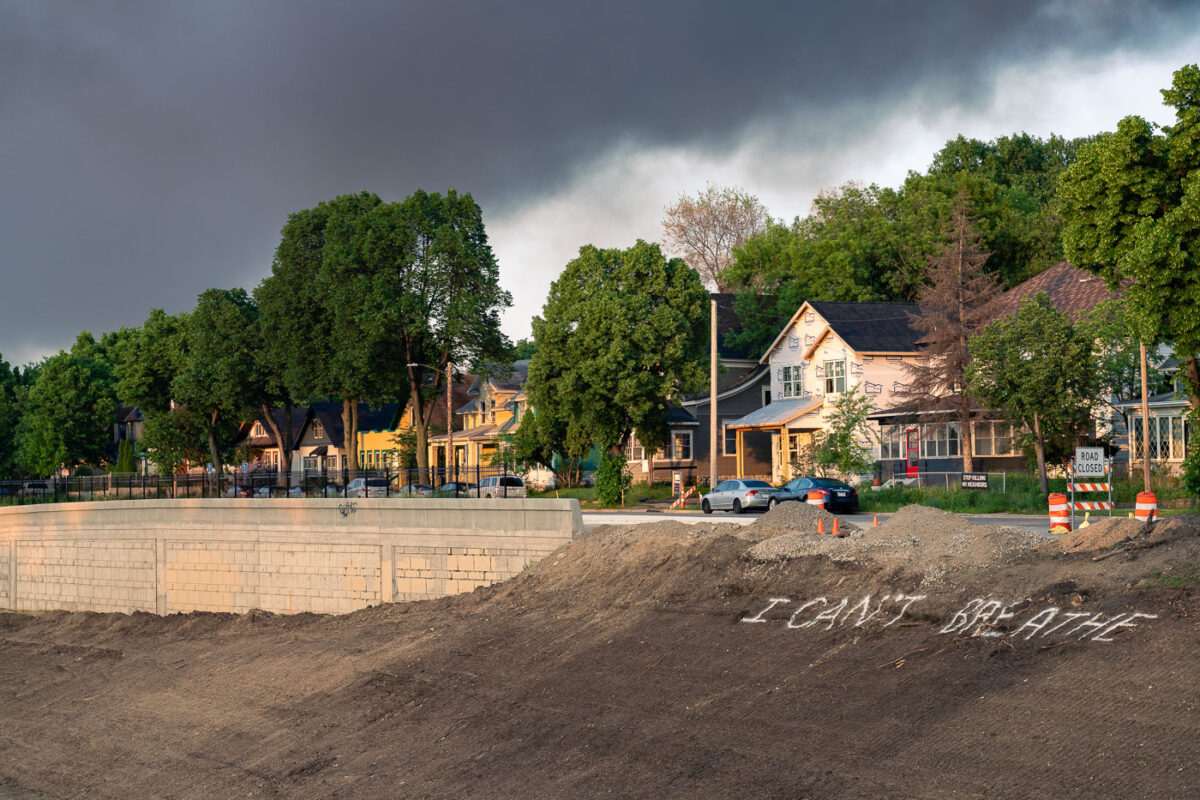
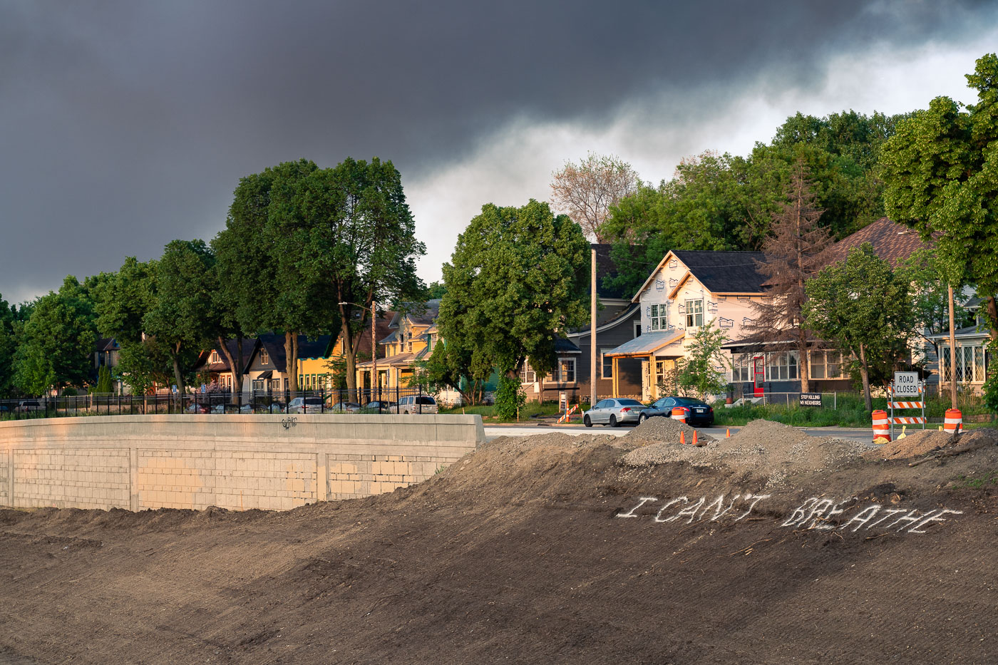
“I Can’t Breathe” graffiti on an embankment beside Interstate 35W in South Minneapolis under smoke-filled skies.
“I Can’t Breathe” is spray-painted on a dirt embankment beside Interstate 35W in South Minneapolis on May 30, 2020. The message appeared in the days after George Floyd was killed by Minneapolis police on May 25, during protests and unrest across the city. Morning light falls on nearby houses while smoke lingers over the neighborhood from fires set overnight.

I Can’t Breathe Graffiti, Minneapolis
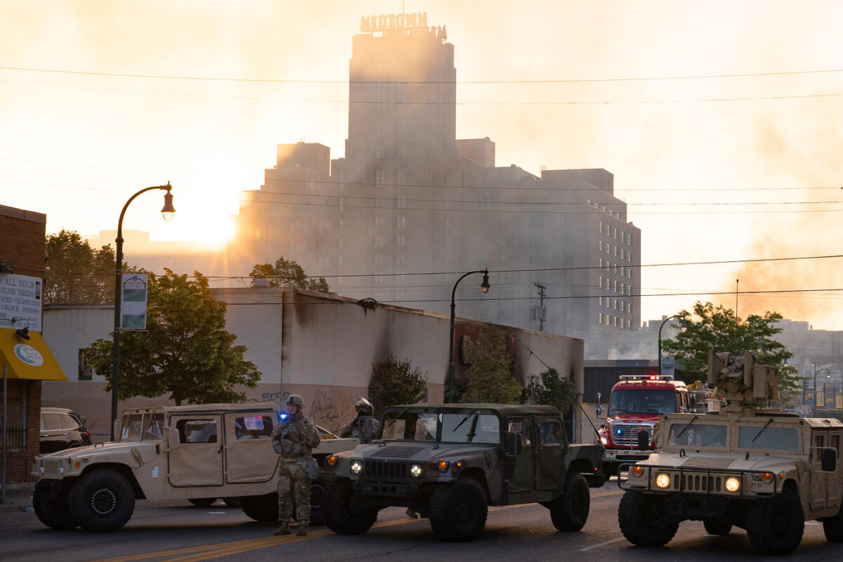
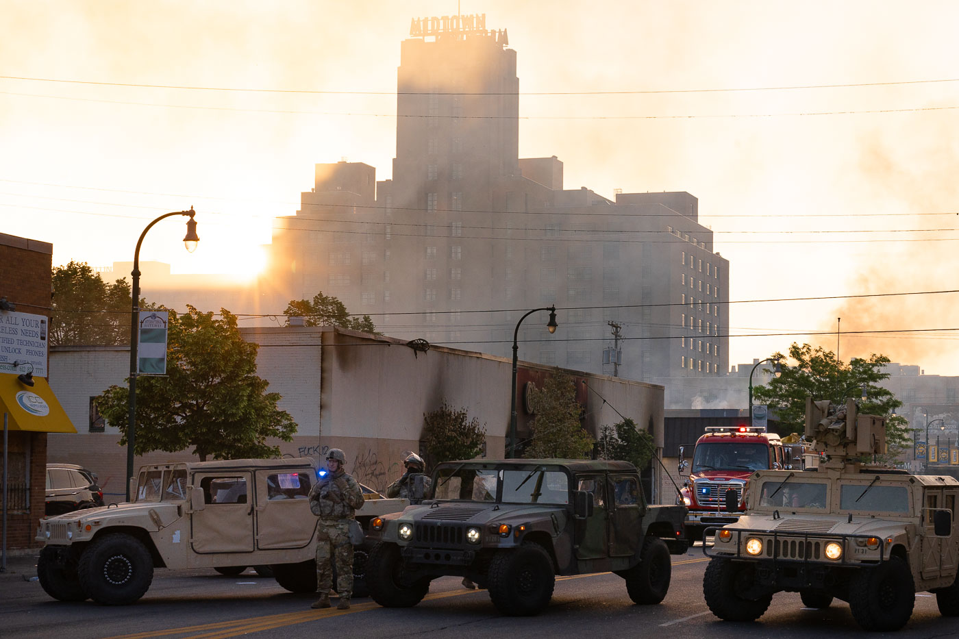
National Guard vehicles and a fire truck in Midtown Minneapolis with Midtown Exchange behind smoke at sunrise.
Minnesota National Guard troops and Minneapolis Fire Department vehicles are positioned in Midtown Minneapolis on May 30, 2020, with the Midtown Exchange building rising through smoke at sunrise in the background. The large brick structure, topped by the “MIDTOWN EXCHANGE” sign, was originally built as a Sears, Roebuck and Company mail-order and retail complex. The deployment came after overnight unrest following the killing of George Floyd, as firefighters responded to active fires and the National Guard supported local authorities.

National Guard, Fire Dept. in Midtown Minneapolis
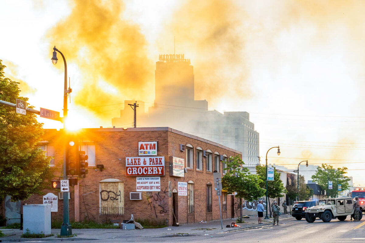
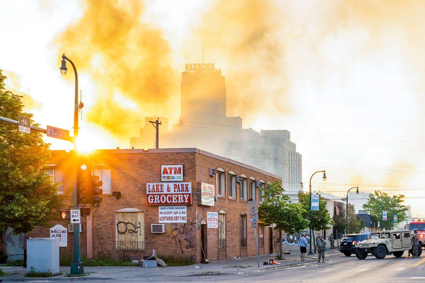
Smoke over Midtown Exchange on East Lake Street in Minneapolis as National Guard vehicles patrol at sunrise.
Smoke rises around the Midtown Exchange in south Minneapolis as sunrise lights East Lake Street on May 30, 2020. Minnesota National Guard troops and Minneapolis Fire Department personnel are visible near the Lake Street commercial corridor after overnight fires and unrest following protests over the killing of George Floyd. The Midtown Exchange, originally built in 1928 as a Sears, Roebuck and Company mail-order and retail complex, had been redeveloped as a mixed-use building before the disturbances.

Smoke over Midtown Exchange, Minneapolis
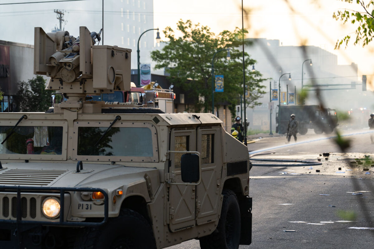
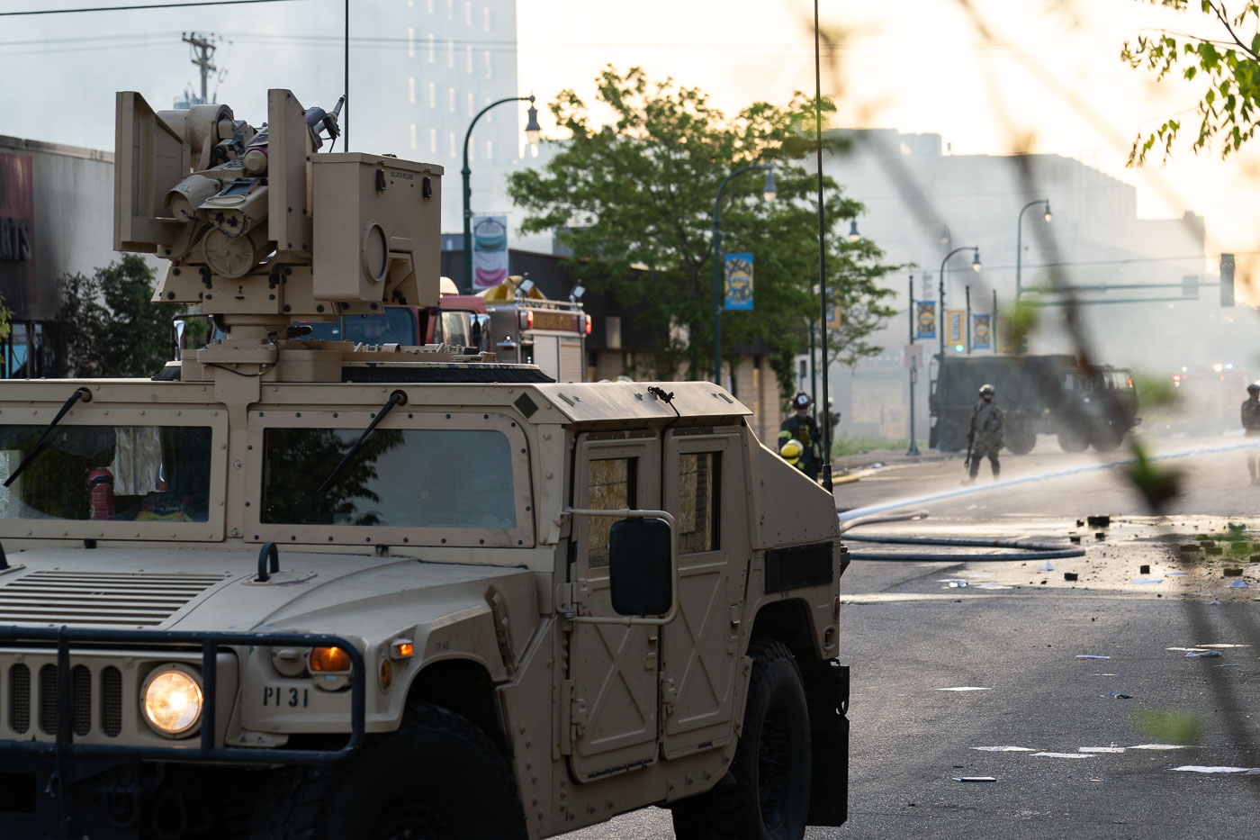
Minnesota National Guard vehicle near Midtown Exchange in Minneapolis as firefighters work amid smoke.
A Minnesota National Guard vehicle stands on a street near the Midtown Exchange in south Minneapolis as Minneapolis firefighters work amid smoke at daybreak on May 30, 2020. The photograph was made during the unrest that followed the killing of George Floyd, when fires and heavy emergency response affected commercial corridors across the city. The Midtown Exchange, a large mixed-use redevelopment of the historic Sears, Roebuck and Company building, is visible in the area behind the response.

National Guard at Minneapolis Midtown Exchange Fires
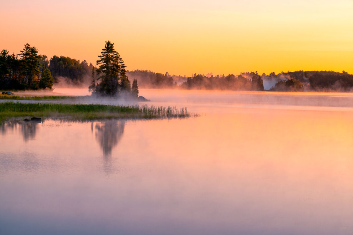
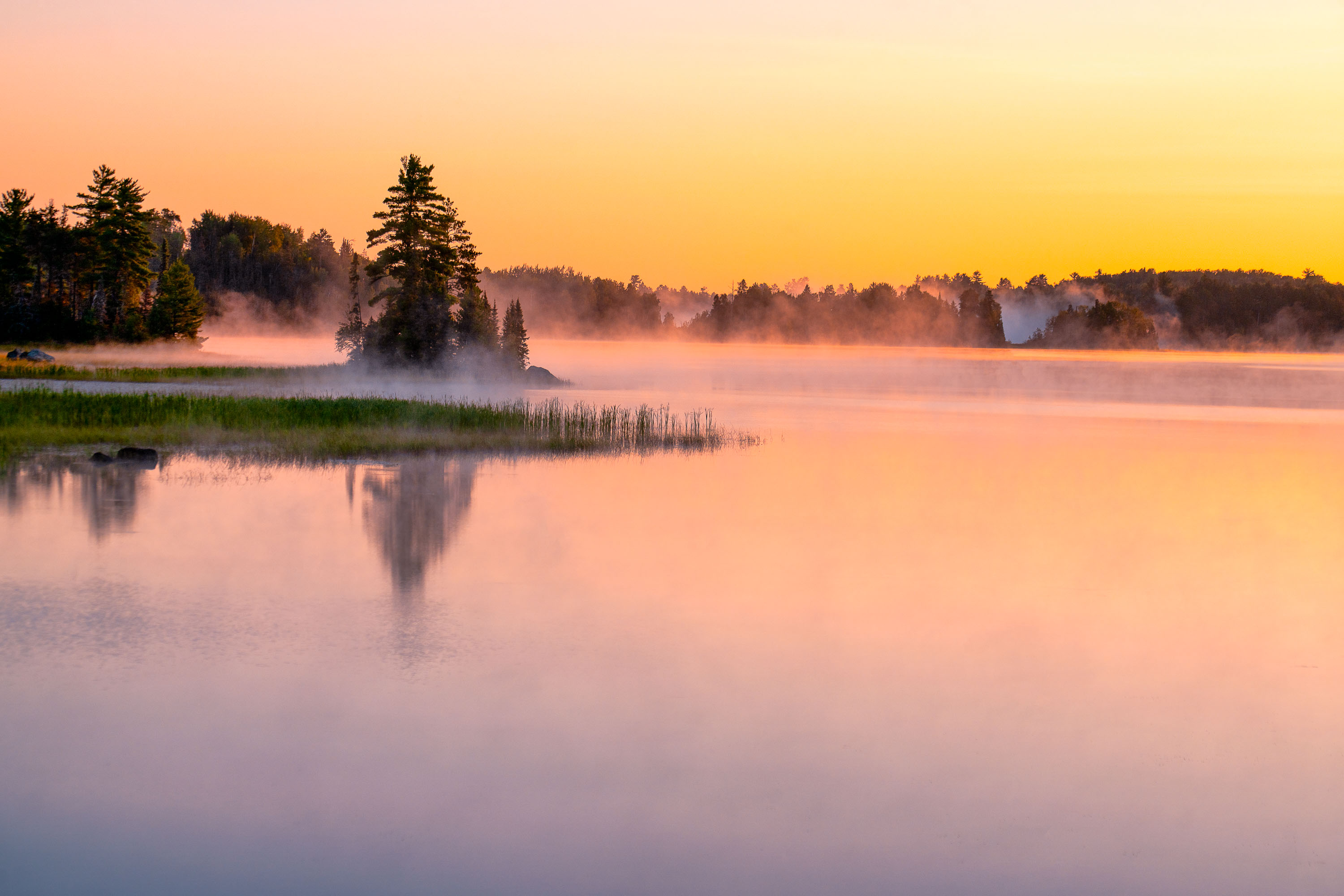
South Kawishiwi River near Ely, Minnesota, at sunrise with mist over calm water.
The South Kawishiwi River near Ely, Minnesota. Forest region of northeastern Minnesota, where calm water and low fog are common in early daylight.

South Kawishiwi River near Ely, Minnesota