
Map
More from Minneapolis Uprising – April 2024
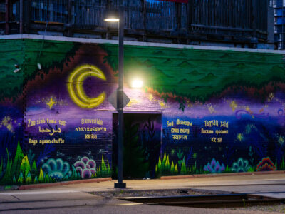
Cedar Riverside LRT Station Multi-Language Welcome Mural
A multi-language welcome mural brightens a wall at the Cedar Riverside LRT station in South Minneapolis. The mural features greetings…

Minneapolis Skyline from Loring Park, Early Spring Storm Clouds
The downtown Minneapolis skyline rises beyond Loring Park, a significant urban green space established in the late 19th century. From…

Hennepin Avenue Road Reconstruction, Uptown Minneapolis
Hennepin Avenue in Uptown Minneapolis is undergoing a major road reconstruction project. This infrastructure upgrade involves excavating the existing roadway…

US Bank Stadium, Minneapolis: J.J. McCarthy 10th Pick
US Bank Stadium in downtown Minneapolis displays the announcement of J.J. McCarthy as the 10th overall pick in the NFL…

Buses and Vans Outside Hennepin County Government Center
Private buses and vans are parked outside the Hennepin County Government Center in Downtown Minneapolis, where Minnesota State Trooper Ryan…

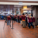
Ryan Londregan Hearing Supporters, Hennepin County Center
Supporters of Minnesota State Trooper Ryan Londregan gather at the Hennepin County Government Center in Downtown Minneapolis. They are present…
Nearby Photos


