Map
More from London
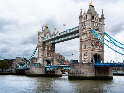
Tower Bridge, London Marathon 2019
Tower Bridge in London spans the River Thames during the 2019 London Marathon. Completed in 1894, the combined bascule and…

River Thames and Palace of Westminster, London
The River Thames runs past the Palace of Westminster in central London, with Westminster Bridge in the foreground and Vauxhall…

London Plane Trees on The Mall, St James’s Park, London
London plane trees line The Mall in St. James’s Park, London. The avenue runs beside open lawns in one of…

Canary Wharf from Greenwich Park, London
Canary Wharf rises beyond Greenwich Park in southeast London, with One Canada Square and neighboring office towers visible above the…

St. James's Park Lake and the London Eye, Westminster
St. James's Park Lake and the London Eye in Westminster, London. The lake sits within St. James's Park, one of…

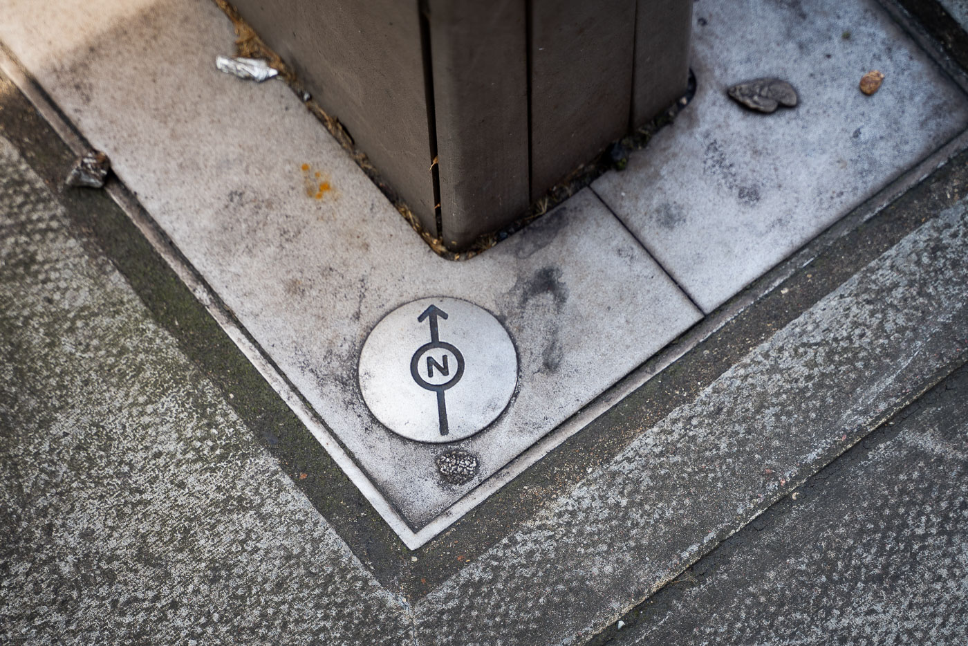
Diana Princess of Wales Memorial Walk Marker, London
A Diana Princess of Wales Memorial Walk marker is set into the pavement in central London. The bronze roundel marks…
Nearby Photos


