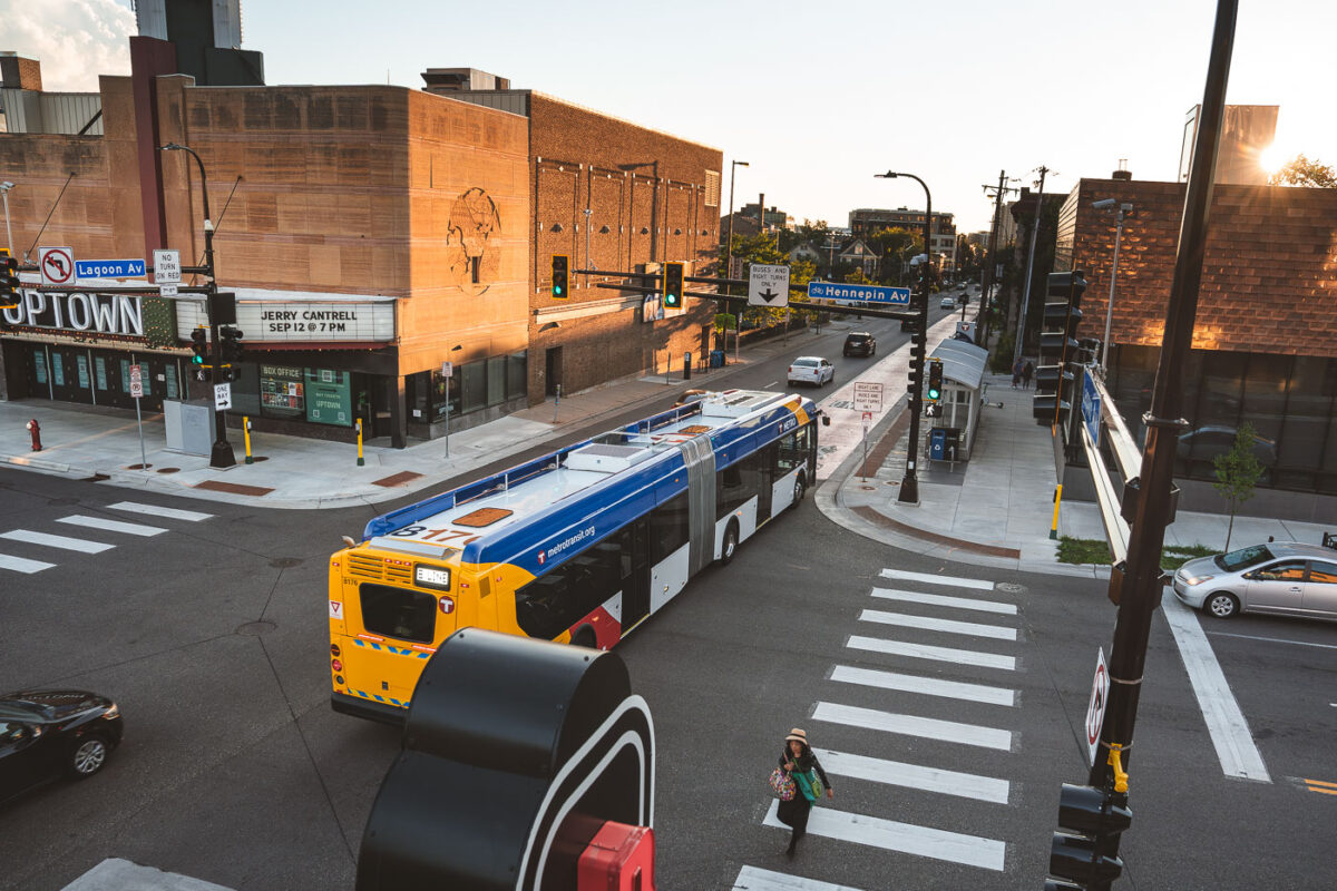
Metro Transit B Line Bus at Hennepin & Lagoon, Uptown Minneapolis
August 2025 — A Metro Transit B-Line bus crosses Hennepin Avenue in Uptown Minneapolis.
Explore photos tagged Public Transit.
August 2025 — A Metro Transit B-Line bus crosses Hennepin Avenue in Uptown Minneapolis.
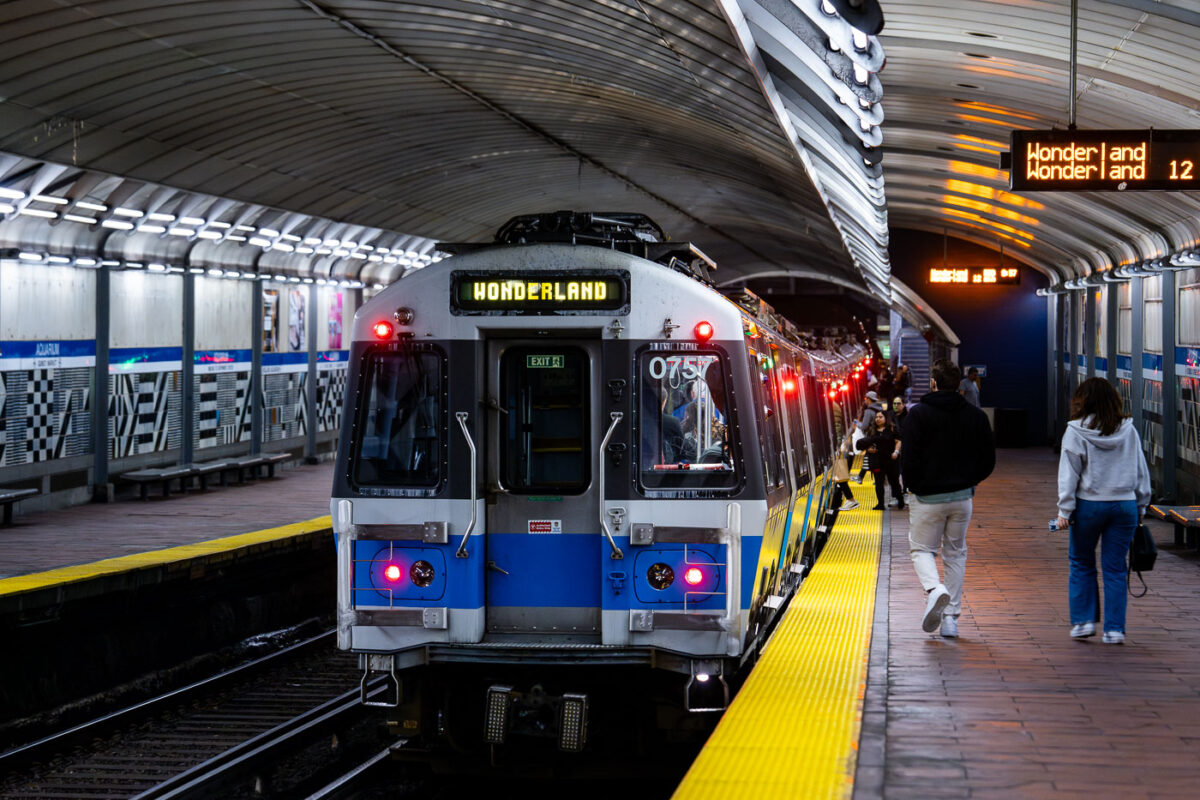
April 2024 — MBTA Wonderland bound train from the Aquarium Station. Passengers on the platform getting on the train.
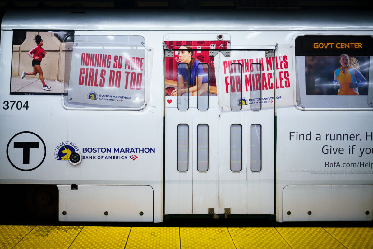
April 2024 — A train with Bank of America Boston Marathon wrap.
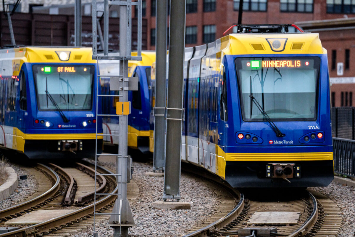
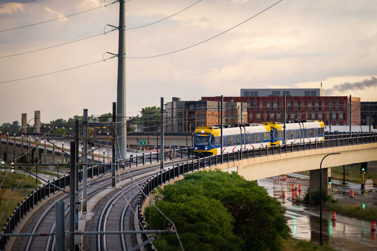
April 2023 — Light Rail trains in Downtown Minneapolis.
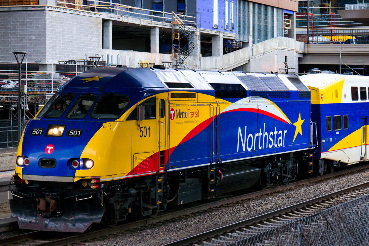
April 2023 — A Northstar Train in downtown Minneapolis.
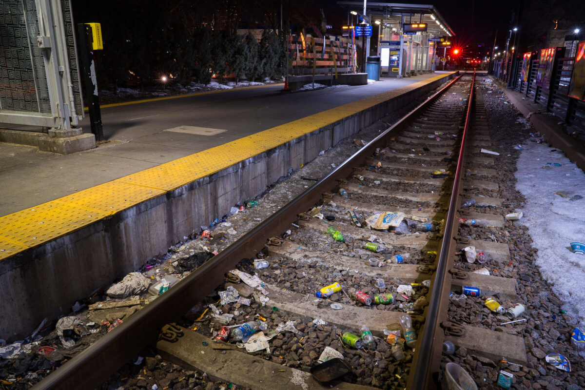
March 2023 — Discarded needles and trash line the tracks at the Cedar-Riverside LRT station.

March 2023 —
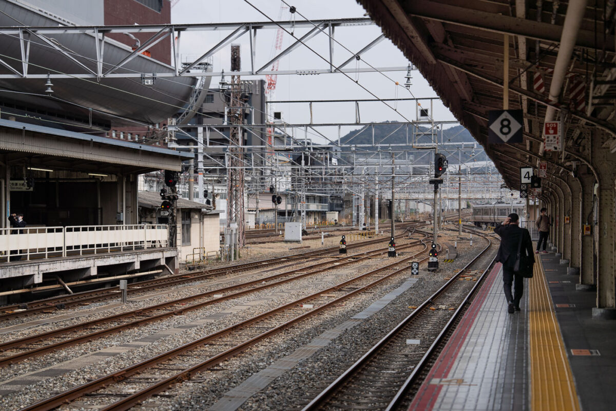
March 2023 — Multiple sets of railway tracks converge toward the distance beneath a grid of steel catenary supports. A man in a dark suit walks along the yellow tactile line on Platform 4, while another commuter waits across the tracks. Overhead signs mark platform numbers, and signal lights display red and amber. The station canopy and surrounding buildings form an industrial backdrop, with a faint view of hills beyond the city.
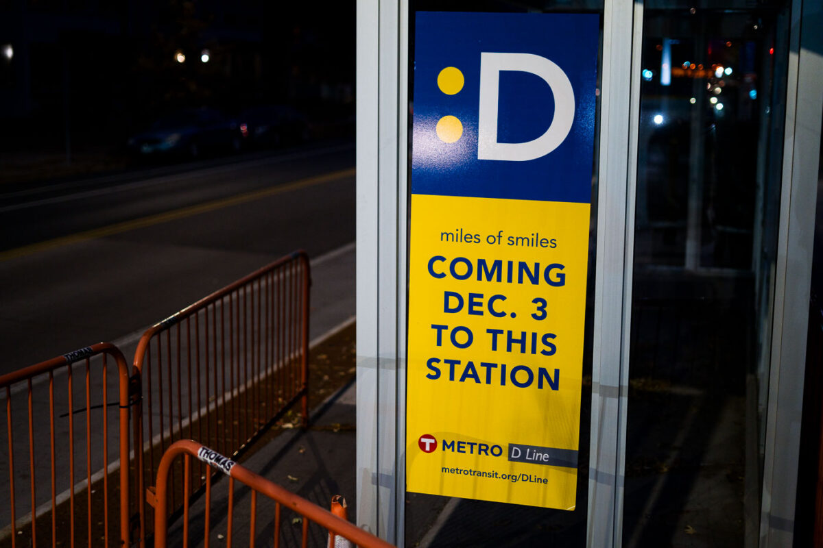
October 2022 — New Metro Transit D Line signage on Chicago Avenue in Minneapolis.
July 2022 — A Metro Transit Blue Line light rail train operates on an elevated track in Minneapolis. Opened in 2004, the Blue Line connects Minneapolis and Saint Paul, with extensions serving the Minneapolis-Saint Paul International Airport and northern suburbs. This elevated segment provides a dedicated right-of-way, ensuring efficient transit operations above street traffic. The light rail system is a crucial element of public transportation in the Twin Cities, linking residential areas with business districts and cultural attractions.
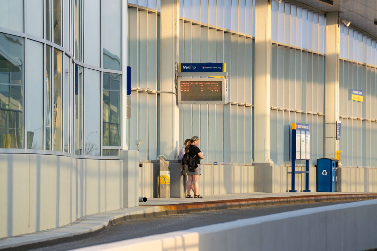
May 2022 — Commuters wait on the northbound platform of the I-35W & Lake Street Transit Station in Minneapolis. The elevated structure, completed in 2021 as part of the Orange Line bus rapid transit project, sits above the freeway’s center median and features glass curtain walls, enclosed waiting areas, and real-time NexTrip displays. Evening sunlight highlights the aluminum framing and sound-barrier panels that shield the station from traffic noise below.
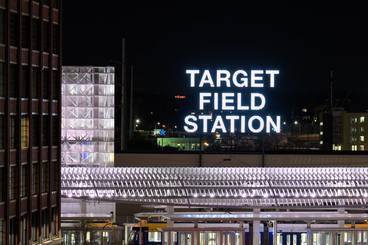
May 2022 — Target Field Station, Minneapolis
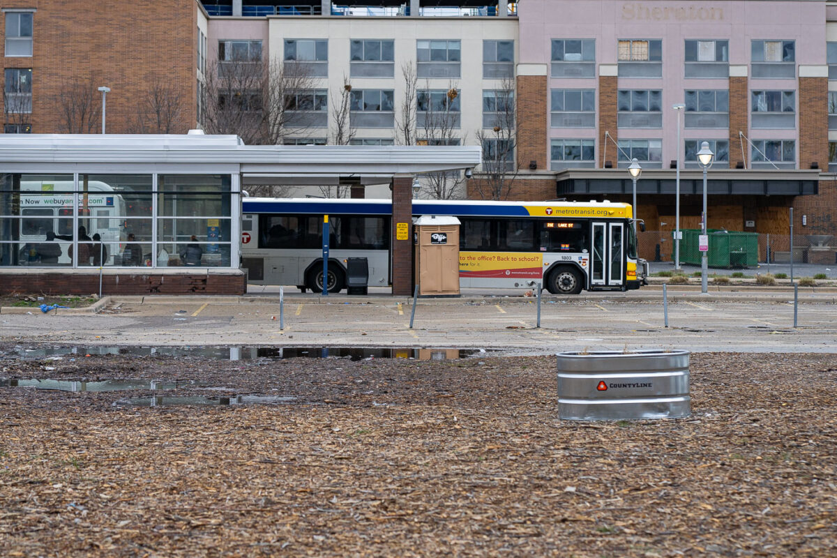
May 2022 — The Chicago Lake Transit Center in South Minneapolis.
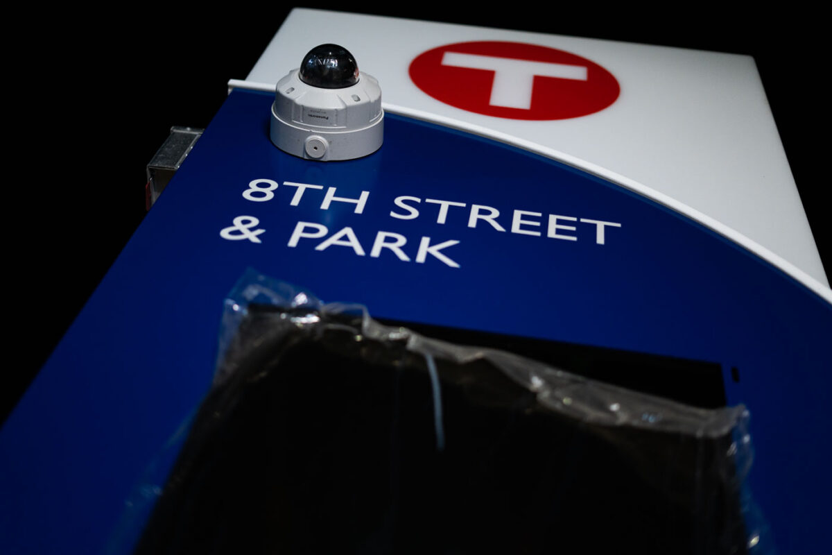
March 2022 — This photograph shows a Metro Transit bus stop sign at the intersection of 8th Street and Park Avenue in Minneapolis. The sign, featuring the Metro Transit logo, indicates a stop for public transportation services. A security camera is mounted on the sign, suggesting a focus on passenger safety and monitoring within the transit system. This infrastructure is integral to the daily operations of Minneapolis's public transit network, serving commuters and visitors.
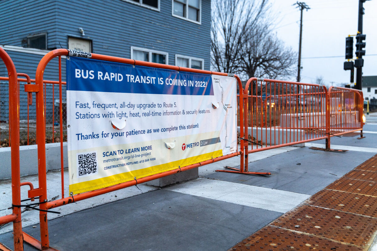
December 2021 — Signage for new Metro Transit D-line bus coming to Chicago Avenue in South Minneapolis.
September 2021 —
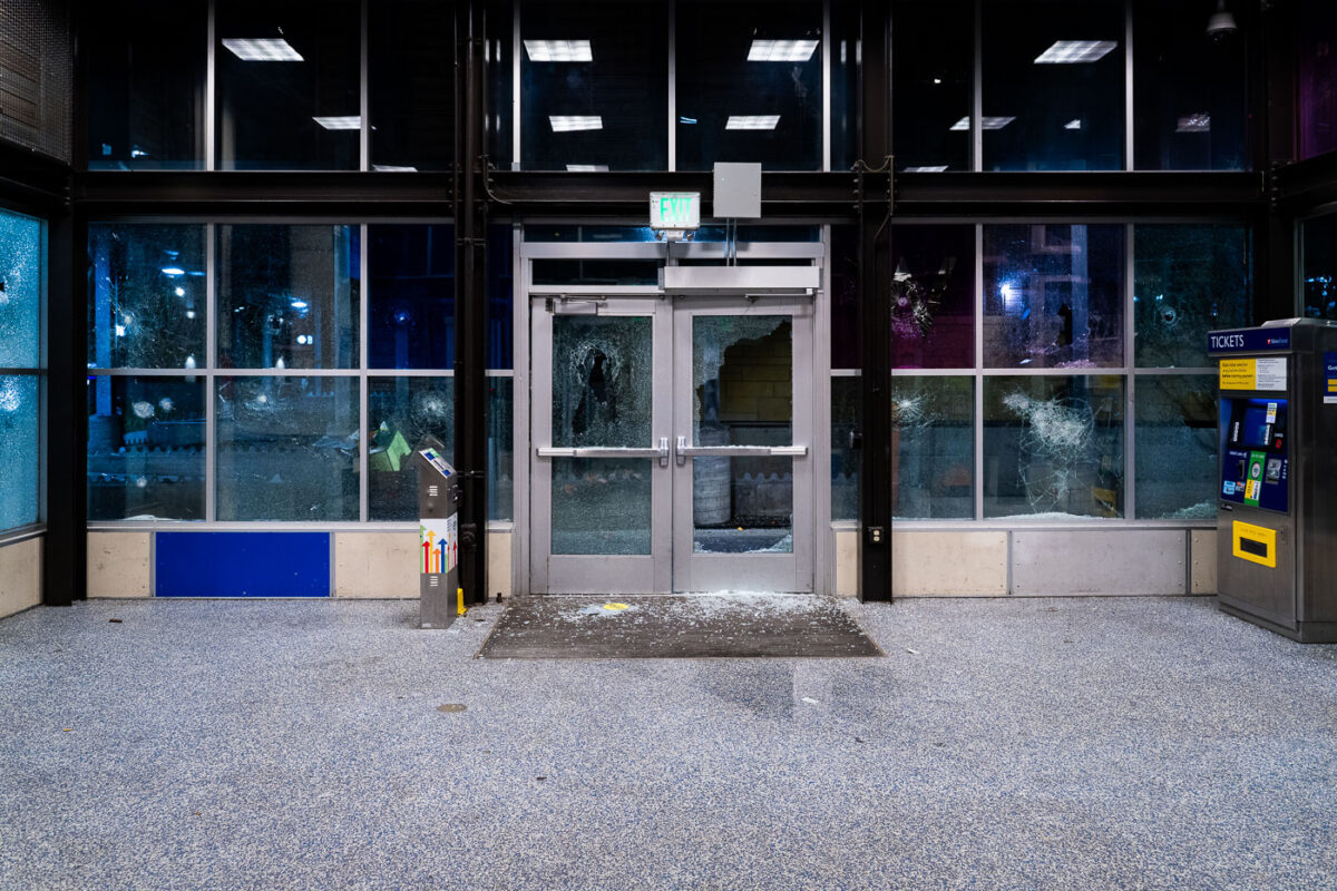
May 2020 — Broken windows at the Lake Street/Midtown Light Rail Station on May 28, 2020 during the 3rd day of protests in Minneapolis following the death of George Floyd.
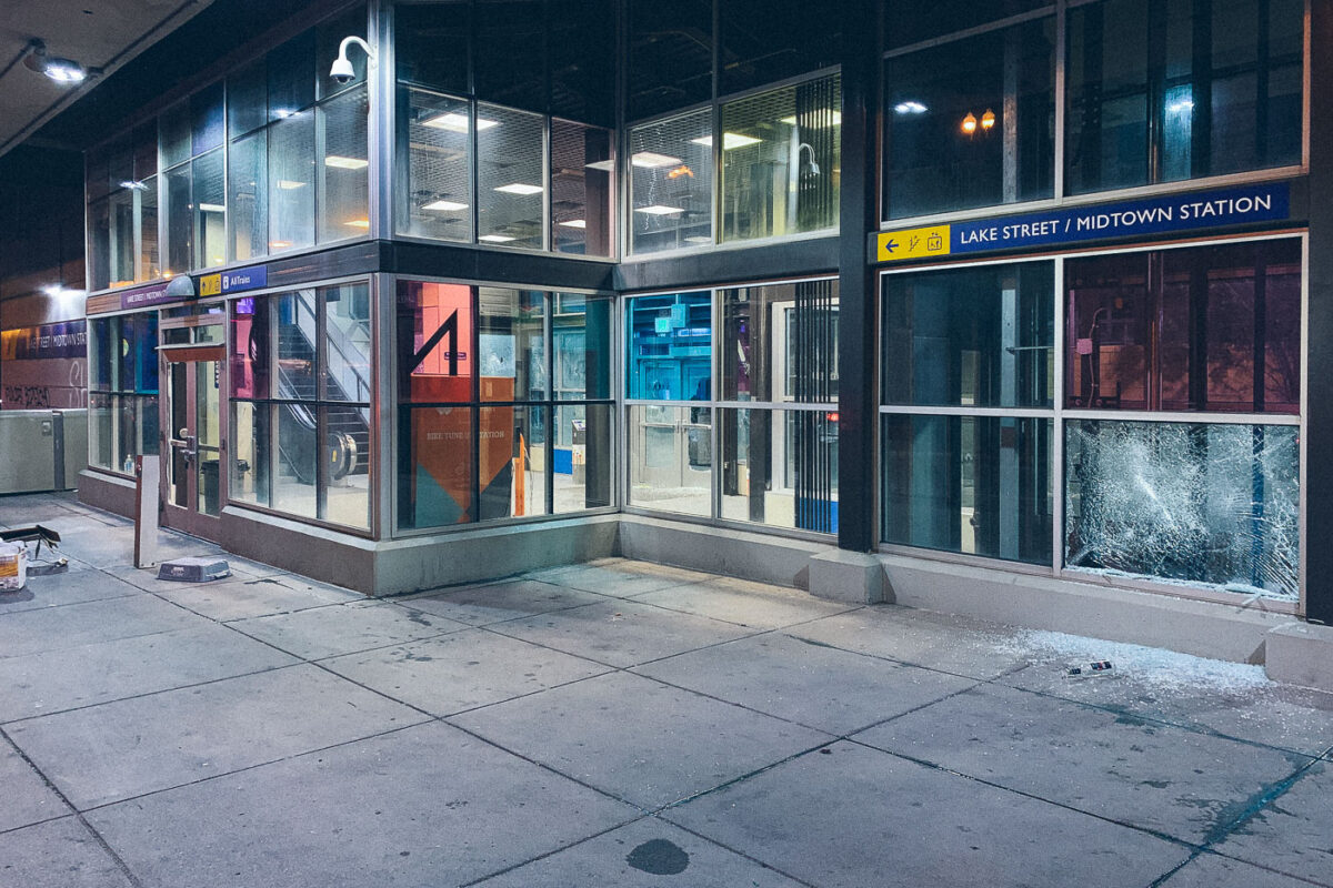
May 2020 — Broken windows on May 28, 2020 at the Lake Street/Midtown Station on the 3rd day of protests in Minneapolis following the death of George Floyd.
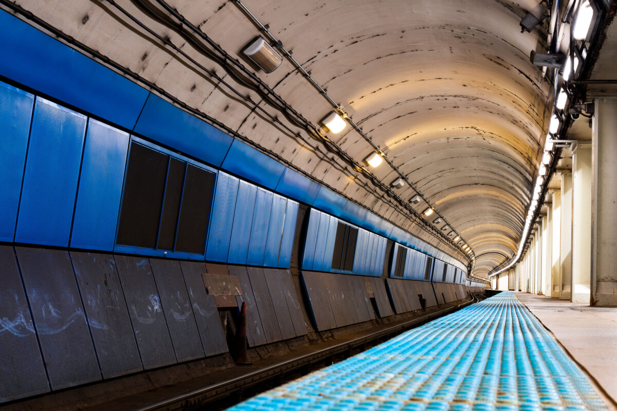
October 2019 — The curved platform of a Chicago Transit Authority Blue Line station reveals the utilitarian design of the city’s subway infrastructure, part of the Milwaukee–Dearborn subway opened in 1951. The tunnel’s tiled blue panels and low arched ceiling reflect the postwar engineering era that brought rapid transit beneath the Loop and the West Side, connecting O’Hare International Airport to downtown. Despite its age, this corridor remains a vital artery in Chicago’s daily commuter network, a symbol of mid-century urban mobility still in constant motion beneath the city streets.
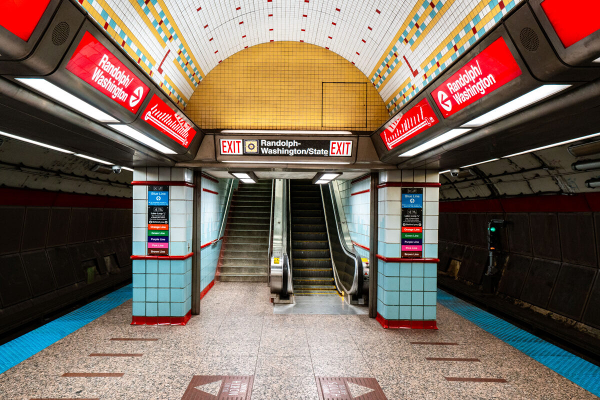
October 2019 — Randolph/Washington station sits beneath the heart of downtown Chicago, forming part of the CTA Red Line that runs through the State Street subway. Opened in 1943 as part of the city’s ambitious subway expansion, the station connects directly to the extensive Chicago Pedway system, linking offices, retail centers, and civic buildings underground. Its tiled vault and distinctive 1940s-era design remain largely intact, representing the Art Moderne phase of Chicago’s transit infrastructure.
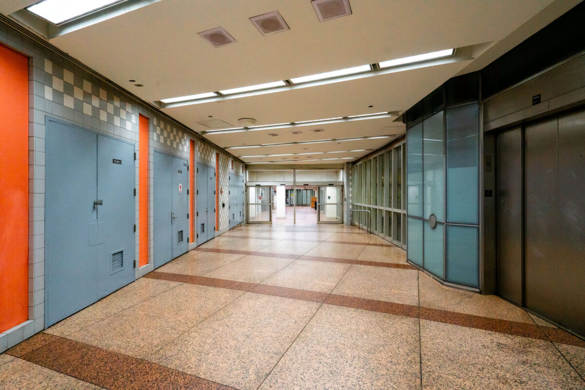
October 2019 — An empty corridor of the Chicago Pedway connects the Randolph/Washington subway station to surrounding office buildings and shopping centers beneath the Loop. The Pedway system, developed beginning in the 1950s, extends for more than 40 city blocks, linking major transit lines with civic and commercial spaces. Its mid-century design—terrazzo floors, tiled walls, and fluorescent lighting—reflects the city’s practical approach to all-weather pedestrian infrastructure, a defining feature of downtown Chicago’s urban core.
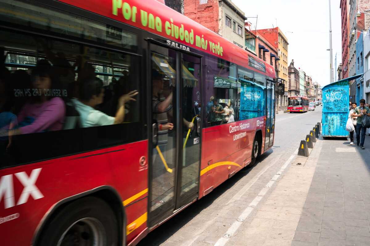
April 2018 — A Mexico City Metrobus on Line 4 passes through the narrow streets of the Centro Histórico, heading toward the San Lázaro terminus. This route, introduced in 2012, was designed to connect the downtown core with the city’s main transit hubs and the airport while reducing congestion in one of Latin America’s most crowded historic districts. The red articulated buses operate along corridors like República de Uruguay and República de El Salvador, part of an effort to modernize and green urban mobility.
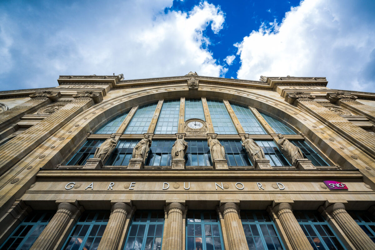
September 2017 — Gare du Nord’s monumental Beaux‑Arts facade is pictured from street level in the 10th arrondissement of Paris, France. The stone frontage features tall arched windows, a central clock, and a row of allegorical statues that represent major European cities historically served by the station’s routes. The inscription “GARE DU NORD” is set above fluted columns, and a magenta SNCF logo marks the national rail operator; cumulus clouds break over a blue sky above the cornice. Opened in the 1860s and designed by architect Jacques-Ignace Hittorff, Paris-Nord is among Europe’s busiest rail hubs, linking regional Transilien lines, RER services, the Paris Métro, and international trains including the Eurostar to London. The station has long served as a gateway for commuters and cross‑border travelers, reflecting the growth of rail travel in northern Europe since the 19th century.
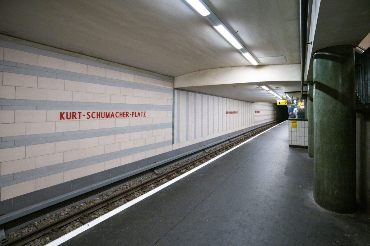
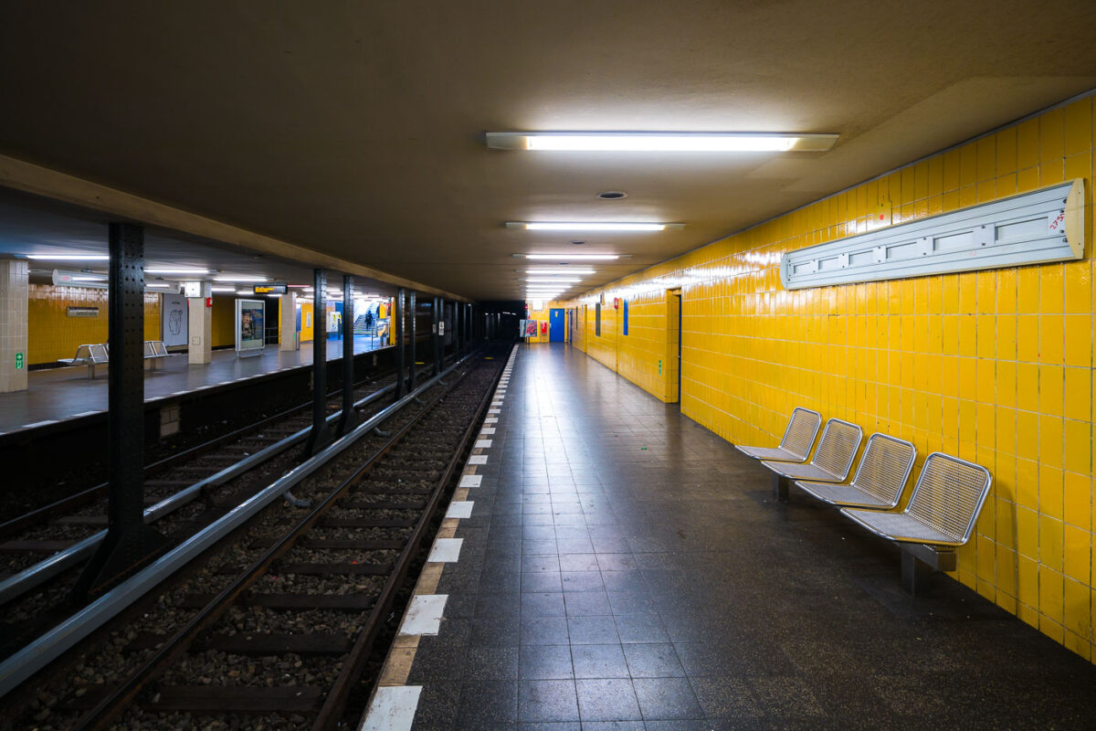
September 2017 — Kurt-Schumacher-Platz station serves Berlin’s U6 U-Bahn line in the Reinickendorf district, located in the city’s northwest. Opened on May 3, 1956, the station was part of the first postwar U-Bahn expansion and named after German statesman Kurt Schumacher, a key figure in rebuilding the Social Democratic Party after World War II. The station features light-colored wall tiles with horizontal gray stripes and minimalist red lettering, reflecting mid-1950s West Berlin design. It includes a central island platform and two tracks, serving as an important stop between Afrikanische Straße and Scharnweberstraße. Above ground, the station connects to several bus routes and lies near the approach to the U6 tunnel under the former Tegel Airport area. Today, it remains a key link for northern Berlin commuters traveling toward the city center.
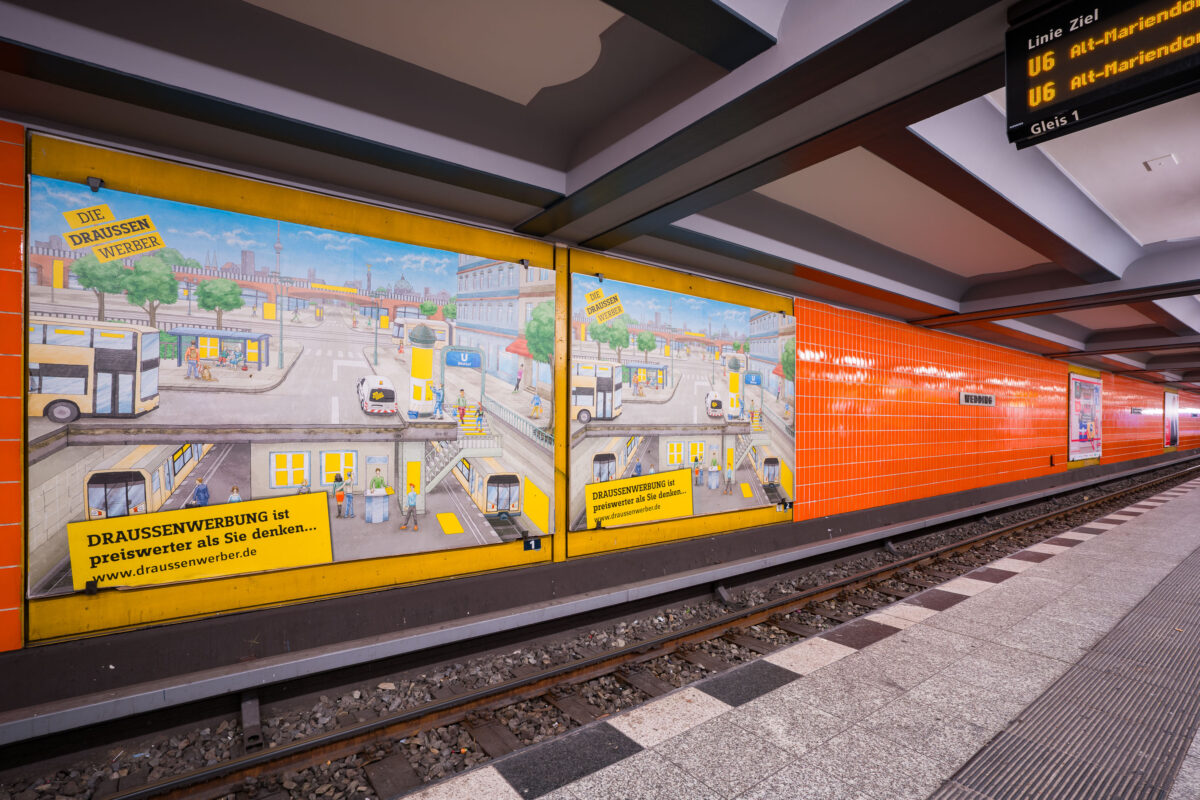
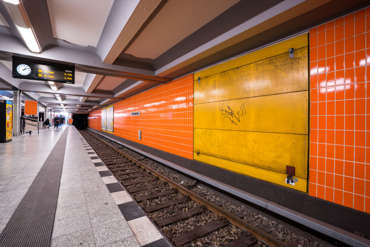
September 2017 — Wittenbergplatz station on Berlin’s U2 line features a distinctive orange-tiled design characteristic of the city’s postwar modernization of U-Bahn interiors. The platform level seen here includes advertising panels with hand-illustrated city scenes, part of a campaign promoting outdoor advertising (“Draussenwerbung”) by Wall GmbH, a longtime transit advertising company in Berlin. Opened in 1902 as part of the city’s first underground railway, Wittenbergplatz is one of Berlin’s oldest stations and a key junction serving the U1, U2, and U3 lines. The orange tiles were installed during mid-20th-century refurbishments to brighten the subterranean space, contrasting with the original Jugendstil architecture preserved at the main hall above. The modern signage displays U6 connections, while the station’s layout—with three island platforms—continues to serve one of the busiest interchange points in Berlin’s U-Bahn network.
September 2017 — Seestraße U-Bahn Station, Berlin Germany
September 2017 — Berlin-Wedding station S-Bahn station in Berlin, Germany
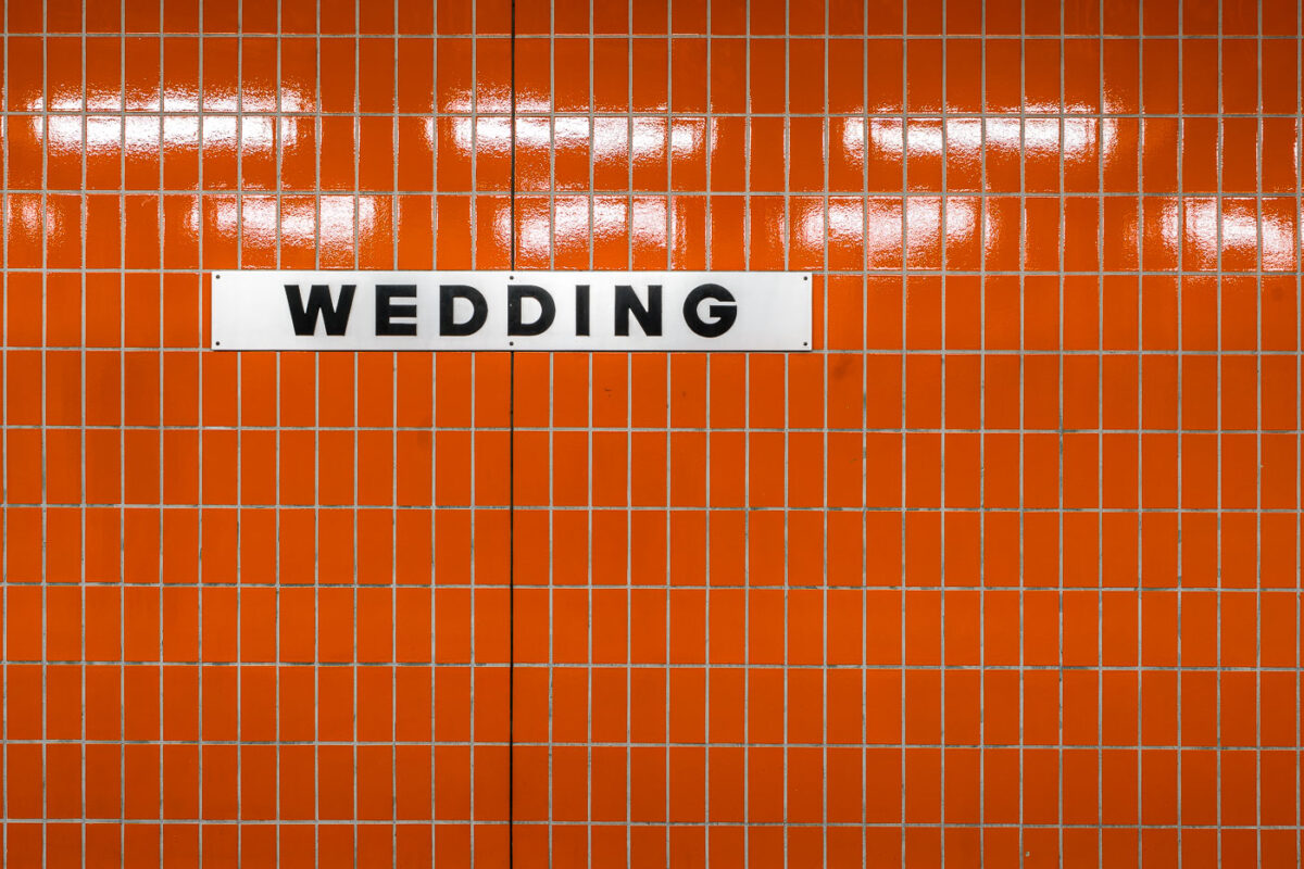
September 2017 — A white station sign reading “Wedding” in black block letters is mounted on an orange, small-rectangle tiled wall inside Wedding station in Berlin, Germany. The station serves the Wedding neighborhood in the Mitte district and functions as an interchange between the U6 U‑Bahn line and the Berlin Ringbahn S‑Bahn. The stark typography and modular tiles reflect the practical design found across much of Berlin’s postwar transit architecture. Operated by BVG for the U‑Bahn and S‑Bahn Berlin GmbH for suburban rail, Wedding is a local hub for commuters moving between the north of the city and central Berlin. No passengers are visible in the frame, emphasizing the graphic clarity of the station’s wayfinding.
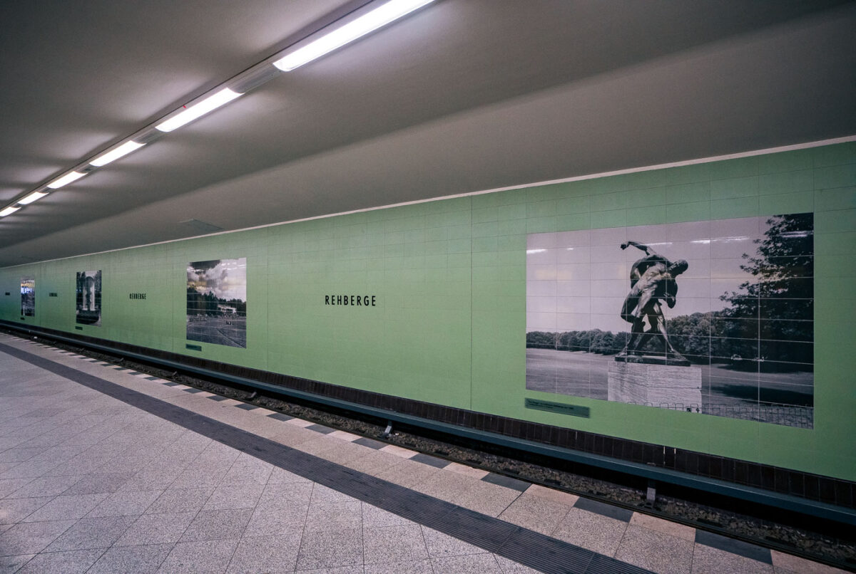
September 2017 — Rehberge U-Bahn Station, Berlin
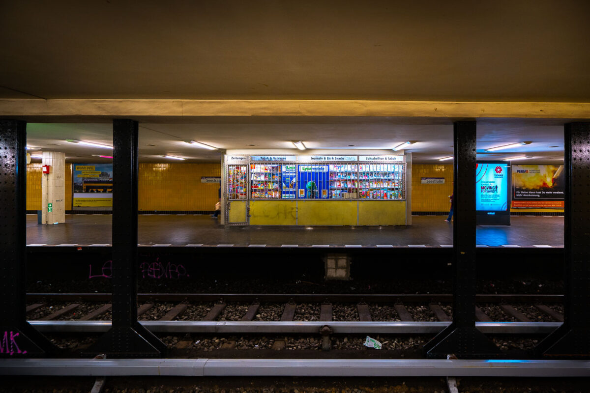
September 2017 — A store at the Seestrabe Station in Berlin.
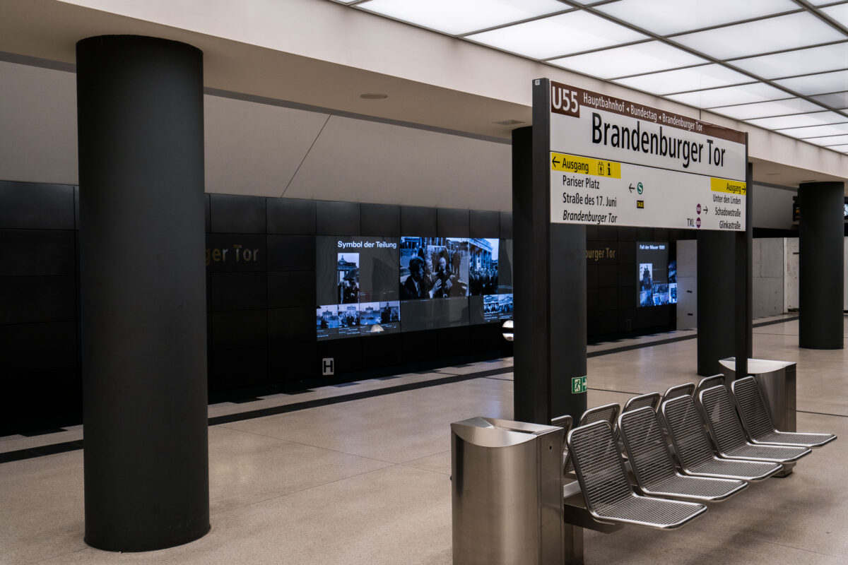
September 2017 — The Brandenburger Tor station in Berlin, Germany. Metal benches on the train platform.
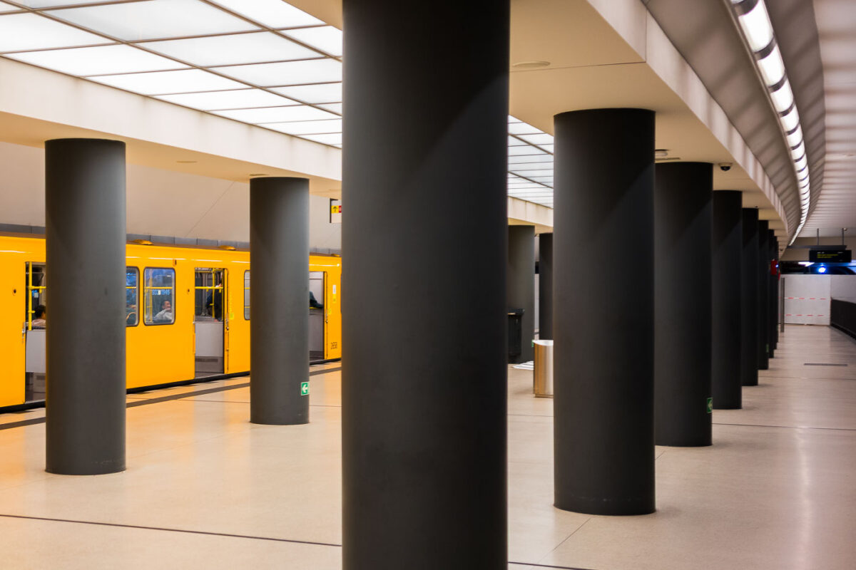
September 2017 — The Brandenburger Tor station in Berlin, Germany.
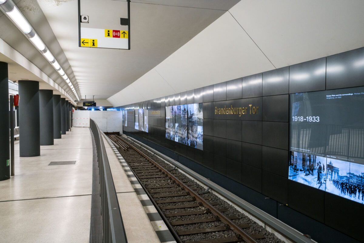
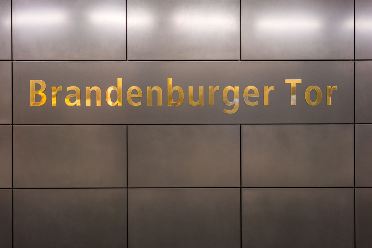
September 2017 — The Brandenburger Tor station on Berlin’s U5 line sits directly beneath Pariser Platz, adjacent to the Brandenburg Gate. The interior features dark composite wall panels inlaid with gold lettering and a series of illuminated displays tracing Berlin’s 20th-century history, including the city’s division and post-reunification development. Originally opened in 2009 as part of the short U55 shuttle between Hauptbahnhof and Bundestag, the station became a through stop in December 2020 when the U5 extension to Alexanderplatz was completed, reconnecting the eastern and western portions of the U-Bahn network after nearly six decades of separation.
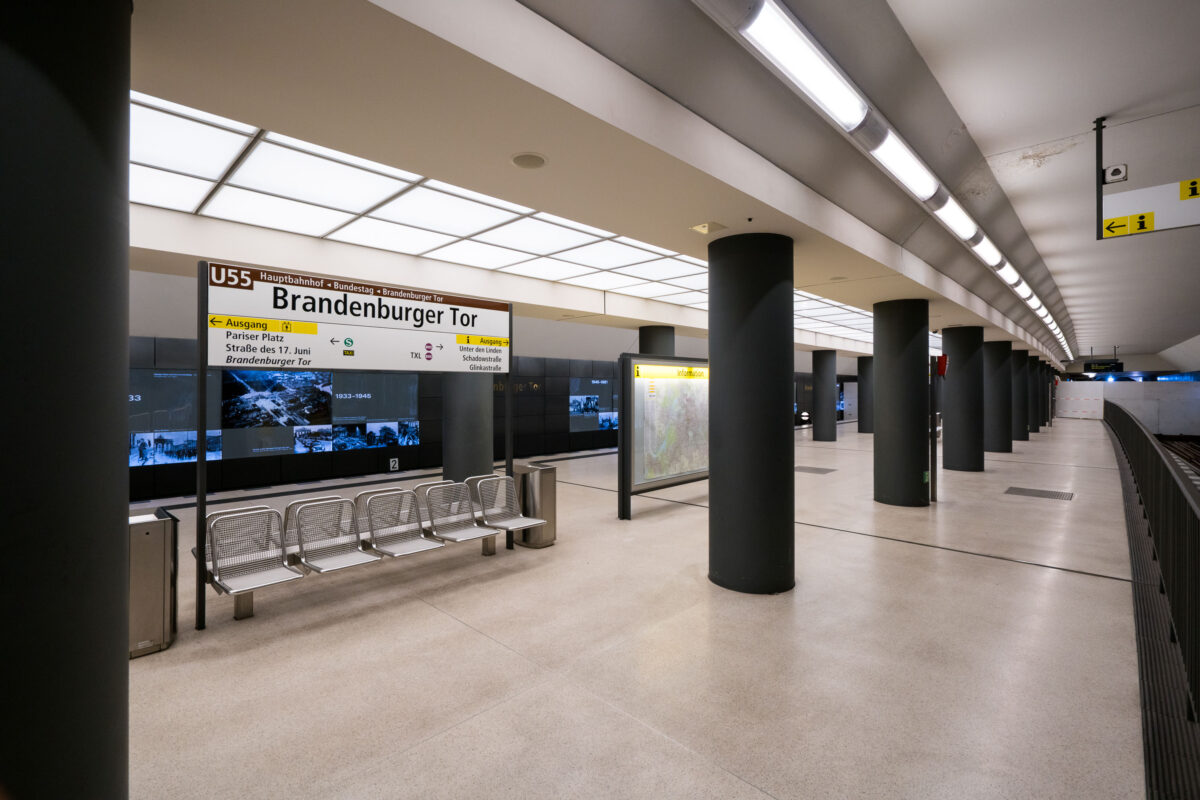
September 2017 — The Brandenburger Tor station in Berlin, Germany.
September 2017 — The Brandenburger Tor station in Berlin, Germany.