Map
More from Greenwood Fire, Superior National Forest

Greenwood Fire damage near Isabella, Minnesota
Within the closure zone of the Greenwood Fire that burned from August to September near Isabella, Minnesota in the Superior…

Burnt cans from Greenwood Fire, Superior National Forest
Melted cans rest on the charred forest floor in the Superior National Forest, a lasting impact of the Greenwood Fire…

Greenwood Fire: Burned Forest & Wetland, Isabella
The landscape near Isabella, Minnesota, displays the aftermath of the Greenwood Fire, which occurred in August 2021. This wildfire significantly…

Greenwood Fire Burned Trees, Superior National Forest
Burned trees stand within the Superior National Forest, illustrating the lasting impact of the Greenwood Fire. This significant wildfire ignited…

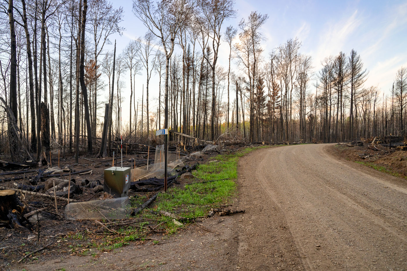
Burned forest after the Greenwood Fire
Within the closure zone of the Greenwood Fire that burned from August to September near Isabella, Minnesota in the Superior…

NJ Forest Fire Service Firefighter, Superior NF, Glenwood Fire
A New Jersey Forest Fire Service firefighter operates a fire apparatus in the Superior National Forest, Minnesota. This deployment occurred…
Nearby Photos


