April 2019
—
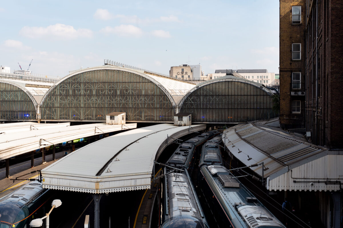
The trains at Paddington Station sit beneath the grand arched glass-and-iron roofs first designed by Isambard Kingdom Brunel and Matthew Digby Wyatt in the 1850s. The repeating barrel-vaulted structures—still marked by the faded “GWR” insignia for the Great Western Railway—remain a hallmark of Victorian railway engineering. Now serving modern intercity services such as the GWR and Heathrow Express, the station continues to blend historic design with contemporary rail operations, standing as one of London’s most architecturally significant transport hubs.
Charing Cross Station Bakerloo Line Train, London
April 2019
—
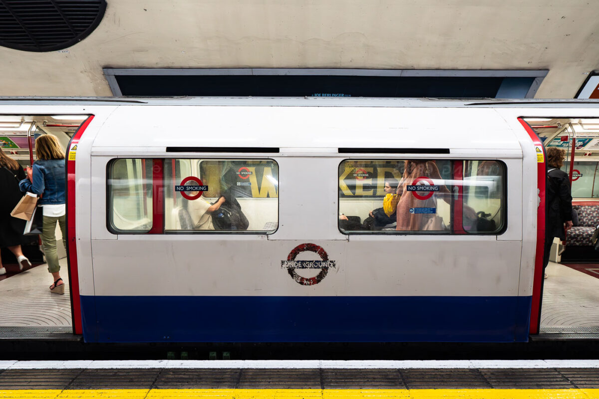
A Bakerloo Line train pauses at Charing Cross Underground Station, one of the most historically layered stations in central London. Opened in 1906, Charing Cross became a key interchange point connecting the Bakerloo and Northern lines beneath the Strand. The photograph captures the distinctive orange-tiled tunnel portal and overhead “Way Out” signage leading toward the mainline station above. Once part of the Jubilee Line until 1999, this section now serves as a terminus for Bakerloo trains, blending Edwardian design elements with the operational systems of a 21st-century network.
Charing Cross Station Escalators, London
April 2019
—
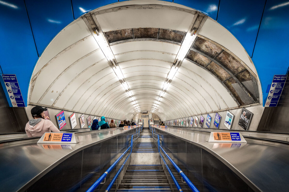
Commuters ride the long escalators inside Charing Cross Underground Station in central London. The station, a busy interchange on the Northern and Bakerloo lines, is known for its deep tunnels, heavy foot traffic, and role as a gateway to Trafalgar Square and the West End. Rows of posters line the walls, while bright fluorescent lighting and metallic finishes highlight the stark, utilitarian design typical of the London Tube.
Charing Cross Station Underground Passageway, London
April 2019
—
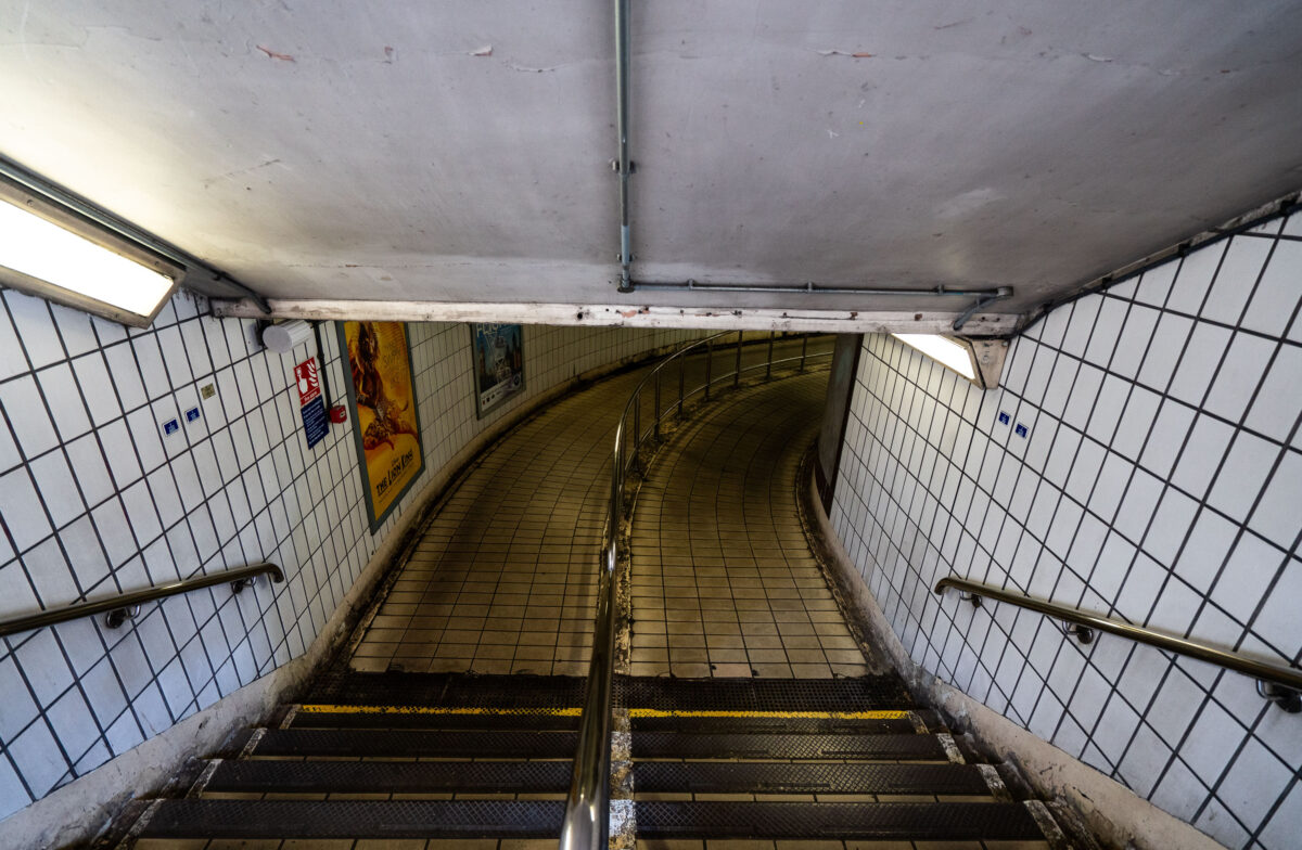
Descending into the tiled corridors of Charing Cross Station, this curved passageway reflects the classic utilitarian design of the London Underground’s mid-20th-century refurbishments. The white-tiled walls, stainless-steel handrails, and fluorescent lighting form a distinctly familiar aesthetic across the network, guiding travelers toward the Northern and Bakerloo lines. Once part of the original terminus for trains entering central London, Charing Cross remains a vital interchange linking rail and Tube services near Trafalgar Square—its passages echoing the constant rhythm of London commuters.
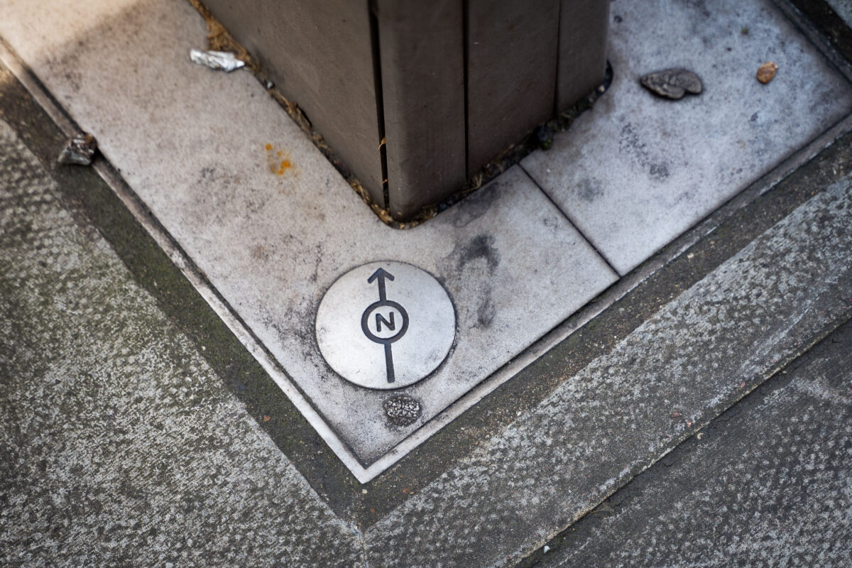
London North Alignment Marker in Pavement
April 2019
—
A small directional survey marker embedded in a London pavement, used by city planners and cartographers for geospatial alignment. The engraved north arrow and circular design mark an official reference point in the city’s street network, often tied to Ordnance Survey data and modern GIS mapping systems. These subtle fixtures are essential for maintaining urban infrastructure accuracy, helping surveyors and engineers align roadworks, utilities, and property boundaries with London’s broader coordinate grid.
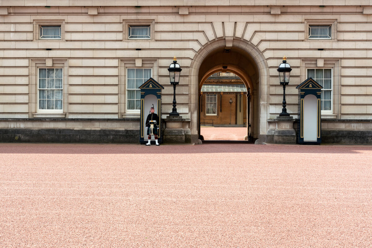
Buckingham Palace Guard at Archway, London
April 2019
—
A member of the Queen’s Guard stands watch outside the archway of Buckingham Palace, London. The sentry is dressed in the traditional dark uniform with white belt and bearskin cap, symbolizing centuries of ceremonial military service. The arched passageway behind him connects the forecourt to the inner courtyard of the palace, the official residence of the British monarch since 1837. These guards belong to one of the Foot Guards regiments, trained soldiers who perform both ceremonial duties and active service in the British Army.
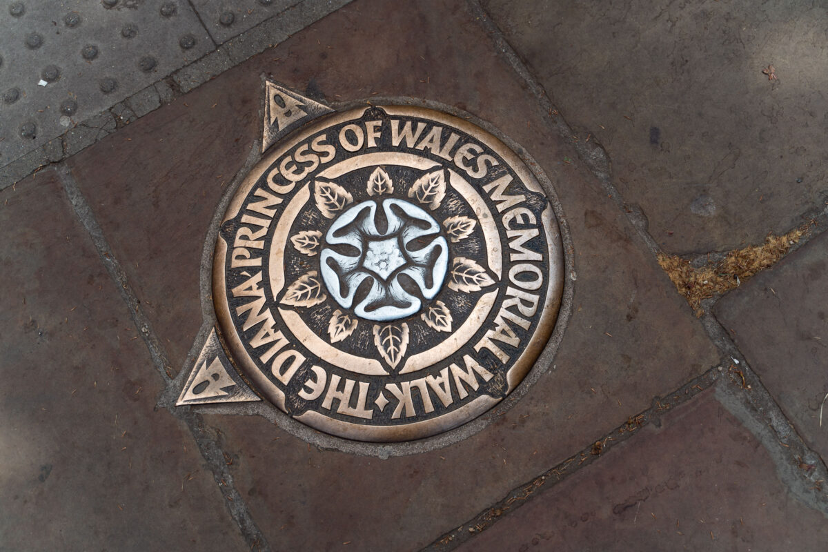
Diana Princess of Wales Memorial Walk Marker, London
April 2019
—
Set into the pavements of central London, this bronze and aluminum marker denotes the Diana Princess of Wales Memorial Walk—a seven-mile circular route passing through four of the city’s royal parks: St. James’s Park, Green Park, Hyde Park, and Kensington Gardens. Installed in 2000, the trail honors the late Princess Diana’s humanitarian legacy, guiding walkers past many places associated with her life. Each plaque features an English rose at its center, surrounded by leaves and directional points that quietly lead thousands of visitors along the commemorative path each year.
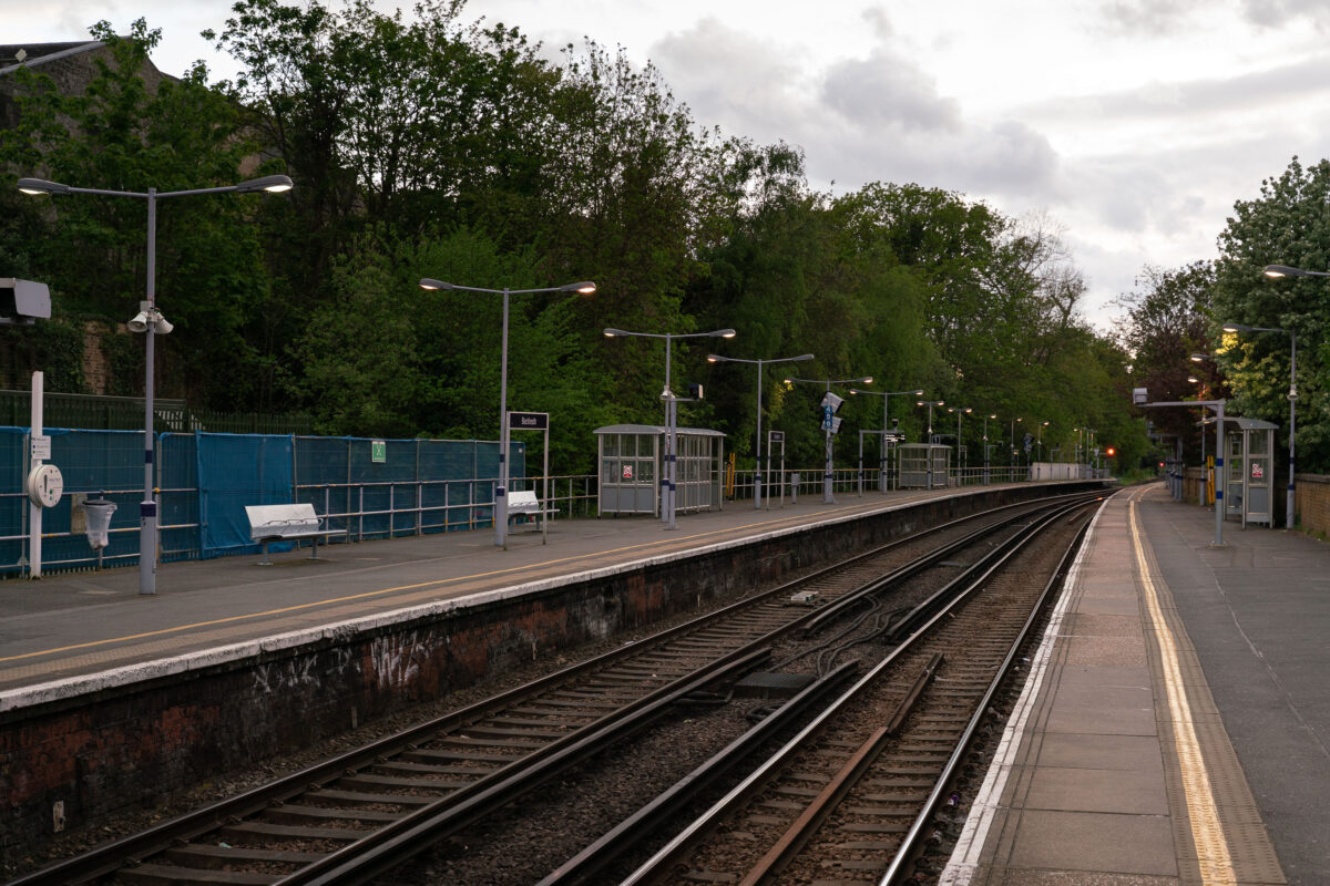
Blackheath Station Platforms, London
April 2019
—
Blackheath railway station, located in southeast London, serves as a key stop on the Southeastern network connecting the capital to Kent. The twin platforms and simple iron canopies reflect mid-Victorian railway architecture, though much of the station has been modernized with LED lighting, CCTV, and accessible ramps. The gentle curve of the tracks and the subdued lighting of the evening evoke the quiet rhythm of the commuter hour, as trains shuttle between London Cannon Street, Charing Cross, and the suburbs beyond.
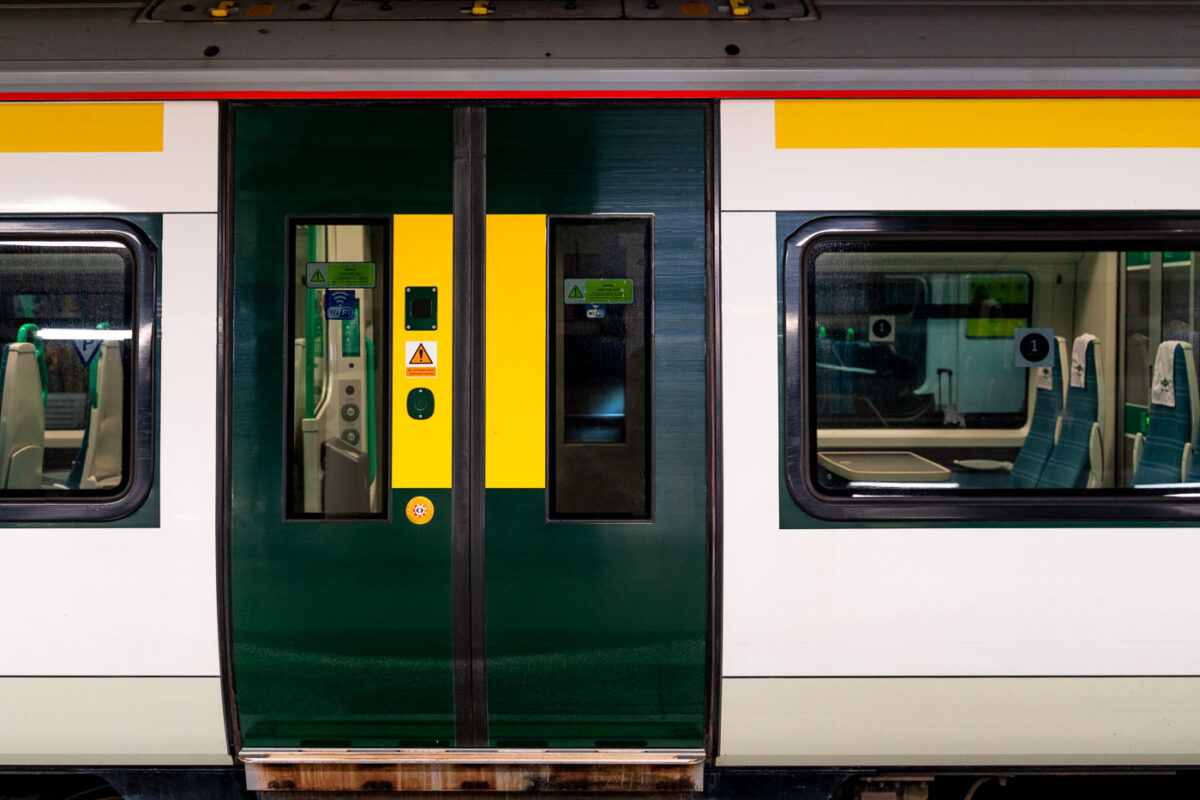
Southern Class 377 Door Detail, London
April 2019
—
A close-up view of a Southern Railway Class 377 Electrostar unit, part of the modern suburban fleet serving routes across South London and the southern counties. The green and yellow livery, with sliding central doors and Wi-Fi signage visible through the window, reflects the operator’s current design standard for high-frequency commuter service. These electric multiple units, built by Bombardier, form the backbone of Southern’s network—efficiently linking London with Brighton, Gatwick, and the South Coast. The clean, modular profile emphasizes function and accessibility typical of post-2000 British rolling stock.
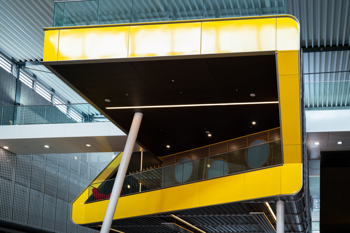
ExCeL London Yellow Concourse Cantilever, Royal Docks
April 2019
—
A bold yellow cantilevered structure projects over the concourse at ExCeL London, the capital’s premier exhibition and convention complex in the Royal Docks. This elevated platform, supported by slanted steel columns and lined with circular observation windows, exemplifies the venue’s late-modern architectural style—combining industrial materials with contemporary design.
Part of the 2010s interior upgrades, the structure houses meeting and hospitality spaces overlooking the main exhibition halls below. Its polished metal, glass, and composite cladding echo the docklands’ engineering heritage while signaling ExCeL’s role as a centerpiece of London’s post-industrial regeneration and event economy.
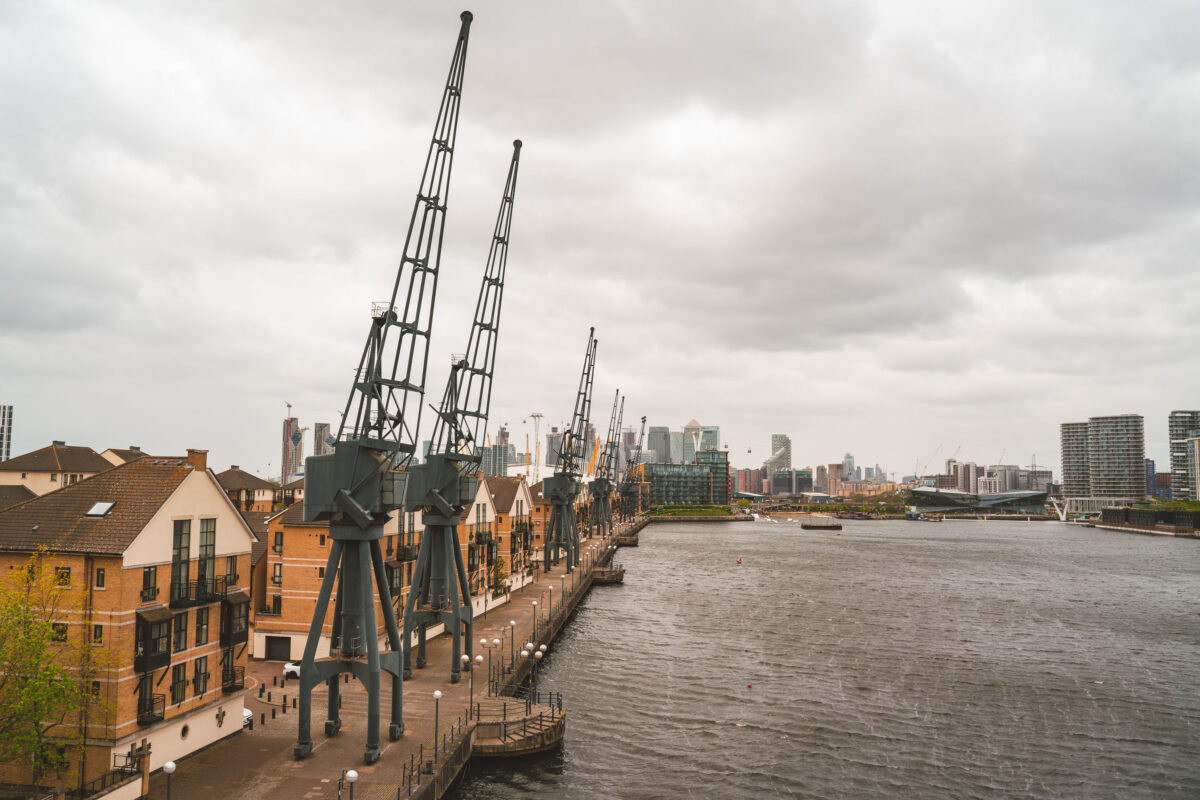
Royal Victoria Dock Cranes and Canary Wharf, London
April 2019
—
A line of preserved dockside cranes stands sentinel along the Royal Victoria Dock, a lasting symbol of London’s once-vast maritime trade. These iron giants were built in the mid-20th century to load and unload cargo ships during the docks’ industrial peak, when the Royal Docks complex handled millions of tons of goods from around the British Empire.
Today, the cranes are carefully retained as part of the area’s regeneration, contrasting sharply with the modern glass towers of Canary Wharf and the O₂ Arena visible across the Thames. The Royal Docks have transitioned from working port to mixed-use district, now home to ExCeL London, residential developments, and the Emirates Air Line cable cars spanning the river. This juxtaposition of preserved machinery and new architecture reflects London’s ongoing evolution from industrial capital to global service and cultural hub.
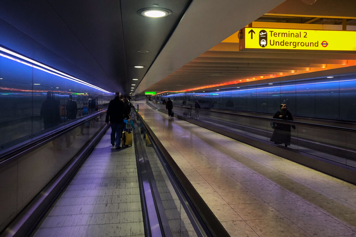
Heathrow Terminal 2 Underground Link, London
April 2019
—
A sleek underground corridor connects Heathrow’s Terminal 2 to the London Underground, illuminated by alternating bands of blue and amber light. The tunnel’s reflective glass walls and moving walkways guide travelers between the arrivals area and transit connections, representing one of the airport’s most efficient passenger links. Opened as part of Heathrow’s “Queen’s Terminal” redevelopment in 2014, this passageway exemplifies the modern design ethos of London’s busiest airport—streamlined, functional, and visually striking in its symmetry and ambient lighting.
Built in Minneapolis
Minneapolis Photographer
Browse by location, move through long-running series, or start with recent work.